In slow-moving hurricanes, the danger comes from all the water

A post by Anne Jefferson When Hurricane Isaac passed over New Orleans as a Category 1 storm on the seventh anniversary of the disastrous Hurricane Katrina, everyone in the US let out a big sigh of relief. A category 1 storm, the lowest level of hurricane intensity on the Saffir-Simpson scale, meant sustained winds in the 74-95 mile per hour (119-153 km/hr) range, which are described as “very dangerous winds [that] will produce some damage.” There were few, if any, mandatory evacuation orders in Louisiana, and the media interviewed people saying that they heard Isaac would be a Category 1 storm so they “didn’t think it would be that bad.” Those people opted to stay in their homes Louisiana’s Plaquemines Parish, along the Mississippi River near New Orleans. Indeed, as the early reports from Louisiana came out, it sounded as if the storm had been relatively low in drama.
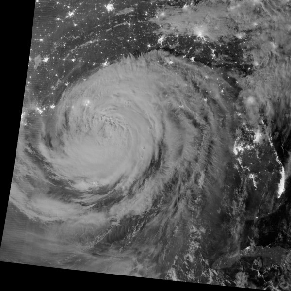
Hurricane swirl as Isaac makes landfall in Lousiana contrasts with the bright city lights in the southeastern US

This will be the iconic image of Hurricane Isaac. NASA/NOAA/DoD VIIRS image of the hurricanes clouds superimposed on the city lights on the southeastern US. All those clouds are full of water. Image source: http://earthobservatory.nasa.gov/NaturalHazards/view.php?id=79023

Only later did reports start to trickle out of levees overtopped, and people stranded on rooftops and in attics, being rescued by neighbors with boats. The flooding this time wasn’t in New Orleans itself, but in nearby Plaquemines Parish, where levee upgrades weren’t scheduled to be completed for a few more years. At least one levee overtopped, flooding the town of Braithwaite and surrounding areas where about 1700 people live, with up to 4.3 m (14 ft) of water. That water ended up trapped between the federal, main Mississippi River levee and more locally managed back levees. State officials have now breached those back levees to more quickly drain the water out of the town, rather than slowly pump the area dry. But several people died inside their flooded homes.

Aerial view of flooding in Louisiana Parish

US Coast Guard photo of floodwaters in Plaquemines Parish, Louisiana

It’s not clear to me from the news reports whether the levee overtopped from a wind- and pressure-driven storm surge or whether it overtopped from the sheer amount of rain that fell on the area, but in either case the slow-moving nature of Hurricane Isaac turned out to make the meager Category 1 hurricane into something much more horrific for some Lousiana communities. A reporter on the scene in Braithwaite described the eyewall, with the most intense winds and rain, stalling out in the area, but throughout its life Isaac was a fairly slow moving tropical cyclone. As it moved across Louisiana, its center was moving north about 9 miles per hour (14.5 km/hr). Typical hurricanes move about 15-20 mph (24-32 km/hr), and some can move up to 60 mph (96.5 km/hr).

The problem with a slow-moving hurricane is that vast amount of precipitation can occur in the affected areas. In some parts of Louisiana, Alabama, Mississippi, and Florida more than 15 inches (380 mm) of rain have fallen in the last week. In New Orleans, the Hydrometeorological Prediction Center reports that 20.08 inches (510 mm). In the image below, you can also see the northward progression of the storm since making landfall.
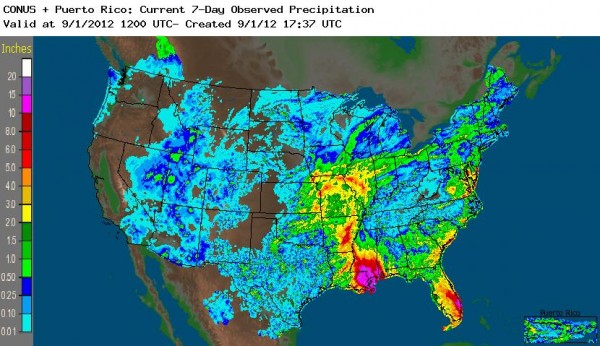
Colorful image of rain in Louisiana, Florida, Arkansas and Missouri as a result of Isaac.

NOAA's Advanced Hydrologic Prediction Service (AHPS) map of rainfall accumulations for the week leading up to September 1, 2012.

All that water can lead to levee over-topping, like in Plaquemines Parish, and the risk of dam failures. Evacuations were ordered along the Tangipahoa River, which drains into Lake Pontchartrain, because of fears that Percy Quin Dam would fail. More than 50,000 people have been evacuated as the risk of dam failure or the need to intentionally breach the dam is still being evaluated. And, of course, while media attention (and this blog post, guilty as charged) focuses on the dramatic stories, there are many other areas in the Gulf Coast where flooding is on-going. Even as far north as Kansas City and southern Illinois, flood warnings are in effect.

Isaac is a good reminder why the primary cause of death in the US from tropical cyclones is from freshwater flooding. And it suggests that the single-minded focus on hurricane windspeeds may distract us from taking the flooding threat as seriously as we should. Those people who decided to stay in Plaquemines Parish because the Category 1 hurricane wouldn’t be that bad? When the interview was conducted, they were expressing their regret. The president-elect of the American Meteorological Society, J. Marshall Shepherd, wrote a blog post about the Lessons from Isaac, in which he suggested: “Is it time to consider an augmentation of the Saffir Simpson scale to capture the rainfall-flood threat? It is a difficult science problem, but probably one worth investigating. I also argue that our media colleagues must consider their coverage strategy and category “anticipation” or hype carefully.”

Categories: by Anne, geohazards, hydrology

Stuff we linked to on Twitter last week

A post by Chris RowanA post by Anne JeffersonActually, two weeks’ worth here – and mainly from Anne, since Chris has been on Twitter vacation (despite Anne probably being the more busy out of us…). Enjoy!

Volcanoes

Fossils

(Paleo)climate

Water

Environmental

General Geology

Tectonics

Interesting Miscellaney

Categories: links

Scenic Saturday: Cuyahoga River at Kent

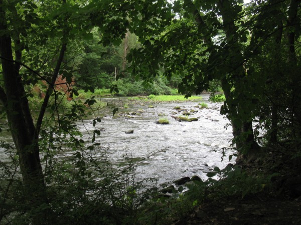
A post by Anne JeffersonA few scenes from a morning walk along the Cuyahoga River through downtown and just downstream of Kent, Ohio.

Cuyahoga River in Kent. Photo by A. Jefferson, August 2012.

Cuyahoga River in Kent. It's a mixed bedrock-alluvial channel in this reach and there's a little bit of class 1-2 whitewater through town. Photo by A. Jefferson, August 2012.

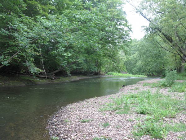
Gravel bar on Cuyahoga River

A bit farther downstream, there's a nice gravel point bar that appears to be a popular spot to put in for float trips. The Kent State Rec Center runs multiple trips per day from here on summer weekends. The gravel bar pictured above seems to mark the start of a fully alluvial reach, with no whitewater. Photo by A. Jefferson.

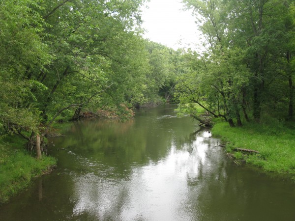
Cuyahoga River, Kent, OH

Here's a view looking upstream from Fred Fuller Park in Kent. There's some nice wood in the stream through here and a few small patches of wetlands along the banks. Photo by A. Jefferson

Categories: by Anne, photos

GSA call for abstracts on urban hydrology and anthropogenic geomorphology

A post by Anne JeffersonShameless plug… I’m convening two fantastic sessions at the upcoming Geological Society of America meeting in Charlotte, North Carolina on November 4-7, 2012. For both sessions there are incredible invited speakers lined up, and all we need to make them an overwhelming success is a strong showing of contributed abstracts. That’s where you come in. If you are interested in the way humans interact with hydrology or landscapes, please consider submitting an abstract by August 14th.

Low head dam

An urban stream in Freedom Park, Charlotte, NC


T101. Hydrology of Urban Groundwater, Streams, and Watersheds
conveners: Anne J. Jefferson, John M. Sharp
This session explores how urbanization affects water quantity, quality, and ecohydrology in groundwater and surface water systems. Field and modeling studies of flow, recharge, water balance, groundwater-stream interactions, water quality, and contamination are welcome. Confirmed invited speakers are Laura Toran, Christina Tague, and Ken Howard.

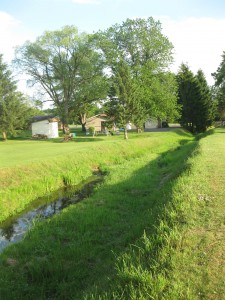
A straight, ditched stream in northeastern Ohio

A straightened and ditched stream in northeastern Ohio is probably the legacy of agriculture

T24. Geomorphology of the Anthropocene: The Surficial Legacy of Past and Present Human Activities
conveners: Anne J. Jefferson, Karl W. Wegmann, Anne Chin
This session explores the legacy of human activities and land use on earth surface processes and landforms. Studies on the impacts of agriculture, mining, urbanization, and forestry in prehistoric, historic, and modern times are welcome. Confirmed invited speakers are Ellen Wohl, Allan James, and Gary Stinchcomb.

If the descriptions above don’t match your research, but you know someone who would be perfect, please share with them or send me their contact information and I’ll personally reach out. Even if you just think these topics might be interesting to listen to for a few minutes or hours, plan on attending the sessions in November. I’ll share details of dates, times, and locations when the final program is announced.

Categories: by Anne, conferences, geomorphology, hydrology

Scenic Saturday: Boulder rocks

A post by Anne Jefferson
I spent most of the last week in Boulder, Colorado at the CUAHSI Biennial Science Meeting, where I gorged myself on the latest and greatest in hydrologic science. I’m going to share more of that in the next few days, but first I wanted to give a few glimpses of Boulder’s geologic environs, in case anyone else has been as deprived of this geologic wonderland as I had been.

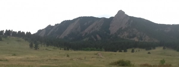
I had the fantastic fortune of being met at the airport by Kea Giles, who proceeded to give me a tour of some of the neatest spots in the Boulder area. We drove past a nice spot to walk a dog on the Bobolink Trail, past the CU campus and downtown, through a gorgeous (and spendy) neighborhood on “the hill,” and up to Chatauqua Park for prime viewing of Boulder’s famous flatirons (pictured below).

Flatirons from Chatauqua Park in Boulder, Colorado. Photo by A. Jefferson, July 2012. What a trip to opt not to bring my good camera. Apologies for the iPad photo.

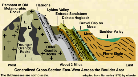
We couldn’t find a place to park at the park because of a special event, so we decided to head up Boulder Canyon toward Nederland. It was a thrill to be able to ogle the scenery during the whole twisty drive, with a cascading Boulder Creek on one side of the road and near vertical rock walls on the other. Among the features I spotted were large rockslides, burn scars, a waterfall, quartz veins, dikes, and beautiful granites. I wish I had pictures, but time, light, and camera resources were limited. Instead, you’ll have to imagine our traverse through this geologic cross-section.

Geologic cross section from Boulder through Front Range. After Runnells, 1976. Click for source.

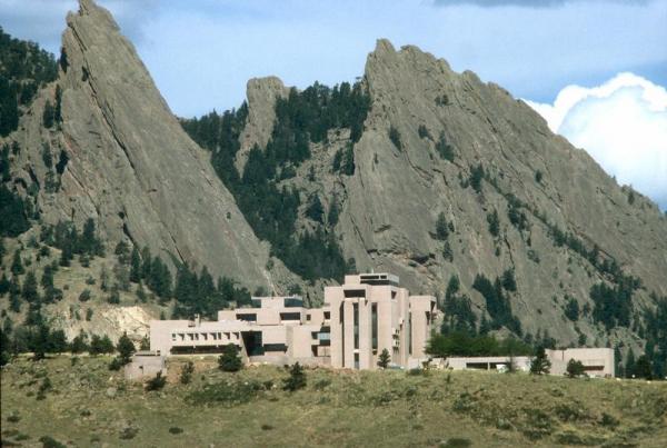
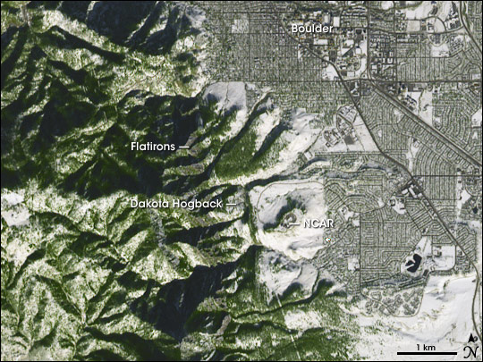
Two days later, I found myself gazing at the geology again as our group of hydrologists headed up to NCAR’s Mesa Lab. The Mesa lab is situated on the gravel-capped mesa shown in the image above, just below the base of the Dakota hogbacks. Its setting is nothing short of spectacular, and the building is suitably architecturally dramatic. It’s also open to the public and has some cool displays and exhibits about atmospheric science. I believe there are also hiking trails that depart from the lab. While we were there, we were treated to an evening thunderstorm passing over the Front Range and a rainbow that seemed to span the Great Plains. It’s as if the weather wanted to compete with the dramatic geology.

NCAR Mesa Lab (image from UCAR website)

Here’s how the whole area fits together in a spatial sense:

ASTER image of Boulder, NCAR Mesa Lab, and the Front Range. Image from NASA's Earth Observatory. Click image for source.

I haven’t said anything about how this spectacular landscape formed, because I really haven’t had a chance to explore the geologic history of the area. I’m thinking that’s a good excuse for another visit to Boulder, with a proper geologist in tow, and more time set aside for hiking amidst the rocks.

Categories: by Anne, outcrops