![]()
![]() Another week, another link extravaganza for you to enjoy.
Another week, another link extravaganza for you to enjoy.
Blogs in motion
The National Ground Water Association joins the blogosphere with its creatively named NGWA Blog (http://info.ngwa.org/blog). Early posts suggest the blog will focus on the practical aspects of the hydrogeology profession.
Volcanoes, Earthquakes, Tectonics
- Video: visiting Iceland’s new volcanic landforms (check out the window down to the molten rock!)
http://www.bbc.co.uk/news/world-europe-11038232
(via @volcanotweet) - Details and perspective on the San Andreas fault paleoseismology paper that argues for a reduced recurrence interval: more risk of moderate quakes.
http://www.latimes.com/news/local/la-me-earthquake-fault-20100821,0,946323.story
(via @EricFielding) - Tipping your tension gash: a nice illustration of rock deformation on a smaller scale: tipping your tension gash (with animation!)
http://mountainbeltway.wordpress.com/2010/08/24/tipping-your-tension-gash/
(via @callanbentley)
Planets
- Extra-solar system with at least 5 planets, possibly 7, discovered by ground-bases observatings: continues the exciting trend towards smaller extra-solar planets with wider orbits…
http://www.physorg.com/news201850291.html - Look at the flux lines on that! : a stunningly detailed photo of a sunspot, images using a new type of adaptive optics.
http://www.universetoday.com/71971/amazing-sunspot-image-from-new-solar-telescope/
(via @elakdawalla) - The Solar System is a few million years older than previously thought (with some good background on the changing views on how formation occurred).
http://www.nature.com/news/2010/100822/full/news.2010.423.html
(via @NatureNews) - Whirling history of asteroid discovery: Video where whites are new, colored are cumulative; wait for late 90s burst
http://www.youtube.com/watch?v=S_d-gs0WoUw&feature=youtu.be
(via @rkerr46)
Environmental
- How short-termism is not just fouling up the environment, but our whole society
http://www.guardian.co.uk/commentisfree/2010/aug/22/generational-warriors-should-go-easy-on-the-old
(via @alicebell) - Deep Sea News continues to provide indispensable coverage of the aftermath from the Gulf of Mexico Oil Spill: on research confirming the presence of a deepwater oil plume (in June at least); the latest research on plumes & bacterial oil munching; and some background on dispersants. The media’s coverage of the persistance (or not) of oil in the Gulf has been somewhat compromised by the tendency to report early and tentative results as certainties: two excellent discussions of the difficulties of accurately reporting research as it is happening can be found at Cocktail Party Physics and the Knight Science Journalism Tracker.
- A very different kind of regeneration: installing solar and wind power on mine tailings.
http://www.miller-mccune.com/environment/can-mining-provide-a-renewable-energy-future-2-21258/
(via @AZStateGeo) - The researchers that created maps of anthropogenic biomes (which Anne has posted about before) have now mapped their anthromes through history. Fascinating!
http://www.wired.com/wiredscience/2010/08/new-anthrome-maps/
(via @clasticdetritus) - Anne’s PhD field area is burning. She wonders if someone will look for hydrologic effects of the forest fires in her streams?
http://www.inciweb.org/incident/2082/
Also check out the NASA Earth Observatory image of the fires in Oregon.
http://earthobservatory.nasa.gov/NaturalHazards/view.php?id=45503 - Ethnic minority communities suffer huge lack of green space [Green space correlates with physical activity]
http://www.guardian.co.uk/environment/2010/aug/18/ethnic-minority-communities-green-space
(via @KateClancy) - The value of Restoring Mississippi River Delta; it provides $12-47+ billion in benefits every year:
http://conserveonline.org/library/gaining-ground-wetlands-hurricanes-and-the-economy/view.html
(via @rivrchik) - Outdoor Science brings us the story behind the story of the discovery of a plankton rich oasis near Antarctica
http://www.outdoor-science.com/?p=631
Water
- An excellent discussion of Ecological rules of thumb and the 10% impervious rule for watersheds by new blogger @Etheostomatt
http://freshwatermatters.blogspot.com/2010/08/ecological-rules-of-thumb-and-10.html
(via @rivrchik) - Stormwater: Waste or Resource? We don’t pay true development cost if stormwater is ignored.
http://www.triplepundit.com/2010/08/stormwater-waste-or-resource/
(via @rivrchik, @WaterOnline) - Diverting Red River floods around Fargo will increase flooding downstream, maybe into Canada )
http://www.nytimes.com/gwire/2010/08/27/27greenwire-flood-fears-downstream-hinder-plans-to-divert-58522.html
(via @NEMWIUpperMiss) - Water AND maps! Doesn’t get much better! : An interesting look at the world’s water resources
http://www.thebigwild.org/blog-wild/thinking-about-worlds-water
(via @rivrchik, @thebigwild) - AMAZING video of debris flow in Pakistan at Dave’s Landslide Blog [Biggest boulders at flow front ~1:15 into video.]
http://daveslandslideblog.blogspot.com/2010/08/hunza-debris-flow-video.html - Deconstructing the Indus River flow during the Flooding. [Great visual of downstream flood propogation]
http://www.watercrunch.com/2010/08/indus-river-flow-during-flooding.html
(via @highlyanne, @watercrunch) - Pakistan flood disaster: the aftermath (Slideshow)
http://www.guardian.co.uk/world/gallery/2010/aug/24/pakistan-flooding-aftermath
(via @rivrchik, @guardianeco) - Pakistan faces long-term damage to irrigation system – second wave of flooding overloads canals
http://www.nature.com/news/2010/100820/full/news.2010.424.html
(via @rivrchik) - A pattern we’ll see with increasing frequency elsewhere – Pakistan Flood Sets Back Years of Gains:
http://www.nytimes.com/2010/08/27/world/asia/27flood.html
(via @afreedma) - The connection between energy supply and expansion of groundwater irrigation in the Indus-Ganges Basin
http://indiawaterportal.org/node/12283
(via @rivrchik)
(Paleo)climate
- Simple. Cheap. Two words that don’t apply to geoengineering.
http://www.nature.com/news/2010/100823/full/news.2010.426.htm
(via @NatureNews) - Hansen et al. hit a Climate Home Run – in 1981. Their simple model predicted the global temperature increases over the next 30 years almost exactly.
http://www.skepticalscience.com/Hansen-hit-a-home-run.html
(via @AGW_Prof) - 5 years since Katrina, @NatureNews asks scientists how it has shaped hurricane research.
http://blogs.nature.com/news/thegreatbeyond/2010/08/evaluating_katrinas_impact.html - Temperatures didn’t go below freezing on the High Arctic’s Ellesmere Island in the Eocene, based on O isotopes of fossil tooth enamel:
http://www.sciencedaily.com/releases/2010/08/100824132417.htm
(via @clasticdetritus) - Plants now absorbing less CO2 than before because of higher temperatures. Another disproof of the “CO2 is plant food” argument.
http://www.scientificamerican.com/article.cfm?id=higher-temperatures-lessen-plants-ability-to-store-co2
(via @KHayhoe, @sciam)
Fossils
- An absolutely beautiful crinoid fossil.
http://louisvillefossils.blogspot.com/2010/08/scytalocrinus-robustus.html
(via @anatotitan) - Earliest direct evidence of human-made arrows found in SA – 64,000 year-old artefacts with traces of blood & bone fragments – & glue!
http://www.bbc.co.uk/news/science-environment-11086110
(via @BBCscience)
General Geology
- More evidence for oxygenated ‘oases’ on anoxic Archean earth. This makes sense: the modern earth does not have one single redox state.
http://www.sciencedaily.com/releases/2010/08/100823113436.htm - Two cool Gigapans:
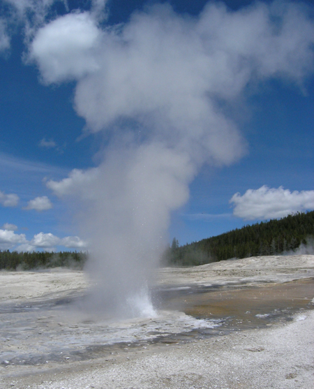
Grand Prismatic Spring Valley, Yellowstone National Park
Mount St. Helens and Spirit Lake from Windy Ridge - A pretty awesome infographic, but you’d need *very* high ceilings to put it up! Explore Planet Earth : Top to Bottom
http://arkarthick.com/2010/06/10/explore-planet-earth-top-to-bottom-infographic/ - Draft science plan to guide scientific ocean drilling for the next decade is online. Comment period lasts till Sept 21.
http://campanian.iodp.org/NewSciencePlan/
(via @BoreholeGroup) - Could be an interesting read: a new History of Science Journal, History of the Geo- and Space Sciences.
http://www.history-of-geo-and-space-sciences.net/
(via @HistoryPhysics) - Another lovely Friday Field Foto from @clasticdetritus: channelized Miocene strata, Tierra del Fuego
http://clasticdetritus.com/2010/08/27/friday-field-foto-122-channelized-miocene-strata-tierra-del-fuego/ - Great plain language geojob profile! : SciMath Career #6: Logging Scientist
http://joidesresolution.org/node/1299
(via @cbdawson, @Geoblogfeed)
Interesting Miscellaney
- Ooh. Solar activity effects radioactive decay rates? Due to neutrinos or some unknown particle?
http://www.physorg.com/news201795438.html
(via @GrrlScientist) - Beer microbes live 553 days outside ISS. FROM Beer, S UK, not used to make it. Boo.
http://www.bbc.co.uk/news/science-environment-11039206
(via @ComplexLifeNAI) - Very cool project and website: The Mannahatta Project — reconstructing NYC’s past landscape and ecosystems.
http://themannahattaproject.org/home/
(via @clasticdetritus) - Swarm modeling started as a poor man’s AI – but it may be the key to the real thing.
http://www.economist.com/node/16789226
(via @edyong209, @vaughanbell) - An interesting ”2 cultures’ framing of the endless discussion of the state of science reporting: scientists and science journalists have different objectives, so may never see completely eye-to-eye…
http://www.timeshighereducation.co.uk/story.asp?sectioncode=26&storycode=413129&c=2 - Fascinating post by @PHLane on the impact of parenthood on salary.
http://networkedblogs.com/7erDy
(via @mariawolters) - And another great post from @PHLane on why mentoring alone won’t break the glass ceiling for women:
http://pascalelane.wordpress.com/2010/08/25/we-need-more-than-mentors/ - Canada’s new Arctic research station site chosen to be Cambridge Bay [Personally I’m surprised it’s not Resolute]
http://www.cbc.ca/technology/story/2010/08/24/arctic-research-station-cambridge-bay.html
(via @rivrchik) - Excellent list of banned words for writing about science by @carlzimmer re writing about science
http://blogs.discovermagazine.com/loom/2009/11/30/the-index-of-banned-words-the-continually-updated-edition/
(via @clasticdetritus)





Nice plan for content warnings on Mastodon and the Fediverse. Now you need a Mastodon/Fediverse button on this blog.