![]() It’s that wonderful time of year, as one semester finally gives up the fight and a new one waits in the shadows, pouncing on unsuspecting students and faculty just as they breathe a sigh of that they’ve won the first battle. This past semester I taught a class on river geomorphology, but in January, my teaching takes a subterranean turn as I lead about 18 students through a semester of hydrogeology. At many research universities, surface water and subsurface water are distinct specialties and courses are taught by different faculty, so I appreciate the chance to get to indulge both of my passions. Besides which, it is really impossible to separate surface and subsurface water, as is aptly illustrated by this week’s Scenic Saturday photos.
It’s that wonderful time of year, as one semester finally gives up the fight and a new one waits in the shadows, pouncing on unsuspecting students and faculty just as they breathe a sigh of that they’ve won the first battle. This past semester I taught a class on river geomorphology, but in January, my teaching takes a subterranean turn as I lead about 18 students through a semester of hydrogeology. At many research universities, surface water and subsurface water are distinct specialties and courses are taught by different faculty, so I appreciate the chance to get to indulge both of my passions. Besides which, it is really impossible to separate surface and subsurface water, as is aptly illustrated by this week’s Scenic Saturday photos.
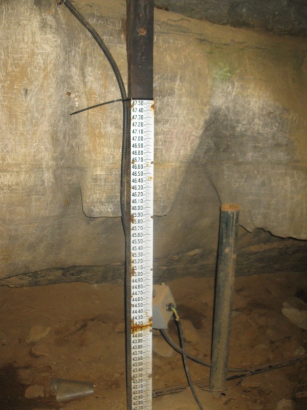
This is a stage gage, which is used to visually measure water height, usually in a lake or river. Here though it’s in River Hall, 250 feet below ground in Mammoth Cave, Kentucky. Normally this area is about 45 feet above the water table, and there are benches here for tourists to rest on. But when it rains hard and the Green River floods above ground, it also backs up into the cave, with the water table rising up into River Hall. The last time it flooded into River Hall was in spring 2010, and you can read more about it from karst hydrologists here.
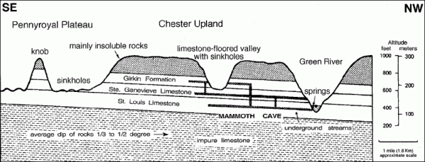
Digging into the origins of the cave, it’s not surprising that cave water and river water should be so well connected, because their geologic history is intricately tied. As the Green River cut downward over the last four million years, it took the regional water down with it. The multiple levels of dry trunk passages in Mammoth Cave correspond with elevations where the Green River paused in its downwards erosion and groundwater had significant time to dissolve the limestone at that elevation. You can read more about the formation of Mammoth Cave and other similar caves on the Cumberland Plateau in this paper by Anthony and Granger from 2004.

Cross-section of Mammoth Cave, adapted from Palmer, 1981 and obtained from http://www.nps.gov (click image to link to source)
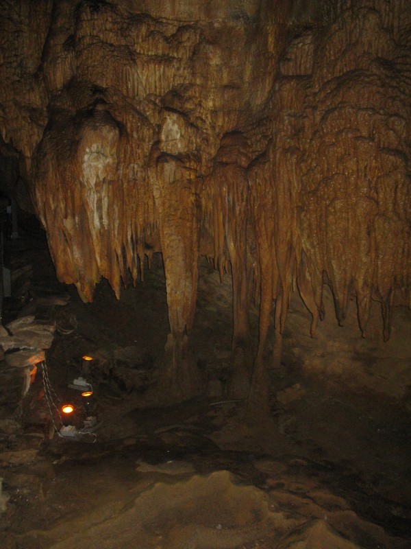
Most of Mammoth Cave is surprisingly dry, as far as caves go, and some would even call it a “fossil cave.” This is because of the lowering of the regional groundwater, but also because a sandstone cap above the cave-forming limestone limits the infiltration of local rainfall into the cave. Where the capstone is missing, some of the more typical cave dripstone formations are seen.


Links (2)-
-
Pingback: Our Highly Allochthonous travels in 2011 | Highly Allochthonous
Pingback: Scenic Saturday: 101 Geo-sites | Highly Allochthonous