
Update: NASA Earth observatory has now put up a much nicer, cloud free-image showing uplifted reefs on the other side of the island, a smaller version of which I’ve added below the fold.
The large subduction zone earthquake that hit the Solomon Islands at the beginning of April had quite a dramatic effect on the coastline of Ranongga, one of the closest islands to the site of the rupture: tectonic uplift of up to 3 metres stranded large areas of coral reef above the high water mark:
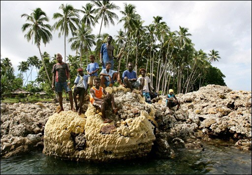
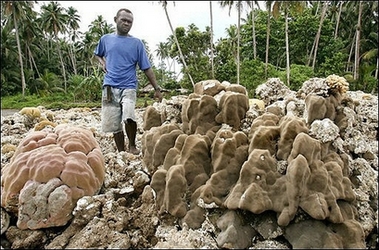
The change was so dramatic, that you can even see it from space. Even with all the cloud cover in the top picture, taken after the earthquake, you can see the newly exposed reef as a dark grey smudge, up to 150 metres wide in places, which is clearly absent from a picture taken in March 2006.
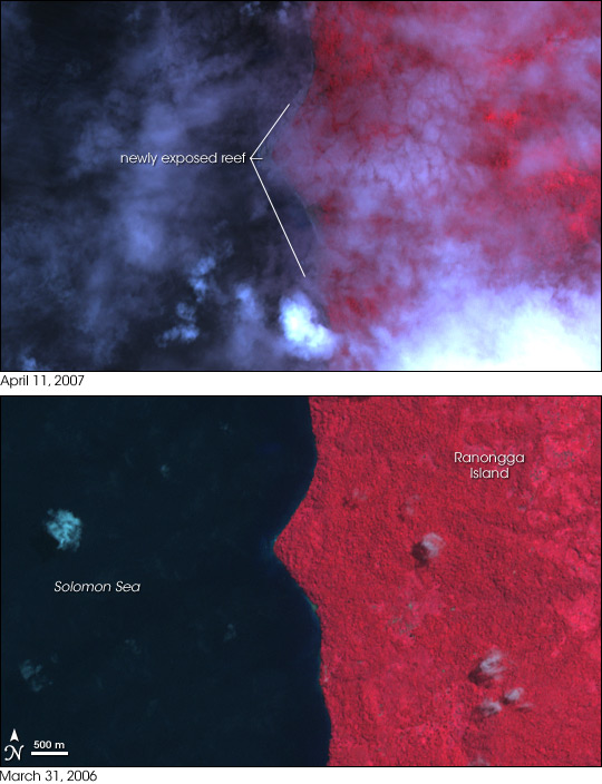
(from NASA’s Earth Observatory)
Updated image:

I wonder if you can find the remnants of reefs stranded by earlier earthquakes on Ranongga? By dating them and measuring how far they’ve been raised above sea-level, you could have a go at reconstructing the past seismic history of the subduction thrust.
Comments (2)