 Fortunately, the schedule for my recent trip to the Big Island of Hawaii included a couple of days of field excursions – I think the conference organisers realised that they would happen regardless, so they decided to make them official so people actually turned up for presentations. On one of these excursions, we visited the Hawaiian Volcano Observatory and the Hawaii Volcanoes National Park, both of which are centred around Kilauea, the youngest and most active of the volcanoes that make up the Big Island. Eruptions on Kilauea are not confined to the summit caldera but also regularly occur along a rift zone that runs roughly east from the summit down to the coast. The combination of lots of lava reaching the surface, and that lava coming out in lots of different places, produces a landscape that is not only extremely young, but also constantly changing. Our hike through the park really brought this home, right from the time we parked at the trailhead; immediately after climbing off the bus, I found myself looking down a road that abruptly ended in a lava field.
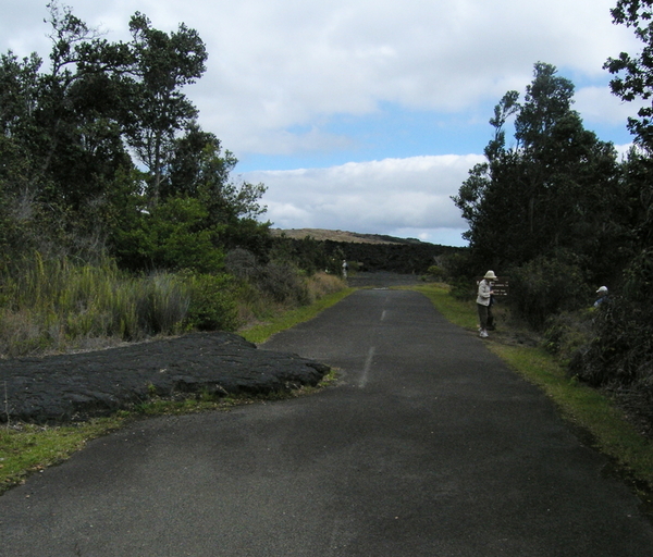
This road through the National Park lasted less than a decade before the Kilauea went all NIMBY on it. Photo: Chris Rowan, 2012.
A road built to view volcanoes that is now part of one was only one of the dramatic recent changes in this area. Our walk took us across a lava field to the summit of Pu’u Huluhulu, the forested hill on the left in the picture below. This cinder cone formed around 500 years ago; and up until around 50 years ago, it was the highest point in the immediate area. A viewpoint at the top gave people a lovely view of surrounding volcanic craters, and an unimpeded look down to the coast. But all that changed between 1969 and 1974 when a major fissure eruption culminated in the the view from Pu’u Huluhulu being cut off by the formation of Mauna Ulu, the shield volcano on the right.
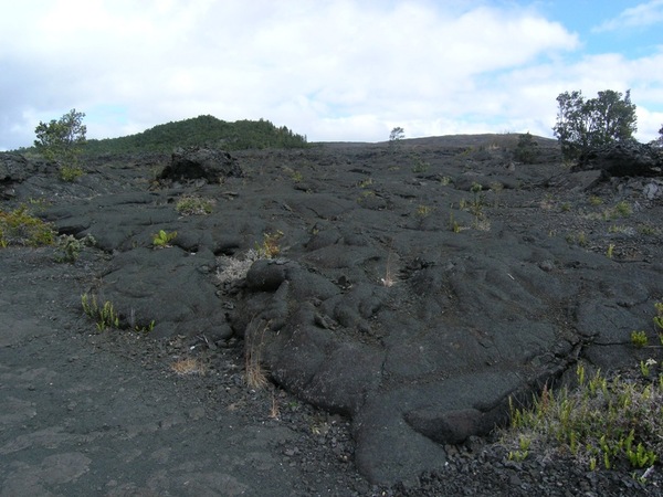
Pu'u Huluhulu, on the left, is an "old" hill now surrounded by new lava from Mauna Ulu on the right. Photo: Chris Rowan, 2012.
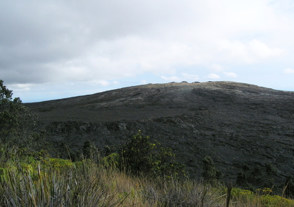
Mauna Ulu from the summit of Pu'u Huluhulu. Note the perched lava lake about half way down. Photo: Chris Rowan, 2012.
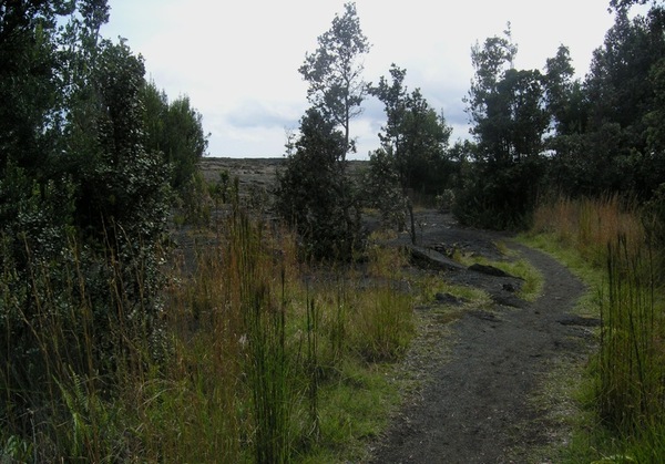
The trail crossed a complex landscape of overlapping flows, including fine examples of pahoehoe and a’a lava flows. No prizes for guessing which type of lava the trail stuck to.
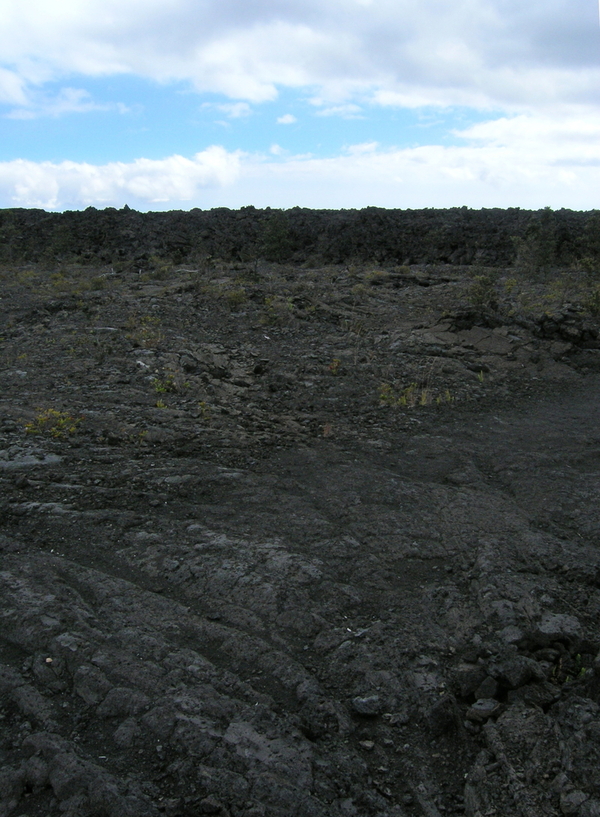
A'a on top of pahoehoe; it's all basalt, but with entirely different textures and structures. Photo: Chris Rowan, 2012.
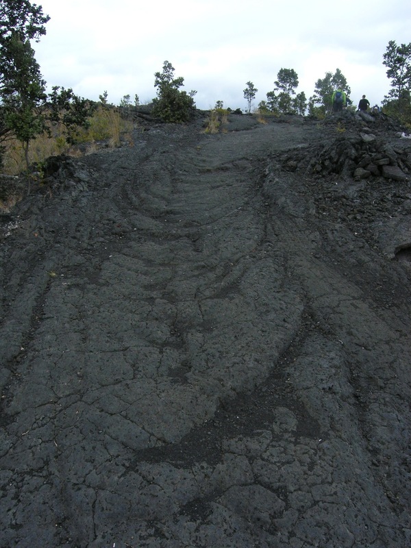
A close up of a ropey pahoehoe lava flow lobe, or 'toe'. The trail actually moves up along it! Photo: Chris Rowan, 2012.
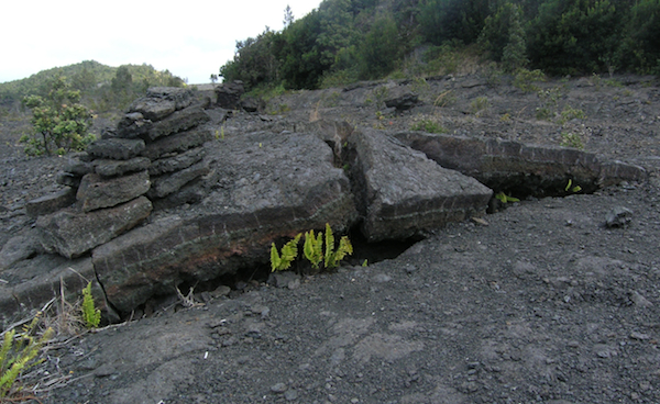
A lava flow that has been broken up by deflation, where still-molten lava at the base of the flow drains away, causing the solid crust to collapse into the space left behind. Photo: Chris Rowan, 2012.
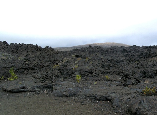
The edge of a blocky a'a flow with its source, Mauna Ulu, in the background.
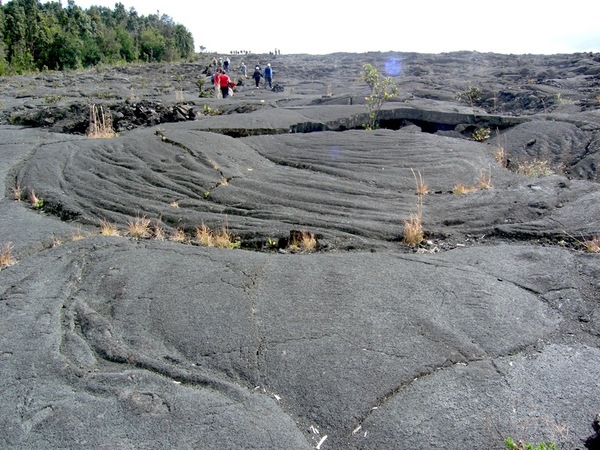
A many-toed pahoehoe lava flow that has engulfed the (former) western slope of Pu'u Huluhulu. Photo: Chris Rowan, 2012.
As we reached the flanks of Pu’u Huluhulu, you could see where the lava from Mauna Ulu had lapped up on it’s flanks. Fortunately for the trees on the summit, the eruption stopped before it engulfed the hill completely, leaving a kipuka – and island of living green in the midst of sterile lava.
Lava from Mauna Ulu lapping against the slopes of Pu'u Huluhulu. Photo: Chris Rowan, 2012.
Of course, the lavas from Mauna Ulu were moving across areas just as forested as Pu’u Huluhulu still is, and the spectacular results of the one-sided contest between molten rock and wood are seen at some points along the trail: these ‘lava trees’ were formed when they were overwhelmed by lava and then exposed as the flow deflated. All that now remains of the original tree is the mould-like imprint of the bark on the inside hollow lava tubes.
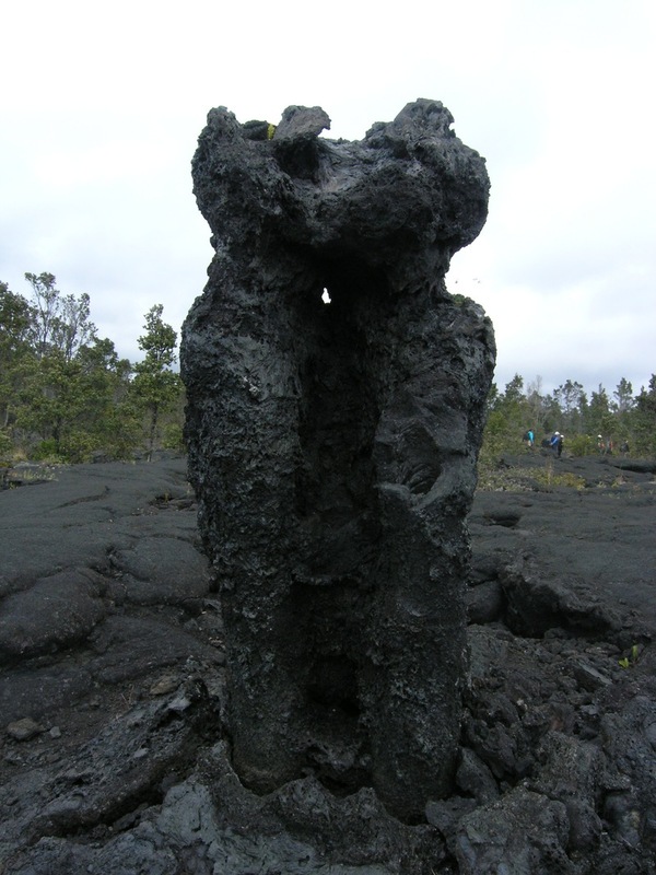
A Hawaiian lava tree. Photo: Chris Rowan, 2012.
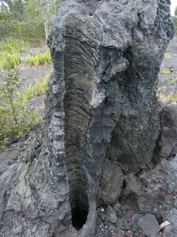
An imprint of the original tree bark is clearly visible inside this lava tube. Photo: Chris Rowan, 2012.
This hike really brought home what a dynamic place Hawaii is: it’s a place where new scenery is being continuously created, where old landscapes are constantly being buried to make way for new. And if you’re more a fan of slower-paced geology, and so feel overwhelmed by all this dynamism: at the end of the day you can just kick back with a Mai Tai, and enjoy the sunset.
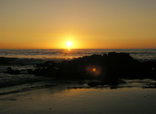
Sunset from Kona coast, Hawaii. Photo: Chris Rowan, 2012.
![]()
![]()




Nice plan for content warnings on Mastodon and the Fediverse. Now you need a Mastodon/Fediverse button on this blog.