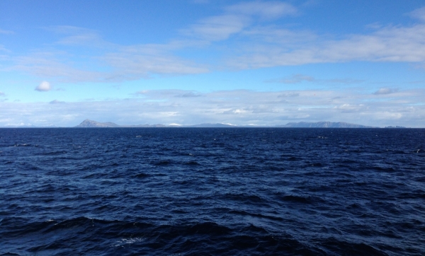
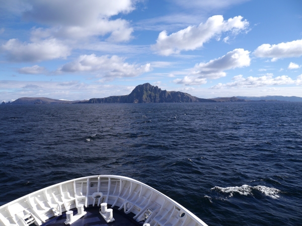
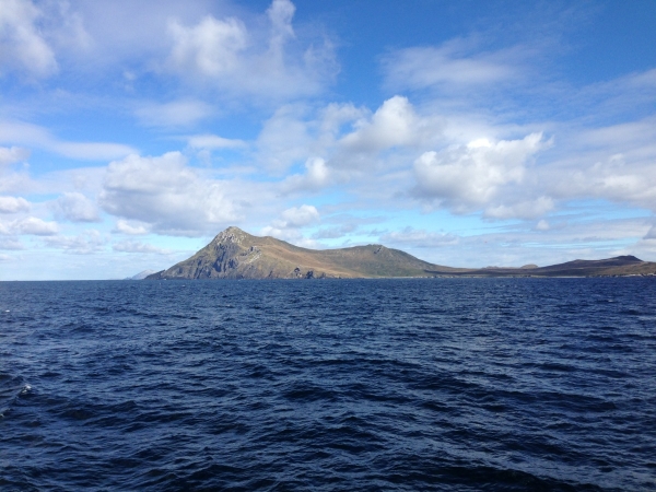
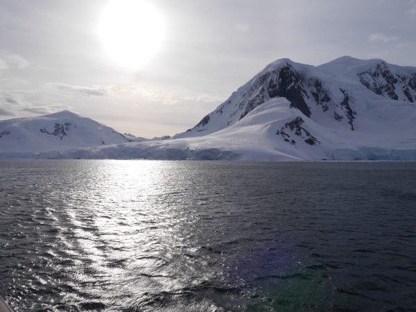
Antarctica had fallen away behind us. The meteorological good fortune that we had been enjoying continued to hold on our return journey across the Drake Passage, and provided a nice bonus as the shores of South America came up over the horizon; a clear view of Cape Horn. Despite its fearsome (and well-earned) reputation, because of the calm weather we ventured much closer than one normally would.
Land ho! The end of our return journey across the Drake Passage. Photo: Chris Rowan, 2013.
Cape Horn from the south. Photo: Chris Rowan, 2013.
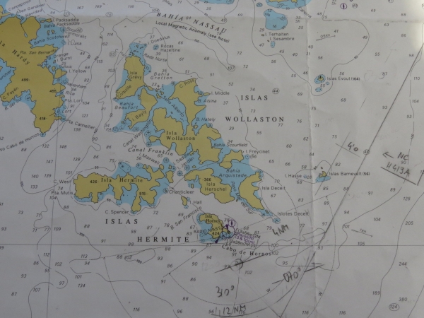
Two things you might not know about Cape Horn: it’s named not for its shape on a map, but for the Dutch city of Hoorn, and as the chart makes clear, its quite a small island – home to a small Chilean coastguard station and a memorial to sailors who encountered ‘The Horn’ in far more deadly conditions than we did.
Bridge chart showing Cape Horn and other associated islands – you can also see how the good weather allowed a closer approach than normal. Photo: Anne Jefferson, 2013.
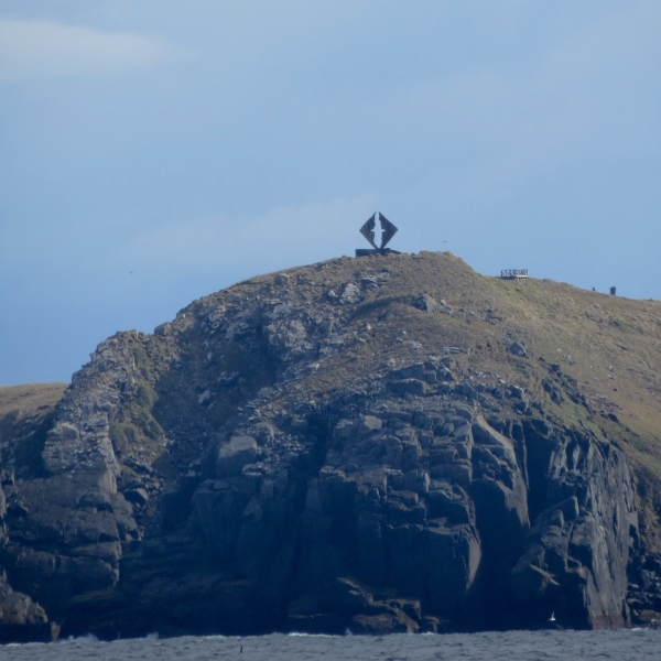
Sailors’ memorial on Cape Horn. Photo: Anne Jefferson, 2013.
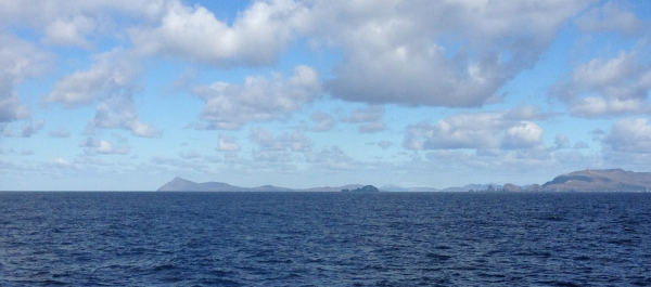
Past ‘The Horn’, looking back southwest. Photo: Chris Rowan, 2013
Our last glimpse of Cape Horn, as Corinthian headed back to Ushuaia. Photo: Chris Rowan, 2013.
Leaving Cape Horn behind us, all that remained was to sail back along the Beagle Channel to Ushuaia, disembark Corinthian, wave goodbye to the lovely crew and expedition leaders, and head to the airport for the long flight home – which ended up being quite an adventure in itself.
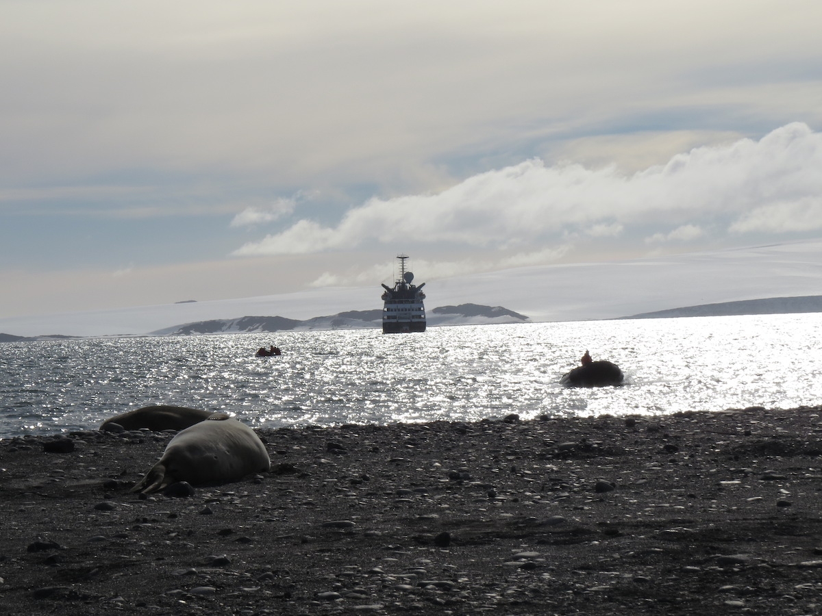
Our last day in Antarctica was filled with a few of my favorite things, and I wished at our last two stops, as I had at many, that we had lots more time to explore and soak in the scenic and geologic richness of our surroundings.
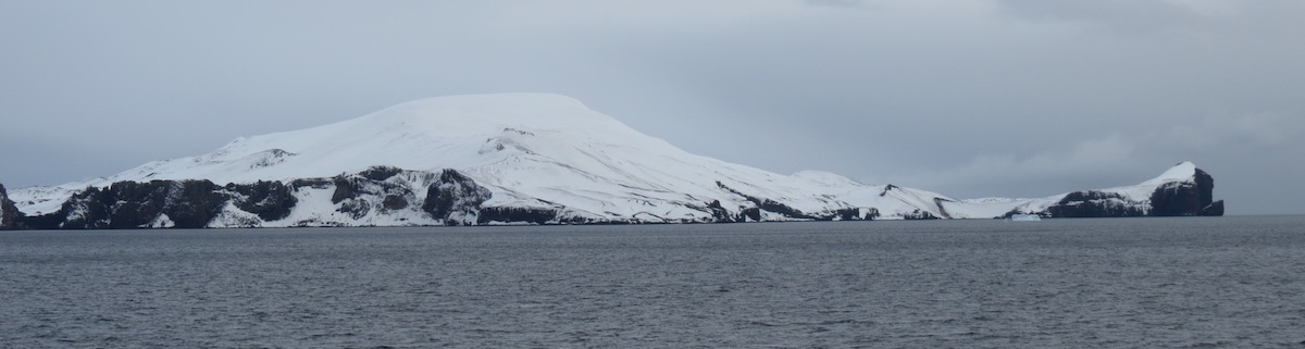
Even from outside the caldera, Deception Island’s volcanic heritage is evident. Photo by A. Jefferson.
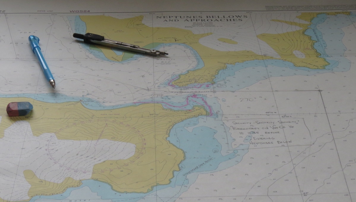
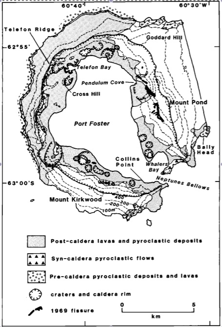
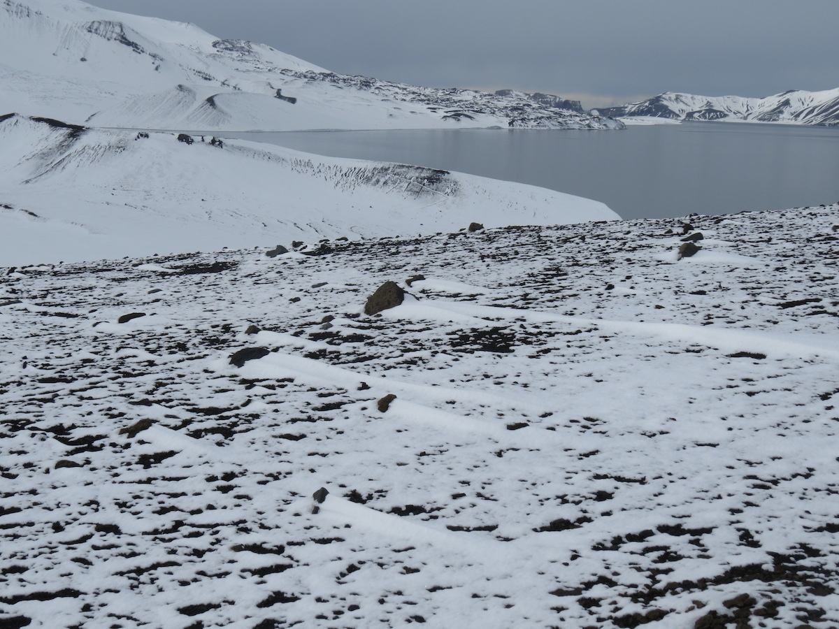
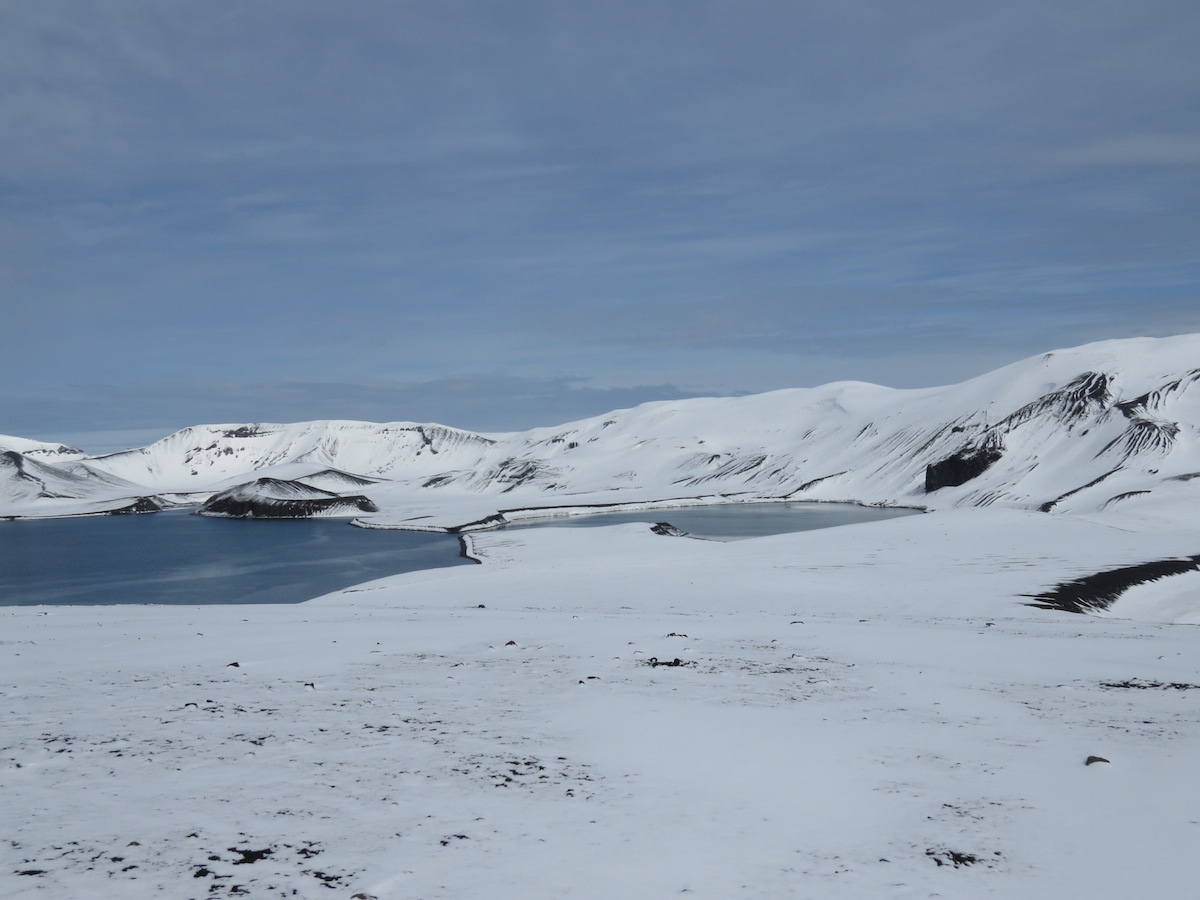
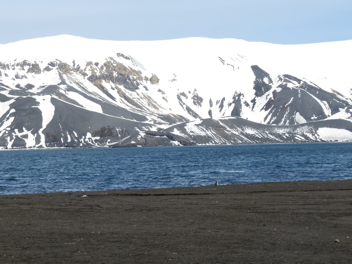
In the morning, we came upon Deception Island, a long-lived shield volcano with a large flooded caldera. There is one narrow and treacherous opening into the caldera, through which ships must carefully navigate to reach the 10 km by 7 km, 190 m deep “Port Foster” on the inside. This opening, called Neptune’s Bellows, allegedly has a submerged rock in the center which has caused significant damage to a number of ships. While our captain was engaged in those maneuvers, we were busy looking at a slice through the volcano.
Navigation chart for Deception Island. Photo by A. Jefferson.
Deception Island is one of the best studied of Antarctic volcanoes, but like all geologic features in Antarctica, knowledge of it is also limited by ice cover. The caldera forming eruption is thought to have occurred in the last 700,000 years, and pre-caldera rocks are not well-exposed. Where they are found, these old rocks are yellow palagonite tuffs with lava and scoria interbeds. To translate for the non-volcanologists, palagonite tuffs have bits of volcanic glass (with a basaltic composition) embedded in a matrix of palagonite, which is alteration product that results when hot basaltic lava & glass come into contact with water. Basically, it’s a really good indication that there was water around when these deposits were formed. In this setting, that water could be either sea water or snow and ice. The lava and scoria interbeds suggest that at least some eruptions took place in drier conditions. The caldera-forming eruption (think Mt. Mazama becoming Crater Lake) is preserved as pyroclastic flow deposits around Neptune’s Bellows.
Geologic map of Deception Island from Smellie (1990).
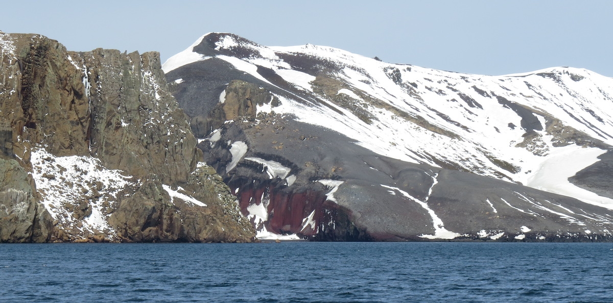
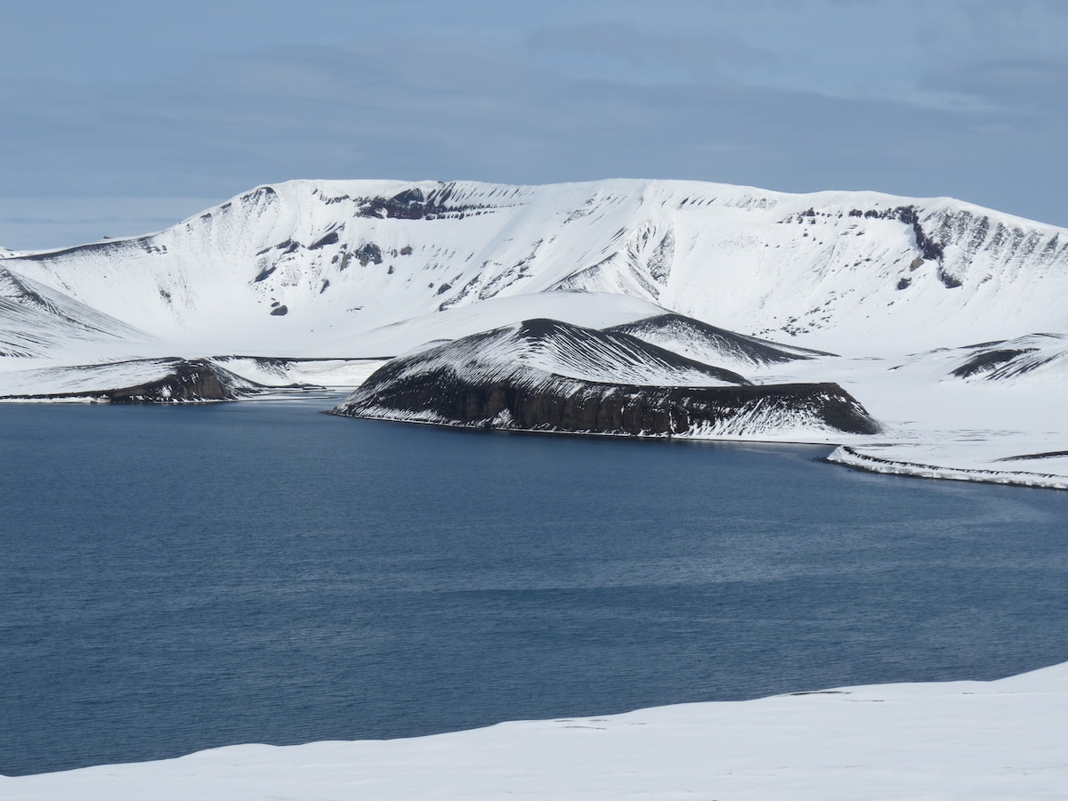
Syn-caldera rocks at Neptune’s Bellows. Photo by A. Jefferson.
Looking from the caldera back at Neptune’s Bellows. On the left are syn-caldera rocks (buff). On the right are post-caldera volcanic products (red and gray). Photo by A. Jefferson.
After the caldera-forming eruption, Deception Island has had lots and lots of volcanic activity and there are numerous tuff cones (steep-sloped volcanic vents indicative of water-magma interactions, called phreatomagmatic eruptions), maars (craters created during phreatomagmatic eruptions), and fissure vents. This volcanic activity is largely controlled by a ring fracture system within the caldera. Some lava flows go down the outer edges of the volcano, but most of the activity has been on the low ground inside the ring fracture. The lavas have diverse compositions – ranging from olivine tholeiites to rhyodacites (low silica to high silica). All told, the volcano is 30 km wide at its base below sea level and is 1200 m high from that base.
We made two stops on Deception Island, both showcasing the recent volcanic activity that has shaped the landscape and impacted the people who took advantage of the island’s safe harbor. Within the caldera, eruptions have been witnessed in 1967, 1969, and 1970, and probable eruptions occurred in 1842 and between 1912 and 1917. This is truly an active volcano.
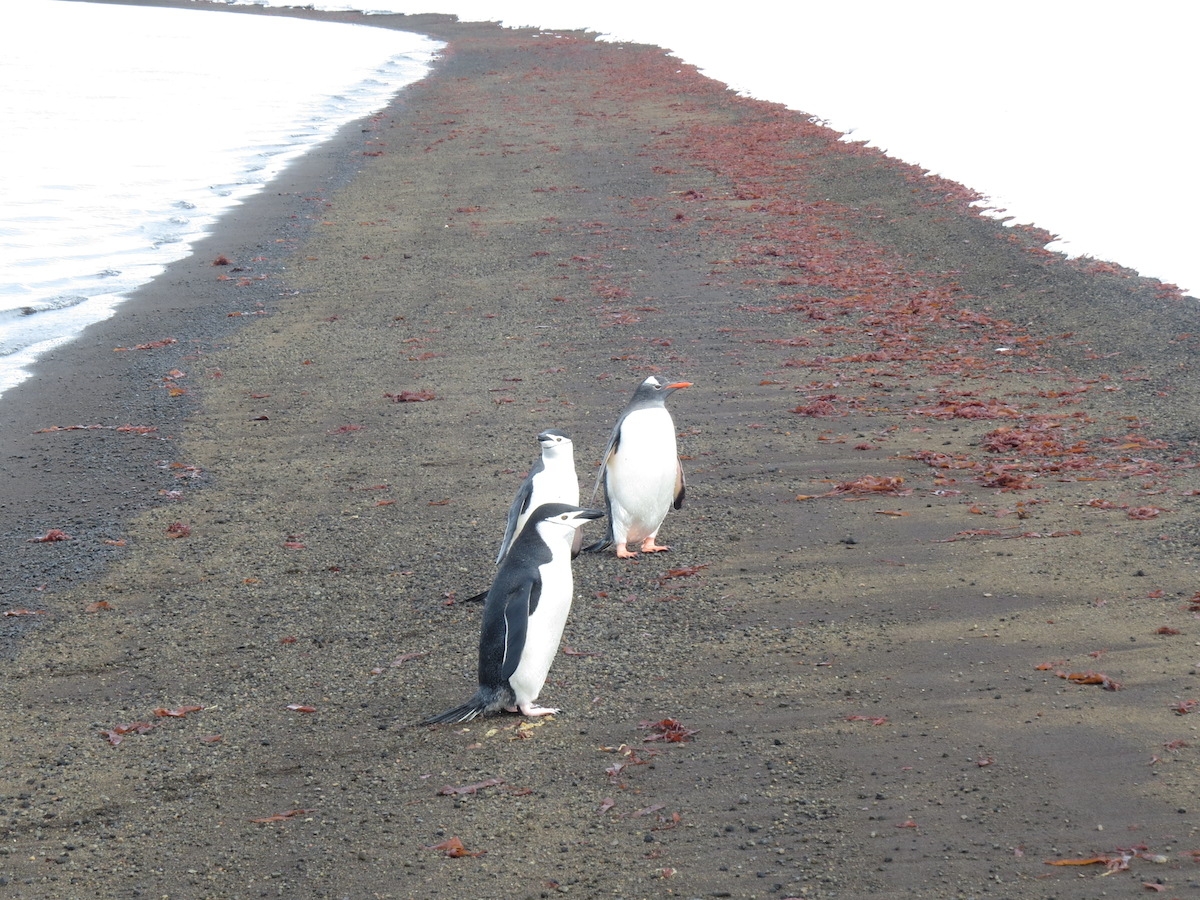
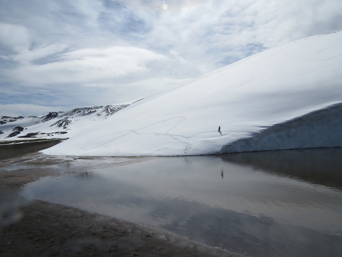
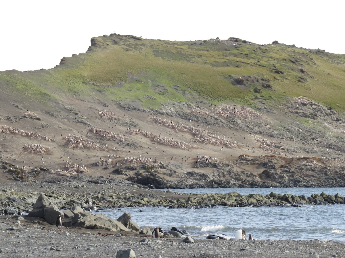
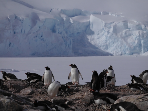
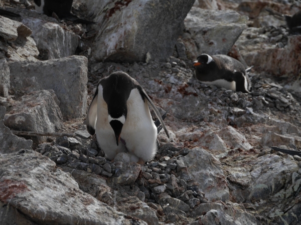
Our welcoming committee at Telefon Bay consisted of Gentoo and Chinstrap penguins, a Weddell seal (not pictured), and some beautiful red kelp(?). Photo by A. Jefferson.
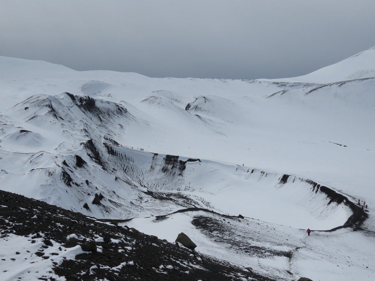
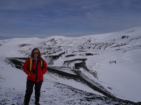
Our first landing took place at Telefon Bay. The beach was black volcanic sand and there was a dusting of snow on the cinder plains, cones, and craters all around us. The beach area itself is probably an old crater, supplanted by more recent volcanic activity. This part of the island was affected eruptions in both 1967 and 1970, and we hiked up to the rim of a crater possibly formed during one of these eruptions. (I’m working from the same geologic map posted above, plus text, so I’m struggling a bit with exactly which bits of the landscape were created when.)
Looking over a 1967(?) crater. Note the people along the crater rim for scale. Photo by A. Jefferson.
I think someone is having fun. Photo: Chris Rowan, 2013
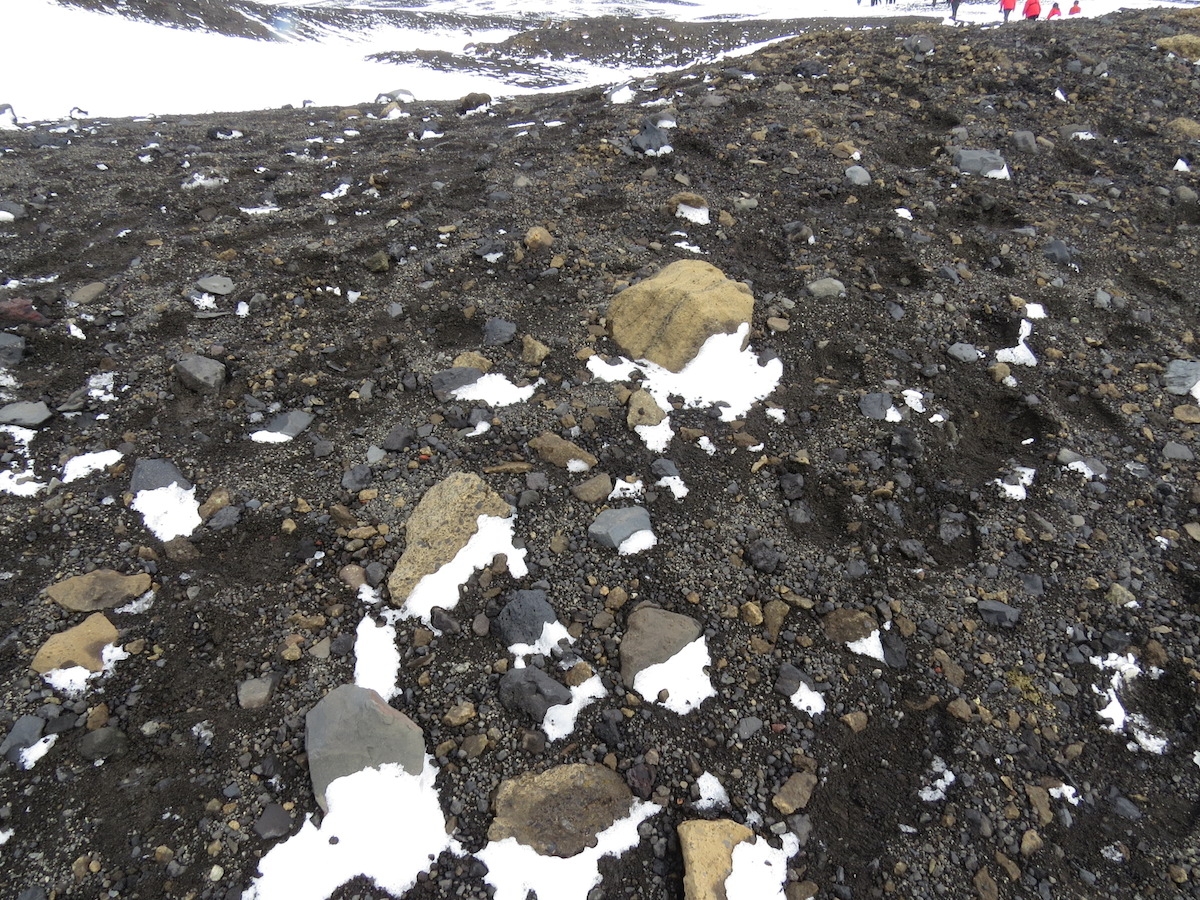
From the crater rim, we hiked in a loop across more young volcanic deposits and had views of a lake and new land formed in the 1967 eruption. The landscape had plenty of juvenile material (lots of scoria), but also a bunch of blocks and older material that looked as if it might have come from a lahar deposit. If it weren’t such a volcanically active place, I would have been worried about humans as geomorphic agents eroding the unconsolidated deposits. However, there are a number of places on Deception Island that are both scientifically interesting and ecologically fragile to warrant protection as Antarctic Specially Protected Areas. Volcanic deposits make great places to study ecological succession on surfaces of known age, and the geothermal features and topography of Deception Island means that it is host to the greatest number of rare and extremely rare plant species in the Antarctic. The lake we looked across to, and the land surrounding it, is encompassed by one of these specially protected areas.
The land surface where we hiked. Photo by A. Jefferson.
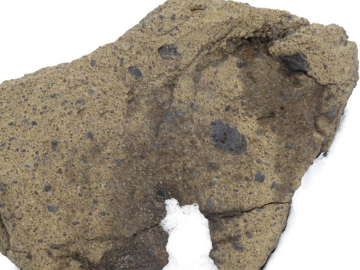
A rock I’m interpreting as an old lahar or pyroclastic flow deposit ejected from a nearby crater quite recently. Photo by A. Jefferson.
Looking towards Neptune’s Bellows from Telefon Bay. I loved the snowdrifts in the lee of the volcanic blocks. Photo by A. Jefferson.
Looking across Telefon Bay towards land created in 1967. This area is now closed to public access as an Antarctic Special Protected Area, because of its ecological fragility and special scientific interest. Photo by A. Jefferson
Crater rim in the background. Hill in front of the crater rim was created as an island in the 1967 eruption and connected to shore by the 1970 eruption. Photo by A. Jefferson.
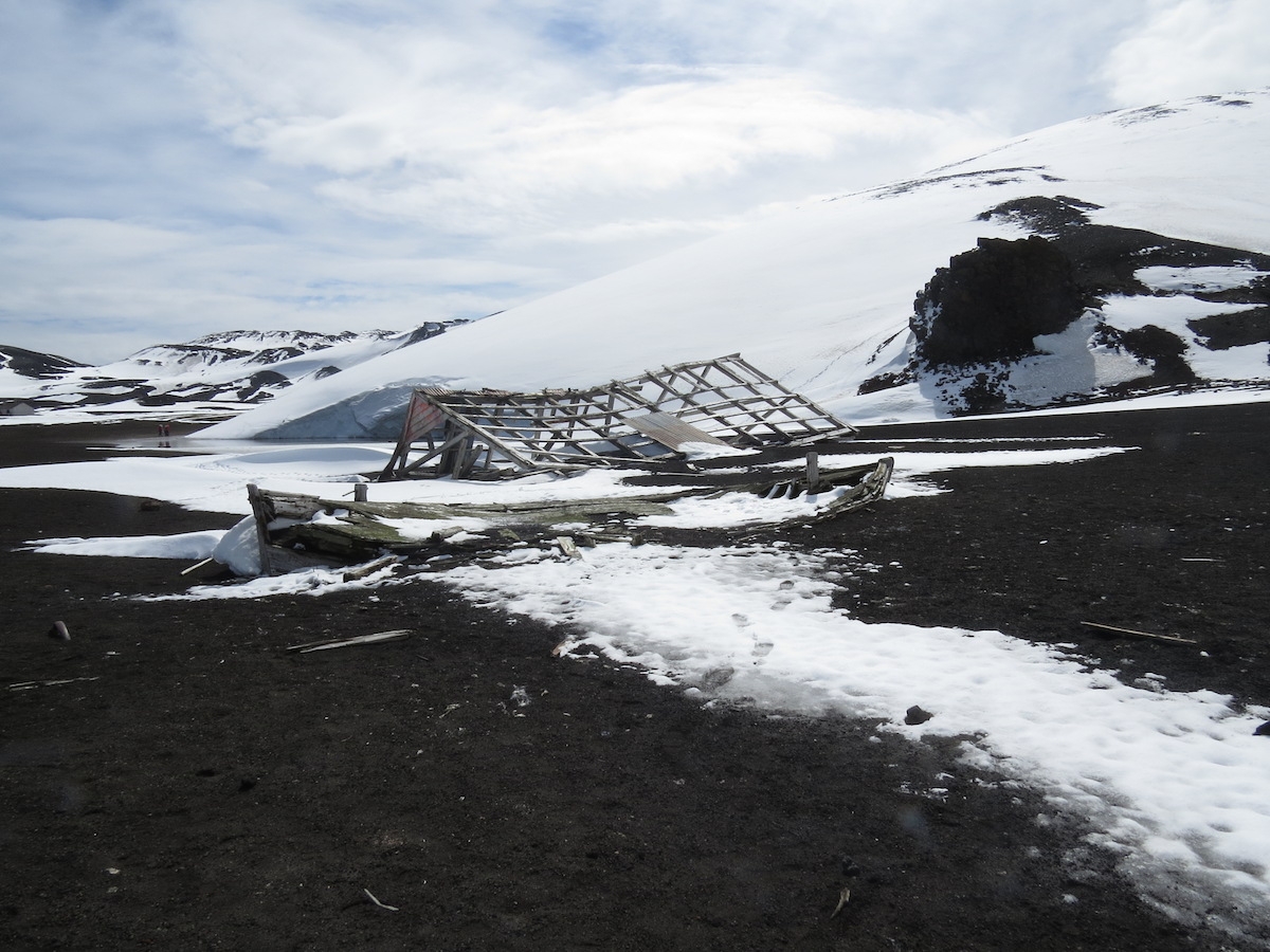
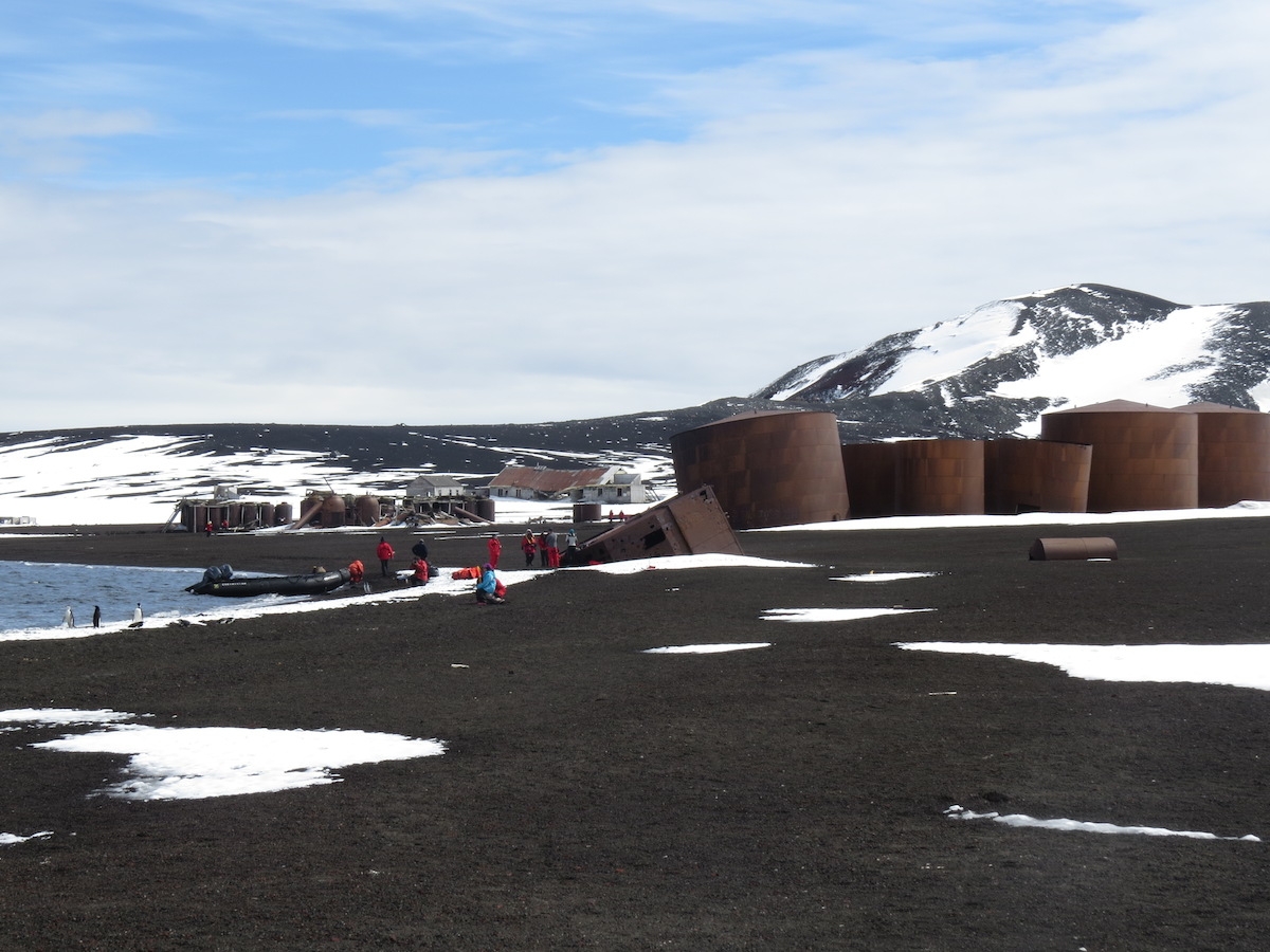
After our explorations at Telefon Bay, we were transported to another site within the caldera, called Whaler’s Bay. This site has the remnants of an old whaling station and a British research station. The whaling station remains (1906-1931) are some of the most significant remains from that awful time of horrific slaughter of tens of thousands of whales each year in Antarctic waters. We’d seen evidence of whaling at Penguin Island and Neko Harbor, but here many of the buildings and fuel oil tanks, whale oil tanks, and cookers were still standing. After the whale processing moved offshore to factory ships, the area was abandoned for a while. In 1944, the British set up a scientific station at Whaler’s Bay and occupied the area until 1969. The Chileans also had a scientific station nearby in Pendulum Cove. Theirs too was abandoned after 1969.
Remains of a boat and building from the whaling station days. Photo by A. Jefferson.
Oil tanks and remains of the whaling station and British station at Whaler’s Bay. Photo by A, Jefferson.
A peak inside one of the many abandoned buildings at Whaler’s Bay. Photo by A. Jefferson.
1969 was a year with more volcanic activity in Deception Island’s caldera – in the form of a subglacial fissure eruption that stretched from Pendulum Cove to Whaler’s Bay. As our guides told us, first the Chilean station was hit by pyroclastic ejecta and the Chileans fled for their lives to the British base at Whaler’s Bay. Not long afterwards, the British station was affected by the volcano. The eruption underneath a thin glacier created a meltwater flood and lahar that headed directly toward the British station and caused significant damage to some of the buildings. (Note: if someone has a link that can verify the fleeing Chileans part of this, that would be lovely.) After that, the Chileans and Brits gave up and the only stations on Deception Island now are summer-only ones on the other side of Port Foster. The 1969 lahar also created new land just beyond the British station, now another Antarctic Specially Protected Area, because of its colonization of known age surfaces and the fact it contains the only geothermal heated lagoon in the Antarctic!
Looking across Port Foster from Whalers Bay to the other caldera wall. Photo by A. Jefferson.
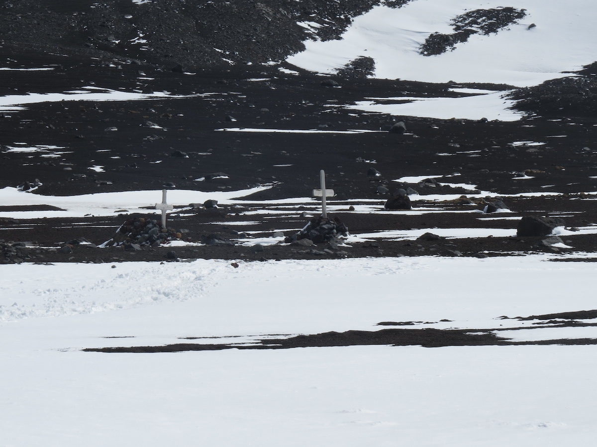
The whaler’s graveyard at Whaler’s Bay was partially over-run by the 1969 lahar. Photo by A. Jefferson.
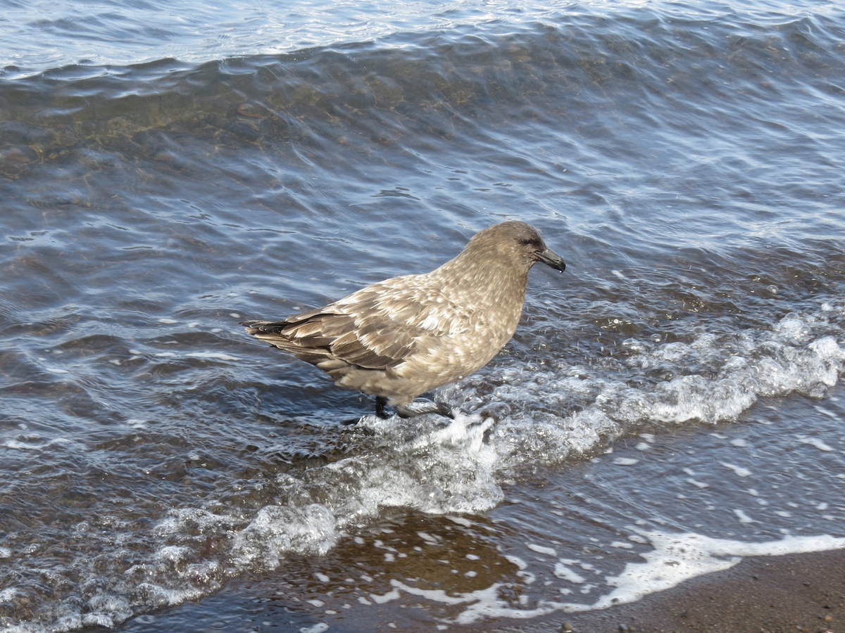
A skua bathing in the waters of Port Foster. Photo by A. Jefferson.
This penguin seemed a bit confused. It spent a long time wandering in circles on the snowbank. Photo by A. Jefferson.
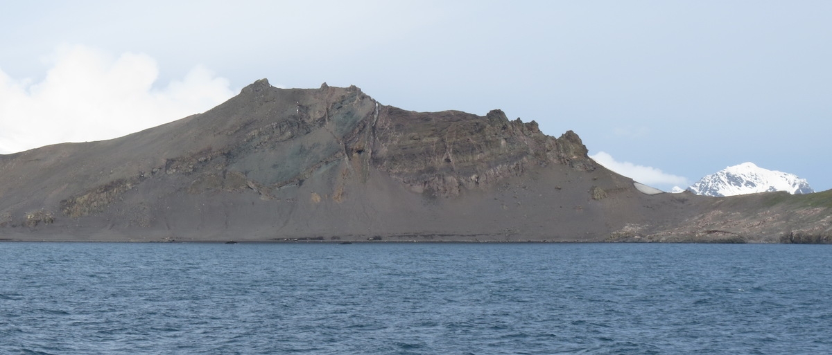
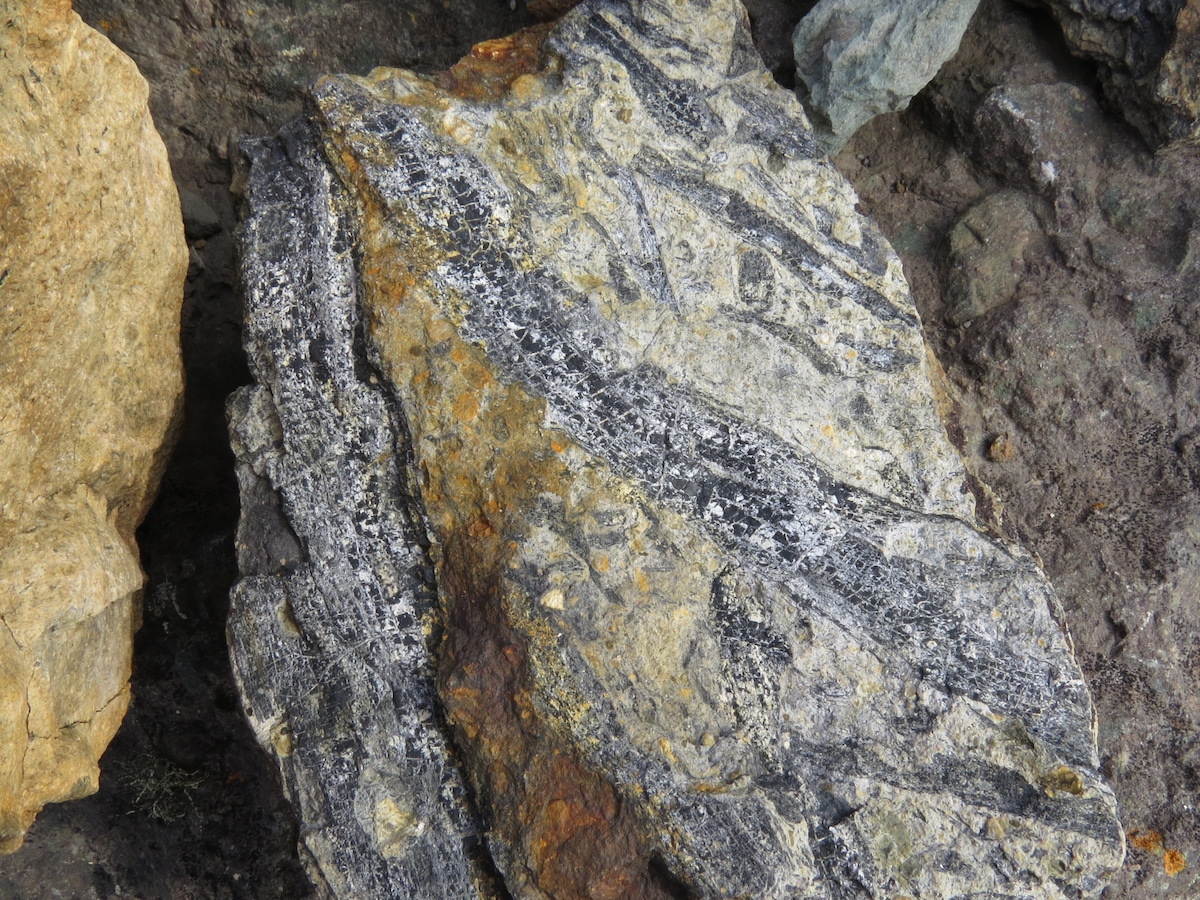
Our final stop of the day – of the trip! – was on Livingston Island, where we got to see the evidence of much older volcanic and biological activity. Livingston Island is huge, complex, and mostly ice covered. But we landed at Walker Bay near Hannah Point, where there was a thin strip of land exposed – ecologically interesting land, both in the modern day and in the Cretaceous. Walker Bay is the eroded remnant of a volcanic caldera formed tens of millions of years ago, when the Antarctic Peninsula was an active volcanic arc above a subduction zone, in contrast to the rift-related modern volcanism at Deception and Penguin Island. The cliffs that back the bay’s beach are a 500 m sequence of basaltic andesite to dacitic lavas, interbedded with pyroclastic and thin sedimentary beds. Two K-Ar dates of the sequence give ages of 87.9+/-2.6 million years and 67.5+/-2.5 million years.
The outcrops at Walker Bay on Livingston Island. Photo by A. Jefferson.
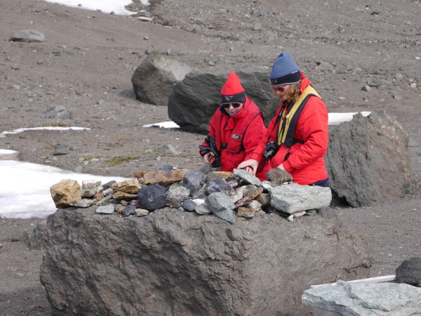
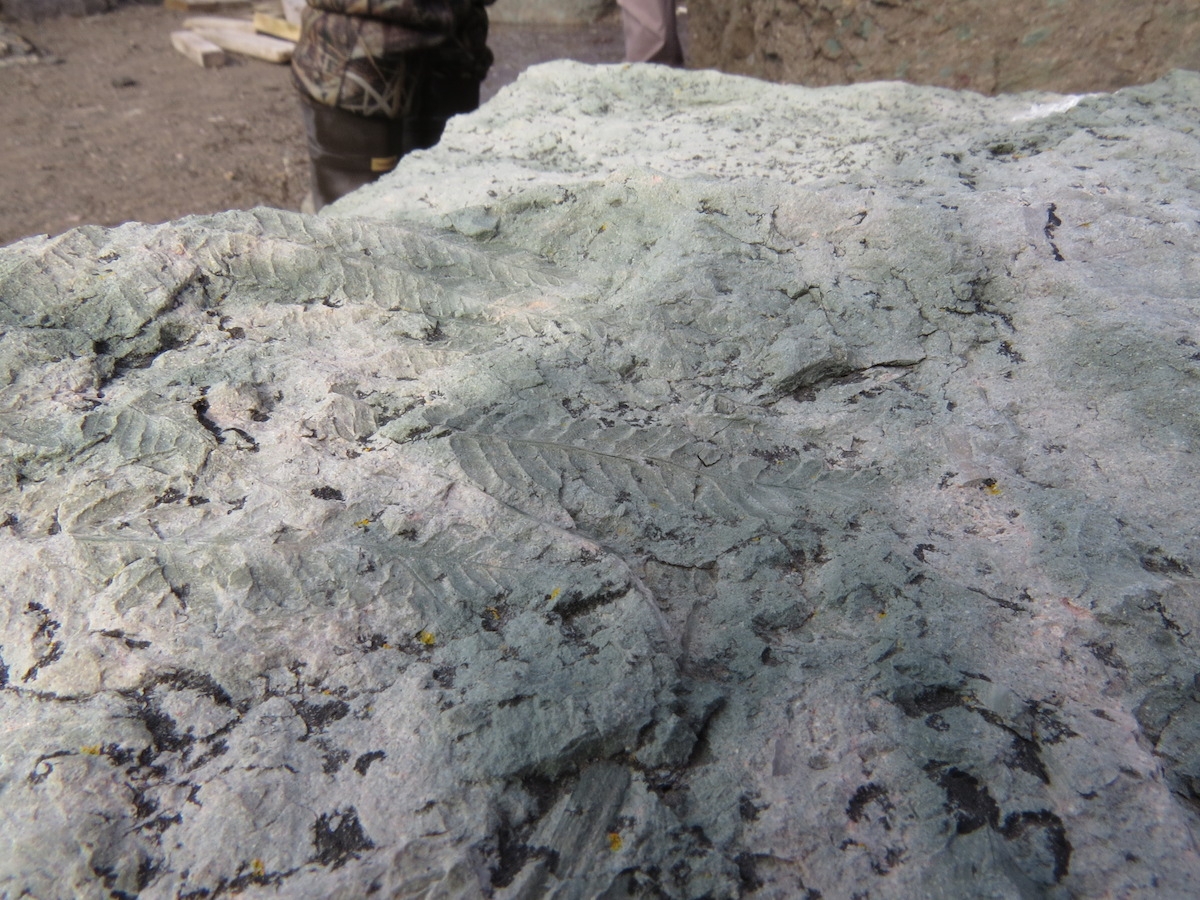
Here, however, it’s the sedimentary beds that are the most geologically interesting, for they contain a rich assemblage of plant fossils. There are 18 taxa recognized from leaf imprints and woody stems, predominantly ferns and conifers of the Podocarpaceae family. Podocarps are classic Antarctic flora, dating from before the breakup of Gondwana and now found throughout the Southern Hemisphere. Interestingly, there is also one angiosperm (flowering plant) identified in the plant fossils at Walker Bay, and angiosperm pollen is also found in the rocks. Because the fossiliferous layers in the middle of the cliff-forming sequence, you can’t walk up things in situ. However, a sort of open-air museum had been created at the back of the beach, with a large number of fossil-rich rocks set up for display. This was a place I particularly worried about the ethos of taking only pictures and leaving only footprints, but our guides at least kept a close eye on everyone. Today, the vegetation at Walker Bay is limited to large patches of moss. Admittedly, this is much more vegetation than at most sites we’d visited, but still quite depauperate compared to what was there in the ice-free late Cretaceous, a good 30 to 50 million years before it entered its current deep freeze.
Anne and her mother Carol Jefferson inspect the Walker Bay Cretaceous plant exhibit. Photo: Chris Rowan, 2013.
Fern fossils from Walker Bay. Photo by A. Jefferson.
Some fossil stems. Photo by A. Jefferson.
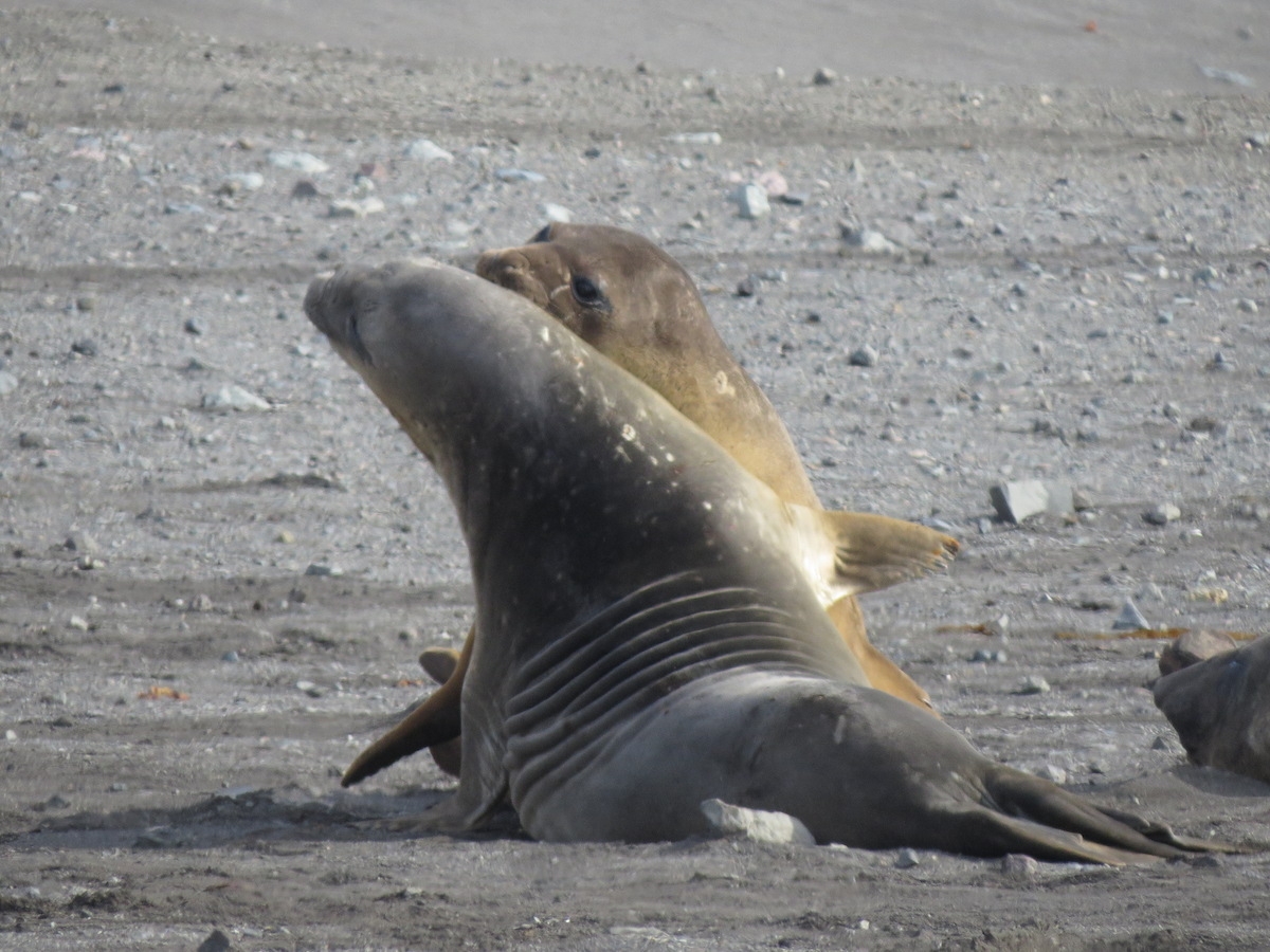
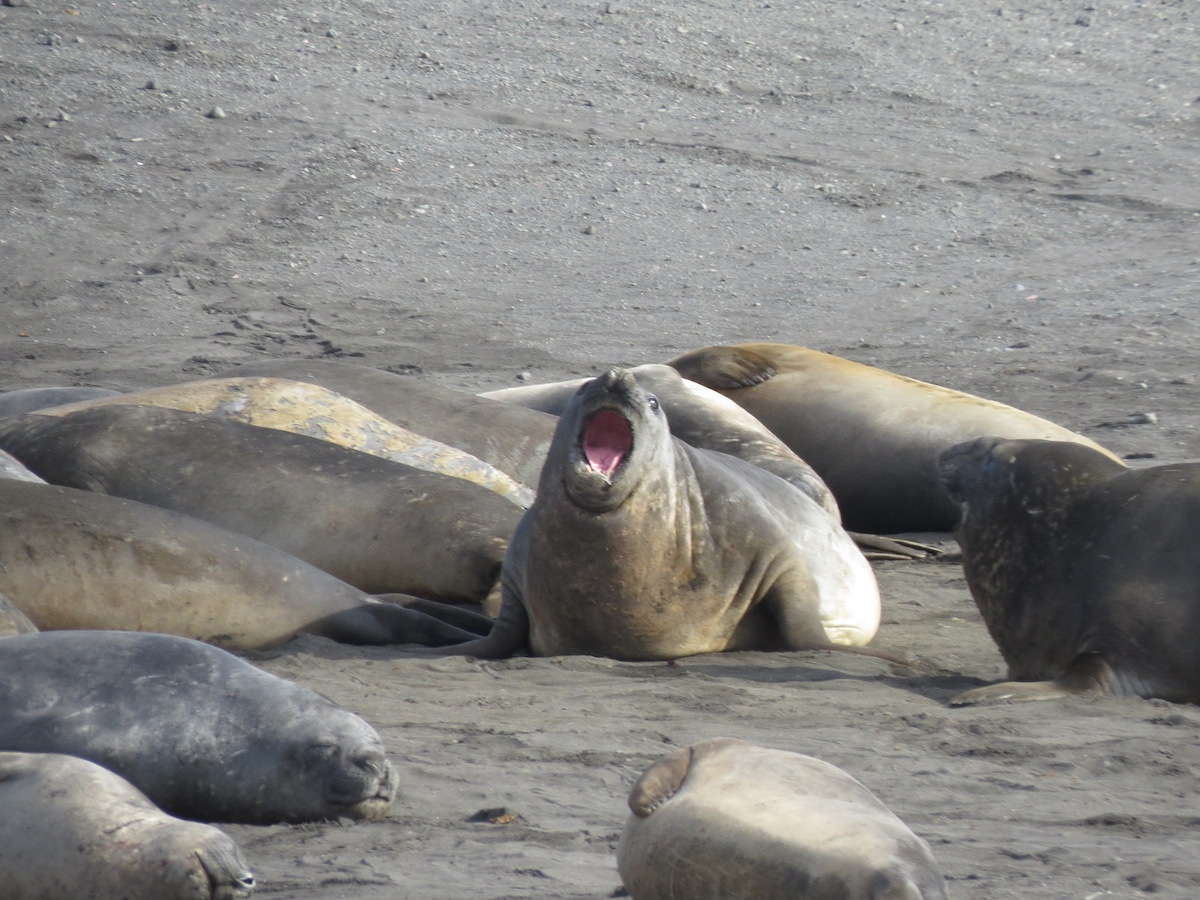
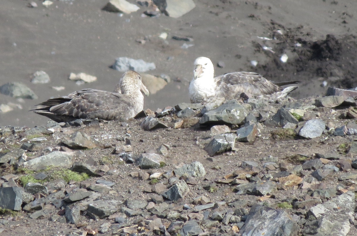
The modern plants and animals also cried out for our attention at this site as well. Lots of elephant seals were molting, wallowing, mock fighting, and generally being impressively large and belchy. There were also chinstrap penguins and nesting Southern giant petrels. The visitor code of conduct specifies that humans must stay at least 5 m away from all wildlife, but is also says to stay at least 50 m away from the giant petrels — more if a change in behavior is noted. Don’t mess with a bird with a 2 m wingspan!
Young elephant seals mock fighting. Photo by A. Jefferson.
Elephant seals resting and bellowing. Photo by A. Jefferson.
Nesting southern giant petrels, observed from a long way away with a very good zoom lens. Photo by A. Jefferson.
Just beyond the beach at Walker Bay is Hannah Point. This area is ecologically rich, with several species of plants and breeding grounds for chinstrap, gentoo, and macaroni penguins, Antarctic (blue-eyed) shags, snowy sheathbills, kelp gulls, Antarctic terns, three species of spetrel, skuas and the aforementioned southern giant petrels. For this reason, the point is closed to visitors during breeding season. I’m glad the area is closed to visitors, and at least my impressive zoom lens gave me a view of what the fertile area looks like.
A view towards Hannah Point and its prolific nesting birds. Photo by A. Jefferson.
A long, choppy zodiac ride took us away from Livingston Island and brought an end to our Antarctic landings. Now only a northward crossing of the Drake Passage and series of flights up the length of the Americas were ahead of us.
Bidding adieu to our last glorious day in Antarctica. Photo by A. Jefferson.
I think everyone was sorry to see us go. Photo: Chris Rowan, 2013.
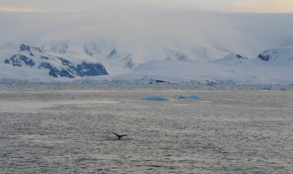
Smith Island: our last glimpse of the Great Southern Continent as we headed back north. Photo: Chris Rowan, 2013
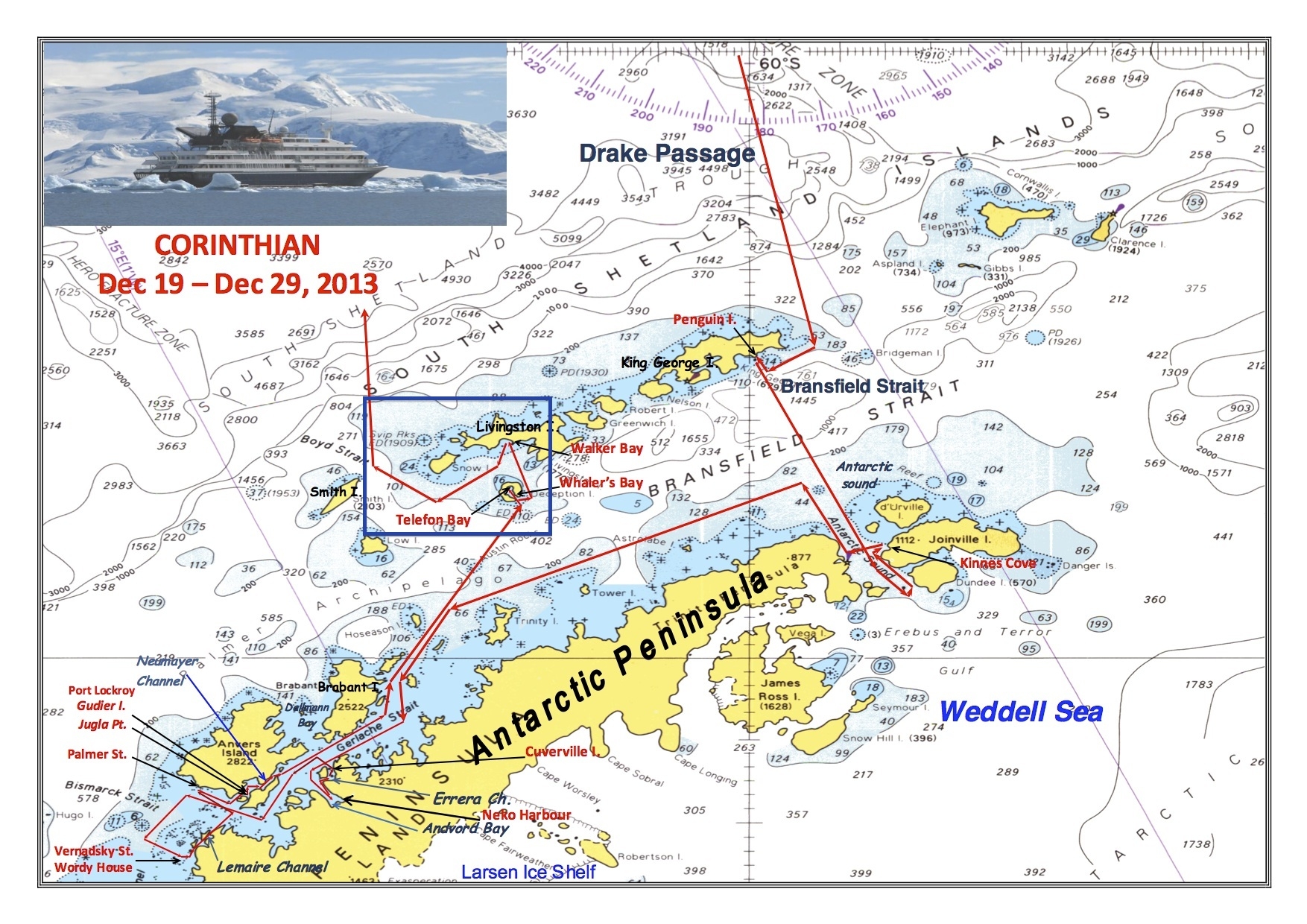
Our areas of exploration on 26 December 2013 are shown inside the blue box at the center of the map.
References:
Smellie, J.L. (1990) D. Graham Land and South Shetland Islands, in Volcanoes of the Antarctic Plate and Southern Oceans (eds W.E. LeMasurier, J.W. Thomson, P.E. Baker, P.R. Kyle, P.D. Rowley, J.L. Smellie and W.J. Verwoerd), American Geophysical Union, Washington, D. C.. doi: 10.1029/AR048p0302
Smellie, J. L. (2002). The 1969 subglacial eruption on Deception Island (Antarctica): events and processes during an eruption beneath a thin glacier and implications for volcanic hazards. Geological Society, London, Special Publications, 202(1), 59-79.
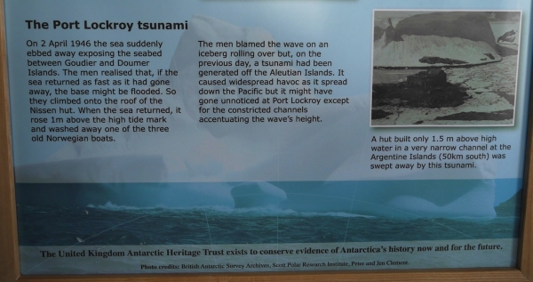
How Port Lockroy was almost washed away by a tsunami in 1946. Photo: Chris Rowan, 2013
This is pretty mind-blowing, if you think about it: an isolated Antarctic outpost at around 65 degrees South, being threatened by the effects of an earthquake at around 53 degrees North1. This is a powerful reminder of the long reach of a large subduction zone earthquake: the shaking is locally very destructive, but if it generates a tsunami then that destruction can be spread across a significant fraction of the planet.
Ten years ago today, we got a much more devastating reminder of this fact. A tsunami generated by a magnitude 9.2 earthquake off the coast of Sumatra radiated throughout the Indian Ocean basin. Waves up to 10 metres high engulfed heavily populated coastal regions from Indonesia and Thailand to Somalia, killing around 230,000 people. As the many sets of then-and-now photos being published this week show, the destruction was almost total. The scale of the disaster was magnified by the lack of any warning system for those in the path of the tsunami, who were taken by surprise and overcome even with several hours’ delay between the earthquake and the tsunami’s arrival.
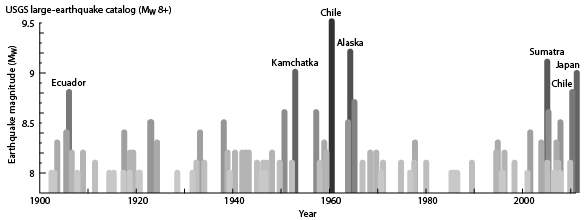
Sumatra was a tragic reminder of the power locked up in the world’s subduction zones. The last truly huge >M9 quakes to shake the earth before Sumatra had occurred in the early 1960s; a time when plate tectonics as we know it was still being pieced together. Indeed, George Plafker’s observations of patterns of uplift and subsidence in the wake of the 1964 M9.2 Prince William Sound earthquake was central to our recognition of the widespread existence of dangerous, shallowly dipping subduction zone thrusts around the edges of the world’s ocean basins. However, following that recognition subduction earthquakes in the plate tectonic era stayed their hands a little, with the largest magnitude earthquakes in the 1970s, 80s and 90s edging just above M8. Then, ten years ago today, a 40-year tectonic silence was broken.
>M8 Earthquakes since 1900. Compiled from the USGS catalogue by Ground Truth Trekking
But our improving, if still limited, understanding of what happens in big subduction zone earthquakes does nothing if we can’t apply it: quickly determining which earthquakes are likely to generate tsunami and when and where they will strike, and then getting a warning to vulnerable coastal communities in time for them to evacuate. It is clear that the last 10 years have seen improvements in both tsunami forecasting and warning systems, although some issues remain in the Indian Ocean for getting timely warnings ‘the last mile’.
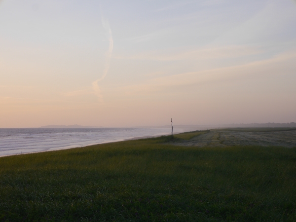
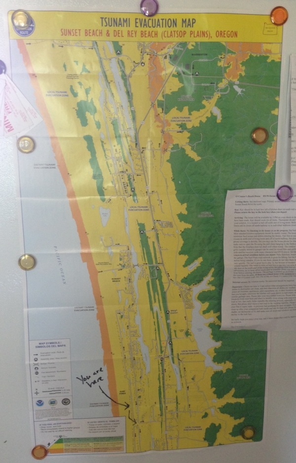
And I still wonder: can you ever be truly prepared for events of this magnitude? This summer, I spent a few days at a beach house on the Oregon coast. It was a beautiful place, but I found it difficult to feel totally comfortable there, given my knowledge of what lay off the coast, and what it was capable of.
The flat coastal plain on the Oregon Coast. Many, many towns and beach houses are built on this. Photo: Chris Rowan, 2014.
Residents of this area have not by any means been left ignorant of the danger. The effects of a tsunami-generating earthquake on the Cascadia subduction thrust have been modelled. Safe areas have been mapped out, and evacuation routes signposted. I could see evidence of this up and down the coast, and even on the fridge of our beach house.
Tsunami Evacuation Map for the area I was staying in. All the yellow areas would be at risk from a tsunami generated by a Cascadia earthquake (not sure I trust the safety of the green ridges, either). Photo: Chris Rowan, 2014
But all I could see was how flat everything was, how far thousands of people would have to go to be truly safe, in not very much time. As we drove through all of the towns that hug the beachfront, all I could think about was how, when Cascadia decides it is time to move like it last did in 1700, all of this would get swept away.
Ten years after Sumatra, we’re still working to understand what happens when really big faults let rip. And despite the signs and the evacuation plans, I’m not sure we’ve truly grasped what it means to have a subduction thrust as your closest tectonic neighbour, either.
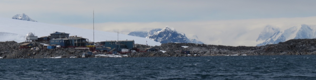
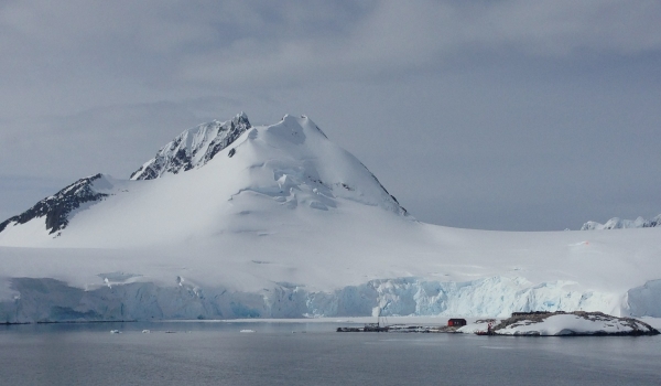
There aren’t many things that sound less festive than sitting through a PowerPoint presentation from the National Science Foundation, but after GeoKid celebrated Santa being able to find her even at 60-odd degrees south, that’s what we found ourselves doing early last Christmas morning. For the ice that had prevented us from getting to Palmer Station the previous day had cleared up enough for us to reach the smallest of the USA’s Antarctic bases, home to about 18 people in the winters, and 40 in the summers.
Palmer Station and surroundings. Photo by A. Jefferson.
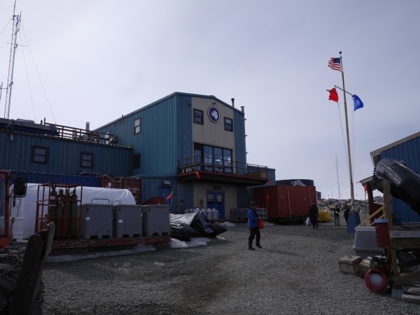
As PowerPoint presentations go, it was a pretty interesting look at the aims and logistics of Antarctic research. And sitting through it bought us the chance to go ashore and tour the station ourselves.
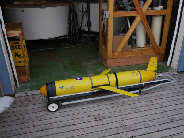
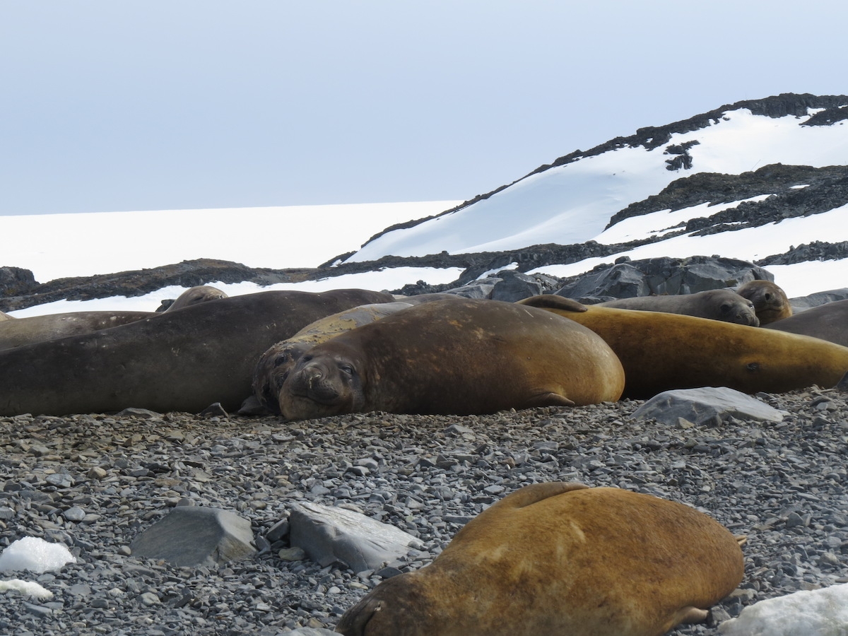
In our journal, Anne notes highlights such as the autonomous underwater gliders being used for data collection; photo displays of women Antarctic scientists; and the spill containment system. We were also keenly aware that this is one of the most rapidly warming places on the Antarctic Peninsula, which had caused the nearby glacier to retreat 1/2 mile since the station was built in 1965. Monitoring the changes in local ecosystems in response to this warming is one of the main foci of research at Palmer, though scientists are limited to where they can get by snowmobile or zodiac. Upon departing the station, we also snuck in a brief zodiac ride to see penguins and a group of juvenile elephant seals sunning themselves on a nearby point.
Ashore at Palmer Station, Antarctica. Photo: Chris Rowan, 2013.
Autonomous glider used for collecting data from underneath marine ice. Photo: Chris Rowan, 2013.
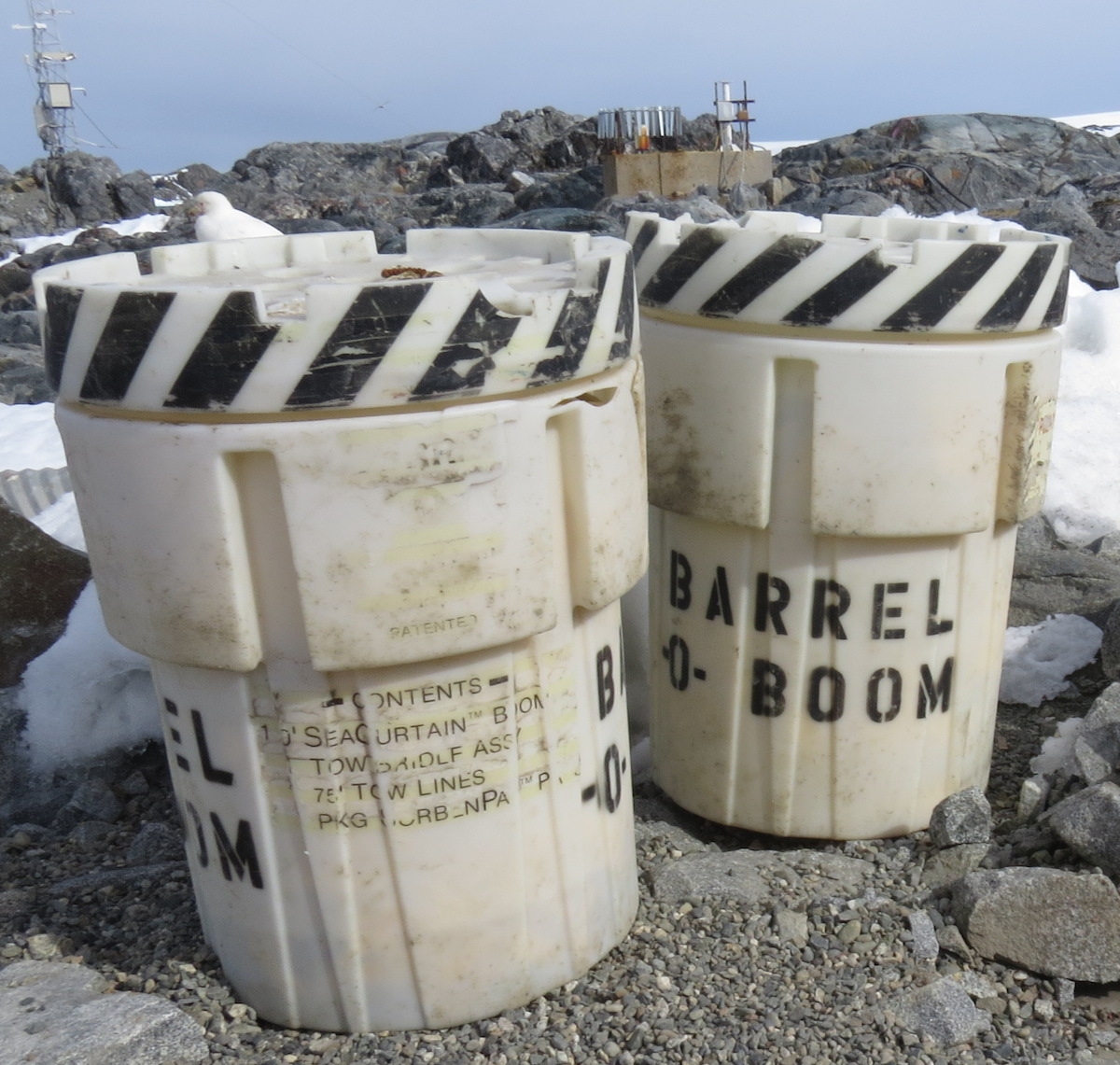
The barrels-o-boom at Palmer Station caused quite a few smiles. Inside, they contain emergency spill response materials.
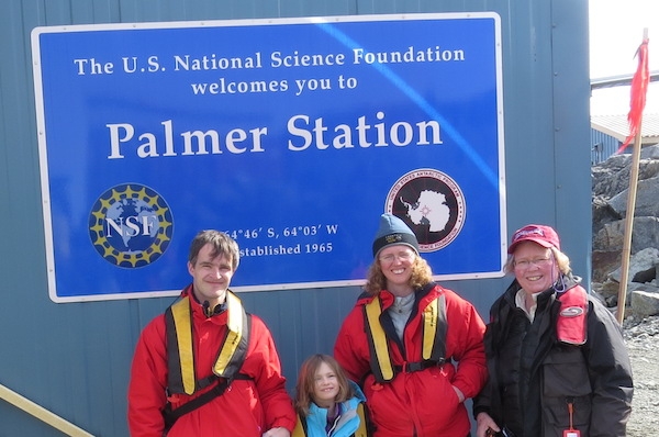
Special thanks to Anne’s mom, on the right, for making this incredible trip possible. Trip of a lifetime, Mom!
Elephant seals near Palmer Station. Photo by A. Jefferson.
Over lunch, Corinthian took us to see a very different Antarctic outpost
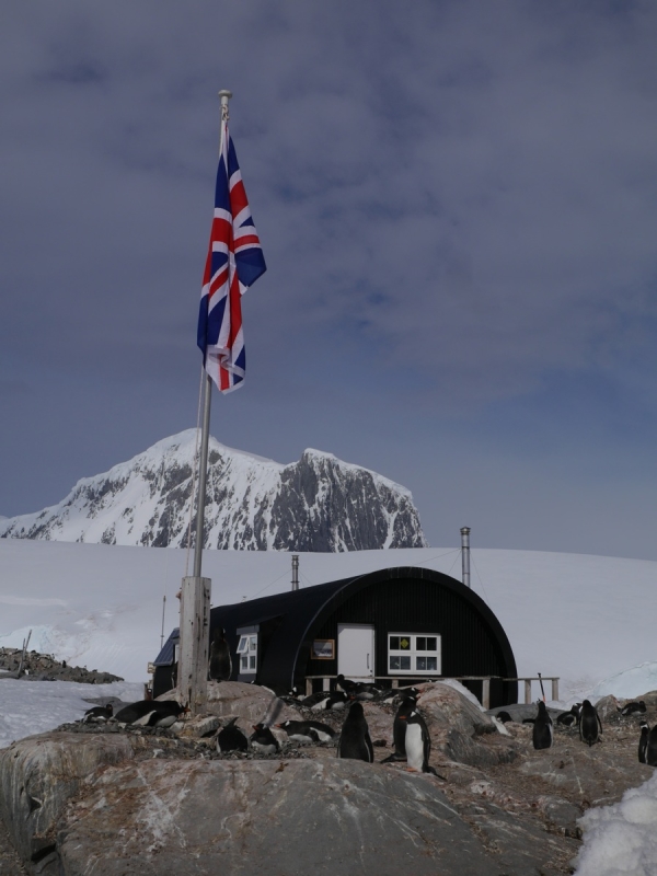
Little Port Lockroy, one of the first permanent bases to be constructed in Antarctica, and now a historic site and monument. Photo: Chris Rowan, 2013.
Anne: “Port Lockroy is a former British station operated as a living museum by the British Antarctic Trust. It was on a tiny island surrounded by glaciers and snow-capped mountains. Five volunteers live on the island from November-March, with no running water, or boat, and little electricity. They are dependent on tourist boats like ours to get in and out and to bring them water [they also harvest chunks of calved glacial ice that wash up on the shore].That seems overly much to me.” This year, the volunteers were all women, and had to beat out a pool of 200 applicants for the position.
The Port Lockroy outpost is in a spectacular location, especially on a sunny day. But imagine seeing that scenery every day and not being able to reach it! Photo: Chris Rowan, 2013
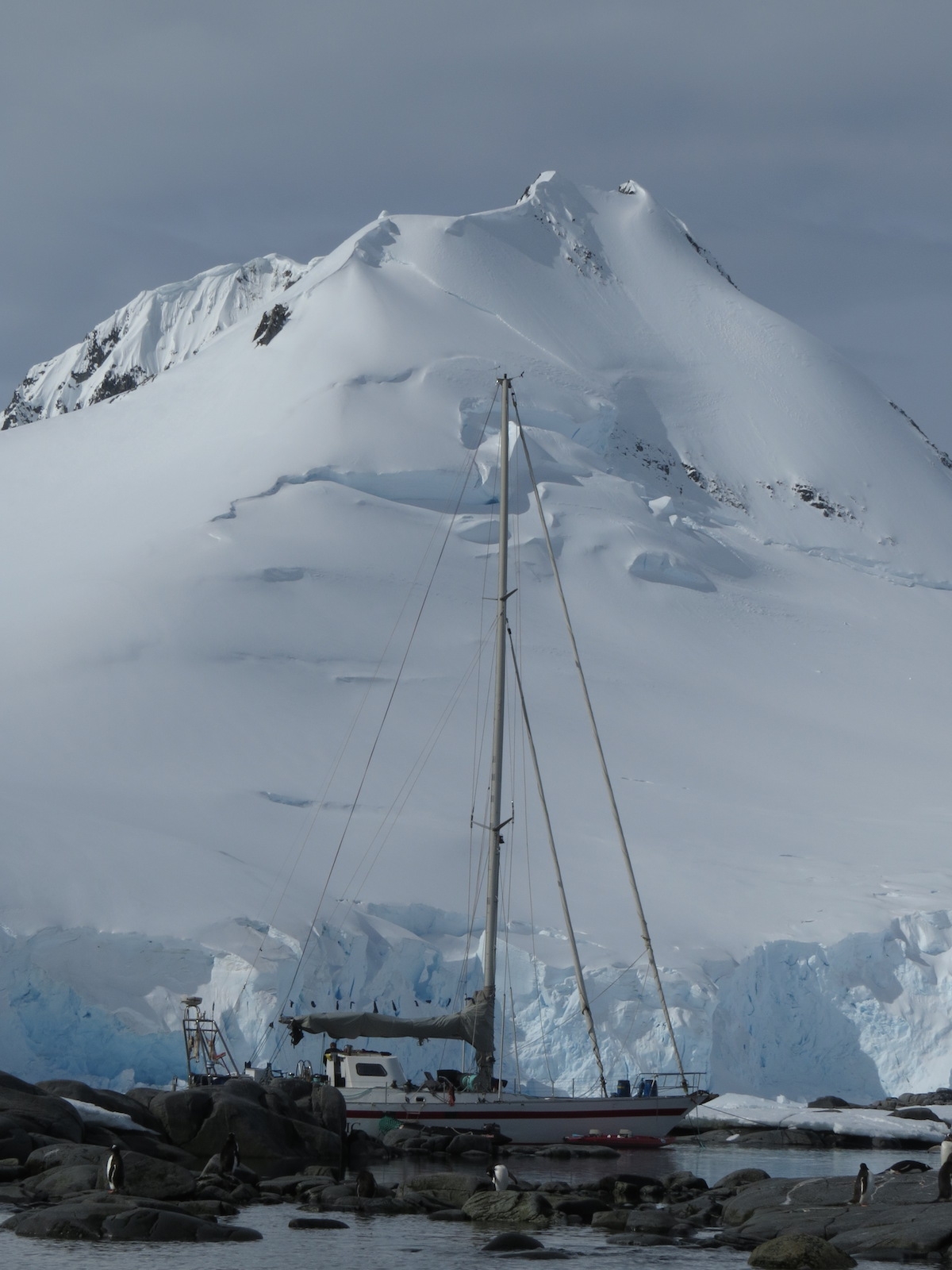
Believe it or not, people sail to Antarctica. This boat, moored at Port Lockroy, was appropriately named Pelagic. Photo by A. Jefferson.
View from the shore of Goudier Island, where Port Lockroy huts are located. Photo: Chris Rowan, 2013.
“The station had been preserved as it was in 1944, and it was fun to see the “period” newspapers, kitchen goods, etc. There were of course penguins nesting around the building and at the base of the flagpole bearing a British flag – a scenic place for a picture!”
The worlds most patriotic penguins? Photo: Chris Rowan, 2013.
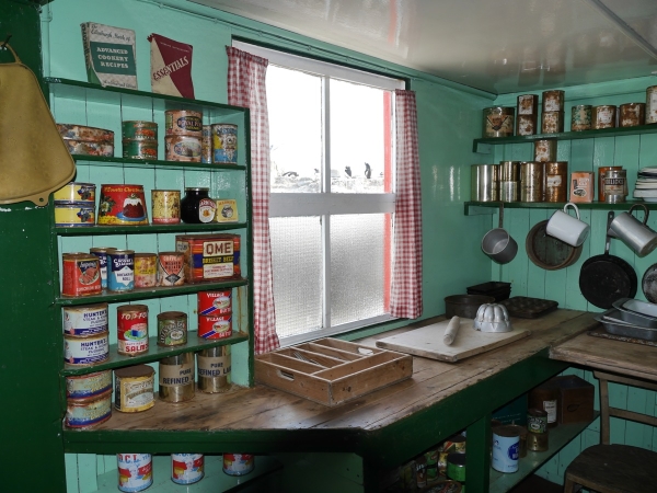
The restored kitchen in the Port Lockroy hut. Photo: Chris Rowan, 2013.
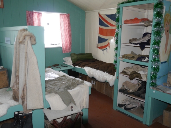
Restored bunkroom at Port Lockroy.
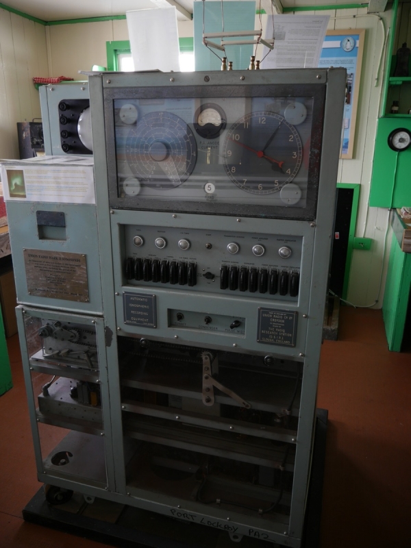
Some of the important research carried out at Port Lockroy, involved bouncing radio waves off the ionosphere to determine the best frequencies for long-range transmission. This ionosonde, known as “The Beastie”, was what was used to do it. Photo: Chris Rowan, 2013.
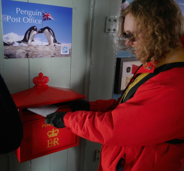
One popular facility at Port Lockroy is the world’s most southerly branch of the Royal Mail. Apparently 70,000 cards are sent a year, with some of the proceeds used to support the museum.
In addition to the penguins nesting right under the huts, we took a brief zodiac ride over to nearby Jougla Point, where we not only saw nesting gentoo penguins, but also Antarctic shags with chicks.
Gentoo Penguins at Jougla Point, Antarctica. Photo: Chris Rowan, 2013.
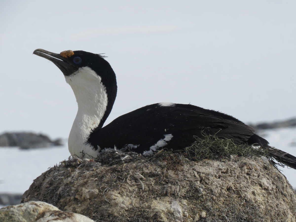
Blue-eyed shag on her nest. Photo by A. Jefferson
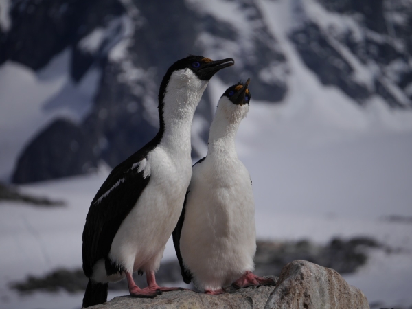
A pair of canoodling Antarctic shags. Photo: Chris Rowan, 2013.
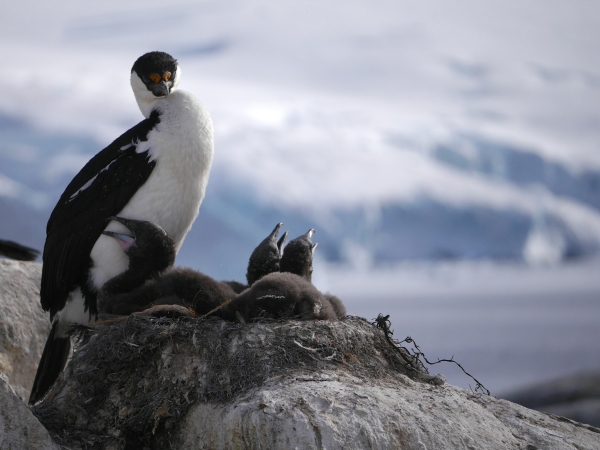
A blue-eyed or Antarctic shag guards her three chicks. Photo: Chris Rowan, 2013.
The close relationship between people and penguins at this particular location has driven a study designed to see if there is any human impact on the breeding success of gentoos: some parts of the island can be freely accessed by visiting shore parties, and some parts are closed off, with yearly surveys to compare the different areas. So far, it seems that fortunately, our gawking does no harm.
A gentoo penguin checks on her egg. Photo: Chris Rowan, 2013.
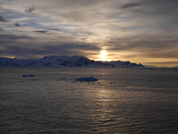
We could have stayed longer at Port Lockroy, but since our ship was leaving, so did we. We closed our Antarctic Christmas with a scenic cruise along the Neumayer Channel before a festive dinner. The weather held, treating us to a spectacular sunset (or as close as one gets in Antarctica near the summer solstice) – and some humpback whales turned up to wish us a Merry Christmas, too.
The sun goes down on a fabulous Christmas Day in Antarctica. Photo: Chris Rowan, 2013.
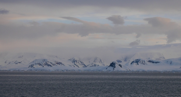
Lots of intriguing geologic features exposed in the rocks along the Neumayer Channel. One of the things that was striking to us is how many of these geologically interesting places were pretty much wholly inaccessible. Photo by A. Jefferson.
More fabulous scenery in the Neumayer Channel. Photo: Chris Rowan, 2013.
A humpback whale gives us a wave. Photo: Chris Rowan, 2013.
Sunset over the Neumayer Channel. Photo: Chris Rowan, 2013.
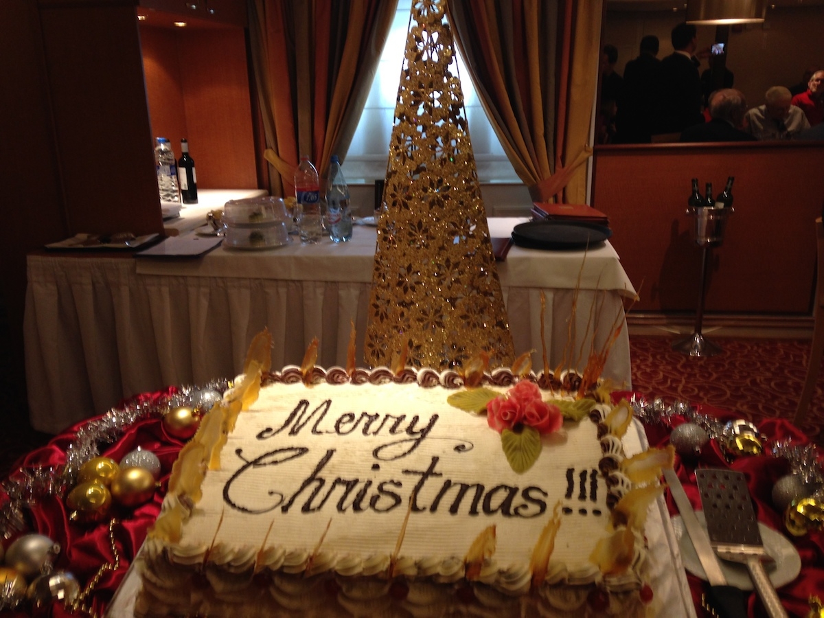
A festive feast ended a very memorable Christmas Day. Photo by A. Jefferson.
Where we were today:
Our areas of exploration on 25 December 2013 are shown inside the blue box at the lower left of the map.
Christmas Eve in Antarctica involved our first look at how people live and work in this harsh environment – both today and in the early days of exploration – and possibly the most fabulous scenery yet.
From Anne’s journal entry: “On the night of the 23rd, we made for the USA’s Palmer Station, where we were hoping to be the first tourist ship of the season; unusual ice conditions in the harbour had kept previous visitors away. In the morning I went up on deck and saw a research station that I thought must be Palmer. But it wasn’t – ice had caused us to change course to the Ukrainian Station Vernadsky.”
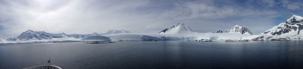
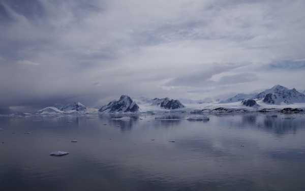
Not a bad view to wake up to on Christmas Eve. Photo, Chris Rowan, 2013.
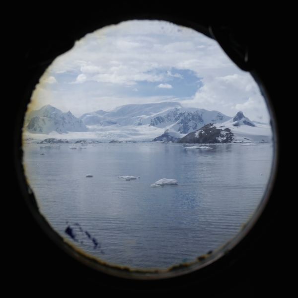
Not a bad view on deck, either! The Argentine Islands, Antarctica. Photo: Chris Rowan, 2013
We later found out that on the other side of Antarctic, another vessel was having considerably more trouble with sea ice than a forced diversion. When we got back home, the first question everyone asked was, ‘was that you?’. It wasn’t – all the ice forced us to endure was a spectacular sunrise in a slightly different location to the one we were expecting. At 65º15′ south, this was also the closest we got to the South Pole on our expedition.
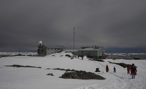
A small (~12 man) outpost located on one of the Argentine Islands, Vernadsky is actually the former British Faraday Station: it was sold to the Ukraine for one pound in 1996. Since the Antarctic Treaty would have required the UK to remove – at great cost – all trace of the base’s existence if it had been shut down, this is not as bad a deal as it might initially seem.
Vernadsky Base, the Argentine Islands, Antarctica. Photo: Chris Rowan, 2013.
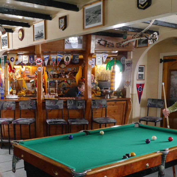
We got a tour of one of the station building, which still bore many signs of its former nationality – lots of signage in English, and the obligatory station pub.
The world’s most southerly pub? A bar installed when Vernadsky was the UK’s Faraday Station. Photo: Chris Rowan, 2013.
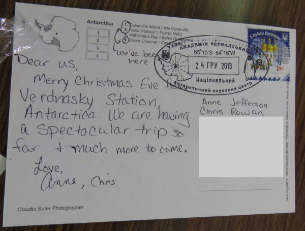
There was also a gift shop that provided to opportunity to send postcards back home via supply ships, a process that could take up to three months. Being scientists, we of course sent one to ourselves so we could time how long it actually took.
They’re going to be so jealous! Photo: Anne Jefferson, 2013.
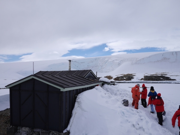
Chris also had the opportunity to hike across some (hopefully!) thick sea ice to an earlier iteration of the British Antarctic base. Built in 1947, Wordie House was named after the chief scientist on Ernest Shackleton’s epically abortive 1914-1917 expedition. It operated until 1954, when a new base where Vernadksy now stands was opened. Now a designated historic site, Wordie House gives an insight into what it was like for scientists in the early days of Antarctic research – namely lonely and cramped.
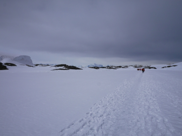
Walking across the sea ice from Vernadsky to Wordie House. Photo: Chris Rowan, 2013.
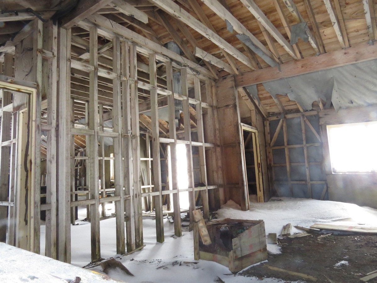
Wordie House: actually the second outpost built by the British on the Argentine Islands: the first was possibly destroyed by a tsunami (!) during the winter of 1946/7. Photo: Chris Rowan, 2013.
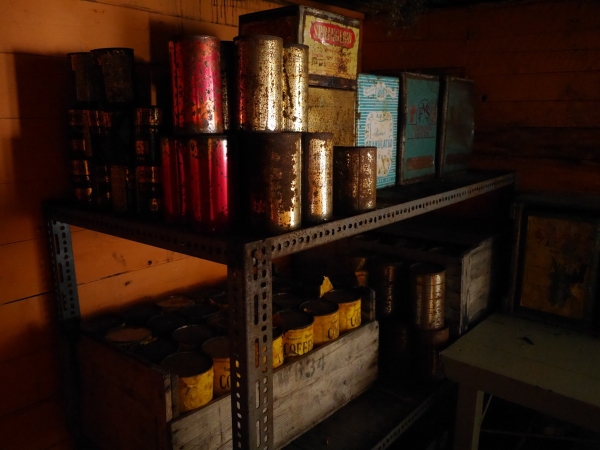
Sample supplies for British Antarctic scientists in the 1940s and 50s, on display in Wordie House. At least they had coffee… Photo: Chris Rowan, 2013
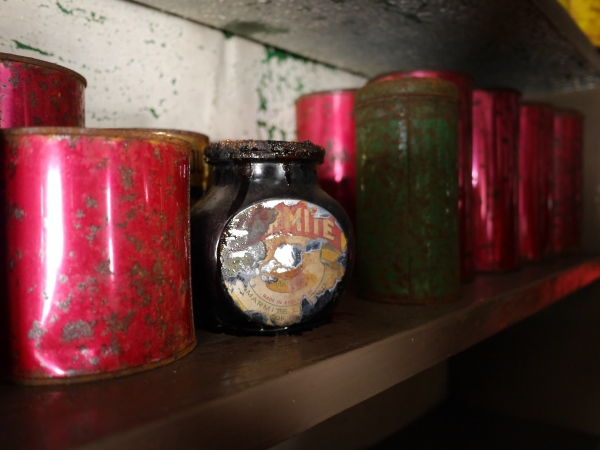
…but they were also inflicted with Marmite. Ugh. Photo: Chris Rowan, 2013.
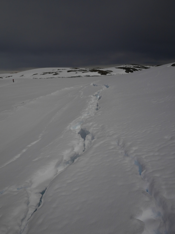
On his return inter-island treck, Chris noted some crevasses opening up at the contact between the sea ice and the shore. This was definitely the right time to notice these.
Cracks opening up where the sea ice meets the shore. Photo: Chris Rowan, 2013.
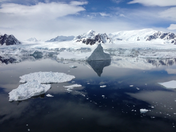
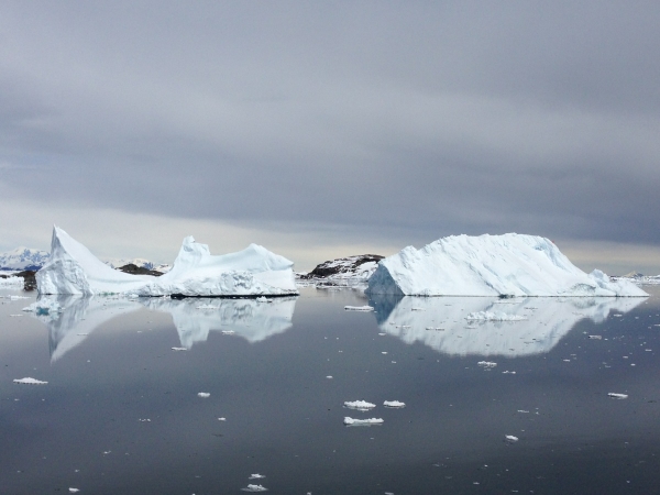
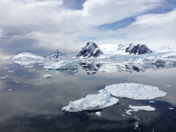
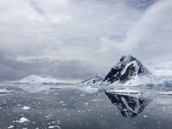
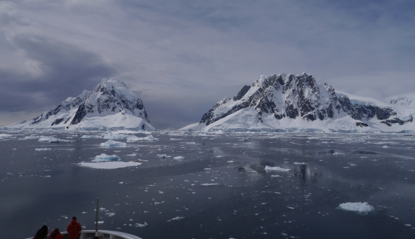
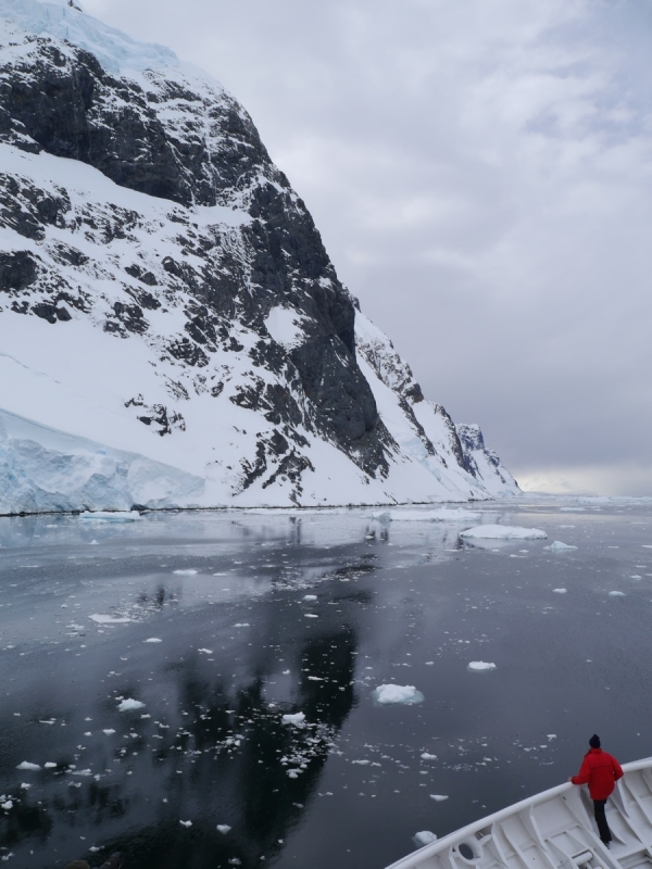
The weather remained fine – fine enough that lunch was served outside on one of the upper decks. As excellent as the food was, the real star was the scenery, which managed to become even more spectacular as we cruised northeast up the Lemaire Channel. You may have trouble believing these photos – we do, and we were there! – but it really was that scenic.
Photo: Chris Rowan, 2013
Photo: Chris Rowan, 2013
Photo: Chris Rowan, 2013
Anne: “we sailed through a narrow channel with high cliffs, glaciers and icebergs on either side of us. Chris and I (and many other passengers) stood on deck the whole time – taking lots of pictures and enjoying the good weather and scenery. A highlight for me was happening to see our ship strike a glancing blow on a bergy bit and watch it break in half”.
Photo: Chris Rowan, 2013
Photo: Chris Rowan, 2013
Photo: Chris Rowan, 2013
Where we were today:
Our areas of exploration on 24 December 2013 are shown inside the blue box at the lower left of the map.