Capetonian Geology: the Seapoint contact

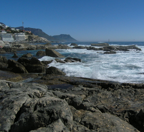
In a previous installment, my intrepid wander along the Capetonian seafront ended at Seapoint, where slightly metamorphosed sediments of the Malmesbury group come into contact with the intrusive Cape Granite. In the photo I showed you then, the contact appeared to be fairly sharp.

SPcontact.JPG

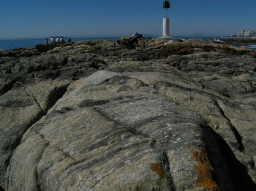
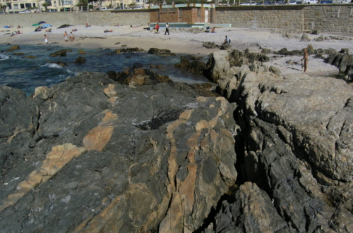
However, if you look closely at the foreground of the photo above, you can see lenses of much darker material within the pale granite. These are actually bits of the Malmesbury Group sediments, completely surrounded, and incorporated within, the granite. The contact at Seapoint is actually anything but sharp; instead, over a hundred metres or so of the shoreline you can walk across a beautifully exposed example of a gradational contact. Starting on obvious outcrops of the Malmesbury group and heading east, first you see distinct veins of granite being intruded into the sediments:

Seapoint1.JPG

Continue reading

Categories: fieldwork, geology, outcrops, photos, volcanoes

Geopuzzle #16

This weeks challenge comes via fellow Scibling Martin of Aardvarchaeology:

I’ve noticed something funny about the map of North America. The Great Lakes in the US form the end of a straight line of huge lakes extending north-west across Canada. Could you please tell me how that line of lakes formed?

It looks like he has a point:

canadasat.jpg

Now, this is one of those situations where I can make an educated guess about the answer, but I’m neither sure if it’s right or if I’m grasping the full story. If I’m even approaching a clue, this (right click to download) or this may prove helpful. Or not. Either way, get guessing.

Categories: geology, geopuzzling

The US election in just three words

Good call, America.

obama.jpg

Categories: bloggery

More Capetonian geology

Before continuing from yesterday the account of my journey along the Capetonian seaside, I should probably adhere to the principle that good field geology starts with knowing where you are, and where you’re going. So, here’s a Google Earth view showing my southward route along the Atlantic coast to the west of the city centre, between Three Anchor Bay and Seapoint.

ctsat.jpg

As I approached Seapoint, it was clear that I had also about to cross a contact between two rock units: looking ahead along the coast the clearly bedded and ridge-like outcrops of the Malmesbury Group were giving way to much more rounded outcrops of a massive looking, lighter coloured, lithology.

seapoint.JPG

Continue reading

Categories: fieldwork, geology, outcrops, photos

OpenLab 2008: more geobloggery needed. Much more

Time is running out to submit entries for the next edition of the Open Laboratory blogging anthology, and running down Bora’s latest list of posts submitted so far reveals very few geologically-themed ones. In fact, I could find but two: this post from Callan, and one from the SVPOW guys. Only two? This needs to be rectified.
In 2007’s anthology, Kim and myself were the sole representatives of the geoblogosphere. This time, it would be nice to mirror the explosive growth of our community in the past year with lots more geoblogging present, both in the list of nominations and in the final anthology. If we all submit something of our own that we’re particularly proud of, and/or nominate one or two of our favourite posts from our fellows, then the first objective will be achieved. Then we’ll just have to remind the judges that most of us have big pointy hammers. Not that we’re trying to imply anything by that, of course…
As for myself, I’m thinking of possibly submitting this, or this, or perhaps even this. Or… Suggestions would be welcomed. In the meantime, I’m also going to be sure to take some time to find and submit some of the finer work of my infinitely more talented geoblogospheric colleages. Get to it, before someone starts thinking that biology and physics are better or something.

Categories: bloggery, public science