
[a post by Anne Jefferson]
“Ten thousand rocks and grassy islets meet the traveler’s eye, ten thousand murmuring streams meander through them. During low water the cattle delight to graze upon the islets…at such times they furnish a curious spectacle in the midst of a mighty river.”
So wrote architect Robert Mills in 1826, describing an outcrop of ~550 million year old diorite in the Catawba River south of Rock Hill, South Carolina. The Catawba River is one of the principal rivers of the Carolinas, with an annual average flow of 4018 cubic feet per second (114 m3/s) just upstream of our diorite outcrop. The outcrop is about 2.6 km long, and changes the single-thread river into a substantially wider, multi-thread anabranching river (Figures 1 and 2). This cattle-friendly piece of rock then represents a major obstacle to flow of the river, and that has ensured it a place in the region’s history.
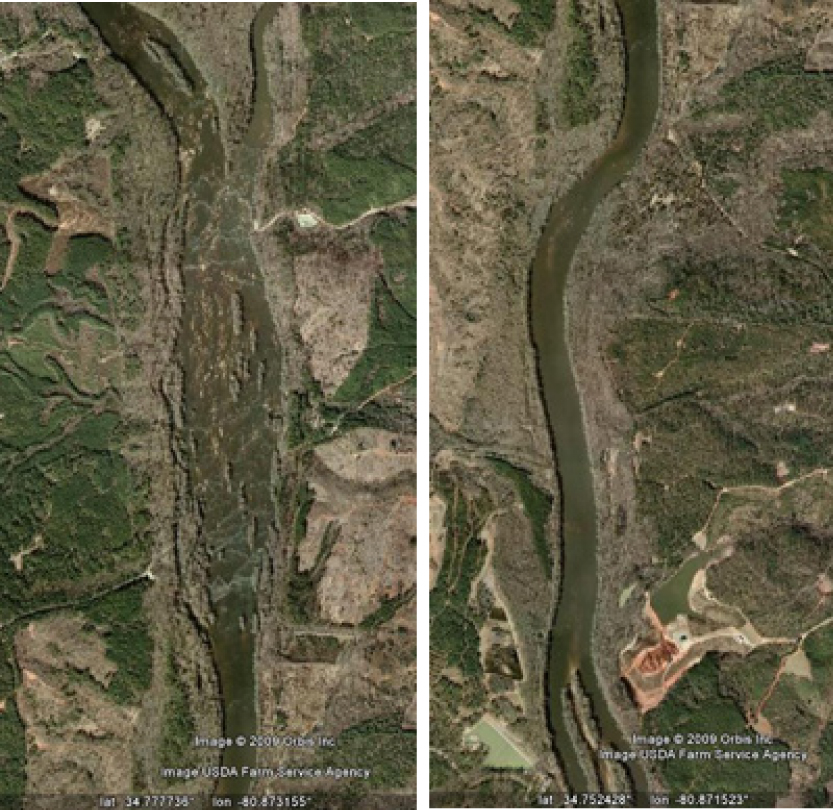
Figure 1. Aerial view of the Catawba River in the vicinity of the diorite outcrop (left) and immediately downstream (right). Both photos are at the same scale and captured from Google Earth.
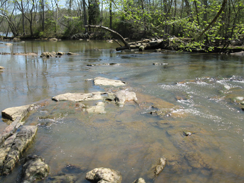
Figure 2. Close-up of diorite outcrops along the shore of the Catawba River at Landsford Canal State Park. The vegetation on the left bank of the channel is an island on a larger diorite protrusion. Flow at USGS gage # 02147020 was 3840 cubic feet per second (108 m3/s) on the date this picture was taken.
The diorite outcrop made an easy place for early travelers to ford and cross the river. In the 1700s, Thomas Land owned the land around the outcrop, and the area today is known as Landsford. But the rock that made the river easy to cross, also made it hard for boats traveling downstream, particularly because of the rapids upstream of the ford proper. And that’s where Robert Mills comes in to the story. Mills was the architect of the Department of Treasury, U.S. Post Office, and the Washington Monument, and he was also the architect of a solution to the transporation dilemma presented by the diorite at Landsford.
In 1823, a canal opened to allow boats to bypass the rapids and ford. Robert Mills was the architect that designed the canal and the locks. All in all, the 1.5 mile (2.4 km) canal, with two locks, circumvented 32 feet (9.75 m) of elevation loss by being dug in at the upstream end and elevated at the downstream end. The canal was lined with clay to prevent dewatering to the alluvial soils. The canal allowed boats 7 feet (2.14 m) wide, 60 feet (18.29 m) long, and carrying up to 50 bales of cotton to be pulled by mules or horses. The canal was built during the height of the American canal craze, and by 1846 it was out of use, replaced by railroads. Today the canal is mostly dry and has been substantially eroded at its downstream end. In places on the banks, there are large trees that couldn’t have been there when the boats were being pulled through the canal. The stonework in the locks is diorite from a nearby quarry and is well-preserved.
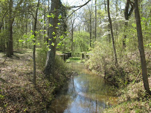
Figure 3. The upstream end of Landsford Canal.
The diorite outcrop and the canal are preserved in Landsford Canal State Park, and you can walk on the mule path along the canal, or along a trail on the banks of the Catawba River. In late May and early June, the park draws thousands of visitors to see spider lilies blooming from amidst the rocky islets. I’m planning to head back in a few weeks and check it out, but I’d really like to explore the area from a kayak.
Information in this post was gleaned from interpretive signs at the State Park and from Exploring the Geology of the Carolina by Kevin G. Stewart and Mary-Russell Roberson (UNC Press).


Nice plan for content warnings on Mastodon and the Fediverse. Now you need a Mastodon/Fediverse button on this blog.