To those with even a little geological knowledge, the view that presents itself as you drive into Yellowstone National Park through the South Entrance may not be quite what you expect. The park encompasses the giant caldera of a hotspot-fuelled ‘supervolcano’ that last exploded 630,000 years ago, and is famous as the place to see geysers, hot springs and other hydrothermal activity, all powered by that same hotspot. So it is perhaps a little disappointing that all that initially presents itself is a sea of lodgepole pine (and, when I visited, snow on the ground). Pretty, but not exactly…dramatic.
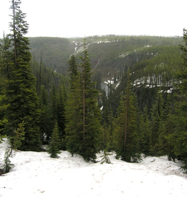
South Yellowstone, near Lewis River. Photo: Chris Rowan, 2010
It does not take long, however, for signs of Yellowstone’s unique volcanic nature to make themselves apparent. In places, the pine-filled horizon is broken by rising plumes of steam from geysers and hot springs.
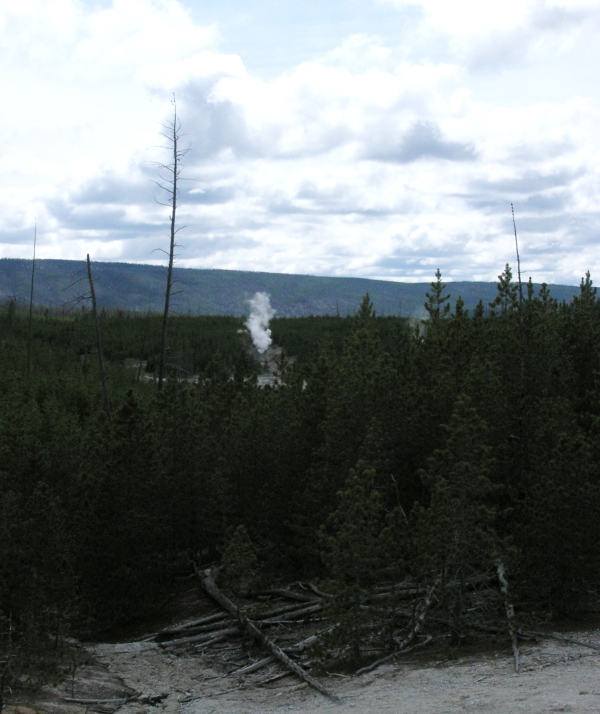
Geyser, Norris Basin. Photo: Chris Rowan, 2010
In some regions, the forest gives way completely to a bubbling, steaming hydrothermal wasteland.
Indeed, the whole area is dynamic and ever-changing: new hot springs and fumaroles can pop up almost anywhere.
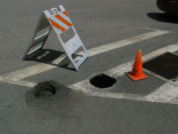
A new vent burns through a parking lot. Photo: Chris Rowan, 2010
However, despite the ample evidence of the large amounts of thermal energy just beneath your feet, the fact that you are effectively standing in the crater of a giant volcano remains a bit abstract and difficult to grasp, mainly because you can’t easily see that crater. The big hole in the ground left by the last explosive eruption 630,000 years ago has been largely filled in by later eruptions of rhyolite lava; the topography has been smoothed by the waxing and waning of ice sheets during recent glaciations. During my visit, I was on the lookout for a large cliffs that might mark the caldera rim, but although there were cliffs aplenty, they generally turned out to be formed of (relatively) young rhyolite.

Rhyolite cliffs overlooking Madison River, W Yellowstone (click for larger version). Photo: Chris Rowan 2010
This does give an inkling of the scale of the geological forces at work in this region: the cliff photographed above represents a ‘minor’ flow that followed the last big explosive eruption, yet it is still getting on for 100 m high. But to really get to grips with the scale of the geological processes operating in Yellowstone, actually standing in it is perhaps not the best vantage point. You really need to take a much wider view:
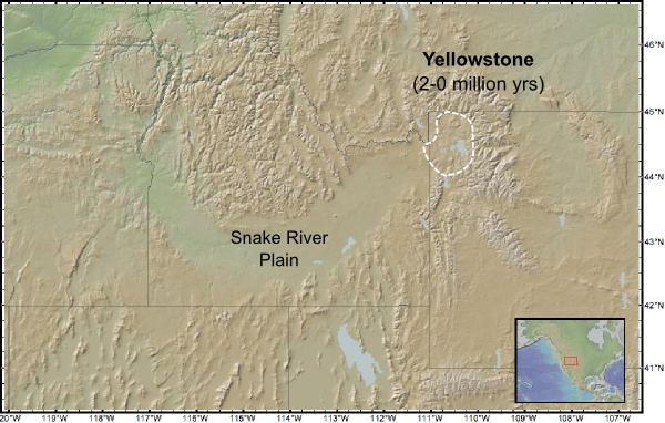
Topography of the area around Yellowstone, including the Snake River plain
If you look at the topography of the northwestern US, the Snake River Plain rather noticeably stands out as a wide channel cutting right through the Rocky Mountains. But this feature was not carved by any river. It is underlain by a line of now-extinct calderas: the oldest, to the west, was active more than 16 million years ago, and they get progressively younger to the east before the line intersects the active Yellowstone caldera.
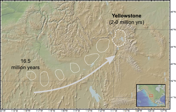
The chain of calderas left in the wake of the Yellowstone hotspot.
This line of ancient supervolcanoes records the passage of the Yellowstone hotspot – or, more accurately, the movement of North America over the Yellowstone hotspot – in the last 15 million years or so. Prior to this, the trough that holds the Snake River Plain was not there – the Rocky Mountains formed a continuous chain running from northwest to southeast. That trough has been excavated; the mountains literally blown into dust by massive supervolcano eruptions gradually eating eastward into the Rockies, with the debris spread far and wide across the continental US. This makes the Yellowstone hotspot the evil twin of the one beneath the Hawaiian Islands: above Hawaii, basaltic volcanism builds up mountains from the sea floor; above Yellowstone, explosive rhyolitic eruptions through continental crust destroys them.
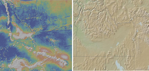
Hawaii and Yellowstone: the Yin and Yang of hotspot volcanism
Fifty years ago, people considered using nuclear bombs to blast through mountain ranges: little did they know that the planet had thought of it first, and on a scale orders of magnitude greater.


Comments (15)
Links (3)
-
-
-
Pingback: Geology Links for August 6th, 2010 | The Geology News Blog
Pingback: Yellowstone: where did all the ash go? | Highly Allochthonous
Pingback: Yellowstone: what lies beneath | Highly Allochthonous