Look at this beautiful 19th century infographic, courtesy of the History of Geology on Twitter:
Here it is in all it’s glory:
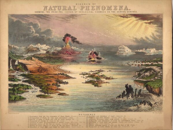
Except for the somewhat interesting landscape associated with label 12 – “Earthquakes and elevations of the land by subterranean forces”, there’s much in this picture of the forces shaping the Earth’s surface that would still fit into a modern physical geology class.
As you can see, this gem was presented in response to another of Emslie’s engravings, a graphical depiction of the history of life on Earth which would not fit very well into a modern paleontology class (in some versions, it is titled the ‘Antediluvian World’).
But the reference to “12 geological cards” sent me down the internet rabbit hole, since I couldn’t help but wonder – what are the other 10?
It was hard to get to a definitive list, but here are some of the cooler ones I found, mostly through the Internet Archive, which also introduced me to the dangerous potential time sink of the David Rumsey Map Collection.
Popular Geology (1849)
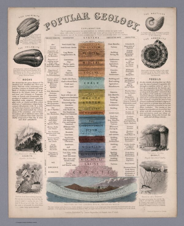
A stratigraphic column for the the rocks exposed in the UK, with other geological tidbits around it. Shedding some light on the controversies of the time, the ‘Fossils’ section on the right succinctly outlines the uniformitarian/Deep Time view of Earth history, then ends with
The results of geological investigations are in perfect harmony with the statements of Revelation, and tend to exalt our ideas of that Almighty Being who formed the earth, and all things therein.
Geological Map of England (1849)
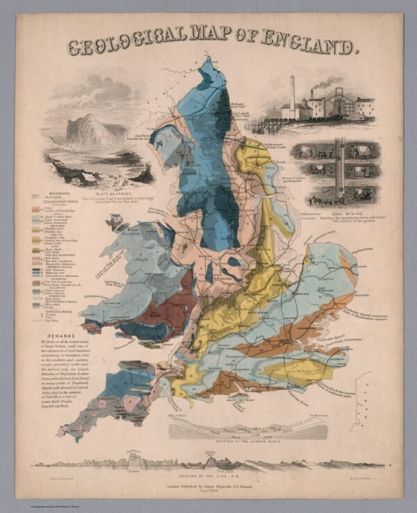
Not quite up the standards of William Smith’s 1815 map, but I was rather tickled by the curvy cross-section line across Southern England. There are also maps of Scotland and Ireland.
Phenomena of Volcanoes and Earthquakes, showing the influence exerted by the heated interior of the Earth upon its external surface (1852).
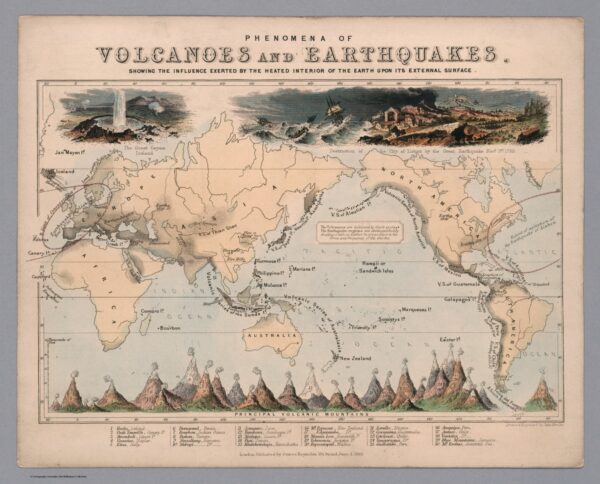
I love this one, especially how it shows how the association of volcanoes and earthquake regions around the Pacific was already known. The 1755 Lisbon earthquake is given huge prominence, even a century later – the New Madrid earthquakes in the US are also marked. No sign of the East African Rift Valley, though!
Geological Map of the World
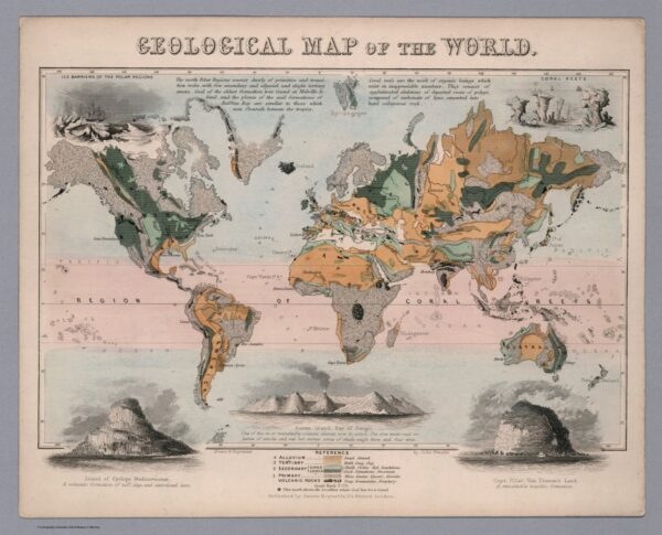
This is certainly ambitious for its time! It also uses the Primary-Secondary-Tertiary division of geological time, which has long been superseded.
Mountains (1851)
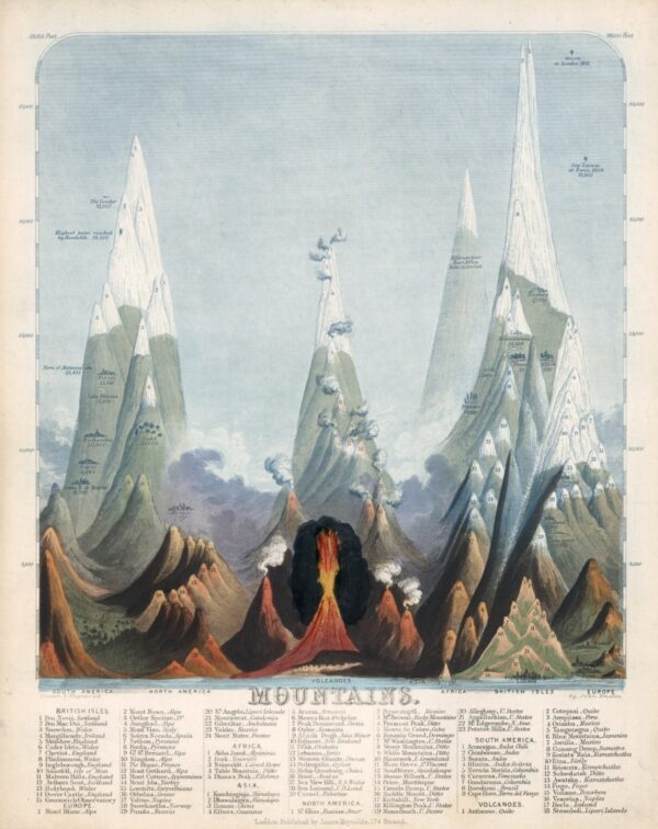
Enslie draws his mountains with an extremely high degree of vertical exaggeration – I’m not sure if it’s a stylistic choice because they look cooler that way, a pragmatic choice to squeeze more into a confined space, or a combination of the two. Also – smoking volcanoes!
Another thing of note is that the highest mountains in Asia excluded Everest (only confirmed as higher than Kangchenjunga in 1852) and K2.
Waterfalls (1846)
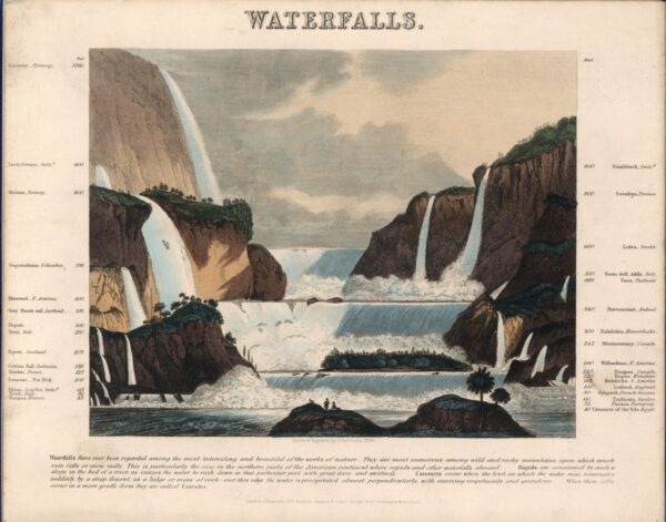
Had to include this one for Anne, but I give it high marks for artistry. There is also “A panoramic plan of principal rivers and lakes” where she can mutter about the inclusion of the Black and Caspian Seas.
I don’t know if all of these count as part of the 10 “geological cards”, but they are all very interesting examples of what we would now call “infographics” from the mid-19th century.


Nice plan for content warnings on Mastodon and the Fediverse. Now you need a Mastodon/Fediverse button on this blog.