![]() We’ve just spent a great week exploring Ireland, which included very sunny days on the Antrim Coast of Northern Ireland. Anne sometimes teases me for picking holiday itineraries based more on the the prevailing geology more than the prevailing weather, and I can’t deny that our choice of locations may possibly have been influenced ever-so-slightly by the close proximity to the Giant’s Causeway, which I have tried to visit before. Fortunately, the weather was a lot more co-operative this time: and despite the large crowds and a very ugly visitor centre (the only redeeming virtue of which is that you can’t see it from the Causeway itself), it is definitely a very impressive geological feature (for all these photos, you can click through to larger versions).
We’ve just spent a great week exploring Ireland, which included very sunny days on the Antrim Coast of Northern Ireland. Anne sometimes teases me for picking holiday itineraries based more on the the prevailing geology more than the prevailing weather, and I can’t deny that our choice of locations may possibly have been influenced ever-so-slightly by the close proximity to the Giant’s Causeway, which I have tried to visit before. Fortunately, the weather was a lot more co-operative this time: and despite the large crowds and a very ugly visitor centre (the only redeeming virtue of which is that you can’t see it from the Causeway itself), it is definitely a very impressive geological feature (for all these photos, you can click through to larger versions).
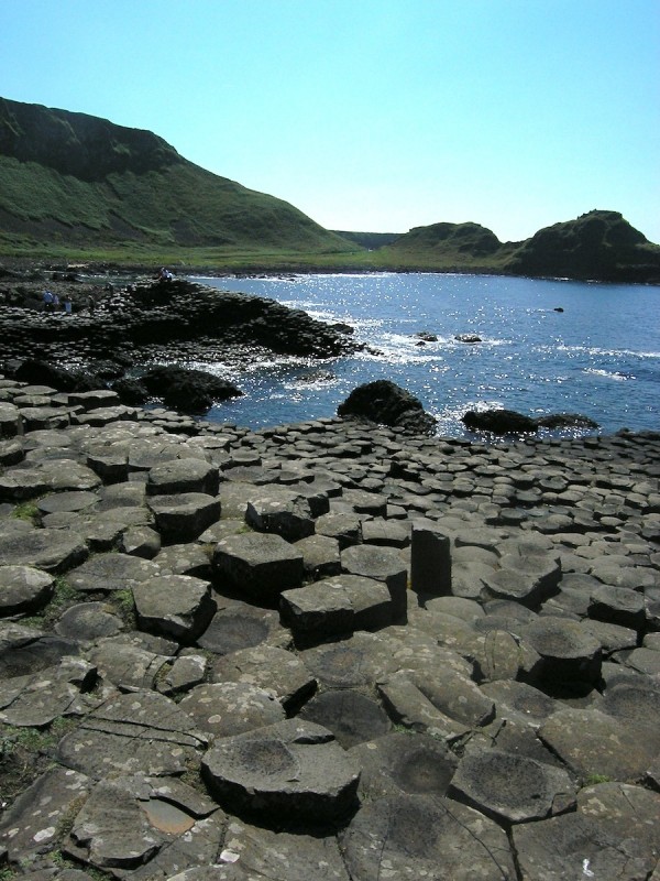
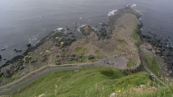
There are many places in the world where you can see columnar basalts from the side, in cliffs and the sides of valleys and gorges; what makes the Giant’s Causeway so special is that the erosive power of the sea has created a Escher-like landscape where you can scramble over and between them. The key to understanding the eerie geometry of tens of thousands of hexagonal and pentagonal columns of volcanic rock, all stacked together, is realising that ‘stacked together’ is the wrong way to think about it; the columns formed after the basaltic lava flow was emplaced over the landscape, due to cooling, shrinkage and cracking, their spacing and shape controlled by the constant, regular physical laws that control heat transport.
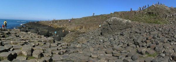
A panorama looking out to sea across the Giant’s Causeway, Northern Ireland. Photo: Chris Rowan, 2013.
The flow that formed the Causeway is but one small part of the extensive volcanic episode 50-60 million years ago that accompanied the opening of the North Atlantic; lavas and intrusive rocks of a similar age can be found all along the coast in Northern Ireland, and up through the western coastal region of Scotland. Later-erupted lava flows can be seen in the cliffs above the causeway, sometimes with their own impressive columns. At ‘the Organ’, you can even see a lovely example of a transition from the slow cooling interior of the flow, where columnar joints eventually formed, into the fast-cooling top.
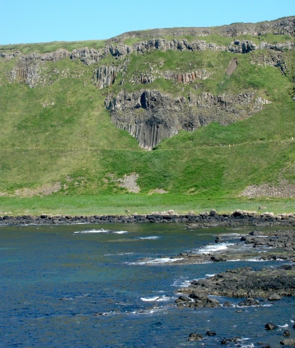
‘The Organ’, a cliff exposure of columnar basalts near the Giant’s Causeway. Photo: Chris Rowan, 2013.
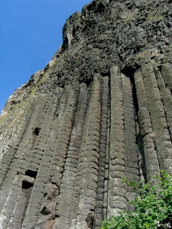
A close-up of ‘The Organ’, showing how the regular columnar jointing vanishes in the fast-cooling top of a lava flow. Photo: Chris Rowan, 2013.
The other prominent feature in the cliffs above the Causeway is the red horizon about half-way up, which marks a laterite, a soil rich in iron and aluminium oxides formed by a long-period of weathering of lavas between successive eruptions.
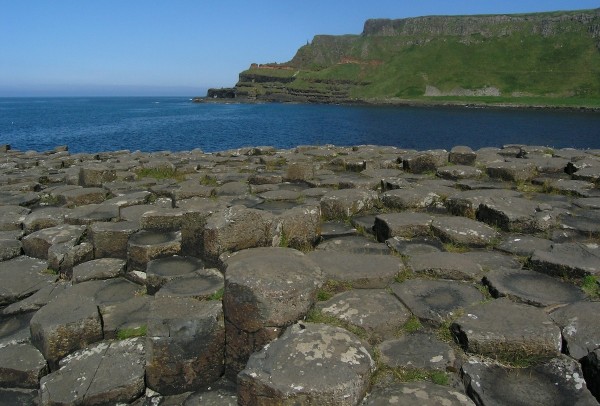
Giant’s Causeway in the foreground, cliffs of more lava punctuated by a red laterite horizon beyond. Photo: Chris Rowan, 2013.
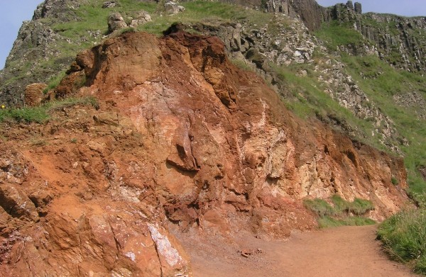
A close-up of the laterite horizon in the cliffs above the Giant’s causeway, formed by intense weathering of the top of a lava flow before the next eruption. Photo: Chris Rowan, 2013.
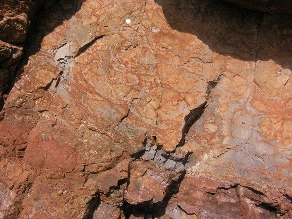
Grey and red banding shows leaching and oxidation of iron minerals during weathering. 50 pence piece for scale at top. Photo: Chris Rowan, 2013.
Exploring further afield, all that basalt had to be intruded through and erupted over something, and in places along the coast you can see that sometimes, that something is chalk, the same stuff – lithologically and stratigraphically – that forms the White Cliffs of Dover in southeast England. Black lava cutting through or lying on top of white chalk leads to some of the most easy-to-discern geological contacts I’ve ever seen. Can you spot the chalk-basalt contact here?
How about here? I took several photos on this ferry trip over to Rathlin Island which may well make it into my Intro Geology lectures…
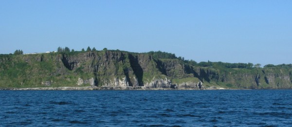
An early Cenozoic lava flow on top of Cretaceous chalk, near Ballycastle, Northern Ireland. Photo: Chris Rowan, 2013.
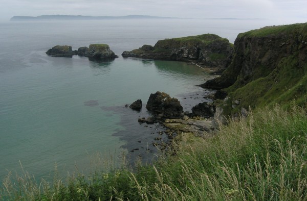
The unique geology of this area has also clearly shaped its inhabitants, both human and non-human, and how they live. The steep cliffs meant that overland travel was difficult (even today, some of the roads are a little terrifying to drive), meaning that it was often be easier to sail the 15 miles to Scotland (I was surprised how close we were to Islay) than drive a cart to the nearest big Irish town. But the cliffs have also provided sanctuary for hundreds of thousands of nesting seabirds, especially on Rathlin Island.
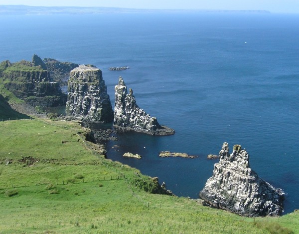
Seastacks on the west side of Rathlin Ireland – basalt with a veneer of guano. Photo: Christ Rowan, 2013.
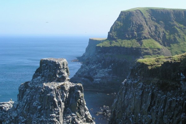
All those little dots? Nesting seabirds, by the tens and hundreds of thousands. Photo: Chris Rowan, 2013
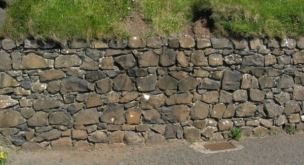
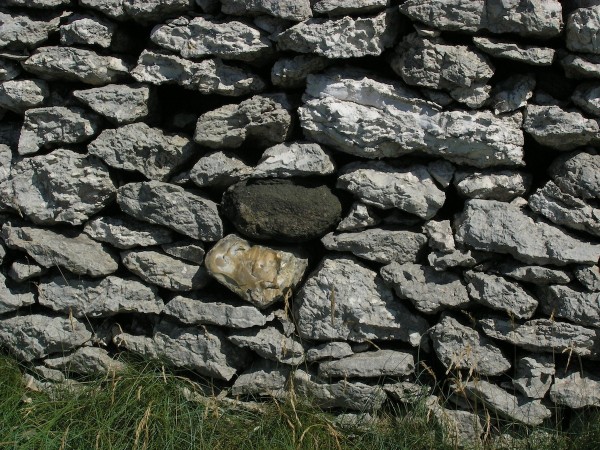
Basalt, chalk and the flint nodules within it have all been well-utilised as building material, depending on what was easiest to hand.
So, I may get teased about my alleged geological bias in trip-planning, but as far as I can tell, it seems to work pretty well!



Comments (1)