![]()
I spent most of the last week in Boulder, Colorado at the CUAHSI Biennial Science Meeting, where I gorged myself on the latest and greatest in hydrologic science. I’m going to share more of that in the next few days, but first I wanted to give a few glimpses of Boulder’s geologic environs, in case anyone else has been as deprived of this geologic wonderland as I had been.
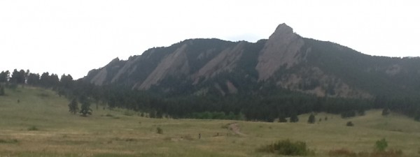
I had the fantastic fortune of being met at the airport by Kea Giles, who proceeded to give me a tour of some of the neatest spots in the Boulder area. We drove past a nice spot to walk a dog on the Bobolink Trail, past the CU campus and downtown, through a gorgeous (and spendy) neighborhood on “the hill,” and up to Chatauqua Park for prime viewing of Boulder’s famous flatirons (pictured below).

Flatirons from Chatauqua Park in Boulder, Colorado. Photo by A. Jefferson, July 2012. What a trip to opt not to bring my good camera. Apologies for the iPad photo.
We couldn’t find a place to park at the park because of a special event, so we decided to head up Boulder Canyon toward Nederland. It was a thrill to be able to ogle the scenery during the whole twisty drive, with a cascading Boulder Creek on one side of the road and near vertical rock walls on the other. Among the features I spotted were large rockslides, burn scars, a waterfall, quartz veins, dikes, and beautiful granites. I wish I had pictures, but time, light, and camera resources were limited. Instead, you’ll have to imagine our traverse through this geologic cross-section.
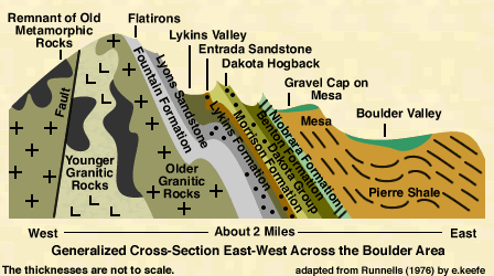
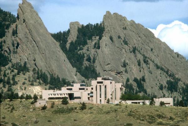
Two days later, I found myself gazing at the geology again as our group of hydrologists headed up to NCAR’s Mesa Lab. The Mesa lab is situated on the gravel-capped mesa shown in the image above, just below the base of the Dakota hogbacks. Its setting is nothing short of spectacular, and the building is suitably architecturally dramatic. It’s also open to the public and has some cool displays and exhibits about atmospheric science. I believe there are also hiking trails that depart from the lab. While we were there, we were treated to an evening thunderstorm passing over the Front Range and a rainbow that seemed to span the Great Plains. It’s as if the weather wanted to compete with the dramatic geology.
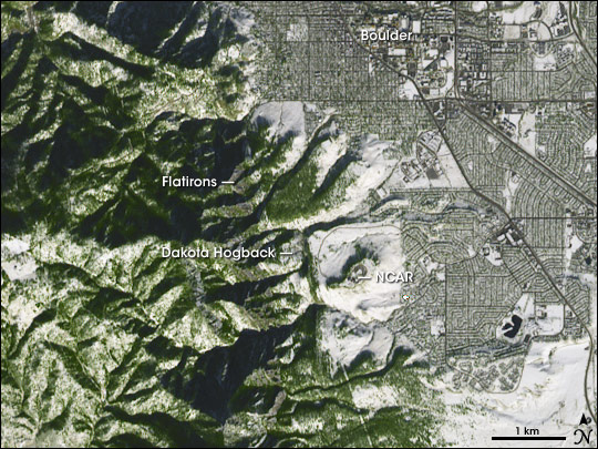
Here’s how the whole area fits together in a spatial sense:

ASTER image of Boulder, NCAR Mesa Lab, and the Front Range. Image from NASA's Earth Observatory. Click image for source.
I haven’t said anything about how this spectacular landscape formed, because I really haven’t had a chance to explore the geologic history of the area. I’m thinking that’s a good excuse for another visit to Boulder, with a proper geologist in tow, and more time set aside for hiking amidst the rocks.


Links (1)-
Pingback: Scenic Saturday: Boulder rocks