![]() It’s been a while since my last update on Lusi, the allegedly/probably drilling-triggered mud volcano near Sidoarjo, Indonesia. But the NASA Earth Observatory has just released this image, taken last autumn:
It’s been a while since my last update on Lusi, the allegedly/probably drilling-triggered mud volcano near Sidoarjo, Indonesia. But the NASA Earth Observatory has just released this image, taken last autumn:
Lusi,October 2009. Source: NASA Earth Observatory
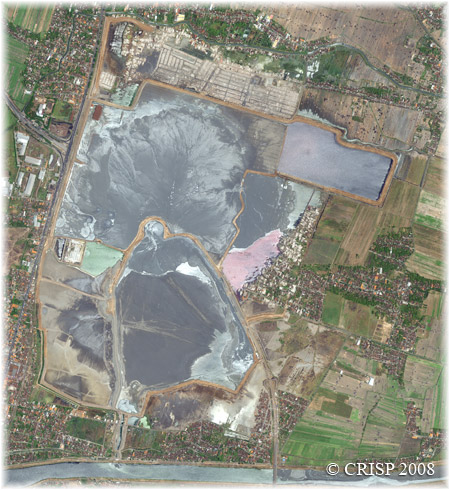
My first thought on seeing this was, “Woah, where’d that mountain come from?” In the last images I had seen, Lusi had from above was effectively a big muddy pool, contained within man-made earthworks, with a steaming vent in the middle. This had been pretty much the case for the previous couple of years.
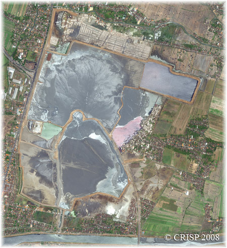
Lusi, October 2008. Source: CRISP
Now, it’s a big muddy pool with a big steaming hill in the middle. By looking through the satellite snapshots put out every couple of months by the Centre for Remote Imaging, Sensing and Processing at the University of Singapore (of which the October 2008 image above is one), you can see that over the last 12 months or so Lusi appears to have started building up instead of out, with the causeways and dams around the vent being gradually swallowed up by the grey ooze.
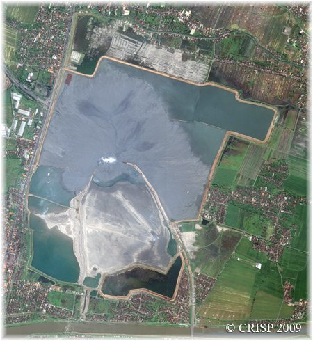
Lusi, May 2009. Source: CRISP
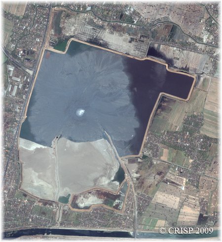
Lusi, September 2009. Source: CRISP
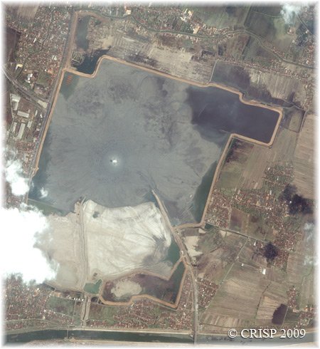
Lusi, December 2009. Source: CRISP
It seems, then, that Lusi has entered a new phase of its life. I wonder if this growth has anything to do with subsidence in the area?
Categories: geohazards, Lusi
Tags: Lusi mud volcano indonesia satellite photo


Comments (9)