![]() Earlier this morning, a magnitude 7.2 earthquake hit near the city of Van on the eastern border of Turkey. The BBC reports that at least 45 people have died as buildings collapsed close to the rupture.
Earlier this morning, a magnitude 7.2 earthquake hit near the city of Van on the eastern border of Turkey. The BBC reports that at least 45 people have died as buildings collapsed close to the rupture.
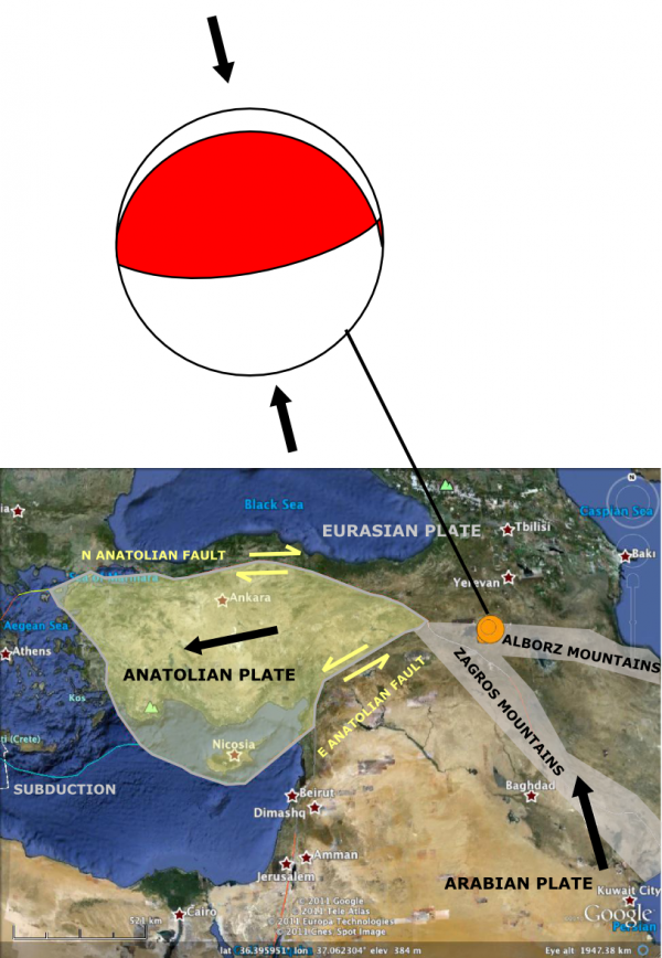
The most well-known seismic hazard in Turkey is probably the North Anatolian Fault, a major strike-slip fault which runs along the south of the Black Sea and underneath Istanbul, and ruptured in an extremely damaging earthquake in 1999. Today’s earthquake is much too far east to be on this stucture, and the focal mechanism shows that it was due to compressional thrust faulting, not strike slip motion.

Focal mechanism for 23rd October earthquake near Van, eastern Turkey, and its wider tectonic context. Click to enlarge.
Eastern Turkey is sandwiched in a continental collision zone, caused by the Arabian plate to the south moving northwards into the Eurasian plate to the north; this is part of a belt of mountain-building that runs all the way from the Alps to the Himalayas. This earthquake appears to have occurred near the junction of two mountain belts, the Zagros and the Alborz ranges, that have been produced by this collision. Like toffee squeezed in a vise, the pressure of Arabia and Eurasia being squashed together in the east forces the crust in between – the Antatolian plate – sideways into an area where the pressure is lower. This lateral eastward motion is largely accommodated by strike slip along the North Anatolian and East Anatolian Faults, and eventually by subduction in the eastern Mediterranean. So in the grand tectonic scheme of things, today’s earthquake can be linked to the more well-known tectonic activity further to the west: they both occur in response to the same driving forces. Convergence in eastern Turkey primes the pump for future westward motion of the Anatolian plate, which will be accommodated by earthquakes on the Anatolian Faults. Note that this is thinking over million year timescales – in the short term, the hazard on the faults further west (which is already high) will not be affected by this one earthquake.
The reported depth of the earthquake is 16-20 km, which seems to have been deep enough to restrict the most intense shaking to a relatively small area around the epicentre.
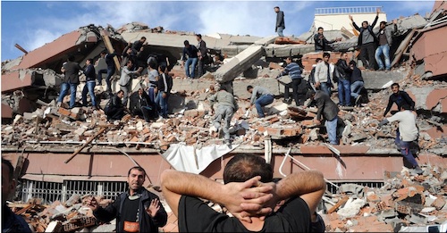
Unfortunately, the city of Van, which has a population of 367,000, lies within this area. Turkey’s building codes do include provisions for earthquake-proofing, but despite more vigorous efforts to enforce compliance in recent years, many older buildings are probably very vulnerable, especially in the poorer eastern parts of the country. This photo from the earthquake zone, via the BBC, which appears to show a collapsed multiple-story building, is unlikely to be an isolated example.


Comments (7)
Links (5)
-
-
-
-
-
Pingback: Terremoto en Turquía: mapa de ubicación
Pingback: Open Thread: Football | My Blog
Pingback: 23 Ekim 2011 Van Depremi
Pingback: Stuff we linked to on Twitter last week | Highly Allochthonous
Pingback: Friday focal mechanisms: aftershocks in eastern Turkey | Highly Allochthonous