![]() Apparently Grand Teton National Park suffers somewhat from being in the shadow of Yellowstone, just to the North. I really can’t think why.
Apparently Grand Teton National Park suffers somewhat from being in the shadow of Yellowstone, just to the North. I really can’t think why.
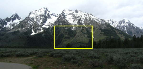
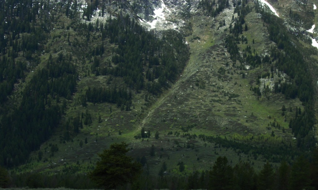
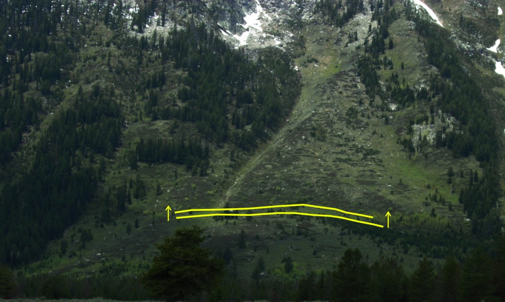
The tendency of this handsome panorama to be cut off by rain clouds hovering a few hundred feet above the valley floor may be an issue for some, but on a clear day the view is pretty much unbeatable. And for a geologist, there’s an additional source of wonder and excitement: the presence of such an abrupt jump in the topography, the extreme linearity of the range front, and the abrupt transition from gravel and silt only a few thousand years old on the valley floor, to hard, crystalline granites and metamorphic rocks that are more than 1.5 billion years old in the mountains, all scream, ‘fault!’. You don’t have to take my word for it, either: if you turn your eyes towards the lower slopes of the mountains just north of Jenny Lake, it is relatively easy to trace a linear scar disrupting the glacial till deposited by melting glaciers at the end of the last ice age, about 14,000 years ago. This initially smooth surface has since been broken; multiple earthquakes have lifted the far side of the breach upwards about 30 metres relative to the near side, creating a sizeable fault scarp.

View from the Cathedral Group Turnout. Can you see the fault scarp? Photo: Chris Rowan, 2010


Scarp marking movement on the Teton Fault since the end of the last glacial period (click for larger images). Photos: Chris Rowan, 2010.
Multiply that up a few orders of magnitude, from maybe ten earthquakes in ten thousand years to ten thousand earthquakes in 10 million years, and voila: your fault scarp forms the face of an entire mountain range. And what is really striking about the Tetons is how clearly this fact – that the Teton Range and the Teton Fault are essentially the same thing – is firmly written in their geomorphology. The total displacement that accumulates across a fault is not constant along its length; faults do not go on forever, and the points where they peter out are, by definition, places where there is no displacement. This means that the total movement on a fault is greatest towards its centre, and decreases towards either end. If you look you trace the profile of the Teton Range from north to south, it matches this form pretty closely, even if erosion has carved numerous large gap.


The morphology of the Teton Range matches the displacement profile for a growing fault, with the middle moving furthest (click for larger image). Photos: Chris Rowan, 2010.
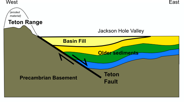
The total distance from the valley floor to the highest peak is about two thousand metres. But if you think a two kilometre-high fault scarp is pretty impressive, remember that the total displacement on the Teton Fault is even greater than. Not only is material constantly being removed from the peaks by erosion, but that material is then transported, by water or ice, down into the hole being created by the faulting, filling it and raising the level of the valley floor. On the western side of the fault, the Precambrian rocks equivalent to those towering above Jackson Hole valley on the eastern side of the fault are at least two kilometres beneath our feet. That implies a minimum displacement of about four kilometres. [Update: I was being far too conservative, it seems: Callan demonstates how exposures of Cambrian sandstones on Mount Moran indicate more like 9 km of displacement.]

E-W cross section through the Teton Range, showing the half-graben structure created by uplift on the Teton Fault
It’s a big fault – and furthermore, it’s a big fault that hasn’t ruptured for a while. When it does, it will produce a magnitude 7-8 earthquake, and throw the Teton Range a few metres higher up into the clouds.
(with regards to the video, it’s a bit of an experiment – I’m not sure it works well as a standalone, but it does provide a nice sweep over the whole range, showing how it rises and falls again as you trace along its length.)


Comments (3)
Links (1)-
Pingback: All quiet on the Alpine Fault? | Highly Allochthonous