What came from outer space

I admit it. I’m geocentric. Not in the old-fashioned sense, I’m not that eccentric. I don’t believe the earth is the physical centre of the universe, but it certainly feels that way. The universe, space, the wonders of the solar system are all very well, but emotionally they are all ‘out there’ somewhere. A Twentieth Century geological education contributed to this – everything on the earth was explained by something else on the earth. For example we were taught about the increasingly odd forms of late Cretaceous ammonites. The implication was that their extinction was due to them becoming decadent and depraved, like the late Roman Empire. When the theory that they and the dinosaurs where killed by a meteorite impact arrived, it felt somehow unnecessary (and yet now seems so obvious).

Which is by way of justifying why my response to Dana Hunter’s Accretionary Wedge call for ‘out of this world’ posts on exogeology has its feet planted firmly on terra firma. One of the most interesting strands of studies of this planet in the last 20 years has been discovering the many terrestrial features caused by external influence. Often ‘it came from outer space’ is science fact, not science fiction.

Meteorites are the most dramatic way in which ‘space’ affects the earth. Lumps of rock and/or iron hitting the earth at cosmic velocities (more than 11 kilometres a second) leave some dramatic traces.
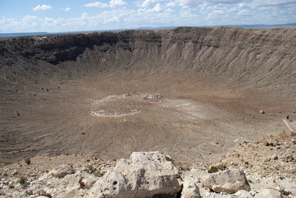
Meteor Crater

Meteor Crater, Arizona. Courtesy of Scott Tanis on Flickr. http://www.flickr.com/photos/8376919@N02/3905452932

What is striking about meteor craters on the earth is how few there are. There are so many craters on Mars that studies of its geology use their areal density to estimate the age of the surface. A bit like people’s skin, old craggy areas look different to smooth new ones. By contrast, there are fewer than two hundred impacts recognised on earth. Partly this is due to a thicker atmosphere, mostly due to high rates of erosion and geological activity and partly because there are many more traces of impact left to be found.

Most large round features on earth have been investigated. Some small craters no doubt remain to be found but there are other ways to find traces of ancient impacts. Some believe that we should be looking in the sedimentary record and that many more impact craters remain to be found, hidden away in oil company seismic data.

In the last few decades geologists have recognised a range of distinctive features found in rocks that have suffered/enjoyed an impact. Structural features within the impact include shatter-cones, fractured rock and faulting. On a microscopic scale, features such as shocked quartz are distinctive traces of the sudden massive stresses of impact. For large impacts, the energy turns into heat that melts and vaporises rocks. If a big enough hole is made, there will be extensive metamorphic changes to deep rocks due to the pressure release of removing kilometres of rock.

Another way to identify past impacts is to find material thrown out beyond the crater area. This can include thick layers of fragments and glass, called suevite. Molten glass may be thrown up into space, falling again as spheres of glass over a wide area of the earth. These may be quite thin layers in sedimentary sequences. These surely represent the most extensive record of past impacts but not many have been recognised to date, so keep your eyes peeled. For recent impacts, the glass lumps may still lie on the surface, where they are known as tektites. The largest set of tektites is found in a vast ‘strewn field’ stretching from south-east Asia into Antarctica and yet no-one has yet the crater that was surely formed at the same time.

The hunt for impacts continues. In the last few months researchers have published evidence for two more. A huge old one in Greenland has long been eroded away, but there are lots of distinctive features in the deep rocks that sat below it, which is all that remains. A smaller more recent one in Canada shows contorted strata and lots of pretty shatter cones (fractures formed by the impact).
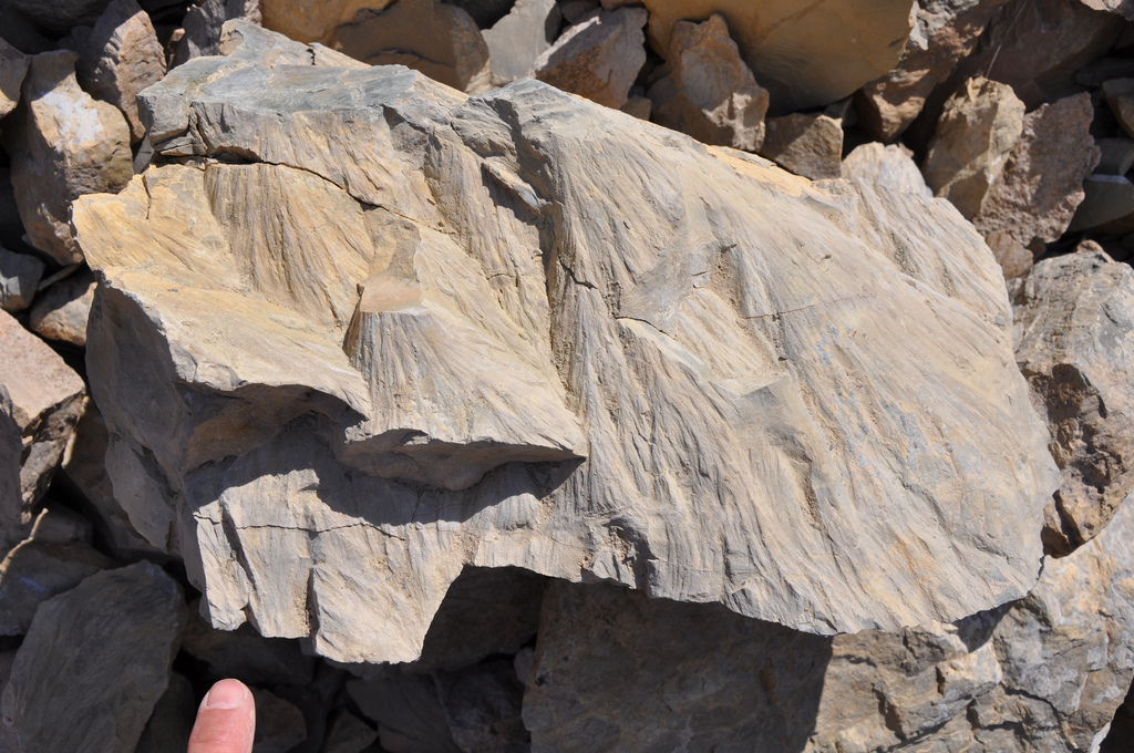
shatter cones

Shatter cones from Prince Albert crater. Courtesy of University of Saskatchewan. http://www.flickr.com/photos/usask/7644732242/in/set-72157630747745754/

The most inventive method of finding evidence of past impacts is to study ancient myths. Some link myths about ‘fire from the sky’ to impacts that occurred in human history and seek to explain flood myths by a cometary impact.

My awareness of my own geocentric bias makes me sceptical of such things. If  I was an astrophysicist, aware of the sheer volume of space debris, I would be much more inclined to explain features of the earth in terms of impacts. Perhaps too much so. I read someone once trying to explain the South African Cape Fold belt as caused by the Vredefort impact. This was nonsense.

Of course this is how science progresses, by bringing perspectives from different disciplines together as a way of stimulating new research. The link between Chixulub and the K-T extinction is pretty clear (but still debated). What is interesting about many mass extinctions is that there are just so many plausible mechanisms. The Deccan Traps may have killed the dinosaurs just as much as a meteorite. In a similar way the end-Jurassic extinction is close in time both to an impact and extensive vulcanism. The only way to take this argument further is by careful study of the evidence, most of which sits in the rocks.

Study of earth’s early history removes any lingering doubts that earth can be studied in isolation from its surroundings. The earth formed within a dusty disc around the new sun 4.56  billion years ago. During the earth’s first few 100 million years it was constantly being struck by other pieces of debris. The best current theory for the formation of the moon is the ‘giant impact hypothesis’. This suggests that the proto-earth was struck by another proto-planet the size of Mars. The impact resulted in two separate blobs which formed the earth and the moon. The energy of such an impact left both bodies completely covered in a magma ocean. Any water in the earth would be boiled off, meaning that our atmosphere and oceans are all derived from water from comets that have hit the earth since. We are all made of star dust, but let’s not forget the comet juice.

My favourite link between the earth and beyond is only an idea so far, but a beautiful one. On earth we find rare meteorites that came from Mars and the moon. When one day we study the moon in more detail, perhaps we’ll find pieces of earth on there. The period when the most impacts hit earth (sending bits flying off) is also the time when we have the fewest rocks preserved on earth. What if the oldest earth rock still in existence is actually to be found on the moon?

To end, a look at earth from the outside to remind me that our planet, endlessly fascinating as it is, is only a tiny dot in space.  ‎
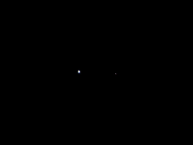
Picture of the earth and moon taken from Juno probe. Courtesy of Nasa http://www.nasa.gov/mission_pages/juno/news/juno20110830.html

 

Eclogite: mysterious visitor from the deep

This post was chosen as an Editor's Selection for ResearchBlogging.orgFifty kilometres is not far. World-class marathon runners run 42km in a little over 2 hours. They only move along the earth’s surface though. Getting to 50 kilometres below your feet is a different thing entirely. It’s a  place of crushing pressure and meltingly high temperatures, somewhere human beings will never go. There is a type of rock that’s been there – and deeper – and yet somehow returned to tell the tale. On this journey its been transformed multiple times, released fluids that cause new crust to be generated far above, even grown diamonds. Its also the most attractive rock type of all. It’s called eclogite and its gorgeous.

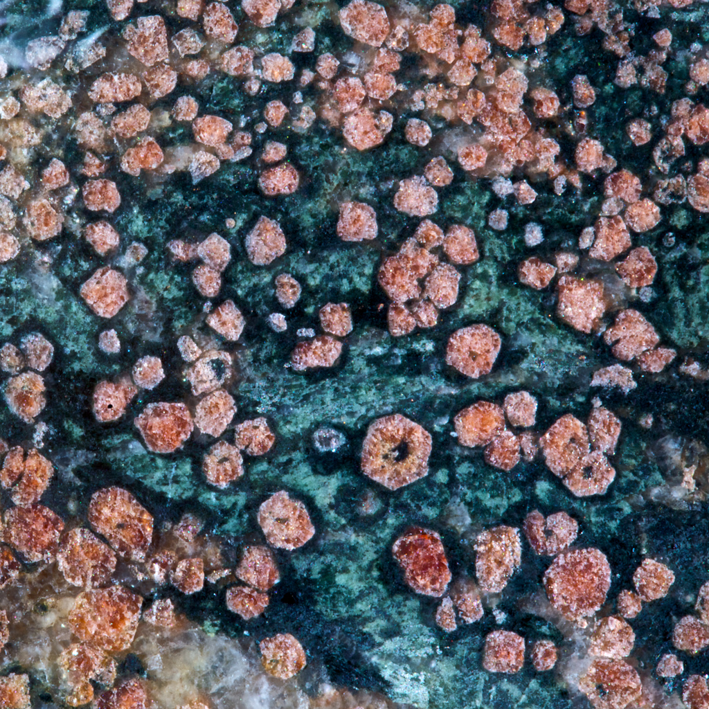
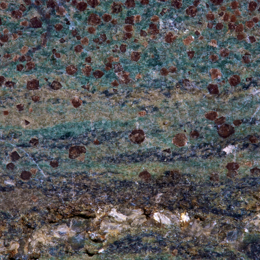
This is from the lawsonite type locality, Reed Station on the Tiburon Peninsula, Marin County, California. Keele collection.

This is from the lawsonite type locality, Reed Station on the Tiburon Peninsula, Marin County, California. Keele collection. From @hypocentre on Flickr http://www.flickr.com/photos/hypocentre/4639062593/in/photostream/

The beautiful red mineral is garnet, the lovely green is omphacite, the exquisite blue glaucophane.

Eclogite is rock of mafic composition (igneous rock relatively low in silica) that has been buried to 50 kilometres or more. At this depth, everyday minerals such as plagioclase feldspar or augite are no longer stable and they break down, allowing the rock to grow new denser (more attractive) minerals that are better suited to higher pressures.

Eclogites are typically formed by subduction of oceanic crust. Oceanic crust forms at mid-ocean ridges, where melting of the earth’s mantle produces a layered crust of mafic composition, basalts on top, gabbro below. New areas of oceanic crust are constantly being created and, to balance, older colder oceanic crust is pushed back down into the mantle at subduction zones. As the crust is pushed deeper and deeper, the gabbro and basalt is transformed into eclogite.

http://www.flickr.com/photos/17907935@N00/4652324838

Another picture from Ian Stimpson. Sample from the Mariánské Lázně Complex in the west Czech Republic. Keele Collection. http://www.flickr.com/photos/17907935@N00/4652324838

Pieces of eclogite that we can study and admire have somehow been brought back to the surface. How does this happen? Does subduction go into reverse, or does it get back to the surface in some other way? I’ll save these questions for another post.

Most eclogite doesn’t reach the surface, but returns to the mantle for good. Eclogite is denser than the surrounding mantle rocks and some subducted plates reach the very bottom of the mantle nearly 3000 kilometres below our feet. Material that’s been on this journey started as humble basalt but has been through a whole range of transformations, into eclogite and beyond.

For this post, I want to stick with a paper that illustrates how eclogites provide direct evidence of processes that we could only otherwise study indirectly.

Deep earthquakes, those below about 70km depth, are a little mysterious. At those depths, rocks are so hot they flow rather than fracture and so squeezed that fractures shouldn’t be able to move. Deep earthquakes are only seen in subducting slabs of oceanic crust. There’s been much speculation about the possible mechanisms that allow deep earthquakes. This is mostly based on seismic evidence and our knowledge about the transformations that occur in these rocks as they are buried. Wouldn’t it be great to somehow get hold of actual rocks from one of these deep fault zones?

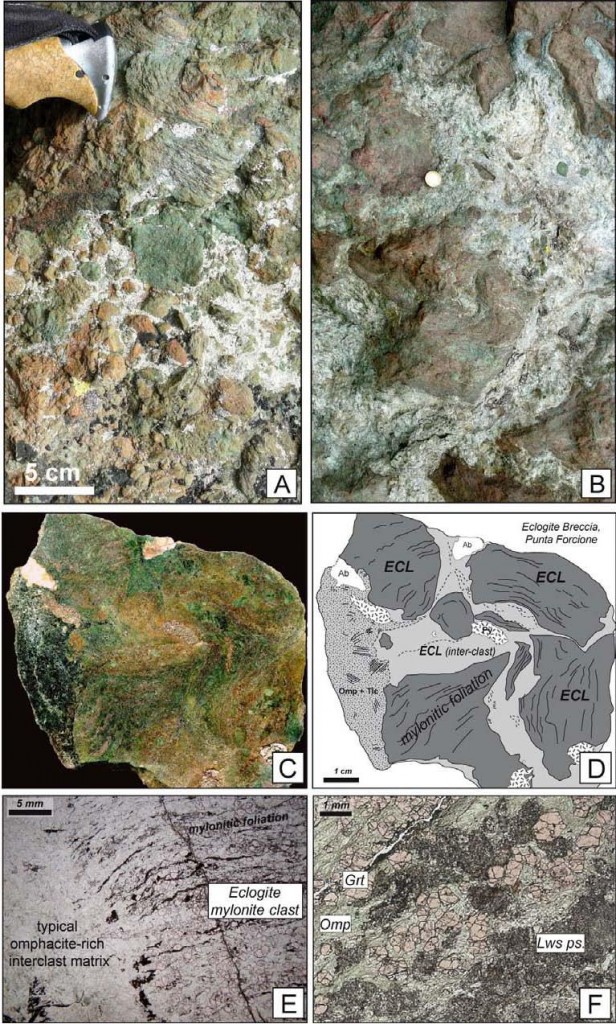
Tucked away in the Italian Alps the Monviso Ophiolite is a crustal slice of an extinct ocean called Tethys. As if moving from ocean basin to high in the Alps wasn’t enough, it’s also been buried 80 kilometres under the surface. As described by Samuel Angiboust and colleagues in this months Geology, it contains not just eclogites, but eclogite breccias, something never found before. These are not sedimentary breccias – the material between the angular blocks is not sand or mud but consists of eclogite facies minerals. The eclogite was fractured at great depth. Even individual grains of garnet show evidence of multiple episodes of fracturing. There is a lot of deformation going on, there is a mylonitic fabric, a result of ductile deformation (flow rather than fractures), active both before and after the fracturing.

Typical textures from eclogite breccias described by Angiboust et al. Figure DR-1 from DATA REPOSITORY/ G32925 (URL in text). Follow this link for more description.

Using multiple lines of evidence, our authors suggest that the breccia was formed in a fault zone that created Magnitude 4 earthquakes at between 70 and 80 km depth. The minerals in the breccia suggest fluids were present and may in some way have allowed the fracturing to occur. The other forms of deformation (mylonites and fractured minerals) were relatively dry, but also silent and not directly detectable from the surface.

Eclogites are like mysterious and beautiful emissaries from another world. You can learn a lot about a place remotely, by listening to its earthquakes and so on, but finding something that’s been there and can tell you about it – that’s really special.

References

S. Angiboust, P. Agard, P. Yamato, & H. Raimbourg (2012). Eclogite breccias in a subducted ophiolite: A record of intermediate-depth earthquakes? Geology DOI: 10.1130/G32925.1

Supplementary material found at  DATA REPOSITORY/ G32925 (downloadable PDF).


How old is plate tectonics?

Plate tectonics is the process that underpins much of our understanding of the Earth. It explains manymany aspects of the Earth, from magnetic patterns in oceanic rocks to the distribution of plants and animals. How unusual is it? Well, it doesn’t seen to be happening on other rocky planets in our solar system. Many geologists have argued that plate tectonics wasn’t active during the earth’s early history. As astronomers find many rocky planets in other solar systems, the question of understanding how ‘typical’ plate tectonics has implications beyond the earth. How long has it been going on – how old is it?

The Precambrian, is the span of earth’s history before the Cambrian. When geological periods were first defined, by largely-British geologists in the Nineteenth century, they were distinguished by the fossils they contained. Precambrian fossils are rare (hard shells only evolved in the Cambrian) and not until the Twentieth century could we calculate the absolute age of rocks. Precambrian rocks in Britain are fairly uncommon, mostly restricted to the Highlands of Scotland, so lumping them into one group made sense at the time.

Geological timescale clock from Wikipedia

Unfortunately, it turns out that the Precambrian covers the vast majority of earth’s history. Now that we can get an absolute age for many rocks, it’s possible to divide the Precambrian into smaller chunks. The next level of division consists of the (increasingly old) Proterozoic (“earlier life”), Archaean (“beginning”) and Hadean (“hellish”).

Precambrian rocks are often very different to modern ones. As well as the atmosphere being very different, the earth itself was hotter (younger radioactive isotopes give off more heat). Rocks like komatiite lavas which erupted at 1600 °C, far hotter than modern basaltic lava, suggest that mantle temperatures were then much higher. For this and other reasons, its often been assumed that plate tectonics was not active in earth’s early history.

A paper by Peter Cawood and two other Oz-based scientists called “Precambrian plate tectonics: criteria and evidence” (free!) addresses this question in a systematic way.  First they contrast plate tectonics and ‘plume tectonics’ as two different ways of transferring heat out of the earth. Both are active now (e.g. Hawaiian plume is a hotspot) but plate tectonics is dominant.

How to distinguish the two? One key difference, Cawood argues, is that plate tectonics involves “the differential horizontal motion of plates”. Plate tectonics is all about chunks of crust wandering about the place, so evidence of this is significant. How to track the ancient movements of the plates? Palaeomagnetology, or palaeomagic as it is jokingly referred to, is the study of earth’s ancient magnetic field. As magnetic minerals form, or cool down, they fix an impression of earth’s magnetic field within them. Heating samples in the lab allows us to measure the orientation of this fossil magnetic field or ‘palaeopole’. One way in which these palaeopoles can be useful is to tell you the latitude of the sample at that time. Plotting palaeopoles from different areas of Precambrian rocks at different times, Cawood demonstrate that they change latitude over time, both absolutely and relative to each other. If continents are drifting, then plate tectonics is responsible.

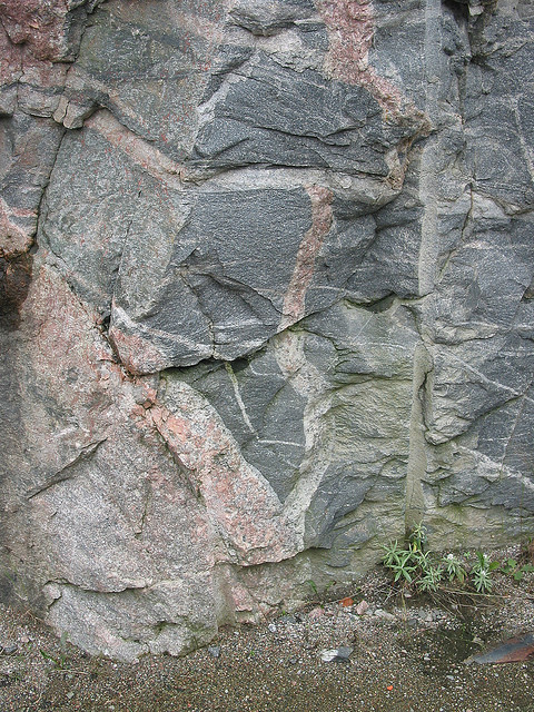
Greenstone Xenoliths in Archean Gneiss, near Sand River, Ontario

Greenstone Xenoliths in Archean Gneiss, near Sand River, Ontario, by Ron Schott: http://www.flickr.com/photos/rschott/303768298/sizes/z/in/pool-517016@N23/

Archean rocks often consist of distinctive granite-greenstone terranes that are not linked obviously to plate tectonic processes. Cawood lists evidence that while it may not be obvious, the link is there – in particular distinctive features such as ophiolites (slices of sea-floor on continents) and eclogites (very deeply buried metamorphic rocks) are increasingly being identified in very old rocks. Evidence from geochemistry and metal deposits is also brought to bare to argue that plate tectonics was active for most of the Precambrian and may have been active from the dawn of earth’s history. Precambrian rocks are distinctive, but the fundamental mechanism that drives the modern earth affected them too.

This paper is a great summary, but is not the final word (of course). Other scientists argue that plate tectonics wasn’t active and other processes were dominant. For example one groupuse numerical modelling and emphasise the importance of mantle temperature. If the mantle is too hot, then the lithosphere is weakened by melt and so not rigid enough to move as plate. An intermediate stage towards modern plate tectonics involves shallow underthrusting of oceanic lithosphere under continents. A very recent paper involving physical modelling of Archean crust provides an overview of alternative views. The paper focuses on explaining features of Granite-greenstone terranes such as “dome and keel” geometry in terms of channel flow. Channel flow is where soft squishy crust starts flowing sideways under pressure; today it happens (perhaps) only in thickened crust in mountain belts, like the Himalayas. In the hot Archean, it could have been a much more common process.

Whether or not the fundamental processes are the same, the Archean earth was very different to the planet we are sitting on now. It was frequently struck by large lumps of space debris, had a radically different atmosphere, no ‘visible’ life and weird geology. If we were suddenly transported to the Archean, we might (in the few moments before we suffocated) think we were on a different planet. When studying the remains of such a place, the uniformitarian idea that “the present is the key to the past” is stretched to breaking point. Understanding these extremely ancient rocks is very hard indeed, but it is one of the most interesting challenges in geology.

References

Cawood, P.A., Kröner, A., & Pisarevsky, S (2006). Precambrian plate tectonics: criteria
and evidence GSA Today DOI: 10.1130/GSAT01607.1

Open access link.

L.B. Harris et al. Regional shortening followed by channel flow induced collapse: A new mechanism for “dome and keel” geometries in Neoarchaean granite-greenstone terrains Precambrian Research 212-213 (2012) 139–154  Open access link.

Sizova et al., (2010) Subduction styles in the Precambrian: Insight from numerical experiments Lithos 116, 3-4  dx.doi.org/10.1016/j.lithos.2009.05.028Open access link.


Orford Ness – nuclear bombs and gravel ridges

Suffolk in England is a peaceful part of a peaceful country. But if you know where to look, between its pretty villages, sandy beaches and open countryside there are many traces of war and violence. Often full of paddling children, the sea eats towns. From an historical perspective, whether they are French, Spanish, German, Dutch or Russian, England’s enemies are usually to its east, putting Suffolk on the front line.

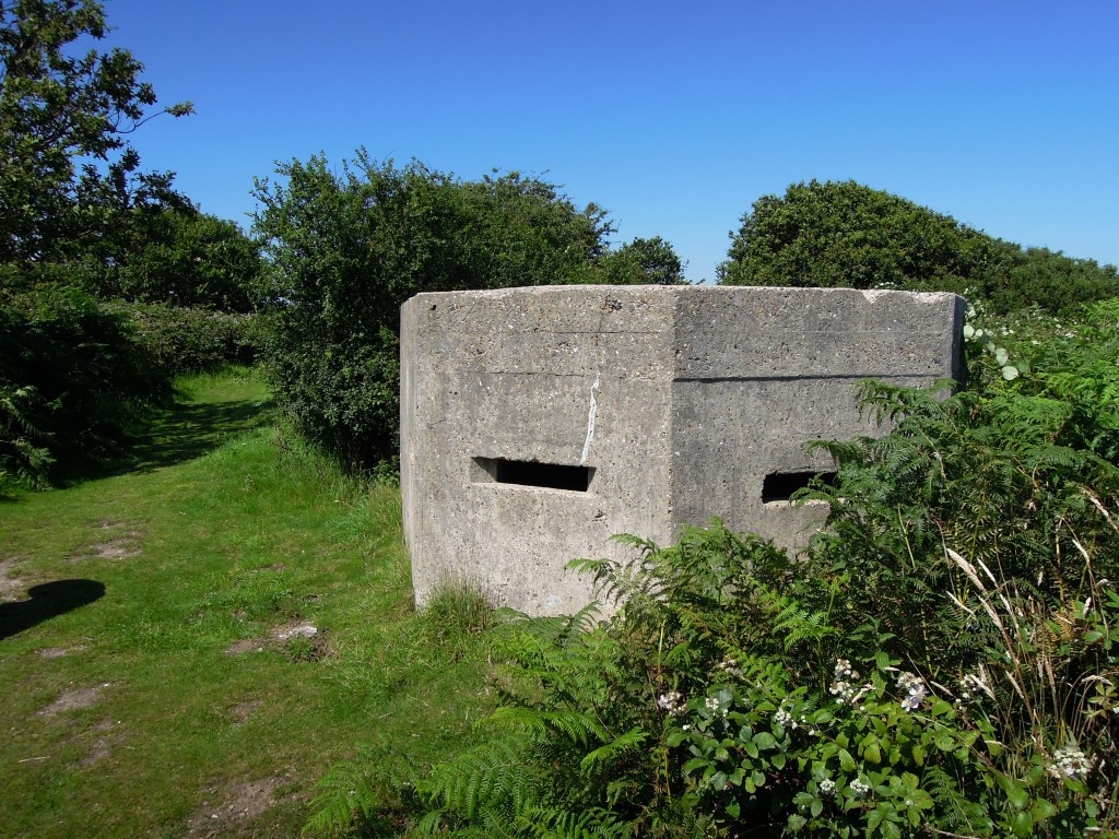
Second world war pillbox south of Walberswick

Second world war pillbox south of Walberswick

The most obvious traces of war in Suffolk are from the Second World War. When Britain “stood alone” from 1939 to 1941 there was a very real threat of invasion from Nazi-occupied Europe. Concrete fortifications such as the pillbox above are common across Britain, but the ones in Suffolk look across the North Sea, where dim shapes in the dawn mist could plausibly have arranged themselves into the terrifying outline of an invasion fleet. Airfields, both British and American are common in Suffolk as well. I want to take you to a remarkable area that touches on WW2, but is mostly about the restless sea and the Cold War.

Map of Orford Ness, via Wikipedia

Map of Orford Ness, via Wikipedia

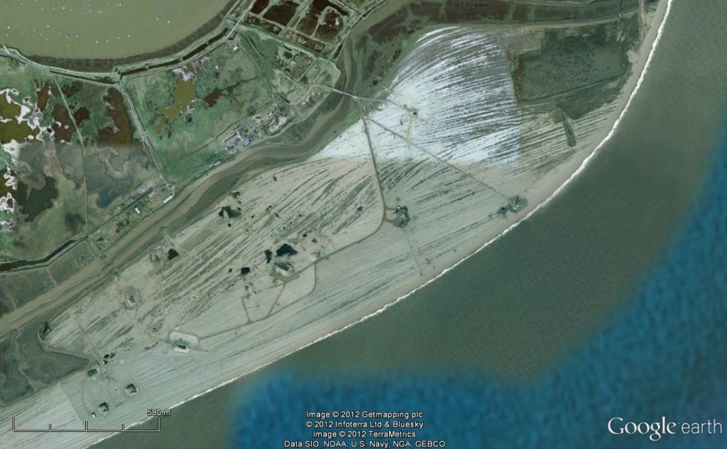
Orford Ness is a very odd place indeed. In the picture above, note the river Alde, flowing past Aldeburgh. It nearly reaches the sea where you’d expect it to, but a thick gravel ridge forces it south, running parallel to the coast for around 15 kilometres before it finally reaches the sea. Dating the Ness is hard, but old maps are the best source of information. As you can see from the map, the southern end of the Ness has moved over time – slowly by historical standards, fast by geological ones.

Let’s take a closer look at the thick elbow part, where the lighthouse sits.

Each line is a gravel ridge, most likely deposited by a single major storm moving 1000s tons of sediment. When the sea eats towns like Dunwich further north, this is where some of the land ends up.

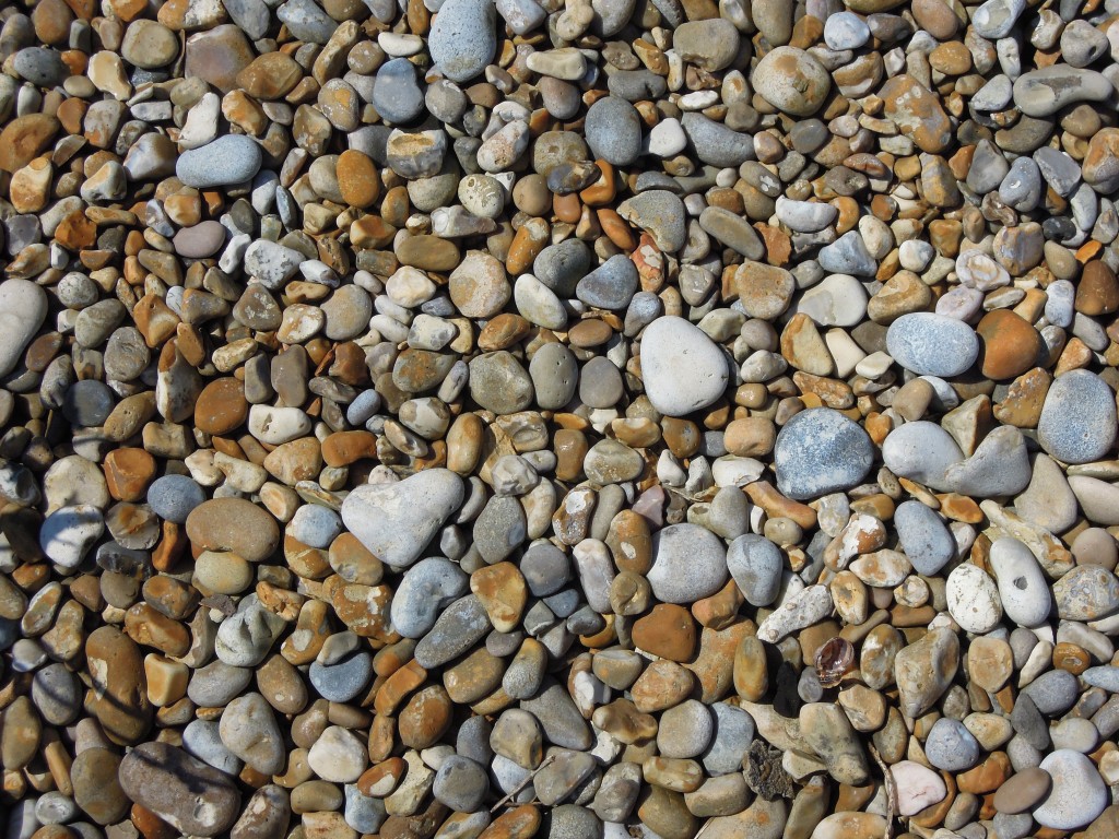
Orford Ness shingle

Orford Ness shingle

The gravel / shingle is made up almost entirely of flint. This remarkable material comes from the Cretaceous chalk layers that dominate the geology of southern England. Flint is extremely durable, so most post-Cretaceous sediments are dominated by flint as well. The pebbles in the Ness may have been eroded and transported and deposited multiple times since they grew in the chalk. In Southwold I’ve also seen brick and tile fragments on the beach, a reminder that buildings are also swallowed by the sea. These flint pebbles may once have been part of a mediaeval church in now vanished Dunwich.

Orford Ness is now owned by the National Trust and is a national nature reserve containing 15% of the world’s coastal vegetated shingle. But its evident from the picture above that something else has been going on – you’ll note the roads and the buildings. These date from the Cold War, when Orford Ness was part of Britain’s military preparations for world war three.

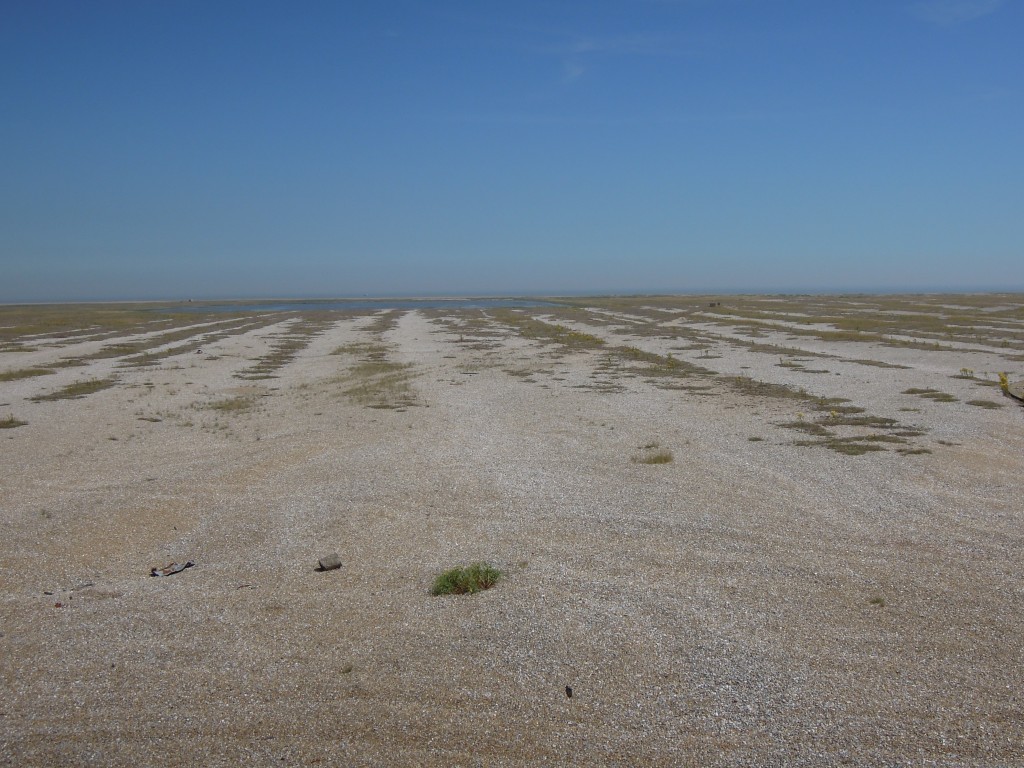
Shingle ridges Orford Ness

Shingle ridges Orford Ness, picture taken from military tower used to track impact of bombs. Note ridges end not in sea, but man-made pond

Orford Ness was used by the military before world war 2, mostly as a bombing range. In 1935 one of the first instances of using radar to detect aeroplanes took place here. In the 1960s the mostly American “Cobra Mist” program of over-the-horizon radar was based on the Ness. Once superceded by satellite technology in the 1970s, the same area was then used to broadcast the BBC World service radio station behind the Iron Curtain into eastern Europe.

The most dramatic traces of the Cold War relate to Britain’s nuclear weapons program. I feel I have some connection to this. My grandfather was a foreman on the  building works at Calder Hall, Britain’s first nuclear power station, built soon after the end of the war. We have a picture that shows the Queen Mother meeting my grandfather, showing the importance attached to this work. Calder Hall, later Windscale, even later called Sellafield, was publicised as a source of cheap electricity, but initially its real purpose was to create Plutonium, to build bombs. These were then constructed at Aldermaston, near to where I now live.

Full testing of nuclear weapons is a messy business  that the British government chose to do as far away as possible, in Australia. As well as exploding bombs, they tested what happens if a bomb is involved in a conventional explosion, say in a plane crash. Unsurprisingly this created “jets of molten, burning plutonium extending hundreds of feet into the air” and created a hell of a mess.

The testing in leafy England never involved radioactive material, but studied all other aspects of the bombs. Nuclear bombs (complete apart from the Plutonium) were dropped, banged, heated, frozen and subjected to various air pressures, all to understand how they would withstand the hurly-burly of a World War 3 battlefield. Nuclear weapons contain large amounts of high explosive, designed to compress the fissile material and initiate a runaway nuclear reaction. For this reason even these ‘cleaner’ tests were done somewhere isolated and within special buildings that would contain any explosions.

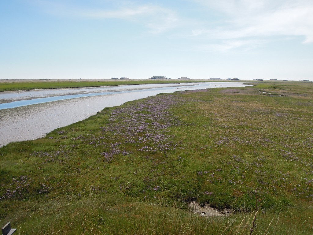
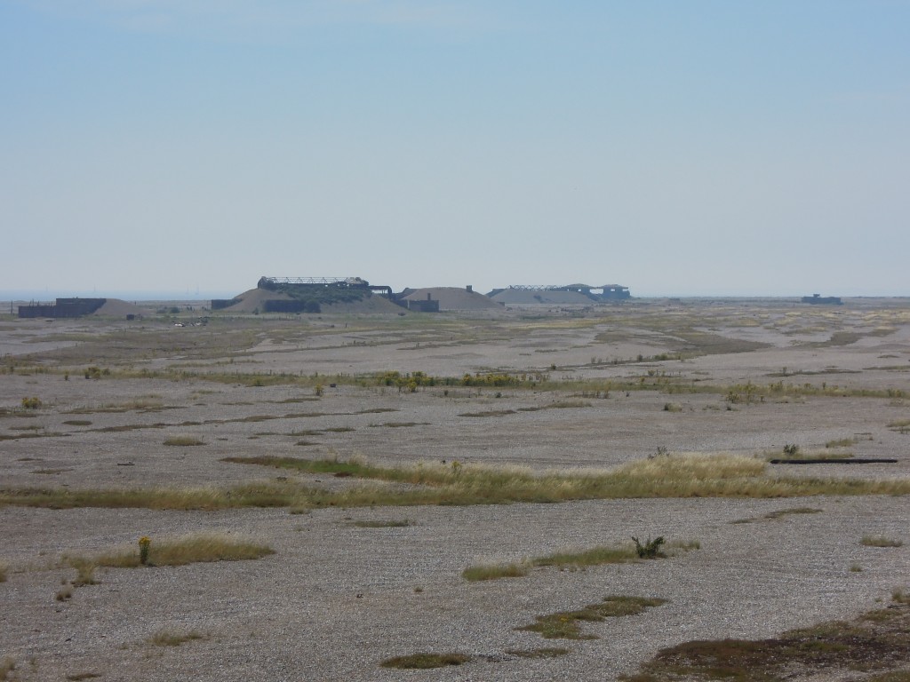
The Ness can only be reached by boat and crossed on specific paths and roads. Initially you start in an area of muddy marsh, rich in bird-life. The first glimpse of the shingle area is off-putting. In the foreground and behind you are bucolic English scenes. On the horizon are some odd structures, but how big are they? Its very hard to tell from a distance – this flat landscape gives little sense of scale.

As you get nearer things only get odder, its like another world. Those structures look like buildings, but they are surrounded by mounds of shingle, as if they are being pushed up from under the ground.

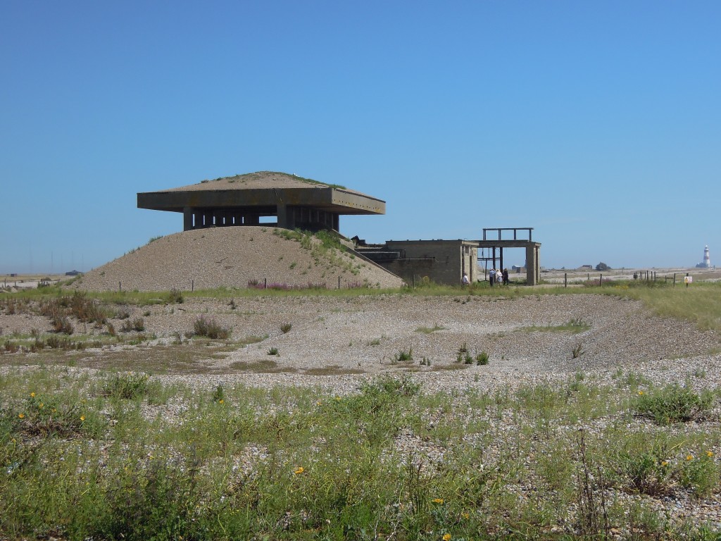
Up close they resolve into decaying buildings, with stained concrete and rust. They are surprisingly small. The banks of gravel are a pragmatic and cheap way of reinforcing the walls.

The oddest structures are the pagodas, which have a concrete roof topped with more gravel. In the event of a conventional explosion, the blast would be diverted sideways through the open vents.

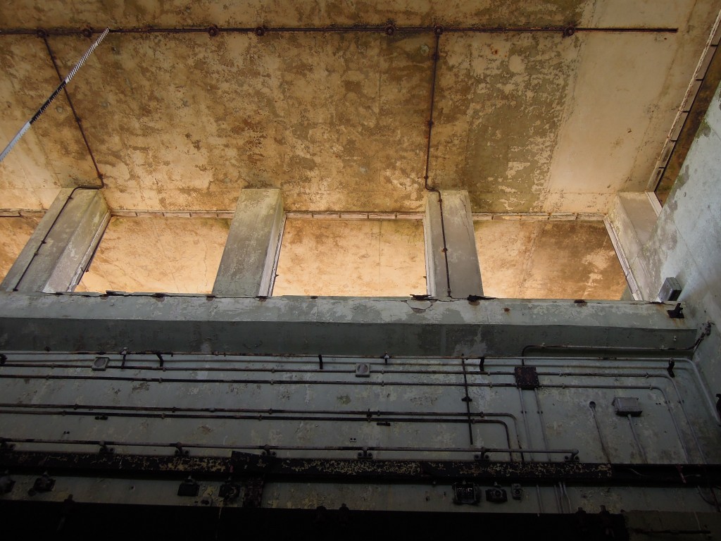
Here’s a view from inside, showing the vents and giving a sense of the brutalist building style.

Testing on Orford Ness spanned only the 1950s until the 1970s, when Britain switched to a nuclear deterrent based on American technology, first Polaris and currently Trident. These buildings are now slowly decaying. Over time they will further merge with the shingle, or perhaps the restless sea will erode the Ness away, releasing the flint gravel within the concrete and sending it round yet another cycle of erosion and deposition on the English coast.