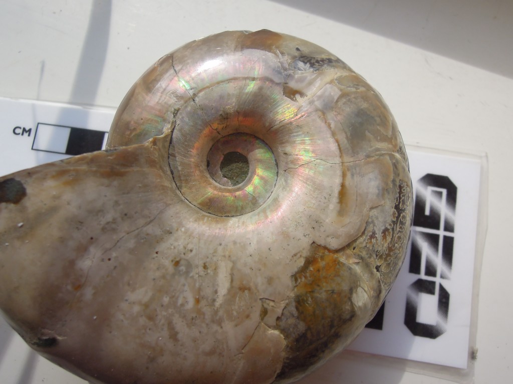
Ecton – copper, limestone and folds

England’s Peak District is made almost entirely from Carboniferous sediments, in a broad anticline. On the outside edges, mid to late Carboniferous rocks are dominated by sandstone, with subsidiary mudstone and coal. The core is an area known as the White Peak where lower Carboniferous limestones form a gentle landscape. It’s a working landscape though, with a long history of mining and quarrying, as we shall see.

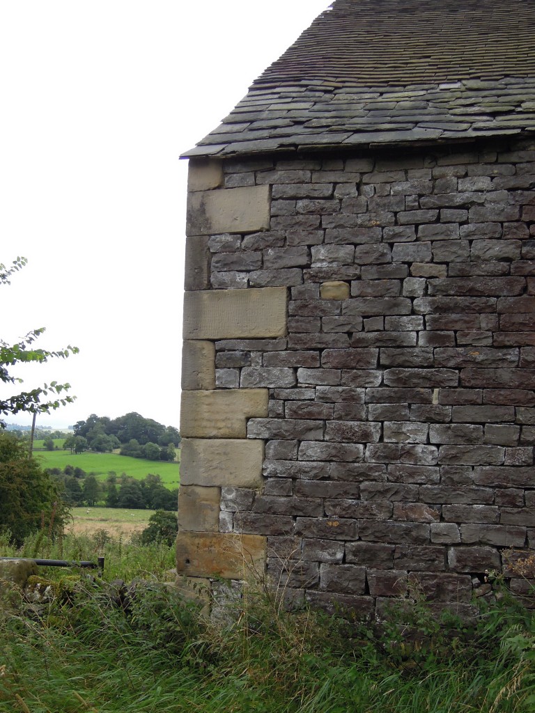
Farm building showing sandstone corners and limestone fill. near Ecton

Farm building showing sandstone corners and limestone fill.

While the limestone was being deposited, most of Derbyshire was a shallow shelf area. The crust was being gently pulled apart and fractured, so the shelf area was surrounded by deeper basins.

Just like the Bahamas

These seas were at tropical latitudes and, on the shelf, relatively free of terrestrial sediment. These are perfect conditions for making limestone, as numerous organisms create calcium carbonate structures that build up into rock.

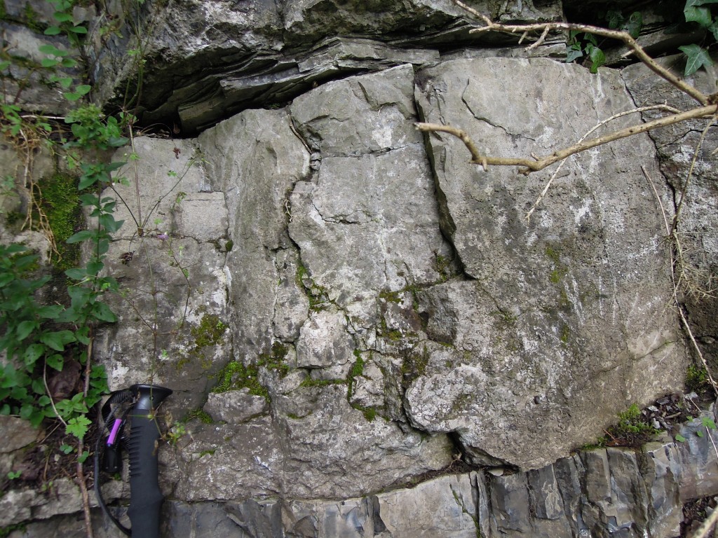
The typical fossil assemblage you find in these rocks includes rudose corals, brachiopods and crinoids (ancient sea-lilies).  Fossil reefs abound, made of limestones packed with (in fact made entirely from) ancient life..

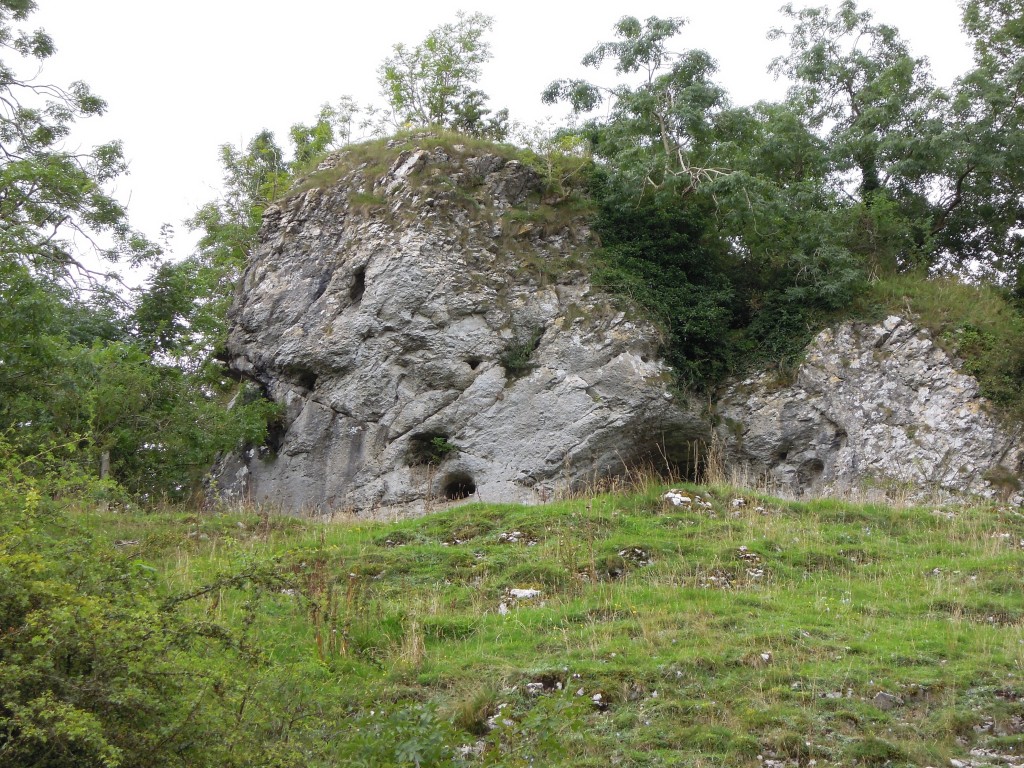
Massive 'reef' limestone, Manifold valley

Massive ‘reef’ limestone, Manifold valley.

Reef limestones are typically ‘massive’ which in a geological context means lacking obvious bedding planes or other structures. The above photo shows a cave, another distinctive feature of limestone areas. This particular cave has been linked to a ‘green chapel’ that features in a famous medieval story.

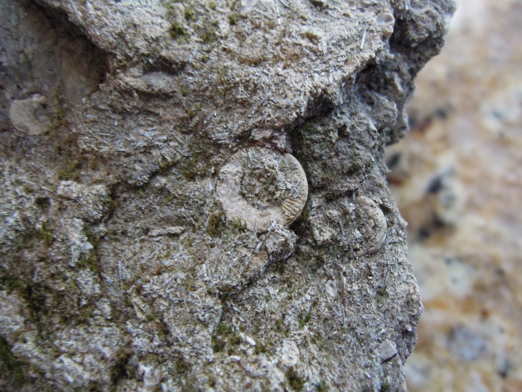
Crinoid ossicle

Crinoid ossicle in grey bioclastic limestone

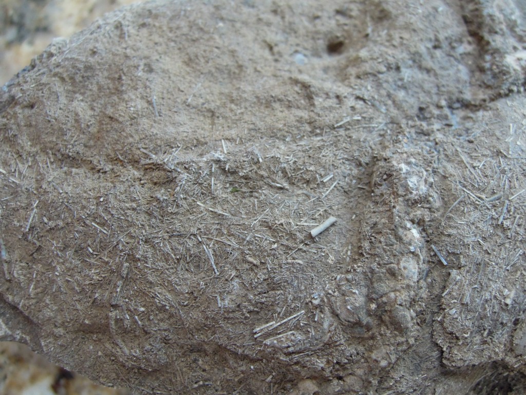
A closer look at the fossils. The round discs is a crinoid ossicle, plates of calcium carbonate that joined up to make the stems. The rock is made up almost entirely of bits of life, either plants or mostly animals, hence the technical term ‘bioclastic’. The numerous little pin-shaped pieces in this sample are (as best as I can tell) brachiopod spines (if you know better, speak up!).

Bioclastic limestone with ?brachiopod spines

Bioclastic limestone with ?brachiopod spines

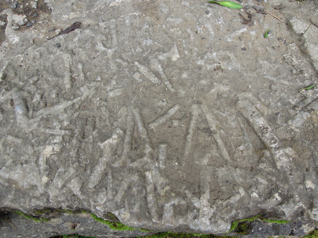
Slab of limestone showing crinoid debris Wooton Mill.

Slab of limestone showing crinoid debris Wooton Mill.

Here’s a worn slab of reef limestone, showing abundant crinoid stems, still in one piece.

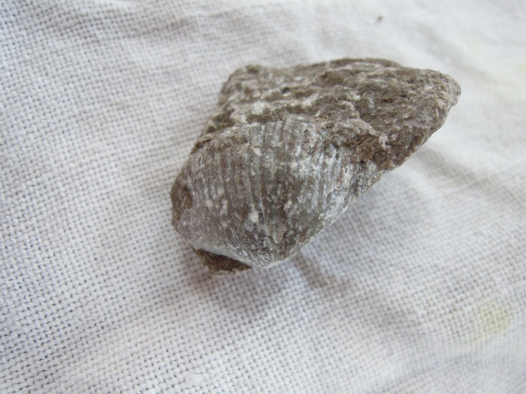
These pictures were taken on a recent trip to Derbyshire, where I didn’t spot a decent brachiopod. Conveniently just the other day I spotted one in the gravel of my drive. There are many massive quarries in the Derbyshire limestones and some of it ends up in as builder’s gravel.

Brachiopod in grey limestone

Brachiopod in grey limestone piece of gravel from my drive

Copper-bottomed

There is a long history of mining in the Peak District. There are many ore bodies, typically found in veins associated with faulting. Blue John, an beautiful banded form of fluorite was mined for ornamental purposes. Less glamorously, lead, zinc and copper have been mined since Roman times. The mineralisation was deposited by hot fluids that formed as the sediments became buried.

Around Ecton the mining was mainly for Copper. Ecton Copper Mines, were most active from early C17th until 1891. Peak production was 4000 tons in 1786. A major use of copper at this time was covering the bottom on ships in the Royal Navy. Sheets of copper (or zinc copper alloy) were used to protect the wooden ships from the attentions of marine life, particularly Teredo worms (‘shipworm’).  The Navy’s ships were cutting edge technology at the time, projecting British power across the globe. They were sometimes used for scientific work too, for example His Majesty’s Ship Beagle that carried Darwin on his famous voyage.

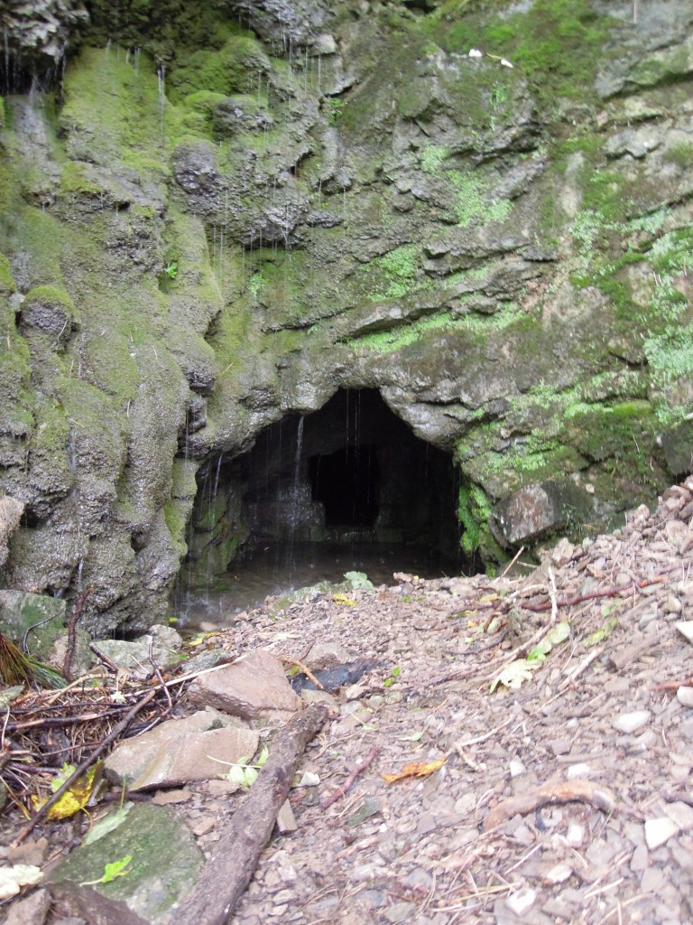
Traces of the mining remain. Found at the bottom of Ecton Hill this is mostly like a sough (pronounced “suff”) a channel to drain the mine shafts higher in the hill.

Evidence of mining, Ecton

Evidence of mining, Ecton

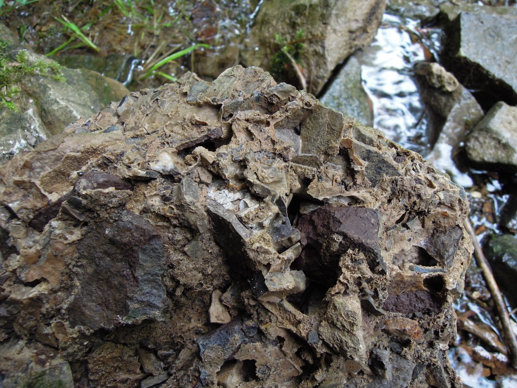
Ecton also contains this odd rock.

Lithified scree, Ecton

Lithified scree

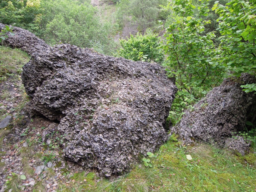
This is calcrete, an angular limestone cemented by groundwater CaCO3 during the Pleistocene. Basically its old scree that got stuck together.

large block of lithified screen, Ecton

large block of lithified screen, Ecton

There’s quite a lot of it.

Deep waters

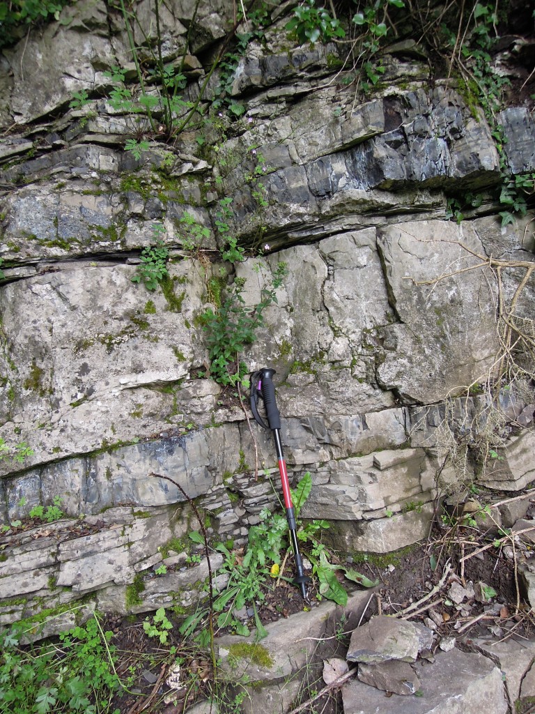
The Ecton limestone is a thinly bedded limestone, with minor shale layers. It represents deeper water sedimentation, very different from the shallow reef sediments. Equivalent rocks further from the shelf edge are simple mudstones. Further north they form the Upper Bowland Shale, which is a source rock for conventional Irish Sea gas-fields and a potential source of shale gas, extracted by the controversial process called fracking.

Here, very near a shelf, limestone dominates.

Ecton limestone

Ecton Limestone. Layers of mud and limestone, plus later chert bands

The shiny black beds are chert – silica layers that formed after deposition.  Here’s a single bed of limestone. It is ‘graded’, with coarse debris at the bottom and fine at the top and so likely deposited by a turbidity current. Some of the bits of dead animal forming in the shallow water on the shelf got carried into deeper water by a single major event.

Graded bed Ecton limestone

Single graded bed of Ecton limestone

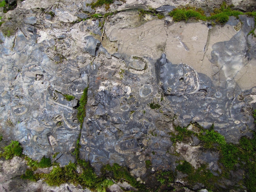
Here’s a closer look at a coarse layer. The fine grained limestone has been partially replaced by chert, which makes the white fossils stand out nicely. There are various sections through crinoid ossicles, which here are completely broken up, as you would expect since they have been transported downhill from where they grew.

Chert band with fossils

Detail of chert band showing crinoid stems

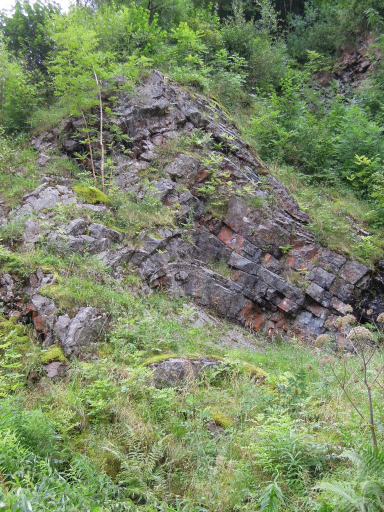
Folding in Derbyshire limestones is rare. Apes Tor in Ecton is unusual in showing tight folds. This is most likely because they are layered and easier to fold compared with the nearby massive limestones. Sadly when I was there the outcrops were heavily vegetated. If you look at the next photo and immediately spot the anticline, you are probably a structural geologist.

Detail of folding Apes Tor, Ecton

Detail of folding Apes Tor, Ecton


Oceanic crust – that sinking feeling

Some rocks lead a quiet life. Stable parts of continental crust just sit there for billions of years, doing nothing. In the oceans things are much more dynamic. Live fast, die young, stay pretty is the motto of oceanic crust. It goes on one of the most amazing journeys rock can take. Along the way it affects well nigh everything in and on the planet. Let’s tag along.

Making the crust

Mantle material, usually made of a dark heavy rock called peridotite, is odd stuff. Whenever I’ve seen it on the surface it always looks out of place somehow, too homogeneous, too brown, too massive. Yet it forms over 80% of the earth’s volume – excepting the metallic core it is what earth is made of. Found everywhere immediately below the crust, from between 5 to 75 kilometers depth, it is very very hot (> 1000 °C) – hot enough so that it flows (slowly to us, but fast on geological timescales) but still remains solid. The top, “lithospheric”, layer of mantle has ‘frozen on’ to the crust, becoming part of a rigid plate. The rest makes up the “aesthenosphere”, where the mantle is constantly flowing and mixing, like hot soup in a saucepan.

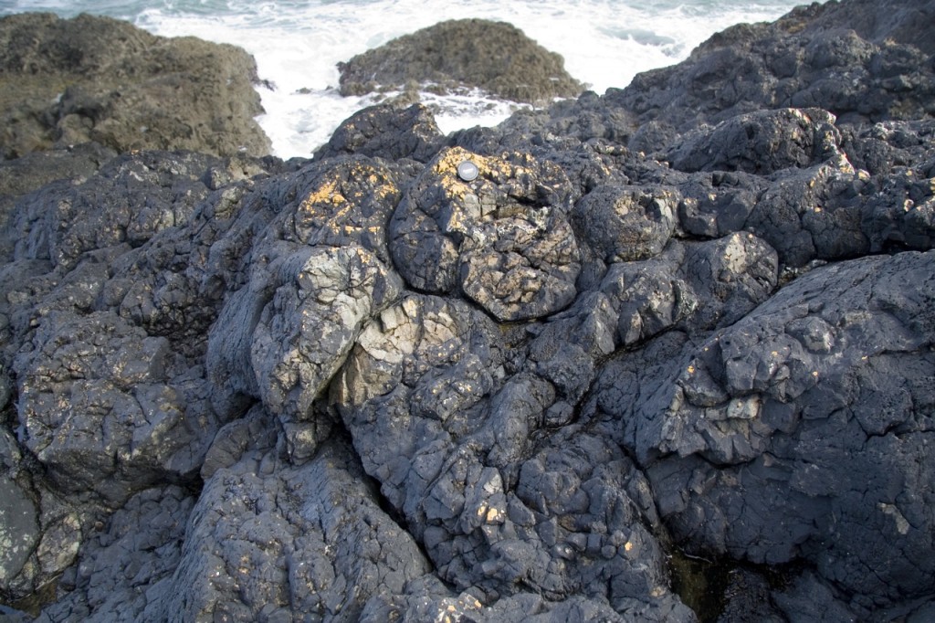
Our little piece of oceanic crust is about to be formed at a mid-ocean ridge, where two plates move apart. This makes space that is filled by part of the hot mantle rising up – whereupon the reduction in pressure causes it to melt. Rock is made up lots of different minerals and when it melts it usually doesn’t melt completely and produces a magma that has a different composition than the original rock. Shallow melting of mantle material gives basaltic magma. This rises up and pools into magma chambers. Here it may cool to form coarse gabbro, or flow upwards through cracks to form basalt lava flows, or cool in the cracks to form a sheeted dyke complex. This creates a characteristic layered pattern in the crust.

pillow basalts from http://www.flickr.com/photos/19311544@N00/2882765413

Pillow basalts. Image from Earthwatcher on Flickr. http://www.flickr.com/photos/19311544@N00/2882765413

All of this is taking place under water. A 2.5 km thick pile of water in fact. When magma reaches the surface, it flows out as lava but it cools extremely quickly and forms piles of distinctive pillow shapes. Water also flows down into the crust where it is heated up. When it comes back to the surface, at places called hydrothermal vents, it may form dramatic chimneys called black smokers, built up as minerals precipitate out of the suddenly cooled brine. Water is making important changes under the surface, changing the original igneous minerals into new ones, often by putting H2O into the mineral structure.  Incredibly, it seems there may be bacteria living in this hot wet rock deep below the surface.

That sinking feeling

As our new crust slowly drifts at finger-nail speed (5 cm/yr) away from the ridge, it cools and grows denser, causing the sea-bed to sink. Sediment builds up on top. We are a long way from land and the sediment tends to consist of dead things with great names falling from above – diatomaceous ooze, globigerina ooze, the Titanic. It depends.

After 50Ma (million years) our crust is denser than the underlying mantle. It would sink down into it, but it is part of a rigid plate so it can’t – until it reaches a subduction zone, that is. Subduction zones, usually associated with deep ocean trenches, are found around the world. They are doorways – a place where our crust leaves the surface and enters the interior of our planet.

As it moves down into the subduction zone, our crust is pushed down under another plate. It bends down and starts to sink into the mantle – the older the crust, the steeper the angle. Some of the sedimentary cover is scraped off, to form an accretionary wedge above the plate. All this scraping and bending is associated with earthquakes, some of the strongest ones known. The bending of the plate allows water to get into the mantle part of the plate, further changing its composition.

Subduction zones and mid-ocean ridges are linked. In them, creation and destruction is broadly balanced. Oceanic crust is created from the mantle and returns there to be destroyed. The balance is not perfect: 0ceanic crust starts of different in composition from the mantle and all that brine it interacted with caused many chemical changes. The crust returns changed and can’t just turn back into peridotite – it stays as something more interesting.

As our crust starts to sink deeper into the subduction zone, the pressure increases. A lot. Imagine the pressure of a kilometre of rock sitting on top of you (I bet you can’t). For every kilometre the crust descends, the more rock is pressing down on it. The temperature increases too, but to a lesser extent – the cold crust takes a long time to heat up.

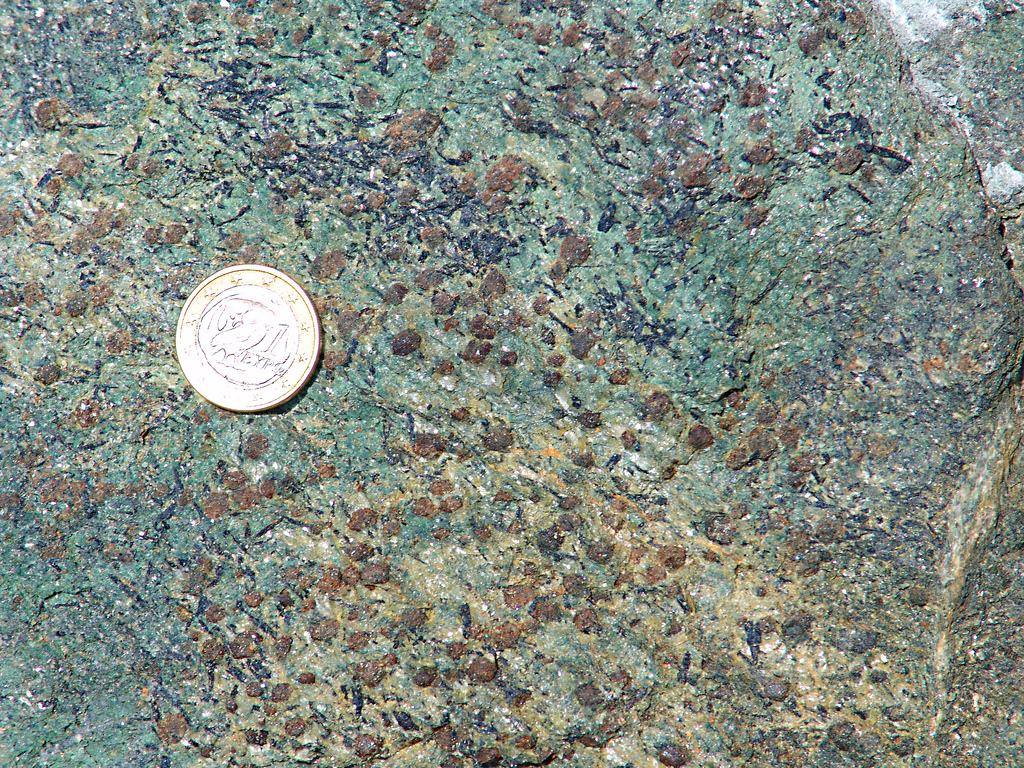
As conditions change, two things start to happen, metamorphism and metasomatism. Firstly the minerals forming the basaltic rock (such as plagioclase, pyroxene, olivine) become unstable and new minerals are formed –metamorphism. This process is fairly continuous as the conditions change, but the most dramatic (and attractive) transformation occurs about 2 million years after subduction starts, at around 50 kilometers depth. Here the basaltic rock turns into eclogite.

eclogite with rutile from http://www.flickr.com/photos/30659367@N00/60820842

Eclogite with rutile. Photo from Graeme Churchard. http://www.flickr.com/photos/30659367@N00/60820842

Many of the metamorphic reactions affecting the crust release water which flows from the subducting crust up into the wedge of mantle sitting above it. Water is a fantastic solvent, so it takes other elements up dissolved with it – this flow of material is called metasomatism. These elements tend to be ones that make large ions, like Potassium and Boron- they are harder to fit into the increasingly tightly-packed mineral structures that form at depth. It’s as if they are being squeezed out of the rock.

How on earth does a slab of rock force its way deep into the earth? The driving force is density. Old cold subducting crust starts off denser than the surrounding rock and the process of turning it into eclogite makes it 10% denser still. Over geological timescales the mantle behaves like a stiff fluid and a cold and rigid dense plate is able to force its way into it. The force generated by the sinking plate is called slab pull and is one of the major drivers of plate tectonics. Eclogites make the world’s plates go round.

After burial, rebirth

A lot of what we know about subducting crust comes from pieces of it that have somehow got back to the surface. We don’t know of any eclogite that has been deeper that 150km, so as our plate sinks further down we have to infer what is going on using indirect methods.

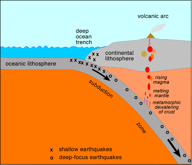
One such method is to study the pattern of earthquakes associated with modern subduction zones. Over time, plotting their distribution picks out the subducting plate and shows that typically it carries moving down to at least 650km depth.

One, rather important, consequence of subduction is the creation of volcanic arcs. These are chains of volcanoes, parallel with the subduction zone, typically about 100km along the surface from the trench. Many major modern day volcanoes, such as Mount St. Helens and Krakatoa are found in volcanic arcs.

subduction diagram from http://www.flickr.com/photos/44615724@N05/6128547564

Subduction zone – diagram from infringer1 on Flickr (http://www.flickr.com/photos/44615724@N05/6128547564)

Working out what is going on below volcanic arcs relies on the indirect tools provided by geochemistry – studying the composition of earth materials. We know the composition of what we start with (subducting crust and mantle materials) and of what we end up with (volcanic rocks) and comparing the two gives insights into the process.  It’s complex.

At depths of 100-250 km the oceanic crust begins to melt. The resulting magma, along with the water mentioned earlier, rises up into the wedge of mantle above. This rising material then lowers the melting point of the hot mantle wedge, so in turn parts of that melt. This new mantle-wedge melt is what rises to the surface and forms the volcanic arc. On the way it may be further modified by melting and then mixing with the crust it is intruded into. The end result is that mantle melting ends up  producing rock with a very different composition, called andesite.

This process is worth studying in detail as it is one of the main engines of continental crust formation, producing the stuff that most of you are currently sitting on. Over time, volcanic arcs have been the major mechanism for turning mantle rocks into continental crust. [If you are not sitting on continent, how’s the pineapple/cod cheeks tasting tonight?  I’ll get to the creation of your oceanic island in the next post]

Subduction is involved in not one but two interlocking cycles of creation and destruction. Oceanic crust is created, but it is destined soon to return to the mantle at subduction zones, to make space for newer crust.  Squeezing out of the water the crust gained from the oceans helps create new continental crust. Eclogite plays an important role in both cycles – it helps pull the mid-ocean ridges apart by slab pull and it sweats out the fluids that kick-off the creation of volcanic arcs.

I talk of destruction, but our crust still lives on, transformed. Maybe 40% of it has melted and flowed upwards, but it it is still a distinct slab, different from the surrounding mantle. By now it  has travelled 250km down, after about 10 million years of subduction. It’s journey is far from over with 10 times as far to sink still. We’ll continue the incredible journey in another post.

Further reading

I found the paper Metamorphic chemical geodynamics of subduction zones an invaluable recent summary of the details of metamorphism within subduction zones and how it drives melting. The link is to a freely available copy.

Dana Hunter’s recent post over at Rosetta Stones gives a perspective on what its like to live above a subduction zone. She’s also writing extensively about Mount St. Helens and the drama caused (indirectly) by devolatilisation reactions in eclogites.

Ludchurch – sandstone, landslips and a beheading game

The ‘Dark Peak’, the land to the south and east of Macclesfield rising up above the Cheshire plain, is a wild place. We are in England though, and even here in the North, things are only mildly wild. This is no wilderness, we are only 25 miles from Manchester, once the ‘workshop of the world’. The area is criss-crossed with (exciting narrow) roads and dotted with farms, but is not totally domesticated or defined by human control. Some 600 years ago its primary purpose was for hunting, as the place name Wildboarclough reminds us. I recently visited a wild place here which is geologically interesting but also spooky, with echoes of medieval violence.

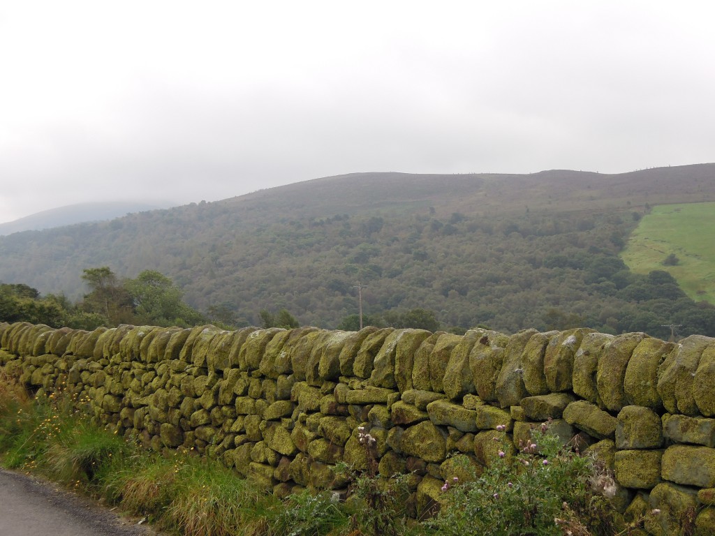
Green view of Lud's Church hillside

The primary colour of this land is green. Note how even the stone walls are green, because the sandstone rock is covered with moss. The wooded hillside you see is a dip-slope – the slope follows the upper surface of a layer of durable coarse sandstone. The woods contain a magical secret place, which is where we are headed.

Our destination is best reached via Gradbach. This contains an old silk mill, where in the 19th Century water-power was used to drive machinery to weave silk. Such places (more usually involving cotton weaving) were the nursery of the industrial revolution. Water power was soon replaced by coal-fired steam power and production shifted from rivers in the middle of nowhere into big cities such as Manchester. Though far from rivers, the new buildings full of looms were still called mills. The Gradbach mill is now a Youth Hostel, giving children a taste of the wild.

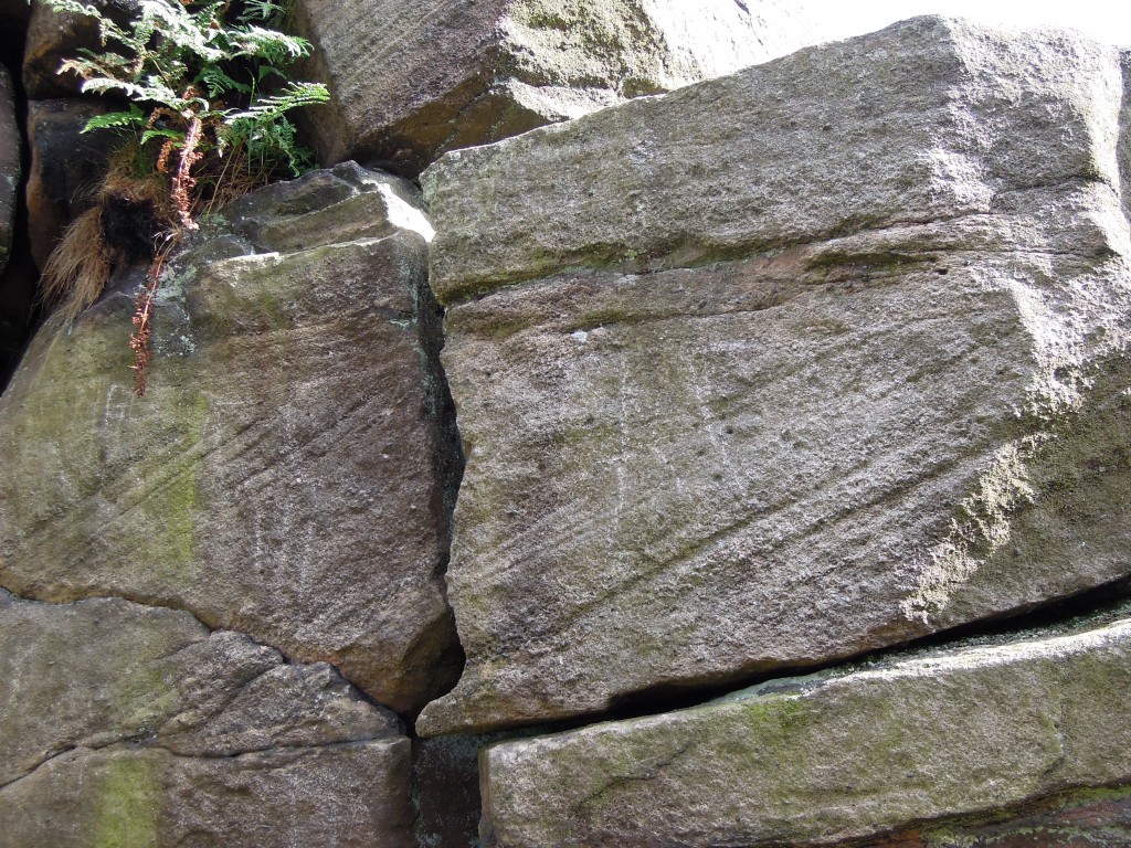
Once across the river and in the woods, everything seems normal. You walk up some muddy paths and you reach a set of small crags. Carboniferous sandstone, coarse grained and with cross bedding – very typical of the area. Note the green algae staining.

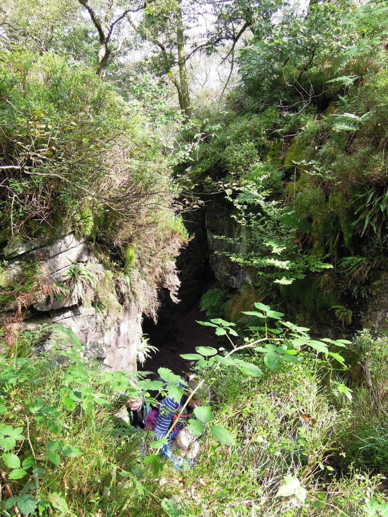
Sitting within these woods, almost hidden amongst the undergrowth is an entrance to another world.

Entrance to Lud's church

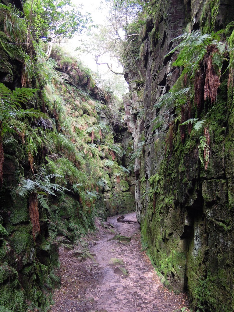
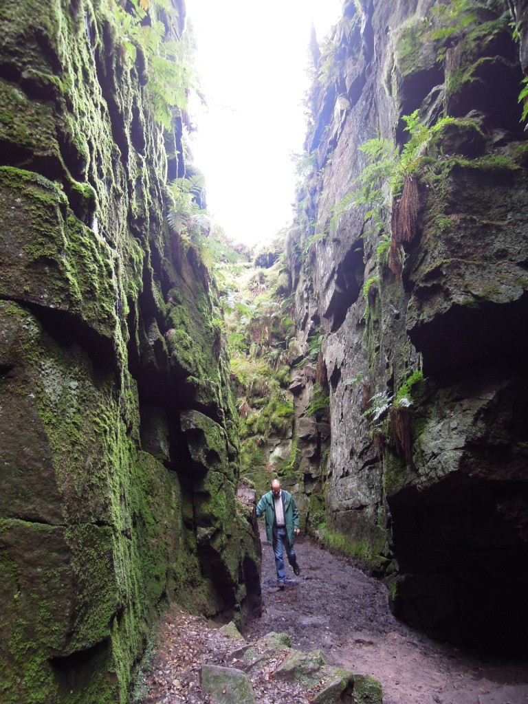
You walk down a little way and you are in a deep dark space like nowhere else I’ve ever been. The air is cool, muffled and moist. Every surface is damp and green. The sky above seems a very long way away, peeking down between two great walls of sandstone, covered in ferns, moss and liverworts. A place that is neither underground or above ground, a chasm not a cave, a rocky place full of plants. This is Ludchurch.

Geologically, this is a large landslip, of unknown age. The bedding planes in the rock, the Roaches Grit, are sloping down hill. A weak layer, probably shale, allows movement sideways and the rock parts along vertical joint planes. A chunk of rock 100s of metres long has slid a few metres downhill, creating a hole in the ground that’s filled with plants and mystery.

What did the medieval inhabitants of the land make of it? Without our modern day paths, the most obvious way to encounter Ludchurch is to ride over the top and fall to your death into it. Even now dead sheep can be found at the bottom. Over the  years Ludchurch has gathered many myths and stories and inspired a great work of literature.

The Green Knight

Sir Gawain and the Green Knight is a complex story from the late 14th Century. Sir Gawain, of King Arthur’s court, gets involved in a ‘beheading game’ with a mysterious Green Knight (like you do). The climax of the story takes place in a Green Chapel. The story is written in a Cheshire dialect, now extinct but recognisable only a few generations ago. Many scholars have linked the Green Chapel directly to Ludchurch itself. That a local man writing a story of the supernatural would be inspired by Ludchurch makes perfect sense to me.

The Green Knight has been linked to the Green Man, a common carved or painted figure in old English churches. It represents a pagan vegetative deity, a figure who embodies the growth cycle of plants. Such a figure would certainly like Ludchurch, covered with plants as it is. The fact that it is made of Carboniferous rocks is appropriate too. This was a time when the air was rich in oxygen, supporting vigorous forests – a golden time for a Green Man. How appropriate then that a block on the base of Ludchurch shows a plant fossil, partly covered in moss and liverworts.

Spooky postscript

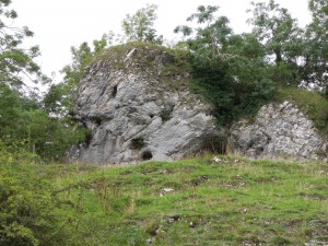
Massive 'reef' limestone, Manifold valley

Crag containing ‘Green Chapel’

I visited Ludchurch during a week’s holiday based in the area. On an earlier day I’d visited the Manifold valley in search of interesting rocks to tell you about (watch this space).

On this other trip I photographed a crag of massive reef limestone. When later researching the link between the Green Chapel and Ludchurch, I found a website that decided that a limestone cave at Wetton Mill was a better fit for the Green Chapel. The name sounded familiar – I clicked on their photo and found a picture of the same crag from the same spot! 

This is purely a coincidence of course. The nature of things is that wildly improbable coincidences happen all the time. It still made the hair on the back of my neck stand up.

A note on nomenclature. Ludchurch is more popularly known as Lud’s Church, but my father, who holidayed here in the 1940s and has always lived nearby, knows it by the non-possessive version that I’ve used. There are many suggestions as to who Lud was, which means no-one knows, but for sure it is nothing to do with the Luddites. Don’t let anyone tell you otherwise.

A year of metageologising

It’s been a year since I started this blog and tradition dictates I do a spot of navel-gazing – talk about this blog and the process of blogging, that sort of thing.

Over the past  year I’ve published 58 posts, received nearly 200 comments and received over 20,000 page views. It’s been fun, exciting and educational. For me at least.

My first post here in August 2011 was about Sexy Geology. You probably didn’t know that as very few people read it; August is a rubbish time for geo-blogging, as you’re all out enjoying yourselves in the field. When I say started here, I mean at all-geo.org/metageologist. I’d already written a few posts at Erratics slightly to the left of here on all-geo.org. BTW, if you’d like to try geo-blogging then start doing it now. There is no down-side, no commitment and you’ll get publicity and encouragement to die for.

This support won’t just come from Chris and Anne here at all-geo, but from pretty much everyone you’ll come across. The geoblogosphere is a really friendly place. Of the comments I’ve received, a few have pounced on lazy, slack mangling of fine details of the science but none have been simply negative. Most are positive and encouraging, which is very motivational indeed. I speak as someone behind a good spam filter of course.

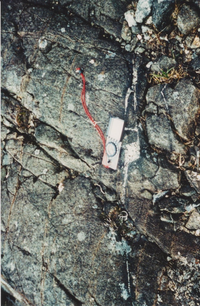
En-echelon fracture with granite magma within gabbro intrusion. Note green rim where hydration of pyroxene creates amphibole

A picture to draw you in

My second post here was Relict of the flood? which is part of a type of post I think of as ‘what I did on my holidays’ – picture led, light on geological detail, often with a historical twist. My next post, the perhaps over-provocatively named What you ought to know about metamorphism started a whole series. When writing about the Vredefort impact crater I wanted to quickly describe how pressure and temperature estimates are derived for metamorphic rocks. Starting as a sentence sub-clause this quickly swelled beyond a paragraph and eventually into seven blog-posts. I enjoyed writing multiple posts on a theme, so when I scanned some photos of Mount Everest I took the opportunity to write 10 posts about the geology of mountains before finally posting the pics.

Given the way blogs are consumed, I wonder if following themes in this way is of more use to me than to you. Looking at my usage statistics (which I do too often) there is a clear bimodal distribution. When a post goes up there is a flurry of activity over a few days. I use Twitter to publicise new posts, but in practice most traffic comes from @geoblogfeed or related traffic. The size of this initial spike depends a lot on whether the post is (re-)tweeted by some of the movers and shakers of geo-Twitter.

Once the dust dies down, its down to the Gods of Google to decide if a post sinks or swims. A big chunk of my traffic comes from search terms relating to metamorphic petrology, partly I think because there is not a lot else out there. Another lump of traffic is using terms like ‘world altitude map’ because a wikicommons altitude map I borrowed comes up first on my site in Google image search. What I learnt from this is that lots of people search for images, so  if you have good ones always tag them properly (even if they are not yours). I think of images as my weak spot, but I find there is an awful lot available under Creative Commons on flickr, searchable via a handy site. I always try to act in accordance with the wishes of the creator, of course.

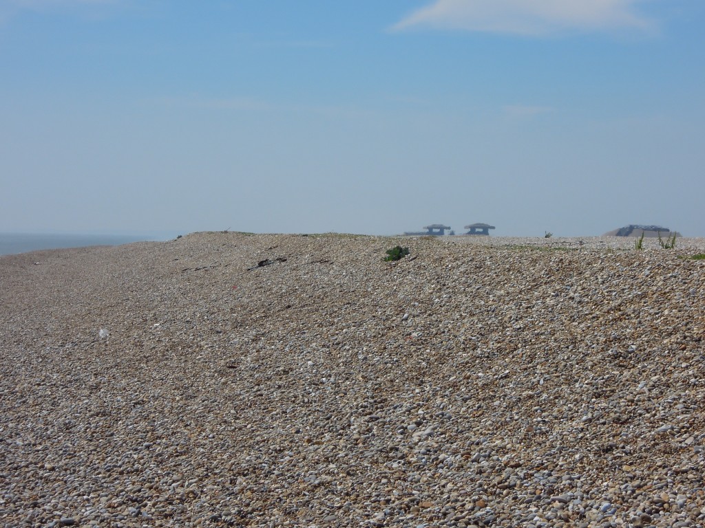
Orford Ness gravel ridge with pagodas

Another picture to break up the text

Some search terms that lead to hits look like sections of questions that students have just thrown into Google. A lot of the enjoyment I get out of writing posts is explaining complicated things. When I was a post-graduate student I enjoyed demonstrating in practical or field classes, for the same reason. There my job was to work alongside the formal teaching provided by the lecturer, helping with student’s understanding. When I get feedback that my blogs are helping in a similar way, I’m very pleased.

As well as indulging the bits of my brain that are still full of geology, blogging has allowed me to learn new skills. Regular practice of writing must have done me some good; I’m quicker at it certainly, also more likely to delete text during review. I now realise that writing is more about what you leave out than what you add – a sign I am no longer a complete novice. I think more about structure than I used to; I’m more likely to start writing an outline rather than just pile in with writing text. My default structure that has diffused into me from years of reading the Economist is: <opening paragraph with context, striking image/story/etc> <facts and explanation> <closing paragraph, summary and link back to opening paragraph>.  It works, but at some point I’ll feel the need to try something different.

One of the things motivating me to blog is a strong case of book-envy. A number of my friends from university have written books. While I may never find the time, or discover a suitable subject, or acquire the skills to keep a reader’s attention for hundreds of pages, my blogging might be a step towards becoming a published author one day. In the meantime I can tell myself that books are sooooo twentieth century.

What next? More of the same I think. One of the nice things about the blogosphere is that putting in the work seems to makes a difference. The people who have put the most work in for the longest are the ones with the most Twitter followers, the biggest profile. In such a meritocracy I need to keep plugging away, improving and keep trying to produce interesting well-written posts and see what happens. This isn’t my day-job so anything is a bonus.

Some sort of fossil thingy

I get nervous if a blog post doesn’t have enough photos in. Had you noticed?

A staple of scientific blogging is writing about specific scientific papers. I’ll be doing a lot more of this and I like the idea of focussing on open access papers, or to be precise papers that are available on the internet. I like the idea of guiding folk without access to university libraries towards real-live scientific papers. I may follow some specific themes with these posts such as “how mountains die”, eclogites and how granites intrude.

My blogging is guided by my academic experience, hence the hard-rock bias. Often I catch-up with a subject and see how it has progressed since I studied it in the 1990s. Posts that talk about what ‘people used to think’ and what ‘we know realise’ are tracing my own journey of discovery. At some point I will write about my own PhD research as well. I’ve referred to it occasionally, but for some reason I’ve never got into it. One day I’ll bore you silly with the west of Ireland, the glories of Currywongaun and how I argued with a zircon and won.

Enough. Having talked about the importance of structure, I’m worried I’ll prove my point with a long rambling post that goes nowhere. I’ll wrap-up with a request. On the Internet, concentrated attention and thought is a precious resource, so I know I’m asking you a biiiig favour – please provide a spot of feedback on this blog. What do you like, what do you dislike, what would you like to see more of?*

*Please don’t be taken in my British self-deprecation. I think many of my posts here are really rather good, I’m just not comfortable saying so in public except in small italic font. I know this blog could be even better though, so I’m not looking for encouragement (although its always nice) so much as genuine constructive criticism and suggestions of new avenues to explore. Thanks!