The north of England is dominated by rocks of Carboniferous age, which give it a distinctive scenery and history, where local coal fuelled the world’s first industrial landscape.
The geology is extremely well known, because of the importance of the coal deposits, but also because of the continuing excellence of the British Geological Survey. A recent paper shows how their deep knowledge allows them to identify and quantify cycles of sedimentation, some of which are less than 100,000 years in duration (a geological eye-blink).

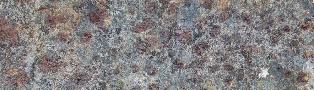
Carboniferous shale, Goyt’s Moss
Spotting the cycles
In an earlier post I’ve written about the rock types found in this area, the Pennine Basin of northern England, so here I’ll cover the broad geological context only.
The early Carboniferous in England was a time of extensive rifting, caused by plate tectonic goings-on further south. This created deep ‘gulfs’ in the grabens and shallow platforms between (horsts and grabens if you’re feeling German). All sedimentation was marine, mud in the gulfs and limestone on the platforms. By the mid-Carboniferous the extension had finished, but the thermal disruption it caused remained, meaning that cooling of the crust caused slow but constant subsidence through the rest of the Carboniferous. The mid to late Carboniferous (Namurian and Westphalian, in local terms) was dominated by shallow water, mostly non-marine sedimentation. A time of rivers, deltas and coal swamps, all close to sea level.
Its long been noticed that they are regular sequences within these rocks. Coal deposits occur regularly and can be correlated from pit to pit for 10s of kilometres. In a similar way ‘marine bands’, thin layers of shale containing marine fossils, are seen again and again. These marine bands contain goniatite fossils (older relatives of ammonites) which evolve rapidly and can also be correlated from place to place. Often the marine bands are succeeded by coarsening-upwards sequences that move into non-marine rocks – in turn topped by another marine band.
As recently as the 1980s this regularity was explained rather feebly in terms of ‘avulsion of deltas’ or some such. Even to this spotty teenager, it wasn’t a convincing story. When sequence stratigraphic concepts arrived soon after, they were a natural fit, particularly when marine bands were correlated across different basins in Europe, showing that the cause couldn’t be local.
There are extensive Carboniferous glacial deposits in many parts of the world. The idea that the waxing and waning of polar ice-caps has a major influence on sedimentary patterns across the world is now common place and it fits these rocks well. Melting of polar ice will cause flooding globally, putting marine mud on top of areas previously above sea-level – this was as true for the Carboniferous as it may be for the Anthropocene.

Carboniferous sandstone. Note the ‘sough’ – a drainage tunnel from shallow coal mining, Goyt’s Moss
Measuring the cycles
In Nature and timing of Late Mississippian to Mid Pennsylvanian glacio-eustatic sea-level changes of the Pennine Basin, UK Colin Waters and Daniel Condon of the British Geological Survey take a massive data set and use it to quantify how long these cycles of sedimentation took.
Sequence stratigraphy emphasises the identification of significant surfaces that correspond to significant changes in sea level. Sequence boundaries are associated with sea-level falls and parasequence boundaries with sea-level maxima. Waters and Condon link Pennine rocks to sequence stratigraphy: “The marine bands occur at the base of marine to non-marine upward-coarsening cycles, equating to the parasequence of the Exxon sequence-stratigraphic model“; marine bands are maximum flooding surfaces. They identify 47 of these and use current day areal extent to infer which ones represent bigger sea-level rises. Minor unconformities, where valleys have been cut into older sediments, can be linked to sequence boundaries – if sea-level falls then river channels will deepen. These palaeo-valleys are rather subtle structures, but they have been mapped out across northern England.
Waters and Condon start by looking at distinctive layers of mud with great names, one is a bentonite, the other a tonstein. These are layers of volcanic ash and they contain primary zircons, volcanic grains that lock in the age of the eruption. Analysis of these grains allows them to calculate accurate dates for when the layers were deposited.
These dates are not just of local interest. Carboniferous rocks in Europe are correlated on the basis of marine fossils, such as goniatites in marine bands. From this, geologists create a biostratigraphy that allows you to know the age of a rock from the fossils within it. The ideal is a global biostratigraphy, but the nature of the fossils found in Carboniferous rocks makes this difficult.

This section of the European biostratigraphy shows how fossils track the passage of time. Note there is no age on there. The rate at which new fossil species arise, or sediments are deposited, is not known. Dating a volcanic ash layer, which is found in a particular position in the biostratigraphy, allows you to put absolute dates against the table above, to start to build up a chronostratigraphy. There are other ways of linking the cycles in the sediments to absolute ages, as we shall see…
Understanding ancient cycles
Interpreting the patterns of rocks in terms of sequence stratigraphy provides further constraints on timing. Patterns of sea-level change are linked to changes in orbital obliquity (wobbles in the spinning of the earth) called Milankovitch cycles. For the Carboniferous we expect long cycles of 413,000 years and shorter ones of 112,000 years.
Putting all these constraints together and using their massive data set, Condon and Waters build up a picture of how distant ice-caps controlled English rocks.
Starting with the big picture, they posit four major ‘ice ages’ for the period in question, each lasting approximately 1 million years. The interglacial periods are associated with no paleo-valleys and few marine bands – sea level is fairly stable.
For the intervening rocks, they see two patterns in the marine bands. At times they follow a 400,000 year cycle, at others 111,000 or 150,000 years. The patterns of rocks in England are controlled by ancient wobbles in the earth’s rotation. This is an extraordinary thing. The link between the two is the ebb and flow of ice-caps half-way across world – in Geology sometimes it feels like absolutely everything is inter-connected.
For rare cases where multiple marine bands contain the same fossils, Condon and Waters infer these must be related to even shorter sub 100,000 year Milankovitch cycles. This is less well-proven as it is based on the assumption that the rate of change of goniatite species is relatively constant.
Although focussed on a small region, this research is interesting in many ways. Firstly it shows how stratigraphers use multiple lines of evidence to build up a picture of earth history. Condon and Waters put dates on the duration of the Ice Ages which are of use when studying rocks of this age anywhere on earth. Also it gives a taste of how aggregating data gives new insights; to map out the marine bands they drew on countless individual data points collected by the BGS over many years.
The work of stratigraphers is not glamorous but it is important. To build up a history of the earth’s history, knowing when things happened is vital.
References, other information
![]() Colin N. Waters, & Daniel J. Condon (2012). Nature and timing of Late Mississippian to Mid-Pennsylvanian glacio-eustatic sea-level changes of the Pennine Basin, UK Journal of the Geological Society DOI: 10.1144/0016-76492011-047
Colin N. Waters, & Daniel J. Condon (2012). Nature and timing of Late Mississippian to Mid-Pennsylvanian glacio-eustatic sea-level changes of the Pennine Basin, UK Journal of the Geological Society DOI: 10.1144/0016-76492011-047
A late draft of this paper is available to you all via an open access portal.
Courtesy of the BGS, here’s a view of the geology of northern England.

Hello,
I took the liberty of color correcting one of your images.
You can look at it here:
http://imgboot.com/user/tritono/images/141cc.jpg
Im also a geology enthuasiast. If you want the full resolution picture or want me to work on more images, just let me know.
Bye
Sebastion – what an improvement, wish you had done all of them.
Metageologist – fab post.
Noel
Pingback: Stuff we linked to on Twitter last week | Highly Allochthonous
Hello,
I´m glad you liked it.
Just send me an email to tritono@gmail.com so i can send you the full resolution file (in case you want to use it). Also, I would be happy to work on more pictures.
Bye,
Sebastian
The work of stratigraphers is not glamorous? Well, why the heck not? It is wicked cool.
Pingback: Ecton – copper, limestone and folds | Metageologist
Pingback: Mantle support of topography – a swell idea | Metageologist
This is exactly the 4th article, of yours I personally
read. However , I actually love this specific
1, “Cycling in the Pennines – 300 million years ago | Metageologist” the best.
Thanks -Colby
Pingback: The edge of Cheshire. Part 3 – abandoned | Metageologist
This has been documented and scientifically proven by health & wellness experts all over the
world. Just limit the amount of consumption to only those
times when you have completed an intense workout. You have to form the belief that
you can achieve your goal and then you have to make
and keep a commitment to yourself to follow through and follow the weight loss and
exercise program that you have selected.