Dalradian – a Celtic Supergroup

Geology is such a great thing to study because it involves making so many connections through time and space, switching scales from the cosmic to the atomic. This means that challenge for this series of posts about the geology of the west of Ireland is going to be managing scope. So. Although I could start with the big bang, I won’t. I’ll start with the Dalradian.

A thick package of sediment, the Dalradian Supergroup, or just Dalradian, to its friends was  was named in the 19th century after Dál Riata a minor kingdom in 6th and 7th century Scotland. Dál Riata was an Irish colony within Scotland, appropriately, as Dalradian rocks are found over much of Highland Scotland and NW Ireland.

A Celtic Supergroup

To fans of 1970s Prog Rock, a supergroup is a band formed from musicians who made their names in other bands. For geologists, it means a bunch of groups that are bound together, a group being a large recognisable package of sediment. The groups usually sit on top of each and represent a period of time during which sediment was deposited. For both types of supergroup, the individual members often have distinctive personalities.

The Dalradian Supergroup is made up of the Grampian, Appin, Argyll and Southern Highland groups.

The Grampian is the solid foundation of the Dalradian, fairly calm and ordinary: the bass guitar player of the supergroup. It is a 7-8 kilometre thickness of sandstones and muddy sandstones*. In Ireland, Grampian Group sediments are found only in North Mayo.

The Appin is the lead singer: shallow, good looking and gets lots of attention. Its made up of sandstones, limestones and more muddy sediments all deposited on a marine shelf in shallow water. Now somewhat changed, it contains some gorgeous rocks.
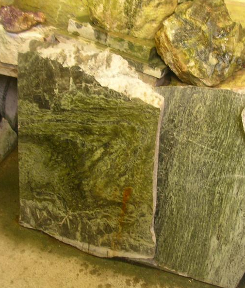
Glencoe Quartzite, Appin Group

Glencoe Quartzite, Appin Group

Picture of Connemara marble from

Famous ‘Connemara marble’ which is from, er, Connemara in Ireland. Picture credit.

The Appin group is found in the heart of Connemara, also across Mayo and Donegal.

The Argyll is the lead guitar. It’s deeper than the Appin and has been through some pretty intense times – brushes with death in fact. It contains the familiar sandstones and muddier sediments, but also more exotic sediment types.

Twice in the Irish Dalradian there occurs an odd pattern of rock-types. First there is a layer of sediment filled with angular fragments with a wide range of  sizes, called a diamictite. A number of subtle features show that it is sediment left behind by a glacier – it is a tillite. Immediately above is a layer of carbonate, a limestone or a dolomite. Such rocks usually form in nice warm parts of the earth so the association with glacial deposits is odd. The first of these tillilte-carbonate pairs can be traced across the Dalradian, indeed across the world. These are ‘snowball earth’ deposits. Some believe that at this time the entire earth was covered in ice, with glacial deposits forming near the equator. The overlying ‘cap carbonates’,  contain unusual carbon isotope compositions suggesting to some that life on earth nearly died at this time. This happened not just once, but twice in the Argyll.**
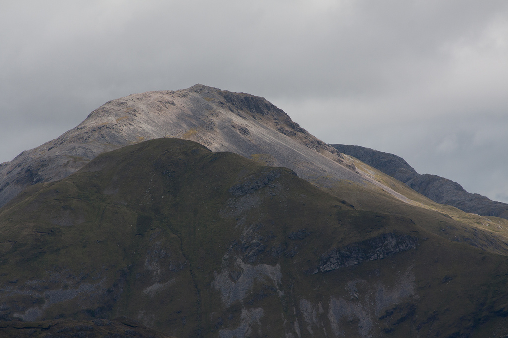
Picture of Argyll group sediments making up the Twelve bens mountains of Connemara. Image from Guilhem Boyer

Picture of Argyll group sediments making up the Twelve bens mountains of Connemara. Image from Guilhem Boyer on Flickr under Creative Commons.

The Argyll is rounded off with molten lava spilling into the sedimentary basin. Dangerous to be around for sure, but the Argyll makes the supergroup as a whole much more interesting and ‘edgy’.

The Southern Highland group is the drummer: completely crazy. The ground’s falling away under your feet, with sediments pouring into deep water and there’s another snowball earth episode***, there are big lumps of serpentinite, plus molten lava keeps coming out of the ground: madness. There’s a problem with ‘groupies’ as well. Lots of areas of sediment that say they’re ‘with the band’ but no-one is quite sure. Some of these, rocks along the Highland Boundary fault in Scotland or in Clew Bay in Ireland are worryingly young as well – Cambrian or even Ordovician. They’ve caused a lot of arguments, as you can imagine.

Song about a break-up

The Dalradian sing sad songs, about break-up: continents who once ‘were as one’ but who gradually drifted apart. It was a ménage à trois, so it was bound to end badly.

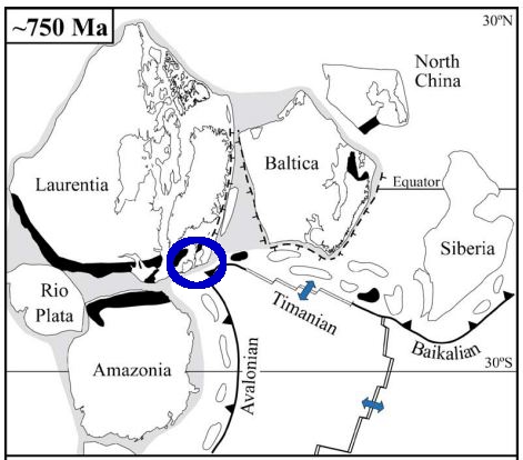
The song starts with the continent of Rodinia about 730 million years ago. This already had a rich and complex geological history which led to the creation of a large supercontinent consisting of pieces that now make up Scandinavia (Baltica), North American and NW Ireland and Scotland (Laurentia) plus Amazonia. Of course at the time these distinctions didn’t exist – it was simply a large single continent.

Rodinia 750 million years ago. From Cocks & Torsvik 2005

Rodinia 750 million years ago. From Cocks & Torsvik 2005

Cracks were starting to show, however. The Grampian Group formed in a rift basin, where Rodinia was starting to break-up. Early variations in the thickness of sedimentary layers suggest that faults were active during deposition. Times when the sedimentary basin became dramatically deeper also suggest tectonic involvement – active rifting was stretching the basin. There wasn’t a full break-up, however. Rifting ceased and a 30 to 40 million year period of calm saw the Appin group deposited in shallow waters under stable conditions.

The Argyll group saw rifting start-up again. By the end of the Argyll (600 million years ago) it became clear the split was going to be permanent. The stretching of the crust allowed the underlying mantle to melt, producing a ‘bimodal magmatic event’ with the intrusion of granites and the eruption of basaltic lavas. By Southern Highland group times, the sediments were forming in really deep water. Large bodies of serpentinite found in Ireland suggest the crust was stretched so much that material squeezed out from the underlying lithosphere.

This final extreme stretching marks the opening of a new ocean, called Iapetus. The opening of Iapetus created sedimentary basins all along the Laurentian margin. The Fleur de Lys Supergroup in Newfoundland and the Eleonore Bay Supergroup in Greenland were deposited in adjacent, equivalent basins. Further south in the US Appalachian belt, sedimentation associated with the opening of Iapetus starts only in Cambrian times.

Sing something simple?

I’ve told a nice simple tale, based on current scientific consensus, but it used to be much more complicated. The problem is that these are no longer sediments. Key concepts in both metamorphic and structural geology were developed on these contorted, baked and squashed rocks. Seemingly simple things like identifying the base of the Dalradian is extremely difficult as the rocks below are often also metamorphosed sediments, first transformed before the Dalradian and then deformed and heated again alongside it. Drawing a line between two types of schist requires extremely careful analysis.

The Dalradian is intruded by many granites. Most are older than the deformation, but some are younger, intruded into deep sediments in the Dalradian basin while sediment was still settling on the surface above. A date of 590Ma for one of these ‘Older Granites’ caused years of academic chaos in the 1990s as the granite was initially (incorrectly) thought to post-date the deformation, meaning that any younger sediments couldn’t belong to the Dalradian.

Geological histories hinge on tiny facts. The age of single zircon grain, a fabric wrapping an andalusite crystal: great geological narratives are built from or destroyed by such tiny pieces of evidence.

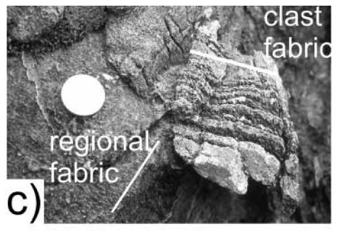
Evidence of mountain building episode during the Dalradian. From Hutton & Alsop 2004 GSL.

Evidence of mountain building episode during the Dalradian. From Hutton & Alsop 2004 GSL.

There is one inconvenient fact that might bring the whole of the simple story crashing to the ground. Respected researchers working in Donegal (Donny Hutton and Ian Alsop) have mapped an unconformity within the Argyll group. This could be consistent with our story – unconformities can form within sedimentary basins – but they interpret it as an orogenic unconformity. Based on various lines of evidence, including a tectonic fabric within sedimentary clasts above the unconformity, they infer a entire episode of mountain building took place during the gap in sedimentation shown by the unconformity. 

So is the Dalradian a single package of sediments formed during the opening of an ocean, or two packages separated by a previously unrecognised period of mountain building? I’ve no idea, but hopefully time will tell.

Regardless, everyone agrees on what happened next. Iapetus no longer exists: it opened and then it closed, moving the Dalradian from a sedimentary basin into the core of a mountain belt. That’s where we’re going next.

——————————————————————————————————————-

*they’re not sandstones any more, but we’ll come to that

** the first, the “Port Askaig Tillite” is correlated with the Sturtian global event at c. 700Ma. The second ‘Stralinchy diamictite’ with the Marinoan at c. 635Ma

*** the Inishowen and Loch na Cille beds are correlated with the Gaskiers global event at c. 580Ma

 References

L. Robin M. Cocks, & Trond H. Torsvik (2005). Baltica from the late Precambrian to mid-Palaeozoic times: The gain and loss of a terrane’s identity Earth-Science Reviews DOI: 10.1016/j.earscirev.2005.04.001

D.H.W. Hutton, & G.I. Alsop (2004). Dalradian Supergroup of NW Ireland
Evidence for a major Neoproterozoic orogenic unconformity within the Dalradian Supergroup of NW Ireland Journal of the Geological Society DOI: 10.1144/0016-764903-094

David Stephenson, John R. Mendum, Douglas J. Fettes, & A. Graham Leslie (2013). The Dalradian rocks of Scotland: an introduction Proceedings of the Geologists’ Association DOI: 10.1016/j.pgeola.2012.06.002

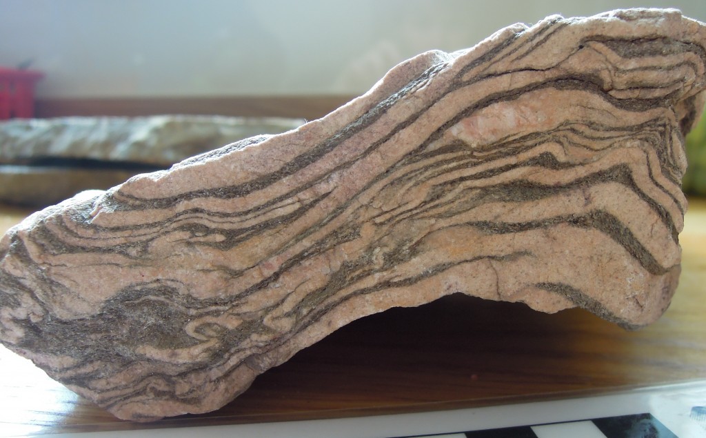
Cratons – old and strong

Cratons are pieces of continents that have been stable for a over a billion years. As earth’s plates drift along, mountains periodically rise and fall, plate boundaries appear and disappear. But cratons are like great-grandmothers at family gatherings, while younger crust moves excitedly around them, they sit quietly, occasionally remarking on how different things were when they were young.

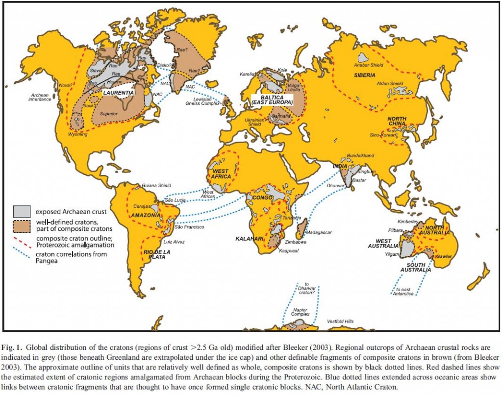
Every continent has cratonic areas, notably the core of North America, Scandinavia, Siberia, India and most of Australia. They may be covered by a thin shawl of sediment, but often they expose ‘basement’ rocks such as gneiss. Economically they are very important – most of the world’s diamonds come from cratonic areas as do many other valuable deposits.

craton world map

Cratons are stable because they are strong. The geology of the Himalayas illustrates this – the modern day plate  boundary between Indian and Asia is at the southern edge of the Himalayas. The cratonic Indian plate is barely deformed, in great contrast to the vast pile of deformed soft young crust in the Tibetan Plateau to the north.

Cratonic crust is strong, being unusually cold and dry, but that is only part of the picture. Continental crust is the upper portion of continental lithosphere. It’s lithosphere that puts the plates into plate tectonics, it’s a rigid layer on the earth’s surface, as opposed to the hot flowing mantle that lies beneath (the asthenosphere). Lithosphere consists of the crust and an underlying layer of mantle that has  become ‘stuck on’. This layer of lithospheric mantle can be 2 to 3 times thicker than the crust above and so contributes a great deal to the strength and stability of continental lithosphere.

It turns out that the lithospheric mantle beneath cratons is unusual. In oceanic crust, as it ages it cools and eventually it sinks down into the mantle again. It is thought that continental lithospheric mantle can fall off as well, but in cratons this doesn’t happen. Finding out why is an interesting challenge but before we start that journey, a brief interlude….

Geochemical interlude

My feelings about geochemistry have changed over time. As a doctoral student I was exiled out into an annex 10 minutes from the main department because a new piece of geochemical apparatus required a lab to be expanded, swallowing our little rock-filled office. I could relate to metamorphic petrology and analysis of mineral chemistry, but the isotope stuff, seemingly requiring months of juggling Hydrofluoric acid to get a couple of data points, left me cold. Years later, with a broader, wiser perspective I find myself marvelling at the way isotope geochemistry leads to so much awesome science.

There are two flavours of isotope geochemistry, stable and radiogenic. Many chemical isotopes are unstable and over time spontaneously turn into different elements, the bits left over being thrown out as matter and energy – radiation. For geologists, this real-life alchemy, known as radioactive decay, is mostly used to tell how old something is. The rate of radioactive decay is constant, so measuring the current abundance of isotopes and working backwards tells you the time elapsed since an event happened. Getting from measurements to age involves assumptions about the sample which may be incorrect – my own research successfully predicted a published age was incorrect. Nevertheless modern geochemists have a wide range of extremely robust and accurate techniques at their disposal. Datable events include a crystal forming from a magma or growing in a metamorphic rock, a surface being exposed to the atmosphere, a critter growing, a mineral cooling below a particular temperature, when magma was extracted from melting rock, even the age of ground water.

Stable isotope geochemistry relies on the fact that two isotopes of the same element, for example Hydrogen and Deuterium, are not precisely the same. Most physical and chemical processes treat them identically, but some do not, the slight different in mass means slight differences between isotopes. For example during evaporation of water the lighter H216O will vaporise first, creating a difference in isotopic composition between the water vapour and the remaining liquid. This phenomena of isotopic fractionation affects water in other ways, such that there is a relationship between fossil oxygen isotopes (in ice or fossil sea shells) and the temperature of the sea they came from. This tremendously useful technique is just one example of the seemingly magical way tiny differences in the physics of atoms can shed light on diverse geological problems. There are many other applications, but the technique shines most when we have very little other evidence to go on. Research into the formation of the earth and moon relies heavily on studies of arcane isotopes. We have only limited information about lithospheric mantle from beneath cratons (remember them?) and isotope geochemistry tells us many interesting things…

Back to the cratons

A recent review by Cin-Ty A. Lee, Peter Luffi, and Emily J. Chin of Rice University focuses on the creation and destruction of continental mantle (I’ll mostly discuss creation).

If lithospheric mantle beneath cratons was the same composition as the rest of the mantle then over time it would cool and become denser and unstable. A consensus has emerged that it does not because at some point in the past it was involved in melting and up to half of its volume was removed. The rock left behind after the melt flowed away is known as depleted peridotite and it is stronger and more buoyant than normal mantle, so it remains stable for billions of years.

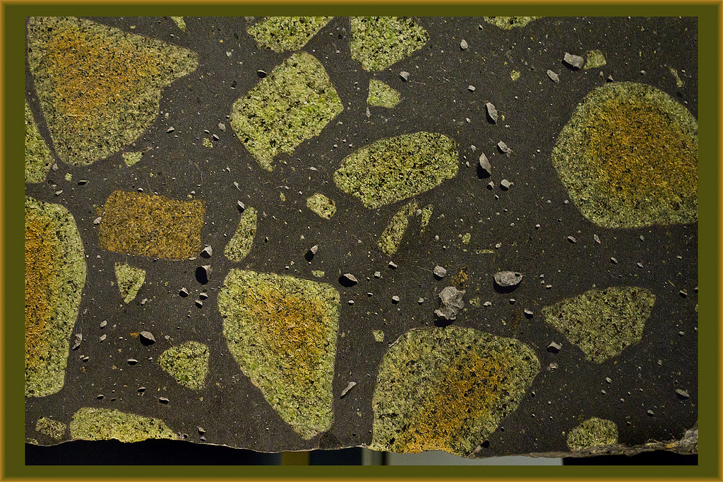
Fragments of mantle peridotite in lava

Fragments of mantle peridotite in lava.

Pieces of continental lithosphere do reach the surface, sometimes as huge slabs such as at Ronda in Spain. Some weird volcanic deposits start at mantle depths and bring up pieces of the surrounding rocks. Sometimes they contain diamonds, but also pieces of the lithospheric mantle. Armed with these samples, geochemists have applied a massive array of techniques.

The geochemistry of melting rock is well understood and it allows us to infer many things about the conditions under which it happens. For example comparing ancient with modern samples, we can tell that older samples melted at higher temperatures (1,500 to 1,700◦C 1,300 to 1,500◦C) and saw more melt extraction (50 to 30% versus <30%). This is consistent with the fact that the early earth was hotter.

Melting is affected by pressure as well as temperature – deeper mantle rocks contain different minerals (at these pressures, garnet at depth, spinel above) which melt in subtly different ways. Cratonic peridotites melted at shallow depths (90km) but were later moved deeper (180km).

Not all samples are of peridotite, next common are pyroxenites, sometimes referred to as eclogites. Chemically these are similar to basalts formed at modern mid-ocean ridges.  Their oxygen isotopes show wide variation, such as is seen in oceanic crust following hydrothermal alteration. Other physico-chemical processes could in theory cause similar patterns, but it seems only low-temperature processes explain the patterns seen. The fact that they were once part of oceanic crust makes these pyroxenite rocks very different from the peridotites (which have only ever been part of the mantle).

Further evidence that pyroxenites were once near the surface comes from sulphur isotopes from eclogitic inclusions within diamonds. Fractionation of these isotopes occurs in ways only explained by chemical reactions high in the atmosphere. These diamonds with eclogitic inclusions themselves have carbon isotopes that are extremely ‘light’. Light carbon is a sign of life – organisms preferentially contain light carbon. In these ancient rocks, life probably means bacteria. So we can lengthen the list of “lovely things bacteria help to make” – cheese, soy sauce, wine, yogurt, healthy digestion and now certain types of diamonds.

NB for visitors from the German wikipedia page on Diamonds, I’m delighted you’re here. Here is a better reference for the science on this.

This is a wonderful thing. A bacterial mat sitting on the sea-floor billions of years ago ends up being stuffed down into a subduction zone. It enters a world of crushing pressure and extreme temperature where it is transformed utterly, its carbon forming a diamond. Later a weird eruption happens and the diamond is squirted back up to the surface for us to marvel at. Only isotope geochemistry (and some generous assumptions on my part) allows us to tell this story.

How does continental mantle form?

Our authors discuss how continental mantle forms (spoiler: we don’t really know). One model is that a large plume of hot mantle material rises up underneath a continent. This would indeed form lots of depleted peridotite (underneath a big pile of lava). However this model is inconsistent with the evidence described above – melting would be expected at greater depths (200km) than is seen.

A plume model also fails to explain the eclogitic parts of the mantle. One mechanism to explain how portions of oceanic lithosphere end up in the sub-continental mantle is that when subducted instead dropping steeply down they remain buoyant and stack up beneath the continents. In this model, the sub-continental lithosphere grows by progressive capturing and stacking of oceanic lithosphere. Its been argued that parts of the Farallon plate were captured beneath western north America in recent times. Hotter oceanic lithosphere (common in the Archean) subducts at a shallower angle and so is more likely to end up getting stuck to the base on the contintent.

This model explains the evidence for shallow melting and subsequent burial, plus the presence of former oceanic lithosphere. Indeed it predicts a larger proportion of eclogitic pyroxenite than is observed. Our authors propose a process of “viscous drainage” whereby the crustal portion of the stacked ex-oceanic lithosphere (now dense inclined sheets of garnet pyroxenite) slowly ‘drains’ down and out, leaving the peridotite ‘framework’ behind.

Models of the creation of continental crust emphasise the importance of island arcs. An oceanic island arc (where oceanic crust, subducts under oceanic) may collide with a small continent, turn into a continental island arc and ultimately become a new piece of continental crust. This mechanism will not give thick lithosphere on its own however – so some process of ‘orogenic thickening’ (squeezing it so it’s thicker) is required.

You will perhaps have sensed that the paper drifts into speculation a little. This is appropriate in a review paper and inevitable as we are on the ragged edge of what we can know about these rocks, so distant in space and time. The paper ends with a ‘future directions’ section full of as yet unanswered questions.

“How do continents form?” is a simple question to ask but we still can’t give a complete answer to it. We still don’t know the secret to great-grandma’s longevity.

 Peridotite picture from dun_deagh on Flickr under Creative Commons.
Craton map from Pearson and Wittig under Geological Society of London fair use policy.
 

PEARSON, D., & WITTIG, N. (2008). Formation of Archaean continental lithosphere and its diamonds: the root of the problem Journal of the Geological Society, 165 (5), 895-914 DOI: 10.1144/0016-76492008-003
Lee, C., Luffi, P., & Chin, E. (2011). Building and Destroying Continental Mantle Annual Review of Earth and Planetary Sciences, 39 (1), 59-90 DOI: 10.1146/annurev-earth-040610-133505

Erosion makes mountains beautiful

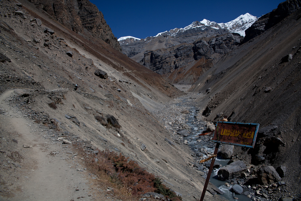
The thing that makes mountains so beautiful and fascinating,is not so much their height as their steepness. Climbers and trekkers flock to the High Himalaya, not to get altitude sickness but for the grandeur of the landscape, the experience of seeing views that require you to lift your head up. Mountains are created by deep-seated geological processes that raise the surface of the earth, but it is erosion that creates the scenery we love.

Erosion is often taught in terms of gentle everyday processes – tiny fragments of rock falling off and slowing washing downstream. Over the awesome expanse of deep time such tiny events can indeed wash away mountains. But mountainous areas can rise at rates of centimetres a year – is small-scale mechanical weathering really quick enough to keep up with such rapid uplift? Erosion in mountains also involves faster acting processes: ravine-making rivers, grinding glaciers and lots of landslides.

If you’ve ever had the pleasure of visiting high mountains such as the Himalaya, you’ll have noticed how common landslides are. A recent scientific paper seeks to quantify how their frequency relates to other factors.

Larsen & Montgomery from the University of Washington, studied the  Namche Barwa area in the eastern Himalayas. This is an area where rocks are being  brought to the surface extremely quickly by high rates of erosion. The mighty Tsangpo-Brahmaputra river flows through the area and its influence may extend deep into the earth, creating a tectonic aneurysm.

A river only directly erodes within a tiny area, but has a wider influence.  Our authors start by describing the threshold hillslope paradigm. This is a concept three year old children understand: if you dig a hole in a sand pit, once the edge reaches a particular steepness, sand slides back into your hole, no matter how fast you dig.  Within a mountainous area, if erosion rates are high enough, hill slopes are limited by the material strength of  the rock.

“Vertical river incision into bedrock is thought to over-steepen hillslopes with gradients near the threshold angle, increasing relief until gravitational stress exceeds material strength and bedrock landsliding occurs.”

Somewhere like Namche Barwa, with high uplift and erosion rates, we would expect to see lots of landslides. To test this, they used an array of remote sensing data, including declassified spy satellite images, to map more than 1500 landslides over a period of 33 years. By looking at an area affected by differing erosion rates, that found a rough correlation between landslide erosion rate, stream erosion power and even cooling ages of metamorphic rocks. The study area showed an order of magnitude difference in exhumation rate which corresponded with a tiny 3 degree difference in average slope angle.

As well as providing evidence for the importance of landslides, they found insights into the processes. They see a link between large landslide dam bursts (flooding events), and landslides – flooding causes more erosion at foot of slope, destabilises the valley sides and causes a series of small landslides.

Another recent paper by James Spotila at Virginia Tech also derives useful data simply from looking at mountains in detail. He made a detailed analysis of topographical data from mountains across the world.

Browse photo galleries taken in mountains and you’ll find most pictures are of the peaks and mountain ridges – that is where the beauty lies. In contrast models of mountain erosion are (conceptually) peering into the valleys. Ridges and peaks are seen as the consequence of valley-shaping processes, in map view merely the negative image of drainage networks.

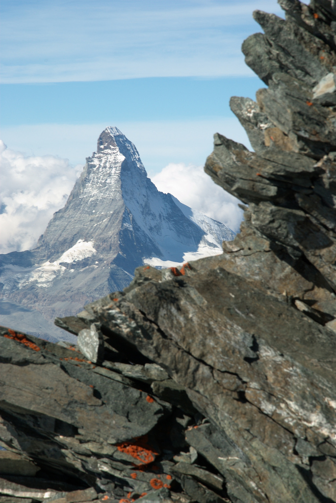
Spotila hypothesises that the highest peaks will form where two ridges meet, at ‘divide-junctions’. High peaks are often broadly shaped like pyramids, forming where three glacial or river valleys meet (and therefore where two ridges meet). Peaks of this shape may be mechnically more stable than on single ridges. Using digital topography to study 255 of the world’s most prominent peaks, Spotila finds that 91% of prominent peaks studied are found at divide junctions. Of these, all are pyramid shaped.

The highest mountains of central Nepal contain most of the world’s highest peaks. The Himalayas are cut by a number of large rivers. The high peaks are preferentially located close to the divides between these rivers – the drainage pattern controls the location of the highest peaks.

Once mountains become pyramidal and have flat triangular faces, they become more resistant to erosion. In the Himalaya the flat faces tend not to be covered by glaciers, for example.  This may make them more stable over time. Some workers have talked of ‘teflon peaks’ that rise above the glacial buzzsaw.  Recent models of landscape evolution have emphasised the importance of the migration of drainage divides over time. However if drainage-divide peaks are stable over time, they will anchor the overall drainage patterns, making them much more stable.

These details of the way mountains erode may seem detached from tectonic studies of mountains, but in fact so many aspects of mountain geology are beautifully intertwined. Erosion of mountains influences processes deep within the crust, allowing material to flow towards the surface – patterns of crustal flow are linked to drainage patterns via erosion. That these patterns of crustal flow become fixed in space due to the way peaks and ridges form is a beautiful idea about beautiful places.

claimtoken-50c4761181470

First photo of landslide area, Annapurna region of Nepal, courtesty of Julien Lagarde on Flickr under Creative Commons
Second photo of Matterhorn, Swiss Alps, courtesy of  Martin Jansen on Flickr under Creative Commons

Larsen, I., & Montgomery, D. (2012). Landslide erosion coupled to tectonics and river incision Nature Geoscience, 5 (7), 468-473 DOI: 10.1038/NGEO1479

Roering, J. (2012). Tectonic geomorphology: Landslides limit mountain relief Nature Geoscience, 5 (7), 446-447 DOI: 10.1038/ngeo1511

Spotila, J. (2012). Influence of drainage divide structure on the distribution of mountain peaks Geology, 40 (9), 855-858 DOI: 10.1130/G33338.1

Mantle support of topography – a swell idea

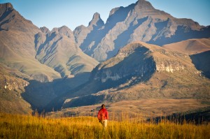
Cathedral Peak area at sunrise - Ukhahlamba Drakensberg National Park, South AfricaWhy are some bits of the earth higher than others? Finding mountains near plate boundaries is easy to explain – various forms of plate collision cause the crust to thicken and the surface to rise. What about Southern Africa?

Reaching a high point of 3473m, most of Southern Africa is a high plateau. It is not tectonically active – the sedimentary layers in the photo are still horizontal – but they are more than a kilometre higher than they ‘ought’ to be. Why?

African swells and superswells

In recent GSL paper, Stephen Jones, Bryan Lovell and Alistair Crosby argue that the topography of Southern Africa can be explained by mantle convection pushing the crust upwards – that flow of the mantle has a direct influence on surface topography. They go onto argue that this phenomena also controls patterns seen in ancient sedimentary basins.

A spot of theory first. On the scale of 100s of kilometres topography is controlled by the properties of the lithosphere – the Tibetan Plateau can be explained this way. But over scales of 1000s of kilometres the lithosphere isn’t strong enough. On this scale, variations in height can only be explained either because the lithosphere is thicker, or because it is being pushed up from below.

Our authors look at Southern Africa and Antarctica, areas far from convergent plate boundaries. Studying the patterns of topography and gravity, they argue that the main geographic features can be explained by dynamic support from mantle convection. So the Drakensberg mountains (pictured above) are high because they sit above a portion of the mantle that is rising, pushing the plate (and the surface) up. The low-lying Congo basin, further north sits above a descending part of the mantle.

They paint a picture where “thousand-kilometre scale dynamically supported swell topography is the norm for continental regions that are not influenced by subduction zones“, suggesting that areas such as eastern Australia, peninsular India, central USA, east Africa, eastern USA, the Siberian Shield and eastern Siberia are all  affected by similar long ‘topographic swells‘. The African swells they study in detail are around 2000km in diameter and between 1.4 to 2.7km in height.

This is a tremendously important idea, suggesting that the broad patterns of the landscape can be explained by slow movements of rock deep under the surface. Patterns of convection within the upper mantle subtly change the shape of the earth we stand on. More, there is talk of an Southern Africa superswell, over 10,000km in size. A long wavelength warping of the earth’s surface that the other swells sit on and which could be partly supported in the lower mantle.

One of the beautifully elegant things about earth sciences is the way we discover that apparently unrelated aspects of the earth are linked. Discovering such a linkage provides insights into both things simultaneously. So, discovering that topography is related to mantle convection gives you new ways of understanding both. For example looking at sedimentary sequences sitting on these African swells allows us to work out how long the swell has existed for (40 million years). This in turn is an insight into the timescales of convection within the mantle hundreds of kilometres under the surface.

To the UK

The concept of dynamic topography is not new to this paper, (there was a conference about it last year), it adds importantly to the debate by quantifying  both modern day swells in Africa and ancient swells in sedimentary basins.

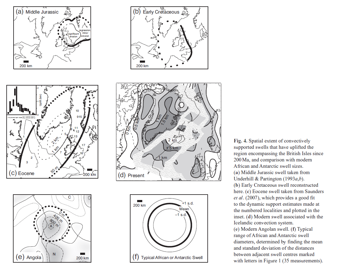
The UK, Ireland and associated oceanic basins make up a stable piece of crust with a long sedimentary record. There is a long and successful history of hydrocarbon exploration in the area, so there is lots of data to draw on. Our authors describe four swells from this area in the last 200Ma, active in the Jurassic, early Cretaceous, Eocene and present day (based on Iceland).

Figure 4 from Jones et al 2012. Reproduced under Geol Soc fair use policy

The evidence presented suggests that these ancient swells are similar in dimensions to present day African ones and formed over similar timescales, growing in 5-10Ma and decaying over 20-30Ma.

A fail for Vail?

The effect of these swells on sedimentary sequences is dramatic – a kilometre of uplift turns a sedimentary basin into an area of erosion. Dynamic support is not just of interest to students of the mantle, but also to lovers of sedimentary basins or those who seek the oil and gas found therein.

It’s been long understood that patterns of sedimentation are controlled by tectonic factors (creating holes with extensional or foreland basins) and by sea-level changes. In the 1970s, the work of a group at Exxon led by Peter Vail transformed the study of sedimentary basins. Their new techniques of sequence stratigraphy showed that patterns of sedimentation are best explained by different cycles of changing water depth (relative sea-level). The level of water within a typical sedimentary basin is constantly changing on both high and low frequencies.

Note that this relative sea-level change can be caused either by moving the surface of the earth or moving the surface of the water. Vail ‘chose’ to move the surface of the water and sought to explain local patterns in terms of global “eustatic” sea-level change. During periods of glaciation there is a plausible mechanism for doing this and the model is successful (for example, the Carboniferous of the UK). A longstanding problem is how to create cycles of sea-level if there are no ice-caps to vary in size and periodically change the volume of sea-water.

In his 2010 Presidential Address for the Geological Society of London, Bryan Lovell challenges the Vail hypothesis asserting that “mantle convection provides an alternative, regional, mechanism to eustatic control for explaining medium-frequency to high-frequency sea-level cycles“. Relative sea-level changes can be explained by moving the surface of the earth in a particular area. Over a mantle swell, basins will be shallower or stop being basins even if global sea-level remains constant.

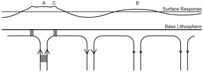
Figure 2 from Lovell 2010. Reproduced under Geol Soc fair use policy

Lovell proposes a mechanism to explain the different frequencies of cycles. Mantle swells, created by convection cells, work over the 10-40 Ma timescale. He proposes that ‘hot blobs’ (grey patches above) move within the wider cells. The blobs cause their own smaller scale (and faster moving) ‘mini-swells’ that explain the higher frequency patterns seen in sediments.

What I like best about the idea of dynamic mantle support of topography is that it is testable. By starting to quantify the time and length scales of mantle swells it becomes possible to recognise them reliably in the stratigraphic record. Changes due to global sea-level variation will be correlatable across many basins whereas mantle swells will not.

Its another way of thinking about the earth, too. As someone living on a tectonically quiescent patch of the earth I’m used to thinking of nothing much happening here until the Atlantic starts to close again. It turns out that “there is no such thing as a stable continental platform” and that a change in the way rocks are flowing deep below could move Britain up or down by a kilometre within as little as 10 million years.

References

Picture of Drakensburgs via Palojono on Flickr under Creative Commons.

Jones, S., Lovell, B., & Crosby, A. (2012). Comparison of modern and geological observations of dynamic support from mantle convection Journal of the Geological Society, 169 (6), 745-758 DOI: 10.1144/jgs2011-118

Lovell, B. (2010). A pulse in the planet: regional control of high-frequency changes in relative sea level by mantle convection Journal of the Geological Society, 167 (4), 637-648 DOI: 10.1144/0016-76492009-127