Four years! Well, that’s gone by pretty quickly. Check out this post for highlights from the last 12 months. As always, expect Iceland, volcanoes, Python and open source software/GIS.
Iceland and volcanoes (volcan…)
This year on the blog has been dominated by basalt lava, and in particular the eruption of Bárðarbunga volcano at Holuhraun, Iceland. I joined the team of University of Iceland scientists working there at the start of September and wrote two posts describing the eruption and particularly the effects of the sulphur dioxide gas that it was producing. Part of the second post was quoted by the NASA Earth Observatory website, which also featured one of the videos, in an article about two great satellite images of the lava flow.
Photos, explanations of what the eruption was doing and descriptions of how it is to work there.
Videos of the crater and the lava flows including sampling and mapping the outline.
The other most popular Bárðarbunga post was a guest article by Ed Baines (@edwinbaynes).
The post is about the powerful floods that could result from a subglacial eruption at Bárðarbunga. Ed describes how the current Jökulsá á Fjöllum canyon was produced by giant floods of the past. His research into this was published this month.
Four other volcano-related posts you CANNOT AFFORD to miss:
- The distance this volcanic ash travelled to reach Ireland will amaze you!
- The secret is out about microbes’ new Eyjafjallajökull lava diet.
- You NEED to read this reliable information about Icelandic flood lavas.
- 20 journals that volcanologists just keep citing.
Open source software and GIS (…01010)
QGIS is an open source GIS package that’s especially great for putting together maps for printing. It’s also really quick to import data from a csv file or spreadsheet. The OpenLayers plugin loads maps from online sources e.g. Google Satellite, Open Street Map, Bing Aerial that you can use as a background.
This post outlines the routine that I follow at each sample site in the field. It describes how to use handheld GPS (or smartphone GPS tracking app) alongside a normal camera to geotag your photos and logs, using the gpsbabel and GpsPrune software.
A handy script for anyone working with geochemical data for igneous rocks. It adds fields with the names of different magma compositions to plots of Total Alkalis vs Silica.
Pretty picture
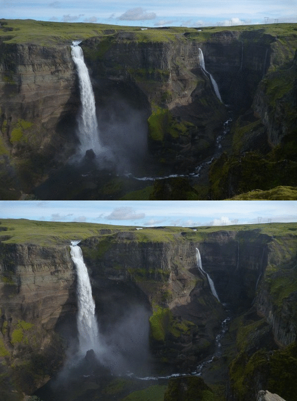
The sole purpose of the (Almost) 3D picture of Háifoss waterfall post was to share this picture/illusion, because I think it is pretty cool.

Haífoss, Iceland. Click image for larger version.
Highlights from 2011-2013
A list of all posts from 2014, and in fact since the blog began, can be found on the Every Post Ever page. I’ve also picked out highlights from each of the previous years so far in the following posts.
Progress since last year
The Bárðarbunga eruption was a big help in bringing people to volcan01010. Over 1,000 people visited the site during one day when the eruption began. The blog had 58,000 page views in 12 months, compared to 28,000 last year. Most of the traffic is still from the UK and USA and there is a steady flow to the software posts. The Mail Online don’t need to worry about competition from me yet, but it is nice to see traffic increasing. I’ve managed to keep posting about once a month. The Twitter account now has 1902 followers (up from 881 last year), lots of whom joined back when the eruption began in September.
If you have enjoyed or found any of the posts useful this year, please spread the word.

