BRITICE-CHRONO: death of an ice sheet

Using many different techniques, dozens of scientists are studying the death of an ice sheet that once covered Britain and Ireland. They want to understand the future fate of modern-day ice.

The phrase “ice sheet” doesn’t do justice to our subject: this is not something you shatter when stepping on a frozen puddle. Covering over a million square kilometres, this sheet is also kilometres thick. As it grew it pulled enough water out of the world’s oceans to lower them by metres, affecting tropical coastlines as well as the land entombed beneath the ice. The vast bulk even pushed down the crust beneath, slowly moving the underlying mantle aside.
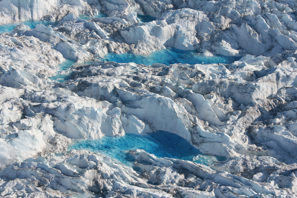
Melt pond on icesheet. Photo by Leif Taurer used under Creative Commons.

Melt pond on ice sheet. Photo by Leif Taurer used under Creative Commons.

The ice is constantly in motion. Snow falling on the ice sheet will eventually make its way to the sea, slowly flowing down and along.  Most is channelled into fast moving ice-streams.  This ice sheet is ‘marine-influenced‘, it sits partly on land, partly on the sea – most of its ice will end its days as an iceberg. The edges of the sheet can become undercut by the oceans, turning the edge into delicate ice shelves.

In the way it grows and flows, this ice sheet can seem almost alive. It will surely die, one day. Changing climate tips the balance between snow build-up and melting, the unstable ice shelves collapse and the ice-streams send ice to melt in the sea. In time the sheet thins to nothing and the world is transformed again.

BRITICE-CHRONO

My description of an ice sheet applies to the modern West Antarctic sheet. Scientists who study it worry about how, in the face of a rapidly changing climate, it might collapse, flooding cities across the globe. The IPCC identified this risk and highlighted how little we know about it.

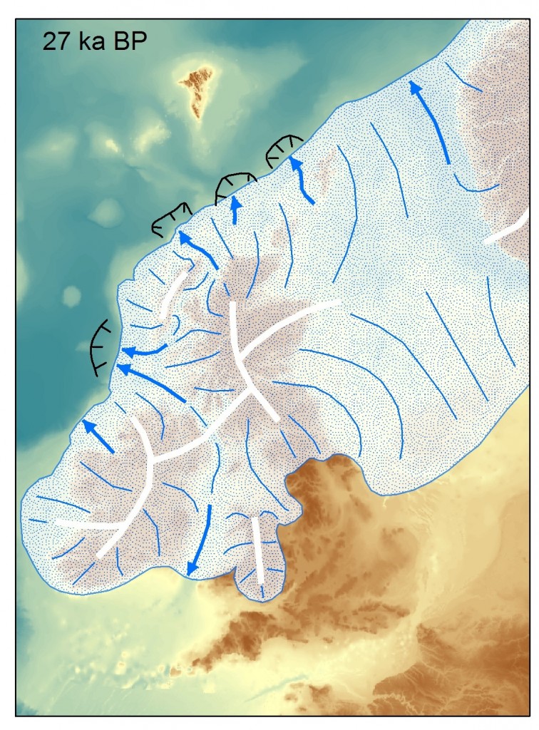
27,000yearsago (2)

The British & Irish ice sheet, 27,000 years ago. Image courtesy of Chris Clarke.

My description also applies to the ice sheet that sat over Britain & Ireland 25,000 years ago.. A multi-disciplinary consortium, called BRITICE-CHRONO will greatly improve our understanding of the death of this ice sheet. This will be of great local interest, but will also help us predict the potentially troubled and troubling future of both the West Antarctic and Greenland ice sheets. The ancient climate change that killed the ice sheet was natural, but modern human-made warming melts ice just the same.

BRITICE

The physical traces of the death of the British ice sheet are easy to find: erratics, moraines and glacial lake deposits are just a few of the subtle but distinctive features to found over much of Britain. A now complete project called BRITICE, led by Professor Chris Clark of Sheffield University, mapped them all, focussing on traces of the final retreat of the ice sheet. Similar work in Ireland allows the pattern of retreat for the entire ice sheet to be inferred.
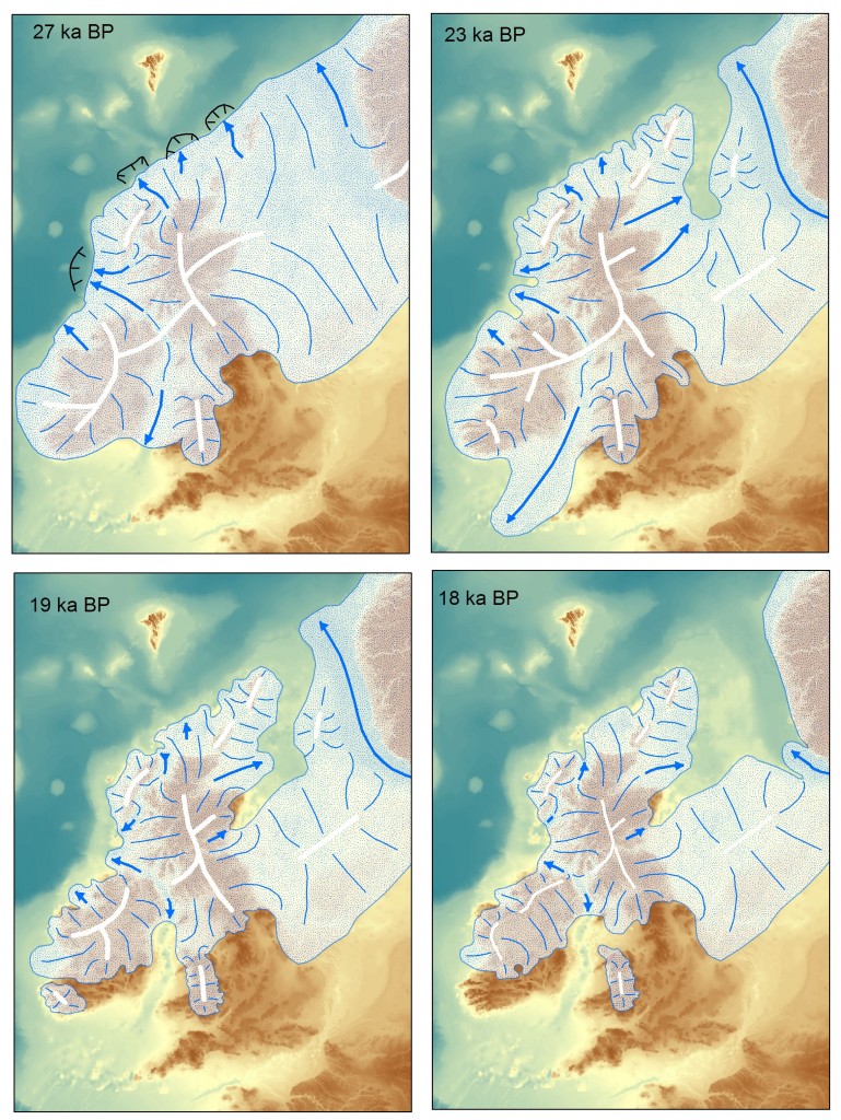
Maps showing the evolution of the British & Irish icesheet over time. Image from Chris Clark.

Maps showing the evolution of the British & Irish ice sheet over time. “19 ka BP” means 19,000 years before present. Image from Chris Clark.

CHRONO

BRITICE-CHRONO involves nearly 50 researchers from 8 universities plus the British Antarctic and Geological Surveys. A big part of the work of BRITICE-CHRONO is working out the age of various features. Familiar techniques such as radiocarbon dating are useful, but a new generation of dating techniques can do things that seem almost magical.

Optical stimulated luminescence (OSL) dates the last exposure of sunlight for individual quartz grains. Natural radioactivity traps electrons within defects in the crystal lattice of the quartz grains. If light comes through it frees them again and produces more light (the luminescence). Quartz exposed to sunlight at the surface does not show luminescence, but grains that have been buried in a sand bank for thousands of years do. Measuring luminescence in the lab allows an estimate how long they have been buried for and therefore when the sand was deposited.

Conversely, TCN (terrestrial cosmogenic nucleides) is a technique used for dating how long a surface has been exposed. Cosmic radiation is constantly streaming down on us and within minerals at the Earth’s surface it produces radioactive elements such as 10Be and 36Cl. The more of these we find, the longer the surface has been exposed to space. Apply this technique to a boulder dropped by a glacier and we can infer when the ice was last present.

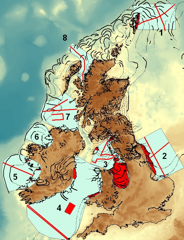
BRITICE-CHRONO's area of investigation. Image from Chris Clark

BRITICE-CHRONO’s  8 transects. Image from Chris Clark

As part of BRITICE-CHRONO people are collecting hundreds of samples from all over Britain and Ireland. Guided by the BRITICE work, they are sampling features tied into different stages of the death of the ice sheet. The goal is to build up a large and robust dataset to understand how quickly the ice sheet shrank.

To the sea

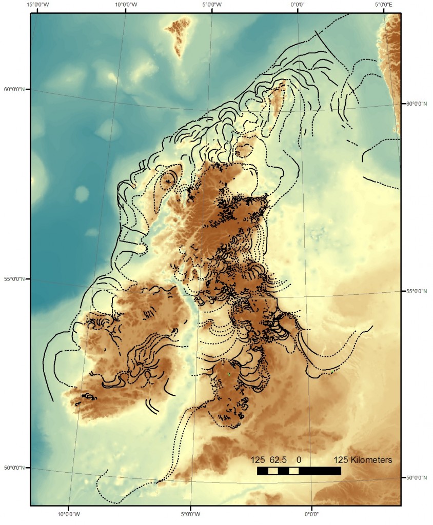
When the ice sheet was there, sea levels were much lower (because the water was in the ice) and the ice left many traces on what is now the seabed.  BRITICE-CHRONO is using geophysical techniques to understand the distribution of glacial sediment on the seabed (sometimes on land too). Collecting cores from the sediments on the seabed also provides samples for dating. Cores from far offshore contain large rock fragments. These show that floating icebergs melted overhead, dropping stones scraped from land that became entombed within the ice sheet. Marine fossils offer their own special insights.

Offshore features. Image from Chris Clark.

Ice retreat features, both offshore and on. Image from Chris Clark.

There is a lot of interest in understanding features on the sea-bed – construction of offshore wind-farms requires better knowledge of what is out there. Also we now understand the potential for archaeology under these shallow seas. The British-Irish ice sheet may be long dead, but that doesn’t mean people never saw it1.

Recreating the ice sheet ‘in silico’

We know a lot about the world in which the last British ice sheet died. Ice from this time still exists, buried deep in the central parts of the Antarctic and Greenland ice sheets. It contains bubbles of air that once blew over a colder world. From this and other evidence, we have a good record of the climate spanning the period in question.

Scientists have built up sophisticated computer models of how ice sheets grow and die, in part based on research in Antarctica. Take known parameters, such as climate and topography and its possible to recreate an ice sheet ‘in silico’, to build up layers of ice within a computer and watch them disappear as the climate warmed.

BRITICE-CHRONO will build up a robust 4-D dataset of how the ice sheet retreated over time. Combining this with computer modelling will create a positive feedback, increasing our knowledge of how ice sheets behave, both in the past and the future.

Scientific Aims

BRITICE-CHRONO will test three main hypotheses, all of which are relevant to the goal of predicting the fate of modern ice sheets:

  1. The portions on ice close to sea level  collapsed rapidly (in less than 1000 years) but the rate of decay was slower for ice on land. Just how catastrophic was the death of the British-Irish ice sheet?
  2. The main ice catchments draining the ice sheet retreated synchronously in response to climatic and sea-level change. Was the retreat of the ice controlled entirely by external factors, or did the response vary over the ice sheet? This helps us understand the significance of local rapid retreat of ice in Antarctica. Does seeing it in one place necessarily mean it is happening to the whole ice sheet?
  3. The volume of ice-rafted debris depends on changes in ice sheet mass balance. Finding large stones in layers of offshore sediment is a direct record of where melting icebergs were found in the past. How is this linked to changes in the ice sheet? Does the amount increase when ice sheets grow, or when they retreat?

BRITICE-CHRONO is less than half way through its 5 years so it is too early to draw any conclusions. The goal is to produce a robust set of data so individual dates will not be published until the full picture is know. Last year saw a massive sampling effort that will continue this year. Although the focus is dating, put experts in the field and they will find new features such as a whole new suite of moraines in Scotland.

The consortium has a blog and is active on Twitter so you can join me in following their progress as they bring an ice sheet back from the dead.

Traces of glacial ice and water

There’s an immediacy to the study of the Quaternary (the last few million years) that is rather seductive. Most geology is (after John McPhee) studying ‘the former world’ but the Quaternary is close enough in time that it is still this world, capped by ice and full of familiar animals and human beings. We can study this period of time in tremendous detail using things – piles of sand, the pattern of the landscape, peat bogs – that are unlikely to be preserved in the geological record.

An outcrop of Irish gabbro tells us about conditions deep within the earth, but the mountain range, even the continent it formed in are all gone. The smooth shape of the outcrop and its covering of fine scratches were caused by the scraping of stones in ice, part of a massive icesheet that stretched across the British Isles. The ice is gone but it flowed over this hill, down that valley. On a chilly day it can feel like it only just left.

Stone moved by ice

One outcome of the great ferment of ideas in 19th Century Britain was the recognition that much of the northern British Isles were once covered by of thick sheet ice. One of the earliest recognised forms of evidence for these vanished ice sheets is found in the form of glacial erratics. These are pieces of rock, sometimes very large, dumped by the ice. The most useful sort come from a distinctive rock type, a granite intrusion perhaps, that allows you to know precisely where the erratic came from and so infer which way the ice was flowing. On the Yorkshire coast in England there are erratics from Norway1, showing that the ice flowed across what is now the North Sea.

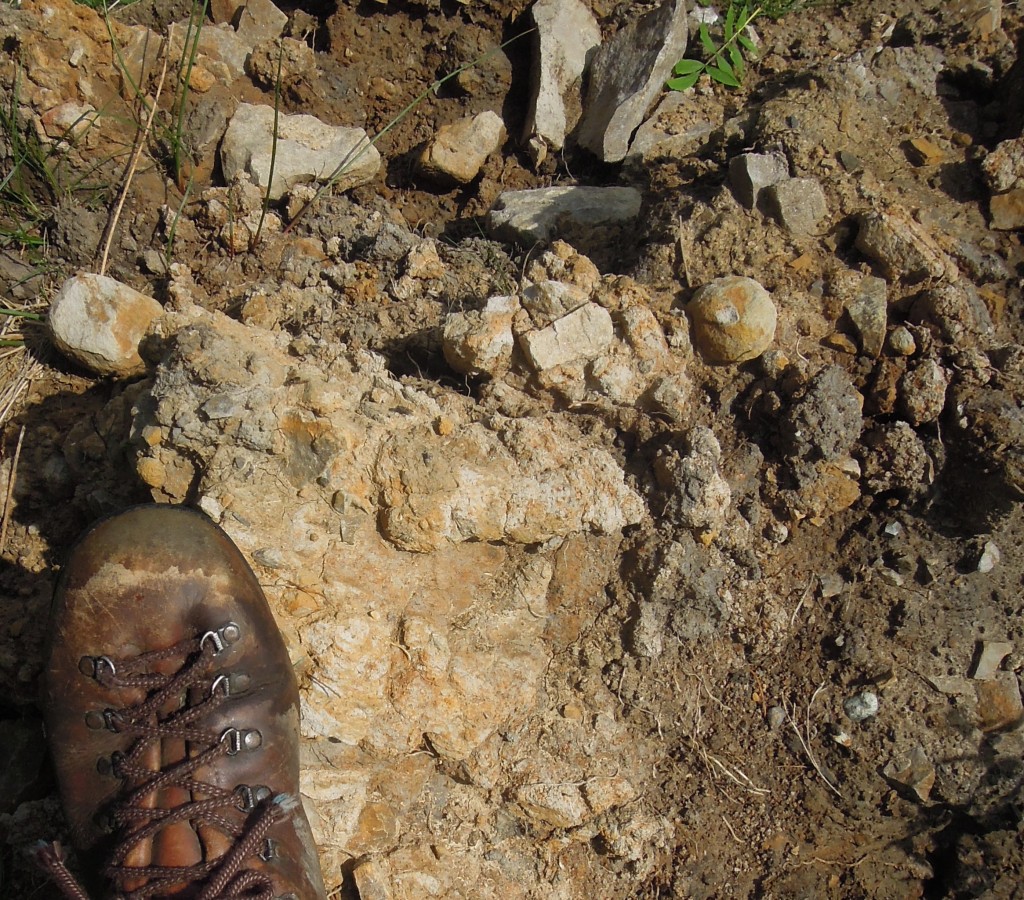
Freshly dug glacial drift from Cheshire.

Freshly dug glacial drift from Cheshire.

Volumetrically the biggest record of glaciation is glacial drift. This is sediment that was moved and ground-up by the ice. It is a very jumbled, poorly-sorted sediment, with big blocks mixed up with sand and silt. If you find a sediment like this, you know there has been glaciation. This applies to ancient sediments just as much as recent ones.

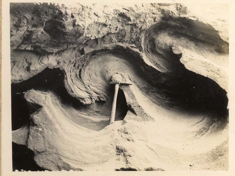
Studying drift, people realised that things were quite complicated. A single place might have multiple layers of glacial drift separated by more normal sediments. They realised that term ‘Ice Age’ is a simplification; this was phenomena that pulsed. Outside of the Polar regions, the ice caps came and went many times, dancing in time with the stately precession of the earth’s axis.

Isoclinal folding in glacial sand and clay. Photo from 1921 courtesy of British Geological Survey. P249721 http://geoscenic.bgs.ac.uk/asset-bank/action/viewAsset?id=78063&index=55&total=56&view=viewSearchItem

Isoclinal folding in glacial sand and clay. Photo from 1921 courtesy of British Geological Survey. P249721

Sometimes, soft drift gets pushed around by advancing ice. Sometimes this results in beautiful folds, other times it puts sediments containing marine shells deep inland. 2. For this reason, the presence of drift is fairly uninformative. To make firmer conclusions about the most recent advance of Ice, we must turn to more subtle features.

Fainter traces

Glacial sediments aren’t laid down in thin even layers, but in various ways, both elegant and ugly. Valley glaciers often have moraines: piles of sediment at the end or sides that fell out of the melting ice. The same principal applies to Ice Caps, such as covered most of Northern Europe and North America. Successive belts or ridges of moraines can record the retreat of an ice sheet.

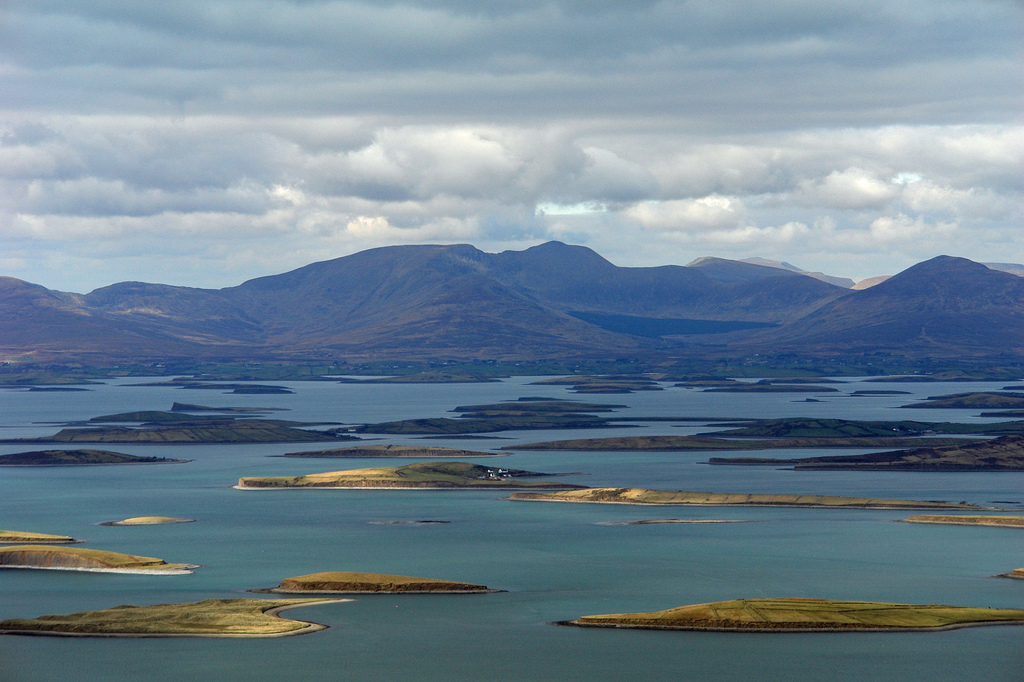
Drumlins are piles of glacial sediment that have been moulded by ice flow. They are very beautiful features, with an aerodynamic shape. They can look like the back of a huge whale, somehow rising out of the ground. Often found grouped together, their shape indicates the direction in which the ice was moving when last it was flowing.

A pod of Drumlins swimming in Clew Bay, Ireland. Photo from chrispd1975 on Flickr under CC. http://www.flickr.com/photos/8289745@N03/2384936935/sizes/l/

A pod of Drumlins swimming in Clew Bay, Ireland. Photo from chrispd1975 on Flickr under CC.

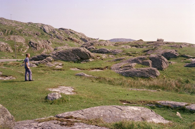
Glacial striations and polishing are common features found on land that was once under the ice. Stones in the ice slowly scratched their way across bed-rock. Asymmetric features known as roche moutonnée tell us the direction of ice flow.

A flock of Scottish roche moutonee (ice flowing to the right). Image from British Geological SurveyP008317 http://geoscenic.bgs.ac.uk/asset-bank/action/viewAsset?id=7032&index=14&total=182&view=viewSearchItem&movedBr=null

A flock of Scottish roche moutonee (ice flowed to the right). Image from British Geological Survey P008317

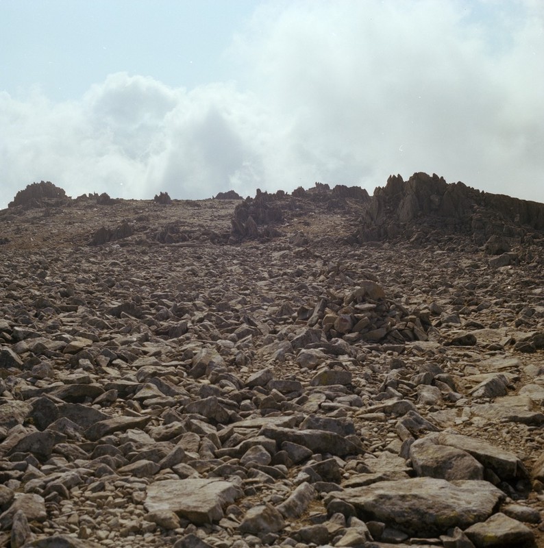
A common experience when walking one of the bigger mountains in Britain is to start in a valley filled with glacial till, perhaps with some moraine visible. Next a climb up a ridge shows lots of polished rock. Finally, the summit pyramid is covered in a great thickness of loose stone3. Between this summit block field and the scraped stone below is the trim line that captures the top of glacial erosion. Map out trim lines on multiple mountains and it tells you something about the vertical extent of the ice4.

Summit block field of Glyder Fawr in Wales. Image courtesy of British Geological Survey. P222636 http://geoscenic.bgs.ac.uk/asset-bank/action/viewAsset?id=29270&index=23&total=38&view=viewSearchItem

Summit block field of Glyder Fawr in Wales. Image courtesy of British Geological Survey. P222636

When ice melts, it turns into water. In my gin and tonic this is fine, but when the melting ice is 100s of metres thick, it will have a big impact. Around my home town of Macclesfield in England there are glacial lake deposits. They are sitting above the edge of the Cheshire Plain – there’s no way you could have a lake there today. The only way to explain this vanished body of still water is: it was dammed by the ice.

Other evidence of water flowing in odd ways if found in glacial meltwater channels. These look like small stream beds, but they have no stream today. Sometimes they flow along slopes or uphill for a time -evidence that when the water was flowing, the ice was still around.

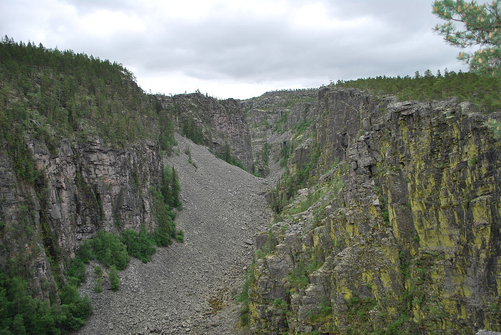
If you were building a dam to make a huge lake and you proposed making it out of ice, you wouldn’t get far as an engineer, because at some point the dam will fail and all the water will come flooding out. This happened with melting ice in several places. The huge scoured landscape of the channeled scablands in Washington State, USA, are the biggest example, but my favourite is the Jutulhogget or ‘Giant’s Cut’ in Norway.

Jutulhogget http://commons.wikimedia.org/wiki/File:Jutulhogget_01.jpg

Jutulhogget  Image from Wikimedia Commons.

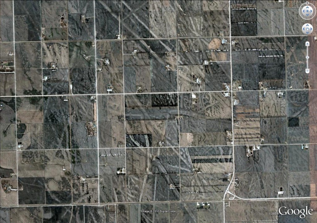
Of limited scientific use, but rather beautiful, iceberg keel marks are more evidence for glacial lakes.

Glacial keel-marks from Canada. Google Earth image.

Aerial view of glacial keel-marks from near Manitoba, Canada. Square lines are roads: see here for more details

 To the science

Knowing about these features really enhances your view of the world – it gives you a way to read landscapes and discover a world of ice so close in time we can almost touch it.  But the best thing about these features is that they tell us about the now-vanished ice. Modern researchers have mapped them to track the ice’s ebb and flow. They combine these maps with computer modelling, insights from active ice sheets and techniques for dating so advanced that they seem almost magical. Their goal is to predict the future. In the face of a changing climate, an ice-cap died in Britain 15,000 years ago. Understanding this process better may help us predict that fate of earth’s remaining ice caps. I’ll write more about this next….

Andalucia: a history of stuff

Andalucia is a province in Spain, at the far south west of Europe. Its long and varied human history has seen it linked to the middle East, north Africa and the Americas. The creation of these links brought new foods, metals, diseases: new stuff into Andalucia. Sometimes the impact of arrival created ripples that reached out far across the world.

Geological history

Some 200 million years ago Andalucia was within a massive continent called Pangea, close to both Africa and North America. Slowly Pangea broke into pieces, a new ocean basin – the Atlantic – filling the gap as the Americas drifted away. Some 50 million years ago, Africa was pushed north in Europe creating a long mountain range. Andalucia was part of this. Mountains form when the crust is thickened, pushing rock into the sky. A similar process at the base of the lithosphere 1 also forms a thick balancing ‘root’. Under Andalucia, this thick root ‘fell off’2 and sank into the hot convecting mantle beneath.

Mountain belts are surprisingly fragile. The sudden removal of the heavy root caused the over-thickened crust to collapse, flowing sideways and bringing deeply buried rocks up to the surface3. Fragments of mantle called peridotite, not often seen at the surface, form brown mountains around the town of Ronda. The collapse of the mountain belt went so far that its centre is now the very western part of the Mediterranean, the Alboran Sea. The mountain became a great hole in the ground.

Most of Andalucia is made up of sedimentary or metamorphic rocks folded and twisted by these dramatic changes. An exception is the basin of the Guadalquivir river. Here the weight of the collapsing rocks pushed down the rocks to the north, making a depression that has filled with recent sediments – a feature called a foreland basin. The edge of this flat basin makes a clear line that is easily visible from satellite views of Southern Spain.

From Wikimedia http://upload.wikimedia.org/wikipedia/commons/5/53/Andalucia_satelite.jpg

Andalucia from Space. Image from Wikimedia 

People

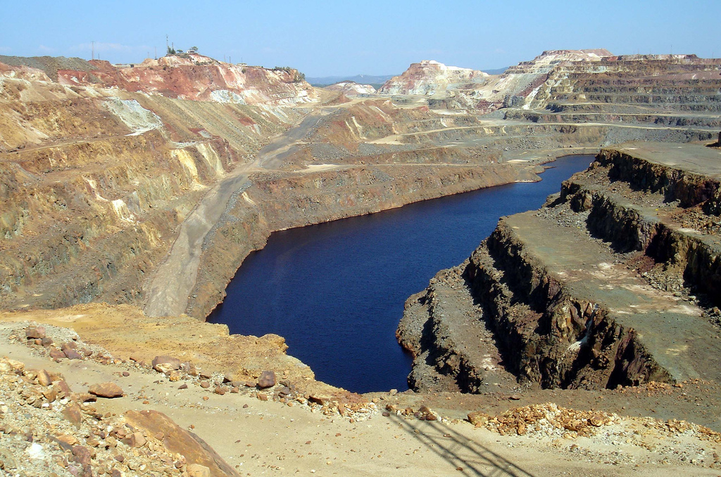
People, at first hominins such as Neanderthals, have lived in Spain for over a million years. The little we know of prehistoric humans comes from their use of materials. First their gradually more sophisticated use of stone tools, then from about 5000 years ago the smelting of metals: first copper, then bronze (copper plus tin) and then iron. Mines in Andalucia have been been involved since the start, notably the Rio Tinto area. Here a Carboniferous massive sulphide deposit has yielded silver, gold and copper and spawned a global mining company.

Image of Rio Tinto mines, Andalucia. Image from David Domingo on Flickr under CC

Rio Tinto mines, Andalucia. Image from David Domingo on Flickr under CC

Around 3000 years ago (1100BC) the Phoenicians reached Andalucia, founding the town of Cadiz. A culture that reached across the Mediterranean they were also involved in trade with the British Isles. Tin from Cornwall in England was smelted with Spanish copper and the resulting bronze traded on. The olive tree reached Spain at this time, brought from the eastern Mediterranean.

A mere thousand years later, the Romans took control – their province of Hispania Baetica covers much of modern-day Andalucia. They introduced deep mining to the Rio Tinto, using the characteristically Roman combination of slaves and very big wheels to pump water up from the depths. Andalucia was a renowned source of many products for the wider Roman Empire, including silver, olives, emperors, philosophers, dancing girls, and garum, a sauce formed from fermented fish guts rich in umami flavours.

Yet Moor invaders

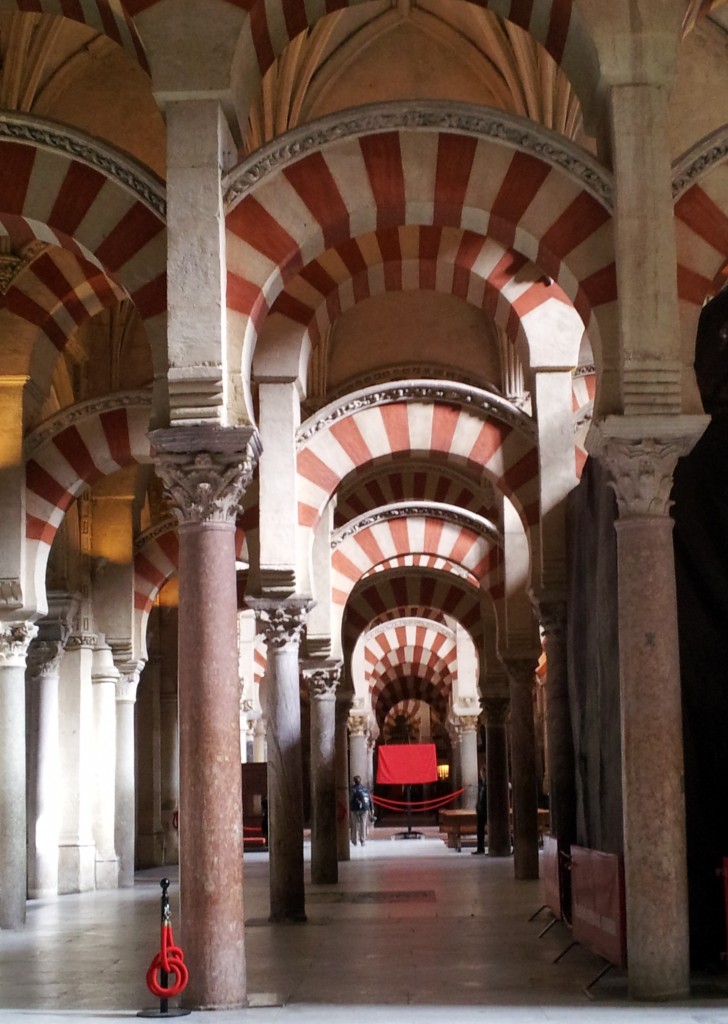
After the slow collapse of the Roman Empire, the next major influx of change in Andalucia was the Moorish invasions. The Islamic Moorish army4 conquered most of Spain between 711 and 718 AD, in time creating a kingdom of Al-Andalus with its capital in Cordoba. Once more Andalucia was part of a multi-national empire with good trade links. Valuable crops from further east, such as figs, citrus and pomegranate were introduced for the first time, as were sophisticated irrigation systems, some of which are still in use. By the 10th century, Cordoba was the most civilised city in Europe, it’s Grand Mosque was one of the wonders of the Muslim world.

Cordoba Grand Mosque

The site of the Grand Mosque was originally a Christian cathedral (before that, a Roman temple). Built over 200 years and funded in part by mining proceeds, the Mosque was built with local stone and brick, but also recycled Roman stone columns. Some of these were found locally, but others were brought in from much further afield, from the rest of Spain and perhaps wider.

The Columbian exchange

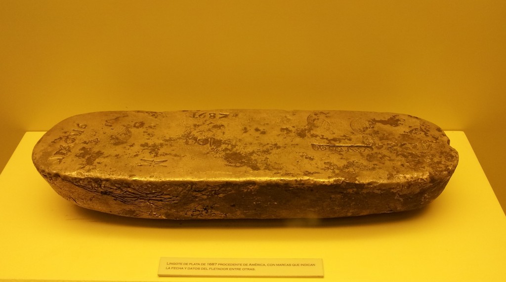
Eventually Moorish Spain came to an end as Christian rulers conquered the Muslim lands. The final Moorish kingdom of Granada fell to Ferdinand and Isabella in 1492, the same year that they sponsored Christopher Columbus to mount an exhibition across the Atlantic. As  the Spanish kingdoms turned into a global Spanish empire, lots of incredible things started flowing back into Andalucia. First Seville and later Cadiz were the main ports for the Atlantic trade. Gold and silver beyond imagining passed through Andalucia – enough to create a century of inflation across Europe. Some of this stuff ended up in the the Grand Mosque in Cordoba, which is now a cathedral again. Sitting within the vast pillared area of the mosque is a Christian church full of beautiful things made of American gold and silver. The choir stalls are made of American mahogany – lots of plant material crossed the Atlantic too.

Ingot of South American silver as brought over by Spanish treasure ships. Cadiz Museum.

Ingot of South American silver as brought over by Spanish treasure ships. Cadiz Museum.

A popular Spanish dish is called ‘patatas bravas’ and consists of potato, tomato and chili – all foodstuffs that spread across the world following the ‘discovery’ of the Americas. Andalucia was the first stop for many of these vegetable treasures. Botanical gardens turned seeds into plants, to be studied and propagated. A fine building in Seville is the old tobacco factory, dedicated to processing another new crop. The setting of Bizet’s opera Carmen, its walls are mottled with yellow and brown, like a smoker’s fingers. More immediately bad for the health, syphilis was first recognised in Europe in 1494, most likely brought back by Columbus’ sailors.

The British dimension

As an Englishman who likes history, I often visit other countries in an apologetic mood. A dimly remembered story about Francis Drake daringly ‘singeing the king of Spain’s beard’  is rather less jolly when you are sitting in Cadiz, the town that was attacked. Drake was engaged in warfare on behalf of his Queen, but also behaving like a pirate, raiding Spanish treasure ships. Still, no one seems to mind any more; it was in 1587 after all.

The British drink everything and anything. Not content with home-grown beer, gin and whisky we also crave grape-based booze. When Francis Drake returned from attacking Cadiz, he brought 2,900 barrels of sherry, a type of wine made only near Jerez in Andalucia. This went down rather well – we’ve been drinking it ever since, even getting involved in its manufacture.

Tonic water is sweet fizzy water flavoured with quinine, best taken with gin. Quinine, an extract from a South American tree was for centuries the only effective way of countering the effects of malaria. First popularised by Spaniards returning from Peru it was introduced to gin by the British in India. In the early 18th century the Royal Navy had a number of bases on Spanish soil, including in Andalucia, and passed the habit on. It remains popular in Spain to this day.

Image from Amanda Slater on Flickr under cc

Image from Amanda Slater on Flickr under cc

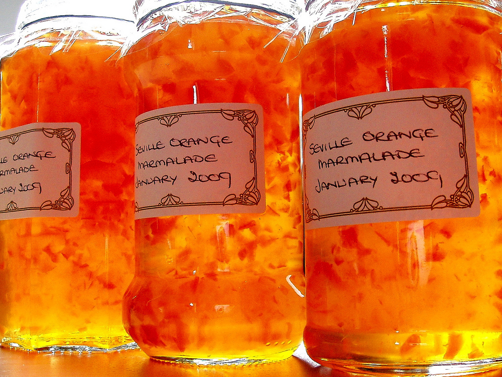
A final anglo-Spanish connection is marmalade. Seville is full of orange trees, of a particular kind, bitter and rich in pectin. They are pretty inedible raw, but for some reason 5A Scottish tradition and industry grew up of preserving them as jam, with pieces of the skin floating in jars of pungent and yielding orange delight. Paddington Bear, James Bond and Alice in Wonderland all eat marmalade, along with many real people, such as me. The bitterness gives it a very grown-up feel, with some of the grimy delight of cigarettes and whisky, but in a healthy breakfast-friendly form.

The future

What of the future? Recent research suggests that soon6The oceanic crust beneath the Atlantic will start to plunge down under Spain into the earth’s mantle. The collapse of the mountain belt I mentioned at the beginning left a tear in the crust and this may grow and extend into a full-blown subduction zone. This will bringing volcanoes to fertilise the soil with ash and earthquakes to shake the buildings (if any remain). As slowly as finger-nails grown the Atlantic will vanish and Spain and the Americas will be reunited once again.

Deep time and dead things in the wall

Here in Cadiz, I’m surrounded by death and I don’t mind at all.

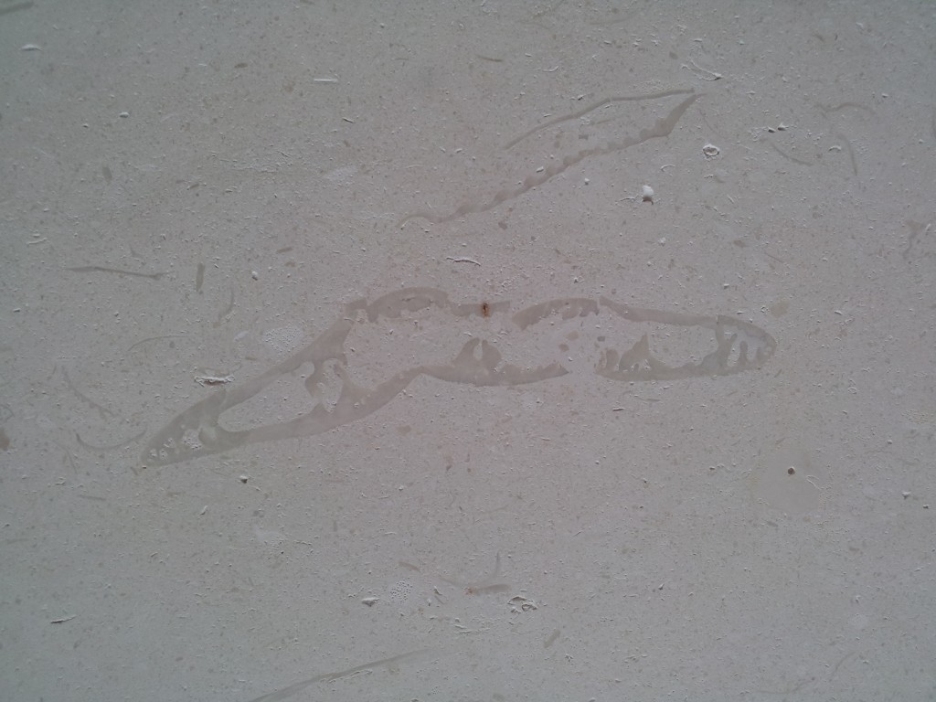
It’s the geologist in me thinking this – in every other way this is a lovely life-affirming holiday. It’s just that every surface seems to be filled with the remains of long-dead animals.

The floor and one wall of the hotel room in which I’m sitting is covered in a fine white limestone packed with the remains of fossils – mostly bivalves. There are thick finely layered oyster shells and finely ribbed shells that remind me of scallops. The stone has mostly been cut perpendicular to bedding so the shells are seen in cross-section. These elegant fine grey lines are within a lighter matrix that – on closer inspection – is made up of smaller pieces of something-that-once-was-alive-and-now-is-not.

20140126_172622

This is of course a wonderful thing. To be surrounded by traces of an ancient sea-bed, as productive and vibrant as any modern tropical sea and to live in a time that fully understands that significant of these little grey squiggles is indeed a privilege. But they are still dead.

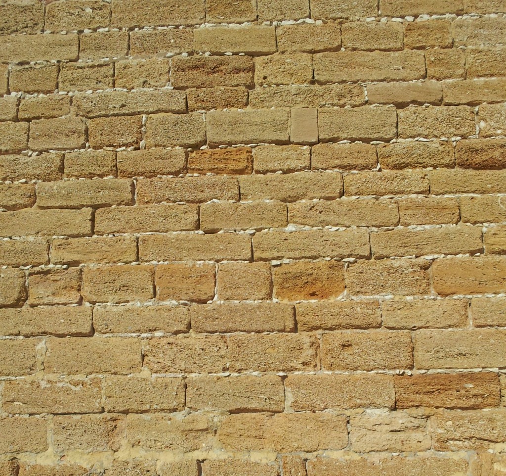
Leaving the room doesn’t help. The city of Cadiz seems largely built from the local rock. This is basically a pile of shells bound together with ground up shell and maybe a little brown sand.

20140126_160603Cadiz is great for seafood, there were men with buckets of sea urchins and big knives wandering around earlier. Imagine a seafood restaurant kitchen at the end of the evening: there’s a pile of shells somewhere – big chunky oyster shells, purple fragments of bust-open sea urchins, maybe a few spiny sea snails. If you laid them out in a layer they’d cover a few tables maybe, not more. If an eccentric restaurant owner made a pile in his garden, after a year it would be pretty big (and very smelly). Archaeologists call similar features shell middens and given thousands of years, greedy people can make piles that are kilometers long and meters thick and wide. The layer of stone that old buildings in Cadiz are made from covers a much wider area – it’s not just a strip along the coast – so it must be thousands of times the volume.

This is where deep time comes in. My simple thought experiment suggests that the stone that Cadiz is made of took millions of years to form. Similar thinking by 19th Century geologists revealed the unsettling scale of geological time and set the scene for Charles Darwin to formulate his theories. Over these timescales tiny steps can make enormous changes, just as piles of small animals can be used to build a city.

Deep time can be unsettling: what will the remorseless grinding of the years do to us and our achievements? Will everything and everybody you know be reduced to a few odd layers and a puzzling mass extinction? Maybe. Nobody knows. But my life is enriched by knowing my place within the wider framework just as my walk to the restaurant this evening will be enlivened by spotting the oyster shells in the wall.