Ludchurch – sandstone, landslips and a beheading game

The ‘Dark Peak’, the land to the south and east of Macclesfield rising up above the Cheshire plain, is a wild place. We are in England though, and even here in the North, things are only mildly wild. This is no wilderness, we are only 25 miles from Manchester, once the ‘workshop of the world’. The area is criss-crossed with (exciting narrow) roads and dotted with farms, but is not totally domesticated or defined by human control. Some 600 years ago its primary purpose was for hunting, as the place name Wildboarclough reminds us. I recently visited a wild place here which is geologically interesting but also spooky, with echoes of medieval violence.

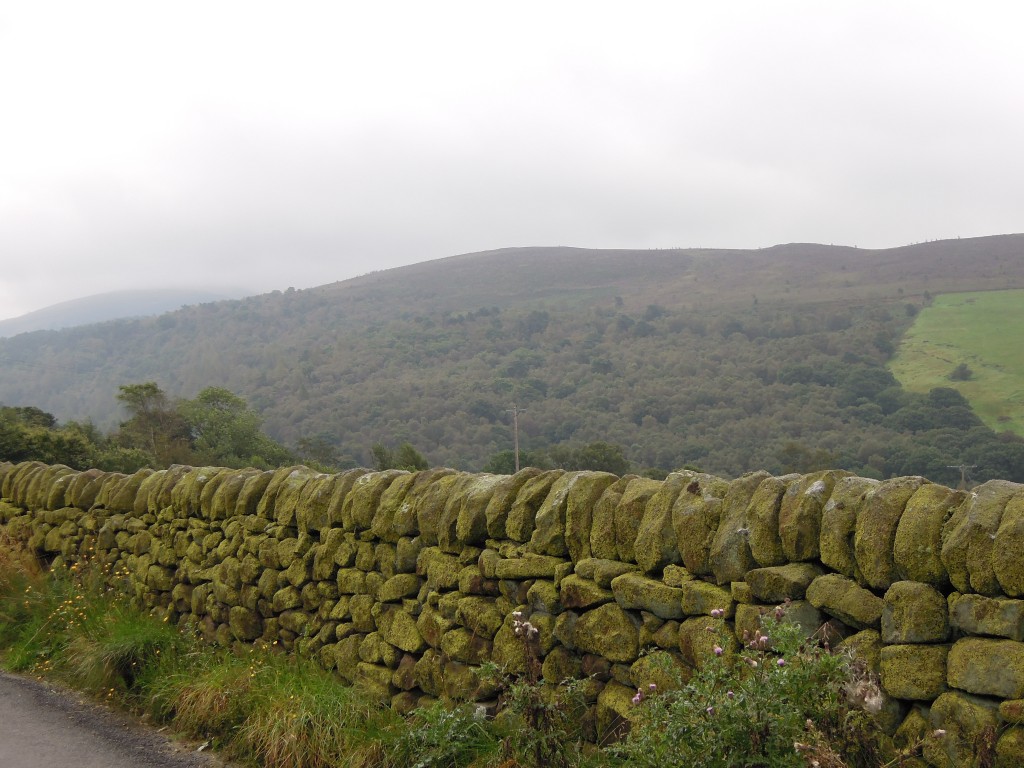
Green view of Lud's Church hillside

The primary colour of this land is green. Note how even the stone walls are green, because the sandstone rock is covered with moss. The wooded hillside you see is a dip-slope – the slope follows the upper surface of a layer of durable coarse sandstone. The woods contain a magical secret place, which is where we are headed.

Our destination is best reached via Gradbach. This contains an old silk mill, where in the 19th Century water-power was used to drive machinery to weave silk. Such places (more usually involving cotton weaving) were the nursery of the industrial revolution. Water power was soon replaced by coal-fired steam power and production shifted from rivers in the middle of nowhere into big cities such as Manchester. Though far from rivers, the new buildings full of looms were still called mills. The Gradbach mill is now a Youth Hostel, giving children a taste of the wild.

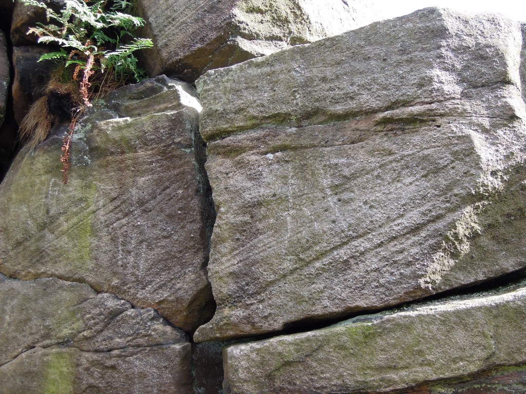
Once across the river and in the woods, everything seems normal. You walk up some muddy paths and you reach a set of small crags. Carboniferous sandstone, coarse grained and with cross bedding – very typical of the area. Note the green algae staining.

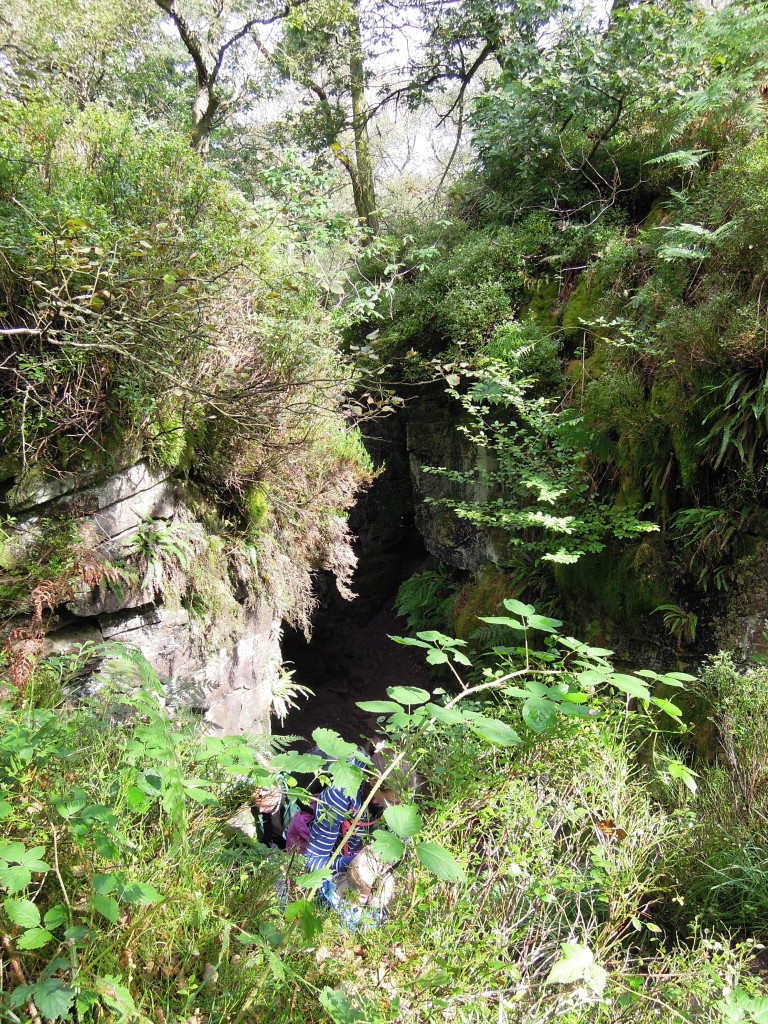
Sitting within these woods, almost hidden amongst the undergrowth is an entrance to another world.

Entrance to Lud's church

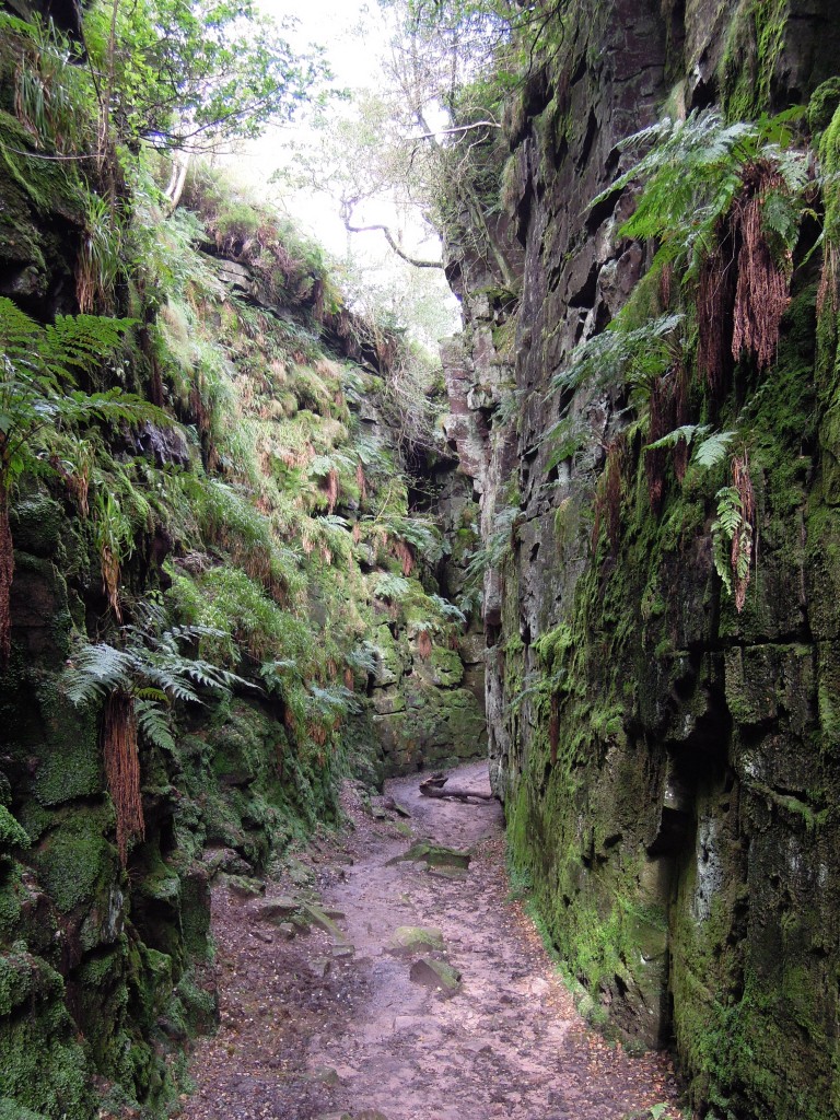
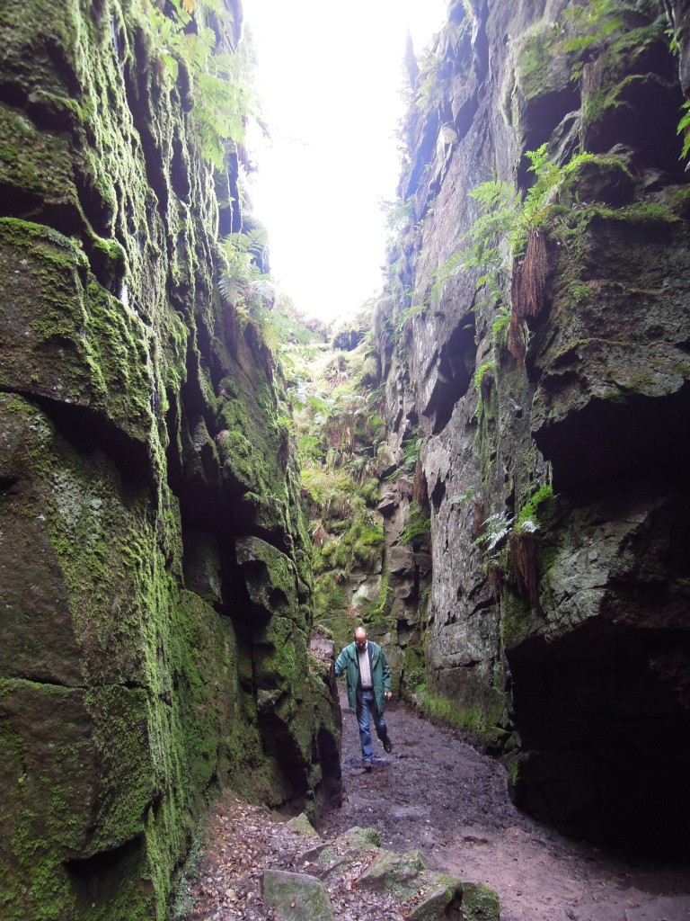
You walk down a little way and you are in a deep dark space like nowhere else I’ve ever been. The air is cool, muffled and moist. Every surface is damp and green. The sky above seems a very long way away, peeking down between two great walls of sandstone, covered in ferns, moss and liverworts. A place that is neither underground or above ground, a chasm not a cave, a rocky place full of plants. This is Ludchurch.

Geologically, this is a large landslip, of unknown age. The bedding planes in the rock, the Roaches Grit, are sloping down hill. A weak layer, probably shale, allows movement sideways and the rock parts along vertical joint planes. A chunk of rock 100s of metres long has slid a few metres downhill, creating a hole in the ground that’s filled with plants and mystery.

What did the medieval inhabitants of the land make of it? Without our modern day paths, the most obvious way to encounter Ludchurch is to ride over the top and fall to your death into it. Even now dead sheep can be found at the bottom. Over the  years Ludchurch has gathered many myths and stories and inspired a great work of literature.

The Green Knight

Sir Gawain and the Green Knight is a complex story from the late 14th Century. Sir Gawain, of King Arthur’s court, gets involved in a ‘beheading game’ with a mysterious Green Knight (like you do). The climax of the story takes place in a Green Chapel. The story is written in a Cheshire dialect, now extinct but recognisable only a few generations ago. Many scholars have linked the Green Chapel directly to Ludchurch itself. That a local man writing a story of the supernatural would be inspired by Ludchurch makes perfect sense to me.

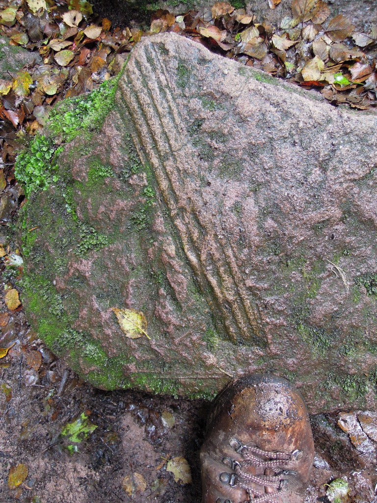
The Green Knight has been linked to the Green Man, a common carved or painted figure in old English churches. It represents a pagan vegetative deity, a figure who embodies the growth cycle of plants. Such a figure would certainly like Ludchurch, covered with plants as it is. The fact that it is made of Carboniferous rocks is appropriate too. This was a time when the air was rich in oxygen, supporting vigorous forests – a golden time for a Green Man. How appropriate then that a block on the base of Ludchurch shows a plant fossil, partly covered in moss and liverworts.

Spooky postscript

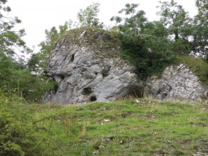
Massive 'reef' limestone, Manifold valley

Crag containing ‘Green Chapel’

I visited Ludchurch during a week’s holiday based in the area. On an earlier day I’d visited the Manifold valley in search of interesting rocks to tell you about (watch this space).

On this other trip I photographed a crag of massive reef limestone. When later researching the link between the Green Chapel and Ludchurch, I found a website that decided that a limestone cave at Wetton Mill was a better fit for the Green Chapel. The name sounded familiar – I clicked on their photo and found a picture of the same crag from the same spot! 

This is purely a coincidence of course. The nature of things is that wildly improbable coincidences happen all the time. It still made the hair on the back of my neck stand up.

A note on nomenclature. Ludchurch is more popularly known as Lud’s Church, but my father, who holidayed here in the 1940s and has always lived nearby, knows it by the non-possessive version that I’ve used. There are many suggestions as to who Lud was, which means no-one knows, but for sure it is nothing to do with the Luddites. Don’t let anyone tell you otherwise.

Orford Ness – nuclear bombs and gravel ridges

Suffolk in England is a peaceful part of a peaceful country. But if you know where to look, between its pretty villages, sandy beaches and open countryside there are many traces of war and violence. Often full of paddling children, the sea eats towns. From an historical perspective, whether they are French, Spanish, German, Dutch or Russian, England’s enemies are usually to its east, putting Suffolk on the front line.

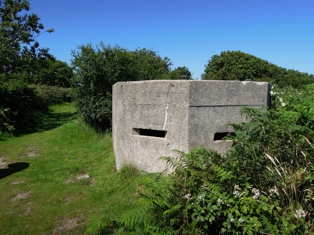
Second world war pillbox south of Walberswick

Second world war pillbox south of Walberswick

The most obvious traces of war in Suffolk are from the Second World War. When Britain “stood alone” from 1939 to 1941 there was a very real threat of invasion from Nazi-occupied Europe. Concrete fortifications such as the pillbox above are common across Britain, but the ones in Suffolk look across the North Sea, where dim shapes in the dawn mist could plausibly have arranged themselves into the terrifying outline of an invasion fleet. Airfields, both British and American are common in Suffolk as well. I want to take you to a remarkable area that touches on WW2, but is mostly about the restless sea and the Cold War.

Map of Orford Ness, via Wikipedia

Map of Orford Ness, via Wikipedia

Orford Ness is a very odd place indeed. In the picture above, note the river Alde, flowing past Aldeburgh. It nearly reaches the sea where you’d expect it to, but a thick gravel ridge forces it south, running parallel to the coast for around 15 kilometres before it finally reaches the sea. Dating the Ness is hard, but old maps are the best source of information. As you can see from the map, the southern end of the Ness has moved over time – slowly by historical standards, fast by geological ones.

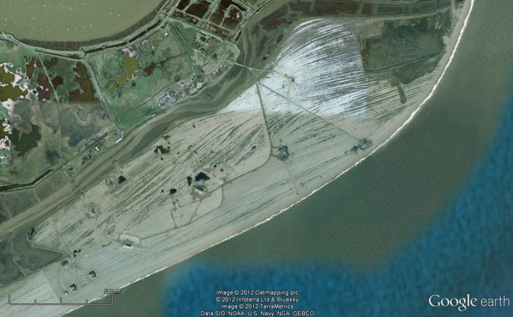
Let’s take a closer look at the thick elbow part, where the lighthouse sits.

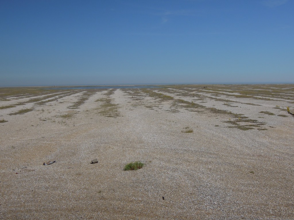
Each line is a gravel ridge, most likely deposited by a single major storm moving 1000s tons of sediment. When the sea eats towns like Dunwich further north, this is where some of the land ends up.

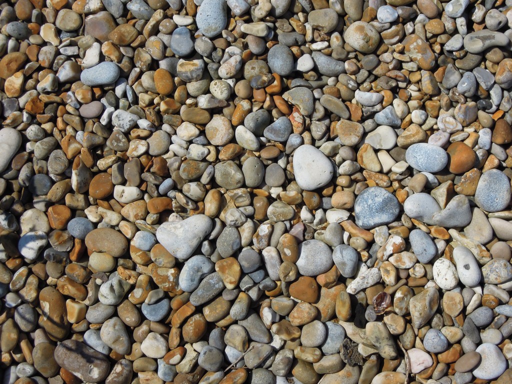
Orford Ness shingle

Orford Ness shingle

The gravel / shingle is made up almost entirely of flint. This remarkable material comes from the Cretaceous chalk layers that dominate the geology of southern England. Flint is extremely durable, so most post-Cretaceous sediments are dominated by flint as well. The pebbles in the Ness may have been eroded and transported and deposited multiple times since they grew in the chalk. In Southwold I’ve also seen brick and tile fragments on the beach, a reminder that buildings are also swallowed by the sea. These flint pebbles may once have been part of a mediaeval church in now vanished Dunwich.

Orford Ness is now owned by the National Trust and is a national nature reserve containing 15% of the world’s coastal vegetated shingle. But its evident from the picture above that something else has been going on – you’ll note the roads and the buildings. These date from the Cold War, when Orford Ness was part of Britain’s military preparations for world war three.

Shingle ridges Orford Ness

Shingle ridges Orford Ness, picture taken from military tower used to track impact of bombs. Note ridges end not in sea, but man-made pond

Orford Ness was used by the military before world war 2, mostly as a bombing range. In 1935 one of the first instances of using radar to detect aeroplanes took place here. In the 1960s the mostly American “Cobra Mist” program of over-the-horizon radar was based on the Ness. Once superceded by satellite technology in the 1970s, the same area was then used to broadcast the BBC World service radio station behind the Iron Curtain into eastern Europe.

The most dramatic traces of the Cold War relate to Britain’s nuclear weapons program. I feel I have some connection to this. My grandfather was a foreman on the  building works at Calder Hall, Britain’s first nuclear power station, built soon after the end of the war. We have a picture that shows the Queen Mother meeting my grandfather, showing the importance attached to this work. Calder Hall, later Windscale, even later called Sellafield, was publicised as a source of cheap electricity, but initially its real purpose was to create Plutonium, to build bombs. These were then constructed at Aldermaston, near to where I now live.

Full testing of nuclear weapons is a messy business  that the British government chose to do as far away as possible, in Australia. As well as exploding bombs, they tested what happens if a bomb is involved in a conventional explosion, say in a plane crash. Unsurprisingly this created “jets of molten, burning plutonium extending hundreds of feet into the air” and created a hell of a mess.

The testing in leafy England never involved radioactive material, but studied all other aspects of the bombs. Nuclear bombs (complete apart from the Plutonium) were dropped, banged, heated, frozen and subjected to various air pressures, all to understand how they would withstand the hurly-burly of a World War 3 battlefield. Nuclear weapons contain large amounts of high explosive, designed to compress the fissile material and initiate a runaway nuclear reaction. For this reason even these ‘cleaner’ tests were done somewhere isolated and within special buildings that would contain any explosions.

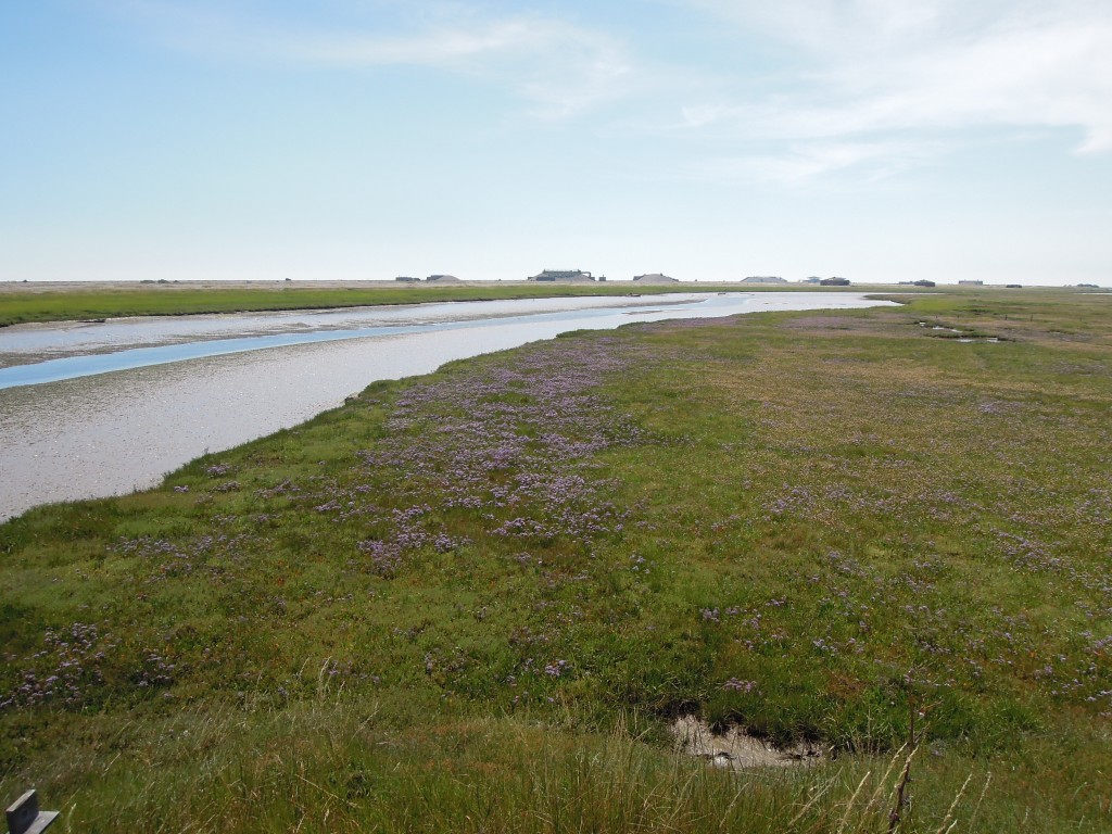
The Ness can only be reached by boat and crossed on specific paths and roads. Initially you start in an area of muddy marsh, rich in bird-life. The first glimpse of the shingle area is off-putting. In the foreground and behind you are bucolic English scenes. On the horizon are some odd structures, but how big are they? Its very hard to tell from a distance – this flat landscape gives little sense of scale.

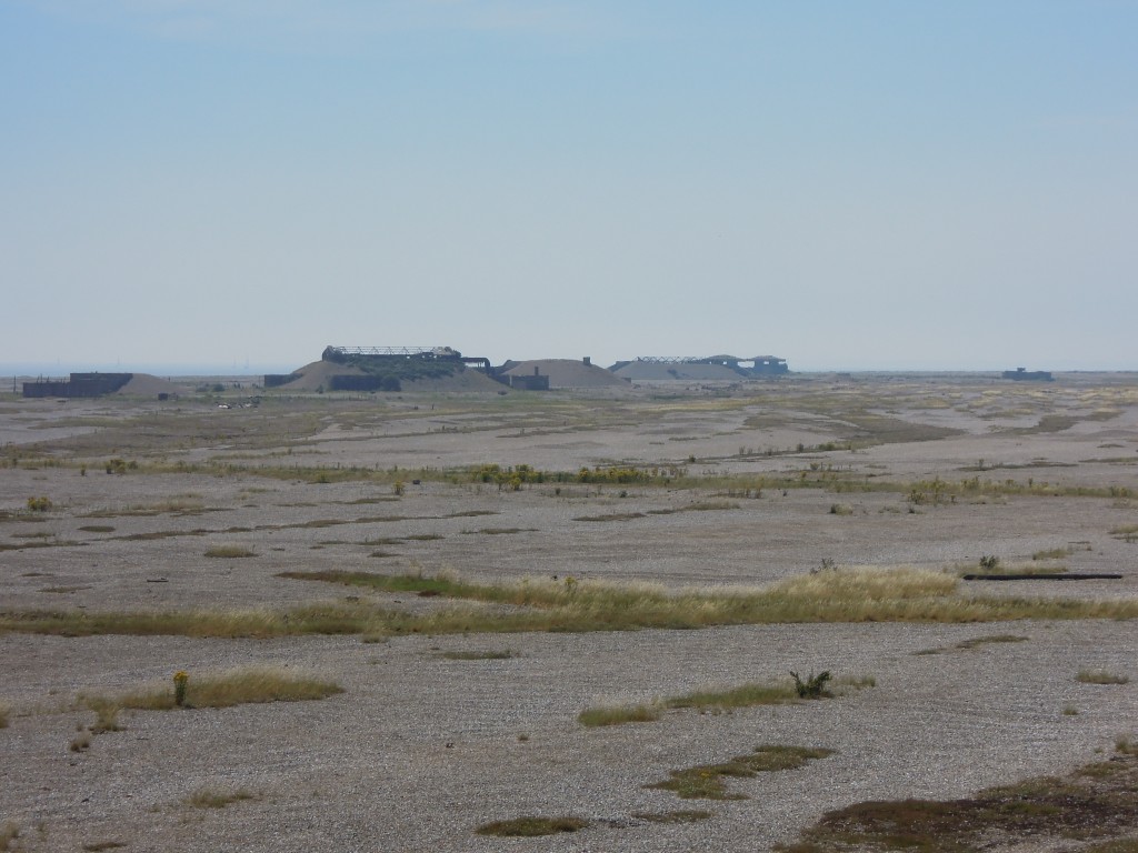
As you get nearer things only get odder, its like another world. Those structures look like buildings, but they are surrounded by mounds of shingle, as if they are being pushed up from under the ground.

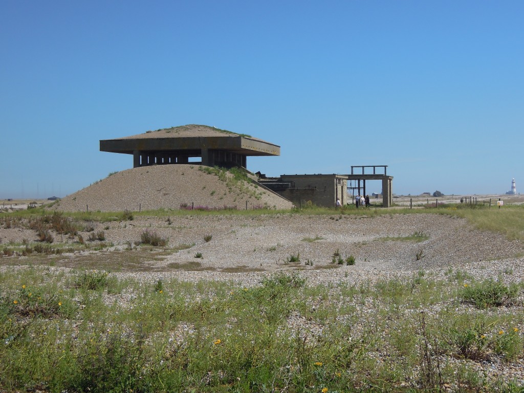
Up close they resolve into decaying buildings, with stained concrete and rust. They are surprisingly small. The banks of gravel are a pragmatic and cheap way of reinforcing the walls.

The oddest structures are the pagodas, which have a concrete roof topped with more gravel. In the event of a conventional explosion, the blast would be diverted sideways through the open vents.

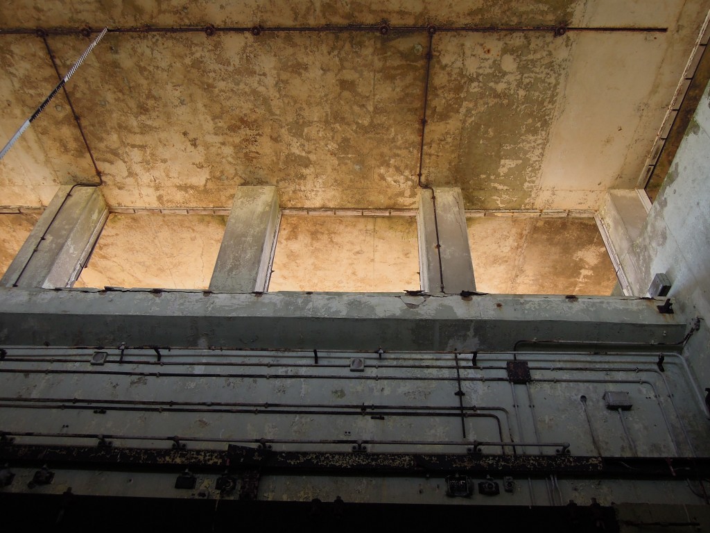
Here’s a view from inside, showing the vents and giving a sense of the brutalist building style.

Testing on Orford Ness spanned only the 1950s until the 1970s, when Britain switched to a nuclear deterrent based on American technology, first Polaris and currently Trident. These buildings are now slowly decaying. Over time they will further merge with the shingle, or perhaps the restless sea will erode the Ness away, releasing the flint gravel within the concrete and sending it round yet another cycle of erosion and deposition on the English coast.

The town eaten by the sea

Some towns have all the luck. A thousand years ago Southwold, in Suffolk on England’s east cost, was a fishing village dwarfed by Dunwich, a major port town to its south. Nowadays Southwold is a thriving seaside town and Dunwich is just a few houses, one pub and a museum. Its priory, leper hospital and over 8 churches are all gone – swallowed by the sea.

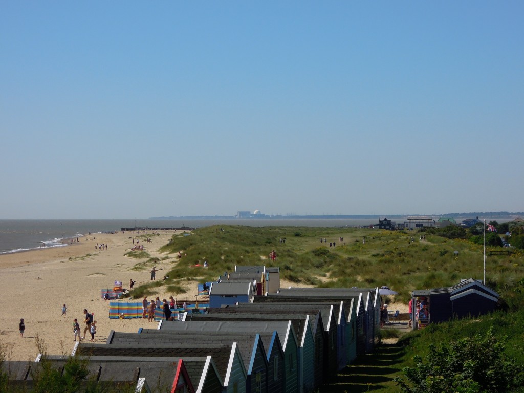
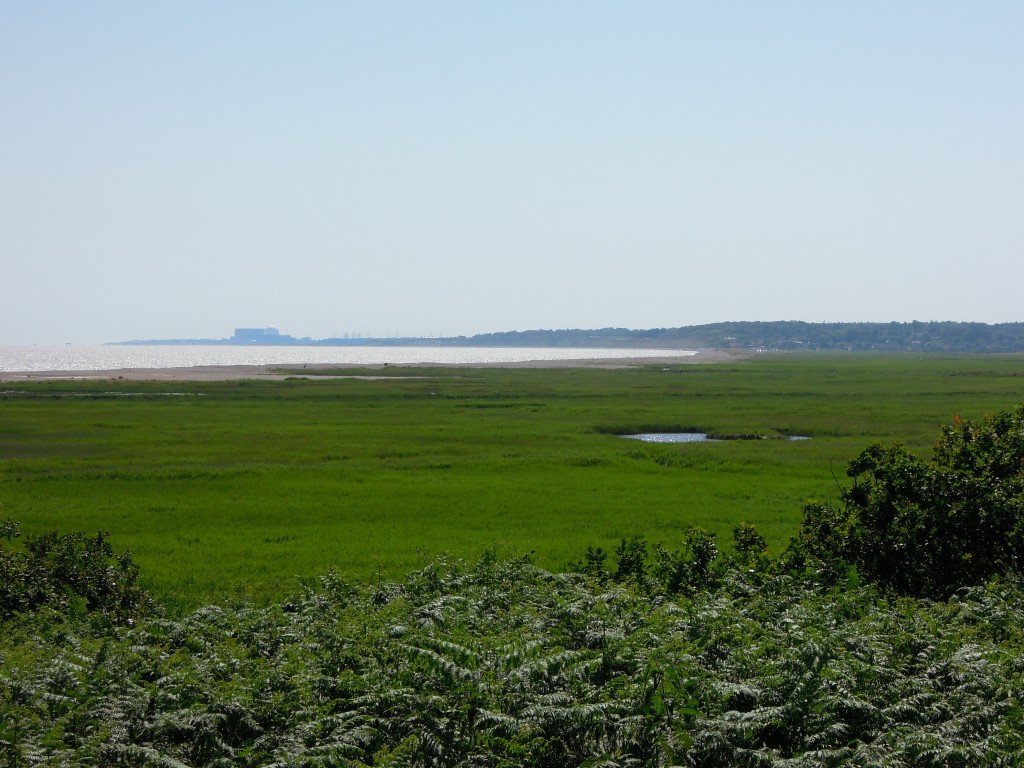
Looking south from Southwold. Sizewell nuclear power station on horizon. Bay in the middle used to contain Dunwich

View south from lovely Southwold. Sizewell nuclear power station is on the horizon. Note the sharks-mouth bite in the coast in between, where Dunwich used to be.

Geologically England’s east coast is part of the North Sea basin. In the Dunwich / Southwold area the bedrock is the Crag group – sands formed up to 5 million years ago in shallow seas. These are only weakly lithified – as much sand as sandstone – and so basically identical to the banks of sand found offshore today. The area is extremely flat, the photo above was taken at only 15m above sea-level but gives a clear view over 10s of kilometres horizontal distance.

This adds up to a landscape that was formed by the North Sea and which can be transformed by it. Seas move sediment around all the time. Tides, waves and especially storms can move massive quantities of sand and gravel to and fro, in often unpredictable patterns. What happened to Dunwich is geologically unremarkable. Over 1000 years a 10-20 metre thick layer of sediment was eaten away and moved elsewhere on the seabed. If this happened offshore, we’d barely notice, but 20 metres can be a long long way – vertically its the distance between a seaside pub and a sandy sea-bed. In human terms these places could hardly be further apart.

The first historical mention of erosion at Dunwich is found the in the Domesday book. Written in 1086, this survey ordered by William the Conqueror of his new kingdom, describes a town that had been important for over 500 years. As an important port and fishing village Dunwich owed a lot to the sea , it was a place where feudal dues could be “£4 and 8,000 herrings”.  Already it was clear that land was being lost:  “Then [there were] 2 carucates of land [one carucate equals 120 acres], [but] now one; the sea carried off the other.”

The sea started to ‘carry off’ a lot more land in the next 1000 years, at an average rate of a meter a year. This rate wasn’t steady. If storms, tides or winds pull together, sudden and dramatic changes can happen. In March 1286 a strip of land up to a hundred metres was washed away, destroying churches, houses and lives in the process. January 1328 saw high tides, storms  and further destruction.

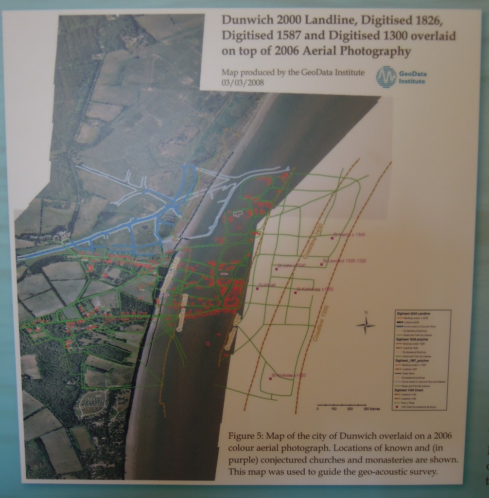
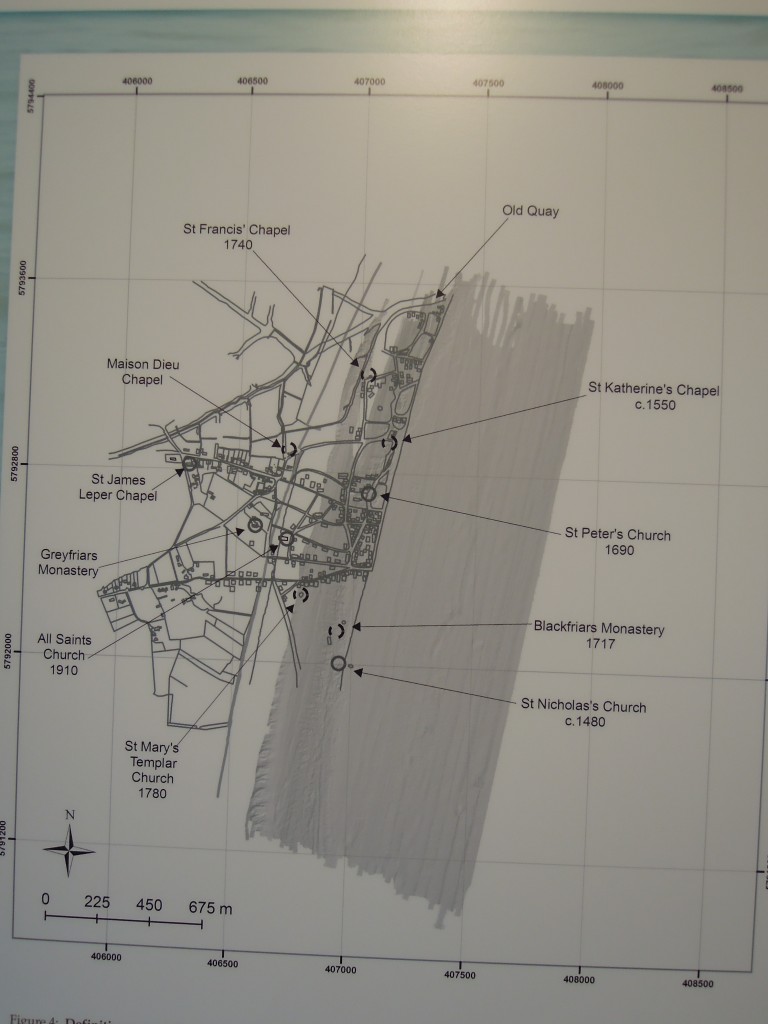
Map of Dunwich showing street-map of lost town

Map showing historic Dunwich and current coastline, from Dunwich museum. Note the far right line is only the 1300 coastline, Dunwich extended further right before this time.

Over this same time, movement of sediment above sea-level caused another serious blow to the town. Dunwich’s wealth and importance was based on its harbour, centred around a large area of calm water where the end of the river Dunwich was protected by a large shingle bank called “Kings Holme”. The river Blyth, that passes between Southwold and Walberswick also sat behind the shingle bank, which meant it reached the sea near Dunwich. Ships from Walberswick therefore had to pay tolls to Dunwich for the right to reach the sea. The two communities did not get on.

In 1250 Kings Holme extended south so as to completely cover the harbour mouth at Dunwich. The rivers found a new exit to the sea near Walberswick, which would mean Dunwich ships paying tolls to Walberswick. Unwilling to accept this change in fortune, the people of Dunwich dug a channel to the sea through their town and forced the closure of the Walberswick gap, creating much ill-feeling. The storms of 1328 finally blocked the Dunwich channel. Since then the low land behind Kings Holme has silted up and it is now ‘marsh’ filled with reed beds. The river Dunwich still reaches the sea at Walberswick, running north parallel to the coast for 5 kilometres.

view of marsh looking towards Dunwich

view of marsh behind Kings Holme, looking towards Dunwich

The events of 1328 saw the beginning of the end for Dunwich. Slow decline followed as people left and the sea kept nibbling away.

Dunwich map from Dunwich museum

Map showing later stages of Dunwich’s decay, from Dunwich museum

As we get nearer to the present time, the detail of Dunwich’s destruction becomes clearer. With the advent of photography, we can move from maps to pictures.

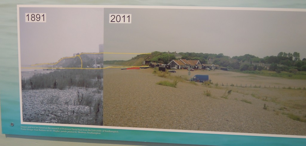
photo-mosaic showing erosion at Dunwich, from Southwold museum

photo-mosaic showing erosion at Dunwich, from Southwold museum

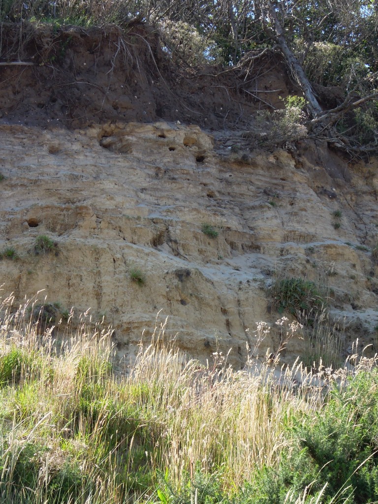
Dunwich today is an odd place. The beach is steep shingle, with some miserable looking cliffs made of soft sandstone.

cliffs at Dunwich

Its a worn-down stump of a town, but is enlivened by its past. The museum is excellent and well worth a visit. The area is of great archaeological and historical interest, with groups studying the remains on the sea-bed and other sites discussing the history. One bonkers idea I quite like (which will never happen) is to stick metal poles in the sea-bed, to create a sculpture above the sea showing where the churches once stood.

Today Southwold is the clear winner in the battle of the towns. It has a pier, a lighthouse, a brewery and a sandy beach surrounded by beach-huts. Once described as being like “the 1950s, but with olives” it combines timeless charm with modern gastronomy. Affluent urbanites (like me) come to enjoy the sea-side experience, complete with local pork pies and beer.

Southwold even beats Dunwich for history, as its mediaeval church remains. As a relative backwater for 600 years, Suffolk churches contain many 14th and 15th century features, like painted rood screens covered in colourful pictures of saints. In most of England these Roman Catholic features have been completely removed during the last 500 years of Protestantism. In Suffolk they were (literally) defaced by Protestant reformers in the 16th and 17th centuries as being ‘idolatrous’, but apart from these rough chisel marks they remain untouched, a glimpse of a former world.

sea at Dunwich

The hungry sea

I love visiting the Suffolk coast, but I wouldn’t buy a house there. Modern studies of coastal dynamics suggest that while Dunwich and other areas will continue to be eaten away, Southwold and the nuclear power stations at Sizewell are safe, for now at least.

These studies work on an engineering timescale. Even if they have fully factored in the impact of increased sea-level and more intense storms that we expect a warmer future to hold, they still only deal with time-scales of decades. To a geologist, places like Dunwich are a reminder of the small scale of human activity. Sea levels will change, sediment will move, coasts will shift. Whether a town benefits or suffers from this is out of our control, as the people of Dunwich learnt to their cost.

Cycling in the Pennines – 300 million years ago

The north of England is dominated by rocks of Carboniferous age, which give it a distinctive scenery and history, where local coal fuelled the world’s first industrial landscape.

The geology is extremely well known, because of the importance of the coal deposits, but also because of the continuing excellence of the British Geological Survey. A recent paper shows how their deep knowledge allows them to identify and quantify cycles of sedimentation, some of which are less than 100,000 years in duration (a geological eye-blink).

Carboniferous shale, Goyt's Moss

Carboniferous shale, Goyt’s Moss

Spotting the cycles

In an earlier post I’ve written about the rock types found in this area, the Pennine Basin of northern England, so here I’ll cover the broad geological context only.

The early Carboniferous in England was a time of extensive rifting, caused by plate tectonic goings-on further south. This created deep ‘gulfs’ in the grabens and shallow platforms between (horsts and grabens if you’re feeling German). All sedimentation was marine, mud in the gulfs and limestone on the platforms. By the mid-Carboniferous the extension had finished, but the thermal disruption it caused remained, meaning that cooling of the crust caused slow but constant subsidence through the rest of the Carboniferous. The mid to late Carboniferous (Namurian and Westphalian, in local terms) was dominated by shallow water,  mostly non-marine sedimentation. A time of rivers, deltas and coal swamps, all close to sea level.

Its long been noticed that they are regular sequences within these rocks. Coal deposits occur regularly and can be correlated from pit to pit for 10s of kilometres. In a similar way ‘marine bands’, thin layers of shale containing marine fossils, are seen again and again. These marine bands contain goniatite fossils (older relatives of ammonites) which evolve rapidly and can also be correlated from place to place. Often the marine bands are succeeded by coarsening-upwards sequences that move into non-marine rocks – in turn topped by another marine band.

As recently as the 1980s this regularity was explained rather feebly in terms of ‘avulsion of deltas’ or some such.  Even to this spotty teenager, it wasn’t a convincing story. When sequence stratigraphic concepts arrived soon after, they were a natural fit, particularly when marine bands were correlated across different basins in Europe, showing that the cause couldn’t be local.

There are extensive Carboniferous glacial deposits in many parts of the world. The idea that the waxing and waning of polar ice-caps has a major influence on sedimentary patterns across the world is now common place and it fits these rocks well. Melting of polar ice will cause flooding globally, putting marine mud on top of areas previously above sea-level – this was as true for the Carboniferous as it may be for the Anthropocene.

'Sough' a drainage tunnel from shallow coal mining, Goyt's Moss

Carboniferous sandstone. Note the ‘sough’ – a drainage tunnel from shallow coal mining, Goyt’s Moss

Measuring the cycles

In Nature and timing of Late Mississippian to Mid Pennsylvanian glacio-eustatic  sea-level changes of the Pennine Basin, UK Colin Waters and Daniel Condon of the British Geological Survey take a massive data set and use it to quantify how long these cycles of sedimentation took.

Sequence stratigraphy emphasises the identification of significant surfaces that correspond to significant changes in sea level. Sequence boundaries are associated with sea-level falls and parasequence boundaries with sea-level maxima. Waters and Condon link Pennine rocks to sequence stratigraphy: “The marine bands occur at the base of marine to non-marine upward-coarsening cycles, equating to the parasequence of the Exxon sequence-stratigraphic model“; marine bands are maximum flooding surfaces. They identify 47 of these and use current day areal extent to infer which ones represent bigger sea-level rises. Minor unconformities, where valleys have been cut into older sediments, can be linked to sequence boundaries – if sea-level falls then river channels will deepen. These palaeo-valleys are rather subtle structures, but they have been mapped out across northern England.

Waters and Condon start by looking at distinctive layers of mud with great names, one is a bentonite, the other a tonstein. These are layers of volcanic ash and they contain primary zircons, volcanic grains that lock in the age of the eruption. Analysis of these grains allows them to calculate accurate dates for when the layers were deposited.

These dates are not just of local interest. Carboniferous rocks in Europe are correlated on the basis of marine fossils, such as goniatites in marine bands. From this, geologists create a biostratigraphy that allows you to know the age of a rock from the fossils within it. The ideal is a global biostratigraphy, but the nature of the fossils found in Carboniferous rocks makes this difficult.

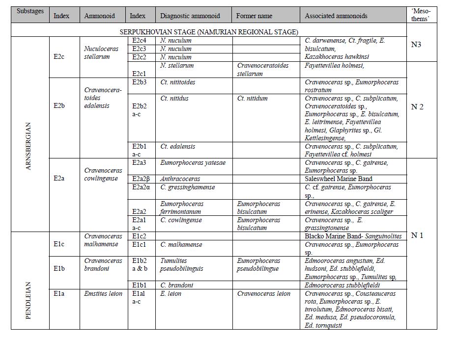
Carboniferous biostratigraphic column from Waters and Condon

This section of the European biostratigraphy shows how fossils track the passage of time. Note there is no age on there. The rate at which new fossil species arise, or sediments are deposited, is not known. Dating a volcanic ash layer, which is found in a particular position in the biostratigraphy, allows you to put absolute dates against the table above, to start to build up a chronostratigraphy. There are other ways of linking the cycles in the sediments to absolute ages, as we shall see…

Understanding ancient cycles

Interpreting the patterns of rocks in terms of sequence stratigraphy provides further constraints on timing. Patterns of sea-level change are linked to changes in orbital obliquity (wobbles in the spinning of the earth) called Milankovitch cycles.  For the Carboniferous we expect long cycles of 413,000 years and shorter ones of 112,000 years.

Putting all these constraints together and using their massive data set, Condon and Waters build up a picture of how distant ice-caps controlled English rocks.

Starting with the big picture, they posit four major ‘ice ages’ for the period in question, each lasting approximately 1 million years.  The interglacial periods are associated with no paleo-valleys and few marine bands – sea level is fairly stable.

For the intervening rocks, they see two patterns in the marine bands. At times they follow a 400,000 year cycle, at others 111,000 or 150,000 years. The patterns of rocks in England are controlled by ancient wobbles in the earth’s rotation. This is an extraordinary thing. The link between the two is the ebb and flow of ice-caps half-way across world – in Geology sometimes it feels like absolutely everything is inter-connected.

For rare cases where multiple marine bands contain the same fossils, Condon and Waters infer these must be related to even shorter sub 100,000 year Milankovitch cycles. This is less well-proven as it is based on the assumption that the rate of change of goniatite species is relatively constant.

Although focussed on a small region, this research is interesting in many ways. Firstly it shows how stratigraphers use multiple lines of evidence to build up a picture of earth history. Condon and Waters put dates on the duration of the Ice Ages which are of use when studying rocks of this age anywhere on earth. Also it gives a taste of how aggregating data gives new insights; to map out the marine bands they drew on countless individual data points collected by the BGS over many years.

The work of stratigraphers is not glamorous but it is important. To build up a history of the earth’s history, knowing when things happened is vital.

References, other information

 
ResearchBlogging.orgColin N. Waters, & Daniel J. Condon (2012). Nature and timing of Late Mississippian to Mid-Pennsylvanian glacio-eustatic sea-level changes of the Pennine Basin, UK Journal of the Geological Society DOI: 10.1144/​0016-76492011-047

A late draft of this paper is available to you all via an open access portal.

Courtesy of the BGS, here’s a view of the geology of northern England.