Charnwood forest – misty traces of ancient landscapes

Precambrian rocks are fairly uncommon in England so I jumped at the chance to visit some with the friendly folk of Reading Geological Society. They were found in Charnwood Forest.

The pattern of rocks in England and Wales is broadly one of younging to the south east. A journey from London to Anglesey takes you backwards through time from the ‘Tertiary’ to the PreCambrian visting all the intervening geological periods. Charnwood Forest, near Leicester in the English Midlands is a reminder that this is a simplification. Only 50 miles to the north, in the Peak District, there are many kilometres thickness of Carboniferous sediments. Older rocks are far below. In Charnwood however, there are no Carboniferous rocks – later Triassic sediments sit directly on top of Precambrian rocks.

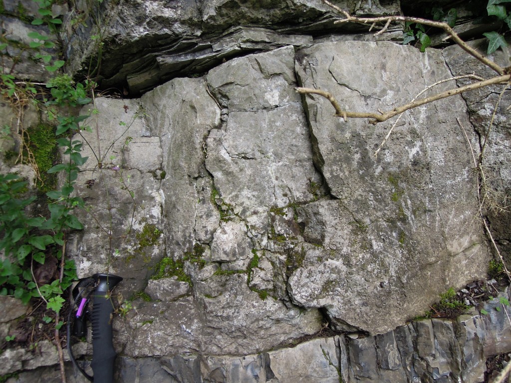
Precambrian (Proterozoic) / Triassic unconformity

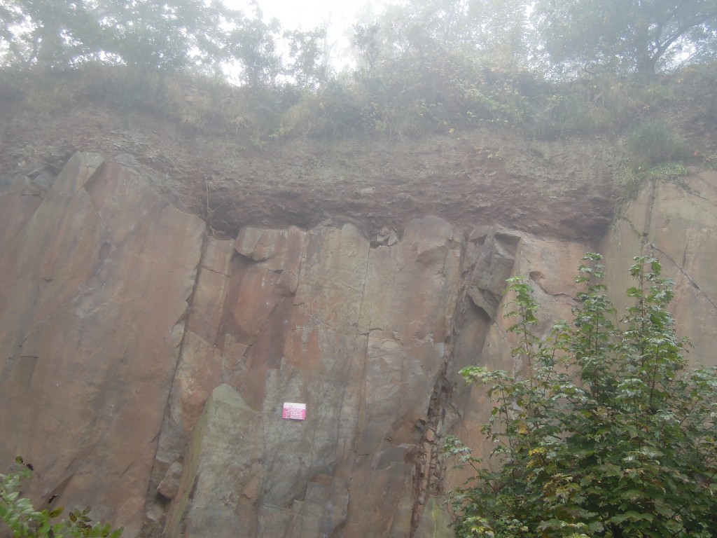
I haven’t gone all Instagram on you – it was a misty morning at Morley Quarry. The smooth rock face at the bottom is made of Proterozoic (latest Precambrian) volcanic sediments and the reddish lumpy layer is of Triassic age. The line of unconformity is a gap of  over 300 million years.

On a geological map, the older rocks appear as little blobs within a red sea of Triassic sediments. This is a sign that an ancient landscape is preserved in this area. We often think of unconformities as planar structures, but this one formed on land and preserves the bumps and jiggles of an ancient landscape. Later folds and faults complicate matters, but the pattern of rocks now is still affected by the ancient landscape.

For example the highest point in the area, Beacon Hill is made up of Proterozoic sediments. It was a hill in Triassic times as well – younger sediments sit in valleys below that are both ancient and modern. There are signs of the Carboniferous landscape here as well. As you might guess from the name, in nearby Coalville there are substantial Carboniferous deposits, sitting between the Proterozoic and the Triassic.  The Charnwood forest area during the Carboniferous was likely land close by a water-filled basin filling up with sediment (and coal). All these traces allow us to peer through the mists of time at these ancient landscapes.

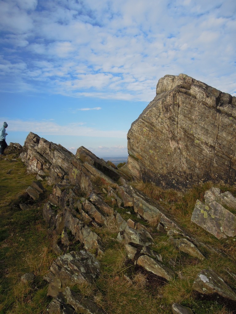
To the rocks. Beacon Hill contains good outcrops of the old fine-grained volcanic rocks.

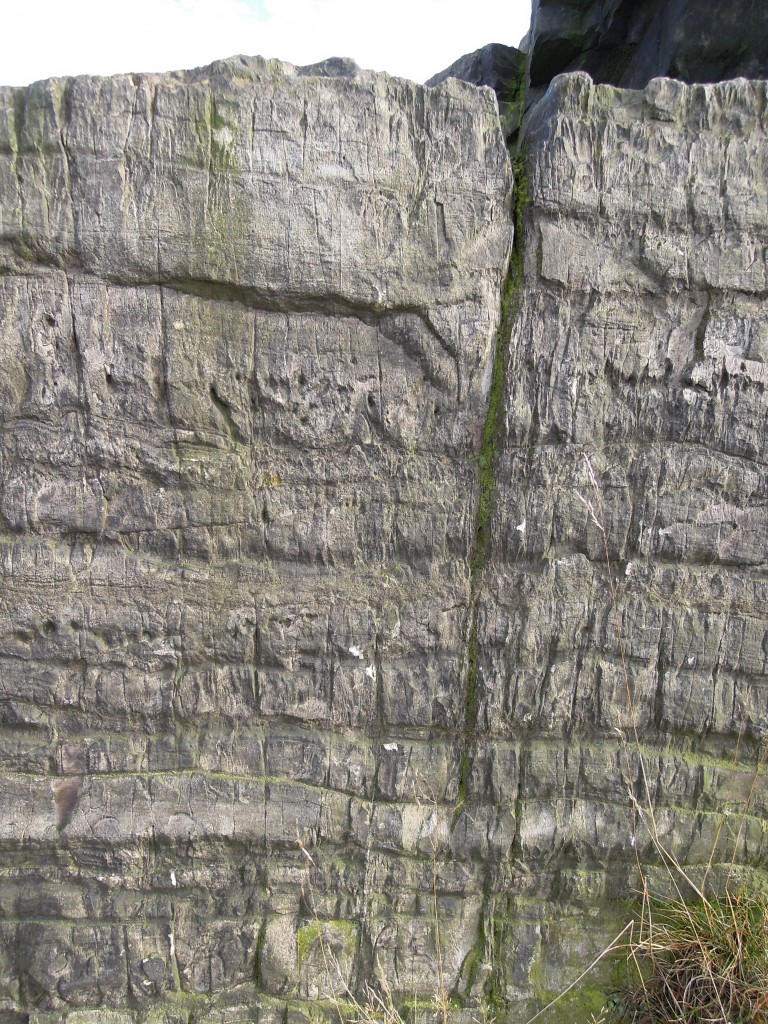
A typical outcrop shows fine beds. The rock is now tilted and hardened by subsequent events. It shows a vertical cleavage as well, formed during the final closure of Iapetus.

The layering is mostly even, but does contain small folds, as you see below.

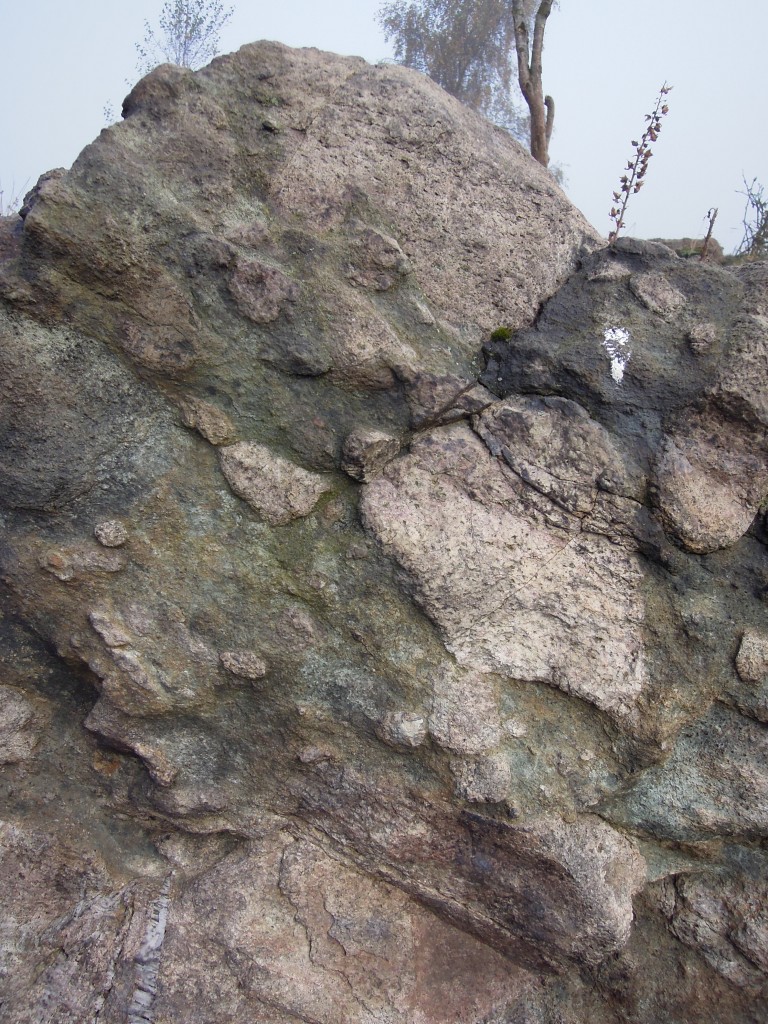
We also visited Charnwood lodge, which contains coarser volcanic sediments, deposited closer to the site of eruption.

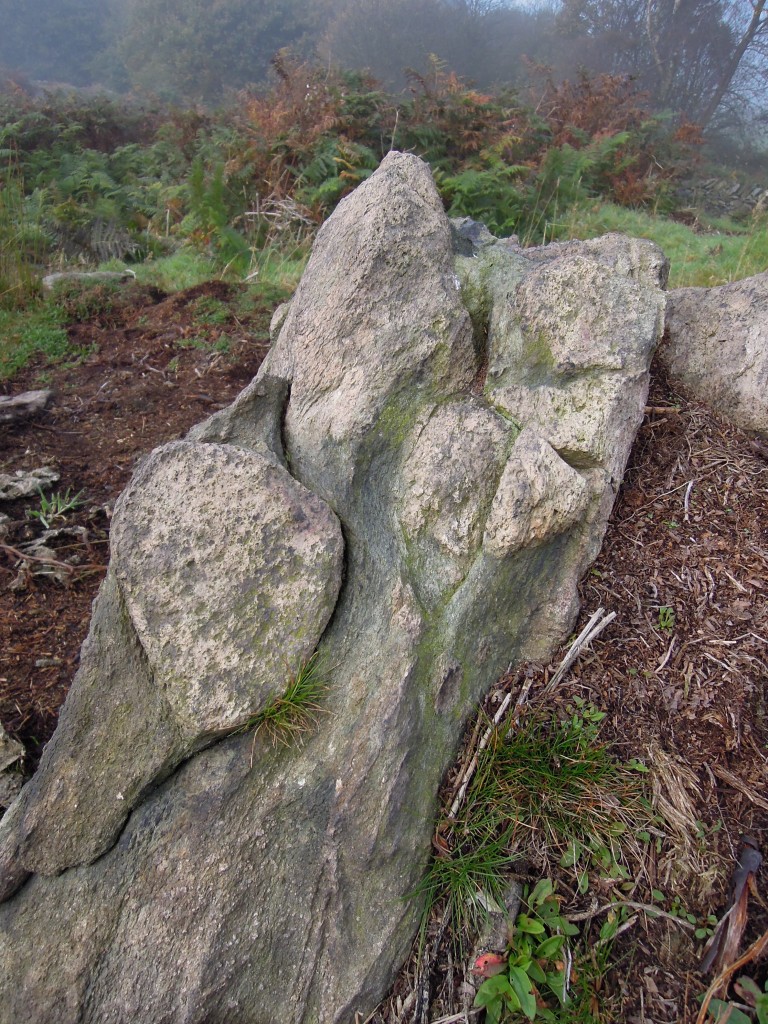
Originally described as volcanic bombs, the fragments here are angular and deposited by debris flows.

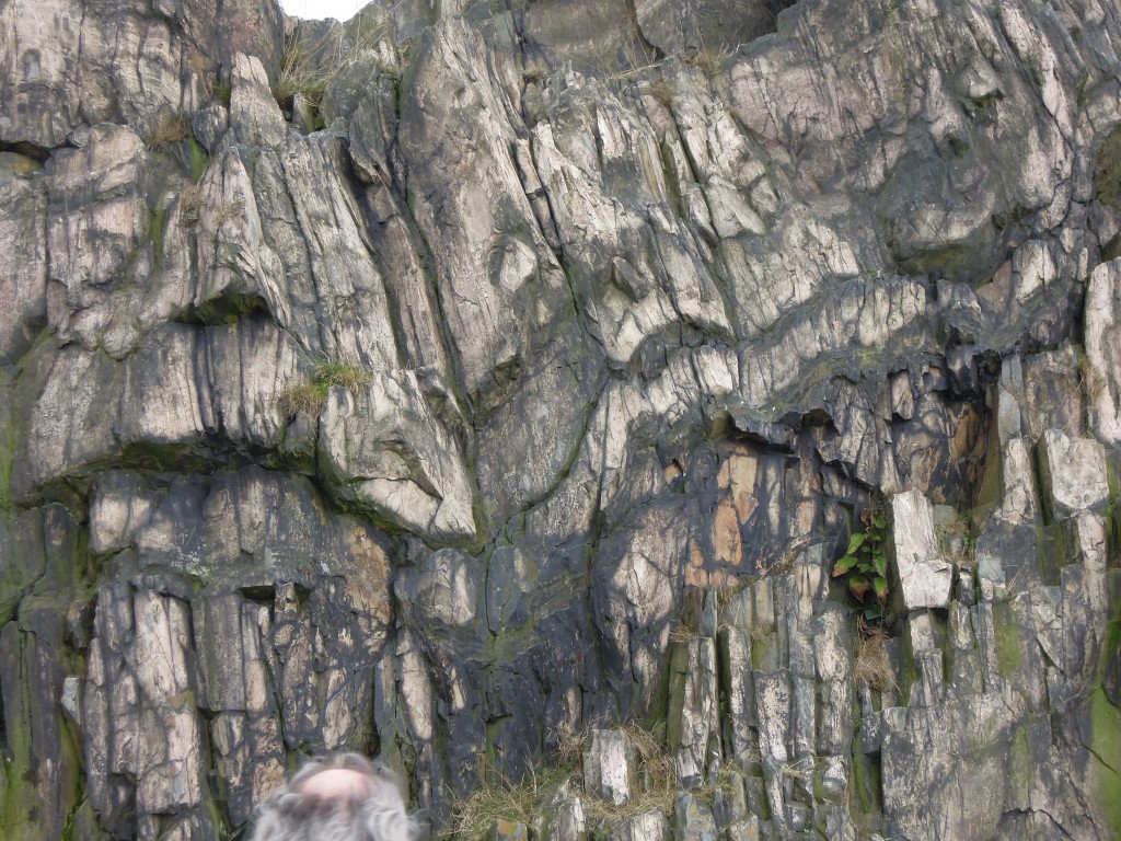
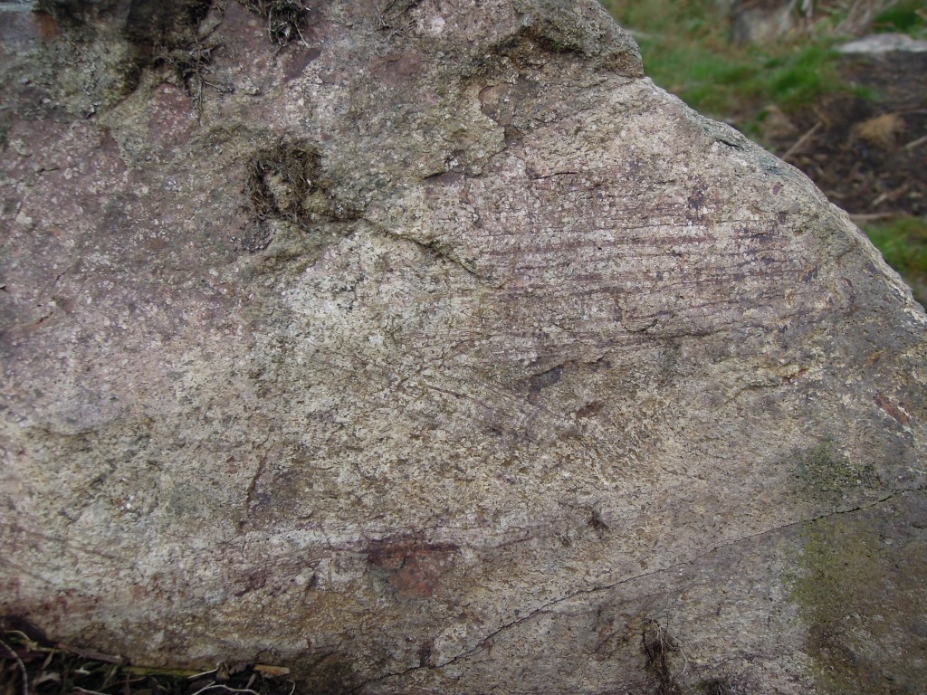
Blocks are of andesitic composition, here with some trace of flow banding.

The rocks contain a pronounced cleavage, as you see above.

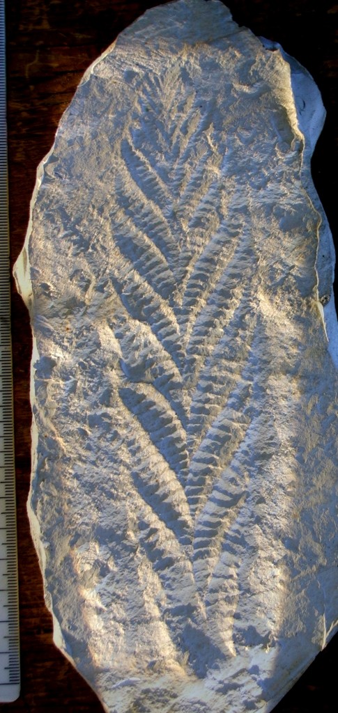
Cast of the holotype of Charnia masoni.

Cast of the holotype of Charnia masoni, courtesy of Smith609 at en.wikipedia

Although they are Precambrian, some rocks in Charnwood Forest contain fossils, subtle outlines of soft-bodied animals that look like plants. In 1956 a local schoolgirl called Tina Negus found the fossil pictured above. Sadly when she spoke to her school geography teacher, he followed ‘common knowledge’ and flatly denied the possibility that she had found a fossil in these ancient rocks, so nothing came of her discovery. A year later, Roger Mason a local schoolboy, found the same structure. Luckily he spoke to Trevor Ford, a geologist, who recognised it for what it was, a fossil, very rare and similar to others found in Ediacara in Australia. He wrote it up as Charnia masoni. Roger Mason went on to be a professor of Geology, with a focus on metamorphic rocks.

There is a moral to this story – truth in Geology resides in the rocks, not in books.

Sherlock Holmes and the case of the detrital zircon

The October copy of the journal Geology contains a paper that made me think of Sherlock Holmes. That doesn’t happen very often. One of the fictional detective’s many skills was the ability to get important insights from the sediment found on shoes. The paper “Detrital zircon record and tectonic setting” looks at ancient sediments and proposes a new way of working out how they formed.

Holmes’ methods were based on linking a sediment sample to its source region – recognise sediment as characteristic of a particular area and you know a suspect with some on their shoe has been there. Holmes (and real forensic geologists) rely on the fact that they can visit the place where the sediment came from. Cawood, Hawkesworth and Dhuime on the other hand study ancient sedimentary basins where the source regions are unknown, either eroded away or removed by tectonic rearrangements. How to get insight from these sediments? A real ‘three pipe problem‘ for sure.

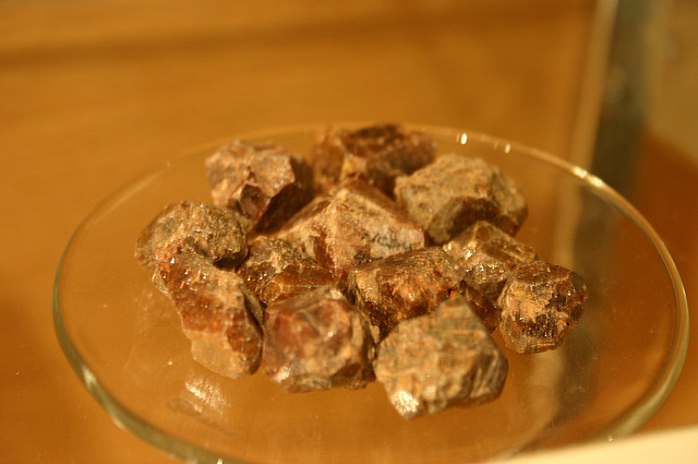
Our authors focus on a particular type of mineral grain, common in sedimentary basins: zircon. Zircon ( ZrSiO4) is beloved by geologists as it contain significant amounts of Uranium which is tightly bound inside small crystals. This makes them perfect for radiometric dating – measuring the ratios of isotopes to infer how long the mineral has existed for. If a zircon is in a granite intrusion, the age of the zircon is most likely the age of the intrusion. Measuring the age of zircon in a sediment doesn’t give you the age of the sediment – being eroded and washed into a sedimentary basin doesn’t reset the isotopic clock.  But measure the age of many zircons in a sediment and you start getting insights into the type of rocks that were eroded to form the sediment – the source region.

Sedimentary basins have been classified into different types, based on their tectonic setting. Convergent basins are found near subduction zones and associated volcanic arcs. Collisional basins, otherwise known as foreland basins, form in the space formed where crust is pushed down by the weight of thickened crust. Finally extensional basins form where crust is stretched, either in rift basins or on the edge of oceans. Our authors’ argument is that each type of basin will have a distinctive pattern of ages preserved in their zircons.

Convergent basins, forming near to volcanic arcs are characterised by a large proportion of very recent zircon ages. Nearby eroding rocks may well have been created by recent volcanism. Volcanic ash may even pop zircon grains directly into the sediment. Collisional basins have much fewer grains of recent ages – there are no volcanoes. However their sediment comes from the nearby mountain range made up of relatively recent metamorphic or igneous rocks. Zircons eroded off the high Himalayas that end up in the Ganges basin are 25 million years old. Extensional basins are far from any contemporary or recent source of zircons. Think of sediment forming off the East cost of North America. It will contains zircons formed during a  whole range of orogenies and volcanic episodes, some very old, none very young.

For a couple of decades now scientists have had machines capable of quickly measuring zircon ages so there is a good data set. Our authors scoured this and found evidence to support their thesis. Taking ages of zircons, and subtracting the age of the basin, they plot cumulative ages. Convergent basins do indeed mostly contain very young zircons and collisional relatively young. Extensional basins show a wider variation, and are much more likely to contain older zircons.

Appropriately they try to solve some mysteries. They take data from Precambrian basins where the tectonic setting is a matter of debate and plot it up.

Since life is not a detective novel, the possibility remains that this technique will yield false conclusions. Their identification of the zircon age pattern from the Proterozoic  Moine basin of Scotland as syncollisional puts them in agreement with workers at the British Geological Survey who came to the same conclusion based on a whole range of studies. For this case, at least, the evidence is looking pretty persuasive.

Picture of Zircon crystals from Ryan Somma on Flickr under Creative Commons.
 

Cawood, P., Hawkesworth, C., & Dhuime, B. (2012). Detrital zircon record and tectonic setting Geology, 40 (10), 875-878 DOI: 10.1130/G32945.1

Folded sediments from the Welsh coast

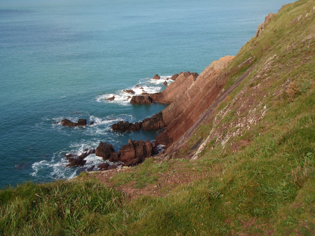
My life is currently in a phase that isn’t compatible with many trips to the field. No complaints, but this does mean a lack of opportunities to take geological photos. So when my mum told returned from a geological field trip to Pembrokeshire in Wales, I was soon pestering for a copy of her pictures. I was not disappointed, as you shall soon see.

Sticking out of the southwestern corner of Wales, Pembrokeshire contains a range of rocks, from Precambrian to Carboniferous. The above photo is of Devonian rocks of the ‘Old Red Sandstone’. These were deposited on the bones of the Caledonian orogeny in a continental setting (hence the red colour).

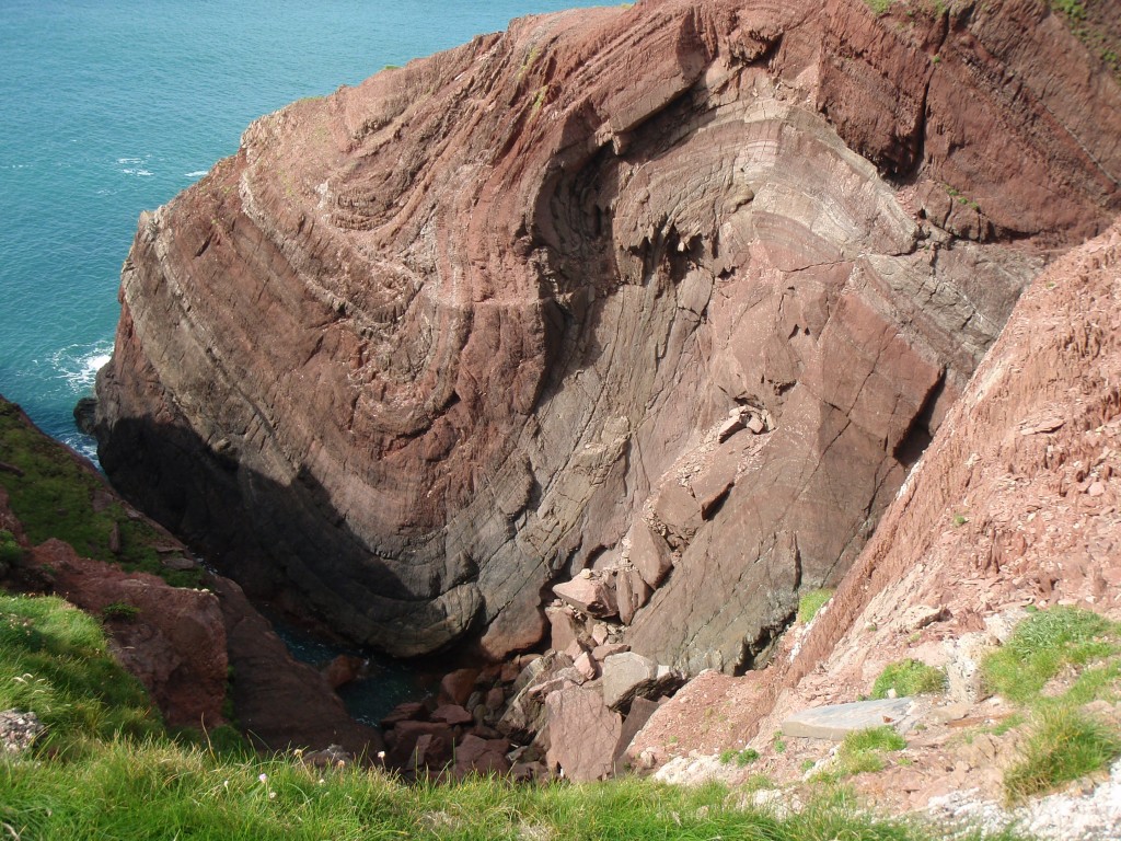
These sandstones started off as flat layers sitting on top of older folded sediments. Geology being complex, they didn’t stay flat for too long. The Variscan orogeny, which along with the American Alleghenian orogeny helped form the supercontinent of Pangea, caused folding of sediments across South Wales.

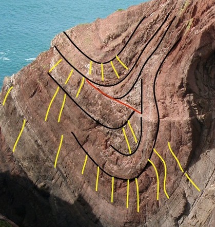
Here’s another example of the folding, from St Ann’s Head (click on it for a big view).

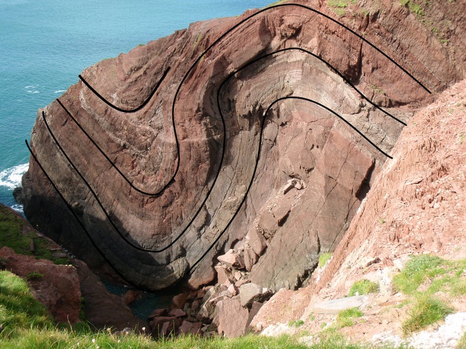
Let’s bring out some of the structure.

Note how the lines are of different shapes. Think about the folding process. These rocks are barely metamorphosed, they are in essences still layers of sandstone. As they are folded they’d much rather not change shape or thickness. Rocks like this often deform by a mechanism called flexural slip, where the layers slide past each other.

From a geometrical point of view, how do these different shaped folds sit alongside each other. Well, they  don’t – at some point the layers need to fracture.

Here’s a more detailed view of the left-hand fold.

In the core of the fold, the layers just don’t match up. I’ve put a red line at the most obvious mismatch – this is likely the location of a minor fault.

In yellow, I’ve highlighted some of the axial-planar cleavage visible in the rocks. Cleavage is where rocks have planes of weakness in them, as a result of deformation. They are a result of alignment or dissolution of minerals as a result of the deformation of the rock. Note how the angle of the cleavage relates to the fold, not the layers. In the core of the old (the axis) they are perpendicular to the bedding and on the limbs of the fold they are at an angle. Some of the lines are curvy, which is cleavage refraction, where the angle varies depending on the physical properties of the rock.

The cleavage, the folding and the minor faulting all formed at the same time – different ways the rock tried to deal with being squashed.

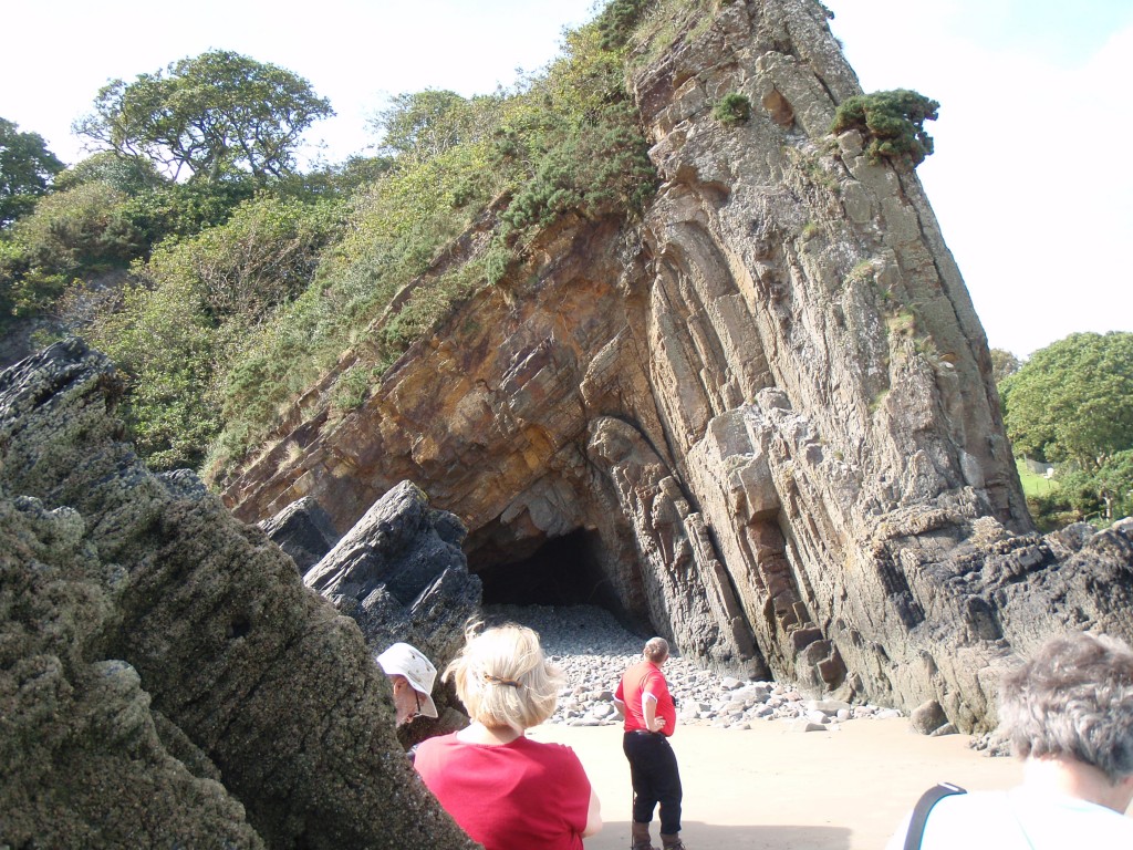
Here’s another Pembrokeshire fold, here in Carboniferous sediments. The style of the fold is completely different – much more angular, with deformation concentrated in the hinge of the fold. The limbs have been rotated, but may otherwise be little deformed.

Ecton – copper, limestone and folds

England’s Peak District is made almost entirely from Carboniferous sediments, in a broad anticline. On the outside edges, mid to late Carboniferous rocks are dominated by sandstone, with subsidiary mudstone and coal. The core is an area known as the White Peak where lower Carboniferous limestones form a gentle landscape. It’s a working landscape though, with a long history of mining and quarrying, as we shall see.

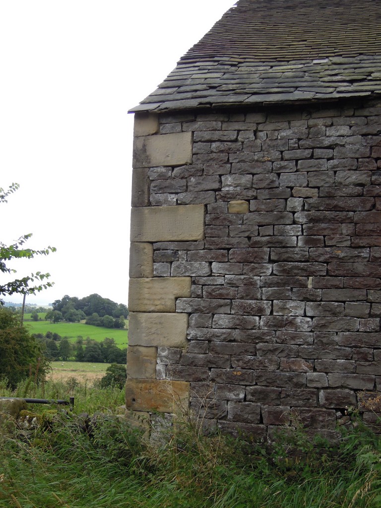
Farm building showing sandstone corners and limestone fill. near Ecton

Farm building showing sandstone corners and limestone fill.

While the limestone was being deposited, most of Derbyshire was a shallow shelf area. The crust was being gently pulled apart and fractured, so the shelf area was surrounded by deeper basins.

Just like the Bahamas

These seas were at tropical latitudes and, on the shelf, relatively free of terrestrial sediment. These are perfect conditions for making limestone, as numerous organisms create calcium carbonate structures that build up into rock.

The typical fossil assemblage you find in these rocks includes rudose corals, brachiopods and crinoids (ancient sea-lilies).  Fossil reefs abound, made of limestones packed with (in fact made entirely from) ancient life..

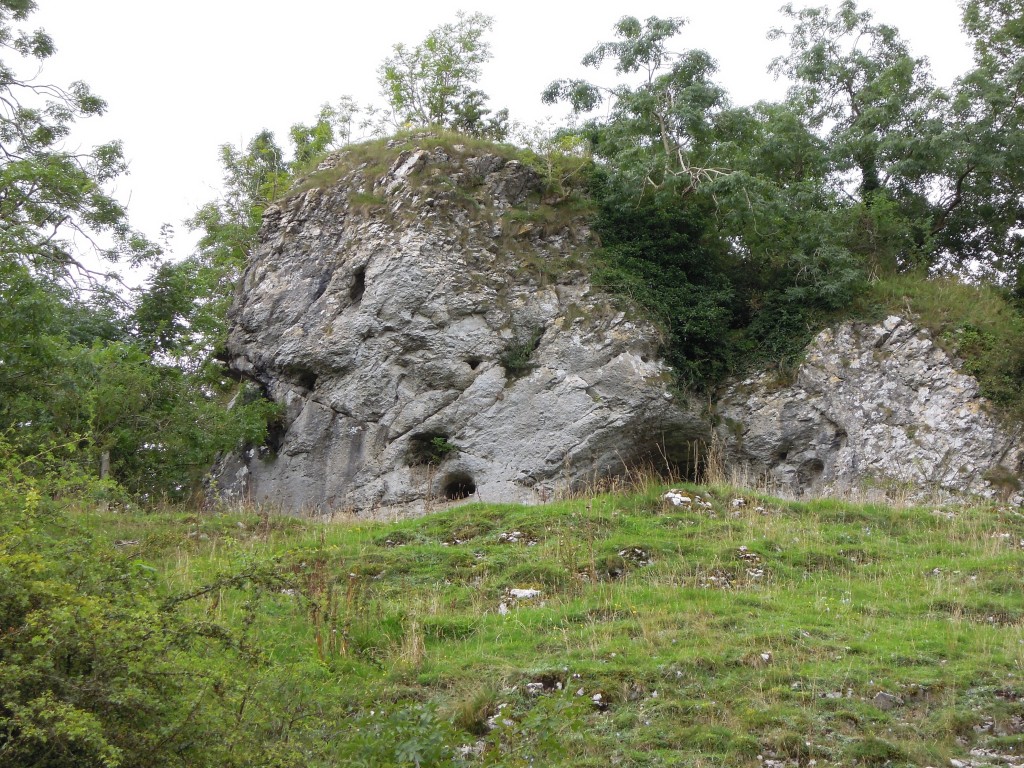
Massive 'reef' limestone, Manifold valley

Massive ‘reef’ limestone, Manifold valley.

Reef limestones are typically ‘massive’ which in a geological context means lacking obvious bedding planes or other structures. The above photo shows a cave, another distinctive feature of limestone areas. This particular cave has been linked to a ‘green chapel’ that features in a famous medieval story.

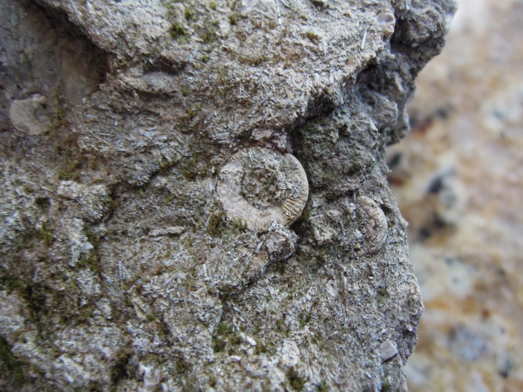
Crinoid ossicle

Crinoid ossicle in grey bioclastic limestone

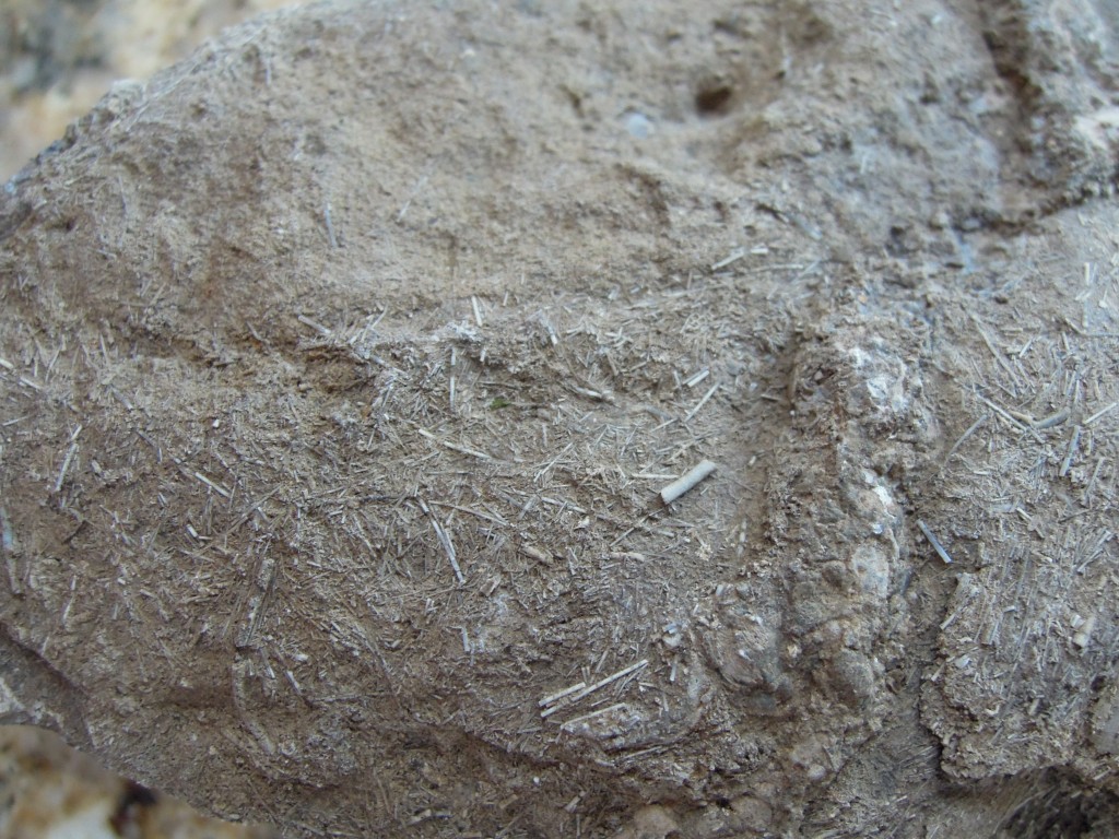
A closer look at the fossils. The round discs is a crinoid ossicle, plates of calcium carbonate that joined up to make the stems. The rock is made up almost entirely of bits of life, either plants or mostly animals, hence the technical term ‘bioclastic’. The numerous little pin-shaped pieces in this sample are (as best as I can tell) brachiopod spines (if you know better, speak up!).

Bioclastic limestone with ?brachiopod spines

Bioclastic limestone with ?brachiopod spines

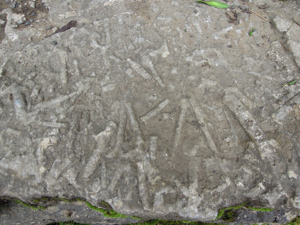
Slab of limestone showing crinoid debris Wooton Mill.

Slab of limestone showing crinoid debris Wooton Mill.

Here’s a worn slab of reef limestone, showing abundant crinoid stems, still in one piece.

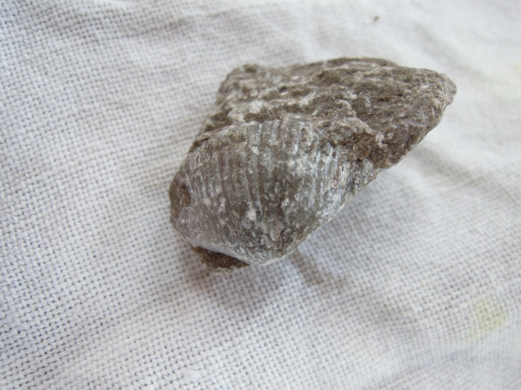
These pictures were taken on a recent trip to Derbyshire, where I didn’t spot a decent brachiopod. Conveniently just the other day I spotted one in the gravel of my drive. There are many massive quarries in the Derbyshire limestones and some of it ends up in as builder’s gravel.

Brachiopod in grey limestone

Brachiopod in grey limestone piece of gravel from my drive

Copper-bottomed

There is a long history of mining in the Peak District. There are many ore bodies, typically found in veins associated with faulting. Blue John, an beautiful banded form of fluorite was mined for ornamental purposes. Less glamorously, lead, zinc and copper have been mined since Roman times. The mineralisation was deposited by hot fluids that formed as the sediments became buried.

Around Ecton the mining was mainly for Copper. Ecton Copper Mines, were most active from early C17th until 1891. Peak production was 4000 tons in 1786. A major use of copper at this time was covering the bottom on ships in the Royal Navy. Sheets of copper (or zinc copper alloy) were used to protect the wooden ships from the attentions of marine life, particularly Teredo worms (‘shipworm’).  The Navy’s ships were cutting edge technology at the time, projecting British power across the globe. They were sometimes used for scientific work too, for example His Majesty’s Ship Beagle that carried Darwin on his famous voyage.

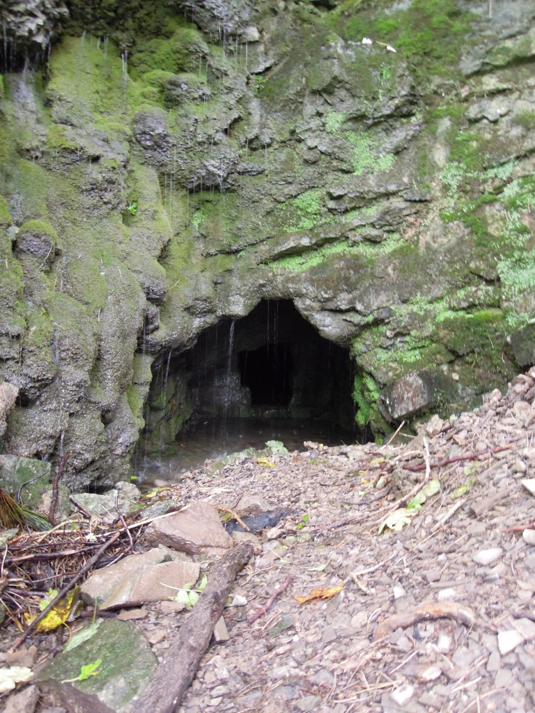
Traces of the mining remain. Found at the bottom of Ecton Hill this is mostly like a sough (pronounced “suff”) a channel to drain the mine shafts higher in the hill.

Evidence of mining, Ecton

Evidence of mining, Ecton

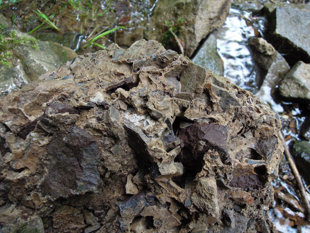
Ecton also contains this odd rock.

Lithified scree, Ecton

Lithified scree

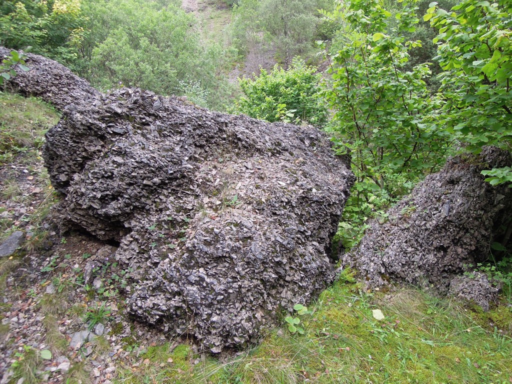
This is calcrete, an angular limestone cemented by groundwater CaCO3 during the Pleistocene. Basically its old scree that got stuck together.

large block of lithified screen, Ecton

large block of lithified screen, Ecton

There’s quite a lot of it.

Deep waters

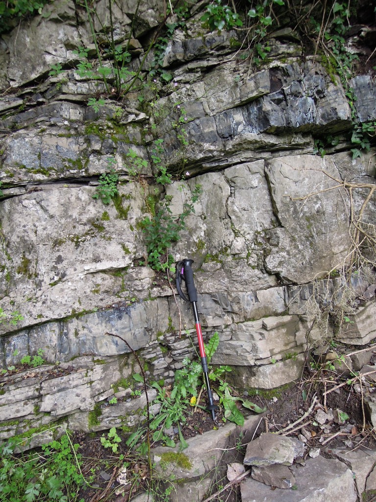
The Ecton limestone is a thinly bedded limestone, with minor shale layers. It represents deeper water sedimentation, very different from the shallow reef sediments. Equivalent rocks further from the shelf edge are simple mudstones. Further north they form the Upper Bowland Shale, which is a source rock for conventional Irish Sea gas-fields and a potential source of shale gas, extracted by the controversial process called fracking.

Here, very near a shelf, limestone dominates.

Ecton limestone

Ecton Limestone. Layers of mud and limestone, plus later chert bands

The shiny black beds are chert – silica layers that formed after deposition.  Here’s a single bed of limestone. It is ‘graded’, with coarse debris at the bottom and fine at the top and so likely deposited by a turbidity current. Some of the bits of dead animal forming in the shallow water on the shelf got carried into deeper water by a single major event.

Graded bed Ecton limestone

Single graded bed of Ecton limestone

Here’s a closer look at a coarse layer. The fine grained limestone has been partially replaced by chert, which makes the white fossils stand out nicely. There are various sections through crinoid ossicles, which here are completely broken up, as you would expect since they have been transported downhill from where they grew.

Chert band with fossils

Detail of chert band showing crinoid stems

Folding in Derbyshire limestones is rare. Apes Tor in Ecton is unusual in showing tight folds. This is most likely because they are layered and easier to fold compared with the nearby massive limestones. Sadly when I was there the outcrops were heavily vegetated. If you look at the next photo and immediately spot the anticline, you are probably a structural geologist.

Detail of folding Apes Tor, Ecton

Detail of folding Apes Tor, Ecton