Traces of glacial ice and water

There’s an immediacy to the study of the Quaternary (the last few million years) that is rather seductive. Most geology is (after John McPhee) studying ‘the former world’ but the Quaternary is close enough in time that it is still this world, capped by ice and full of familiar animals and human beings. We can study this period of time in tremendous detail using things – piles of sand, the pattern of the landscape, peat bogs – that are unlikely to be preserved in the geological record.

An outcrop of Irish gabbro tells us about conditions deep within the earth, but the mountain range, even the continent it formed in are all gone. The smooth shape of the outcrop and its covering of fine scratches were caused by the scraping of stones in ice, part of a massive icesheet that stretched across the British Isles. The ice is gone but it flowed over this hill, down that valley. On a chilly day it can feel like it only just left.

Stone moved by ice

One outcome of the great ferment of ideas in 19th Century Britain was the recognition that much of the northern British Isles were once covered by of thick sheet ice. One of the earliest recognised forms of evidence for these vanished ice sheets is found in the form of glacial erratics. These are pieces of rock, sometimes very large, dumped by the ice. The most useful sort come from a distinctive rock type, a granite intrusion perhaps, that allows you to know precisely where the erratic came from and so infer which way the ice was flowing. On the Yorkshire coast in England there are erratics from Norway1, showing that the ice flowed across what is now the North Sea.

Freshly dug glacial drift from Cheshire.

Freshly dug glacial drift from Cheshire.

Volumetrically the biggest record of glaciation is glacial drift. This is sediment that was moved and ground-up by the ice. It is a very jumbled, poorly-sorted sediment, with big blocks mixed up with sand and silt. If you find a sediment like this, you know there has been glaciation. This applies to ancient sediments just as much as recent ones.

Studying drift, people realised that things were quite complicated. A single place might have multiple layers of glacial drift separated by more normal sediments. They realised that term ‘Ice Age’ is a simplification; this was phenomena that pulsed. Outside of the Polar regions, the ice caps came and went many times, dancing in time with the stately precession of the earth’s axis.
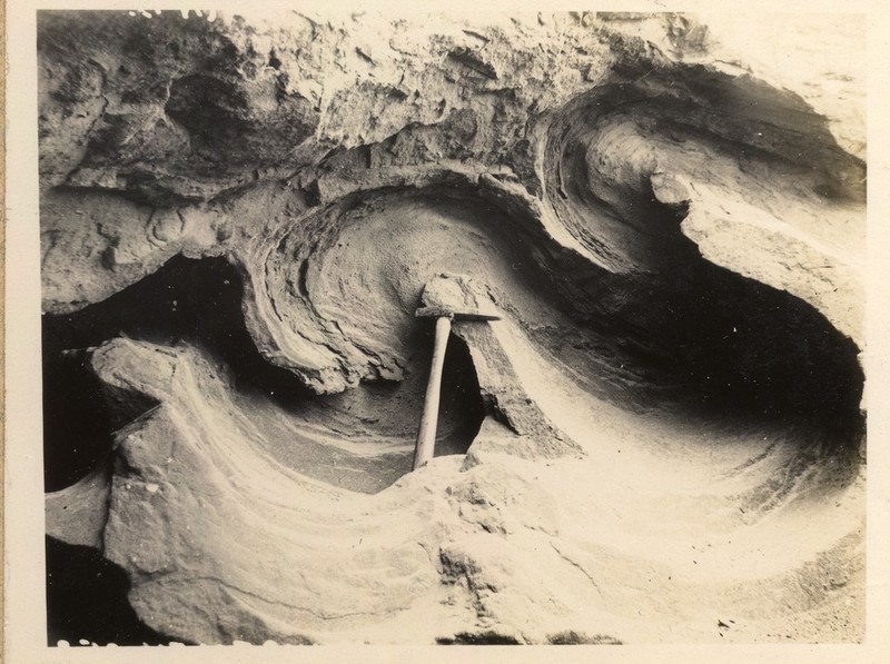
Isoclinal folding in glacial sand and clay. Photo from 1921 courtesy of British Geological Survey. P249721 http://geoscenic.bgs.ac.uk/asset-bank/action/viewAsset?id=78063&index=55&total=56&view=viewSearchItem

Isoclinal folding in glacial sand and clay. Photo from 1921 courtesy of British Geological Survey. P249721

Sometimes, soft drift gets pushed around by advancing ice. Sometimes this results in beautiful folds, other times it puts sediments containing marine shells deep inland. 2. For this reason, the presence of drift is fairly uninformative. To make firmer conclusions about the most recent advance of Ice, we must turn to more subtle features.

Fainter traces

Glacial sediments aren’t laid down in thin even layers, but in various ways, both elegant and ugly. Valley glaciers often have moraines: piles of sediment at the end or sides that fell out of the melting ice. The same principal applies to Ice Caps, such as covered most of Northern Europe and North America. Successive belts or ridges of moraines can record the retreat of an ice sheet.

Drumlins are piles of glacial sediment that have been moulded by ice flow. They are very beautiful features, with an aerodynamic shape. They can look like the back of a huge whale, somehow rising out of the ground. Often found grouped together, their shape indicates the direction in which the ice was moving when last it was flowing.
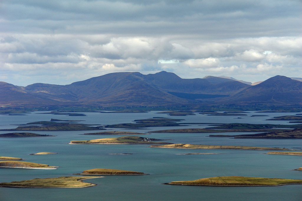
A pod of Drumlins swimming in Clew Bay, Ireland. Photo from chrispd1975 on Flickr under CC. http://www.flickr.com/photos/8289745@N03/2384936935/sizes/l/

A pod of Drumlins swimming in Clew Bay, Ireland. Photo from chrispd1975 on Flickr under CC.

Glacial striations and polishing are common features found on land that was once under the ice. Stones in the ice slowly scratched their way across bed-rock. Asymmetric features known as roche moutonnée tell us the direction of ice flow.
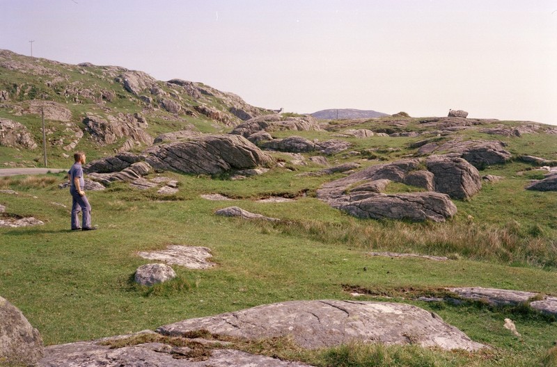
A flock of Scottish roche moutonee (ice flowing to the right). Image from British Geological SurveyP008317 http://geoscenic.bgs.ac.uk/asset-bank/action/viewAsset?id=7032&index=14&total=182&view=viewSearchItem&movedBr=null

A flock of Scottish roche moutonee (ice flowed to the right). Image from British Geological Survey P008317

A common experience when walking one of the bigger mountains in Britain is to start in a valley filled with glacial till, perhaps with some moraine visible. Next a climb up a ridge shows lots of polished rock. Finally, the summit pyramid is covered in a great thickness of loose stone3. Between this summit block field and the scraped stone below is the trim line that captures the top of glacial erosion. Map out trim lines on multiple mountains and it tells you something about the vertical extent of the ice4.
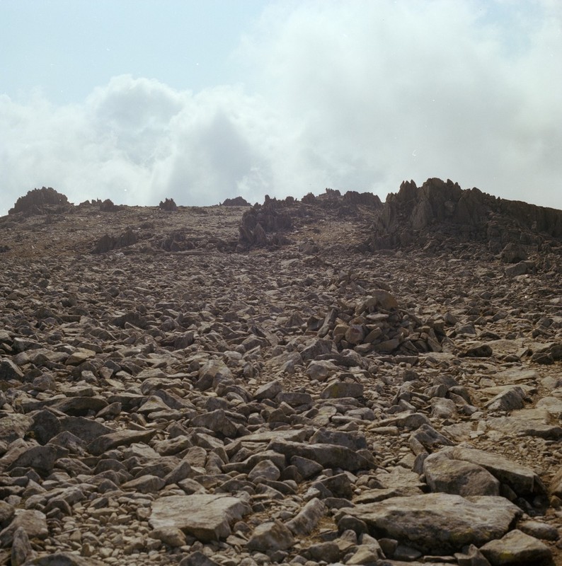
Summit block field of Glyder Fawr in Wales. Image courtesy of British Geological Survey. P222636 http://geoscenic.bgs.ac.uk/asset-bank/action/viewAsset?id=29270&index=23&total=38&view=viewSearchItem

Summit block field of Glyder Fawr in Wales. Image courtesy of British Geological Survey. P222636

When ice melts, it turns into water. In my gin and tonic this is fine, but when the melting ice is 100s of metres thick, it will have a big impact. Around my home town of Macclesfield in England there are glacial lake deposits. They are sitting above the edge of the Cheshire Plain – there’s no way you could have a lake there today. The only way to explain this vanished body of still water is: it was dammed by the ice.

Other evidence of water flowing in odd ways if found in glacial meltwater channels. These look like small stream beds, but they have no stream today. Sometimes they flow along slopes or uphill for a time -evidence that when the water was flowing, the ice was still around.

If you were building a dam to make a huge lake and you proposed making it out of ice, you wouldn’t get far as an engineer, because at some point the dam will fail and all the water will come flooding out. This happened with melting ice in several places. The huge scoured landscape of the channeled scablands in Washington State, USA, are the biggest example, but my favourite is the Jutulhogget or ‘Giant’s Cut’ in Norway.
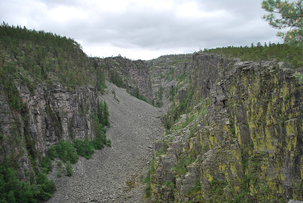
Jutulhogget http://commons.wikimedia.org/wiki/File:Jutulhogget_01.jpg

Jutulhogget  Image from Wikimedia Commons.

Of limited scientific use, but rather beautiful, iceberg keel marks are more evidence for glacial lakes.
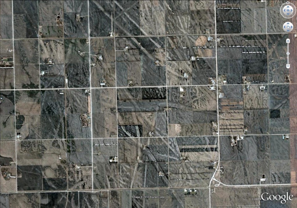
Glacial keel-marks from Canada. Google Earth image.

Aerial view of glacial keel-marks from near Manitoba, Canada. Square lines are roads: see here for more details

 To the science

Knowing about these features really enhances your view of the world – it gives you a way to read landscapes and discover a world of ice so close in time we can almost touch it.  But the best thing about these features is that they tell us about the now-vanished ice. Modern researchers have mapped them to track the ice’s ebb and flow. They combine these maps with computer modelling, insights from active ice sheets and techniques for dating so advanced that they seem almost magical. Their goal is to predict the future. In the face of a changing climate, an ice-cap died in Britain 15,000 years ago. Understanding this process better may help us predict that fate of earth’s remaining ice caps. I’ll write more about this next….

The edge of Cheshire. Part 3 – abandoned

This is the third part of a set of posts describing a walk I took across Cheshire. My goal was to find out everything that was interesting about the places I visited. Previously I’ve seen traces of apocalypse and traced the layers of the landscape.

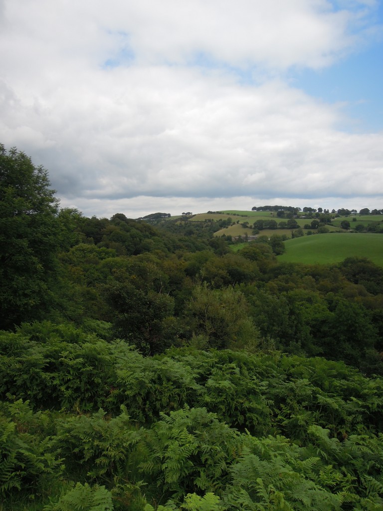
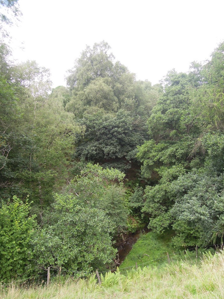
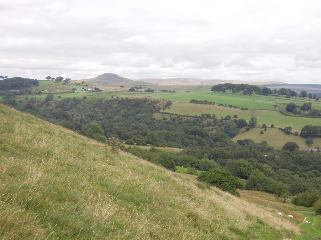
Dropping off the ridge, the wind suddenly stops and everything feels very different. I’m walking down towards a deep river valley, quite unlike the surrounding area. Rivers hereabouts tend to feel rather incidental, hemmed in by ridges of sandstone, man-made dams, or simply too small to matter. Shell Brook is an exception (brook is one of the many English words for stream). Sitting on an unusually large expanse of soft shale, overlaid by softer glacial boulder clay it is a proper dendritic stream that has made a big hole in the ground.

Summer 2013 177

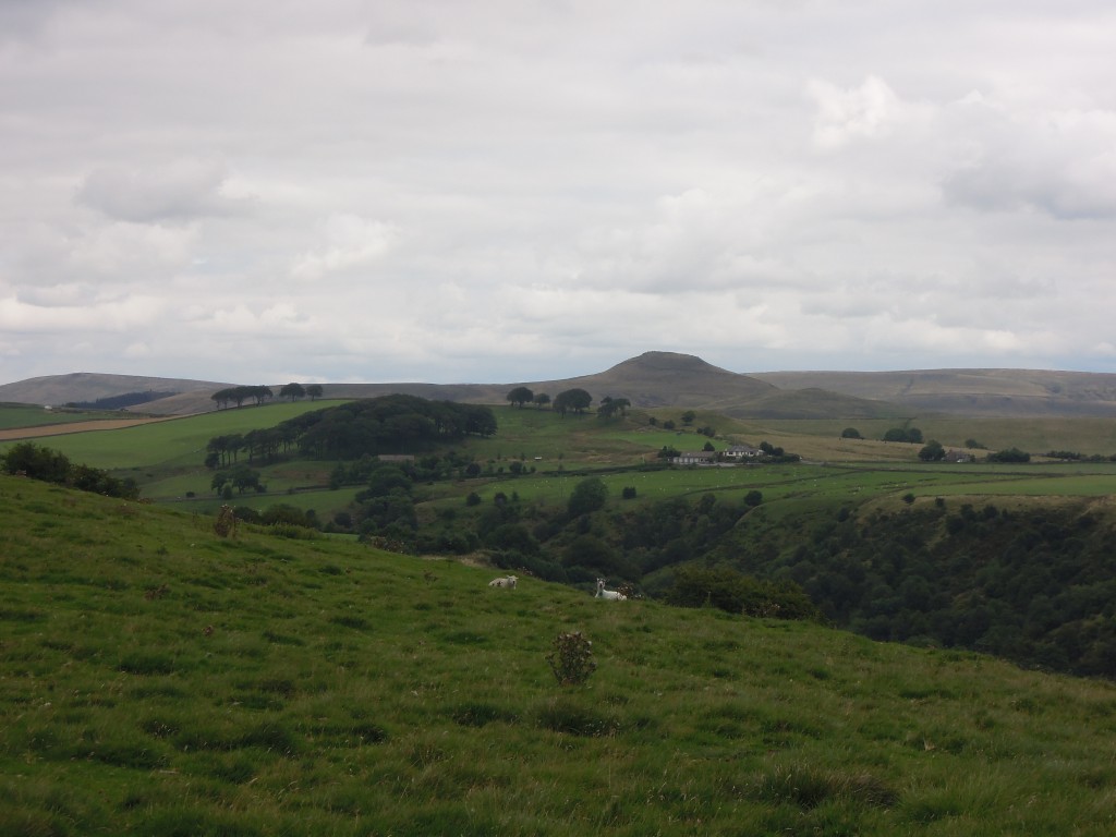
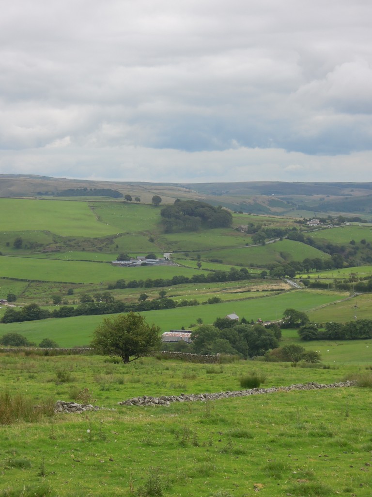
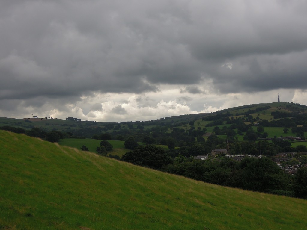
View of the top of Shell Brook. The peak is Shutlingsloe and the clump of trees contains Cleulow Cross, site of an ancient barrow. Note that the sheep are staring at me.

Shell Brook is also unusual for being so full of trees. Apart from the horrid industrial evergreens of Macclesfield Forest – planted to make pit-props in coal mines that have since been shut – woodland is rare in these parts.

If you look at a geological map of the area and toggle the geological overlay, there is a clear pattern. The gentle upper slopes of the valley, covered in glacial sediment and free of trees. Closer to the river it has cut down to the shale beneath and this area is mostly wooded.

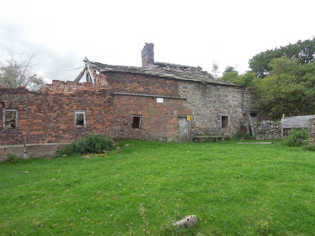
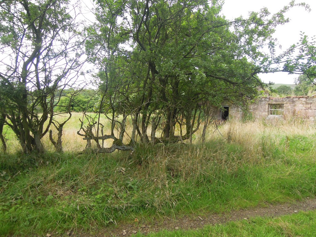
On the way down into the valley, there is a ruined farmhouse, Mareknowles. Summer 2013 181It’s an old building, started in local sandstone and extended in rough bricks. The roof tiles are local flag stones. If the house had been built in the 20th or even late 19th century it would almost certainly have been built with thinner lighter slates from North Wales.

Summer 2013 184

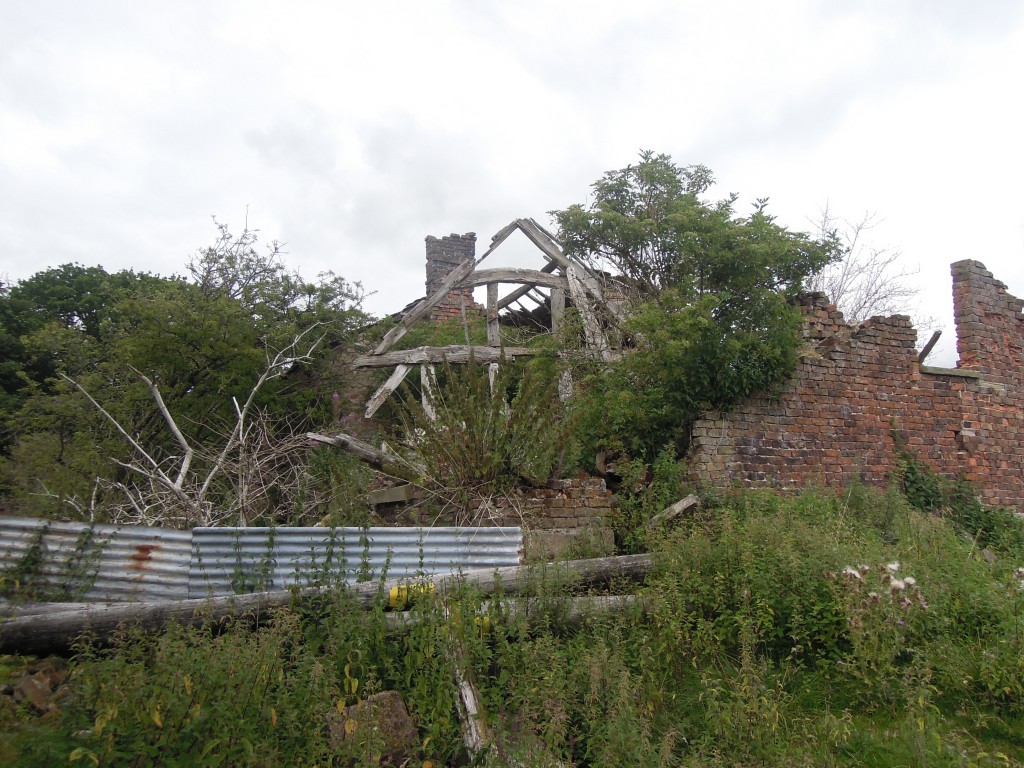
You can trace the change in use. Windows lose glass and are bricked up. A layer of ancient dung indicates it was used to house livestock. Vivid white streaks down the inner wall suggest local buzzards live here now.

It is genuinely surprising to see a wrecked house here. High demand for housing combined with planning restrictions on rural areas mean that old buildings in nice bits of  England are usually converted into expensive dwellings. I would be very happy to live with a view like this.

Summer 2013 182

After a steep descent, my first glimpse of the river is a little surprising. Did such a small thing make such a big hole? It seems it did.

Summer 2013 188

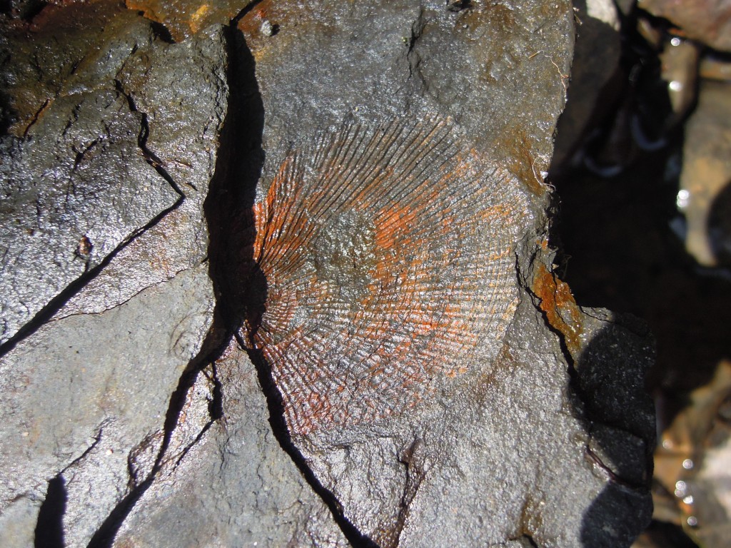
Once I reached the stony stream bed I look for fossils (of course). The second piece I pick up has this beauty on it: a ridged bivalve, a fossil shell – what else would you expect from Shell Brook?

Summer 2013 190

I cheated a little, making sure I met the stream where the geological map marks a ‘marine band’. These rocks were deposited during times (like today) when distant Ice Caps caused periodic fluctuations in sea level (more here). Times of high sea level brought sea water into this area, leaving muds rich in fossils.

This is a quiet spot. Nearly 200 years ago, it was affected by the world’s first phase of industrialisation and the introduction of an important transportation technology: canals.

Macclesfield Canal was brought in to link the industrial towns of Macclesfield and Congleton to the wider world. Road transport was inefficient; although Macclesfield was linked to the turnpike system, there were cheaper ways of shifting goods than a horse and cart. Places with navigable rivers were more fortunate – a boat can carry a big load. So in 1826 they started to build a man-made river, a canal.

Britain’s canals are waterways that join up the country. They are narrow shallow waterways with long flat sections and little flow of water. Long thin shallow boats can be heavily laden and yet pulled by horses that walk along the tow-path. Some are triumphs of engineering. Keeping canals flat, yet tracing them across a bumpy landscape may require tunnels (no horses here, men would lie on the roof of the boat and push against the tunnel roof to move), aqueducts or locks (to link two sections of canal at different heights).

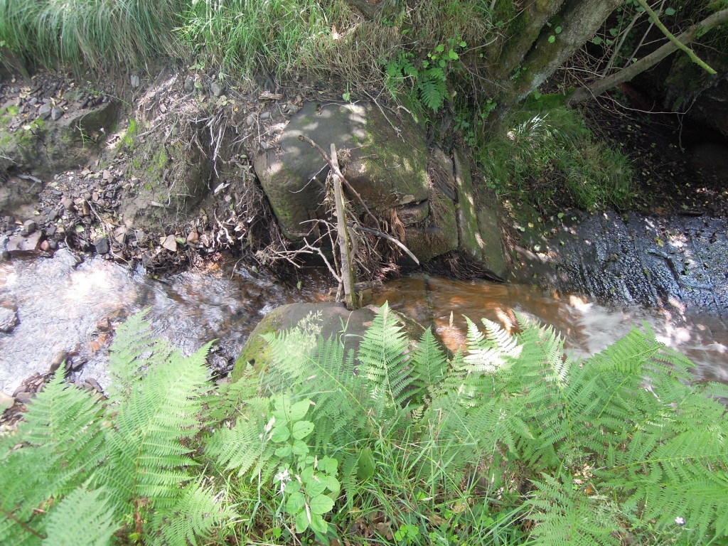
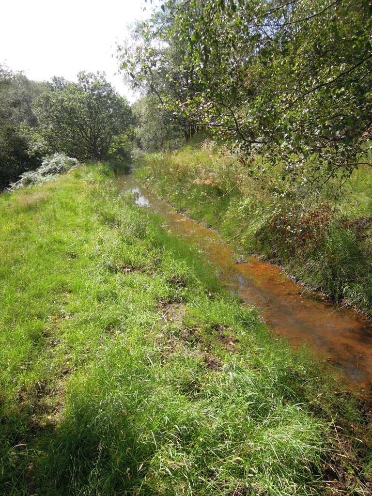
Locks lift boats up by flowing water down. All of this water must be managed somehow and this is where Shell Brook comes in. When the canal was built in To feed the canal, a new reservoir was built near Bosley. To feed the reservoir, they weren’t allowed to use the main river in the area, the Dane1 so they turned to its tributaries. They built a small channel from Shell Brook, that travels 5km to Bosley Reservoir. It is fairly flat, so it follows the contours right round to the other side of Wincle Minn ridge where it joins a network of channels (marked as ‘conduit’ on Ordnance Survey maps). Neatly, one of these conduits follows the trace of a glacial meltwater channel – a line scooped out of the hillside by water flowing underneath or alongside the major Ice Sheet that covered this land around 10,000 years ago.

Engineers built things to last then, lots of traces remain.

Summer 2013 191

Where the conduit meets the stream

No doubt water in the canal is managed by pumps these days – the channel is somewhat neglected. But I disturbed a heron while walking along here, so someone likes it.

Summer 2013 193

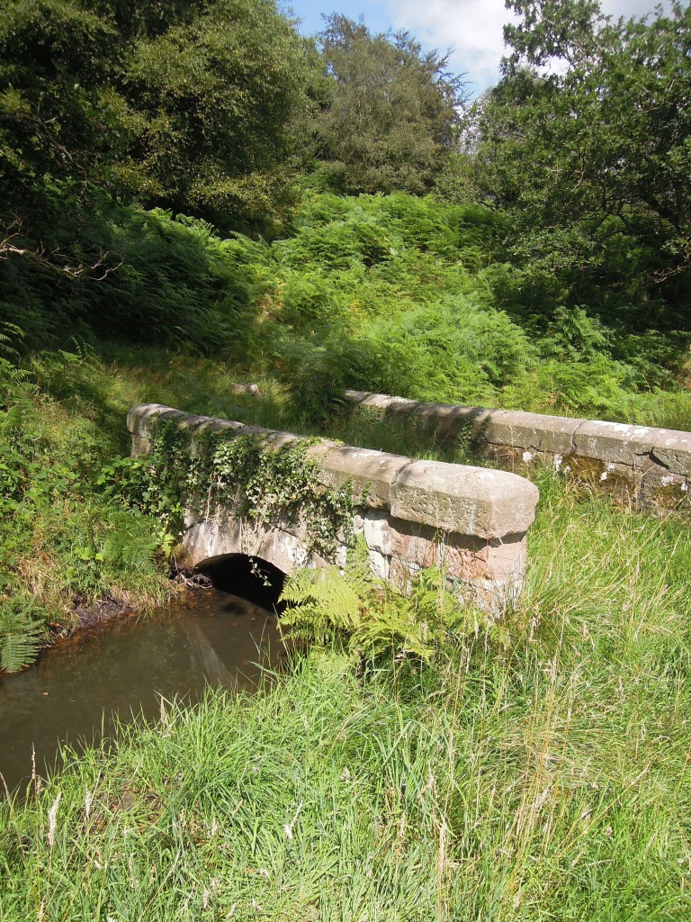
This is barely a path, mostly used by sheep, but it still deserved a little bridge over the conduit.

Summer 2013 195

This tracery of industry, wriggling up from the plain into the edge of Cheshire is rather neglected now. I kept seeing traces of neglect.

Summer 2013 196

The lower horizontal branches of this straggly bush show that it was once part of a managed hedge. The technique of hedge-laying, part cutting of  branches and laying them flat to get a thick barrier to livestock, is little practised these days.

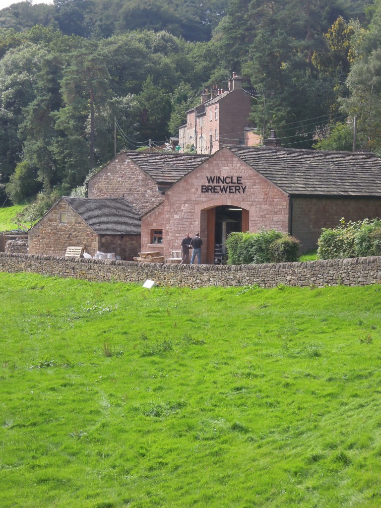
After a pleasant walk along the Dane Valley I arrived in Wincle, passing the place where last night’s pint came from.

Summer 2013 202

Note the colour of the stone. In Britain this red-pinkness is associated with the desert sandstones of the New Red Sandstone. Yet these rocks are the older Carboniferous ones. New Red Sandstone is found nearby sitting on top, the old desert surface was not far above us. These 300 million year old sandstone were nearly exposed 250 million years ago and stained by the desert conditions.

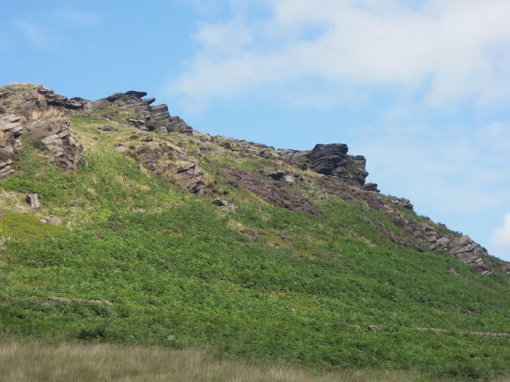
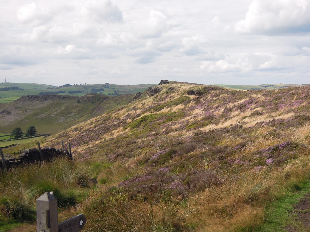
Beyond Wincle we move into Gawain and Green Knight territory. A classic of english Medieval literature, it is written in a dialect from this area. The climactic scene takes place in an eerie Green Chapel. Many believe it is based on a real place – a nearby chasm formed by landslip, Ludchurch. Reading it makes you see the place with new eyes. The depictions of hunting are a reminder of why nearby “Wildbercluff” is written Wildboarclough. Viewing the crags from the route Gawain would have taken to the Green Chapel, its tempting to see them as the “ru3e knokled knarrez with knorned stonez” (rough, rugged rocks) of the poem.

Summer 2013 207

ru3e knokled knarrez with knorned stonez

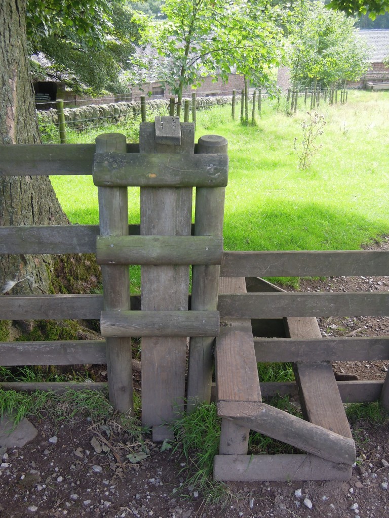
One of the mysteries of the poem is the meaning of the word “wodwo”. From the context it is some type of wild thing. Crossing this stile there is a funny wooden post that can be lifted up to let your small dog (or your wodwo) through.

Summer 2013 203

The Roaches are part of the High Peak, a browner more desolate landscape. I’ve crossed the edge of Cheshire now and reached wilder lands (Derbyshire!). My journey is over.

Summer 2013 208

The edge of Cheshire. Part 2 – layers of landscape

This is part 2 of a series of posts seeking to describe everything of interest on a walk along the edge of Cheshire, in England’s Peak District. Part 1 ended as I left Sutton Common, my mood lifting as the ground dropped.

Descending the hill I passed a small house with a pigeon coop in the garden. On top there are two plastic birds of prey and occasionally, recorded bird noises sound out. It guess it is some of defence against real predators, but it can’t be good for the mental health of the pigeons inside.  These are racing pigeons – there is a small and lovely film about the owners.

Summer 2013 170Passing over a little col and a main road I find myself on a high wide ridge with two odd names. The western side is Bosley Minn, the eastern Wincle Minn and the track I’m walking along is Minn-End Lane. Bosley and Wincle are the nearest villages and Minn most likely comes from the Welsh mynydd meaning mountain or moorland – a reminder that Celtic languages were once spoken in England too.

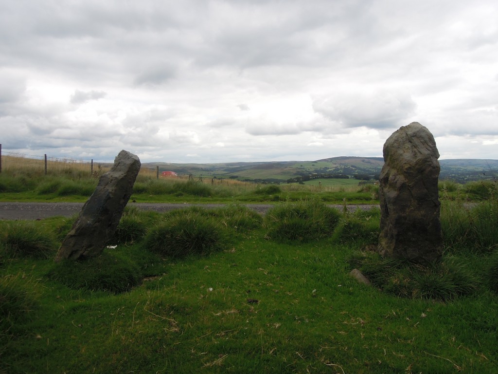
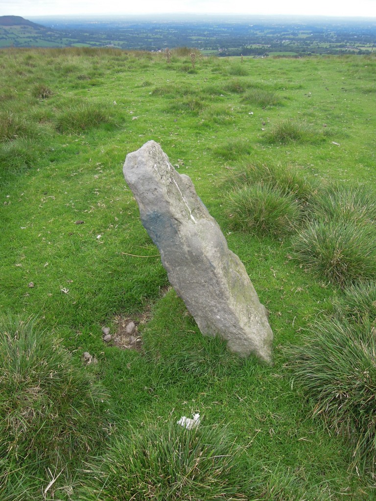
There are traces of pre-Celtic cultures here too; there are standing stones on the Minns. They’ve been used as gate posts, but people who know more than me suggest that some of them are ancient standing stones. The area is rich in pre-historic remains; Cleulow Cross nearby is an ancient artificial mound crowned by a later Anglo-Saxon cross. It sits in a clump of trees located high on a ridge that has been catching my eye since the beginning of the walk.

Summer 2013 174

Up close the Minn stones have patches of an odd blue tinge. Sadly this is not ancient woad dye but rather scrapings from modern itchy sheep, spray-painted bright blue by the farmer.

Summer 2013 176

Barrows and standing stones are often found in prominent positions in the landscape, within sight of each other. It is humbling to think of humans, potentially my ancestors, viewing this same landscape in totally different ways. These monuments suggest a whole layer of meaning, mythical or religious was once overlaid on these hills and valleys, but is now completely lost.

I’m on the edge of the Cheshire plain and it is hard to take my eyes off The View. It’s a clear day and my attention is caught by a sudden sharpness on the horizon – Snowdonia. All around me are rounded landforms, smooth hills and undulating plains, but these distant Welsh mountains have sharp peaks and steep cliffs. This difference is due to ice and its ebb and flow across this landscape.

To a geologist, we are living in an Ice Age. For great periods of time the earth has had no ice at all – even the Poles were free of it. But Ice Ages are not static. The amount of ice changes in great cycles, driven by tiny changes in the spin of the earth. Today we are in a relatively warm period, called an interglacial – the ice has retreated to high mountains or the far north. During the last cold period (around 20 thousand years ago) everything to the west of here was covered by a thick ice-cap. We know that ice flowing into east Cheshire came from the Lake District as it left behind fragments of rock from there, some of them very large.

The ice failed to cover all of the Pennines, England’s central spine. Looking to the east we’d have seen the edge of the ice sheet. Shutlingsloe, the most distinctive peak in the area is through to have peeked out through the ice, forming a feature called a nunatak.

Summer 2013 178

As the cycle of climate shifted warmer, the ice sheet melted, leaving behind thick deposits of ‘boulder clay’ over a smoothed landscape. There was a brief reversal in the warming trend around 12,000 years ago. In Britain, this ‘Younger Dryas’ event caused ice to return – the ‘Loch Lomond readvance’. The ice was restricted to mountainous areas, forming valley glaciers rather than an ice cap. These glaciers explain the spikiness of Snowdonia in the distance.

It feels like I am floating above most of Britain here. These uninterrupted views were once briefly of use to military men at the dawn of electronic warfare. In 1941 the air war above Britain was making full use of the new Radar technology. German bombers were flying at night into Britain along special radio beams. These allowed them to fly low (avoiding detection by British radar) and to find their targets. The ‘blackout’, where every house covered their windows and even car headlights were masked, was designed to ensure the enemy couldn’t find their target cities.

In response to this new threat, the RAF developed Meacon, a system that jammed the German beams and confused the incoming bombers. For a short while, one of these transmitters was sited at the very top of the ridge, sowing electronic confusion across the country. The evolutionary game of technological development soon moved on and not a trace remains.

My path takes me off the ridge and down the side. The wind suddenly drops and it feels like I’m entering a new world.

The final part is now up.

The edge of Cheshire. Part 1 – traces of apocalypse

Someone once said: “if you know enough Science, nothing is boring”1.  I love this idea, but I’m also intrigued by the geographical equivalent: no place is boring, if you know enough about it. Recently I went for a walk to try and find out if this is true.

Summer 2013 164

The walk started from my childhood home in Macclesfield in the north of England. Growing up I could not fail to be aware of living on a dividing line. Down the hill was the town – first school, shops, the train to the bright lights of Manchester, later pubs and the train south to University. Up the hill was the Peak District National Park, open space, hills and geology (I was rock-mad from an early age).

The road down into town crosses a geological boundary – the Red Rock fault. It’s trace is not obvious (it has not moved from a *very* long time) but it is a major boundary. To the west are the red rocks of the Cheshire Basin. They are Permo-Triassic in age – forming both before, after and during the world’s most extreme mass-extinction event. No traces of that here though – the desert environment left sediments containing very few traces of life, even before 97% of the species on earth were killed off.  The fault was active during this time, actively making a hole for sediments to fill – a sedimentary basin.

To the east are the older rocks of the Carboniferous, rich in fossils, coal and fine building stone. Go far enough, to Buxton, and you reach early Carboniferous limestone and a tamer landscape, the ‘White Peak’. But my walk sticks with the sandstones and muds of the middle and upper Carboniferous. A bleaker, grander landscape – the ‘Dark Peak’.

My walk started steeply down the road. Just before I reached the canal (I’ll encounter it again, if not directly) I swung back up to the golf club. Here, in the bushes is a reminder of a different era, but one that I lived in: the Cold War.

From my 70s/80s youth I’ve a memory of a distant noise sounding – the minor third intervals you hear in war films during air raids. This was the testing of a siren sitting up the road, on the hill above Macclesfield. It was there to sound the infamous ‘four minute warning’ indicating that nuclear apocalypse was about to be unleashed.

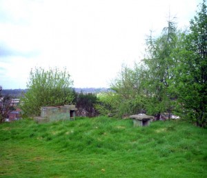
Picture from SubBrit

Picture from SubBrit

For a few years in the 1960s, if world war three had broken out, there would have been members of the Royal Observatory Corps (ROC) sitting in a bunker near the golf club. Their job was to monitor the various ways in which civilisation was being extinguished. One device measured the electro-magnetic pulse from the initial explosion. Another the house-flattening pressure wave following a little later on. In the following days they would measure the intensity of the radioactive fallout – vaporised cities and short-lived fatally potent radioactive isotopes drifting down from the sky. Those standing above the bunker would get a more visual spectacle – intense but (in several senses) short-lived, with flashes and looming mushroom clouds across most of the horizon2

Macclesfield has never been on anyone’s strike list. When my parents were little during World War 2 they heard the sirens sound for real, but few bombs fell nearby. During my youth, if the Russians had ‘dropped the bomb’ it wouldn’t have been on Macclesfield. Manchester to the due North, maybe Warrington NNW, Liverpool NW, Stoke on Trent to the south. Standing on the hill, these are the flashes and vast mushroom clouds that would be visible,  Pynchon’s “unbearable sight in the mirror”3. My parents, living much of their adult life under the shadow of nuclear annihilation were almost comforted by living on a hill and being in line-of-sight of the vast Manchester conurbation. They would be among the lucky ones – instantly killed rather dying slowly of radiation sickness4.

Moving beyond the golf club, you reach the countryside; fenced, managed, farmed, but full of open space and wildlife. There is a northern sky – full of moving clouds, threatening rain but not delivering, a constantly moving shadow-show of sunlight and gloom playing over the landscape.

Summer 2013 158

This section was a favourite childhood walk, down over the Hollins into Langley. The stream, good for paddling, that was our usual destination is smaller than I remember. Of course.

Langley started its life as a mill town – a place conjured into existence by the mechanisation of cloth production (here silk) and the creation of factories (mills) to house the machines. Early factories in the area were driven powered by watermills – a name that stuck, being used also for later coal-powered factories. Leaving Langley round the back of the industrial area (now disturbingly quiet) I passed a reservoir, barely 100 metres long. Surrounded by wooden areas for fisherman to stand on, it resembles a very English form of Coliseum or bull-ring – an arena for man and animal to do battle. Instead of blood on the sand the climax is the weighing and then the release of the fish. Everyone gets to go home for tea, even the vanquished.

Next I cross  a small ridge. The map shows Backridges Farm, Ridgehill, Ridgehill Farm, Ridge Hall Farm and Ridge Hill (twice), just in case I hadn’t noticed the ridge.  There is tough sandstone underneath and shales down in the lower land below. The landscape is shaped by the rocks underneath – the bones are showing beneath the green skin.

Between the wars my grandfather visited these farms for his job. One farmer told him he had left home for only two nights in his life – to visit nearby Buxton on his honeymoon. Judging by the cars outside, these farms are now lived in by professional couples, thinking nothing of leaving before dawn to fly to a day meeting in Frankfurt or Madrid.

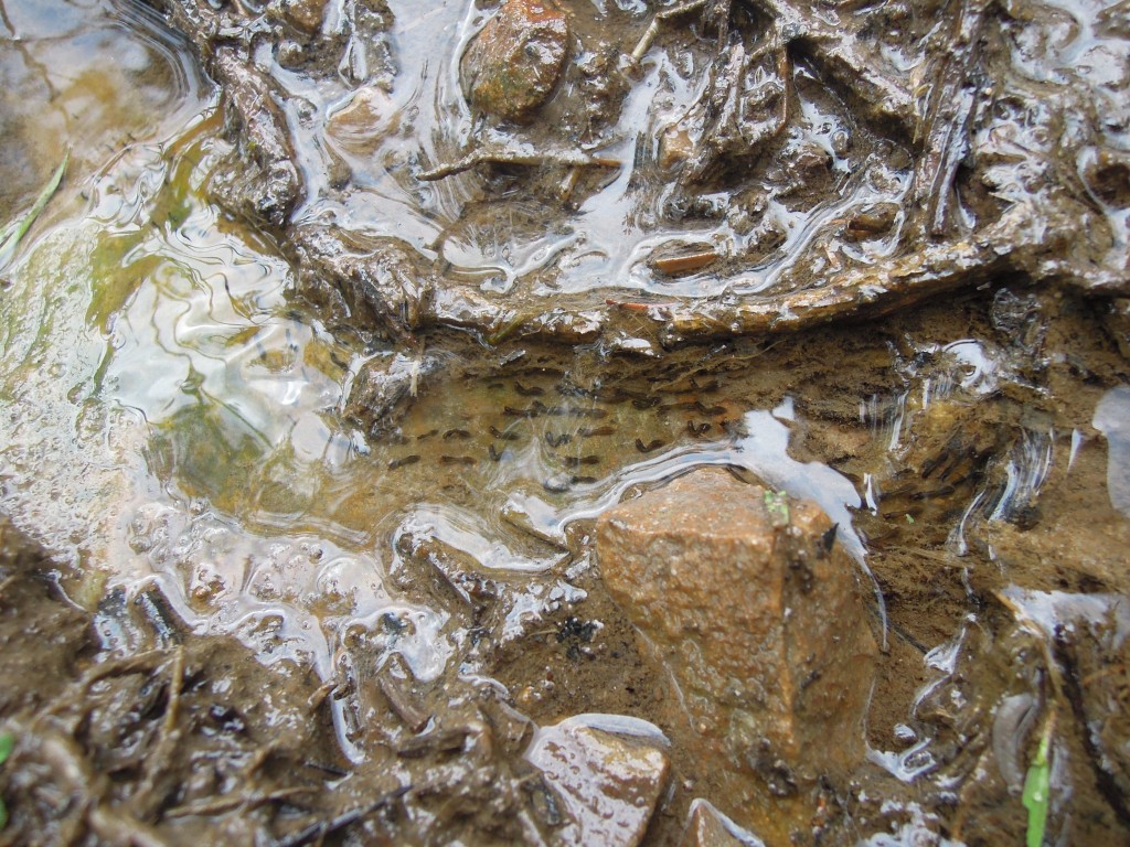
On the way up a long hill slope, I gratefully seize the opportunity to stop and look at something odd. I was on a steep rough path, that was doubling as a tiny stream, yesterday’s rain spilling down it. The water flowed over a patch of something transparent, with little black blobs in it, becoming elongated and a little wriggly. It was frog spawn (or toad) and I had nearly stood on it. Pleased I hadn’t squashed it, I admired the blind optimism that had put it here, far from any permanent stream or pond.

Summer 2013 163

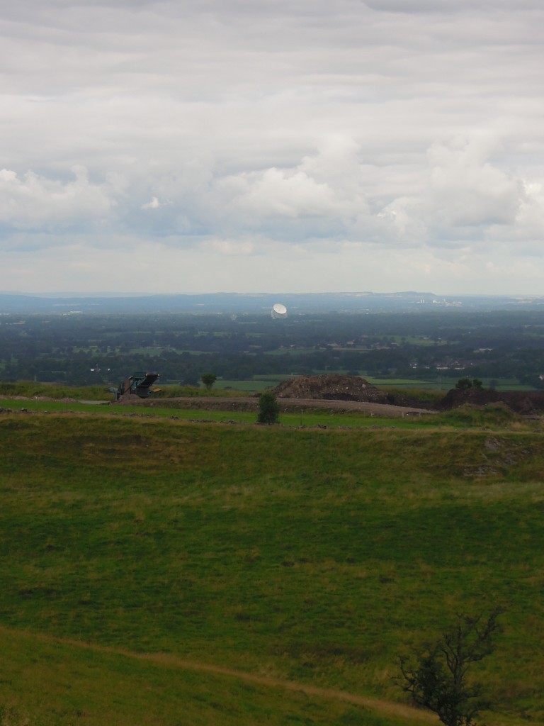
Once I reached the top of the ridge I once again came face to face with The View. It’s not a visual spectacle – it photographs very poorly, unless at extreme magnification. It’s impact is as much visceral as visual, creating an extreme sense of space and scale as the eye sweeps over the whole of the county of Cheshire and beyond into North Wales, Manchester and Merseyside. It is a little like one of those fantastically detailed early Renaissance pictures of fantastic scenes, such as The Garden of Earthly Delights. Pick any part, look carefully and something interesting pops out. Unlike the Bosch picture, Cheshire contains no giant ears holding a blade, but standing at this point in front of the ‘canvas’, you get a fine view of Jodrell Bank. This massive radio telescope was crafted in part from decommissioned WW2 battleships. It is fully directional, so every time you look at it it’s pointing at a different part of cosmos, showing off another side of its structure.

Summer 2013 165

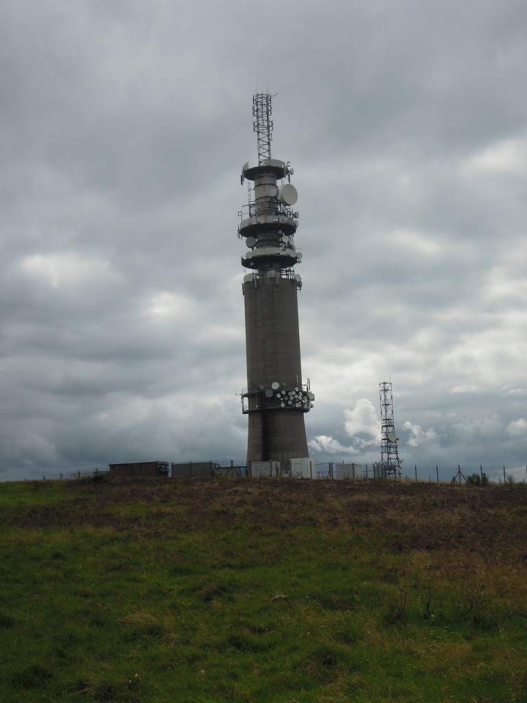
Turning left along the top of the ridge, Sutton Common tower comes into view. It is a startlingly ugly concrete structure, massively out of scale. As a child I remember being told it was where the TV pictures came from; this was true, but not the full picture. The tower is another Cold War structure, part of a communications spine through England. The towers are robust, not too near towns and in line of sight of each other. The communication was via microwave relay, making it less exposed to Soviet sabotage.

Like the bunker, this a structure built to survive apocalypse. The British government expected the Soviets to drop scores of thermonuclear devices on the western side of Britain, letting the prevailing winds spread fallout over the entire country. During the 1950s and 60s, the government was still actively planning how government could continue even after apocalypse. Slowly, however the focus turned away from ‘passive’ defence to ‘active defence’ – maintaining a nuclear deterrent5.

Up close the tower is buzzing with masts and dishes, covered with an accumulation of civilian devices, like technological lichen. Countless conversations are whizzing through the air above.

Summer 2013 167

On the top, near the tower I got a shock from on an electric fence which plunged me into a morbid frame of mind. We survived the Cold War – death from above never came. But are we like the frogspawn down the hill? My boot missed it, but it is surely doomed despite that near miss. It’s need for resources grows and grows, yet the conditions around it could change at any moment, snuffing it out. Is modern civilisation the same, nurtured by a temporary river of oil that cannot last for ever? Is there an environmental apocalypse coming that we only dimly perceive (and many of us simply refuse to consider)?

Maybe. But some chocolate biscuits and a look to where I’m going next dispel my gloom. Ahead of me lie traces of thousands of years of human activity and animal traces a hundred thousand times older- evidence of the tenacity of life and the power of human ingenuity. It may be all downhill from here, but for a walker with tired legs that counts as an invitation to live in the moment and enjoy the journey.

Summer 2013 170The second part of this journey is now available.