A bit of Scotland in an English playground

There is a park near my home that my children like. As is the way of things, this means I stand around it a lot, ready to rub bruised knees or produce biscuits or push ‘faster!’, but otherwise redundant. My attention often wanders to the big blocks of stone in the park – they are worth looking at.

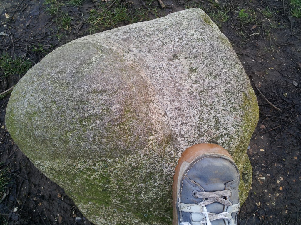
To start with, here’s some ‘granite’.

granite with xenolith / blobby

The white material is a medium to coarse grained igneous rock of ‘felsic’ composition – granite (loosely speaking). The dark area is a portion of material within the granite. It may be a xenolith, a piece of rock that fell into the magma, but it looks to me like diorite, possibly the result of magma mingling.

There are few blocks of mafic igneous rock:

20121227_145035

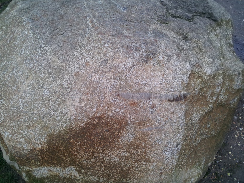
This ‘gabbro’ above shows both fresh and weathered surfaces. Plagioclase feldspar is colourless and weathers white while the dark minerals (pyroxenes?) sit within it. Note the rusty iron patch at the top.

20121227_145103

Another block of gabbro has a slight sniff of layering to it.

Mafic magma is molten from about 1200°C, whereas more normal continental rocks (sediments say) can melt from 700°C. Put the two together, therefore and you expect some melting, producing migmatites.

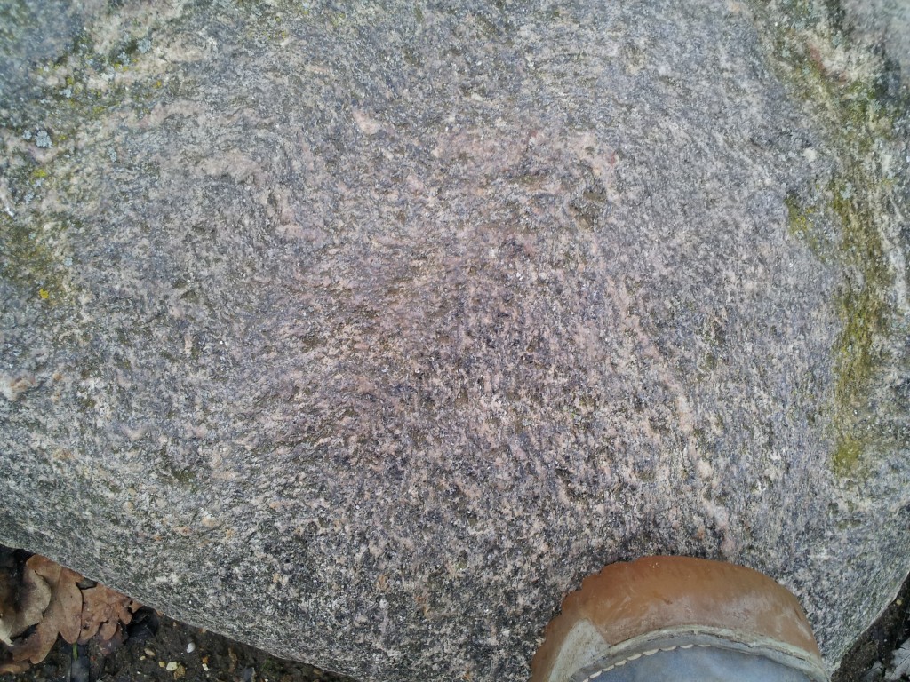
migmatiteThis block is of high-grade metamorphic rock, with a gneissic foliation. A thin granite vein cuts through and has itself been folded.

high grade rockHere’s some more metamorphic rock, with a folded foliation and a mica sheen.

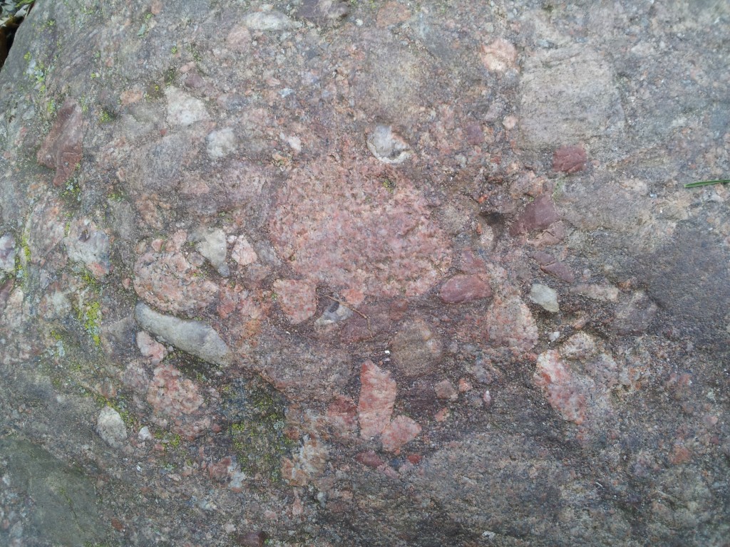
Our final type of rock is sedimentary, a conglomerate.

20121227_144803

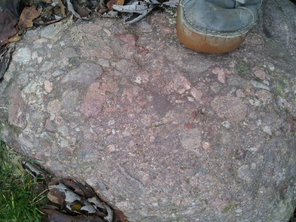
Notice the variety of clast types. We’ve some red sediments, some ‘granite’, vein quartz, quartzite and more. Here’s a closer look.20121227_144825

I’ve no idea where these blocks came from, but I know it’s not nearby. They are part of the park landscaping and so were brought from somewhere else in Britain, on a lorry. The blocks are rounded and weathered, so they are not blasted from a quarry. I think they are glacial blocks. Assuming they came from the same glacial deposit I suggest they are from North East Scotland. There is a series of syn-orogenic mafic intrusions in this corner of the world that sit within the high-grade parts of the Buchan and Barrow metamorphic areas. Granites are two-a-penny in Scotland and the conglomerate looks like the post-orogenic ‘Old Red Sandstone’.

These rocks are very similar to those in my PhD field area, so to have them turn up close to home is rather splendid.

All photos by me. I was hoping for a sunny day to take them, but I’ve given up waiting. The photos give you an authentically gloomy and dark view of rocks from Scotland, at least.

Erosion makes mountains beautiful

The thing that makes mountains so beautiful and fascinating,is not so much their height as their steepness. Climbers and trekkers flock to the High Himalaya, not to get altitude sickness but for the grandeur of the landscape, the experience of seeing views that require you to lift your head up. Mountains are created by deep-seated geological processes that raise the surface of the earth, but it is erosion that creates the scenery we love.

Erosion is often taught in terms of gentle everyday processes – tiny fragments of rock falling off and slowing washing downstream. Over the awesome expanse of deep time such tiny events can indeed wash away mountains. But mountainous areas can rise at rates of centimetres a year – is small-scale mechanical weathering really quick enough to keep up with such rapid uplift? Erosion in mountains also involves faster acting processes: ravine-making rivers, grinding glaciers and lots of landslides.

If you’ve ever had the pleasure of visiting high mountains such as the Himalaya, you’ll have noticed how common landslides are. A recent scientific paper seeks to quantify how their frequency relates to other factors.
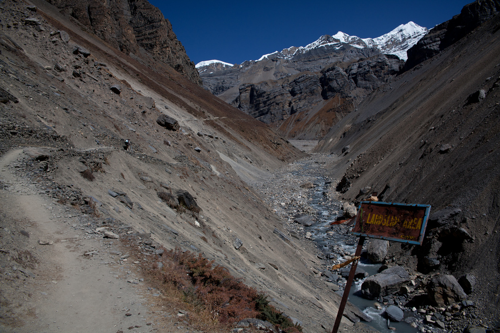
Larsen & Montgomery from the University of Washington, studied the  Namche Barwa area in the eastern Himalayas. This is an area where rocks are being  brought to the surface extremely quickly by high rates of erosion. The mighty Tsangpo-Brahmaputra river flows through the area and its influence may extend deep into the earth, creating a tectonic aneurysm.

A river only directly erodes within a tiny area, but has a wider influence.  Our authors start by describing the threshold hillslope paradigm. This is a concept three year old children understand: if you dig a hole in a sand pit, once the edge reaches a particular steepness, sand slides back into your hole, no matter how fast you dig.  Within a mountainous area, if erosion rates are high enough, hill slopes are limited by the material strength of  the rock.

“Vertical river incision into bedrock is thought to over-steepen hillslopes with gradients near the threshold angle, increasing relief until gravitational stress exceeds material strength and bedrock landsliding occurs.”

Somewhere like Namche Barwa, with high uplift and erosion rates, we would expect to see lots of landslides. To test this, they used an array of remote sensing data, including declassified spy satellite images, to map more than 1500 landslides over a period of 33 years. By looking at an area affected by differing erosion rates, that found a rough correlation between landslide erosion rate, stream erosion power and even cooling ages of metamorphic rocks. The study area showed an order of magnitude difference in exhumation rate which corresponded with a tiny 3 degree difference in average slope angle.

As well as providing evidence for the importance of landslides, they found insights into the processes. They see a link between large landslide dam bursts (flooding events), and landslides – flooding causes more erosion at foot of slope, destabilises the valley sides and causes a series of small landslides.
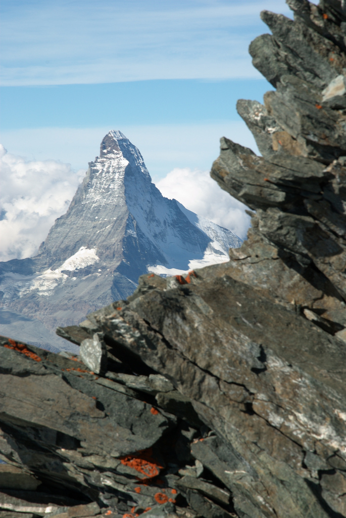
Another recent paper by James Spotila at Virginia Tech also derives useful data simply from looking at mountains in detail. He made a detailed analysis of topographical data from mountains across the world.

Browse photo galleries taken in mountains and you’ll find most pictures are of the peaks and mountain ridges – that is where the beauty lies. In contrast models of mountain erosion are (conceptually) peering into the valleys. Ridges and peaks are seen as the consequence of valley-shaping processes, in map view merely the negative image of drainage networks.

Spotila hypothesises that the highest peaks will form where two ridges meet, at ‘divide-junctions’. High peaks are often broadly shaped like pyramids, forming where three glacial or river valleys meet (and therefore where two ridges meet). Peaks of this shape may be mechnically more stable than on single ridges. Using digital topography to study 255 of the world’s most prominent peaks, Spotila finds that 91% of prominent peaks studied are found at divide junctions. Of these, all are pyramid shaped.

The highest mountains of central Nepal contain most of the world’s highest peaks. The Himalayas are cut by a number of large rivers. The high peaks are preferentially located close to the divides between these rivers – the drainage pattern controls the location of the highest peaks.

Once mountains become pyramidal and have flat triangular faces, they become more resistant to erosion. In the Himalaya the flat faces tend not to be covered by glaciers, for example.  This may make them more stable over time. Some workers have talked of ‘teflon peaks’ that rise above the glacial buzzsaw.  Recent models of landscape evolution have emphasised the importance of the migration of drainage divides over time. However if drainage-divide peaks are stable over time, they will anchor the overall drainage patterns, making them much more stable.

These details of the way mountains erode may seem detached from tectonic studies of mountains, but in fact so many aspects of mountain geology are beautifully intertwined. Erosion of mountains influences processes deep within the crust, allowing material to flow towards the surface – patterns of crustal flow are linked to drainage patterns via erosion. That these patterns of crustal flow become fixed in space due to the way peaks and ridges form is a beautiful idea about beautiful places.

claimtoken-50c4761181470

First photo of landslide area, Annapurna region of Nepal, courtesty of Julien Lagarde on Flickr under Creative Commons
Second photo of Matterhorn, Swiss Alps, courtesy of  Martin Jansen on Flickr under Creative Commons

Larsen, I., & Montgomery, D. (2012). Landslide erosion coupled to tectonics and river incision Nature Geoscience, 5 (7), 468-473 DOI: 10.1038/NGEO1479

Roering, J. (2012). Tectonic geomorphology: Landslides limit mountain relief Nature Geoscience, 5 (7), 446-447 DOI: 10.1038/ngeo1511

Spotila, J. (2012). Influence of drainage divide structure on the distribution of mountain peaks Geology, 40 (9), 855-858 DOI: 10.1130/G33338.1
Relict of the flood?

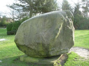
I’ve recently spent a lot of time with my kids in the fabulous public parks of Macclesfield. An ex-mill town in the north of England, Macclesfield expanded greatly in the Nineteenth Century and the civic leaders at the time took care to build large green spaces into the town. In a nicely manicured lawn in West Park, there is a large stone, which is rather interesting.

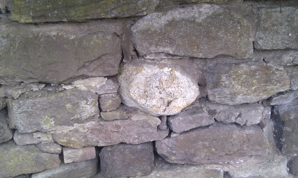
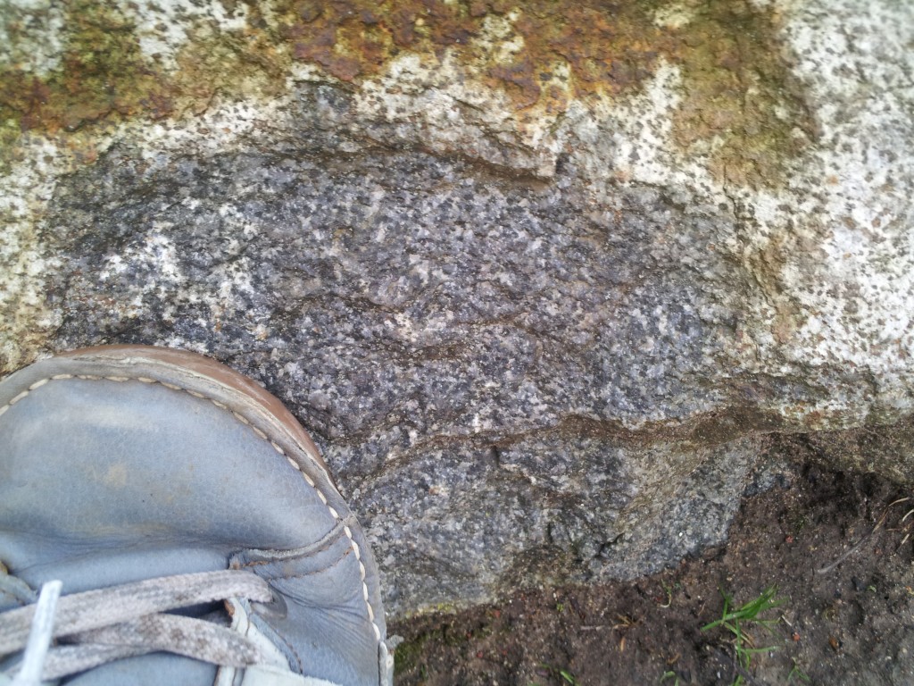
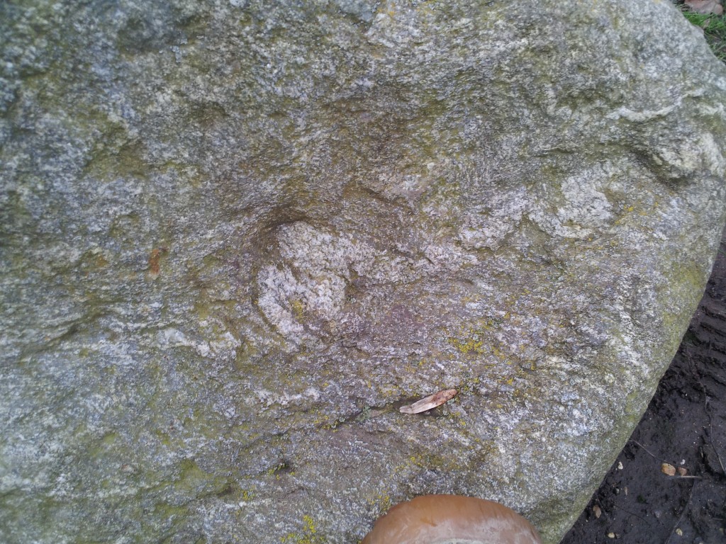
It is a large boulder with rough edges, but a striated smooth top. It is of course a glacial erratic, that is a large block of rock, picked up in a glacier or ice sheet, moved a long way and then dumped somewhere else. It is, in the loosest sense, granite and to anyone familiar with English geology, comes from the Lake District. Smaller blocks from the Lake District are extremely common in the East Cheshire area, and are often seen ‘sticking out’ of dry-stone walls, where their rounded shape spoils the otherwise regular pattern.

A teenie-tiny glacial erratic incorporated into a typical Macclesfield stone wall. The rounded white-weathering block of Lake District igneous rock contrasts with regular bedded local stone

At the last Ice-Age maximum, Macclesfield was near the southern edge of the glaciated area, which covered pretty much all of the British Isles to the north. An ice-dome centred on the high ground of the Lake District swept down south over the Cheshire Plain. Just east of Macclesfield is the higher ground of the Peak District, that remained unglaciated.

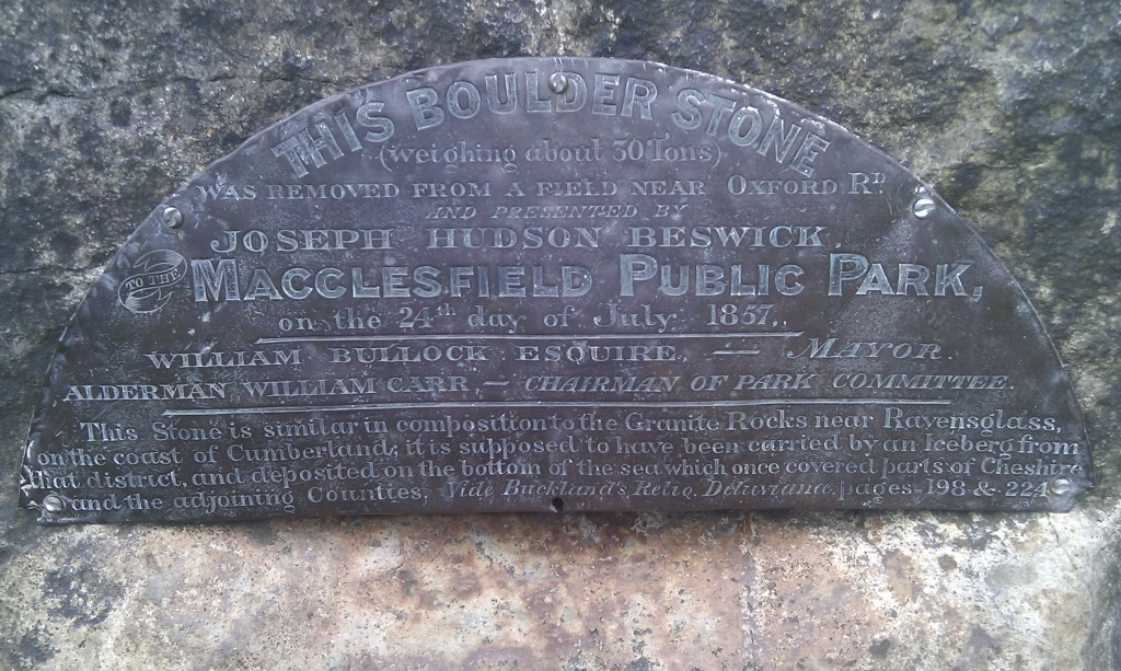
The West Park boulder was found in 1857 and was moved a small way by a team of 8 horses into the 3 year old park where it was put on a plinth and a brass plaque attached.

The bottom section of the text says: “This Stone is similar in composition to the Granite Rocks near Ravenglass on the coast of Cumberland; it is supposed to have been carried by an Iceberg from that district and deposited on the bottom of the sea which once covered parts of Cheshire and the adjoining Counties. Vide Buckland’s Relio. Deluvianae, pages 198 & 224″.

William Buckland, was an interesting character and important figure in Nineteenth Century science. His 1823 book, referenced on the plaque, “Reliquiæ diluvianæ: or Observations on the organic remains contained in caves, fissures, and diluvial gravel, and on other geological phenomena, attesting the action of an universal deluge” was a best-seller and evidently a copy made it as far as Macclesfield. Following the plaque reference to page 199 shows that the reference to Ravenglass is a direct lift from Buckland’s book (rocks like this are found all over the Lake District, Ravenglass is only where Buckland happened to see them). Page 224 summarises his main argument, that blocks like this are evidence of a ‘universal deluge’, such as described in the bible, and that this block is a relict of the Biblical flood.

William Buckland is a great figure in Geology, because, like Darwin, he was one of the people who used careful observation to overturn the traditional idea that the Bible is a literal description of the Earth’s history. By 1836 he had changed his mind about the flood and by 1840 was in agreement with Louis Agassiz‘s theory that features such as erratics were the product of glacial processes.

So, by 1857, the theory expressed in Reliquae diluvianae had been rejected by its own author in favour of one we would agree with today. However nobody had told the good folk of Macclesfield. Or had they? The reference to an iceberg as the form of transport does not come from Buckland’s early book; Noah’s ark was not an ice-breaker, so where does the ice reference come from? It suggests to me that the text on the plaque is a form of compromise. The book and its idea of the block moving while Macclesfield was underwater is in there, but so is a reference to the more modern theory of ice being involved. The result is still wrong (an ice-sheet, not an iceberg was the form of transport) and it is not surprising that they started their description with the phrase “it is supposed to have been”, if they couldn’t agree amongst themselves.

So, next time you get access to most of human knowledge via your smart-phone, spare a thought for your ancestors. This plaque reminds us that only 150 years ago, in a town in one of the (then) most-developed and wealthiest countries on earth, the most definitive source of geological information available was a 30 year old book.