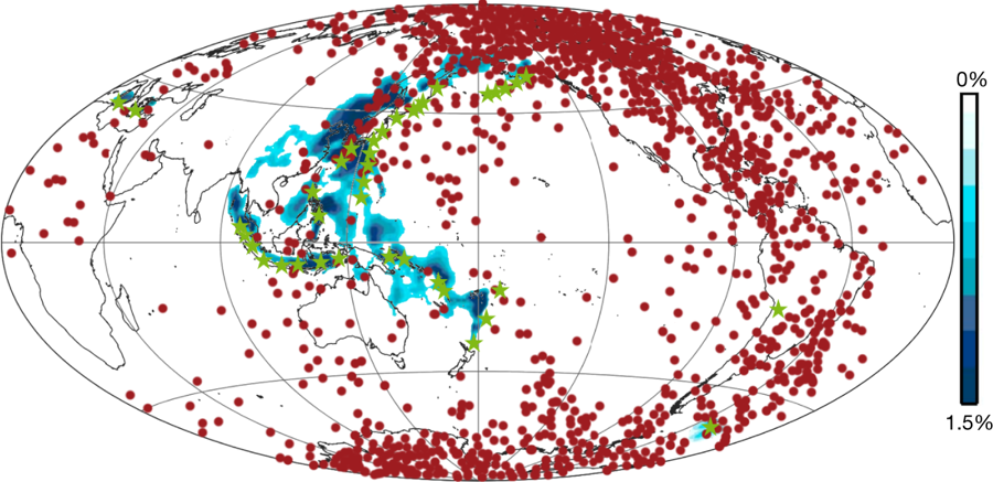
Blue region: position of subducted lithosphere in Western Pacific at mantle depths of 500km. Red dots: ‘virtual geomagnetic poles’ from multiple reversals, including the last one. Source: Kupenko et al., 2019.

Blue region: position of subducted lithosphere in Western Pacific at mantle depths of 500km. Red dots: ‘virtual geomagnetic poles’ from multiple reversals, including the last one. Source: Kupenko et al., 2019.