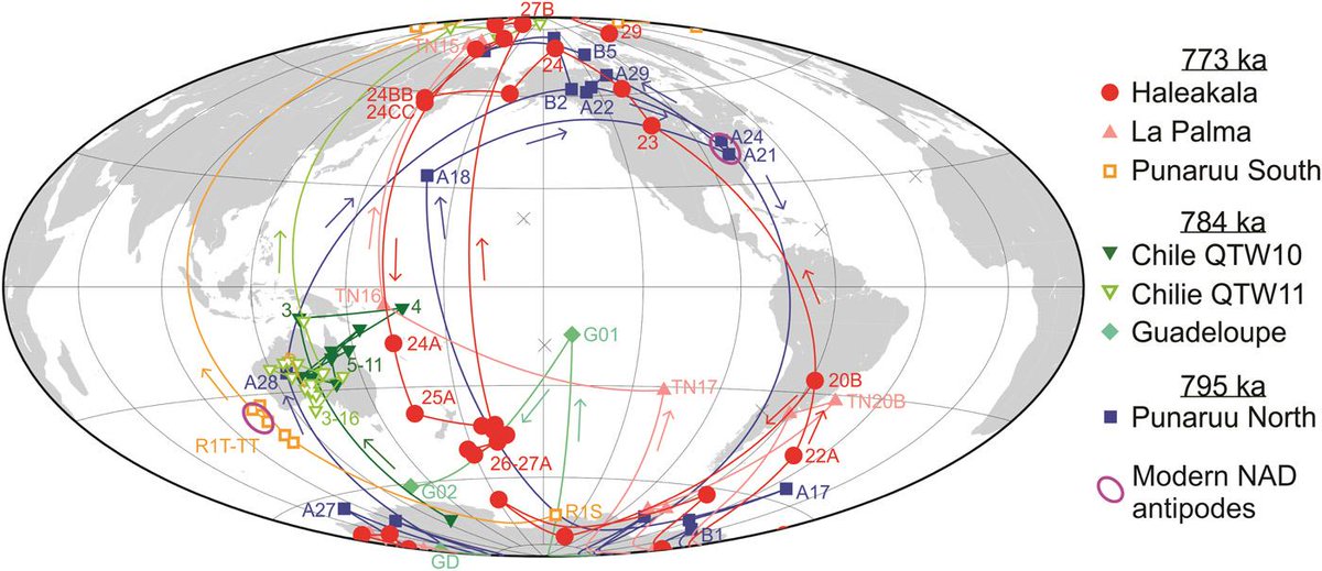
‘Virtual Geomagnetic Poles’ in lavas spanning the last magnetic reversal, showing transition from reversed to normal polarity along two bands around the edges of the Pacific. Source Singer et al., 2019.

‘Virtual Geomagnetic Poles’ in lavas spanning the last magnetic reversal, showing transition from reversed to normal polarity along two bands around the edges of the Pacific. Source Singer et al., 2019.