Oman’s view of the Snowball Earth

A post by Chris Rowan The latest Accretionary Wedge, being hosted at Geology Happens, asks: what are you working on? This seemed to me to be a good excuse to finally write something about this whole Snowball Earth thing that I’m currently researching. More musings will hopefully follow in the future.
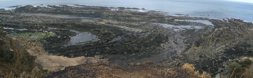
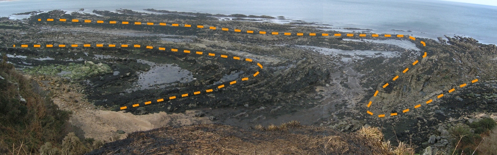
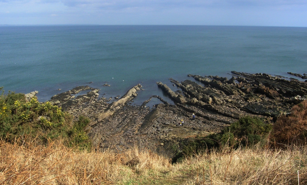
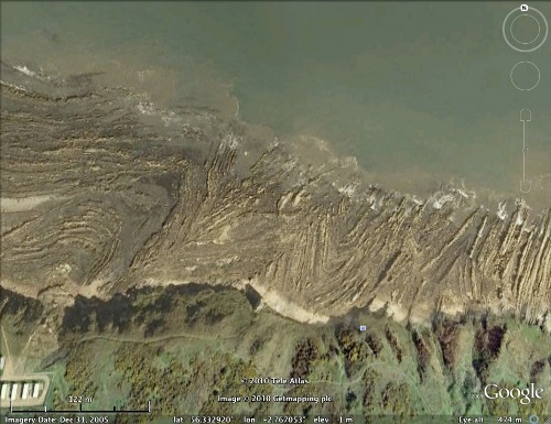
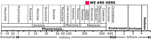
Why did visit I Oman last year? Because in Oman you can find Late Neoproterozoic rocks, between about 750 and 600 million years in age, that contain sequences like this:

Snowball1.jpg
Fiq-Hadash diamictite-carbonate couplet, Oman

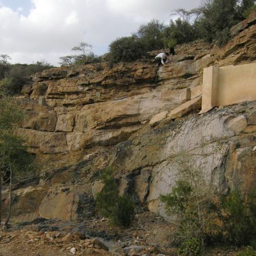
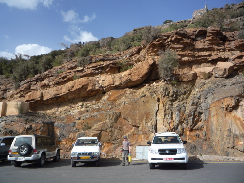
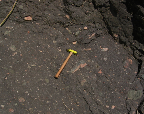
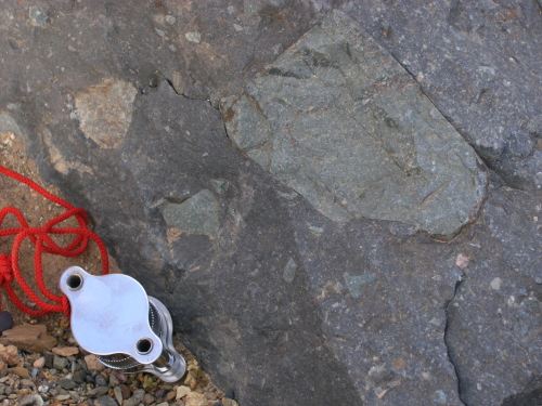
There are two very different rock units in this outcrop. The lower part consists of a diamicite: a sedimentary rock that contains both very fine particles (the dark grey matrix) and also large pebbles, cobbles and even occasionally boulders, and possibly everything in between (this range of different grain sizes means that is a poorly sorted sediment).

Mirbat_DMa.JPG
Close up of Fiq diamictite, Huqf Group, Oman

The buff coloured unit deposited directly above this is a carbonate rock, more specifically dolomite; it is crystalline, and generally quite fine grained.

Hadash cap carbonate, Huqf Group, Oman

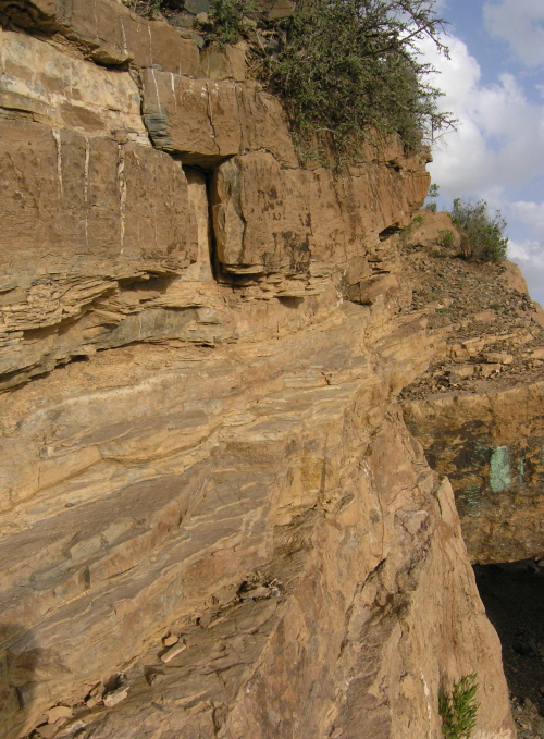
This is not just an outcrop of extremes because of the obvious lithological differences between the two units. Diamictites are often interpreted as having being deposited in a glacial environment*. Bedrock underneath a glacier is very efficiently ground up into fine powder by the slowly moving ice, while larger rock fragments are also swept along, frozen within the main body of the glacier itself. Thus, when the ice melts at the end of a glacier, fine and coarse material will all get mixed up in the same deposit. However, whilst this suggests that the lowermost unit was deposited in a very cold, icy climate, the carbonate appears to have been directly chemically precipitated from seawater, something which only happens in warm, tropical conditions – think the Bahamas. There is no sign of a large time gap between the formation of these two units, so if these interpretations are correct, this outcrop records an extremely abrupt climatic shift from very cold conditions to very warm ones.

Climatic interpretation of Fiq-Hadash diamictite-carbonate couplet

Continue reading

Categories: climate science, deep time, fieldwork, geology, outcrops, palaeomagic, past worlds, Proterozoic

Is Anne a hydrologist? geomorphologist? hydrophillic geologist? or whathaveyou?

A post by Anne JeffersonThe theme for the next edition of the geoblogosphere’s Accretionary Wedge carnival is along the lines of “what are you doing now?” Recently as I was whining to my co-blogger about how busy my teaching was keeping me, and how I wouldn’t have time to write anything for the Wedge, Chris suggested that I exhume some navel-gazing writing I’d done a while ago and simply post that. If you would rather have seen some pretty pictures of my students on field trips, just blame Chris for this text-heavy post.
So, what do I do? The major theme of my research is analyzing how geologic, topographic, and land use variability controls hydrologic response, climate sensitivity, and geomorphic evolution of watersheds, by partitioning water between surface and ground water. The goal of my research is to improve reach- to landscape-scale prediction of hydrologic and geomorphic response to human activities and climate change. My work includes contributions from field studies, stable isotope analyses, time series analyses, geographic information systems, and hydrological modeling. My process-based research projects allow me to investigate complex interactions between hydrology, geomorphology, geology, and biology that occur on real landscapes, to test conceptual models about catchment functioning, and to show whether predictive models are getting the right answers for the right reasons. My current and past research has allowed me to investigate landscapes as diverse as the Cascades Range volcanic arc, the Appalachian Mountains and Piedmont of the southeastern United States, the Canadian Arctic Archipelago, and the Upper Mississippi River watershed.
In brief, my research interests look like this (thanks to TagCrowd):

created at TagCrowd.com


More specifically, my on-going and developing research program focuses on three areas:

  1. Watershed influences on hydrologic response to climate variability and change;
  2. Controls on and effects of partitioning flowpaths between surface water and groundwater; and
  3. Influence of hydrologic regimes on landscape evolution and fluvial geomorphology

If you really want the long version of my research interests, venture onward. But don’t say I didn’t warn you.

Continue reading

Categories: by Anne, geomorphology, hydrology, in the lab

Research Blogging likes us

A post by Chris RowanWhen the winners of the 2010 Research Blogging Awards were announced earlier today, it was no surprise that Ed Yong deservedly won big or that Bora was crowned king of the Tweeters. However, it was a bit more of a surprise to discover that Highly Allochthonous was voted the best Conservation or Geosciences blog. And in another triumph for the geoblogosphere, the excellent Amphibol was top of the German research blog pile.

Research Blogging Awards 2010 Winner!

I can’t help being a little chuffed at this, although any good opinions of this blog’s effectiveness at distilling the scientific literature for the layman are almost certainly just as much a testament to my coblogger Anne’s excellent literature picks posts as any of my own semi-irregular research blogging. I’d like to thank whoever nominated us, and whoever liked what we do here enough to vote for us ahead of the other excellent contenders in our category: ConservationBytes , Dave’s Landslide Blog, Ecographica, In Terra Veritas, Southern Fried Science, Thriving Oceans, and Voltage gate. All are well worth checking out. In fact, all of the nominees found on the awards page are worthy additions to your feed reader.

Categories: bloggery

More folds a-plunging

A post by Chris RowanIf you’re lucky enough to be a geologist, life is one continuous serendipity. Take my view from the cliffs as I wandered along the Scottish coast south of St Andrews over the weekend:

Folding, Strathcylde Group, St Andrews
Click for larger image.

Hopefully it doesn’t take too much squinting to spot the lovely plunging folds, exposed on the wave-cut platform along the shore. The alternating sequence of hard sandstones and softer shales make the deformed beds very easy to trace. The fold axes appear to be plunging northwards, out to sea.

Folding, Strathcylde Group, St Andrews
Click for larger image.

Here’s another one a little further down the coast. I was amused to find that this one was covered in infant geologists (easily identifiable by their distinctive hard hats) who were probably puzzling over the mysteries of compass-clinometers and stereonets.

Folding, Strathcylde Group, St Andrews
Click for larger image.

Folding, Strathcylde Group, St Andrews
Click for larger image.

And here’s yet another. I’m sure you can make do without the virtual orange pen this time.

Folding, Strathcylde Group, St Andrews
Click for larger image.

When I got back home, I discovered that Google Earth shows this whole section in all its buckled glory:

St_Andrews_folds.jpg

Plunging folds are formed by two deformation events: the crust is squashed in one direction, forming the folds, then stress oriented in a completely different direction warps the fold axes away from the horizontal. These rocks are Carboniferous, about 320 million years old, so are too young to have been folded in the Caledonian orogeny which marked the closure of the Iapetus Ocean; when these rocks were deposited, that was getting on for 100 million years in the past. However, the Variscan orogeny, associated with the amalgamation of the supercontinent Pangaea (and, in local terms, the collision of France and Spain with Southern England), was fast approaching on the geological horizon, and since it involved lots of different continental fragments colliding with each other at slightly different times, it could well have resulted in multiple, differently oriented episodes of deformation.
It’s nice to speculate, but of course, the folds are still beautiful regardless of how or when they formed.

StAndrews_timescale.png

Categories: outcrops, photos, structures, tectonics

Clean Water for a Healthy World (World Water Day 2010)

World Water Day 2010
A post by Anne JeffersonMore than one billion people (1 in 6) do not have access to adequate clean fresh water – which is defined as just 20 to 50 liters per day. In contrast, the average American can use in excess of 400 liters per day indoors. More than 2.5 billion people do not have access to basic sanitation facilities. Without sanitation, human and animal wastes reach drinking water supplies and illness proliferate. Diarrhea, caused by water-born pathogens, is the leading cause of illness and death in the world. And most of its victims are children under 5 years old.
Today is World Water Day, an annual recognition of the importance of freshwater and an opportunity for focusing attention on advocating for its sustainable management. World Water Day is organized by the UN Environmental Program. Each year has a particular theme, and in 2010 the theme is “Clean Water for a Healthy World.”

The all-around excellent Pulitzer Gateway “Downstream”is focused on water conflict and cooperation, water and economics, water and health, and water and climate. Of particular relevance for this World Water Day is the section on water and health, where I found the video and written account of women in Kakuma daily digging a dry riverbed for water because they couldn’t afford the 5 cents per jerry can fee for the clean, pumped water supplied by aid organizations and the local government.
(One thing you might notice if you watch some of these videos is that it is women and girls who are disproportionately affected by lack of access to clean water. Women are the ones who have to walk miles to fill jugs with water and girls drop out of school in order to do so. Improving access to water would give these women and girls additional opportunities to contribute to their own and their families’ economic well-being.)
In 2000, the UN set out its Millenium Development Goals, one of which is “By 2015, reduce by half the proportion of people without sustainable access to safe drinking water.” With five years to go, we’re making some progress toward the drinking water goal (only 900 million more people to go) but the number of people without access to adequate sanitation is actually increasing. There are many organizations working to install wells and establish clean water supplies. There are also organizations working to develop and distribute affordable water purification technologies, some even using entrepreneurial solutions. Just as importantly, there are groups working to improve sanitation conditions. We need to break the taboo on sanitation and recognize it to be a necessary ingredient to preserving clean water resources. Unfortunately, all of these well-meaning organizations face significant limitations because of cost, political instability, cultural taboos, hydrogeology, and climate.
No matter how much scientific geek-love I may have for streams and groundwater, mostly I live a water-rich life and can take water for granted. Yet, in other parts of the world, access to clean water is literally a matter of life or death. I’m glad for this year’s reminder of how fortunate I am, how far the world needs to go to meet basic human needs, and how many of the solutions are within our grasp, if concerted, adequately-funded efforts are made. Simply put, global health depends on access to adequate clean water and sanitation. It’s time to move water higher on our collective to-do list.

Categories: by Anne, hydrology