Assynt’s etched landscape

Some place names describe the shape of landscape. South east of Lochinver lie Cnoc a Mhuilinn (“Mill Hill”), Gleann Sgoilte (“Cleft Glen”) and Gleannan na Gaoithe (“Windy Glen”). These are dramatic features where the land has been cleaved, leaving narrow slots where the wind howls and narrow fast rivers make mill streams.
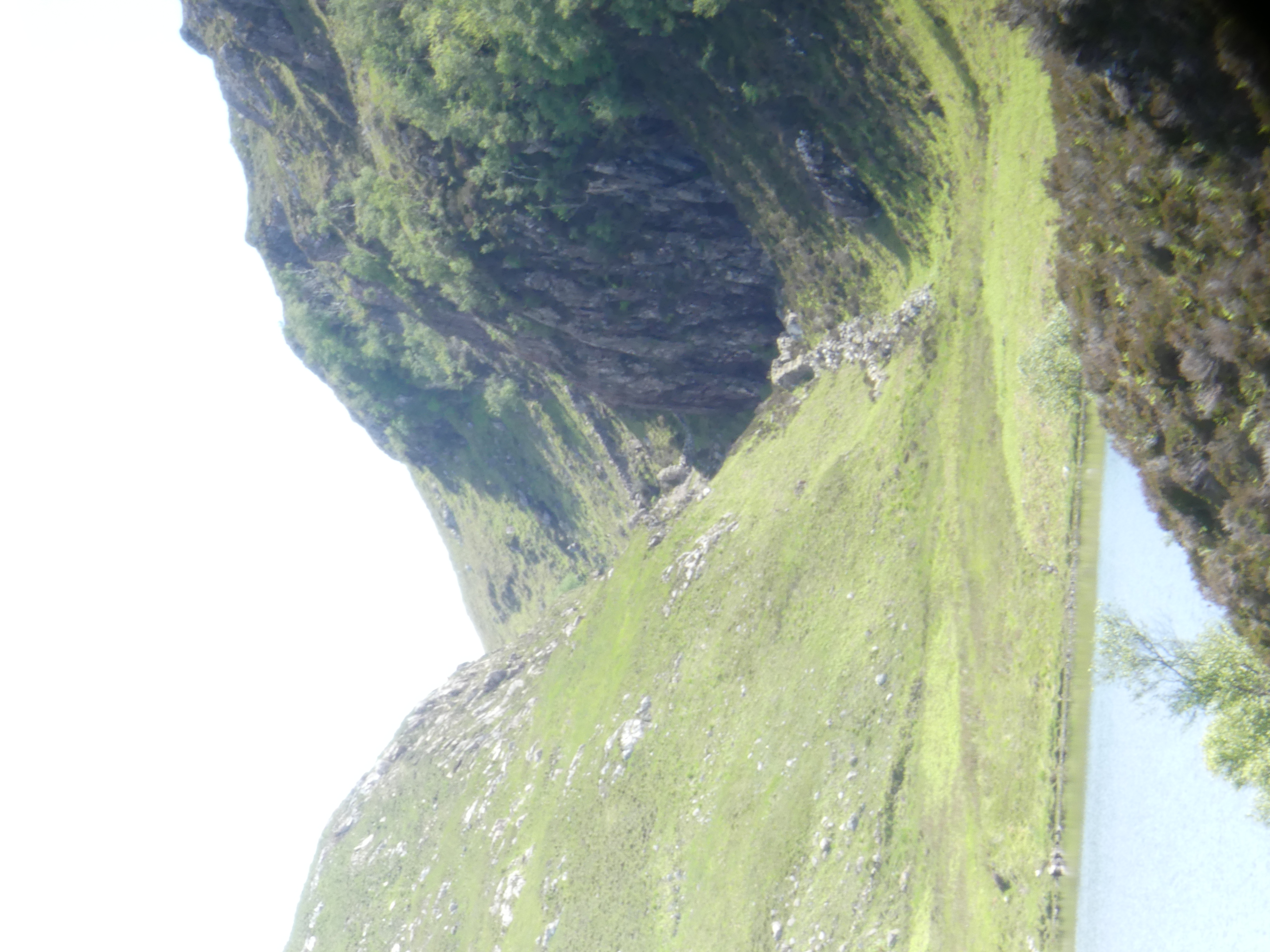
Gleannan na Gaoithe, looking ESE

These dramatic features are all aligned in space. How did they form? A paper from 1956 maps them out and links them to a now vanished lake they call ‘Loch Suilven’. Using “an
ex-R.A.F. bubble-sextant in conjunction with a box-sextant
“, Alex J. Boyd of Inverkirkaig carefully mapped the fossil beaches left behind by this Loch. From this work it is clear that water levels were once much higher. He inferred that the lake once drained via our dramatic glens, until the modern Inverkirkaig river breached the lake and drained it, separating it out into Fionn Loch, Loch Veyatie and others.

Location map. Figure 2 from Boyd (1965).

The picture is complicated by ice. This landscape is haunted by the Ice Age and any carving into the ground could have been done by ice as well of water. Glacial melt water channels are features formed by the flow of ice close to glaciers. Water beneath may flow under pressure, or ice may dam rivers, or melt suddenly to create large volumes of water. Under these conditions, channels may be cut by catastrophic flood events.

Tracing the western edge of the area, around Badnaban (place of the women) Boyd reports “rounded boulders” of large size that suggest the water flow was of “torrential character”. High up, the walls of the channel below Cnoc a Mhuilinn have a polished appearance with scalloped shapes. The British Geological Survey interpret these as S-forms and P-forms and call the structure a glacial meltwater channel.
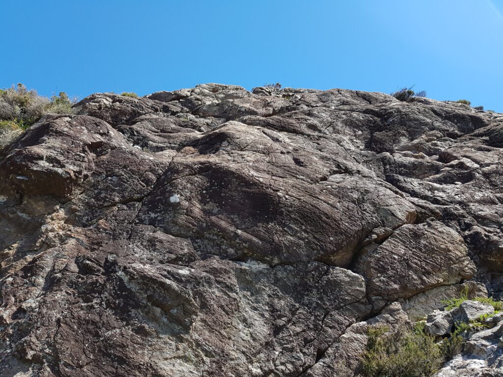
View of a rock surface in the glen below Cnoc a Mhuilinn

A brief scan of modern literature suggests that there is no consensus about the precise meaning of these features, but for sure they are consistent with a dramatic flooding event scouring out the channels. Ice flow may also have shaped the glens and both mechanisms may have acted at different times. But maybe what was eroded is more important than how it was done.
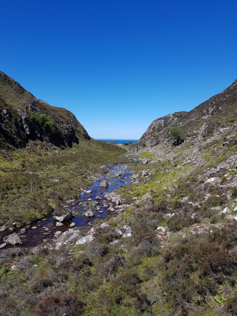
Glacial meltwater channel below Cnoc a Mhuilinn

The sculpture within the block

There’s a quote attributed to the sculptor Michelangelo, to the effect that the sculpture is already there within the block of marble, his job is merely to remove the material surrounding it. For this landscape, this may be literally true. We’ve talked of ice and water cutting into the ground, but maybe the most important features were already physically present within the bed rock, waiting to be revealed.

The cnoc and lochan landscape is an extremely distinctive feature of Lewisian gneiss areas. A similar landscape exists in Connemara on the deformed igneous rocks of Roundstone Bog. The writer Tim Robinson describes this landscape as “frightened”. It’s a largely random distribution of lochs and hills, straight lines appearing where it is cut by geological faults, breaks in the rock that weaken it.

Maarten Krabbendam and Tom Bradwell (of the British Geological Survey) have reviewed the cnoc and lochan terrane in Sutherland and conclude that its distinctive roughness is not a direct product of glacial erosion.

They review similar landscapes in other countries and note that they are a feature of rock type, not of erosion style. They compare the Assynt area with similar terrane in Namibia, where erosion is caused by wind-blown sand rather than ice. They show that the shape of the landscape is mostly controlled by chemical weathering, that weakens solid rock into weak ‘saprolite’. The role of erosion, whether scouring by ice or glacial meltwater, is to remove the saprolite, leaving the harder rock behind.

Chemical erosion is highly sensitive to rock type. The Lewisian Gneiss is cross-cut by vertical sheets of rock called dykes. One particular dyke (400 million years younger than the other Scourie dykes) is rich in olivine, a mineral too chemically delicate to last long at the surface. This dyke easily rots into saprolite, forming deep zones of soft rock. The glacial meltwater channel below Cnoc a Mhuilinn precisely follows this dyke; its location was determined not by the ephemeral flow of ice or water, but by events 1,992,000,000 years ago. Gleann Sgoilte was cut into another dyke and Gleannan na Gaoithe formed along a later shear zone, full of fractured and altered rock.

This pattern is common across the whole of Assynt, wherever Lewisian Gneiss is found. These remarkable glens may be more dramatic than most, thanks to glacial floods, but these were simply picking out the bones of the rock. This landscape was etched rather than scraped.

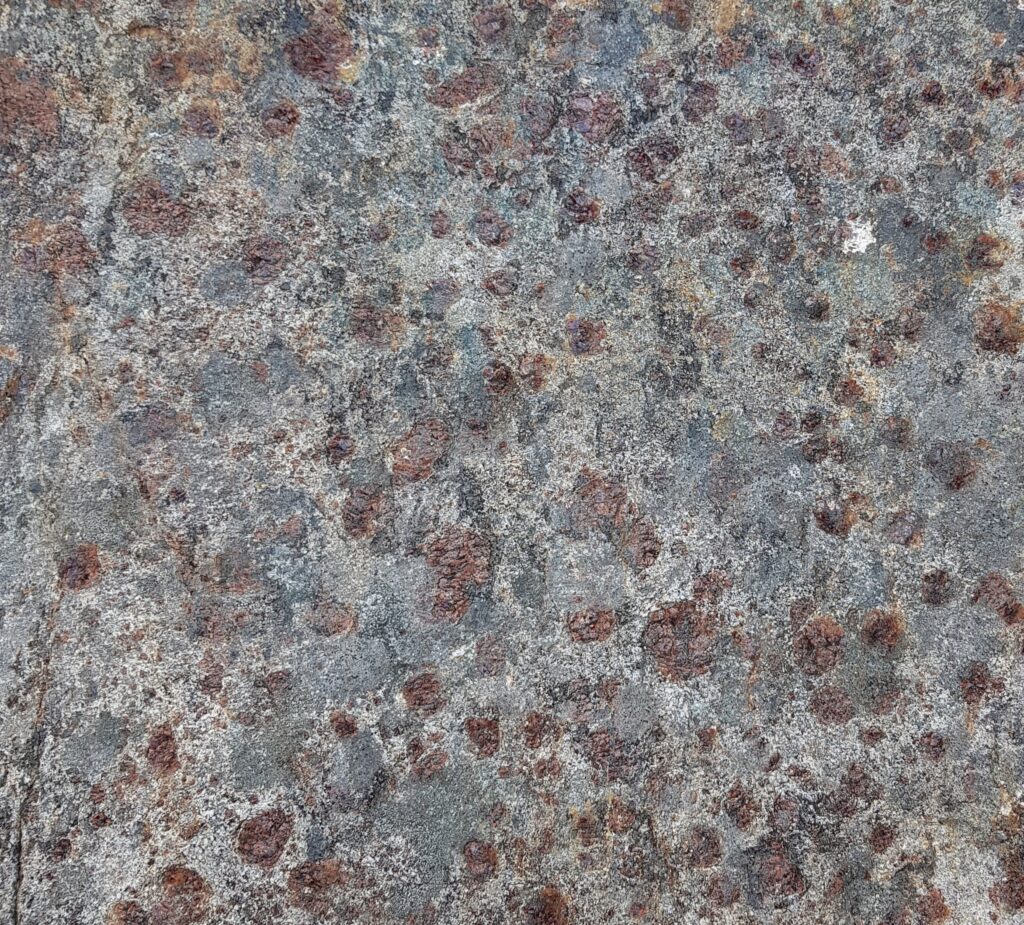
Looking out for the red rocks

Author Tim Robinson spent countless hours in the west of Ireland, unearthing local Irish-language place names. Some are anchored in myth and poetry, referring to miracle-working saints or Celtic Gods. Most though are prosaic, being linked to people’s names, local plants or animals and – occasionally – geological features.

Fàire nan Clach Ruadha is one of the countless hills within Assynt’s central wilderness, just another small summit amid the craggy wastes of the Cnoc and Lochan landscape. Once I’d roughly translated it as ‘red stone lookout’, I knew I had to pay a visit. Secretly I was hoping the ‘red rocks’ would be garnet-rich, as is often the case within the Lewisian Gneiss.

The sort of red rocks I was hoping for. Garnet-rich Lewisian Gneiss from Scourie

On a perfect June day I went in search of the physical realities behind the name. Let’s start with ‘Fàire’. The online resources I’ve used translate this as ‘watch, lookout’, which implies someone once sat on the top of the hill, keeping an eye out for something. This could have been livestock: sheep or cattle. Subsistence farming practices saw animals brought into the interior during the Summer, to make use of the good grazing found here and keep them away from arable crops. Ruins out here are often Shielings, simple buildings built for Summer use only. We are not far here from some and the hill offers good all-round views of the immediate area.

So maybe previous visitors were enjoying themselves, having a relaxed Summer just like me. Tim Robinson translates the Irish phrase for a nostalgic return: “Cuairt an lao ar an athbhuaile” as “the calf’s visit to the old milking place”, a reference to the practice of taking livestock into the hills in Summer. This booleying (to use the Irish terminology) lasted until the 1930s in Ireland and Robinson quotes some idyllic sounding memories of those times.

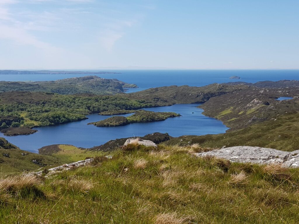
View west from Fàire nan Clach Ruadha, out to sea.

There is another possibility. Walking inland, this hill is the first to give really distant views of the sea, to raise you above this land’s crinkly corrugations. In the photo above you can see the Achiltibuie peninsula, top left, about 10 km distant. The faint smudges of the Outer Hebrides are clearly visible to the naked eye. Maybe this was a place to look out for ships. There are Norse-inflected names are present near here – Suilven and Inverkirkaig for example. Could a lookout here once have run off in terror, sprinting to give advance warning of a hostile Viking attack? On a glorious June day it seems like an impossible idea. Surely a dot on the horizon would cause joyful anticipation of a returning loved one, home from the sea.

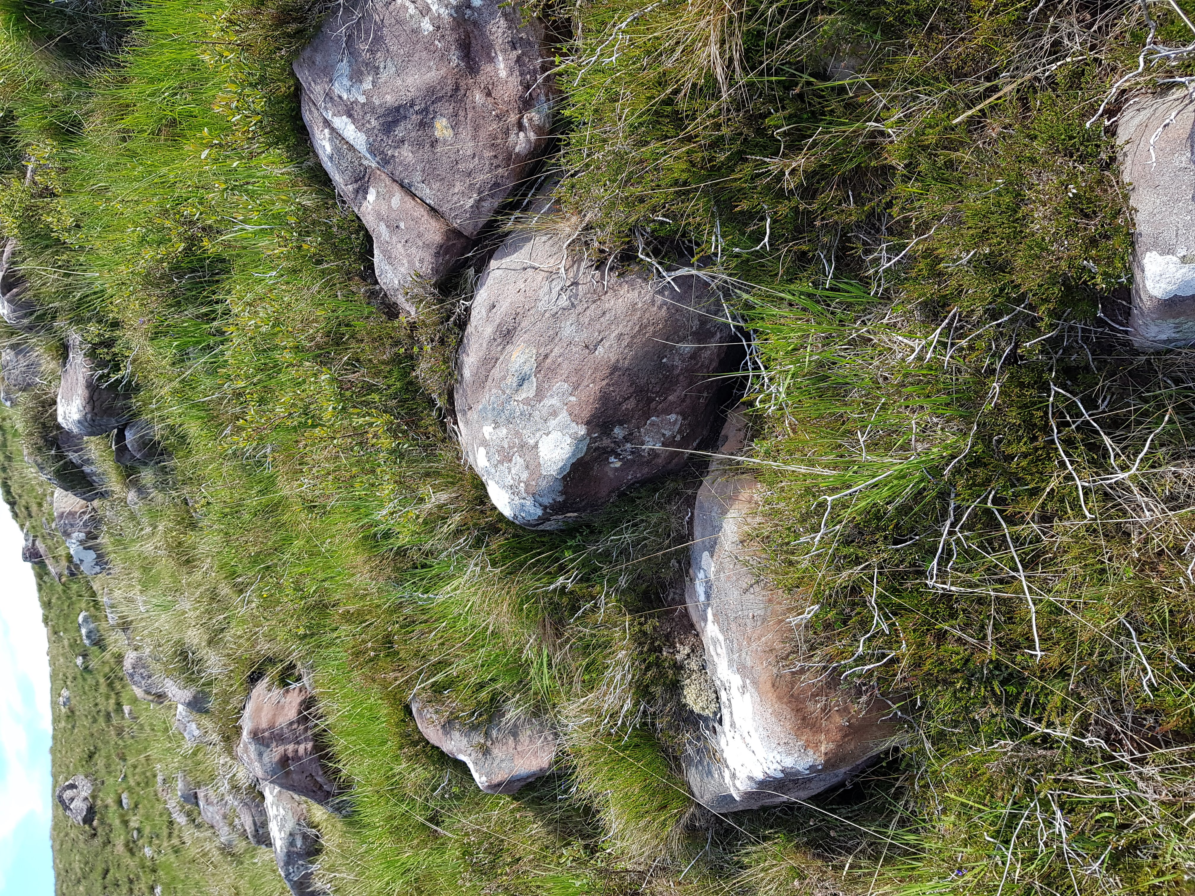
What of the “red rocks”? While the bedrock of Fàire nan Clach Ruadha is made of Lewisian Gneiss, blocks of red Torridonian sandstone are found in great abundance here littering the surface. Some sit proud on the top of the hill, but the most abundant areas are on west-facing slopes.

Red rocks
Red rocks of Torridonian sandstone

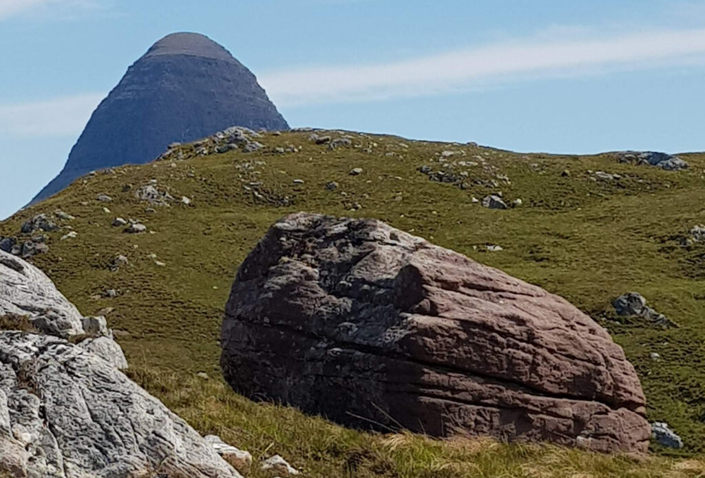
As for much of Assynt, photos taken from here become dominated by the great charismatic peaks of Suilven and Stac Pollaigh. Like being photo-bombed by a celebrity, they immediately become the focus of the image, demanding your attention through sheer charisma. These peaks are also made of Torridonian sandstone, so on Fàire nan Clach Ruadha it feels like they are proud parents, peering down upon their tiny offspring.

Suilven peering down at its little baby mountain

Imagine this is how mountains form. The big parent mountain silently urging its offspring to grow up big and strong. Perhaps they are like sharks, the biggest feasting off their siblings in a race to reach adult size. I could be in the midst of a massacre, too slow to register on human timescales.

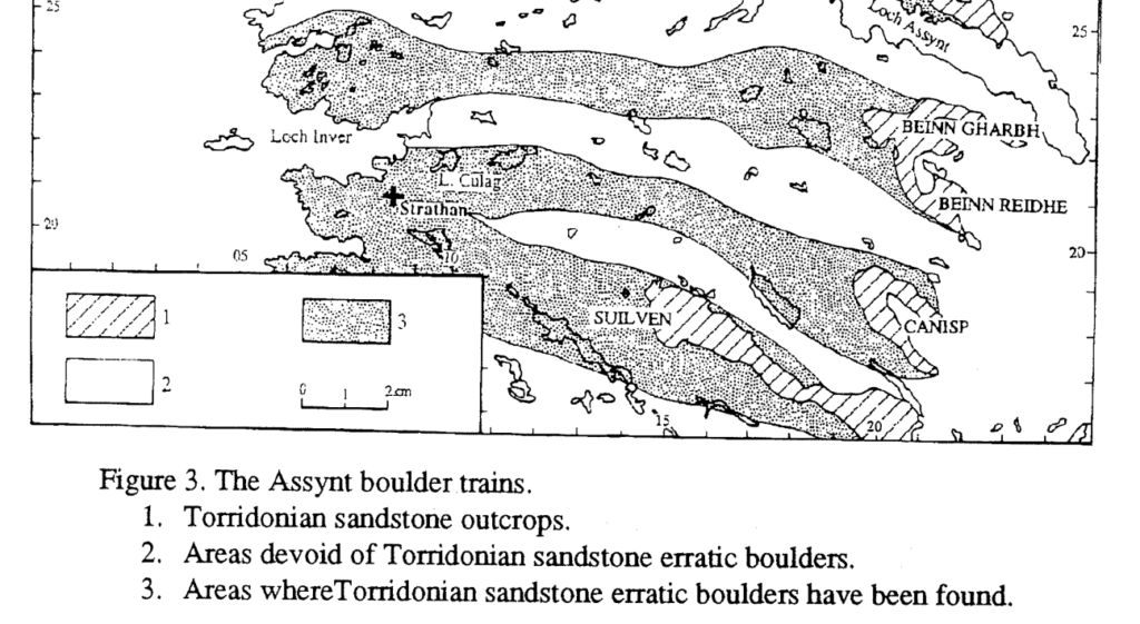
Of course this is actually how mountains die. Each block was plucked from the side of Suilven by ice and left behind by a now vanished ice sheet. We know this, as people have laboriously mapped the location of these ‘boulder trains’ of Torridonian sandstone, showing a clear link.

Image from Lawson (1995).
Fàire nan Clach Ruadha is within the boulder train coming from Suilven

This academic paper ends with a great acknowledgements section, thanking “the unstinting, though often forced, efforts of a large number of A level Geography students ….helped in the plotting… across this knurled and unyielding landscape, often in the most unhelpful of weather“.

Place names are echoes of how past generations have engaged with a landscape, a reminder that our feet are not the first to tread these rocks. Subsistence farmers on a lazy Summer’s day; somebody anxiously scanning the sea; wet and grumpy teenagers; maybe all have noticed these red rocks before me.