Granite and green shoes (AW #42)

I have a busy suburban lifestyle which rather restricts opportunities for fieldwork. Consequently I make the most of the few opportunities that do arise. These might be a glacial erratic in a park or turbidites in the toilets but here it’s granites in shopping centres. These are found sometimes on counter-tops, but often as flags on the floor. So, if you’ve seen someone apparently furtively taking pictures of his shoes, while his children try to pull him into a shop, that would have been me.

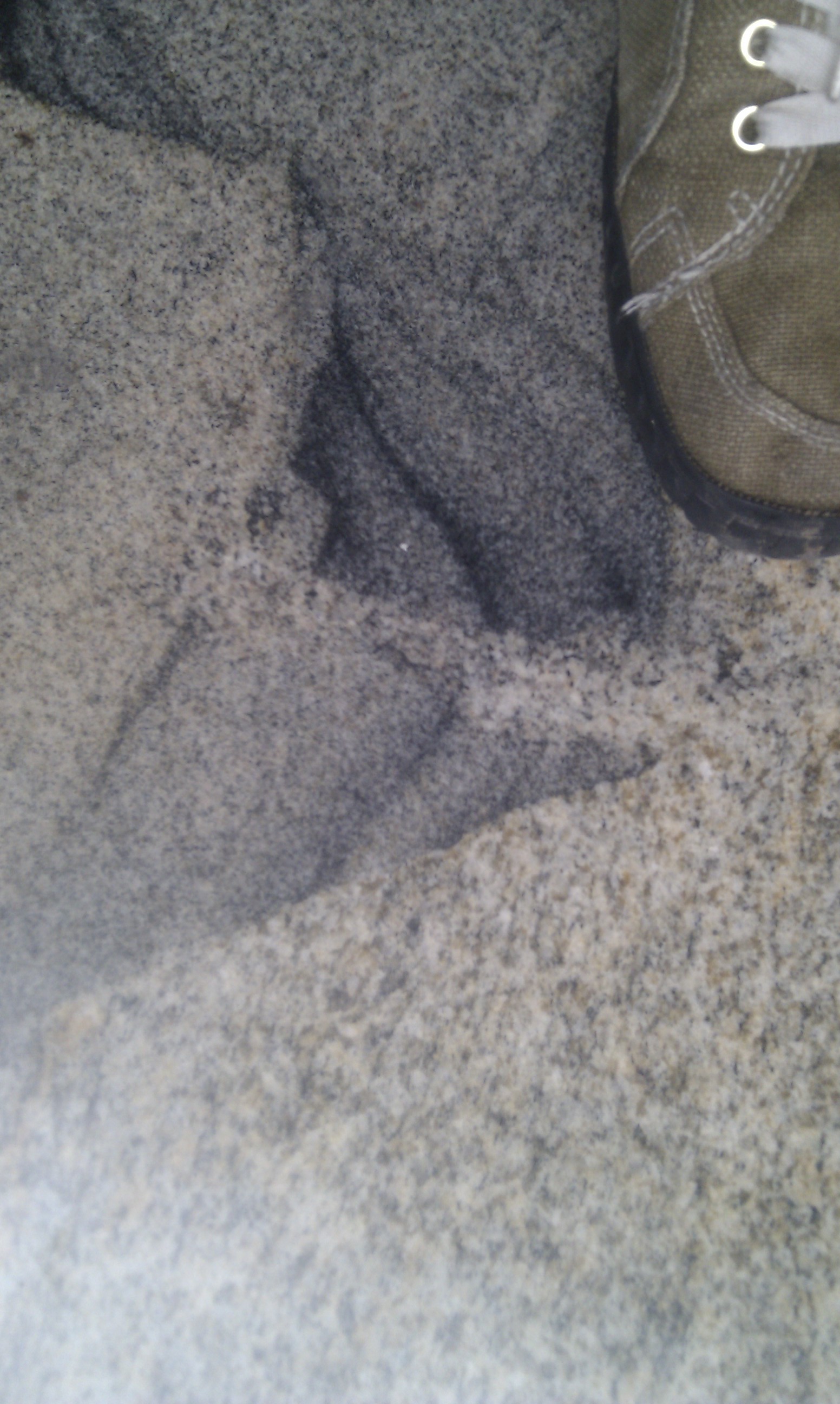
Here’s a nice piece of granite (a good place to sit and eat sticky buns), green shoe for scale:
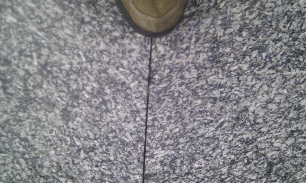
By granite, I mean granitoid or granite ‘sensu lato’ (e.g. in the loose sense). The term granite ‘sensu stricto’ is tightly constrained in terms of proportions of feldspar, quartz and so on. I’m not an igneous petrologist and when I look at ‘granites’ I don’t worry about the composition of the feldspars, I work out whether they are aligned randomly or not. Look through the eyes of a structural geologist and you see fabrics. In these blocks there is a planar fabric, largely defined by the alignment of the feldspar laths. Like so:
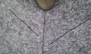
So this is a deformed granite, so we should call it a meta-granite? Not necessarily. It turns out that fabrics can form in granites as they cool.

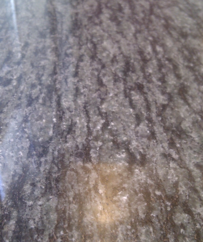
Normally in deformed rocks, fabrics are formed by the deformation of the actual minerals. In intensely deformed rocks such as mylonites, the individual minerals have had their shapes dramatically changed.

Here’s a counter-top example of an igneous rock that has deformed after cooling:

Nice counter-top. Bad coffee, sadly.

Note how the original igneous minerals have all been deformed and/or recrystallised. The fabric was caused by crystal-plastic deformation. The rock was deformed after it crystallised.

In my original example, the fabric was defined by the alignment of laths of plagioclase, but these feldspar grains were themselves undeformed. It turns out that fabrics like this form in granites while they are still molten. If you put stress on a cooling magma (which is a mix of molten rock and freshly crystallised minerals) you can deform it and so align the minerals.

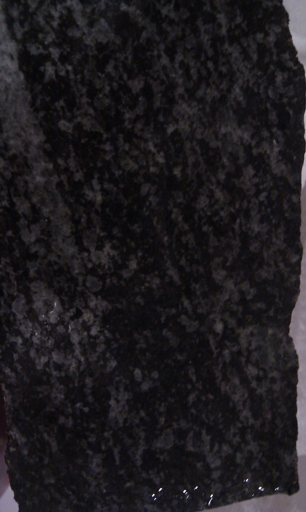
Also, if the magma is compositionally inhomogenous it will end up as a granite with patches of different colour. If it has been deformed, you will end up with flattened patches, which themselves form a visible fabric in the rocks.

Time for some examples, from a set of slabs that cover huge areas of my local shopping centre. Here’s my favourite:
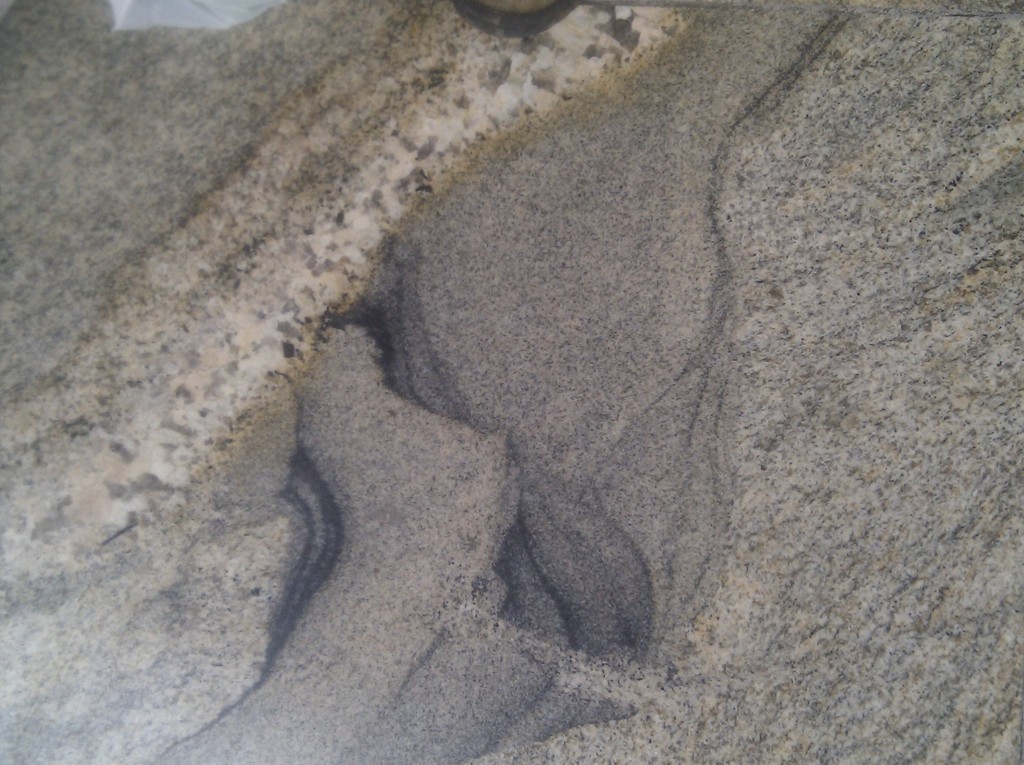

There’s a lot going on there, so I’ll put on my annotating hat.
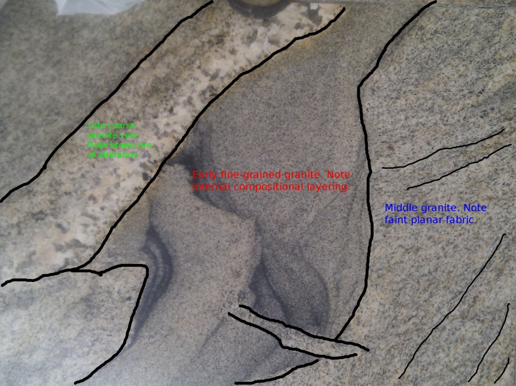
Talking through in sequence, we start with a fine grained granite (area with red text). This contains compositional layering that is a little bit folded. Next we have an area (blue text) of more homogeneous slightly coarser granite. It looks like the early ‘red’ block has sharp edges and so was mostly solid when the ‘blue’ magma arrived on the scene. The blue area has a faint fabric to it. Finally we have a ‘late’ granite vein (green text) that crosses everything. This probably is late in the granite’s history as its coarser grain size and the zone of alteration around suggest it was rich in fluids and so some of the magma that cooled last.

The ‘blue’ granite is the only area showing a fabric. This is a neat proof that this fabric was caused by deformation of the magma, not solid rock. The fabric was formed after the early ‘red’ block was solid and before the late ‘green’ granite was intruded. It therefore must be syn-magmatic and as such is an insight into what goes on it cooling magma chambers.

Here’s a close up of the most interesting area. Note the sharp edge between ‘blue’ and ‘red’.

Here’s an intriguing one:

Those are not my shoes.

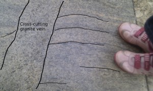
A bit of annotation to bring out some interesting features:

Note another coarse cross-cutting vein, in an area with a clear fabric. What is intriguing is the way the fabric appears to swing into the vein, with a consistent sense of shear. What *might* be going on here is that there was a shear-zone cutting the fabrics, which the vein subsequently is intruded into.

What causes the fabrics then? It is very likely, for the examples shown, that the fabrics are caused by normal processes associated with granite intrusion. Intrusions of new magma, changes in volume on cooling or other processes can cause movements that explain these weak fabrics.

What if granite is intruded into crust that is being deformed? If the country rocks are being flattened or sheared, what effect does this have on the cooling intrusion? Its now recognised that many granites are syn-tectonic and that they contain magmatic fabrics that ultimately are caused by deformation of the surrounding rocks. More than that, there are classic areas, such as Donegal in Ireland, where it is clear that the granite was intruded into a deforming shear-zone. This is a whole new take on the classic ‘space problem’ for granites. One answer to the question of how you make space for granite magmas to fill is that shear-zones are involved. Much of the evidence for this is found in fabrics like the ones I’ve shown you.

My PhD was based around a set of syn-tectonic mafic intrusions. These had magmatic fabrics too, only in gabbro rather than granite. In this case I demonstrated a link between the fabrics in the intrusion and the fact it was actively being deformed while cooling. I’ve never seen gabbro fabrics in a counter-top though, more’s the pity.

 This story is my contribution to the Accretionary Wedge #42.

Where on Google Earth #328 – now with another hint

Christoph’s lovely view of fractal patterns in the Scheldt estuary took a while to find, but his hint made me think of European estuaries and I happened to start in the West….

I’ve given up guessing how hard my Where on Google Earth pictures are going to be to find so I’ve not much to say about it, for the moment. Schott Rule does apply, in case this one is easy to get. If you don’t know what the Schott Rule is, you don’t need to worry about it.

Rules are best expressed here, but in summary, look at the entire Earth’s surface until you find the area shown in this picture. Then find out about its Geology. Then add the location and Geological description in the comments.

It’s nearly been a fortnight, so time to drop some subtle hints, I think. An interesting fact: a mate of mine found this within half an hour, but doesn’t want to claim the credit. Also he had an advantage: his PhD field area was near Ronda. NB see Felix’s comment below, he’s on the right lines.

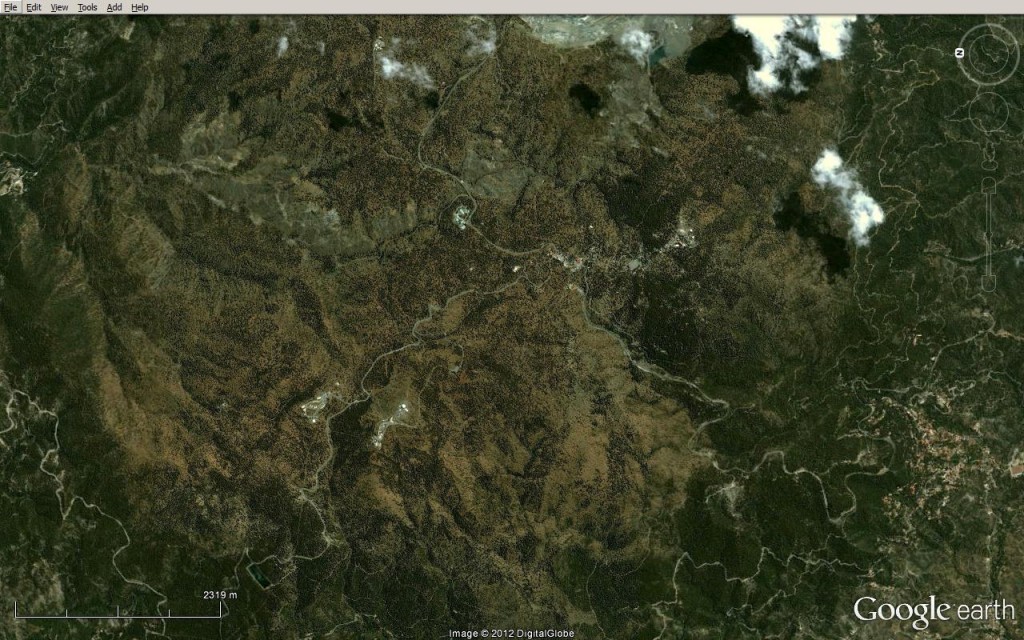
Hint #2, here is a screenshot of an area of the world where the same rocks can be found (but not on the surface). Once you find the main picture, you’ll find it’s a classic.

A journey through the geology of mountains

This post is part of my journey into the geology of mountains.

I’ve got a picture of Mount Everest to show you. It is gorgeous. I’ve got a plan to rhapsodise for a good while about its Geology, too. I’m going to make you wait though, so I can be sure that you understand what I’m talking about, that you fully understand how the Geology of Everest is interesting and counter-intuitive. You’ll see it in the context of mountain belts across the world, old and young. What a glorious moment that will be!

In order to reach those giddy heights I need to do two things. First, write a series of posts detailing our geological understanding of mountains, secondly get you to read them. A huge challenge no doubt, but I at least will enjoy the journey. So, I’ve a mountain to climb, let’s get going!

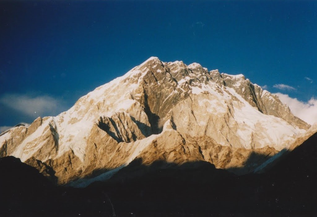
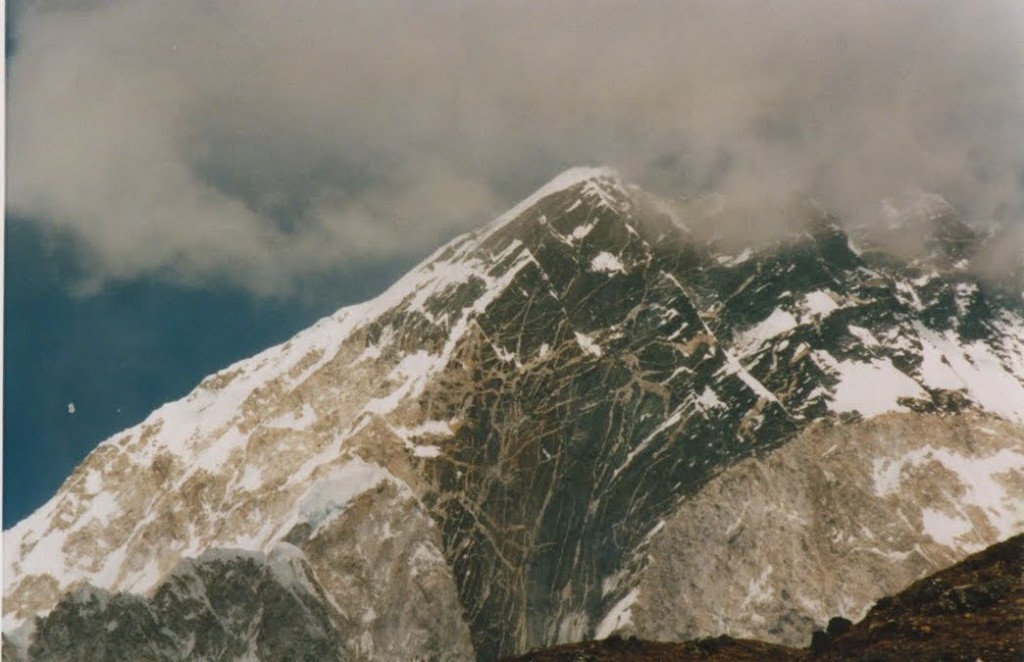
Mountains are rather obvious things, if you’ve been near any. They look like this:

South face of Nuptse, Nepal. Everest is hidden behind this.

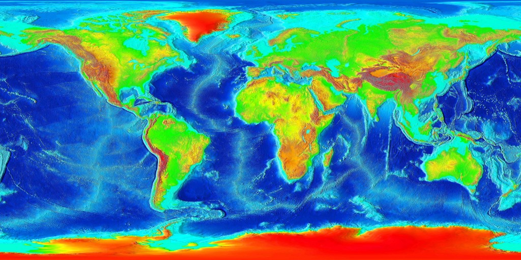
Big, pointy, covered in snow. A look at a topographic map of the world shows us where  modern mountains are to be found.

Look at the red areas which are high altitudes. Ignore Greenland and the Antarctic, they are high due to ice-caps, which is cheating. Ignore Southern Africa as that is a high plateau rather than mountainous. Otherwise, what do you see?

Firstly, an obvious chain of mountains all along the west side of the Americas. Next a line of red staring at Spain and Morocco moving east via the Alps, Iran into the Himalayas and Tibet. Extra marks if you spotted New Guinea. All of these areas are active mountain belts. Belts because of the shape, active because the plate tectonic forces that created them are still ongoing.

As with most things in Geology, an explanation of why mountains are formed starts with plate tectonics. Where a continental plate is involved in a collision, mountains are formed. The second plate might be oceanic (Pacific ocean hitting Americas = the Andes, Rockies) or continental (India/Africa hitting Eurasia = Alps/Himalayas). That’s the sentence-length explanation. Much more in later posts.

Oh, and we are not talking about volcanoes. A volcano is a big hilly thing and so is a mountain, but geologically it is totally different. Think about the volcanoes in the Andes. They are locally important but the reason the Andes stand out in the map above is not due to the volcanoes, they sit on top of the mountain belt.

There are those who say that the only sensible place to study how mountains form is in active mountain belts. Where you know the plate tectonic context (you can trace India’s progress north, for example) and you can use geophysical techniques to infer what is happening at depth. There are others (those with smaller fieldwork budgets perhaps) who say that studying ancient fossil mountain belts is also vital. Why restrict yourself to only the few active mountain belts? There are rocks that were formed in ancient mountain belts virtually everywhere.  When discussed these, geologists are apt to start using the term orogens or orogenic belts. These are basically fossil mountain belts. They contain rocks that are deformed and metamorphosed, recording the processes that caused a mountain belt to be formed. Across Geological time, there have been a lot of orogenies.

My favourite orogenic belt is the Appalachian-Caledonian, which sits either side of the North Atlantic. It stretches from the Appalachians via Ireland and Scotland into Norway and east Greenland. A note of caution here, the orogen is found in areas that are locally known as mountainous, but this is not due to mountain building processes directly. The Appalachian mountains are higher than their surroundings because they are more resistant to erosion, or due to effects relating to Atlantic opening (same for Scotland and Norway). Also, with all due respect, they are not real mountains. They only reach 2km in height whereas most of the Tibetan plateau is at 5km and Everest is nearly 9km. If large chunks don’t regularly fall off and you don’t get short of breath due to altitude at the top, its not a real mountain, no matter how pretty it is.

In the next step on our journey up towards the top of world, I’ll be talking about how the recognition that classic plate tectonics doesn’t work well with mountainous areas led to the complimentary concept of continental tectonics.

I’ll leave you with another view of Nuptse, to whet your appetite.

Topographic map of world courtesy of Wikicommons. All others are mine, for a change.

Geology and myth

As a word, myth has taken on negative connotations. False modern stories are dismissed as “urban myths”, myths are seen as old superstitions to be ‘busted’ by scientific truth. There are geologists who take a different view. Taking myth in its original sense – the stories by which pre-literate societies make sense of their world – they see it as a precious scientific resource, shedding light on dramatic but infrequent geological events that might otherwise go unrecognised.

Myths have traditionally been studied by those trained in ‘the arts’. They have been studied for their religious, or psychological or literary qualities. Looked at like this, they seem in opposition to a modern scientific world-view. At the most extreme, myths are either stories told by those ignorant of how the world really is, or insights into realities that transcend ‘reductive science’. Perhaps this tension between science and myth is not one that would make sense to the actual authors of the myths. They were intelligent and observant people trying to make sense of the world. They described events in terms of their world-view, (fighting gods and such-like) but that doesn’t mean they weren’t describing real events to the best of their abilities.

A glimpse of the ways in which pre-literate societies store practical information about geological events came with the 2004 Indian Ocean ‘Boxing Day’ tsunami. In some remote areas people survived because they climbed to high ground in advance of the tsunami hitting. They did so because they recognised the warning signs from their verbal folklore, which advised moving to high ground in such cases. Such an ability to transfer important information across generations is clearly valuable.  Perhaps this is going on in some myths, stories preserved from other pre-literate societies?

The Geological Society 2007 special publication Myth and Geology is a selection of papers from scholars grappling with this very question. The opening essay contains my favourite example of mythology that is clearly linked to a natural event; the Klamath Indians from Oregon in the US have a myth concerning a fight between the chief of Below World and the chief of the Above World. They hurled rocks and flames at each other and darkness covered the land. The fight ended when the chief of Below World was forced back into his kingdom. The hole where this happens remains – we know it today as Crater Lake, the site of a major volcanic eruption 6500 years ago. Human artefacts are found in the ash layers of this eruption so we can be certain that this myth is a modified eye-witness account.

Myth and Geology is full of stories like this. I want to pull out three themes – fossils, faults and impacts, leaving much of the book unmentioned.

Fossils and Myth

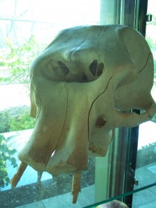
Dwarf elephant skull courtesy of Wiki Commons

Cyclops, brought to you courtesy of Wiki Commons


Before science came along with its amazing tale of life’s billions of years of twists and turns, what stories did we tell ourselves about fossils? Finding colossal bones of unfamiliar creatures, we told stories about fighting giants. Adrienne Mayor describes place names across the world based on the fossils found there. Native Americans were well aware of dinosaur track-ways, for example.  Agnesi, Di Patti and Truden take us to Sicily and describe how elephant skulls found there are likely the origin for the myth of cyclops: giants with a single eye in the middle of their forehead. Fossil echinoids are common in southern England. K. J. McNamara describe how they were know as fairy loaves or thunderstones and associated with magic. Today they can found in significant places in the walls of old churches.

Earthquakes and Myth

Major earthquakes are geologically common events all around the Pacific Rim and figure in the myths of that region. Ludwin & Smits compare traditions from pre-Columban cultures in Cascadia (close to Seattle, USA) with Japan. Their broad thesis is that even when expressed in symbolic language, myth and folklore describe geological events.

In both areas, earthquakes are explained in terms the movements of creatures of great power living underground. In Cascadia, stories are of struggles between a Thunderbird and a whale, in Japan – giant catfish. In North America, the folklore helps clarify recent seismic activity on the Seattle fault, and so sheds light on future hazards.

The Japanese material is from the 18th Century and is in the form of sophisticated pictures. My favourite has to be the one showing “courtesans and male workers of the elite brothel district” attacking a giant earthquake-causing catfish. A group of builders rushes in to defend the fish, as earthquakes bring them a lot of work.

A fairly well known piece of geomythology concerns the Delphic Oracle. Consulting oracles was a major political and cultural part of Ancient Greece, featuring frequently in Greek literature. The Oracle was consulted and then went into a special place to consult with the Gods, breathing vapours that arose from the ground. Recent geological work shows that the temple sits on a fault and that it is plausible that ethylene vapours were present. In a recent BBC Radio ‘In Our Time’ program on the Delphic Oracle this research was raised. An expert on Ancient Greece culture dismissed it in a word. She gave no reasons, perhaps showing the disdain towards science sadly so often found in British ‘Arts Graduates’.

Myth and cosmic impacts

I’ve talked so far about common, important but infrequent events. There is another set of events so uncommon that no-one living has witnessed one – major cosmic impacts, where a big chunk of space comes hurtling out of the sky. Massie & Massie write about a big dataset of myths from South America. They link myths that talk about ‘sky fall’ or ‘great darkness’ with Andean volcanic eruptions and associated ash clouds. Having established the usefulness of their data-set, they turn to another set of myths that talk of a ‘world fire’ with origins in the sky. They link a set around Argentina with a known impact site, Campo del Cielo. Other data, myths collected from the Brazilian Highlands and elsewhere can’t be linked to any obvious crater, but they speculate a link to an ‘air-burst’ where the impacting object doesn’t reach the ground, but does create enough energy to cause widespread burning.

This paper is only a part of the work Bruce Masse is doing. Looking at flood myths from around the world he proposes a link between them and a major cometary impact in the Indian Ocean. This would apparently put large volumes of water into the atmosphere, causing rain, plus massive flooding around the world.

Myth and belief

I’ve deliberately stuck to describing the work where the author is describing the myths of another culture. In these cases, the author has no emotional stake in the validity of the myth and they are objective. In the case of a Christians looking for Noah’s Ark, or the role of geological features in Hindu faith, I have my doubts that a person’s beliefs will not get in the way of a rational analysis of the facts </english understatement>.

One consequence of geomythology, this new way of looking at myths, is that it reduces the gap between us and humans in the distant past. To quote Myth and Geology it provides us “with a profound respect and appreciation for the observational powers of our ancestors”. A modern scientist describes natural phenomena in light of her world-view, no less than any myth-maker. With ‘science’ we have a fantastic, useful and sophisticated world-view that has been tested against reality for centuries. What a privilege! However, without the benefit of this body of knowledge and ways of thinking, are we modern people much different from our ‘primitive’ ancestors? After all, we all just want to make sense of the world, one story at a time.

Note, David Bressan has an excellent post on the whole Japanese catfish, earthquake thing, including pictures.