My favourite map

This is my contribution to the Accretionary Wedge geoblog festival, number 43: My Favourite Geological Illustration. You can read all about it at In the Company of Plants and Rocks. 

I was struggling for inspiration on this latest Accretionary Wedge, but this was solved by Matt Hall’s post over at Agile Geoscience, where he talks about a map he produced as part of his degree. Geological maps have captured my imagination since a very early age. I’ve spend many an hour poring over the geological map of the British Isles (particularly the Northern sheet) but of course I had a modern copy, not the William Smith original.

I have hidden away somewhere a very similar undergraduate map to Matt’s but I won’t steal his idea outright. I have a bigger map produced as part of my PhD thesis somewhere as well, but instead I want to talk about someone else’s map.

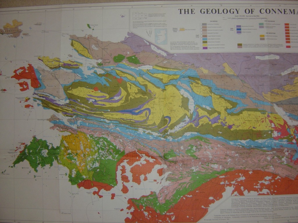
My PhD field area was in Connemara in the west of Ireland, which is an extremely well-known piece of Geology. A fantastic detailed map was published in the 1990s but is based on decades of study by geologists from Glasgow University, Bernard Leake and Geoff Tanner. It is of course in copyright and for sale, but I include an impressionistic photo. I’m sure the Royal Irish Academy will not disapprove.

I’m tempted to rhapsodise at length at the Geology shown by this map, but I’ll be brief. It is a small area (top to bottom about 20km) but it contains such a lot! Such as: evidence of Precambrian glaciations; two overlapping phases of metamorphism, from greenschist to granulite; three major phases of folding; three suites of igneous intrusions, one syntectonic, two post; three tectonic terranes; two terrane boundaries, one a thrust the other an extensional detachment complete with syn-deformational sediments; some world famous marble.  Oh, and some sediments around the edge.

One of the greatest pleasures of my PhD research was meeting and disputing with Geoff Tanner and Bernard Leake, standing on the rocks themselves and referring to their fabulous map.


What Geology did to me #3 – commando

I’ve another quirky habit, picked up from years of field work that I’d like to confess to you all.

Picture the scene: I’m standing on an Irish hillside and I’ve just found the most glorious outcrop. It’s glacially polished, each feature beautifully highlighted by a layer of water from a recent rain-shower. Excitedly, I dump my ruck-sack and get out my notebook and pencil and start making notes. I decide this merits marking as a location, so I tuck the notebook under my left arm and pull my clip-board out. This holds a grubby piece of paper held in place by about 6 strong rubber bands. Why six? Well, the memory of sprinting down-wind after a map sheet is still strong. I keenly remember speeding after weeks of work, watching the capricious wind that snatched it away bounce it cheekily towards a big black lake. I smile at the rubber bands and then realise I need to move one to write on the correct spot. My hands are full, what do I  do?

Well, I could put the pen down on the ground, but it will be wet. Also I remember accompanying a student on a mapping project once. She put her pen on the ground only to watch in horror as a bored Irish sheep dog rushed over and chewed it up. It was a cute scene as the dog grinned at us, ink dripping down its jaws, but the pen was a £20 mapping job. Bad memories, so I put my pen in my mouth, gripping it gently but firmly, like a mother cat carrying a kitten. I move the rubber bands and then take the pen out of my mouth. Success!

Soon, holding things in my mouth becomes a habit; it’s like having 2 and a half hands. You can hold a lot of things in there: Pens and pencils – easy; compass clino too, but a notebook strains your jaw after a while. I once forgetfully tried to hold a hammer in my mouth, but only once.

Years later, the habit remains. I try to be discrete about it, but various of my belongings do have faint teeth marks in them. One day, absent-mindedly I’ll find myself, smart and besuited, walking from the sandwich bar at work with a cup of coffee, a sandwich and a packet of crisps dangling  from my jaws.

I wasn’t consciously inspired by the image of WW2 British Commandos holding a knife in their teeth as they crawl under barbed wire, but it was probably in the back of my mind, a relict of boyhood comics. Drifting off-subject, the term ‘going commando’ has other connotations. It is used to describe the popular pastime of wearing trousers without under-garments (wearing pants without pants, to be transatlantic about it). A doctor friend in the army tells me young soldiers (‘squaddies’) do it a lot. They come into her surgery with a bad knee and are then asked to take their trousers off so she can see their leg. The look of shock and worry on their faces as they realise they’ll be showing her a lot more brightens her day up no end.

Image from the Imperial War Museum

The many ways of understanding mountains

This post is part of my journey into the geology of mountains.

When I’m climbing in mountains I like to take my time of it. The summit is not the point; the journey’s the thing. Direct and fast routes the top are not for me. In that spirit I’m getting diverted into a post that doesn’t really help us get the end of our mountainous journey. Think of it as a detour to get a nice view or an added bonus that adds to our enjoyment and wonder at the variety of mountains.

I’m reading a Geological Society of London special publication at the moment. It’s about mountains, naturally, and I’m going to list out all the geological and geophysical techniques mentioned in it. I’ll start with the obvious, but by the end I’ll hope you’ll share my surprise at the sheer range of different types of evidence being gathered.

The obvious: structural geology is an important technique. You can’t get mountains without deforming rocks and the study of structure, from map-scale to microscopic is essential. I’ve written extensively before about metamorphism and this fine subject is indeed extremely useful when studying mountains; the ability to extract P-T-t paths particularly so.

The geophysical – seismic: for modern mountain belts, such as Tibet, the ability to peer into the depths of the earth is very useful. Seismic techniques have a lot to offer here. First there is the pattern of earthquakes themselves. If a body of rock hosts an earthquake then it is most likely being deformed in a brittle fashion. The pattern of earthquakes with depth can then be used to infer the presence of strong, brittle, rigid rocks versus soft, aseismic, viscously deforming rocks.

More direct field-based seismological studies are of great importance in the study of Tibetan geology. If you place close arrays of seismographs and make your own earthquakes (using dynamite) you can get a lot of data, by looking at the way the returning waves are reflected and refracted through the earth’s surface. This might give you a direct image of an important structure (for example the Moho).

Field-based studies tend to give data on the crustal scale.  For deeper insights, seismic tomography is used. This looks at natural earthquakes and the patterns traced by seismic waves through the earth. This can be used to build up pictures of very deep, very big structures such as subducted crust in the mantle.

There’s more. With enough data, the speed with which seismic waves move through portions of  the earth’s interior can be inferred. In some places this value is different depending on the direction in which the wave was travelling. This anisotropy is interpreted in terms of a preferred orientation of minerals within the rock. We can measure the effect directly in minerals at the surface, which allows us to infer the direction in which the minerals are orientated deep below the ground. Minerals are orientated by ductile deformation so seismic data can let us tell the direction in which rocks are flowing kilometres below the surface.

Other geophysical: the value of gravity at the earth’s surface can be measured and the way this varies sheds light on Geological processes. Measuring gravity over the Himalayas has a fine pedigree, starting with Nineteenth Century observations of how plumb bobs weren’t pulled towards the mountains enough.  The extra mass of rocks above the surface is offset by a greater depth of lighter rocks below: the crust is thicker.

Magnetotelluric studies look at electrical and magnetic fields and can be used to infer the presence of melt (or fluid) beneath the surface.

Apply enough maths and a map of altitude can tell you a lot. For instance the pattern of altitude around recent faults can be used to infer how weak the crust is.

Isotopes: isotopes are useful things, no doubt. Firstly they can tell you how old things are. Cleverly, they can date lots of different events. For a single granite intrusion for example you can use U-Pb in magmatic zircon to tell you the age of intrusion and the same in an ‘inherited’ zircon to tell you the age of the crust that melted. A variety of techniques in mica, apatite and other minerals can then tell you the age at which it cooled through a variety of temperatures. If you want to know how fast rocks are reaching the earth’s surface, this is very useful.

The isotopic composition of Helium in hot springs gives a handle on mantle input to magmatic systems. Cosmogenic nucleides can show how long a rock surface has been, umm, on the surface. Stable isotopes of carbon and oxygen can be used to infer past altitudes.

Indirect: When mountains are eroded, lots of evidence is removed. Not lost though, it is stored in rivers, and river and ocean sediments. Look at the contents of the sediment, in particular heavy mineral contents and the age of zircons and you can tell what was being eroded through time.

Sometimes when intrusions arrive at the surface they contain little pieces of unmelted rock. These xenoliths can give a record of the types of rocks found beneath the surface.

Very indirect: finally the one that makes me smile. Plants. Detailed studies of leaf morphology can be linked to the climatic conditions under which they grew. Apply this to fossil leaves on the Tibetan plateau and you can infer the altitude at which the plants grew. This gives a record of the height of the plateau over time, which is something of great interest.

Phew! The best thing about Geology is the variety. Getting up to speed with contemporary work I’ve been most impressed with the increasingly cross-disciplinary nature of the Earth Sciences. I’ve not even mentioned the variety of numerical modelling techniques that are used, for example. It seems geophysicists and field geologists are working together at last, a pleasant change from the situation I remember in the 1990s.

So, have I missed any? If you know of a technique for studying the geology of mountains that I’ve missed, let me know.

What Geology did to me #2 – flamingo

I have an odd habit. My wife mocks me for it, good-naturedly, but I am slightly embarrassed about it.

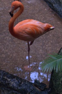
No, not that! What it is, I always stand on one leg while tying my shoelaces, like a mad boot-wearing flamingo. To be precise, I rest one ankle on the opposite knee, like a Buddhist monk frozen in the act of jumping up to answer the phone. As if this wasn’t daft enough, I’m not very good at it so I sometimes fall sideways onto the wall, or hop around gracelessly.

This is something Geology did to me, since I picked the habit up in the field. An Irish field, to be precise, which is always, always damp. I wore boots and the laces came undone. When I knelt down to do them up, in the traditional fashion, I got a wet knee. I didn’t like getting a wet knee and so developed my odd habit.

Now I mostly tie the shoelaces of my shiny shoes by the front door, where the only risks to the dryness of my knee come from my potty-training son. Standing on one leg is therefore a kind of atavism, like calling CDs tapes, (or using CDs for that matter). I still carry on doing it though, as it would take conscious effort to change and I rather like a bit of randomness in life.

Do other field geologists do this, or is it just me?

* Flamingo image from yumievriwan on Flickr, found via eng.letscc.net