Sicily’s other volcanoes

In early February I went on a trip to Sicily with friends. I had originally planned to visit Etna, but I was travelling with non-geologists and the cost and discomfort of going up there in the winter put me off. I was therefore a little narked that Etna decided to erupt a few days before I was due to fly off. The fantastic pictures from @EtnaWalk and @EtnaBoris made me feel I was missing out.

By the time we flew into Catania Etna had (just) stopped erupting. It was also totally invisible beneath cloud. This made me feel a bit better about my decision to focus the holiday around seafood and leisure rather than lava. From Catania, at the foot of Etna, we made our way to Siracusa, which Archimedes called home. The drive south revealed a landscape characteristic of a stable platform, with lots of flat layered sediments creating a ‘trap topography’ with flat-topped hills with long steps between them. The south-eastern corner of Sicily is in fact part of the African plate and so is as yet untouched by the exciting things that have happened to most of the rest of the Mediterranean.

Siracusa is a nice place (well at least the old quarter of Ortygia is). Local buildings make use of basalt and limestone together, often with basalt forming parts that need to be hard wearing, such as steps.

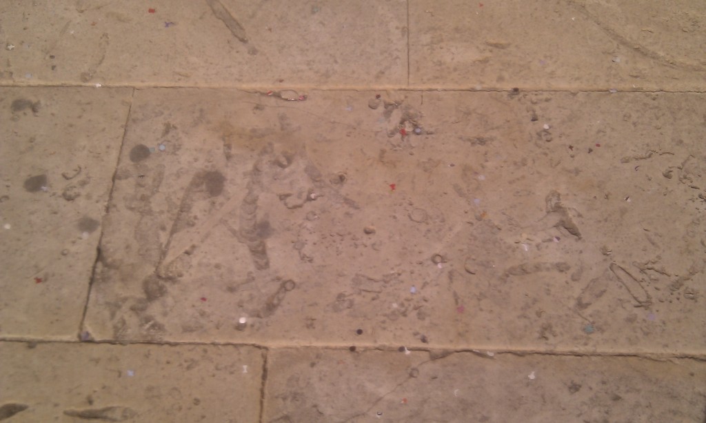
The square in front of the cathedral in Ortygia has been recently paved with slabs rich in trace fossils. I won’t hazard a guess as to the names but you can tell these critters were having lots of fun in the (limey) mud.

Having forgotten about Etna, a surprise on our first morning was that the breakfast room of the hotel had a nice distant view of it. Note how the modern cathedral echoes the shape of the volcano, but focus on the white triangle in the centre of the picture.
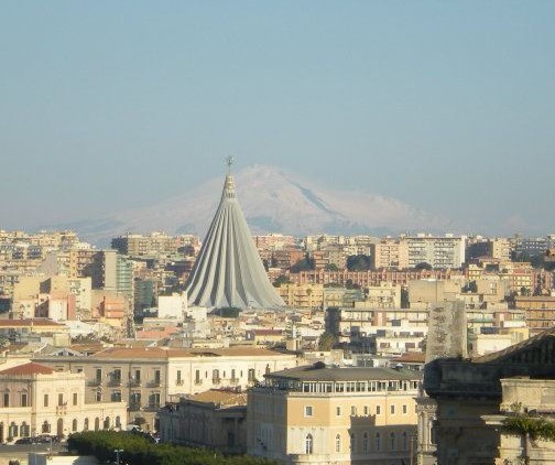
The black streak on its right hand side is the days-old lava flow, standing out against the snow. It was an awesome sight which together with top-quality espresso got the day off to a great start.

After Siracusa we drove west along the South coast to Agrigento. This journey took us off the stable platform and into an accretionary wedge. This is a package of sediments all stacked up on top of a major thrust. In this case, the rest of Sicily was being thrust over the eastern part along what is in effect a plate boundary.

The reason tourists visit Agrigento is for the ancient Greek temples. These are in some ways better than anything you find in Greece, I am told. They are made of a rather handsome orange calcarenite (limey sandstone) which underlies the town. This layer makes a rather nice structure and is, I infer, one of the reasons the ancient Greeks sited their colony here.

Let me explain. The Greek temples sit on the top of an escarpment, which makes them highly visible from the sea. There is a hill above the temples topped by the same escarpment, only pointing the other way. There is a dip slope in the middle making a nice flat area. Agrigento therefore is a nice flat area surrounded by cliffs on three sides. This must have made it easier to defend from attack.

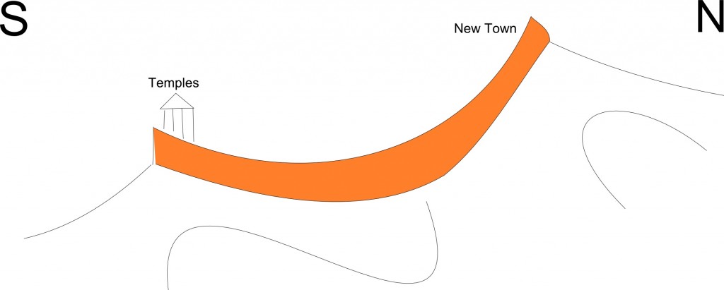
This structure is due to the sandstone being gently folded. Here is a cross-section sketch-cartoon with the sandstone shaded in something close to its natural colour.

Note that I’ve made a gesture towards showing more intensely folded sediments below. The calcarenites are thrust-top sediments meaning they were deposited onto the already deforming thrust wedge. This is why they are only gently folded, whereas the other rocks in Sicily have enjoyed a lot more structural hijinks. There is of course an unconformity between the two sets of rocks.

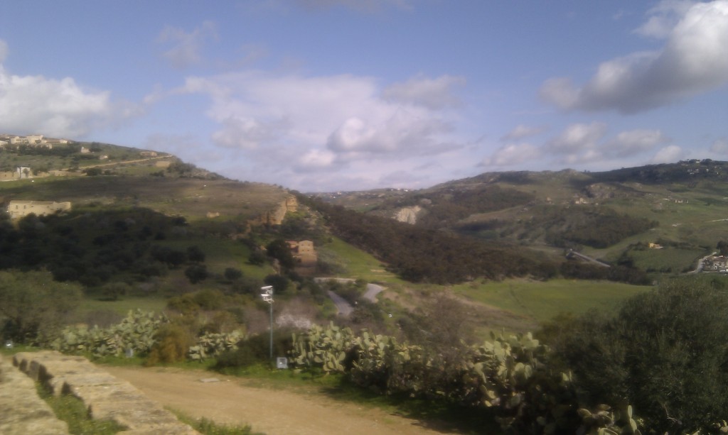
This photo is looking North down the line of the cross-section, standing by the temples. On the left you see the dip-slope climbing up the hill with a glimpse of the orange escarpment just before it forms the left-hand skyline. The right-hand side shows the paler limestones and evaporites that lie unconformably below.

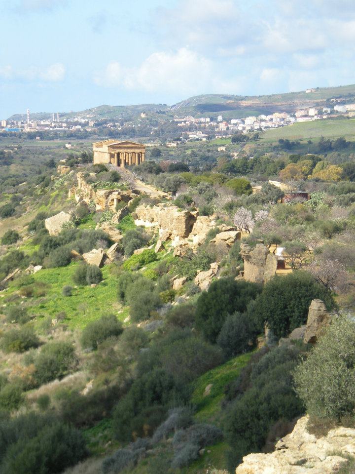
Here’s a view looking west along the southern escarpment. It gives some sense of why these temples were built where they were.


We ate a lot of seafood in Sicily, as we were always staying on the coast. I never saw oysters on the menu though, but to make up for it, there were fossil oysters available in the calcarenite (scallops too).

We managed to get a trip to one Geological feature, as an alternative to Etna. Appropriately enough we visited Etna’s other volcanoes.

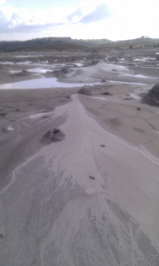
The Macalube nature reserve  is a big patch of mud. I’ll try that again, with my marketing hat on. Macalube is outstanding location of international renown where you too can experience the thrill of standing on top of an erupting volcano at no personal risk (except to your shoes).

This is an area of mud volcanoes, which in many ways are completely unlikely proper volcanoes.

Consider the sediments in the accretionary wedge. They are under pressure, they are being lithified, with mud turning to mudstone, driving off water. Also organic matter is producing methane gas plus there are extensive evaporite deposits in these sediments, a product of the Messinian crisis when the Mediterranean completely dried up. All these things going on underground act to create big masses of mud that start to flow up towards the surface. When they run out of rock to rise through, they form mud volcanoes.

Macalube is nowhere as dramatic as Lusi in Indonesia that erupted last year, but it has its charms. It was quiet when we were there, with just a few ‘bloops’ every minute or so which reminded me of my granddad’s home-brewing kit.

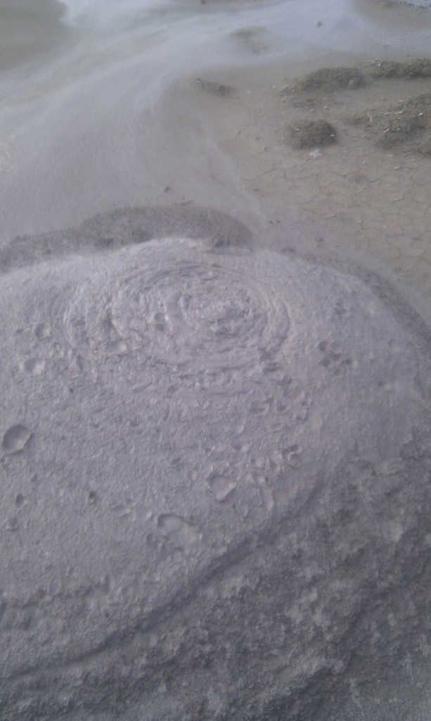
When looking at mud volcanoes you can’t help but compare them to the real thing. The underlying mechanism is totally different, but the shapes are often very similar. The viscosity of the mud varies, which gives effects like different viscosity magmas. Here is some viscous mud which spits out big lumps now and then. It is sort of kinda like Mount St. Helens (note the big splats).


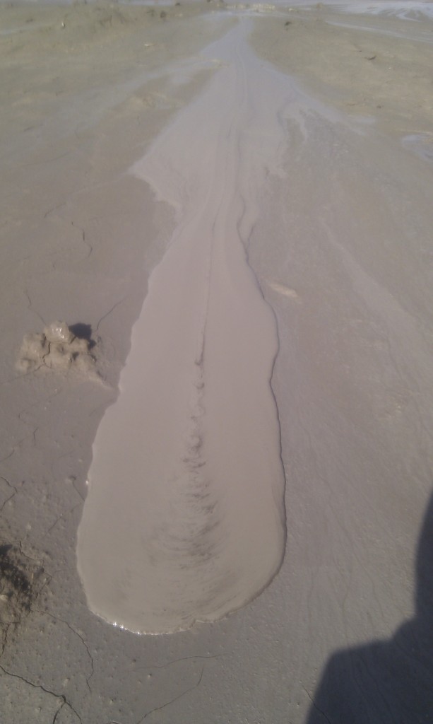
Whereas here is some runny mud, making a discrete ‘flow’. This area was a flatter shield-like area, more reminiscent of the Hawaiian volcanoes.

There were some bits of fibrous minerals in the mud, probably broken veins of gypsum; my only brush with the Messinian.

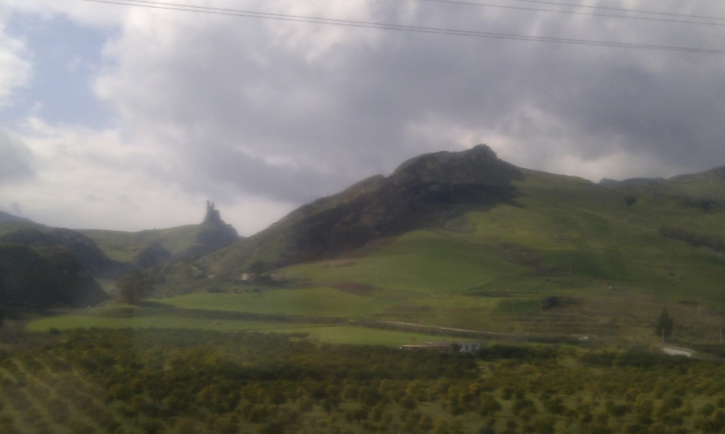
On our penultimate day we took the train across the island to Palermo on the north coast. Through the window there were many examples of folded sediments, such as this one. You’ll notice the layers dipping to left first, but note that the pointy crags a third along from the left are vertical.

Volcanoes, limestone, structure and good food. Sicily has a lot going for it.

Call for posts: Accretionary Wedge #44, “most important teacher”

On Twitter earlier today, Ron Schott of the Geology Home Companion Blog asked for volunteers to host future Accretionary Wedges. I’ve long been a fan of this geologically-themed blog carnival so I jumped at the chance.

An interest in Geology, perhaps more than other subjects, is something that is often nurtured by good teaching. Geological learning is often about someone passing you a hand-lens and rock sample and telling you about the wonderful things you can see. None of us are  starting from scratch; we all have access to a tremendous body of knowledge that enriches our understanding and enjoyment of Geology. So how did you get access to that knowledge?

The theme for this month is to tell us about your ‘most important teacher’. For those of us with a formal training an obvious route is to write about a person who taught us, talking about them and what we learnt from them. This is the route I shall be following, but   my purpose here is not to constrain but to inspire you. We don’t just learn from people face-to-face. Or from people: sometimes it seems that rocks can speak. They can certainly teach us things.

Whatever your circumstances, if you’re still reading this post you are someone who loves Geology and loves to write about it. You know more now than you did when you started out. Tell us about that journey and the most important thing or person that helped you on your way.

Send in your links in comments below, or via Twitter. Since we are starting late, the closing date is the 13th April. I’ll collate all your links in the usual fashion.

Request for information about left-handed geologists

I’m a cack-handed sinister southpaw and the chances are surprisingly high that you are too.

At University, about 40% of my peers studying Earth Sciences were left-handed. Faculty professors confirmed that this was normal, based on their experience of teaching geologists over the decades. This is of course an unusually high proportion. No, correction, this is an incredibly high proportion. A random selection of people would have around 10% of left-handers.

If Geologists are genuinely four times as likely to be left-handed then this is a remarkably strong pattern and someone should take a look into it. I emailed an academic psychologist of my acquaintance and he agreed that this merited more research. He seemed interested in talking more about how to make it happen.

So the first thing is, I need to improve the quality of my anecdotal evidence. My experience may be a statistical fluke, so I need your help. Are you a left-handed or right-handed geologist? In particular, if you teach geology to students, are they unusually prone to cack-handedness?

I reckon a mere minute of your time (“hands-up if you’re left-handed”) would provide me with some solid data, which I’ll collate and publish here. I’m thinking “x of y students from z were sinistrals”. Assuming a strong pattern holds I’ll then do my best to get some research happening. My current thinking is that this will involve match-making between someone involved in psychology research and others with access to geology students. I have various ideas of how to make this happen but would love to hear more.

I’m very excited about this, it’s the sort of thing that the Internet is for. A small amount of time from a lot of you could be the start of something rather good. Please comment away below. Or go to this simple form.

NB, I’ve collated the results of your replies; with more data, the pattern still holds.

Rheology re: geology

“Wibble wobble, wibble wobble, jelly on a plate” Childrens’ rhyme.

To understand the geology of mountains, you need to know how they are  built, which means you need to know how rocks deform. I have a tendency to throw phrases around, so I want to define some of them properly. Also I’ve bought a new toy I’d like to play with.

Rheology is the study of the flow of matter. A understanding of a rock’s rheological properties tells us how it behaves when a force is applied to it.

The trouble with rocks is we don’t have much direct experience of deforming them. So let’s start with jelly (or “jello” as most of you know it). If you put a big pile of jelly (not jam, jelly) on a plate and push it, it moves (wibble) and then moves back (wobble). It may then take a while to settle back to exactly where it started (wibble wobble). Once you get tired of poking, stick a spoon in it and eat some. Notice that the pieces break off with a clean sharp edge.

The properties I’ve described are those associated with elastic materials. If you apply a force to the material, it changes shape but returns to its original shape when the force is removed. If  you apply a larger force it will permanently change its shape. Apply a large enough force and it will fracture.

Rocks as we know them behave like this. Earthquake waves can be thought of as little wibble-wobbles moving through elastic rock. Apply enough force to rock and it will fracture – if they are big we call these fractures faults.

But what happens if you leave jelly out in the sun, or make it with too much water? It starts to collapse under its own weight. It  doesn’t fracture but flows, like a liquid. Materials that behave in this way exhibit viscous behaviour. Don’t just think of water, which has low viscosity, think of high viscosity liquids like tar or honey or felsic magma.

So, we have two broad ways in which materials can deform, elastically or viscously. In practice a material can exhibit type of behaviour, under different conditions or different rates of deformation. This hybrid behaviour is know as visco-elastic.

My new toy. I’ve bought some magic putty. It is a material with complicated properties, but for our purposes it shows how a material can have both elastic and viscous rheological properties.

First the elastic behaviours: silly putty is very bouncy. It will fracture too, but this is harder to do. I tried hitting it with a hammer; a word of advice – don’t.  Matt Kutcha persisted and got some great video.

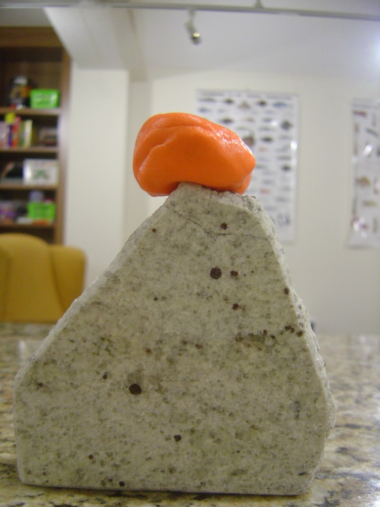
The viscous side of things is best expressed in photos. Here’s a nice round piece of silly putty, perched on a slab of Himalayan granite.

Silly putty, round blob

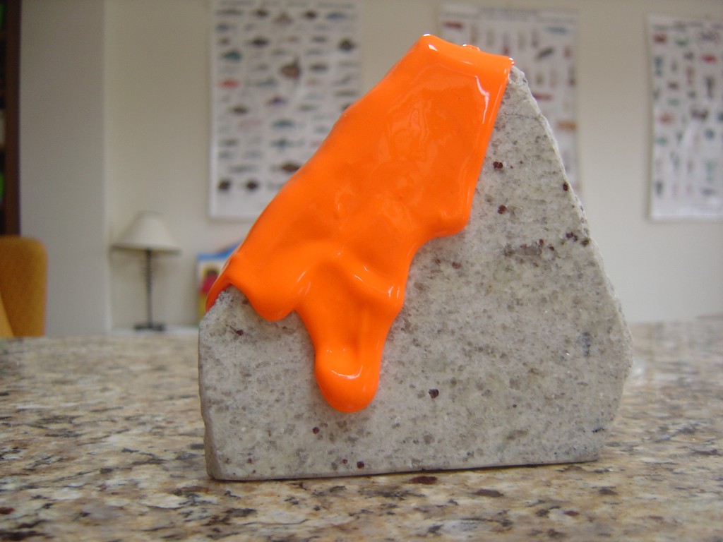
Here’s the same blob the morning after. It’s takes a while, but if definitely flows viscously.

Very stretched silly putty

How does this apply to rocks? Rocks are (usually) made of crystals which are formed by mineral lattices. The atoms within these crystals are joined together by atomic bonds. Apply a force to them and you can increase the gap between the bonds. Remove the force and the bonds return to their original size. Apply enough force and the bonds break. This explains elastic behaviour.

How to explain viscous behaviour in rocks? Just like jelly, if you heat rocks, or add water they are more likely to flow like a liquid, only very very slowly. Luckily geology has lots of time available. A crystal lattice can deform by crystal plastic mechanisms know as creep (diffusion or dislocation). These are where atoms in the lattice shift one by one (helped by little imperfections). In time, the mineral lattice becomes a different shape, and writ large, the rock has been deformed. Individual grains remain whole so conceptually the rock has flowed like a liquid. This type of deformation in rocks is referred to as ductile. The terms ductile and viscous are often used as synonyms*.

In summary, rocks can behave in an elastic manner, but also in a ductile/viscous way. The question of which rocks behave in which ways, and how this is relevant to the geology of mountains is a matter for another post.

* Note on terminology Viscous/ductile/plastic are terms that seem in practice to be used synonymously as being things different from elastic behaviour. It’s not clear to me which is correct, if any. Viscosity is a measure of the resistance of a fluid to stress whereas plasticity and ductility relate to changing the shape of solids. It seems that ductile deformation is a description of what happens to rocks whereas viscosity comes in where numerical modelling of rock  flow is required. Plastic is deformation of materials without fracturing. Or so it seems to me. Anyone who knows more care to comment?

This post is part of my journey into the geology of mountains.