Metamorphic petrology: under pressure and getting stressed?

High pressure (HP) terranes are areas containing eclogites and other eclogite-facies rocks found within many mountains belts, including the Himalaya and the Alps. HP rocks were metamorphosed at extreme pressures, up to 3 or even 4 billion Pascals (or GPa. Atmospheric pressure is 0.0001 GPa). Based on the assumption that metamorphic pressure relates to depth of burial, these rocks have been to depths below the base of the crust. Explaining how to bury rocks so deeply, and then bring them back again, is a tricky problem.

Two parallel threads of research are challenging the assumption that high metamorphic pressures relate simply to depth of burial. Both seek to show that metamorphic reactions, and the patterns of minerals that they form, are also influenced by the squeezing and squashing rocks receive as they flow deep within the earth.
Alps 025

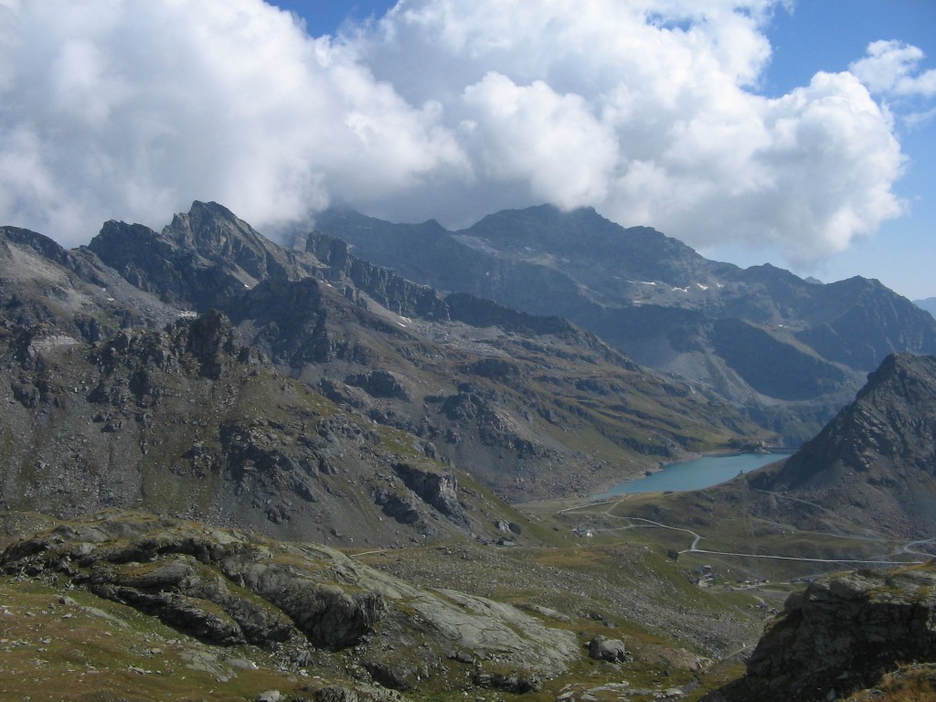
High pressure rocks looking moody and gorgeous. Photo of the Internal zones of the Alps from John Wheeler.

A little theory (please, don’t get stressed)

Metamorphic petrology is the art and Science of calculating the conditions under which metamorphic minerals form – I’ve written extensively about it already1. It has its basis in an understanding of the thermodynamics of the reactions that form minerals, which depend (among other things) on the temperature and pressure at the time. The lithostatic pressure that affected the rock is assumed to be caused by the weight of the column of rock overhead, following Pascal’s law2. With some assumptions as to the density of that rock, pressure can be converted into depth.

Earth scientists who study the structure of deeply buried rocks look instead at the patterns that the minerals form: fabrics, lineations, folds and the like. They have a different way of looking at the way rocks are squashed. Theories of rock deformation talk about stress, often visualised as arrows in 3 dimensions. If the stress is isotropic – equal in all three dimensions – then it is conceptually the same as lithostatic pressure. In contrast, differential stress is where the arrows are different sizes. Differential stress drives deformation – the rocks change shape.

Time for an analogy. Lithostatic pressure is like water pressure. Deep hot rocks flow like a fluid (slowly) and so the stress is equal in all directions. Rocks keep the same shape, but are put under tremendous pressure. It’s the same as putting a styrofoam cup into deep water.
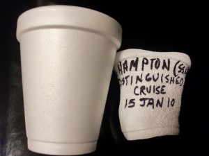
4279612391_a075b4de30_o

Sytrofoam cup crushed at 600m ocean depth. Image from Gina Trapani under Creative Commons.

Differential stress is like putting the cup between the grabbers of the submersible. Squeezing in only one direction will change the shape of the cup.

Now we’re ready to look at the two challenges to the depth-pressure connection.

Challenge 1 – High levels of differential stress exist in the crust

Metamorphic petrologists who argue that high pressures are caused by deep burial believe that the effects of differential stress are unimportant. These rocks are usually extremely deformed, but they were hot and soft – by flowing easily they prevented high differential stresses from building up. In a similar way, as every toddler learns, you can’t squeeze jelly hard with your hands, because it just flows out of your fist.

Some scientists, with an interest in the European Alps, disagree. Neil Mancktelow argues that the effects of differential stress (he uses the basically equivalent similar term ‘tectonic overpressure’3 ) can be dramatic. Mathematical modelling of conditions within a confined channel (like a subduction zone) gives ‘overpressure’ of “perhaps even a few GPa”. Rocks that formed under these conditions would yield high pressure minerals but may not have been buried very deep.

At this years EGU meeting Stefan Markus Schmalholz, Yuri Podladchikov, and Sergei Medvedev used computer modelling of the Alpine orogeny, and other arguments to suggest that Alpine high-pressure eclogites need not have been deeply buried, but instead their distinctive minerals formed under conditions of tectonic overpressure.

image006

Folded layers from eclogite facies rocks in Norway. Photo from John Wheeler

Challenge 2 – John Wheeler’s recent paper in Geology

Computer models are extremely useful, but only as good as the assumptions made in them. Alone they will always have their critics. John Wheeler, a professor at Liverpool University has fingers in many pies: metamorphism;  structural geology; field-based studies; laboratory work… He takes a different approach to also puts the assumption that we can apply Pascal’s law under intense pressure 4.

In a recent open source paper in Geology he combines 2 pieces of theory. The first is from thermodynamics as used in metamorphic petrology. The second is an equation relating stress to the phenomena of pressure solution (that can form cleavage in slaty rocks).  Both are concerned with the movement of atoms to grow new minerals and neither is controversial. He converts both into terms of chemical potential and combines them to link differential stress to standard metamorphic reactions.

Applying uncontroversial values for differential stress (e.g. 50 MPa, or 1/40th of the levels Mancktelow proposes) to a standard metamorphic reaction he shows that they shift by up to 500MPa – equivalent to 15km of lithostatic pressure.

This is an extremely dramatic result from a provocative paper, as John Wheeler himself acknowledges. Metamorphic rocks are almost always deformed, sometimes dramatically so. If both approaches are correct, then putting differential stresses of Manckletow levels into John Wheeler’s equations suggests any estimates of depth of metamorphism are open to challenge. Maybe eclogites never left the crust after all?

metagabbro deformed and recrystallizing to new minerals at the same time (from Alps).

Metagabbro deformed and recrystallizing to new minerals at the same time (sample from Alps image from John Wheeler).

Where are we now?

John Wheeler  expects some  “turbulent interactions in the next few years”.  I’m sure there are  metamorphic petrologists writing their replies to his paper right now. But assuming they can’t find some fundamental flaw he hasn’t spotted (extremely unlikely, I’d say), metamorphic petrology is facing a very big challenge.

This seems like bad news. Much work on metamorphic petrology is put to work refining tectonic models by building P-T-t paths that track metamorphic rocks as they are buried and return to the surface. The error bars on these estimates were big enough already – now a entire literature of estimates that ignore differential stress are thrown into question.

But let’s think positively. Might there be ways to disentangle the effects of lithostatic pressure and differential stress? Might there be ways to get even more information out of deformed metamorphic rocks? John Wheeler certainly thinks so and he aims to get there by integrating detailed studies of rock samples with laboratory experiments.

Big advances in Science often give us new ways to understand evidence that previously didn’t make sense. Studies of metamorphism from the classic locality of the Scottish Highlands (e.g. Viete et al 2011) have noted that the highest grades of metamorphism occur within shear zones. They tried to explain this in terms of the flow of hot fluids, but maybe the answer is simpler: stressing rocks really does cause them to grow different suites of metamorphic minerals.

References:

Mancktelow N.S. (2008). Tectonic pressure: Theoretical concepts and modelled examples, Lithos, 103 (1-2) 149-177. DOI: http://dx.doi.org/10.1016/j.lithos.2007.09.013

Wheeler J. (2014). Dramatic effects of stress on metamorphic reactions, Geology, DOI: http://dx.doi.org/10.1130/g35718.1

Viete D.R., G. S. Lister & I. R. Stenhouse (2011). The nature and origin of the Barrovian metamorphism, Scotland: diffusion length scales in garnet and inferred thermal time scales, Journal of the Geological Society, 168 (1) 115-132. DOI: http://dx.doi.org/10.1144/0016-76492009-087

A world without subduction

The greatest achievement of the generation of Earth Scientists now retiring is the concept of plate tectonics. The insight that the earth’s surface is made up of rigid plates that move has shed light on all aspects of Earth Science, from palaeontology to geophysics to the study of ancient climates. What’s less well known is that the way the plates interact has changed over time. Key plate tectonic features such as subduction, didn’t happen for large periods of earth history.

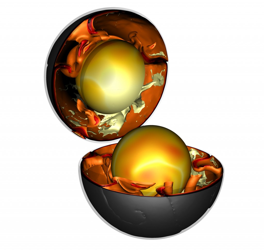
Cut-away diagram showing modern convection from computer modelling by Fabio Crameri. White is hot rising plumes, black cold sinking plates.

Cut-away diagram showing modern convection from computer modelling. White is hot rising plumes, black cold sinking plates .  Image used with permission of Fabio Crameri.

Earth scientists have a pretty good idea of the details of how modern plate tectonics works. This has required the integration of indirect observation of modern subduction zones (using geophysical techniques) with direct study of rocks that have been inside subduction zones (such as eclogites) plus the creation of subduction zones ‘in silico’ (with computer modelling).

Of these 3 methods of study, only the first (direct observation) cannot be used on the ancient earth. So what do the rocks and computer models tell us?

Old rocks are odd

We’ve known for a while that ancient rocks (Eoarchean–Mesoarchean, older than 2.5 Ga1are very different from modern ones. Often they consist of greenstone belts – containing an unusual lava called komatiite – surrounded by large areas of granitic gneiss. The pattern of metamorphism in these rocks shows high temperatures, even at shallow depths.

The chemistry of the igneous rocks tells a similar tale. Komatiites only melt at temperatures of around 1600°C – 400 degrees hotter than modern basalt lava. Granitic rocks have tonalite–trondhjemite–granodiorite compositions and are thought to have formed from direct melting of basaltic rock – unlike granites formed above subduction zones today.

Rocks characteristic of modern subduction – blueschists and eclogites  – are not found in rocks this age. There is a pretty good consensus, based on field evidence and model modelling, that subduction did not happen in the early earth. The earth’s mantle was much hotter and more heat was flowing up through the crust. Hot rocks are weak rocks – forcing a slab of rock into the deep mantle requires it to be cold and hard. Hotter rocks act not as rigid slabs but as soft blobs.

Computer modelling confirms the importance of temperature, both of the crust and the underlying mantle. Models are our best hope of understanding what a hot planet without subduction looked like. More like a bubbling pan of porridge perhaps, with tectonics dominated by hot upwelling plumes and lithospheric delamination, with blobs dripping-off down again. Some studies of mantle mixing suggest a ‘stagnant-lid’ model where the earth’s surface layer doesn’t move at all.

Subduction starts

At some point in time between 3.2–2.5 Ga, subduction started. The planet had cooled enough that a lithospheric plate stayed rigid enough to sink down into the mantle. Evidence for this is found in ‘paired metamorphic belts’. Rocks within the subduction zone remain cool at depth (as they are pushed down before they can get as hot as the surrounding rocks) and form eclogites or high-pressure granulite rocks. Rocks nearby in the overriding plate are much hotter and enjoyed granulite–ultrahigh temperature metamorphism.

Mathematical modelling of the earth suggests subduction started because the earth cooled below a particular threshold. As an explanation, this is a little dull. Much more excitingly, coverage of a recent paper suggests massive meteorite impacts about 3.2 Ga could have broken up the surface and somehow kickstarted plate tectonics. Scientists who study impacts are always really keen to use them to explain events or features on earth, whereas other scientists are sceptical, preferring to explain them via things that they study. We’ll need to wait to see who is right about this one (but my money is on the dull explanation).

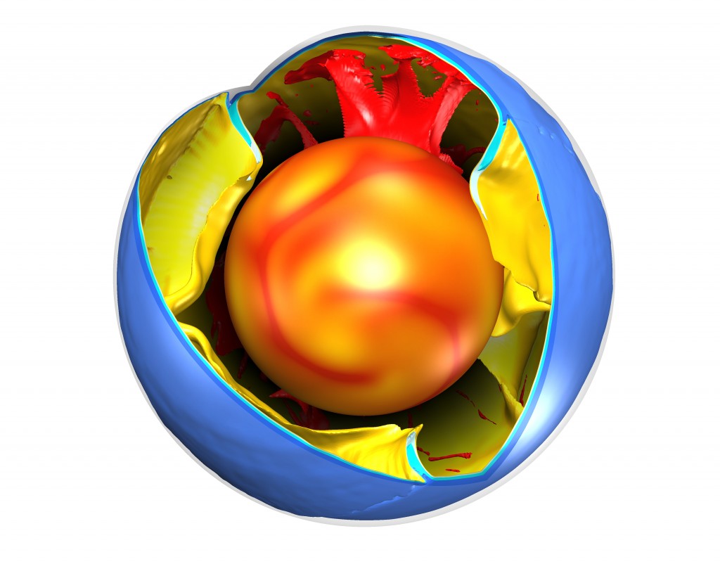
Cut-away diagram showing modern convection from computer modelling by Fabio Crameri. Red is rising plumes, blue sinking plates.

Cut-away diagram showing modern convection from computer modelling. Red is  hot rising plumes, blue cold sinking plates. Image used with permission of Fabio Crameri.

Subduction as a cure for boredom

When subduction first started, mantle temperatures were still 175–250 °C hotter than today. Hotter, softer slabs are more likely to break off, perhaps making subduction something that stopped and started.

Blueschists and low-temperature eclogites, high-pressure & low-temperature rocks that are found in modern subduction zones are not found until the the Neoproterozoic at 600–800 Ma. Mantle temperatures by then were less than 100 °C greater than today – this marks the wide spread development of modern-style (cold) subduction on Earth. Cold slabs of oceanic lithosphere break-off deep, allowing large volumes of dense oceanic crust to pull continental lithosphere down, creating the first ultra-high pressure metamorphic complexes.

The Neoproterozoic is the end of what is known as the ‘boring billion’ – a time of tedious environmental and evolutionary stability. A recent open acess paper in Geology suggests a link between the exciting changes that followed (glaciations! Cambrian explosion!) and the onset of subduction. The boring billion was stable in part because most continental crust was part of a supercontinent called Rodinia. The paper argues that the disruptive effects of the onset of cold subduction broke Rodinia apart, setting off a chain of events that transformed the world.

—–

The early earth was a very different planet. Understanding it better informs the general subject of planetology. As we get more and more data about other planets (both within and beyond our solar system) it’s natural to speculate on their tectonic activity. Why does Venus not have subduction? Does subduction here exist because of life and its role in moderating climate and creating the earth’s oceans? Ancient rocks and computer models may help us answer these questions as much as probes and telescopes.

REFERENCES

Brown M. (2014). The contribution of metamorphic petrology to understanding lithosphere evolution and geodynamics, Geoscience Frontiers, DOI:
Available here

Cawood P.A. & Hawkesworth C.J. Earth’s middle age, Geology, DOI:
Available here

Gerya T. (2014). Precambrian geodynamics: Concepts and models, Gondwana Research, 25 (2) 442-463. DOI:
Available here

The Himalaya: mountains made from mountains

Good building stones get reused. Sometimes the only traces of very old buildings are their stones, built into more modern ones. It’s the same with rocks and mountain belts. Stone that now forms parts of the Himalaya was once part of a now-vanished mountain range.

The Himalaya were formed by the collision between the Indian and Asian plates. For 50 million years, the Indian plate has been pushed down into the Himalayas where it is squashed, mangled and changed by heat and pressure. Working out the details of this process of mountain building has taken decades of careful study. Modern isotopic techniques are now so powerful that researchers studying Himalayan rocks can peer through beyond the effects of the recent mountain building to see traces of older events.

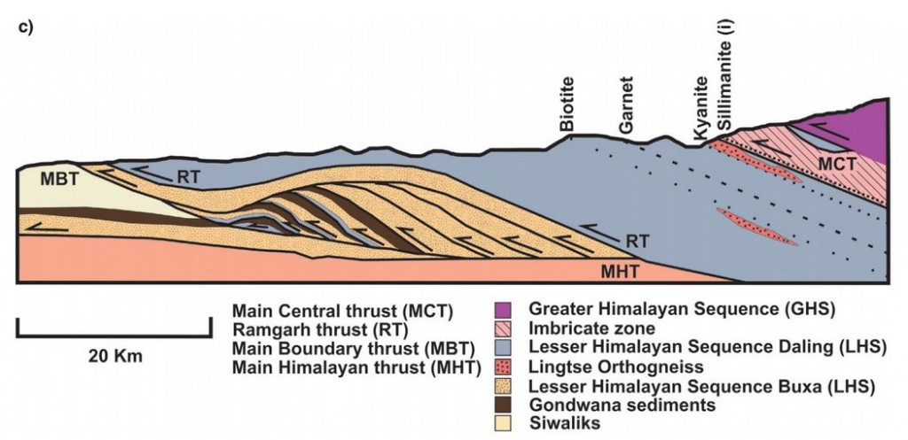
A recent open access paper by Catherine Mottram, Tom Argles and others looks at rocks in the Sikkim Himalaya, around the Main Central Thrust (MCT). As you can guess from the name (and the Use Of Capitals) this is an important structure; it can be traced over 1000km across the Himalaya and separates two distinct packages of rock known as the Lesser and Greater Himalayan Series.

Figure 2c. Cross section of MCT in the Sikkim Himalaya

Figure 2c. Cross section of MCT in the Sikkim Himalaya

As the rocks of the Indian plate were stuffed into the moutain belt, much of the movement of rock was along near-flat faults, known as thrusts. These stack up layers of rock, shortening and thickening the crust. Thrusts near the surface may be a single fault plane, but at greater depths rocks flow rather than snap and a thick thrust zone of deformed rocks is formed. This makes drawing a line on a map and calling it the Main Central Thrust rather difficult. Should the line be placed where the rock types change, or where they are most deformed, or where there is a break in metamorphism? Each approach has its advocates.

Our authors took an isotopic approach, measuring Neodymium isotopes for the whole rock and Uranium-Lead in useful crystals called Zircon. Their analysis shows that the two packages of rock separated by the MCT can be distinguished using isotopes. The actual boundary is not sharp: they prove interlayering of the two rock packages within the thrust zone, rather than a single boundary. This is not surprising given that thrusting is a gradual process and thrust surfaces are not flat.  Deformation seems to have started at the boundary between the Lesser and Greater Himalaya and gradually moved down over time.

The patterns of isotope measurements that can be used to distinguish between the Greater and Lesser Himalayan Series also tell us about what happened before India met Asia.

The zircons whose isotopes were measured are of two types, detrital and igneous. The first are grains that were eroded from old rocks and settled into a sedimentary basin. The second crystallised from molten rock: their ages record significant events. Together these sets of dates give a view of a long and complicated pre-Himalayan history.

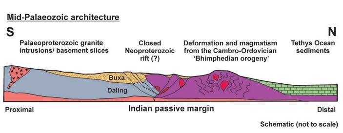
Our authors attempt to reconstruct the leading edge of the Indian plate, as it might have looked before it crashed into Asia.

Figure 10.

Figure 10. “Schematic illustration showing the pre-Himalayan architecture of the Sikkim rocks, during the mid-Palaeozoic. The Lesser Himalayan Sequence lithologies were once separated from the Greater Himalayan Sequence rocks by a Neoproterozoic rift. The Bhimpedian orogeny was responsible for closing the rift and thickened the Greater Himalayan Sequence, causing metamorphism and intrusion of granites. The failed closed rift may represent a weak structure later exploited by the Main Central Thrust. Lithologies are the same as in the legend in Figures 1 and 2.”

The Greater Himalayan Sequence had already been heated and deformed in the roots of a mountain belt long before the Himalayas existed. This a relatively common situation. Polyorogenic rocks such as these1 need to be treated with care, otherwise we might mix up events separated by millions of years. A single garnet crystal may contain different areas that formed in totally separate mountain building events

One of the detrital zircon grains dated in this study was 3,600,000,000 years old. We can only guess how many cycles of erosion and burial, how many splittings and couplings of continents this mineral has ‘seen’. As it was buried and heated once again maybe, like the bowl of petunias in The Hitchhiker’s Guide to the Galaxy it thought to itself: “Oh no, not again”.

References

Mottram C.M., Argles T.W., Harris N.B.W., Parrish R.R., Horstwood M.S.A., Warren C.J. & Gupta S. (2014). Tectonic interleaving along the Main Central Thrust, Sikkim Himalaya, Journal of the Geological Society, 171 (2) 255-268. DOI:

Argles T.W., Prince C.I., Foster G.L. & Vance D. (1999). New garnets for old? Cautionary tales from young mountain belts, Earth and Planetary Science Letters, 172 (3-4) 301-309. DOI:

Andalucia: a history of stuff

Andalucia is a province in Spain, at the far south west of Europe. Its long and varied human history has seen it linked to the middle East, north Africa and the Americas. The creation of these links brought new foods, metals, diseases: new stuff into Andalucia. Sometimes the impact of arrival created ripples that reached out far across the world.

Geological history

Some 200 million years ago Andalucia was within a massive continent called Pangea, close to both Africa and North America. Slowly Pangea broke into pieces, a new ocean basin – the Atlantic – filling the gap as the Americas drifted away. Some 50 million years ago, Africa was pushed north in Europe creating a long mountain range. Andalucia was part of this. Mountains form when the crust is thickened, pushing rock into the sky. A similar process at the base of the lithosphere 1 also forms a thick balancing ‘root’. Under Andalucia, this thick root ‘fell off’2 and sank into the hot convecting mantle beneath.

Mountain belts are surprisingly fragile. The sudden removal of the heavy root caused the over-thickened crust to collapse, flowing sideways and bringing deeply buried rocks up to the surface3. Fragments of mantle called peridotite, not often seen at the surface, form brown mountains around the town of Ronda. The collapse of the mountain belt went so far that its centre is now the very western part of the Mediterranean, the Alboran Sea. The mountain became a great hole in the ground.

Most of Andalucia is made up of sedimentary or metamorphic rocks folded and twisted by these dramatic changes. An exception is the basin of the Guadalquivir river. Here the weight of the collapsing rocks pushed down the rocks to the north, making a depression that has filled with recent sediments – a feature called a foreland basin. The edge of this flat basin makes a clear line that is easily visible from satellite views of Southern Spain.

From Wikimedia http://upload.wikimedia.org/wikipedia/commons/5/53/Andalucia_satelite.jpg

Andalucia from Space. Image from Wikimedia 

People

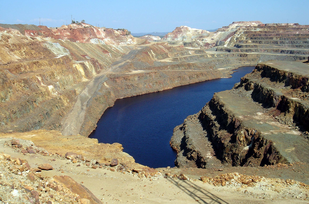
People, at first hominins such as Neanderthals, have lived in Spain for over a million years. The little we know of prehistoric humans comes from their use of materials. First their gradually more sophisticated use of stone tools, then from about 5000 years ago the smelting of metals: first copper, then bronze (copper plus tin) and then iron. Mines in Andalucia have been been involved since the start, notably the Rio Tinto area. Here a Carboniferous massive sulphide deposit has yielded silver, gold and copper and spawned a global mining company.

Image of Rio Tinto mines, Andalucia. Image from David Domingo on Flickr under CC

Rio Tinto mines, Andalucia. Image from David Domingo on Flickr under CC

Around 3000 years ago (1100BC) the Phoenicians reached Andalucia, founding the town of Cadiz. A culture that reached across the Mediterranean they were also involved in trade with the British Isles. Tin from Cornwall in England was smelted with Spanish copper and the resulting bronze traded on. The olive tree reached Spain at this time, brought from the eastern Mediterranean.

A mere thousand years later, the Romans took control – their province of Hispania Baetica covers much of modern-day Andalucia. They introduced deep mining to the Rio Tinto, using the characteristically Roman combination of slaves and very big wheels to pump water up from the depths. Andalucia was a renowned source of many products for the wider Roman Empire, including silver, olives, emperors, philosophers, dancing girls, and garum, a sauce formed from fermented fish guts rich in umami flavours.

Yet Moor invaders

After the slow collapse of the Roman Empire, the next major influx of change in Andalucia was the Moorish invasions. The Islamic Moorish army4 conquered most of Spain between 711 and 718 AD, in time creating a kingdom of Al-Andalus with its capital in Cordoba. Once more Andalucia was part of a multi-national empire with good trade links. Valuable crops from further east, such as figs, citrus and pomegranate were introduced for the first time, as were sophisticated irrigation systems, some of which are still in use. By the 10th century, Cordoba was the most civilised city in Europe, it’s Grand Mosque was one of the wonders of the Muslim world.

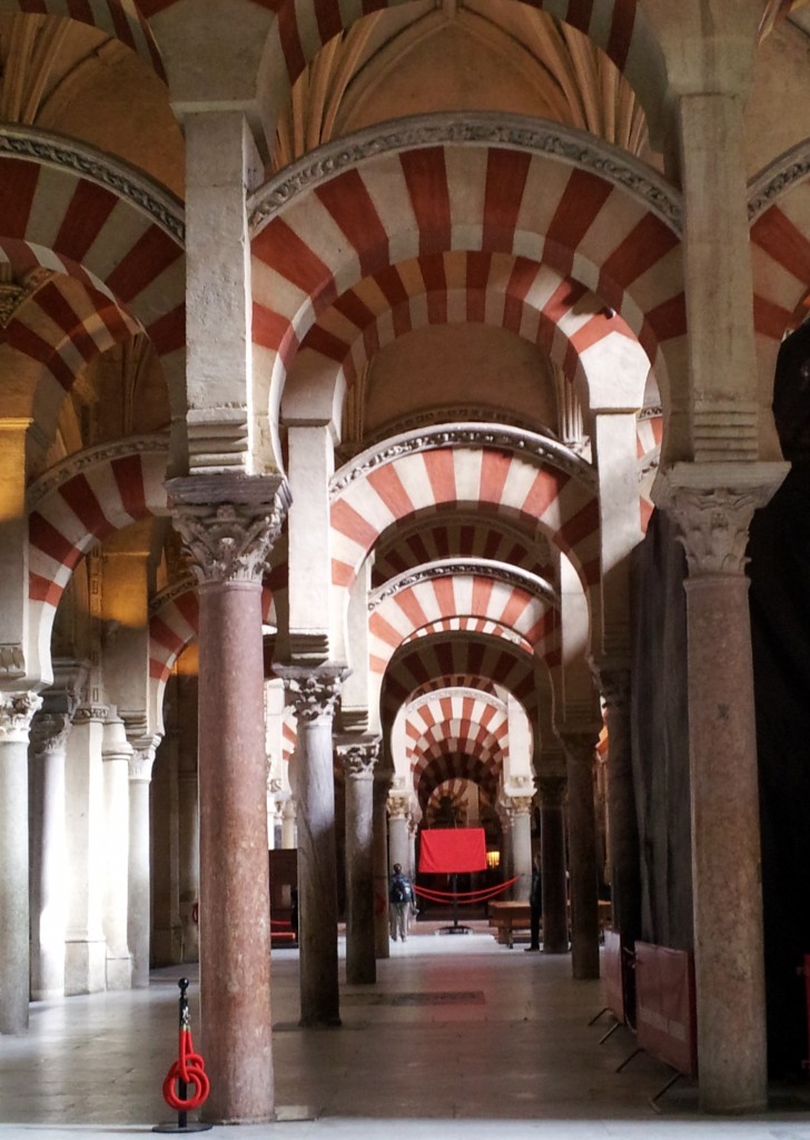
Cordoba Grand Mosque

The site of the Grand Mosque was originally a Christian cathedral (before that, a Roman temple). Built over 200 years and funded in part by mining proceeds, the Mosque was built with local stone and brick, but also recycled Roman stone columns. Some of these were found locally, but others were brought in from much further afield, from the rest of Spain and perhaps wider.

The Columbian exchange

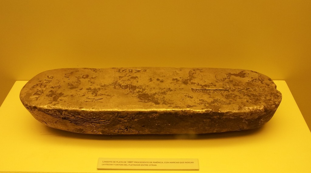
Eventually Moorish Spain came to an end as Christian rulers conquered the Muslim lands. The final Moorish kingdom of Granada fell to Ferdinand and Isabella in 1492, the same year that they sponsored Christopher Columbus to mount an exhibition across the Atlantic. As  the Spanish kingdoms turned into a global Spanish empire, lots of incredible things started flowing back into Andalucia. First Seville and later Cadiz were the main ports for the Atlantic trade. Gold and silver beyond imagining passed through Andalucia – enough to create a century of inflation across Europe. Some of this stuff ended up in the the Grand Mosque in Cordoba, which is now a cathedral again. Sitting within the vast pillared area of the mosque is a Christian church full of beautiful things made of American gold and silver. The choir stalls are made of American mahogany – lots of plant material crossed the Atlantic too.

Ingot of South American silver as brought over by Spanish treasure ships. Cadiz Museum.

Ingot of South American silver as brought over by Spanish treasure ships. Cadiz Museum.

A popular Spanish dish is called ‘patatas bravas’ and consists of potato, tomato and chili – all foodstuffs that spread across the world following the ‘discovery’ of the Americas. Andalucia was the first stop for many of these vegetable treasures. Botanical gardens turned seeds into plants, to be studied and propagated. A fine building in Seville is the old tobacco factory, dedicated to processing another new crop. The setting of Bizet’s opera Carmen, its walls are mottled with yellow and brown, like a smoker’s fingers. More immediately bad for the health, syphilis was first recognised in Europe in 1494, most likely brought back by Columbus’ sailors.

The British dimension

As an Englishman who likes history, I often visit other countries in an apologetic mood. A dimly remembered story about Francis Drake daringly ‘singeing the king of Spain’s beard’  is rather less jolly when you are sitting in Cadiz, the town that was attacked. Drake was engaged in warfare on behalf of his Queen, but also behaving like a pirate, raiding Spanish treasure ships. Still, no one seems to mind any more; it was in 1587 after all.

The British drink everything and anything. Not content with home-grown beer, gin and whisky we also crave grape-based booze. When Francis Drake returned from attacking Cadiz, he brought 2,900 barrels of sherry, a type of wine made only near Jerez in Andalucia. This went down rather well – we’ve been drinking it ever since, even getting involved in its manufacture.

Tonic water is sweet fizzy water flavoured with quinine, best taken with gin. Quinine, an extract from a South American tree was for centuries the only effective way of countering the effects of malaria. First popularised by Spaniards returning from Peru it was introduced to gin by the British in India. In the early 18th century the Royal Navy had a number of bases on Spanish soil, including in Andalucia, and passed the habit on. It remains popular in Spain to this day.

Image from Amanda Slater on Flickr under cc

Image from Amanda Slater on Flickr under cc

A final anglo-Spanish connection is marmalade. Seville is full of orange trees, of a particular kind, bitter and rich in pectin. They are pretty inedible raw, but for some reason 5A Scottish tradition and industry grew up of preserving them as jam, with pieces of the skin floating in jars of pungent and yielding orange delight. Paddington Bear, James Bond and Alice in Wonderland all eat marmalade, along with many real people, such as me. The bitterness gives it a very grown-up feel, with some of the grimy delight of cigarettes and whisky, but in a healthy breakfast-friendly form.

The future

What of the future? Recent research suggests that soon6The oceanic crust beneath the Atlantic will start to plunge down under Spain into the earth’s mantle. The collapse of the mountain belt I mentioned at the beginning left a tear in the crust and this may grow and extend into a full-blown subduction zone. This will bringing volcanoes to fertilise the soil with ash and earthquakes to shake the buildings (if any remain). As slowly as finger-nails grown the Atlantic will vanish and Spain and the Americas will be reunited once again.