Hot rocks, big rivers and the world’s tallest mountain face

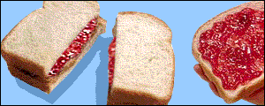
In areas of active mountain-building the middle crust can get hot and weak, like a soft jam/jelly filling in a sandwich.  These squishy rocks are hidden from us by the cold rigid upper crust, so we wouldn’t expect to see them reach the surface, would we? Well, what happens if you overfill a sandwich and there’s a break in the upper layer? Nanga Parbat in the Karakoram Himalaya tells us what.

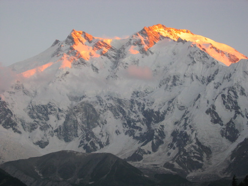
Nanga Parbat Rakhiot Face

Nanga Parbat is one of only 14 mountains over 8,000m in height. It’s summit is a mere 25km from the Indus, a major river flowing off the Tibetan Plateau and then along the length of Pakistan. The mountain face between the two (the Rakhiot Face, above) is often called the world’s highest as there is a drop of 7,000m, from peak to river. Nanga Parbat sits at the Western syntaxis of the Himalaya, this is the point where the structural grain of the Himalaya changes from East-West to North-South. It corresponds roughly to the corner of the Indian plate (buried somewhere below), where the plate boundary swings around.

Nanga Parbat contains granites at the surface that cooled only a million years ago. Not lava but granite that was intruded at depth and yet is now at the surface. A active major thrust puts gneisses on top of river gravels. It’s estimated that 25km of crust has been eroded away in the last 10 million years (or 12-15km over the last 3Ma, take your pick).

A hard rain falling

In order to remove 25km of crust, you need a lot of erosion. That sort of erosion requires high rainfall and a major river to take all the bits away. Both of these things are present at Nanga Parbat. What is mind-expanding is the idea that the erosion and the tectonics are linked. 

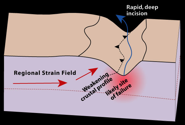
The “tectonic aneurysm” model (defined in Zeitler et. al 2001) suggests that the tectonics of the area are caused by the high rainfall and presence of the Indus river valley. Consider a river valley cutting deep into a mountainous area – it’s made a kilometres deep hole in the crust and this weakens the rocks below and either side of it.

Tectonic aneurysm initial

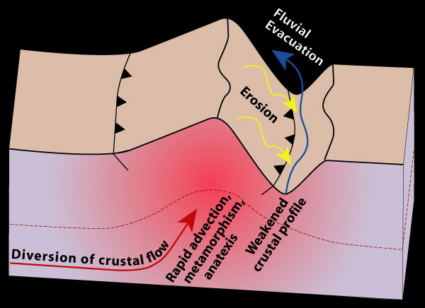
To state the obvious, remove rock from the surface and the material below moves closer to the surface. This does two interesting things – firstly the reduction in pressure makes brittle rocks weaker. Secondly, the valley will change the thermal structure of the crust. Cutting a hole into the crust will bring hotter rocks closer to the surface (because the surface is lower). Then if the rocks beneath the valley start moving up (a process called advection) then they may move up so fast that they can’t cool down on the way. There’s more. Releasing pressure in very hot rocks (decompression) can trigger melting and granite production. The presence of melt reduces the strength of the crust by an order of magnitude. This means that the crustal flow will become easier as the rocks become weaker.

tectonic aneurysm

Erosion causes uplift which causes crustal flow which causes more uplift which causes more erosion which….. This positive feedback loop turns the initial weakness into a much bigger structure that affects the entire crust. The term ‘tectonic aneurysm’ refers to a medical condition where a weakness in an artery wall can cause serious medical problems as it gets bigger. My analogy of the overfilled sandwich with a cut in the top is more cheerful, but ‘tectonic aneurysm’ sounds much more sciency.

Egg or chicken?

The tectonic aneurysm model has also been applied to the Eastern syntaxis, at Namche Barwa in Tibet, where the Tsangpo river forms a deep gorge. These syntaxes are tectonic features, related to the corners of the Indian indentor, yet the aneurysm model regards a river gorge as thing that initiates extrusion. Why is there a connection between the two?

For me this is the most satisfying part of the model – the rivers flow across the syntaxes because of the geometry of the mountains – tectonics controls the location of the rivers which in turn influences the tectonics. Processes that affect the surface and those involving the entire crust are intertwined in a dance that lasts millions of years.

Consider the growth of the Himalayas. Rivers that used to drain off proto-Tibet into the Tethys ocean are now blocked by a mountain range, where India is pushing into Asia. These rivers start to flow parallel to and behind the mountains. Over time syntaxes develop and news rivers start to cut into them. Eventually these new rivers reach the old mountain-parallel ones and ‘capture’ them. The precipitation that has been stuck to the North of the Himalayas can now get through and the major river systems of the Indus and the Tsangpo-Bhramaputra can finally reach the Indian Ocean. At the ‘knick-point’ where these rivers drop sharply in altitude major gorges are formed. These ‘cut the sandwich’ and allow the weak hot middle crust to extrude out to the surface, forming some of the most fantastic scenery on earth.

The idea that patterns of erosion affect tectonics is a lovely illustration of the interconnectedness of the geosciences and is a current topic. A  very recent paper in GSA Today by Paul Kapp and co-workers looks at wind erosion in the North of Tibet. They show significant rates of erosion and speculate a link with the (small-scale) tectonics of the area. It seems you don’t need big rivers (or indeed water) for the atmosphere to influence the way rocks deform.

The processes of crustal thickening that created the hot middle crust now extruding to the surface at Nanga Parbat affects all of Tibet. What happens to this soft material where it can’t reach the surface? Also are the syntaxes the only places the sandwich has leaked? Interesting questions. Someone should write a blog-post about them…

This post is part of my journey into the geology of mountains.

Further reading

ResearchBlogging.orgAll of the papers listed here are publicly available right now. Click on the links and you get the entire paper no matter who you are. There are links in the text above, but here’s a list of the good stuff.

The good folk of the Geological Society of America make GSA Today available to all.

The GSA Today paper Zeitler et. al (Erosion, Himalayan Geodynamics, and the Geomorphology of Metamorphism) is the place to start for the tectonic aneurysm model.

Peter K. Zeitler, Anne S. Meltzer, Peter O. Koons, David Craw, Bernard Hallet, C. Page Chamberlain, William S.F. Kidd, Stephen K. Park, Leonardo Seeber, Michael Bishop, & John Shroder (2001). Erosion, Himalayan Geodynamics, and the Geomorphology of Metamorphism GSA Today

There is also a great set of papers on the Lehigh University website.

The  Kapp et. al paper is in GSA Today, link to html version if you didn’t like PDF link above.  DOI: 10.1130/GSATG99A.1

Kapp, P., Pelletier, J., Rohrmann, A., Heermance, R., Russell, J., & Ding, L. (2011). Wind erosion in the Qaidam basin, central Asia: Implications for tectonics, paleoclimate, and the source of the Loess Plateau GSA Today, 21 (4), 4-10 DOI: 10.1130/GSATG99A.1

For more information on Nanga Parbat geology, the 2006 paper from Jones et al.  gives a good overview, plus a taster of what I’m writing about next.

Picture of Rakhiot Face from sunbeer on Flickr under Creative Commons
Diagrams from Lehigh University ‘indentor corners’ project pages, with permission.
Crème brûlée or jelly sandwich?

This post is part of my journey into the geology of mountains.

Rocks can behave rigidly, or under some conditions, they are ductile and can flow. This is a remarkable thing, which helps explain why the theory of Continental Drift was not more widely accepted (prior to the plate tectonic revolution of the 1950s). Seismic evidence from the deep earth shows that the crust and mantle rocks behave elastically (on short timescales). This was taken as evidence that they could never flow, meaning the continents couldn’t drift. We now know that hot rocks in the mantle can flow (over long timescales) and that this is a necessary part of plate tectonics.

What about other geological implications? What other things can be explained by the ‘Jekyll and Hyde’ way in which rocks deal with stress?

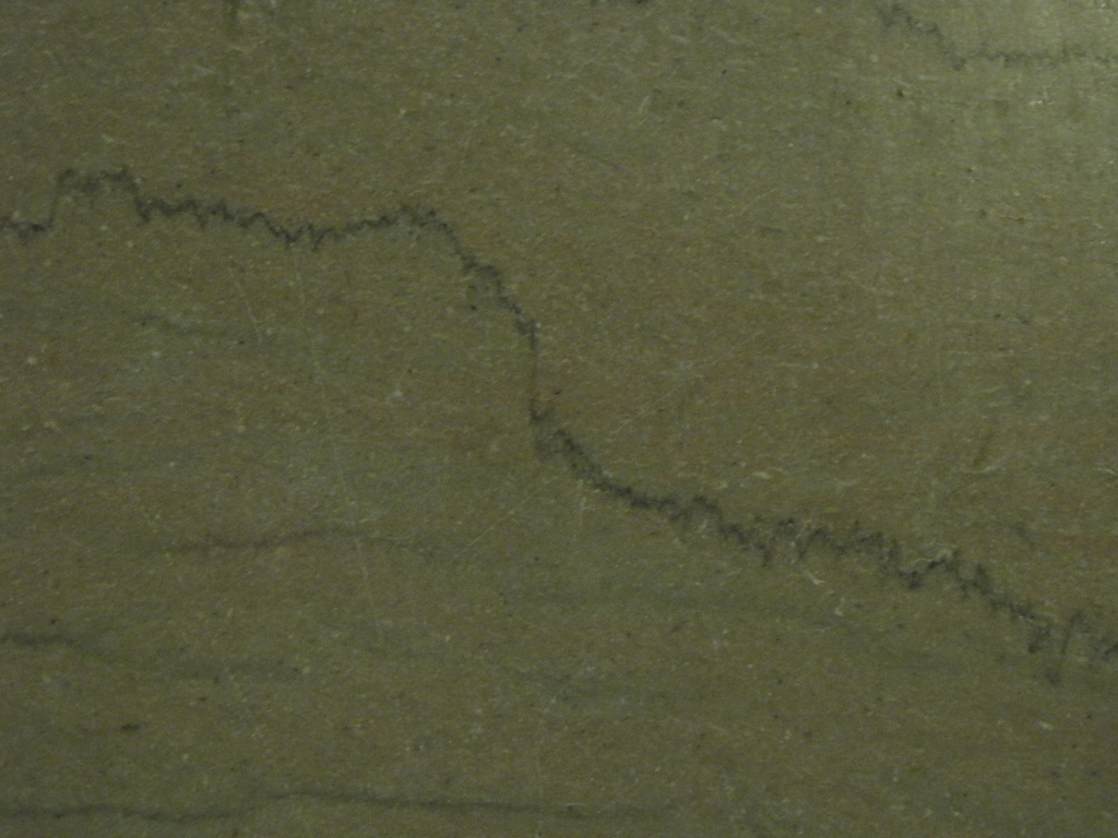
Small scale structures: Most rocks under surface conditions behave rigidly – they only change their shape by fracturing or by being dissolved. Rocks deformed near the surface are therefore typically fractured or faulted. Slightly hotter rocks may be deformed by dissolution, where material is dissolved into solution and redistributed into veins. Stylolites and cleavage are structures formed in this way that are common in deformed sediments. Salt and mud and are two substances that can flow in cold shallow rocks. Salt diapirs and mud volcanoes are structures where these light substances flow towards the surface.

Stylolite from Ron Schott on Flickr (http://www.flickr.com/photos/22644739@N00/4468019786)

To deform typical rocks in a ductile way, they need to be under conditions associated with metamorphism – below depths of about 15-25 km and above temperatures of ca. 300 oC.

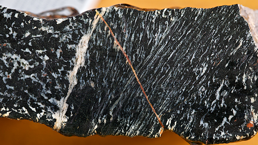
Under these conditions, various forms of sold-state creep begin to work and rocks can ‘flow’. Typical structures here are fabrics, such as schistosity or gneissosity – entire rocks are deformed as shown by the flattened minerals within them. Often there are areas of very high strain called shear zones, typically containing mylonites. A process called strain softening, plus perhaps a focussing of water or heat flow makes these zones softer than the surrounding rocks, meaning that they get more and more deformed.

Shear zones are analogous to faults, indeed a major structure may be a fault near the surface but a shear-zone at depth. A shear-zone is likely to be wider than the equivalent fault – the deformation is distributed through a large volume of rock.

Shear zone in amphibolite from Ian Stimpson @hypocentre (http://www.flickr.com/photos/17907935@N00/6723121739)

What controls the brittle-ductile transition? Major controls on the rheology of rocks are  composition, temperature, pressure, the presence of liquid, and the presence of melt. Composition is quite hard to change, but if you increase any of the other things, the rock is more likely to behave in a ductile fashion.

Large scale features, large scale evidence. There are some big features that can  be explained in terms of their rheology, which means they can be used to directly measure the rheological properties of the crust.

Foreland basins are sedimentary basins where the accommodation space (the hole in the ground filling up with sediment) is created by the flexure of the rigid upper crust.  Think of the Indian continent being pushed under the Himalayas and Tibet.  The weight of Tibet is pushing down on the Indian plate and this bends it downwards. The space created fills with sediment being eroded from the Himalayas. The Ganges basin is formed.

The Indian crust is cold and rigid. Clever folk can do the maths on the shape of the crust as it bends down. This confirms that the pattern matches the model for rigid, elastic deformation. It also allows then to calculate the plate’s flexural rigidity, which is a measure of its strength. This means quantifying the rheology of real bits of the earth, which is a very useful trick.

If you read up more on foreland basins, the picture gets more complicated as, over time the crust will further deform in a viscous way. I want to take you away to a different example of viscous behaviour.

There are raised beaches all over high-latitude areas of the Northern hemisphere. These are fossil beach deposits now found metres above sea-level. They can’t be explained by global sea-level changes as equivalent features are not found further south.

Raised beach from Scotland (in foreground). From SAGT @http://www.flickr.com/photos/sagt/4304338029/

These raised beaches formed when global sea-level was similar to today’s level: they are raised because the earth’s surface has risen up since they were formed. This isn’t due to tectonics – these areas are far from any plate boundary. What these areas have in common is that they were covered with kilometres of ice during the last ice age. This ice weighed a lot and this force pushed the crust down. The upper crust bended rigidly, pushing underlying viscous rocks (probably in the mantle) out of the way. The ice melted relatively quickly, removing the downward force. The viscous mantle rocks are slowly recovering, flowing back into glaciated areas and lifting the earth’s surface, leaving fossil beaches high and dry. The overlying rocks are being passively pushed up, with occasional post-glacial earthquakes occurring in otherwise tectonically quiescent areas. Once again, these natural phenomena are an excellent opportunity to directly measure the physical properties of the earth’s interior: the rate of rise lets you measure the viscosity.

Crème brûlée versus jelly sandwich

So the earth is strong near the top and weaker at deeper levels? If so, it would be like a crème brûlée. A giant spoon digging into the earth would crack through an upper layer (like burnt sugar in a crème brûlée) and then scoop gently through the soft mantle beneath (creamy custard).

If the earth were boringly simple, this would be accurate, but as you know, life is more interesting than that. The earth gets hotter with depth, so rock is more likely to be weaker with depth, but the composition of the earth is not constant. It’s long been known that the surface layer that moves as part of plate tectonics (the lithosphere) is not just the crust. There is a layer of mantle material (lithospheric mantle) stuck to the bottom of the crust meaning that within the lithosphere, there is a dramatic compositional change which complicates matters.

An interesting paper by E.B. Burov and Tony Watts (available here, thanks GSA!) discusses the crème brûlée model and compares it with a ‘jelly sandwich’ model. A jelly (jam) sandwich has a soft layer between two stronger layers. The sandwich model supposes a strong rigid upper crust, a weak hot lower crust  and then a strong layer of lithospheric mantle.

You’d have thought that, knowing the composition of average crust and mantle and the conditions with depth, we could resolve this debate easily. As it turns out, although we know that olivine-rich mantle is much stronger than quartz-rich crust we don’t know by how much. It is very hard to run experiments with low strain rates and high temperatures comparable to real-life conditions so we can’t measure directly.

Burov and Watts combine numerical modelling and indirect observations to settle the issue. Think back to the Indian crust subducting under Tibet. One of the things you can infer from geophysical studies of these situations is the effective elastic thickness of the lithosphere. This is the cumulative thickness of rocks that are behaving elastically. For India, this is 70km, which is greater than the thickness of the crust. This is hard to explain, unless the lithospheric mantle is strong, suggesting you have a thick sandwich, not a thin layer of burnt sugar. They also show numerical modelling that suggests that without a strong lithospheric mantle, subduction and mountain building wouldn’t be possible.

Note that for this last section I’ve switched to talking about weak/strong rather than rigid/ductile. If you a simple sort like me, you can think of the two as synonymous, but they are not really which is why Watts and Burov talk about long-term strength. Complications arise because most rocks are viscoelastic – they transmit earthquake waves elastically (over short timescales) but behave viscously over longer timescales. The paper gives you a taste of this, but I’m not the man to take you any further into that world.

Rocks behave in complicated ways when placed under stress. I hope I’ve given a taste of the complications that arise from this in the wider world. I leave you with one thought: if you squeeze an over-filled sandwich – what happens to the filling? I will return to this and how it relates to Tibet and the Himalayas, in another post.

Sicily’s other volcanoes

In early February I went on a trip to Sicily with friends. I had originally planned to visit Etna, but I was travelling with non-geologists and the cost and discomfort of going up there in the winter put me off. I was therefore a little narked that Etna decided to erupt a few days before I was due to fly off. The fantastic pictures from @EtnaWalk and @EtnaBoris made me feel I was missing out.

By the time we flew into Catania Etna had (just) stopped erupting. It was also totally invisible beneath cloud. This made me feel a bit better about my decision to focus the holiday around seafood and leisure rather than lava. From Catania, at the foot of Etna, we made our way to Siracusa, which Archimedes called home. The drive south revealed a landscape characteristic of a stable platform, with lots of flat layered sediments creating a ‘trap topography’ with flat-topped hills with long steps between them. The south-eastern corner of Sicily is in fact part of the African plate and so is as yet untouched by the exciting things that have happened to most of the rest of the Mediterranean.

Siracusa is a nice place (well at least the old quarter of Ortygia is). Local buildings make use of basalt and limestone together, often with basalt forming parts that need to be hard wearing, such as steps.

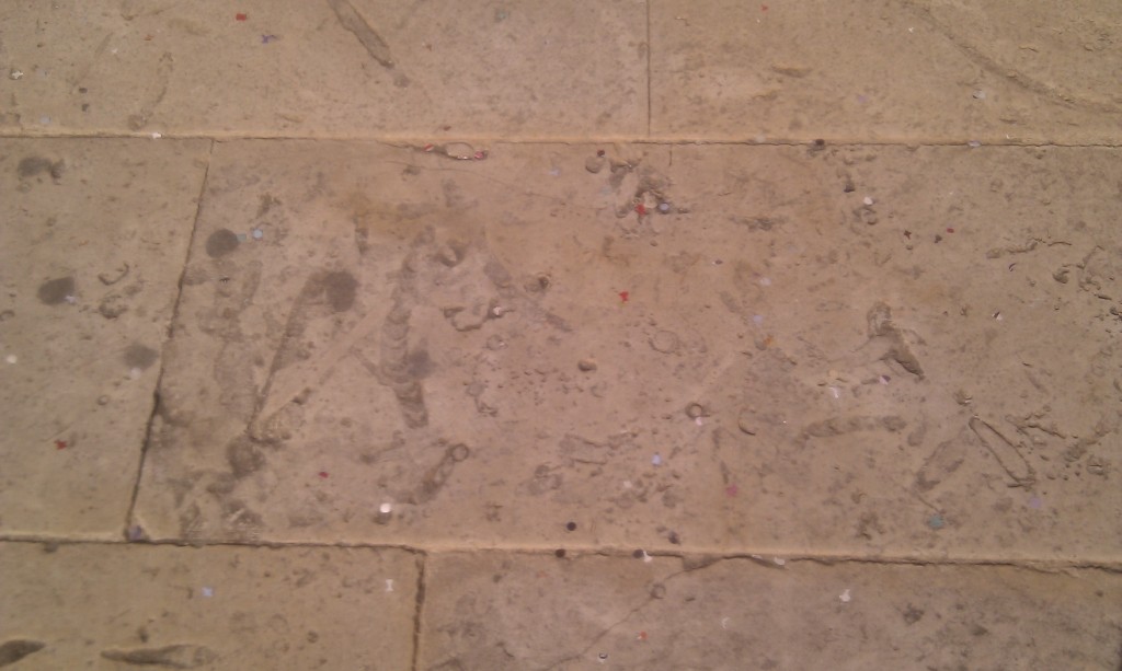
The square in front of the cathedral in Ortygia has been recently paved with slabs rich in trace fossils. I won’t hazard a guess as to the names but you can tell these critters were having lots of fun in the (limey) mud.

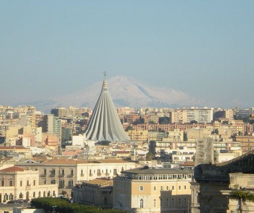
Having forgotten about Etna, a surprise on our first morning was that the breakfast room of the hotel had a nice distant view of it. Note how the modern cathedral echoes the shape of the volcano, but focus on the white triangle in the centre of the picture.

The black streak on its right hand side is the days-old lava flow, standing out against the snow. It was an awesome sight which together with top-quality espresso got the day off to a great start.

After Siracusa we drove west along the South coast to Agrigento. This journey took us off the stable platform and into an accretionary wedge. This is a package of sediments all stacked up on top of a major thrust. In this case, the rest of Sicily was being thrust over the eastern part along what is in effect a plate boundary.

The reason tourists visit Agrigento is for the ancient Greek temples. These are in some ways better than anything you find in Greece, I am told. They are made of a rather handsome orange calcarenite (limey sandstone) which underlies the town. This layer makes a rather nice structure and is, I infer, one of the reasons the ancient Greeks sited their colony here.

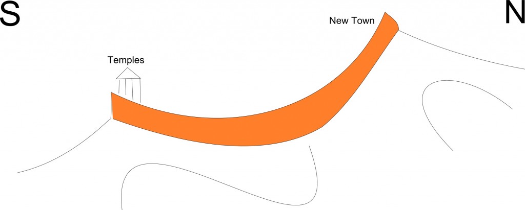
Let me explain. The Greek temples sit on the top of an escarpment, which makes them highly visible from the sea. There is a hill above the temples topped by the same escarpment, only pointing the other way. There is a dip slope in the middle making a nice flat area. Agrigento therefore is a nice flat area surrounded by cliffs on three sides. This must have made it easier to defend from attack.

This structure is due to the sandstone being gently folded. Here is a cross-section sketch-cartoon with the sandstone shaded in something close to its natural colour.

Note that I’ve made a gesture towards showing more intensely folded sediments below. The calcarenites are thrust-top sediments meaning they were deposited onto the already deforming thrust wedge. This is why they are only gently folded, whereas the other rocks in Sicily have enjoyed a lot more structural hijinks. There is of course an unconformity between the two sets of rocks.

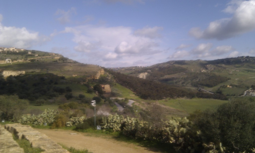
This photo is looking North down the line of the cross-section, standing by the temples. On the left you see the dip-slope climbing up the hill with a glimpse of the orange escarpment just before it forms the left-hand skyline. The right-hand side shows the paler limestones and evaporites that lie unconformably below.

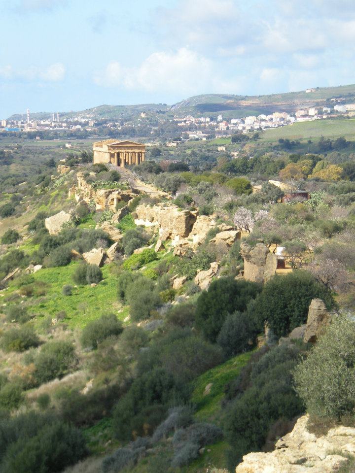
Here’s a view looking west along the southern escarpment. It gives some sense of why these temples were built where they were.


We ate a lot of seafood in Sicily, as we were always staying on the coast. I never saw oysters on the menu though, but to make up for it, there were fossil oysters available in the calcarenite (scallops too).

We managed to get a trip to one Geological feature, as an alternative to Etna. Appropriately enough we visited Etna’s other volcanoes.

The Macalube nature reserve  is a big patch of mud. I’ll try that again, with my marketing hat on. Macalube is outstanding location of international renown where you too can experience the thrill of standing on top of an erupting volcano at no personal risk (except to your shoes).

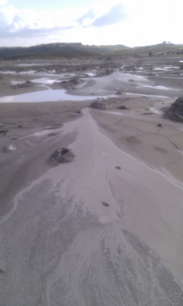
This is an area of mud volcanoes, which in many ways are completely unlikely proper volcanoes.

Consider the sediments in the accretionary wedge. They are under pressure, they are being lithified, with mud turning to mudstone, driving off water. Also organic matter is producing methane gas plus there are extensive evaporite deposits in these sediments, a product of the Messinian crisis when the Mediterranean completely dried up. All these things going on underground act to create big masses of mud that start to flow up towards the surface. When they run out of rock to rise through, they form mud volcanoes.

Macalube is nowhere as dramatic as Lusi in Indonesia that erupted last year, but it has its charms. It was quiet when we were there, with just a few ‘bloops’ every minute or so which reminded me of my granddad’s home-brewing kit.

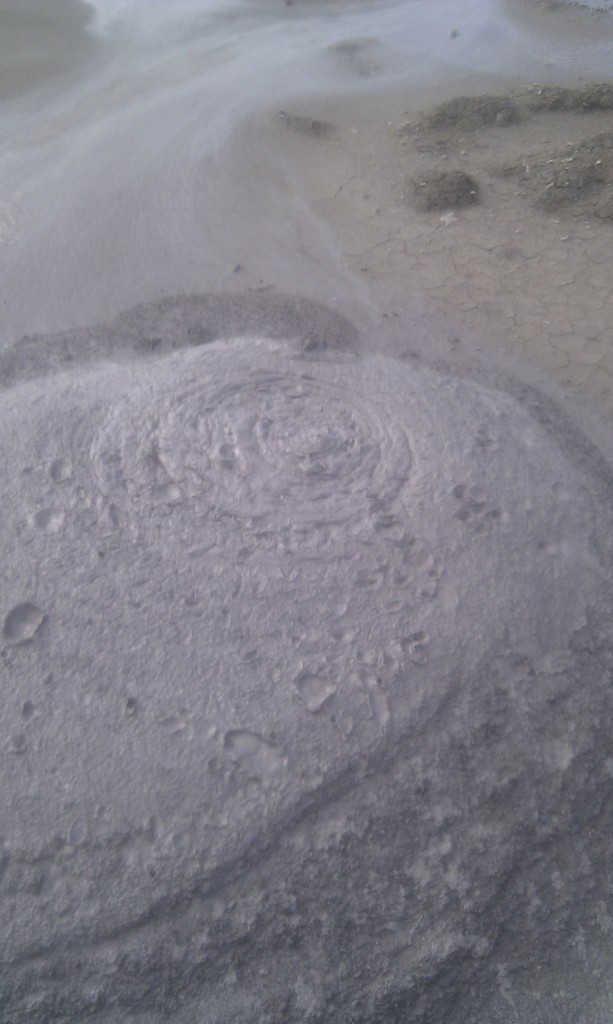
When looking at mud volcanoes you can’t help but compare them to the real thing. The underlying mechanism is totally different, but the shapes are often very similar. The viscosity of the mud varies, which gives effects like different viscosity magmas. Here is some viscous mud which spits out big lumps now and then. It is sort of kinda like Mount St. Helens (note the big splats).


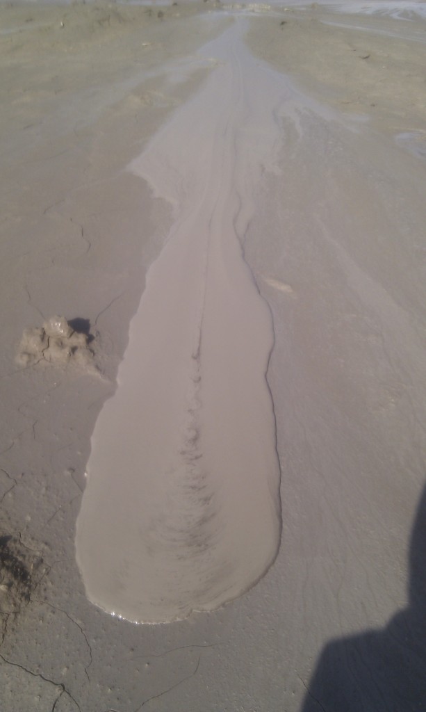
Whereas here is some runny mud, making a discrete ‘flow’. This area was a flatter shield-like area, more reminiscent of the Hawaiian volcanoes.

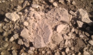
There were some bits of fibrous minerals in the mud, probably broken veins of gypsum; my only brush with the Messinian.

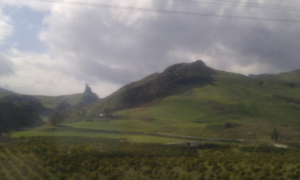
On our penultimate day we took the train across the island to Palermo on the north coast. Through the window there were many examples of folded sediments, such as this one. You’ll notice the layers dipping to left first, but note that the pointy crags a third along from the left are vertical.

Volcanoes, limestone, structure and good food. Sicily has a lot going for it.

Rheology re: geology

“Wibble wobble, wibble wobble, jelly on a plate” Childrens’ rhyme.

To understand the geology of mountains, you need to know how they are  built, which means you need to know how rocks deform. I have a tendency to throw phrases around, so I want to define some of them properly. Also I’ve bought a new toy I’d like to play with.

Rheology is the study of the flow of matter. A understanding of a rock’s rheological properties tells us how it behaves when a force is applied to it.

The trouble with rocks is we don’t have much direct experience of deforming them. So let’s start with jelly (or “jello” as most of you know it). If you put a big pile of jelly (not jam, jelly) on a plate and push it, it moves (wibble) and then moves back (wobble). It may then take a while to settle back to exactly where it started (wibble wobble). Once you get tired of poking, stick a spoon in it and eat some. Notice that the pieces break off with a clean sharp edge.

The properties I’ve described are those associated with elastic materials. If you apply a force to the material, it changes shape but returns to its original shape when the force is removed. If  you apply a larger force it will permanently change its shape. Apply a large enough force and it will fracture.

Rocks as we know them behave like this. Earthquake waves can be thought of as little wibble-wobbles moving through elastic rock. Apply enough force to rock and it will fracture – if they are big we call these fractures faults.

But what happens if you leave jelly out in the sun, or make it with too much water? It starts to collapse under its own weight. It  doesn’t fracture but flows, like a liquid. Materials that behave in this way exhibit viscous behaviour. Don’t just think of water, which has low viscosity, think of high viscosity liquids like tar or honey or felsic magma.

So, we have two broad ways in which materials can deform, elastically or viscously. In practice a material can exhibit type of behaviour, under different conditions or different rates of deformation. This hybrid behaviour is know as visco-elastic.

My new toy. I’ve bought some magic putty. It is a material with complicated properties, but for our purposes it shows how a material can have both elastic and viscous rheological properties.

First the elastic behaviours: silly putty is very bouncy. It will fracture too, but this is harder to do. I tried hitting it with a hammer; a word of advice – don’t.  Matt Kutcha persisted and got some great video.

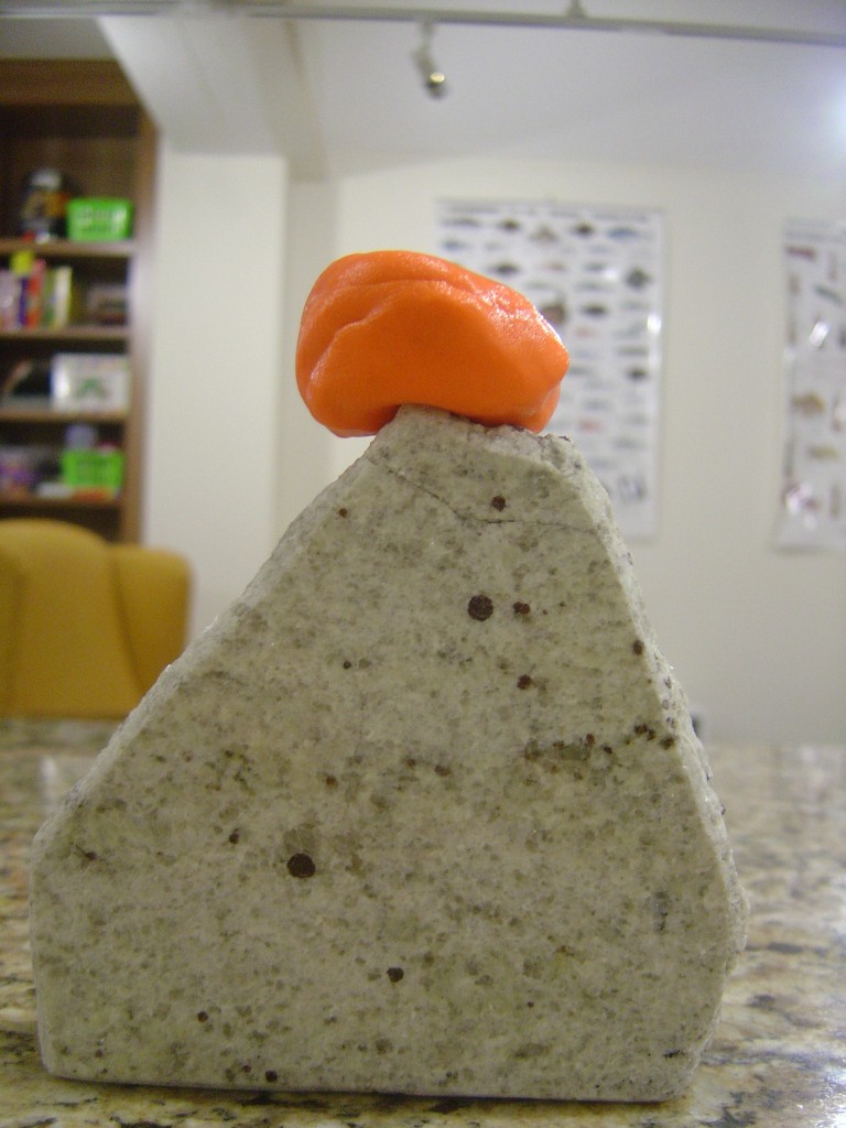
The viscous side of things is best expressed in photos. Here’s a nice round piece of silly putty, perched on a slab of Himalayan granite.

Silly putty, round blob

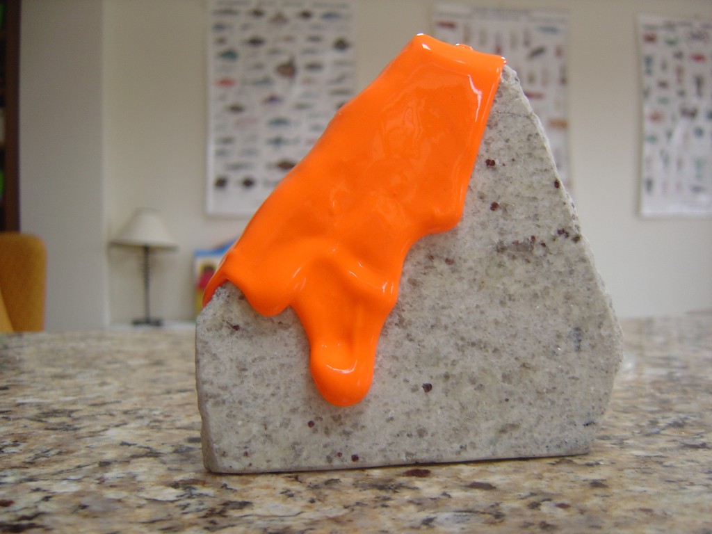
Here’s the same blob the morning after. It’s takes a while, but if definitely flows viscously.

Very stretched silly putty

How does this apply to rocks? Rocks are (usually) made of crystals which are formed by mineral lattices. The atoms within these crystals are joined together by atomic bonds. Apply a force to them and you can increase the gap between the bonds. Remove the force and the bonds return to their original size. Apply enough force and the bonds break. This explains elastic behaviour.

How to explain viscous behaviour in rocks? Just like jelly, if you heat rocks, or add water they are more likely to flow like a liquid, only very very slowly. Luckily geology has lots of time available. A crystal lattice can deform by crystal plastic mechanisms know as creep (diffusion or dislocation). These are where atoms in the lattice shift one by one (helped by little imperfections). In time, the mineral lattice becomes a different shape, and writ large, the rock has been deformed. Individual grains remain whole so conceptually the rock has flowed like a liquid. This type of deformation in rocks is referred to as ductile. The terms ductile and viscous are often used as synonyms*.

In summary, rocks can behave in an elastic manner, but also in a ductile/viscous way. The question of which rocks behave in which ways, and how this is relevant to the geology of mountains is a matter for another post.

* Note on terminology Viscous/ductile/plastic are terms that seem in practice to be used synonymously as being things different from elastic behaviour. It’s not clear to me which is correct, if any. Viscosity is a measure of the resistance of a fluid to stress whereas plasticity and ductility relate to changing the shape of solids. It seems that ductile deformation is a description of what happens to rocks whereas viscosity comes in where numerical modelling of rock  flow is required. Plastic is deformation of materials without fracturing. Or so it seems to me. Anyone who knows more care to comment?

This post is part of my journey into the geology of mountains.