The biggest pile of sand the world has ever seen

The Moine, a set of sedimentary rocks found in furthest north-west Scotland have enjoyed at least three cycles of metamorphism and deformation. My only sample from here is a migmatitic gneiss, so when I heard about people studying sedimentology in the Moine, my mind was a little bit boggled – gneisses have lost all trace of their sedimentary history. Once I read a bit more I discovered a story about sand. Lots of sand. The biggest pile of sand the world has ever seen, in fact.

High grade migmatitic gneiss with folded granite vein - Moine from Scotland

Metamorphic and sedimentary

Formally ‘the Moine’ is the Moine Supergroup of early Neoproterozoic age. This is a phrase the makes me think of a 1970s prog rock band but it is a stratigraphic term. The Moine supergroup is made up of groups like the Glenfinnan and Morar groups, each of which is a recognisable package of sediments, representing a period of time. The Moine is defined as a group of sediments that formed in a single sedimentary basin.

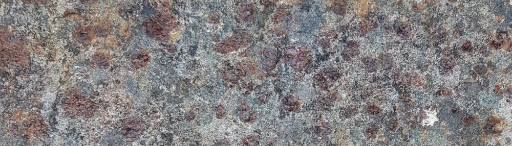
How did sediments end up looking like the picture above? This sample of gneiss started as mud but has since been buried and heated so it  was metamorphosed (it contains garnet and biotite), melted (the vein of granite) and deformed (the lovely folds). We know it was once mud only from its bulk chemistry. However I’m a big fan of deformation and metamorphism, so I picked a sample that shows these things. A more representative rather different sample of the Moine is seen in this picture.

Moine crossbeds from zeesstof on Flickr

This is a sample of metamorphosed sandstone, or psammite in local parlance. A practiced eye will quickly pick out the bedding (horizontal) and cross-bedding (sloping lines). These are primary sedimentary features and if you see enough of these, you can work out the conditions under which the sediment formed.

Why are these traces of an ancient river or sea-bed preserved? There are two reasons.

Firstly the rock is made up mostly of quartz, and so is not affected by metamorphic reactions under normal conditions. During metamorphism the quartz may be recrystallised, but fine structures like cross bedding can survive. Note that some of the lines above are a slightly different colour – these are rich in ‘heavy minerals’ such as Zircon.

Secondly, conditions of metamorphism and (particularly) deformation vary depending on where you are. The mylonites of the Moine Thrust zone were once sandstones, but no bedding can be seen in them now. The Moine rocks have been intensely deformed, but particular areas such as the hinges of folds still contain original sedimentary structures.

Geological paradise

NW Scotland geology map

The map above shows Northwest Scotland. The key structure is the Moine Thrust (MT) which runs parallel to the mainland coast. To the west are foreland rocks – ancient basement gneisses (Lewisian), Proterozoic sandstones (Torridonian) and a thin sliver of Cambro-Ordovician sediments. These last contain fossils that link them to rocks of similar age in North America. All these rocks formed before the Atlantic existed, in fact most formed before the ocean before the Atlantic. For the rest of this story we are in North America, geologically speaking.

East of the Moine Thrust are the Moine rocks, deformed, metamorphosed and containing igneous intrusions, in stark contrast to the sediments to the west…

Torridonian sandstone on Liathach, courtesy of Sandchem

This lovely picture of undeformed Torridonian sandstones, with a white cap of Cambrian sandstone highlights the different geological histories either side of the Moine Thrust.

How to explain the difference? One possibility is that the Moine rocks are exotic, brought in from elsewhere as part of an allochthonous terrane. Much of Alaska is made up of large chunks (terranes) which have very different histories but have all ended up being scraped onto the American continent. In the 1990s people were finding applying this then-fashionable concept everywhere, including Scotland. Or possibly the Moine and Torridonian are equivalent; twins separated at birth, who experienced very different histories as they grew older. To decide between these options, what you need is something akin to DNA for sedimentary basins.

Long-lost twins

The ‘heavy minerals’ in sediments are literally heavy. Geologists crush up samples and put them into dense liquids. The quartz floats, the heavy fraction that sinks is separated and analysed. Zircon grains are common heavy minerals and they have a very useful feature – they contain lots of Uranium which is tightly locked in. If you analyse them isotopically, you can tell the age at which they formed, even if they’ve subsequently been metamorphosed.

These ‘detrital Zircons’ will have a range of ages, reflecting the age of the rocks that were eroded to form the sediment. This may have a distinctive pattern that gives a picture of the eroding rocks surrounding a sedimentary basin. This is like DNA for sediments.

Work led by Maarten Krabbendam of the British Geological Survey strongly suggests that parts of the Moine and Torridonian are direct equivalents – twins. Rocks of the lowest part of the Moine, the Morar group have detrital zircon age profiles that are very similar to rocks from the main part of the Torridonian. They are more similarities indeed than between the Morar group and the higher parts of the Moine. Krabbendam and colleagues state that the Torridonian and lowest Moine are “similar in terms of lithology, stratigraphical thickness, sedimentology, geochemistry, detrital zircon ages and stratigraphical position on Archaean basement” which is a compelling case that they are two parts of the same basin.

Lots and lots of sand

The link between Moine and Torridonian tells us that about a billion years ago there was a sedimentary basin covering northern Scotland, containing 6-9 kilometres thickness of sand. To get that much sediment, you need to make a hole to put it in. What formed the sedimentary basin the Torridonian and Moine sediments were deposited in?

To find out, Maarten Krabbendam and Helen Bonsor at the British Geological Survey (with others) have been looking at the Moine rocks as sediments. Detailed field work allows them to create maps and sedimentological logs. Logs are vertical graphical descriptions of many things such as grain-size (mud or sand), sedimentary features or direction of water flow inferred from ripples. Remember that these are highly deformed rocks. The bedding is very rarely flat, indeed sedimentary features may be the only way of telling if the rocks are upside down or not, such is the intensity of folding in the area.

All this hard-won data can tell you a lot. Sedimentary features and patterns allow you to infer water depth. As an example, to quote Bonsor et al: “The presence of pinstripe, flaser and lenticular bedding, bidirectional ripple crosslamination and abundant mud drapes indicates that deposition was strongly tidally influenced“, in other words in relatively shallow sea-water. Other parts of the sequence contain hummocky cross stratification which is associated with deposition in deeper waters.

Add all this up and you get a picture of the sedimentary basin through time. Geologists have done this for many basins where the cause of basin-formation is known. Comparing these with the Moine/Torridonian lets us infer how this particular basin formed.

Many workers have interpreted the Torridonian and Moine as separate rift basins. These are where active faulting makes space in a relatively narrow area. The characteristics of sediments in these basins tend to change rapidly horizontally (over location in the basin) and vertically (over time). Near faults you expect coarse fan deposits. None of these things are seen in the Moine or Torridonian, which were deposited under relatively uniform conditions.

Gentle stretching of continental crust forms ‘contintental sag’ basins. Again this isn’t a good fit for the Moine/Torridonian, in part because sag basins are not often so deep.

Bonsor and Krabbendam argue that the best candidate for the Moine/Torridonian is a foreland basin, like the modern day Ganges. A mountain range pushes down onto the continental plate next to it, forming a hole that is quickly filled by sediment eroded from the mountains. These basins can be wide and deep, with long-lived stable conditions close to sea-level as the bending down of the crust and the amount of sediment arriving reach a balance.

The American connection

If the Moine/Torridonian basin formed next to a set of mountains, there should be traces of these mountains somewhere in the geological record. Which orogeny formed these mountains?

There are no fossils in these old rocks, but detrital zircons give a constraint on the maximum age of sedimentation. The sedimentary basin is around a Billion years old, and tectonic reconstructions put the basin near the active Grenville orogeny. This is a major event that created a belt of metamorphic rocks found across the North American continent.

A large range of mountains produces a lot of sand. A billion years ago there were no land plants – nothing like Rhododendrons that stabilise slopes in the Himalayas – so rates of erosion would be higher. It’s also been suggested that the Grenville mountains were located so as to get monsoonal weather patterns. The combination of high precipitation and no vegetation would have caused extremely high erosion rates and created an awful lot of sand. Perhaps the biggest pile of sand the world has ever seen.

A question: If there is a Grenvillian foreland basin in Scotland, why can’t I find anything out about an equivalent in North America? I can find references to equivalent basins in Greenland and Scandinavia but not America itself. Anyone care to suggest why not? [See interesting comments from F below]

References and further reading

ResearchBlogging.org
H. C. Bonsor, R. A. Strachan, A. R. Prave, & M. Krabbendam (2012). Sedimentology of the early Neoproterozoic Morar Group in northern Scotland: implications for basin models and tectonic setting Journal of the Geological Society DOI: 10.1144/0016-76492011-039

H.C. Bonsor, R.A. Strachan, A.R. Prave, & M. Krabbendam (2010). Fluvial braidplain to shallow marine transition in the early Neoproterozoic Morar Group, Fannich Mountains, northern Scotland Precambrian Research DOI: 10.1016/j.precamres.2010.09.007

MAARTEN KRABBENDAM, TONY PRAVE, & DAVID CHEER (2008). A fluvial origin for the Neoproterozoic Morar Group, NW Scotland; implications for Torridon–Morar Group correlation and the Grenville Orogen foreland basin Journal of the Geological Society DOI: 10.1144/0016-76492007-076

The British Geological Survey now puts its research papers into an Open Access archive. Good for them. Encourage them by going and reading the actual papers I’m talking about.

I’ve talked most about Bonsor et al. (2012) as its the most recent. Bonsor et al. (2010) covers different ground using the same techniques. Looking at a different aspect of the Moine, Krabbendam et al. (2011) summarise some of the structural work the BGS are doing in parallel with the sedimentary studies.

Location map taken from Krabbendam et al 2008 with implicit permission of Geological Society of London

Torridon photo with kind permission of David Shand (Sandchem on Flickr).

Moine cross-beds from zeesstof on Flickr under Creative Commons

The BGS have a new feature of embedded geological maps in your web pages. I’ve had a go below, centred on the North-west Highlands.


Geology and life in the English ‘Coal Measures’

The geology of the North of England is where our modern industrial civilisation was born, based on the burning of fossil life. I’ve wanted to write about the fascinating geology I grew up with for a while. I’ve been spurred into action by Accretionary Wedge #46 where Cat asks us to write about “Geology, Life and Civilization”.

The spine of northern England is the Pennines, ending in the south with the Peak District, where I come from. This area is almost entirely made up of Carboniferous sediments that have shaped the landscape and the culture of the area.

True Grit

One of the most characteristic landforms of the Pennines is the gritstone crag.

These thick resistant layers of sandstone form prominent lines of outcrops (crags), with gentle dipslopes in between. Generations of rock climbers have been trained on them. The cliffs are low, but make for great climbing. You can battle with gravity all day and be in the pub half an hour later.

The sandstone is often coarse (gritty) and was traditionally used to make Millstones, which are now the emblem of the Peak District national park. ‘Millstone Grit’ is great building stone and the area is dotted with quarries. In some areas it forms easily into regular slabs, perfect for building drystone walls or making cobbled streets.

Macclesfield cobbled street

The crags of sandstone have fabulous names, like Froggat Edge, Stanage Edge and ‘the Roaches’ and these names enrich the stratigraphy and therefore the geological maps of the area.

Gritstone is poetic as well. The great English poet Ted Hughes grew up in these landscapes and wrote about them. In “Still Life” he writes that “Outcrop stone is miserly” and is “Warted with quartz pebbles from the sea’s womb”. The outcrop marks the ‘fly-like dance of the planets’ and thinks itself eternal, but only because it is ignorant of what water will do it, over time. Elsewhere in Wodwo he writes of walkers escaping the valley onto the moors above. The Pennines and Peak District have long  been a means of release for inhabitants of the industrial cities and valleys that sit below. The mass trespass of Kinder Scout (type locality of local stage “Kinderscoutian”, 318 to 317 million years ago) in the 1930s was in favour of the ‘right to roam’ and is seen as a milestone in English social history.

Romantic looking m

Mud, glorious mud

The gritstone crags are only prominent because they are surrounded by softer rocks. Mudstones and shales are common in this area, they form the plain backdrop on which the gritstones can perform. A humble, elusive rock type, best found in stream beds the shales are not devoid of interest. Far from it – they were teeming with life.

Shale

Below is a section of an early armoured fish.

Fossil armoured fish

I don’t know what this is, maybe nothing.

Mystery ?fossil?

At times the shales are clearly marine (mostly, like the sandstones, they are not). In distinct ‘marine bands’, goniatites (ammonoids) and crushed shelly debris are common.

Crushed fossils from marine band. Goniatite on right, ?bivalve shell debris elsewhere

The clearest goniatite above is middle right, where you can see the parallel lines of the external ornamentation. Here’s a close-up where the spiral shape of the goniatite is more obvious.

Carboniferous goniatite from marine band

Goniatites are marine creatures, but here’s a clear sign of land, a piece of fossil bark. Carboniferous forests were dominated by primitive plants called Lycopods which have leaves growing direct from the stems, leaving the scars you see below.

plant fossil in shale ?Lycopod bark?

King Coal

Cat herself mentions Iain Stewart talking about the importance of Carboniferous coal deposits in the history of the Industrial Revolution. Just how important coal was is an area of vigorous historical debate but no-one would argue that industrialisation started in the North of England and that burning of local coal deposits was important.

Let’s start with the roots of the matter. Coal is of course compressed plant material found in seams. At the base of these seams is usually a layer of very pure quartz sandstone. This is a fossil soil, a palaeosol which locally may be known as seatearth, or ganister. Appropriately enough these fossil soils often contain fossil roots, often Stigmaria, with a distinct ‘holey’ appearance.

Seat-earth with plant fossil Stigmaria

Coal is relatively rare in the Peak District, where all of these photos and samples were taken (most on a single afternoon in the Goyt Valley). The area contains the transition between ‘Millstone Grit’ deposits and the ‘Coal Measures’ proper. Coal seams are thin and extraction was via shallow ‘bell-pits’ for local use only. The main coal fields were further north in Lancashire and Yorkshire, where whole communities were built up around the ‘pits’.

These coals put the ‘carbon’ into ‘Carboniferous’ – there are massive deposits worldwide but the name was coined in Britain. This was an odd period in earth history, associated with high levels of oxygen (perhaps up to 35% compared with 21% today). One of the lines of evidence for high oxygen are the massive insect fossils found at this time (no photos sadly). These animals depend on oxygen diffusing into their bodies, so the more oxygen, the bigger they could grow.

Coal is fossil plant material, so no surprise that it contains impressions of plants within it.

Plant fossil in coal ?Lycopod bark?

This weathered piece, from a stream bed, looks rather like shale until you break the end and see it shine. I could have set fire to it and taken a picture, I suppose, but that would just be showing off.

Coal showing shiny edge "vitreous habit"

Cycles

Together, these rock types make up most of northern England. What is intriguing is that they often occur in a regular pattern. This is an interesting thing and I shall return to it.

Another form of cycling concerns the carbon locked up in the coal. What was locked below the surface is now floating above it in the form of carbon dioxide. Releasing the power of this buried carbon kicked off our industrial civilisation. How we deal with the powerful effects of the atmospheric version will determine how our civilisation fares in the future.

The first image, of the Roaches, image from Plbmak on Flickr under Creative Commons.
All others mine, scale bars are centimetres.
If you want to know more about English Carboniferous Geology, this open access book chapter is where to start. 

Sicily’s other volcanoes

In early February I went on a trip to Sicily with friends. I had originally planned to visit Etna, but I was travelling with non-geologists and the cost and discomfort of going up there in the winter put me off. I was therefore a little narked that Etna decided to erupt a few days before I was due to fly off. The fantastic pictures from @EtnaWalk and @EtnaBoris made me feel I was missing out.

By the time we flew into Catania Etna had (just) stopped erupting. It was also totally invisible beneath cloud. This made me feel a bit better about my decision to focus the holiday around seafood and leisure rather than lava. From Catania, at the foot of Etna, we made our way to Siracusa, which Archimedes called home. The drive south revealed a landscape characteristic of a stable platform, with lots of flat layered sediments creating a ‘trap topography’ with flat-topped hills with long steps between them. The south-eastern corner of Sicily is in fact part of the African plate and so is as yet untouched by the exciting things that have happened to most of the rest of the Mediterranean.

Siracusa is a nice place (well at least the old quarter of Ortygia is). Local buildings make use of basalt and limestone together, often with basalt forming parts that need to be hard wearing, such as steps.

The square in front of the cathedral in Ortygia has been recently paved with slabs rich in trace fossils. I won’t hazard a guess as to the names but you can tell these critters were having lots of fun in the (limey) mud.

Having forgotten about Etna, a surprise on our first morning was that the breakfast room of the hotel had a nice distant view of it. Note how the modern cathedral echoes the shape of the volcano, but focus on the white triangle in the centre of the picture.

The black streak on its right hand side is the days-old lava flow, standing out against the snow. It was an awesome sight which together with top-quality espresso got the day off to a great start.

After Siracusa we drove west along the South coast to Agrigento. This journey took us off the stable platform and into an accretionary wedge. This is a package of sediments all stacked up on top of a major thrust. In this case, the rest of Sicily was being thrust over the eastern part along what is in effect a plate boundary.

The reason tourists visit Agrigento is for the ancient Greek temples. These are in some ways better than anything you find in Greece, I am told. They are made of a rather handsome orange calcarenite (limey sandstone) which underlies the town. This layer makes a rather nice structure and is, I infer, one of the reasons the ancient Greeks sited their colony here.

Let me explain. The Greek temples sit on the top of an escarpment, which makes them highly visible from the sea. There is a hill above the temples topped by the same escarpment, only pointing the other way. There is a dip slope in the middle making a nice flat area. Agrigento therefore is a nice flat area surrounded by cliffs on three sides. This must have made it easier to defend from attack.

This structure is due to the sandstone being gently folded. Here is a cross-section sketch-cartoon with the sandstone shaded in something close to its natural colour.

Note that I’ve made a gesture towards showing more intensely folded sediments below. The calcarenites are thrust-top sediments meaning they were deposited onto the already deforming thrust wedge. This is why they are only gently folded, whereas the other rocks in Sicily have enjoyed a lot more structural hijinks. There is of course an unconformity between the two sets of rocks.

This photo is looking North down the line of the cross-section, standing by the temples. On the left you see the dip-slope climbing up the hill with a glimpse of the orange escarpment just before it forms the left-hand skyline. The right-hand side shows the paler limestones and evaporites that lie unconformably below.

Here’s a view looking west along the southern escarpment. It gives some sense of why these temples were built where they were.


We ate a lot of seafood in Sicily, as we were always staying on the coast. I never saw oysters on the menu though, but to make up for it, there were fossil oysters available in the calcarenite (scallops too).

We managed to get a trip to one Geological feature, as an alternative to Etna. Appropriately enough we visited Etna’s other volcanoes.

The Macalube nature reserve  is a big patch of mud. I’ll try that again, with my marketing hat on. Macalube is outstanding location of international renown where you too can experience the thrill of standing on top of an erupting volcano at no personal risk (except to your shoes).

This is an area of mud volcanoes, which in many ways are completely unlikely proper volcanoes.

Consider the sediments in the accretionary wedge. They are under pressure, they are being lithified, with mud turning to mudstone, driving off water. Also organic matter is producing methane gas plus there are extensive evaporite deposits in these sediments, a product of the Messinian crisis when the Mediterranean completely dried up. All these things going on underground act to create big masses of mud that start to flow up towards the surface. When they run out of rock to rise through, they form mud volcanoes.

Macalube is nowhere as dramatic as Lusi in Indonesia that erupted last year, but it has its charms. It was quiet when we were there, with just a few ‘bloops’ every minute or so which reminded me of my granddad’s home-brewing kit.

When looking at mud volcanoes you can’t help but compare them to the real thing. The underlying mechanism is totally different, but the shapes are often very similar. The viscosity of the mud varies, which gives effects like different viscosity magmas. Here is some viscous mud which spits out big lumps now and then. It is sort of kinda like Mount St. Helens (note the big splats).


Whereas here is some runny mud, making a discrete ‘flow’. This area was a flatter shield-like area, more reminiscent of the Hawaiian volcanoes.

There were some bits of fibrous minerals in the mud, probably broken veins of gypsum; my only brush with the Messinian.

On our penultimate day we took the train across the island to Palermo on the north coast. Through the window there were many examples of folded sediments, such as this one. You’ll notice the layers dipping to left first, but note that the pointy crags a third along from the left are vertical.

Volcanoes, limestone, structure and good food. Sicily has a lot going for it.

AW #41 – why nothing is significant

In Accretionary Wedge #41 – “Most Memorable/Significant Geologic Event That You’ve Directly Experienced” Ron Schott asked us to relate the story of the most memorable or significant geological event that you’ve directly experienced.

Living far from a plate boundary, I have a problem. There are no volcanoes in the UK. We have feeble earthquakes every now and then, but I always seem to be away or asleep when they happen (that’s right, these are earthquakes you can sleep through). I’ve witnessed rock-falls and erosion, which are important, but really I’ve not experienced any significant geological events at all. Which, come to think of it, makes me rather like a lot of the geological record.

Consider a nunatak in Antarctica. This is a lump of rock sticking out of the ice-cap. It is surrounded by ice for miles around and nothing happens. Cosmogenic nucleide studies show that the rocks surfaces are millions of years old. So little has happened that blobs of glass that fell from the sky the best of a million years ago (tektites), can be easily found on them.

On a bigger scale, Australia has had a quiet time of it since the dinosaurs. Many land surfaces on that continent are dated to be 10s of millions of years old. Weathering and soil formation has happened, but little else of geological significance.

Absence of evidence is not evidence of absence, but I can’t talk about nothing and Geology without mentioning unconformities. James Hutton’s realisation that these surfaces between rock packages can represent gigantic periods of time led us to the recognition of Deep Time, one of the most profound insights we have.

Unconformities are the most dramatic reminder of the amount of geological time for which we have no record, but a simple outcrop of sediments can do the same. Most sediments don’t represent a continuous record of sedimentation. Turbidites tend to record only occasional dramatic episodes of sedimentation. The steady drip-drip (or is that drop-drop?) of pelagic sedimentation is only intermittently preserved in such rocks. Sometimes we admire only the products of dramatic events and forget the huge periods of time in between. Even a calm-looking sandstone might in fact be mostly made up of storm deposits. A package of conformable sediments can contain huge gaps, but only subtle hints such as beds with intense bioturbation give a sense that for great periods of time, nothing happened, for all we can tell.

We should think about nothing more often. Thinking of Geology as a series of dramatic events is all very well, but its the enormous chunks of nothing that are truly remarkable. The human brain isn’t equipped to understand quite how insignificant we are in terms of space or time. Perhaps we should think about this more often, while staring at nothing.