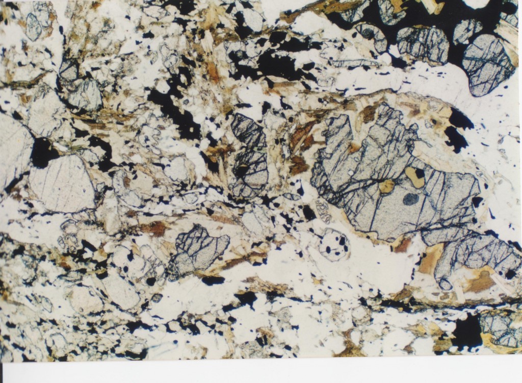
The Moine, a set of sedimentary rocks found in furthest north-west Scotland have enjoyed at least three cycles of metamorphism and deformation. My only sample from here is a migmatitic gneiss, so when I heard about people studying sedimentology in the Moine, my mind was a little bit boggled – gneisses have lost all trace of their sedimentary history. Once I read a bit more I discovered a story about sand. Lots of sand. The biggest pile of sand the world has ever seen, in fact.
Metamorphic and sedimentary
Formally ‘the Moine’ is the Moine Supergroup of early Neoproterozoic age. This is a phrase the makes me think of a 1970s prog rock band but it is a stratigraphic term. The Moine supergroup is made up of groups like the Glenfinnan and Morar groups, each of which is a recognisable package of sediments, representing a period of time. The Moine is defined as a group of sediments that formed in a single sedimentary basin.
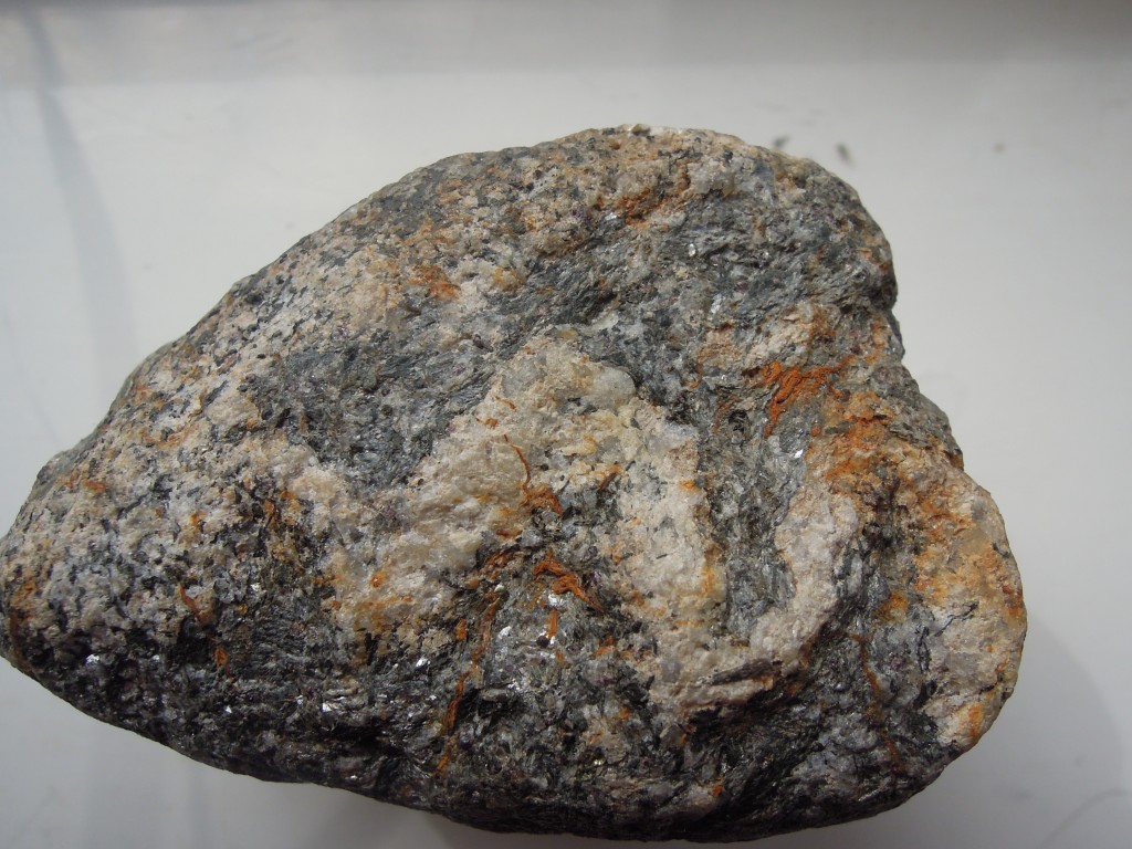
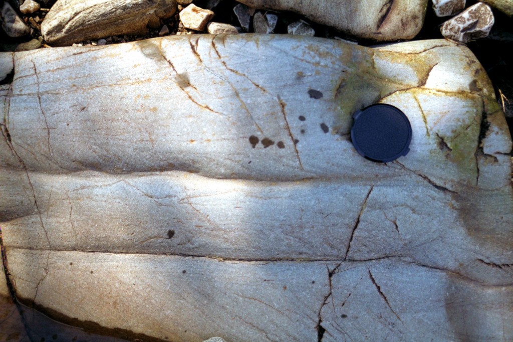
How did sediments end up looking like the picture above? This sample of gneiss started as mud but has since been buried and heated so it was metamorphosed (it contains garnet and biotite), melted (the vein of granite) and deformed (the lovely folds). We know it was once mud only from its bulk chemistry. However I’m a big fan of deformation and metamorphism, so I picked a sample that shows these things. A more representative rather different sample of the Moine is seen in this picture.
This is a sample of metamorphosed sandstone, or psammite in local parlance. A practiced eye will quickly pick out the bedding (horizontal) and cross-bedding (sloping lines). These are primary sedimentary features and if you see enough of these, you can work out the conditions under which the sediment formed.
Why are these traces of an ancient river or sea-bed preserved? There are two reasons.
Firstly the rock is made up mostly of quartz, and so is not affected by metamorphic reactions under normal conditions. During metamorphism the quartz may be recrystallised, but fine structures like cross bedding can survive. Note that some of the lines above are a slightly different colour – these are rich in ‘heavy minerals’ such as Zircon.
Secondly, conditions of metamorphism and (particularly) deformation vary depending on where you are. The mylonites of the Moine Thrust zone were once sandstones, but no bedding can be seen in them now. The Moine rocks have been intensely deformed, but particular areas such as the hinges of folds still contain original sedimentary structures.
Geological paradise
The map above shows Northwest Scotland. The key structure is the Moine Thrust (MT) which runs parallel to the mainland coast. To the west are foreland rocks – ancient basement gneisses (Lewisian), Proterozoic sandstones (Torridonian) and a thin sliver of Cambro-Ordovician sediments. These last contain fossils that link them to rocks of similar age in North America. All these rocks formed before the Atlantic existed, in fact most formed before the ocean before the Atlantic. For the rest of this story we are in North America, geologically speaking.
East of the Moine Thrust are the Moine rocks, deformed, metamorphosed and containing igneous intrusions, in stark contrast to the sediments to the west…
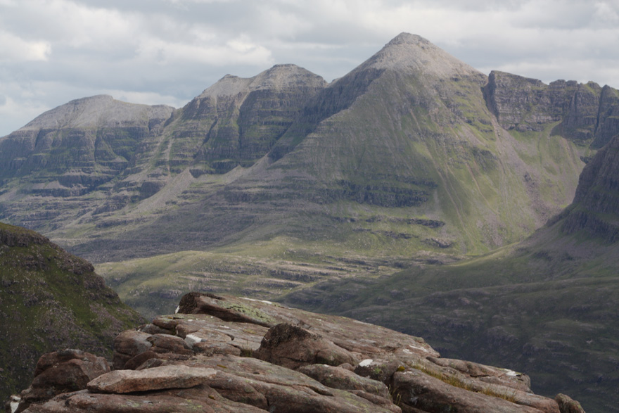
This lovely picture of undeformed Torridonian sandstones, with a white cap of Cambrian sandstone highlights the different geological histories either side of the Moine Thrust.
How to explain the difference? One possibility is that the Moine rocks are exotic, brought in from elsewhere as part of an allochthonous terrane. Much of Alaska is made up of large chunks (terranes) which have very different histories but have all ended up being scraped onto the American continent. In the 1990s people were finding applying this then-fashionable concept everywhere, including Scotland. Or possibly the Moine and Torridonian are equivalent; twins separated at birth, who experienced very different histories as they grew older. To decide between these options, what you need is something akin to DNA for sedimentary basins.
Long-lost twins
The ‘heavy minerals’ in sediments are literally heavy. Geologists crush up samples and put them into dense liquids. The quartz floats, the heavy fraction that sinks is separated and analysed. Zircon grains are common heavy minerals and they have a very useful feature – they contain lots of Uranium which is tightly locked in. If you analyse them isotopically, you can tell the age at which they formed, even if they’ve subsequently been metamorphosed.
These ‘detrital Zircons’ will have a range of ages, reflecting the age of the rocks that were eroded to form the sediment. This may have a distinctive pattern that gives a picture of the eroding rocks surrounding a sedimentary basin. This is like DNA for sediments.
Work led by Maarten Krabbendam of the British Geological Survey strongly suggests that parts of the Moine and Torridonian are direct equivalents – twins. Rocks of the lowest part of the Moine, the Morar group have detrital zircon age profiles that are very similar to rocks from the main part of the Torridonian. They are more similarities indeed than between the Morar group and the higher parts of the Moine. Krabbendam and colleagues state that the Torridonian and lowest Moine are “similar in terms of lithology, stratigraphical thickness, sedimentology, geochemistry, detrital zircon ages and stratigraphical position on Archaean basement” which is a compelling case that they are two parts of the same basin.
Lots and lots of sand
The link between Moine and Torridonian tells us that about a billion years ago there was a sedimentary basin covering northern Scotland, containing 6-9 kilometres thickness of sand. To get that much sediment, you need to make a hole to put it in. What formed the sedimentary basin the Torridonian and Moine sediments were deposited in?
To find out, Maarten Krabbendam and Helen Bonsor at the British Geological Survey (with others) have been looking at the Moine rocks as sediments. Detailed field work allows them to create maps and sedimentological logs. Logs are vertical graphical descriptions of many things such as grain-size (mud or sand), sedimentary features or direction of water flow inferred from ripples. Remember that these are highly deformed rocks. The bedding is very rarely flat, indeed sedimentary features may be the only way of telling if the rocks are upside down or not, such is the intensity of folding in the area.
All this hard-won data can tell you a lot. Sedimentary features and patterns allow you to infer water depth. As an example, to quote Bonsor et al: “The presence of pinstripe, flaser and lenticular bedding, bidirectional ripple crosslamination and abundant mud drapes indicates that deposition was strongly tidally influenced“, in other words in relatively shallow sea-water. Other parts of the sequence contain hummocky cross stratification which is associated with deposition in deeper waters.
Add all this up and you get a picture of the sedimentary basin through time. Geologists have done this for many basins where the cause of basin-formation is known. Comparing these with the Moine/Torridonian lets us infer how this particular basin formed.
Many workers have interpreted the Torridonian and Moine as separate rift basins. These are where active faulting makes space in a relatively narrow area. The characteristics of sediments in these basins tend to change rapidly horizontally (over location in the basin) and vertically (over time). Near faults you expect coarse fan deposits. None of these things are seen in the Moine or Torridonian, which were deposited under relatively uniform conditions.
Gentle stretching of continental crust forms ‘contintental sag’ basins. Again this isn’t a good fit for the Moine/Torridonian, in part because sag basins are not often so deep.
Bonsor and Krabbendam argue that the best candidate for the Moine/Torridonian is a foreland basin, like the modern day Ganges. A mountain range pushes down onto the continental plate next to it, forming a hole that is quickly filled by sediment eroded from the mountains. These basins can be wide and deep, with long-lived stable conditions close to sea-level as the bending down of the crust and the amount of sediment arriving reach a balance.
The American connection
If the Moine/Torridonian basin formed next to a set of mountains, there should be traces of these mountains somewhere in the geological record. Which orogeny formed these mountains?
There are no fossils in these old rocks, but detrital zircons give a constraint on the maximum age of sedimentation. The sedimentary basin is around a Billion years old, and tectonic reconstructions put the basin near the active Grenville orogeny. This is a major event that created a belt of metamorphic rocks found across the North American continent.
A large range of mountains produces a lot of sand. A billion years ago there were no land plants – nothing like Rhododendrons that stabilise slopes in the Himalayas – so rates of erosion would be higher. It’s also been suggested that the Grenville mountains were located so as to get monsoonal weather patterns. The combination of high precipitation and no vegetation would have caused extremely high erosion rates and created an awful lot of sand. Perhaps the biggest pile of sand the world has ever seen.
A question: If there is a Grenvillian foreland basin in Scotland, why can’t I find anything out about an equivalent in North America? I can find references to equivalent basins in Greenland and Scandinavia but not America itself. Anyone care to suggest why not? [See interesting comments from F below]
References and further reading
![]()
H. C. Bonsor, R. A. Strachan, A. R. Prave, & M. Krabbendam (2012). Sedimentology of the early Neoproterozoic Morar Group in northern Scotland: implications for basin models and tectonic setting Journal of the Geological Society DOI: 10.1144/0016-76492011-039
H.C. Bonsor, R.A. Strachan, A.R. Prave, & M. Krabbendam (2010). Fluvial braidplain to shallow marine transition in the early Neoproterozoic Morar Group, Fannich Mountains, northern Scotland Precambrian Research DOI: 10.1016/j.precamres.2010.09.007
MAARTEN KRABBENDAM, TONY PRAVE, & DAVID CHEER (2008). A fluvial origin for the Neoproterozoic Morar Group, NW Scotland; implications for Torridon–Morar Group correlation and the Grenville Orogen foreland basin Journal of the Geological Society DOI: 10.1144/0016-76492007-076
The British Geological Survey now puts its research papers into an Open Access archive. Good for them. Encourage them by going and reading the actual papers I’m talking about.
I’ve talked most about Bonsor et al. (2012) as its the most recent. Bonsor et al. (2010) covers different ground using the same techniques. Looking at a different aspect of the Moine, Krabbendam et al. (2011) summarise some of the structural work the BGS are doing in parallel with the sedimentary studies.
Location map taken from Krabbendam et al 2008 with implicit permission of Geological Society of London
Torridon photo with kind permission of David Shand (Sandchem on Flickr).
Moine cross-beds from zeesstof on Flickr under Creative Commons
The BGS have a new feature of embedded geological maps in your web pages. I’ve had a go below, centred on the North-west Highlands.

