Geology and life in the English ‘Coal Measures’

The geology of the North of England is where our modern industrial civilisation was born, based on the burning of fossil life. I’ve wanted to write about the fascinating geology I grew up with for a while. I’ve been spurred into action by Accretionary Wedge #46 where Cat asks us to write about “Geology, Life and Civilization”.

The spine of northern England is the Pennines, ending in the south with the Peak District, where I come from. This area is almost entirely made up of Carboniferous sediments that have shaped the landscape and the culture of the area.

True Grit

One of the most characteristic landforms of the Pennines is the gritstone crag.

These thick resistant layers of sandstone form prominent lines of outcrops (crags), with gentle dipslopes in between. Generations of rock climbers have been trained on them. The cliffs are low, but make for great climbing. You can battle with gravity all day and be in the pub half an hour later.

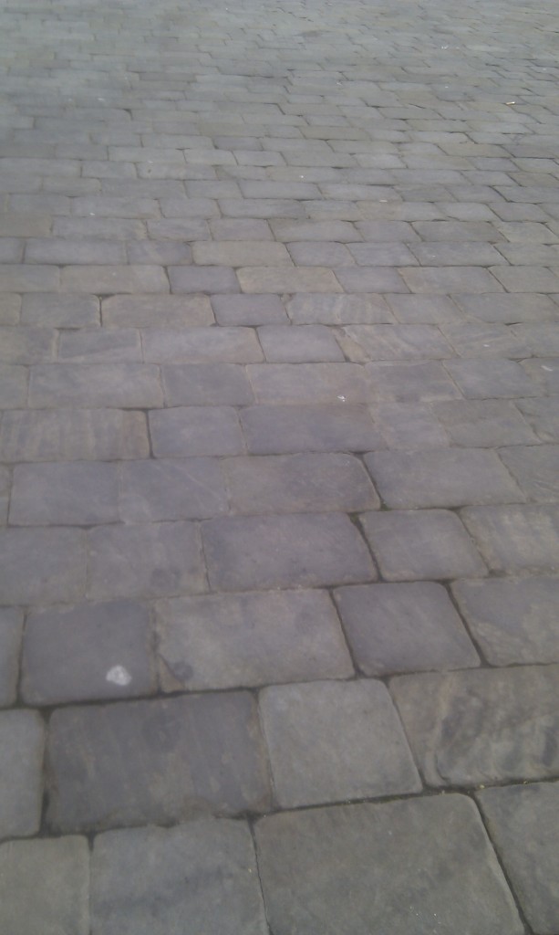
The sandstone is often coarse (gritty) and was traditionally used to make Millstones, which are now the emblem of the Peak District national park. ‘Millstone Grit’ is great building stone and the area is dotted with quarries. In some areas it forms easily into regular slabs, perfect for building drystone walls or making cobbled streets.

Macclesfield cobbled street

The crags of sandstone have fabulous names, like Froggat Edge, Stanage Edge and ‘the Roaches’ and these names enrich the stratigraphy and therefore the geological maps of the area.

Gritstone is poetic as well. The great English poet Ted Hughes grew up in these landscapes and wrote about them. In “Still Life” he writes that “Outcrop stone is miserly” and is “Warted with quartz pebbles from the sea’s womb”. The outcrop marks the ‘fly-like dance of the planets’ and thinks itself eternal, but only because it is ignorant of what water will do it, over time. Elsewhere in Wodwo he writes of walkers escaping the valley onto the moors above. The Pennines and Peak District have long  been a means of release for inhabitants of the industrial cities and valleys that sit below. The mass trespass of Kinder Scout (type locality of local stage “Kinderscoutian”, 318 to 317 million years ago) in the 1930s was in favour of the ‘right to roam’ and is seen as a milestone in English social history.

Romantic looking m

Mud, glorious mud

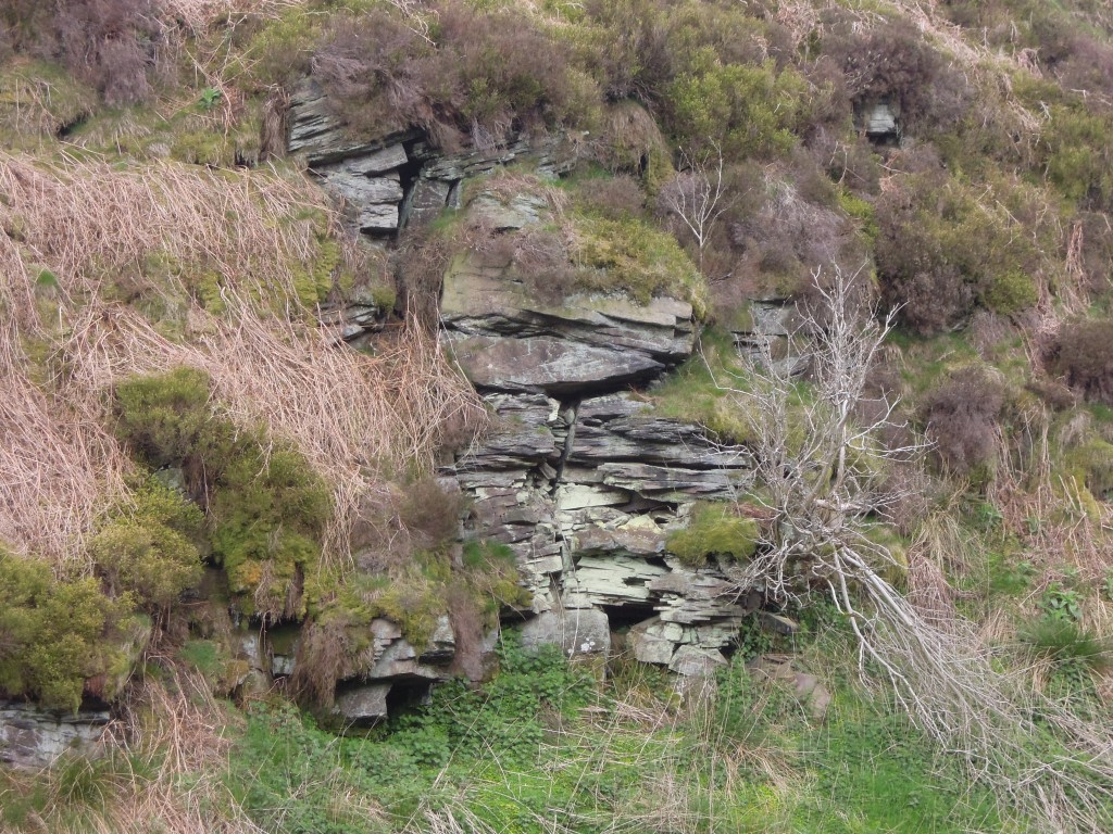
The gritstone crags are only prominent because they are surrounded by softer rocks. Mudstones and shales are common in this area, they form the plain backdrop on which the gritstones can perform. A humble, elusive rock type, best found in stream beds the shales are not devoid of interest. Far from it – they were teeming with life.

Shale

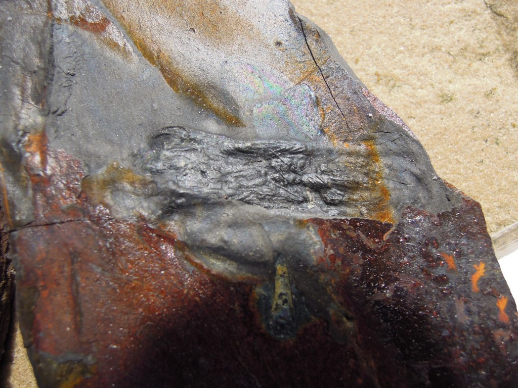
Below is a section of an early armoured fish.

Fossil armoured fish

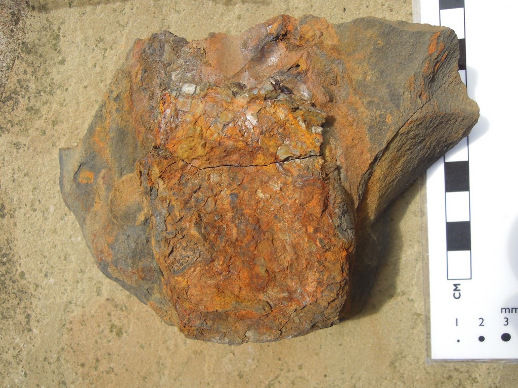
I don’t know what this is, maybe nothing.

Mystery ?fossil?

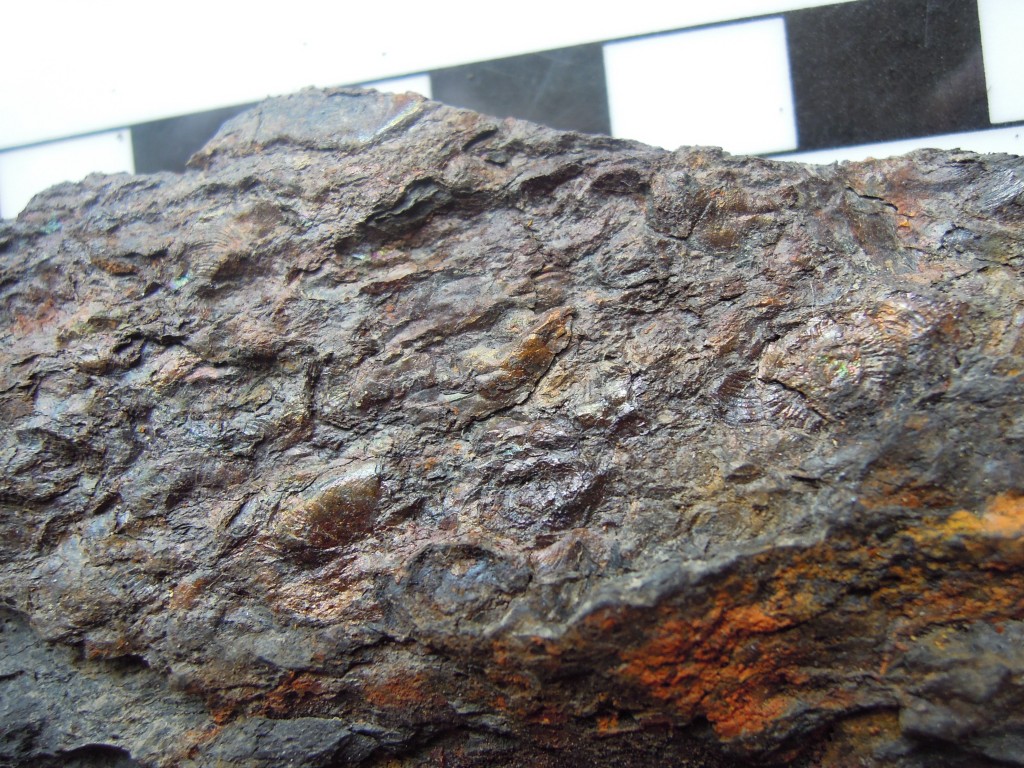
At times the shales are clearly marine (mostly, like the sandstones, they are not). In distinct ‘marine bands’, goniatites (ammonoids) and crushed shelly debris are common.

Crushed fossils from marine band. Goniatite on right, ?bivalve shell debris elsewhere

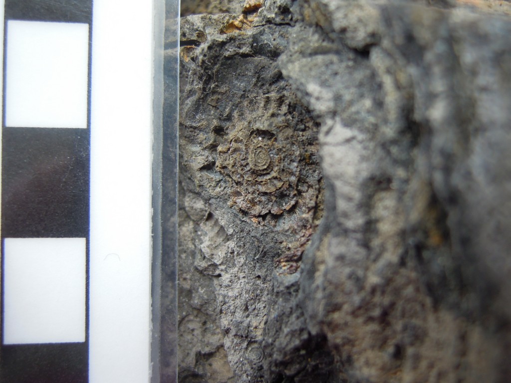
The clearest goniatite above is middle right, where you can see the parallel lines of the external ornamentation. Here’s a close-up where the spiral shape of the goniatite is more obvious.

Carboniferous goniatite from marine band

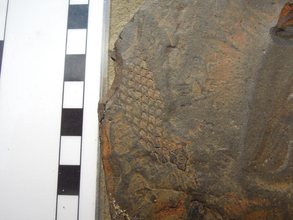
Goniatites are marine creatures, but here’s a clear sign of land, a piece of fossil bark. Carboniferous forests were dominated by primitive plants called Lycopods which have leaves growing direct from the stems, leaving the scars you see below.

plant fossil in shale ?Lycopod bark?

King Coal

Cat herself mentions Iain Stewart talking about the importance of Carboniferous coal deposits in the history of the Industrial Revolution. Just how important coal was is an area of vigorous historical debate but no-one would argue that industrialisation started in the North of England and that burning of local coal deposits was important.

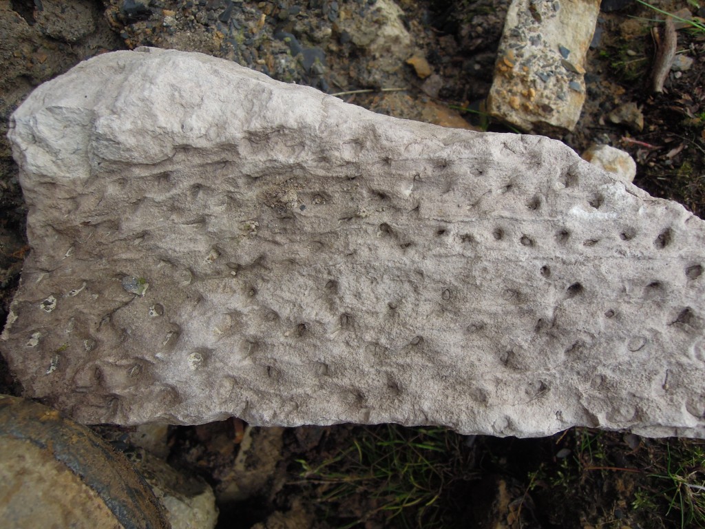
Let’s start with the roots of the matter. Coal is of course compressed plant material found in seams. At the base of these seams is usually a layer of very pure quartz sandstone. This is a fossil soil, a palaeosol which locally may be known as seatearth, or ganister. Appropriately enough these fossil soils often contain fossil roots, often Stigmaria, with a distinct ‘holey’ appearance.

Seat-earth with plant fossil Stigmaria

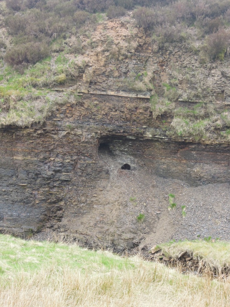
Coal is relatively rare in the Peak District, where all of these photos and samples were taken (most on a single afternoon in the Goyt Valley). The area contains the transition between ‘Millstone Grit’ deposits and the ‘Coal Measures’ proper. Coal seams are thin and extraction was via shallow ‘bell-pits’ for local use only. The main coal fields were further north in Lancashire and Yorkshire, where whole communities were built up around the ‘pits’.

These coals put the ‘carbon’ into ‘Carboniferous’ – there are massive deposits worldwide but the name was coined in Britain. This was an odd period in earth history, associated with high levels of oxygen (perhaps up to 35% compared with 21% today). One of the lines of evidence for high oxygen are the massive insect fossils found at this time (no photos sadly). These animals depend on oxygen diffusing into their bodies, so the more oxygen, the bigger they could grow.

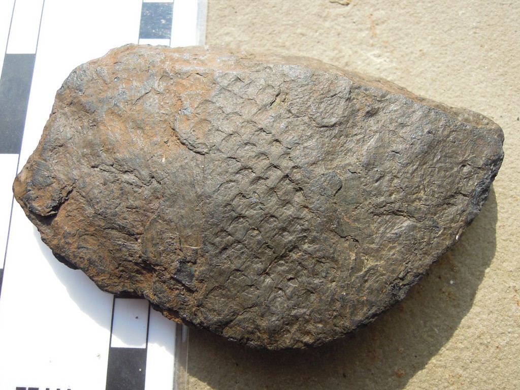
Coal is fossil plant material, so no surprise that it contains impressions of plants within it.

Plant fossil in coal ?Lycopod bark?

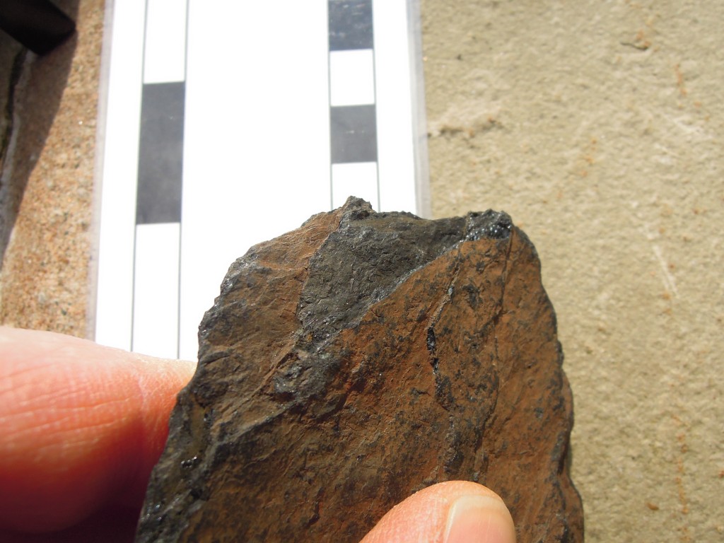
This weathered piece, from a stream bed, looks rather like shale until you break the end and see it shine. I could have set fire to it and taken a picture, I suppose, but that would just be showing off.

Coal showing shiny edge "vitreous habit"

Cycles

Together, these rock types make up most of northern England. What is intriguing is that they often occur in a regular pattern. This is an interesting thing and I shall return to it.

Another form of cycling concerns the carbon locked up in the coal. What was locked below the surface is now floating above it in the form of carbon dioxide. Releasing the power of this buried carbon kicked off our industrial civilisation. How we deal with the powerful effects of the atmospheric version will determine how our civilisation fares in the future.

The first image, of the Roaches, image from Plbmak on Flickr under Creative Commons.
All others mine, scale bars are centimetres.
If you want to know more about English Carboniferous Geology, this open access book chapter is where to start. 

Hot rocks, big rivers and the world’s tallest mountain face

In areas of active mountain-building the middle crust can get hot and weak, like a soft jam/jelly filling in a sandwich.  These squishy rocks are hidden from us by the cold rigid upper crust, so we wouldn’t expect to see them reach the surface, would we? Well, what happens if you overfill a sandwich and there’s a break in the upper layer? Nanga Parbat in the Karakoram Himalaya tells us what.

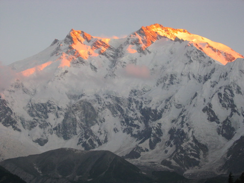
Nanga Parbat Rakhiot Face

Nanga Parbat is one of only 14 mountains over 8,000m in height. It’s summit is a mere 25km from the Indus, a major river flowing off the Tibetan Plateau and then along the length of Pakistan. The mountain face between the two (the Rakhiot Face, above) is often called the world’s highest as there is a drop of 7,000m, from peak to river. Nanga Parbat sits at the Western syntaxis of the Himalaya, this is the point where the structural grain of the Himalaya changes from East-West to North-South. It corresponds roughly to the corner of the Indian plate (buried somewhere below), where the plate boundary swings around.

Nanga Parbat contains granites at the surface that cooled only a million years ago. Not lava but granite that was intruded at depth and yet is now at the surface. A active major thrust puts gneisses on top of river gravels. It’s estimated that 25km of crust has been eroded away in the last 10 million years (or 12-15km over the last 3Ma, take your pick).

A hard rain falling

In order to remove 25km of crust, you need a lot of erosion. That sort of erosion requires high rainfall and a major river to take all the bits away. Both of these things are present at Nanga Parbat. What is mind-expanding is the idea that the erosion and the tectonics are linked. 

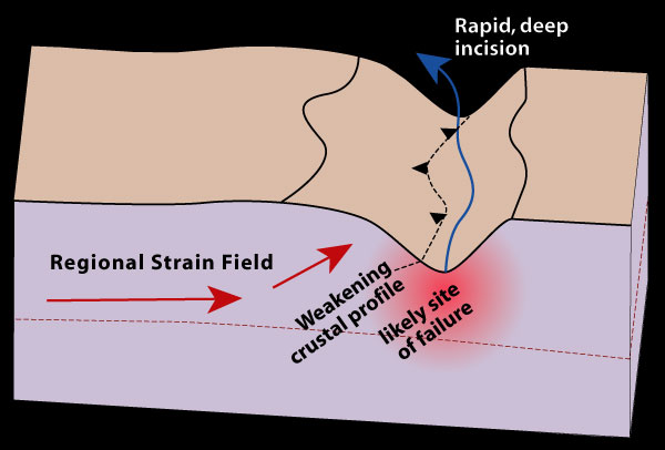
The “tectonic aneurysm” model (defined in Zeitler et. al 2001) suggests that the tectonics of the area are caused by the high rainfall and presence of the Indus river valley. Consider a river valley cutting deep into a mountainous area – it’s made a kilometres deep hole in the crust and this weakens the rocks below and either side of it.

Tectonic aneurysm initial

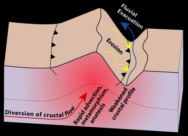
To state the obvious, remove rock from the surface and the material below moves closer to the surface. This does two interesting things – firstly the reduction in pressure makes brittle rocks weaker. Secondly, the valley will change the thermal structure of the crust. Cutting a hole into the crust will bring hotter rocks closer to the surface (because the surface is lower). Then if the rocks beneath the valley start moving up (a process called advection) then they may move up so fast that they can’t cool down on the way. There’s more. Releasing pressure in very hot rocks (decompression) can trigger melting and granite production. The presence of melt reduces the strength of the crust by an order of magnitude. This means that the crustal flow will become easier as the rocks become weaker.

tectonic aneurysm

Erosion causes uplift which causes crustal flow which causes more uplift which causes more erosion which….. This positive feedback loop turns the initial weakness into a much bigger structure that affects the entire crust. The term ‘tectonic aneurysm’ refers to a medical condition where a weakness in an artery wall can cause serious medical problems as it gets bigger. My analogy of the overfilled sandwich with a cut in the top is more cheerful, but ‘tectonic aneurysm’ sounds much more sciency.

Egg or chicken?

The tectonic aneurysm model has also been applied to the Eastern syntaxis, at Namche Barwa in Tibet, where the Tsangpo river forms a deep gorge. These syntaxes are tectonic features, related to the corners of the Indian indentor, yet the aneurysm model regards a river gorge as thing that initiates extrusion. Why is there a connection between the two?

For me this is the most satisfying part of the model – the rivers flow across the syntaxes because of the geometry of the mountains – tectonics controls the location of the rivers which in turn influences the tectonics. Processes that affect the surface and those involving the entire crust are intertwined in a dance that lasts millions of years.

Consider the growth of the Himalayas. Rivers that used to drain off proto-Tibet into the Tethys ocean are now blocked by a mountain range, where India is pushing into Asia. These rivers start to flow parallel to and behind the mountains. Over time syntaxes develop and news rivers start to cut into them. Eventually these new rivers reach the old mountain-parallel ones and ‘capture’ them. The precipitation that has been stuck to the North of the Himalayas can now get through and the major river systems of the Indus and the Tsangpo-Bhramaputra can finally reach the Indian Ocean. At the ‘knick-point’ where these rivers drop sharply in altitude major gorges are formed. These ‘cut the sandwich’ and allow the weak hot middle crust to extrude out to the surface, forming some of the most fantastic scenery on earth.

The idea that patterns of erosion affect tectonics is a lovely illustration of the interconnectedness of the geosciences and is a current topic. A  very recent paper in GSA Today by Paul Kapp and co-workers looks at wind erosion in the North of Tibet. They show significant rates of erosion and speculate a link with the (small-scale) tectonics of the area. It seems you don’t need big rivers (or indeed water) for the atmosphere to influence the way rocks deform.

The processes of crustal thickening that created the hot middle crust now extruding to the surface at Nanga Parbat affects all of Tibet. What happens to this soft material where it can’t reach the surface? Also are the syntaxes the only places the sandwich has leaked? Interesting questions. Someone should write a blog-post about them…

This post is part of my journey into the geology of mountains.

Further reading

ResearchBlogging.orgAll of the papers listed here are publicly available right now. Click on the links and you get the entire paper no matter who you are. There are links in the text above, but here’s a list of the good stuff.

The good folk of the Geological Society of America make GSA Today available to all.

The GSA Today paper Zeitler et. al (Erosion, Himalayan Geodynamics, and the Geomorphology of Metamorphism) is the place to start for the tectonic aneurysm model.

Peter K. Zeitler, Anne S. Meltzer, Peter O. Koons, David Craw, Bernard Hallet, C. Page Chamberlain, William S.F. Kidd, Stephen K. Park, Leonardo Seeber, Michael Bishop, & John Shroder (2001). Erosion, Himalayan Geodynamics, and the Geomorphology of Metamorphism GSA Today

There is also a great set of papers on the Lehigh University website.

The  Kapp et. al paper is in GSA Today, link to html version if you didn’t like PDF link above.  DOI: 10.1130/GSATG99A.1

Kapp, P., Pelletier, J., Rohrmann, A., Heermance, R., Russell, J., & Ding, L. (2011). Wind erosion in the Qaidam basin, central Asia: Implications for tectonics, paleoclimate, and the source of the Loess Plateau GSA Today, 21 (4), 4-10 DOI: 10.1130/GSATG99A.1

For more information on Nanga Parbat geology, the 2006 paper from Jones et al.  gives a good overview, plus a taster of what I’m writing about next.

Picture of Rakhiot Face from sunbeer on Flickr under Creative Commons
Diagrams from Lehigh University ‘indentor corners’ project pages, with permission.

Sources of open access scientific papers

We are all used to open access to information on the Internet, but when it comes to scientific papers, for most people a barrier comes down. However it is possible to find publicly accessible copies of scientific papers available right now.

I’m building up a list of sites as I find them, as I will use them in my blogging. I’m focussing on Geosciences but many sites are not subject specific. Please make use and if you know of any others, let me know via the comments. I’ll add them to the main text over time.

Caveats – A lot of these sites don’t have a massive amount of content. Some list papers but have no publicly available copy. Often the copies are ‘pre-publication drafts’ with odd formatting. All sites have terms of use that you probably read, definitely if you want to do anything but read them.

Usage – Most of these are repositories for organisations. If the primary author of a paper you know of is at one of these institutions then its worth a look. At least some of them are Google searched, in which case that is your best route if you are looking for a specific paper. Either way, don’t assume a recent paper can only be found via the journal.

In descending order of usefullness:

http://nora.nerc.ac.uk/ is a repository for papers produced by UK government agencies, for my purposes the British Geological Survey and British Antarctic Survey. Coverage sketchy before 2010 but good thereafter.

http://www.geosociety.org/gsatoday/ All of the GSA’s “GSA Today” are available online and they are keen for bloggers to refer to them.

Open source journals may be the future? EGU has a selection: http://www.egu.eu/publications/open-access-journals.html (thanks Bill).  The Solid Earth journal is the one that most caught my eye.


http://oro.open.ac.uk is a repository for the UK Open University. Seems to list all papers since 2009 and about 30-40% have text.

http://dspace.mit.edu MIT seems to have very good coverage.

http://eprints.whiterose.ac.uk is pretty good coverage.

Poikiloblastic in the comments has useful stuff about planetary science articles and lists of Open Access Journals.

John Stevenson, aka volcan01010 my blog-neighbour, points me to http://www.pubvolc.net/ which is a rather smart idea. It is a volcanology literature database that allows you to contact the author for a reprint.

http://wiredspace.wits.ac.za/ appears to be just MSc/PhD theses at Wits University in South Africa.

http://earth.usc.edu/~jplatt/Publications.html  only papers by John Platt, but each one a gem!

http://ora.ouls.ox.ac.uk/ is a repository for Oxford University and http://www.dspace.cam.ac.uk/ the same for Cambridge. Coverage of geoscience is pretty poor. Oxford is apparently digitising all of its theses, even the old paper ones, which is rather pleasing to me since I wrote one of them.


UPDATED: Copyright, blogging and scientific papers

Is it legitimate to reproduce diagrams from scientific papers in a blog post? Curious, I asked the question of Twitter. It returned two distinct responses.

One response, from a pair of scientists and highly respected and active bloggers was (to simplify and paraphrase) that it was OK since you were discussing Science. Asking permission of the author was the polite thing to do, but ask the publisher only if you get the material direct from their website.

Another response, from a professional archivist and soon-to-be-published book author was a clear statement of the legal situation: it would be a clear breach of copyright, not covered by ‘fair use’.

Both sets of responses entirely correct, but reflecting two ways of viewing the situation. Copyright is an important legal protection for content-creators and should be respected (and is The Law), but equally communication of scientific ideas is an important public good. An interesting contrast, which I thinks maps nicely onto a growing discontent with academic publishers. Academics are the creators of the content, yet the Copyright is held by the publisher. When journals were distributed in paper form, the value added by the publisher was clear. Now that online access is the norm, and authors submit formatted papers and when scientific editing and refereeing is also done by academics, the value added by publishers is less clear. When even the Economist talks of ‘fat profits’, it seems the balance is skewed.

So, what’s a boy to do? Well, I happen to belong to the Geological Society of London and the particular diagram I am dying to copy is in their journal. A quick and helpful twitter response from them pointed me to their publications permissions page. All is well! With acknowledgement, I can use up to three figures without permission and up to 100 words. [NB this implies a picture only paints 33 words, surely wrong?].

This gave me a warm glow, since this seems to be a nice balance between the need for protection of copyright and the fact that “data wants to be free”. A search of a commercial publisher soon deadened the glow. Elsevier have a process whereby I can request permission to use content. Selecting a random Earth Sciences paper and requesting to put a single image on the web, for non-commercial use would cost me $28.75. How much of this is given to the person who created the diagram? None, of course.

Following the equivalent process with Nature Publishing (who use the same RightsLink software) cheered me up again as using figures for non-profit is free.

The roller-coaster continues down again, as it appears that the Geological Society of America does not allow posting material on the web unless you are the author. You can request permission, but this costs $10 for processing. Also they haven’t responded to my tweet yet. UPDATE: Those lovely people at the Geological Society of America have responded to my tweet. In a very rapid response to this post and a related post from Brian Romans (@clasticdetritus) they have revised their policy to say that using a single image/table/paragraph counts as ‘fair use’ and does not require permission. I feel inspired to go off blog about a paper from one their journals now, by way of thanks.

Anyway, I am beginning to bore myself. I shall be off and send an email to the author, whose paper in the JGS I covet.

Disclaimer: I don’t really know what I’m talking about. If you wish to do be certain about copyright law, don’t take my word for it. Opinions expressed here are not those of the author, past blog post quality is no guide to future performance, may contain nuts.