Assynt’s etched landscape

Some place names describe the shape of landscape. South east of Lochinver lie Cnoc a Mhuilinn (“Mill Hill”), Gleann Sgoilte (“Cleft Glen”) and Gleannan na Gaoithe (“Windy Glen”). These are dramatic features where the land has been cleaved, leaving narrow slots where the wind howls and narrow fast rivers make mill streams.
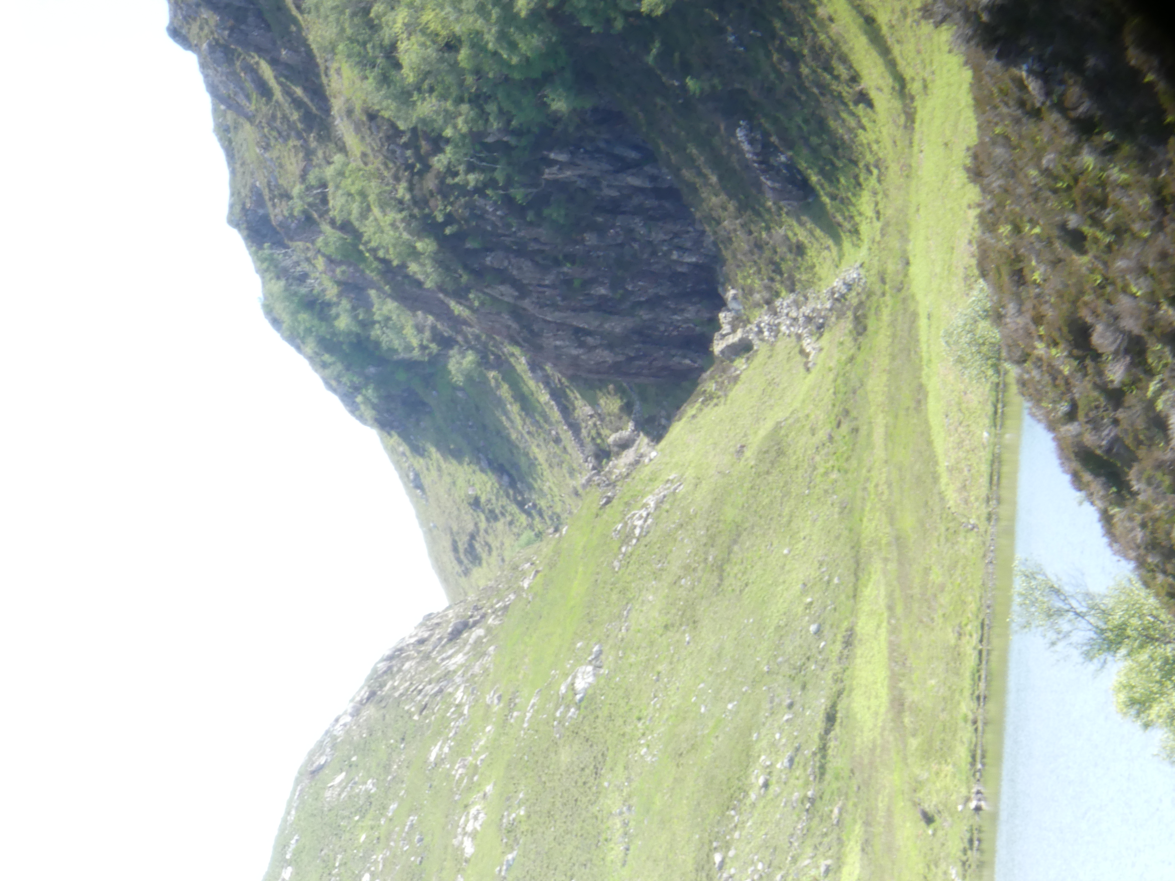
Gleannan na Gaoithe, looking ESE

These dramatic features are all aligned in space. How did they form? A paper from 1956 maps them out and links them to a now vanished lake they call ‘Loch Suilven’. Using “an
ex-R.A.F. bubble-sextant in conjunction with a box-sextant
“, Alex J. Boyd of Inverkirkaig carefully mapped the fossil beaches left behind by this Loch. From this work it is clear that water levels were once much higher. He inferred that the lake once drained via our dramatic glens, until the modern Inverkirkaig river breached the lake and drained it, separating it out into Fionn Loch, Loch Veyatie and others.

Location map. Figure 2 from Boyd (1965).

The picture is complicated by ice. This landscape is haunted by the Ice Age and any carving into the ground could have been done by ice as well of water. Glacial melt water channels are features formed by the flow of ice close to glaciers. Water beneath may flow under pressure, or ice may dam rivers, or melt suddenly to create large volumes of water. Under these conditions, channels may be cut by catastrophic flood events.

Tracing the western edge of the area, around Badnaban (place of the women) Boyd reports “rounded boulders” of large size that suggest the water flow was of “torrential character”. High up, the walls of the channel below Cnoc a Mhuilinn have a polished appearance with scalloped shapes. The British Geological Survey interpret these as S-forms and P-forms and call the structure a glacial meltwater channel.
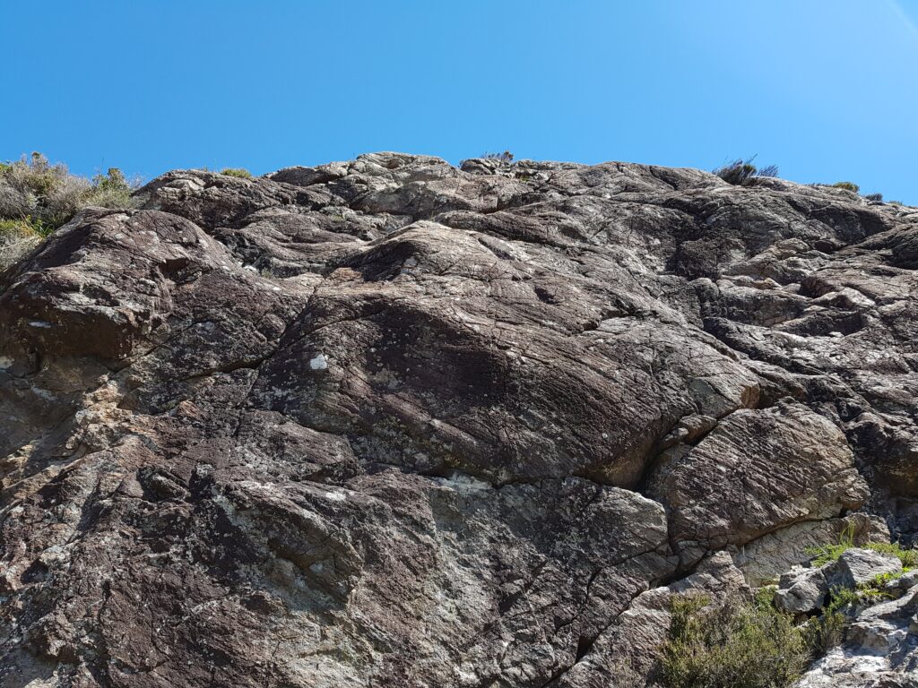
View of a rock surface in the glen below Cnoc a Mhuilinn

A brief scan of modern literature suggests that there is no consensus about the precise meaning of these features, but for sure they are consistent with a dramatic flooding event scouring out the channels. Ice flow may also have shaped the glens and both mechanisms may have acted at different times. But maybe what was eroded is more important than how it was done.
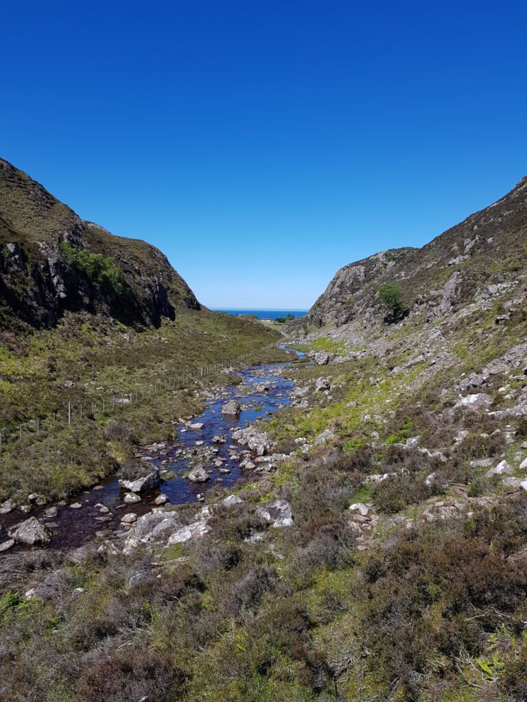
Glacial meltwater channel below Cnoc a Mhuilinn

The sculpture within the block

There’s a quote attributed to the sculptor Michelangelo, to the effect that the sculpture is already there within the block of marble, his job is merely to remove the material surrounding it. For this landscape, this may be literally true. We’ve talked of ice and water cutting into the ground, but maybe the most important features were already physically present within the bed rock, waiting to be revealed.

The cnoc and lochan landscape is an extremely distinctive feature of Lewisian gneiss areas. A similar landscape exists in Connemara on the deformed igneous rocks of Roundstone Bog. The writer Tim Robinson describes this landscape as “frightened”. It’s a largely random distribution of lochs and hills, straight lines appearing where it is cut by geological faults, breaks in the rock that weaken it.

Maarten Krabbendam and Tom Bradwell (of the British Geological Survey) have reviewed the cnoc and lochan terrane in Sutherland and conclude that its distinctive roughness is not a direct product of glacial erosion.

They review similar landscapes in other countries and note that they are a feature of rock type, not of erosion style. They compare the Assynt area with similar terrane in Namibia, where erosion is caused by wind-blown sand rather than ice. They show that the shape of the landscape is mostly controlled by chemical weathering, that weakens solid rock into weak ‘saprolite’. The role of erosion, whether scouring by ice or glacial meltwater, is to remove the saprolite, leaving the harder rock behind.

Chemical erosion is highly sensitive to rock type. The Lewisian Gneiss is cross-cut by vertical sheets of rock called dykes. One particular dyke (400 million years younger than the other Scourie dykes) is rich in olivine, a mineral too chemically delicate to last long at the surface. This dyke easily rots into saprolite, forming deep zones of soft rock. The glacial meltwater channel below Cnoc a Mhuilinn precisely follows this dyke; its location was determined not by the ephemeral flow of ice or water, but by events 1,992,000,000 years ago. Gleann Sgoilte was cut into another dyke and Gleannan na Gaoithe formed along a later shear zone, full of fractured and altered rock.

This pattern is common across the whole of Assynt, wherever Lewisian Gneiss is found. These remarkable glens may be more dramatic than most, thanks to glacial floods, but these were simply picking out the bones of the rock. This landscape was etched rather than scraped.

Looking out for the red rocks

Author Tim Robinson spent countless hours in the west of Ireland, unearthing local Irish-language place names. Some are anchored in myth and poetry, referring to miracle-working saints or Celtic Gods. Most though are prosaic, being linked to people’s names, local plants or animals and – occasionally – geological features.

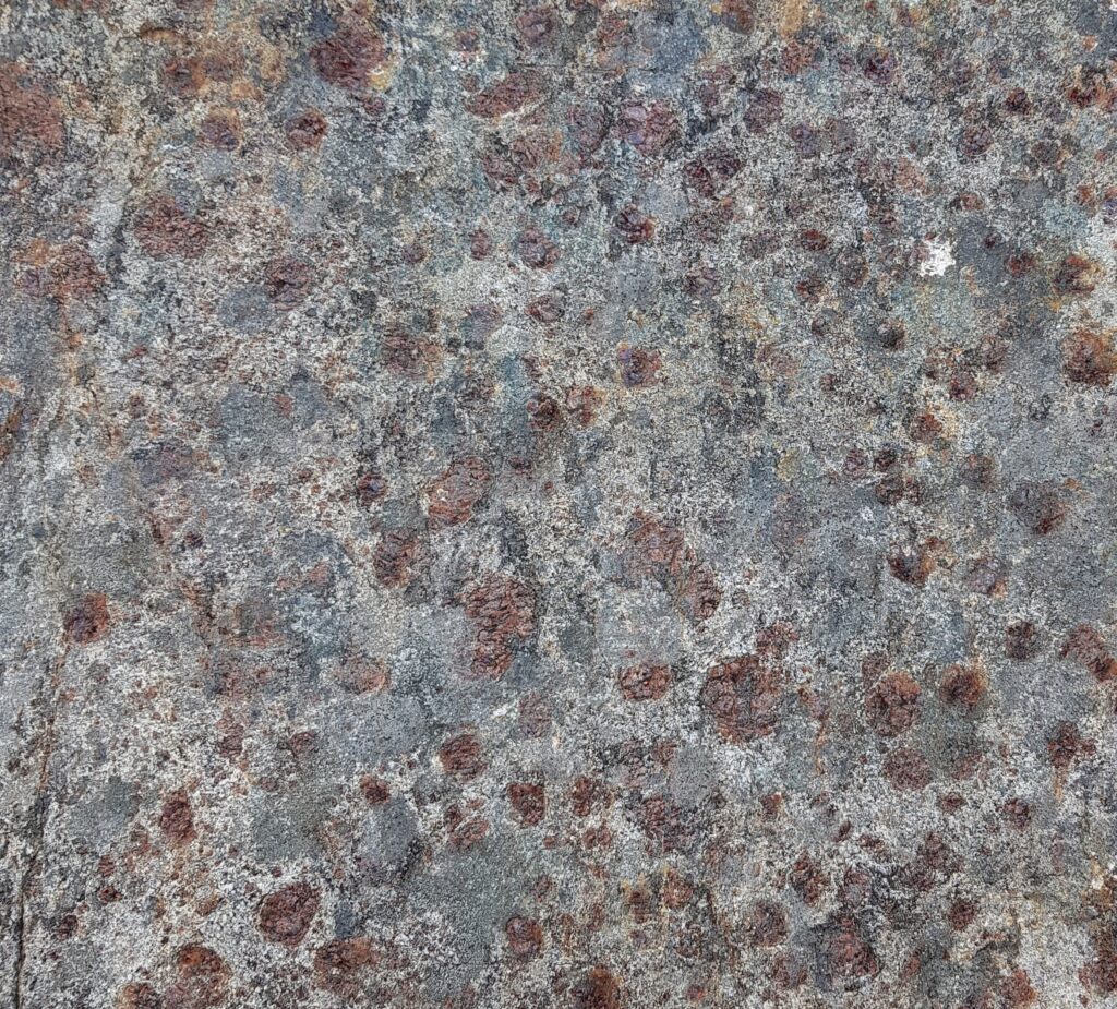
Fàire nan Clach Ruadha is one of the countless hills within Assynt’s central wilderness, just another small summit amid the craggy wastes of the Cnoc and Lochan landscape. Once I’d roughly translated it as ‘red stone lookout’, I knew I had to pay a visit. Secretly I was hoping the ‘red rocks’ would be garnet-rich, as is often the case within the Lewisian Gneiss.

The sort of red rocks I was hoping for. Garnet-rich Lewisian Gneiss from Scourie

On a perfect June day I went in search of the physical realities behind the name. Let’s start with ‘Fàire’. The online resources I’ve used translate this as ‘watch, lookout’, which implies someone once sat on the top of the hill, keeping an eye out for something. This could have been livestock: sheep or cattle. Subsistence farming practices saw animals brought into the interior during the Summer, to make use of the good grazing found here and keep them away from arable crops. Ruins out here are often Shielings, simple buildings built for Summer use only. We are not far here from some and the hill offers good all-round views of the immediate area.

So maybe previous visitors were enjoying themselves, having a relaxed Summer just like me. Tim Robinson translates the Irish phrase for a nostalgic return: “Cuairt an lao ar an athbhuaile” as “the calf’s visit to the old milking place”, a reference to the practice of taking livestock into the hills in Summer. This booleying (to use the Irish terminology) lasted until the 1930s in Ireland and Robinson quotes some idyllic sounding memories of those times.

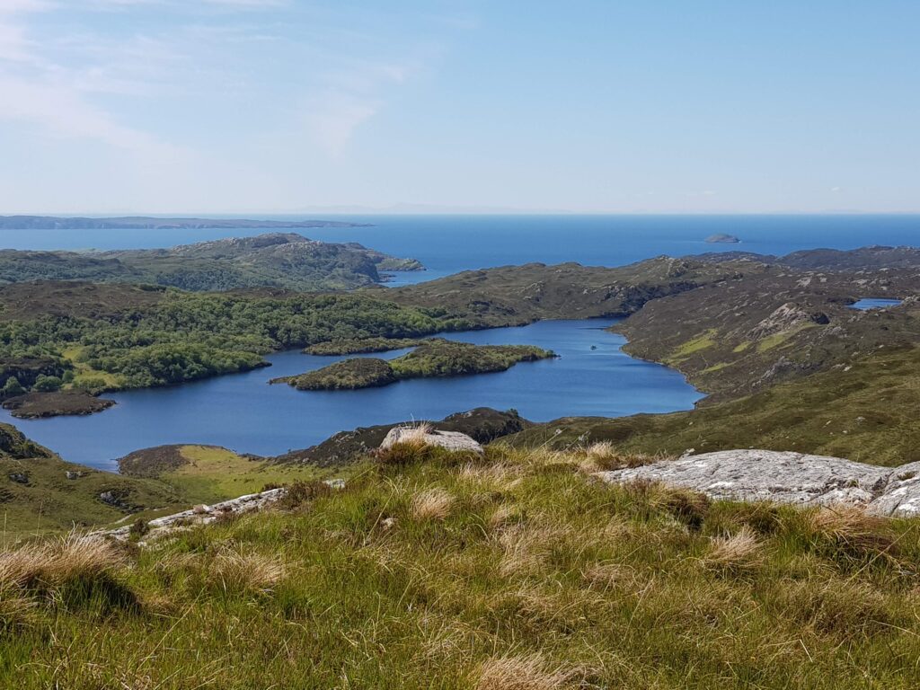
View west from Fàire nan Clach Ruadha, out to sea.

There is another possibility. Walking inland, this hill is the first to give really distant views of the sea, to raise you above this land’s crinkly corrugations. In the photo above you can see the Achiltibuie peninsula, top left, about 10 km distant. The faint smudges of the Outer Hebrides are clearly visible to the naked eye. Maybe this was a place to look out for ships. There are Norse-inflected names are present near here – Suilven and Inverkirkaig for example. Could a lookout here once have run off in terror, sprinting to give advance warning of a hostile Viking attack? On a glorious June day it seems like an impossible idea. Surely a dot on the horizon would cause joyful anticipation of a returning loved one, home from the sea.

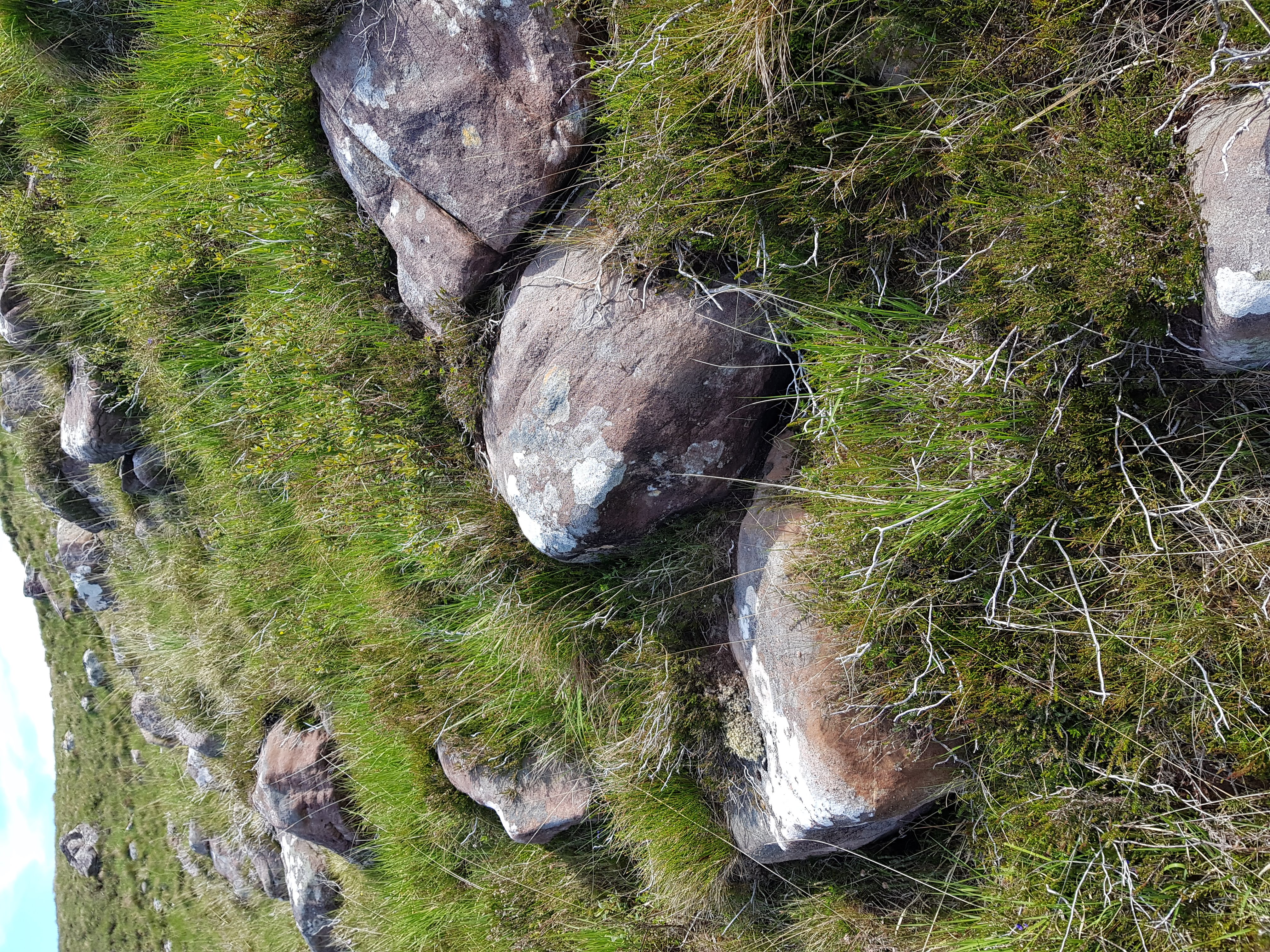
What of the “red rocks”? While the bedrock of Fàire nan Clach Ruadha is made of Lewisian Gneiss, blocks of red Torridonian sandstone are found in great abundance here littering the surface. Some sit proud on the top of the hill, but the most abundant areas are on west-facing slopes.

Red rocks
Red rocks of Torridonian sandstone

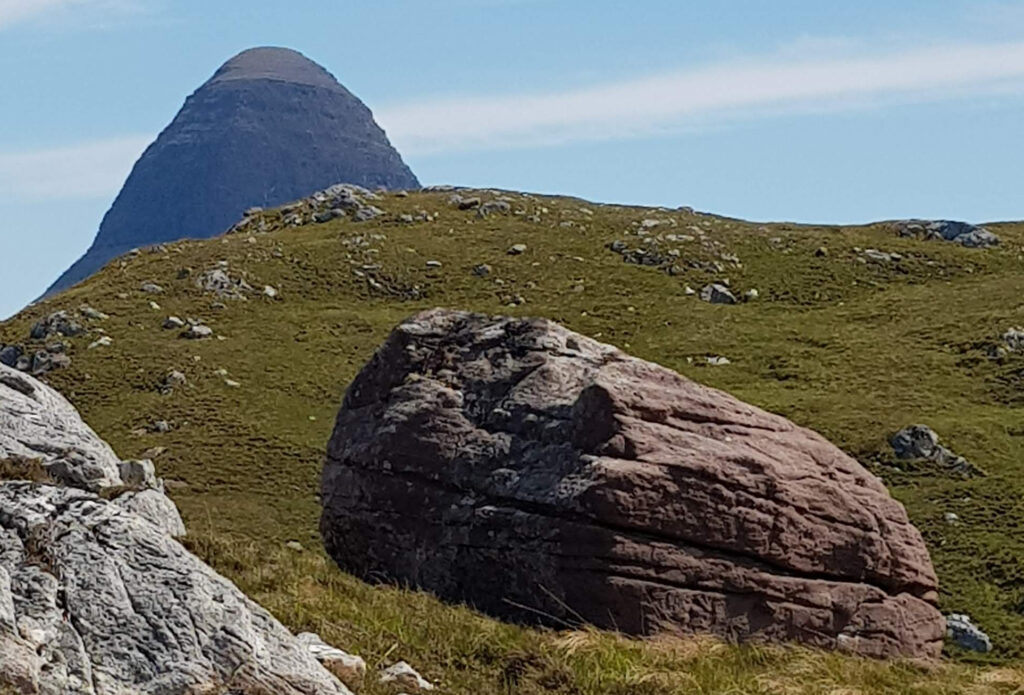
As for much of Assynt, photos taken from here become dominated by the great charismatic peaks of Suilven and Stac Pollaigh. Like being photo-bombed by a celebrity, they immediately become the focus of the image, demanding your attention through sheer charisma. These peaks are also made of Torridonian sandstone, so on Fàire nan Clach Ruadha it feels like they are proud parents, peering down upon their tiny offspring.

Suilven peering down at its little baby mountain

Imagine this is how mountains form. The big parent mountain silently urging its offspring to grow up big and strong. Perhaps they are like sharks, the biggest feasting off their siblings in a race to reach adult size. I could be in the midst of a massacre, too slow to register on human timescales.

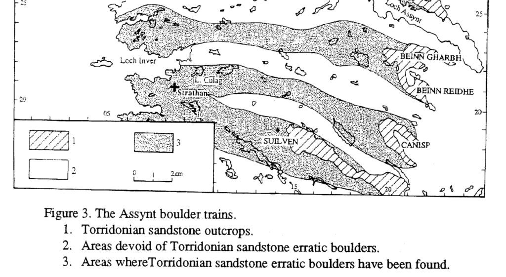
Of course this is actually how mountains die. Each block was plucked from the side of Suilven by ice and left behind by a now vanished ice sheet. We know this, as people have laboriously mapped the location of these ‘boulder trains’ of Torridonian sandstone, showing a clear link.

Image from Lawson (1995).
Fàire nan Clach Ruadha is within the boulder train coming from Suilven

This academic paper ends with a great acknowledgements section, thanking “the unstinting, though often forced, efforts of a large number of A level Geography students ….helped in the plotting… across this knurled and unyielding landscape, often in the most unhelpful of weather“.

Place names are echoes of how past generations have engaged with a landscape, a reminder that our feet are not the first to tread these rocks. Subsistence farmers on a lazy Summer’s day; somebody anxiously scanning the sea; wet and grumpy teenagers; maybe all have noticed these red rocks before me.

North American Arctic – icy beauty

Look at this. As an abstract pattern, it looks like something Gustav Klimt might paint.

But drill down into it in more detail and it changes into an uncomfortably close view of a reptiles skin.

All images in this post come from the North American Arctic – a place made beautiful and strange by ice. Conditions are so cold that the soil layers are almost permanently frozen. The rare occasions when it melts warps the ground in various distinctive ways.

Take the first image – the striking elongated light-blue lozenges are lakes. Lakes may form in the Arctic in areas called thermokarst. This a landscape full of hollows formed when patches of permafrost melt, causing hollows in the ground. These elongated examples are unusual. No-one knows for sure why these “oriented lakes” form, but they are often aligned with the prevailing wind, suggesting it has a role to play.

Here are some other examples, which seem to have edges with two sets of directions, making some of them look like badly-drawn hearts.

The lizard skin pattern above is known as “patterned ground” forms where soils regularly freeze and thaw. The periodic expansion of ice rearranges the soil and in the case of these polygons, wedges of ice may form in a regular pattern.

These processes occur in ‘peri-glacial’ environments. The term literally means “around glaciers” but it occurs over vast areas of the Arctic that are too near sea-level for glacial ice to build up. It can also occur at height in milder climates such as the Cairngorms in Britain or on top of African volcanoes (or even on Mars). During the colder parts of the current Ice Age, when large areas of the world were covered by ice sheets, the areas to the south of the ice were often peri-glacial. Ice-wedges and other peri-glacial features are relatively common in southern England where I live.

Pingoes are classic peri-glacial feature. In England these are round lakes formed when plugs of ice melted thousands of years ago as the climate warmed. In the Arctic they are 30-50m high hills with a core of ice – the name is Inuit for ‘small hill’. He is an example that is still a hills in Canada (note the patterned ground to its south).

These peri-glacial features are best seen near to rivers that flow into the Arctic. Further south, vast areas have very little soil, having been scraped clean by vast ice-sheets. One advantage of this, from my point of view, is that the geology is extremely well-exposed.

Here on Bathurst island in the Canadian Arctic, open folds in the some Devonian sediments are beautifully clear, complete with thickening of layers in the fold hinges.

These crazily-shaped islands in Hudson Bay are relics of folding deep within the earth. Imagine walking along those thin islands!

I’ll end with my favourite trace of ice in Canada.

The ghostly marks hiding under productive land in southern Canada were produced in a vast lake that formed as an ice-sheet melted. Ice-bergs floating in the shallow lake scraped along the lake-bed, leaving these ‘keel-marks’.

Paths across the Cheshire Peak

Driving west across the edge of the English Peak District is a good way to see how geology shapes landscape. Tracing the routes that cross it – feeling their shapes with a finger on a map or with your body as the car swings round bends – hints at how they are shaped by the landscape beneath, but also the intentions of the people who first made them. Paths across the Cheshire peak were shaped by dramatic changes across both human and geological history.

http://www.geograph.org.uk/photo/1093601

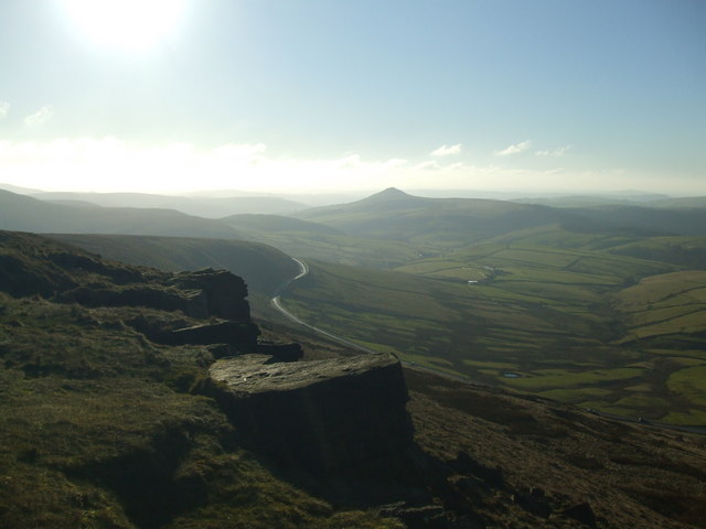
The new Buxton road winds below Shining Tor. © Copyright Jonathan Wakefield and licensed for reuse under this Creative Commons Licence

Roads in Derbyshire’s ‘White Peak’ are shaped by the limestone beneath; they sit in the bottom of ‘dales’ – steep gorges etched into rock – or wind across a bucolic landscape of green fields tessellated by white stone walls. But drive out of Buxton on the Macclesfield (“Cat and Fiddle”1) road and you suddenly enter a wilder world. Within a few feet, the stone walls at the side of the road turn from pale grey to a buff beige.  The landscape is brown and open, empty under a sky that is rarely entirely blue, mantled by peat bog and growing little but heather. You are entering one of the ‘Dark Peak’, one of the wild moors of northern England, the wuthering heights where Heathcliff roamed and Ted Hughes’ hawk roosts.

Further west, at the edge of the moors everything changes again – the Cheshire Plain appears laid out for inspection. On a clear day – or better still night – the view takes the breath away. The homes and lights of 3 million people twinkle and beguile. The depth of detail invites you to study, to pick out Jodrell Bank, flights descending into Manchester airport, Alderley Edge….

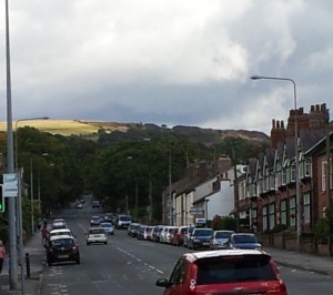
The Buxton road climbs up out of Macclesfield. Taken near Toll Bar Avenue.

The Buxton road climbs up out of Macclesfield. Taken near Toll Bar Avenue.

Drivers shouldn’t enjoy the spectacle: this road needs your full attention. It’s popular with motorcyclists for its many bends. Sadly some are total idiots, making the A537 one of Britain’s most dangerous roads. Their attitude to the area is not much different from many other modern travellers – this is a place to enjoy yourself in. Older generations – those who made this and other routes – had other motivations.


Early trade-routes

Some old routes over the high moors of northern England are know as the Saltways. The ‘wiches’ of Cheshire: Nantwich, Northwich and Middlewich, are towns based on salt. Thick layers sit deep within the Cheshire Basin, formed as a shallow sea was repeatedly evaporated under the Permian desert sun.

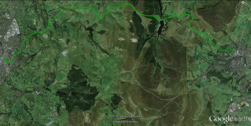
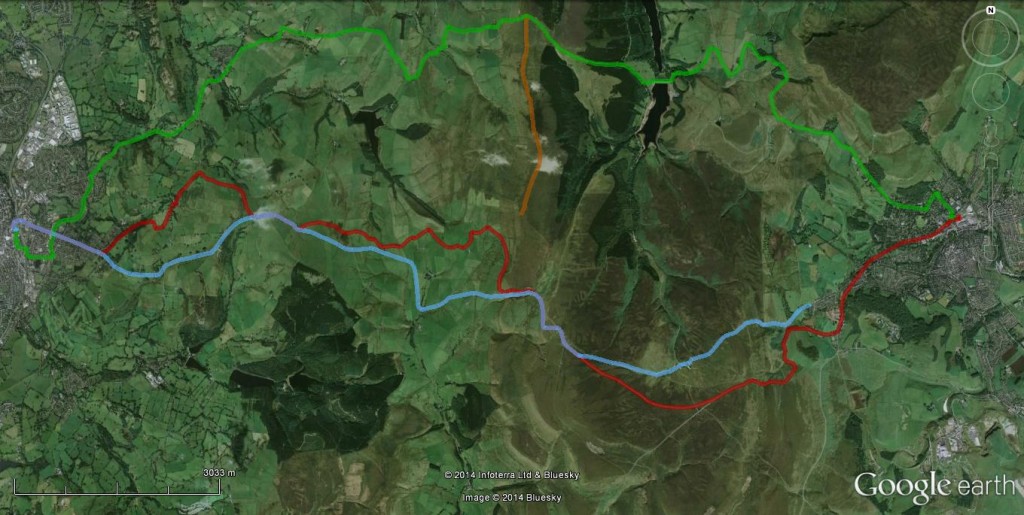
Salt has been produced in Cheshire since at least Roman times. An important commodity essential to food preservation (cheese! bacon!) it was transported across the country by salt traders (“salters”) who name attached to their routes. Below is my inference as to the route taken by salters through this area, passing through Saltersford Hall.

Trace of Salters way

Trace of Salters way in green. Macclesfield is the town on the left, Buxton on the right. The brown area in the middle is the moor

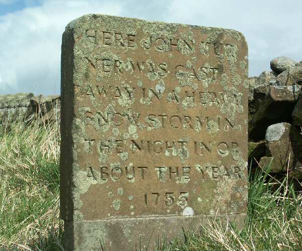
Buxton was a Roman town  and a direct line from the salt towns to there passes this way, but there is not good evidence it is that old. These routes are pre-industrial though, used by men and horses walking through the landscape, at the mercy of the elements. A reminder of how perilous this could be – hard to remember when speeding in a warm car – comes from an odd memorial stone on the route, that reads: “Here John Turner was cast away in a heavy snow storm in the night in or about the  year 1755. The print of a womans shoe was found by his side in the snow where he lay dead”

http://www.carlscam.com/rainow/turner.htm

The front of the memorial stone. Source

 The modern age approaches

Even as John Turner grew cold in the snow,  the epoch-making2 Industrial Revolution was hotting up. Using new technology to centralise production in factories only make sense if you can then get your goods to the people who buy them – new forms of transport were an important factor.

The 18th Century – early on in the Industrial Revolution – innovation came in the form of many new roads, called turnpikes. These were independently financed toll roads, sanctioned by Acts of Parliament.

The first Macclesfield-Buxton toll road followed an old route, was ‘engineered by a blind man, John Metcalfe’, and opened in 1759. Initially controversial, it was opposed by some (local coal producers) but championed by the new industrialists.

Old Buxton road in blue, new road in red. Route over Shining Tor in brown.

Old Buxton road in blue, new road in red. Route over Shining Tor in brown.

This road and the salters way are both direct but steep. This is ideal when moving goods with pack horses, but horse-drawn wagons work better with more gradual slopes, even if the route is longer. By the dawn of the 19th Century, new road-building techniques had emerged that cut into the hillside to make wider carriage-ways that avoided steep slopes even over hilly terrain.

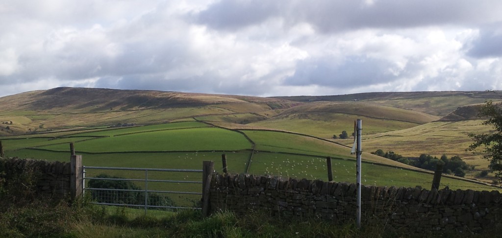
New and old Buxton roads cross the far hillside. Cat and Fiddle pub right hand skyline

New and old Buxton roads converge on the far hillside. The Cat and Fiddle pub is on the right hand skyline

In 1808, a new Eddisbury bypass just above Macclesfield was built by the famous engineer Thomas Telford, the “Colossus of Roads”. In 1821 the rest of the Macclesfield-Buxton road was modified with new winding flatter routes and a pub for the weary. The new road is wider than the old and climbs more gradually. To achieve this is has many bends, which attract the loonies in leather on their motorcycles.

A new ancient road

The transition from White to Dark peak, as you go east from Buxton is dramatic to us, but the incoming darkness would have been felt much more keenly by the Carboniferous inhabitants. The sparkling tropical seas where trilobites frolicked in crinoid forests were suddenly snuffed out by the arrival of massive amounts of sand and mud. Rocks made from the remains of life are replaced by those where fossils have to be sought out – traces in sand, crushed shells in rare marine muds or eventually, coal.

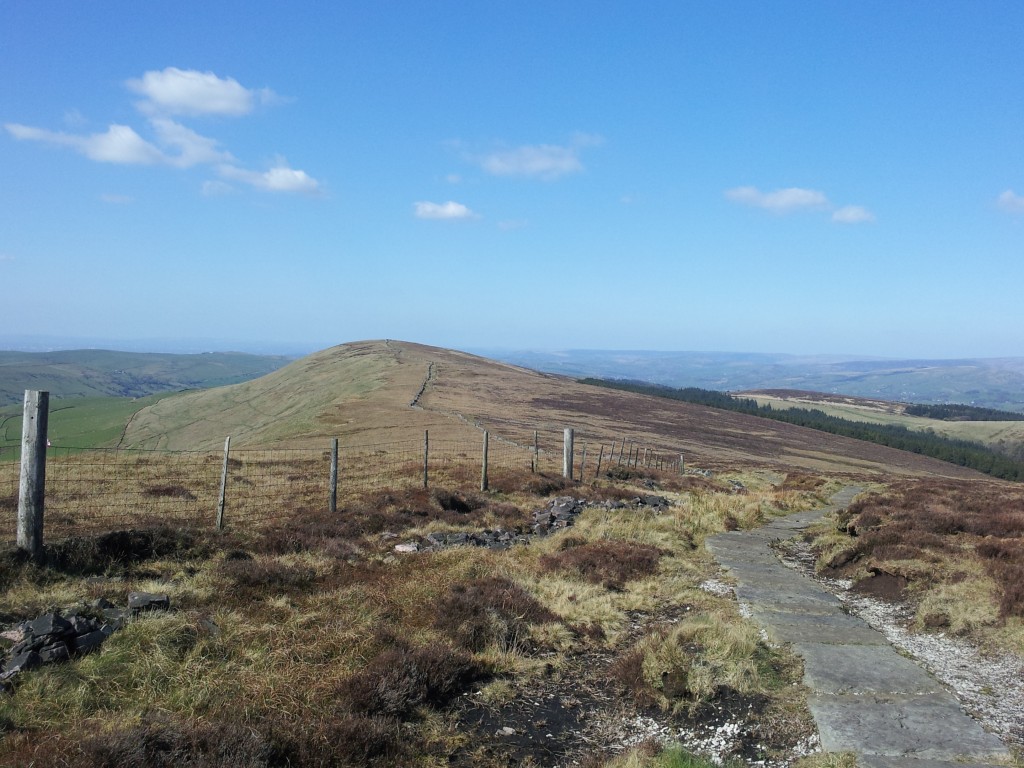
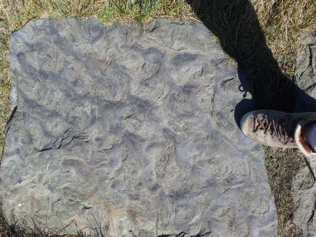
The most modern path across the Peak is also the most ancient. Walking across these hills for pleasure is extremely popular and paths easily cut into the soft peat. The most popular routes are now paved with big slabs of the local sandstone – along Shining Tor there are hundreds of them. Covered in ripples and the traces of burrowing bivalves, walking along these makes you feel like you are on a sandy shore 300 million years ago.

wpid-wp-1398008342435.jpeg

Slabs of sandstone along Shining Tor


Ancient ripples

Ancient ripples

"Lockeia" - traces of burrows from bivalves

“Lockeia” – traces of burrows from bivalves