Geology and life in the English ‘Coal Measures’

The geology of the North of England is where our modern industrial civilisation was born, based on the burning of fossil life. I’ve wanted to write about the fascinating geology I grew up with for a while. I’ve been spurred into action by Accretionary Wedge #46 where Cat asks us to write about “Geology, Life and Civilization”.

The spine of northern England is the Pennines, ending in the south with the Peak District, where I come from. This area is almost entirely made up of Carboniferous sediments that have shaped the landscape and the culture of the area.

True Grit

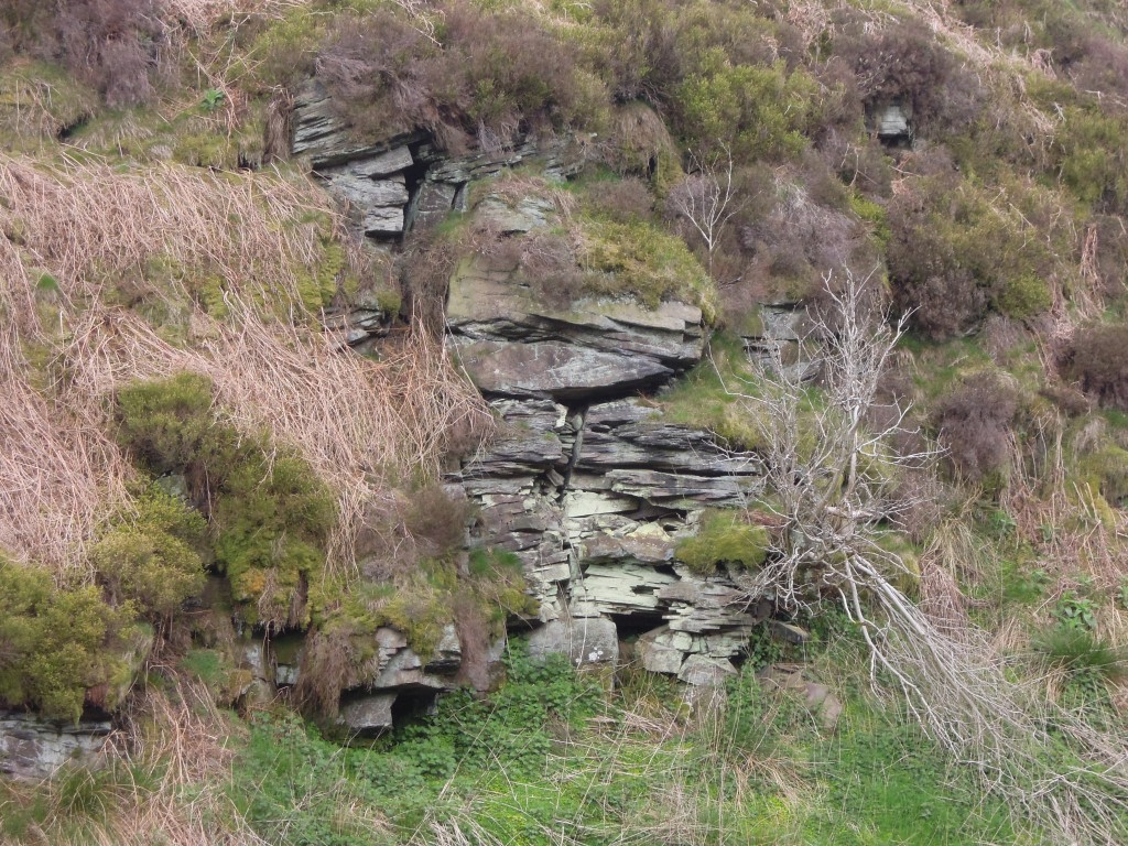
One of the most characteristic landforms of the Pennines is the gritstone crag.

These thick resistant layers of sandstone form prominent lines of outcrops (crags), with gentle dipslopes in between. Generations of rock climbers have been trained on them. The cliffs are low, but make for great climbing. You can battle with gravity all day and be in the pub half an hour later.

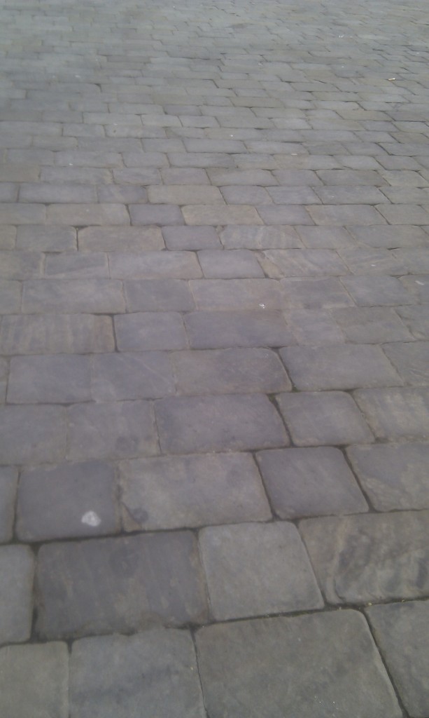
The sandstone is often coarse (gritty) and was traditionally used to make Millstones, which are now the emblem of the Peak District national park. ‘Millstone Grit’ is great building stone and the area is dotted with quarries. In some areas it forms easily into regular slabs, perfect for building drystone walls or making cobbled streets.

Macclesfield cobbled street

The crags of sandstone have fabulous names, like Froggat Edge, Stanage Edge and ‘the Roaches’ and these names enrich the stratigraphy and therefore the geological maps of the area.

Gritstone is poetic as well. The great English poet Ted Hughes grew up in these landscapes and wrote about them. In “Still Life” he writes that “Outcrop stone is miserly” and is “Warted with quartz pebbles from the sea’s womb”. The outcrop marks the ‘fly-like dance of the planets’ and thinks itself eternal, but only because it is ignorant of what water will do it, over time. Elsewhere in Wodwo he writes of walkers escaping the valley onto the moors above. The Pennines and Peak District have long  been a means of release for inhabitants of the industrial cities and valleys that sit below. The mass trespass of Kinder Scout (type locality of local stage “Kinderscoutian”, 318 to 317 million years ago) in the 1930s was in favour of the ‘right to roam’ and is seen as a milestone in English social history.

Romantic looking m

Mud, glorious mud

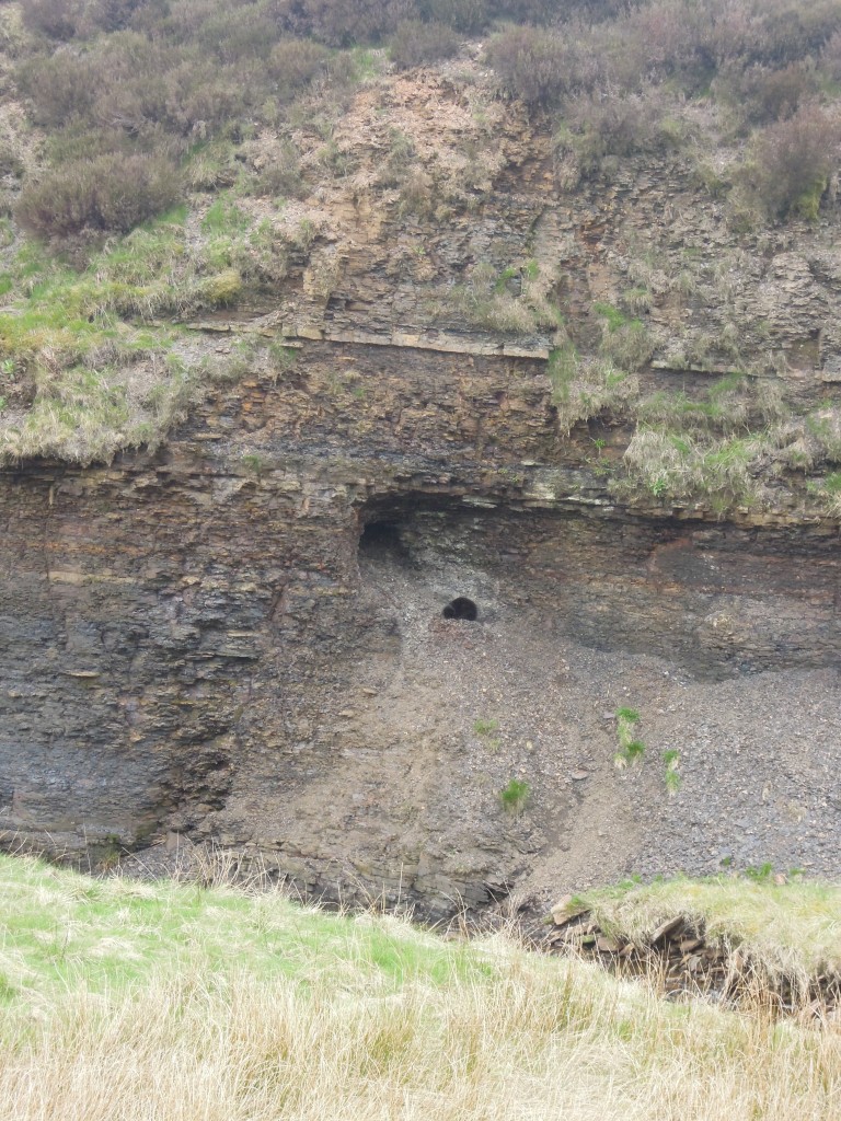
The gritstone crags are only prominent because they are surrounded by softer rocks. Mudstones and shales are common in this area, they form the plain backdrop on which the gritstones can perform. A humble, elusive rock type, best found in stream beds the shales are not devoid of interest. Far from it – they were teeming with life.

Shale

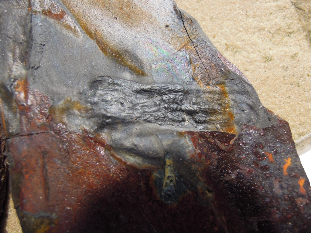
Below is a section of an early armoured fish.

Fossil armoured fish

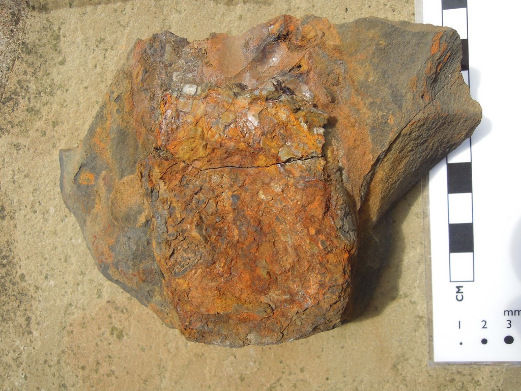
I don’t know what this is, maybe nothing.

Mystery ?fossil?

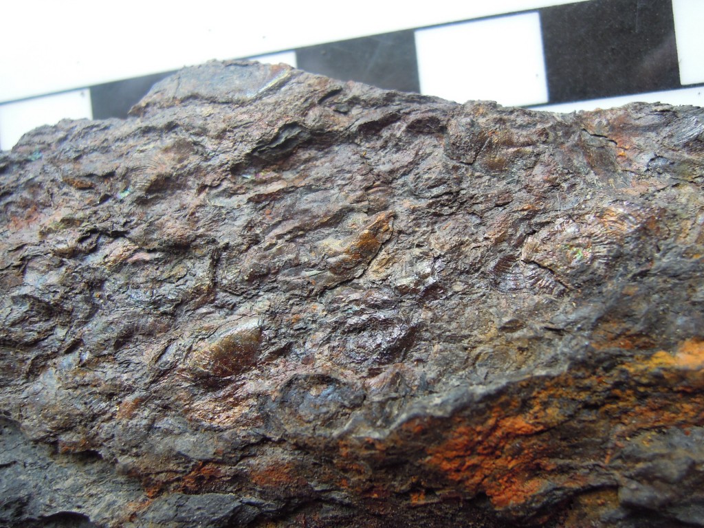
At times the shales are clearly marine (mostly, like the sandstones, they are not). In distinct ‘marine bands’, goniatites (ammonoids) and crushed shelly debris are common.

Crushed fossils from marine band. Goniatite on right, ?bivalve shell debris elsewhere

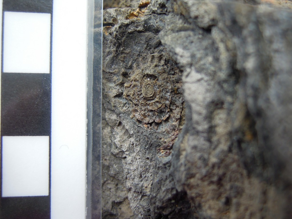
The clearest goniatite above is middle right, where you can see the parallel lines of the external ornamentation. Here’s a close-up where the spiral shape of the goniatite is more obvious.

Carboniferous goniatite from marine band

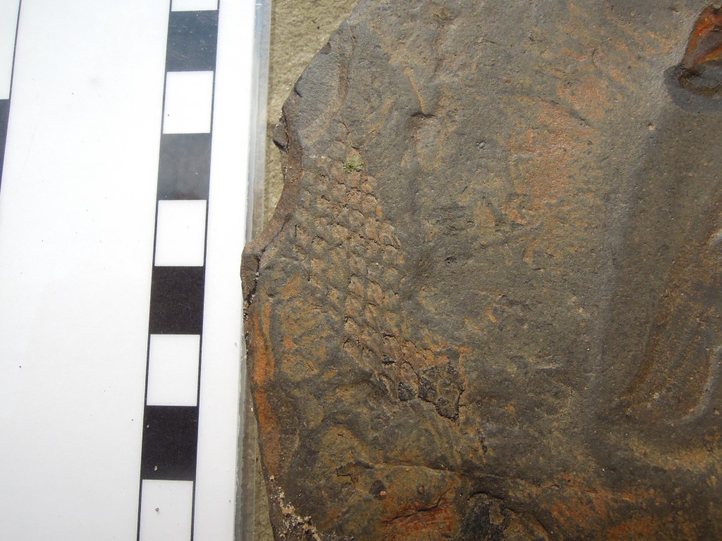
Goniatites are marine creatures, but here’s a clear sign of land, a piece of fossil bark. Carboniferous forests were dominated by primitive plants called Lycopods which have leaves growing direct from the stems, leaving the scars you see below.

plant fossil in shale ?Lycopod bark?

King Coal

Cat herself mentions Iain Stewart talking about the importance of Carboniferous coal deposits in the history of the Industrial Revolution. Just how important coal was is an area of vigorous historical debate but no-one would argue that industrialisation started in the North of England and that burning of local coal deposits was important.

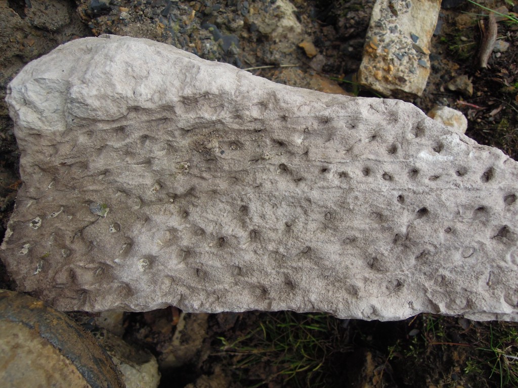
Let’s start with the roots of the matter. Coal is of course compressed plant material found in seams. At the base of these seams is usually a layer of very pure quartz sandstone. This is a fossil soil, a palaeosol which locally may be known as seatearth, or ganister. Appropriately enough these fossil soils often contain fossil roots, often Stigmaria, with a distinct ‘holey’ appearance.

Seat-earth with plant fossil Stigmaria

Coal is relatively rare in the Peak District, where all of these photos and samples were taken (most on a single afternoon in the Goyt Valley). The area contains the transition between ‘Millstone Grit’ deposits and the ‘Coal Measures’ proper. Coal seams are thin and extraction was via shallow ‘bell-pits’ for local use only. The main coal fields were further north in Lancashire and Yorkshire, where whole communities were built up around the ‘pits’.

These coals put the ‘carbon’ into ‘Carboniferous’ – there are massive deposits worldwide but the name was coined in Britain. This was an odd period in earth history, associated with high levels of oxygen (perhaps up to 35% compared with 21% today). One of the lines of evidence for high oxygen are the massive insect fossils found at this time (no photos sadly). These animals depend on oxygen diffusing into their bodies, so the more oxygen, the bigger they could grow.

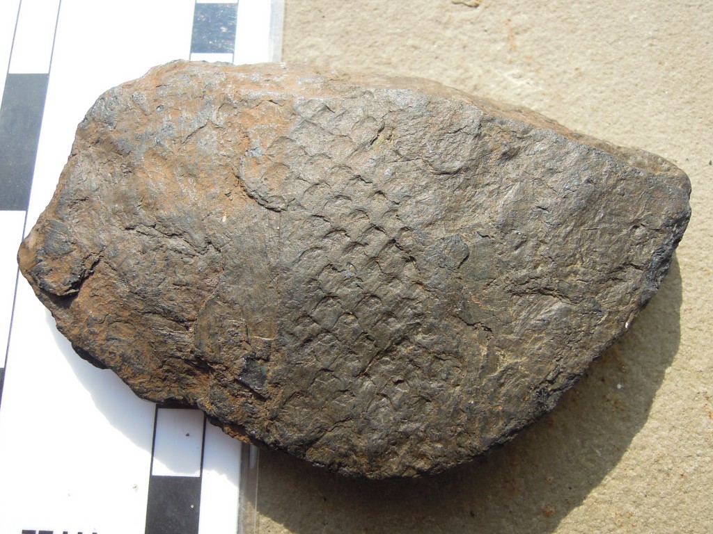
Coal is fossil plant material, so no surprise that it contains impressions of plants within it.

Plant fossil in coal ?Lycopod bark?

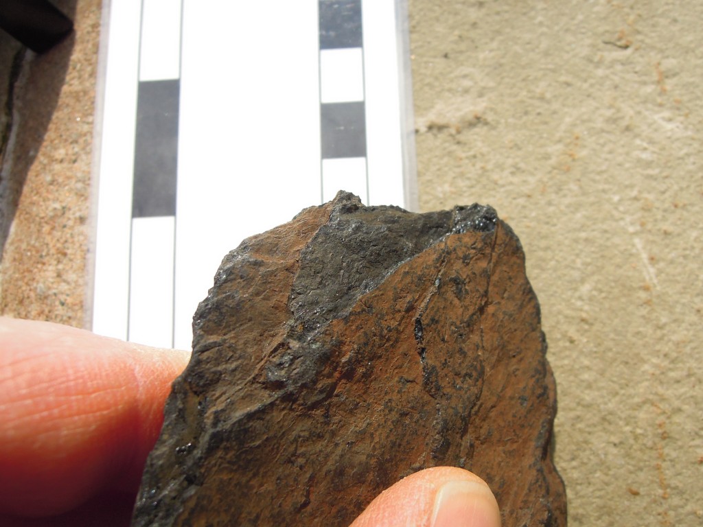
This weathered piece, from a stream bed, looks rather like shale until you break the end and see it shine. I could have set fire to it and taken a picture, I suppose, but that would just be showing off.

Coal showing shiny edge "vitreous habit"

Cycles

Together, these rock types make up most of northern England. What is intriguing is that they often occur in a regular pattern. This is an interesting thing and I shall return to it.

Another form of cycling concerns the carbon locked up in the coal. What was locked below the surface is now floating above it in the form of carbon dioxide. Releasing the power of this buried carbon kicked off our industrial civilisation. How we deal with the powerful effects of the atmospheric version will determine how our civilisation fares in the future.

The first image, of the Roaches, image from Plbmak on Flickr under Creative Commons.
All others mine, scale bars are centimetres.
If you want to know more about English Carboniferous Geology, this open access book chapter is where to start. 

Like talking about a stone wall

I grew up surrounded by stone walls, something which certainly nurtured the geologist in me. I certainly didn’t view them in any negative Pink Floyd kind of way. These were outdoors walls, field boundaries tracing across the hills for miles. They were easily scaled, fun to walk on top of and a place to store contraband, should the need arise.

The walls of my youth were top-class, I now realise. My English mill-town home was surrounded by Carboniferous sandstone that produces beautiful regular rectangular slabs. Turning such regular stones into a beautiful stone wall is easy. A dry-stone wall mind, building a wall like this with cement would be like putting Coke into a gin and tonic: both barbaric and unnecessary.

Dry-stone walls are common on British uplands, but are found in many other countries. They are an attempt to solve two problems: a field full of stones and the roving instinct of livestock. I’ve seen Irish fields incredibly finely divided by walls, also with a pile of stones in the middle. Here the need to get stones off the ground is paramount. Some walls in Ireland are known as ‘famine walls’, they were built by starving men during the Great Hunger of the 1840s. These men were fed by the state, but the ideology of the time meant they had to work for earn the food. Sometimes stone walls dividing nothing from nothing were the result.

To a geologist, a stone wall can present a temptation. By their very nature, they are often built from stones picked off the ground, possibly moved from a distance away. And yet, they often seem to reflect changes in the geology quite precisely. Driving into the town of Buxton, for example, the bedrock change from sandstone to limestone is marked with a short (>3m) change in the rock-type of the stone walls. A geologist should ignore such evidence when mapping and look only at outcrops, but it can be very tempting, believe me….

Stone walls are a reflection of the underlying geology. This is clearly demonstrated at the millennium wall, to be found at the National Stone Centre, in Derbyshire, England. This is a series of dry-stone walls, representative of types from across Britain.

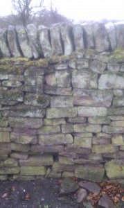
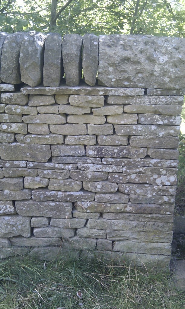
First, here’s a handsome gritstone wall, similar to the ones I grew up with. Its made from Carboniferous sandstone as found over most of Northern England.

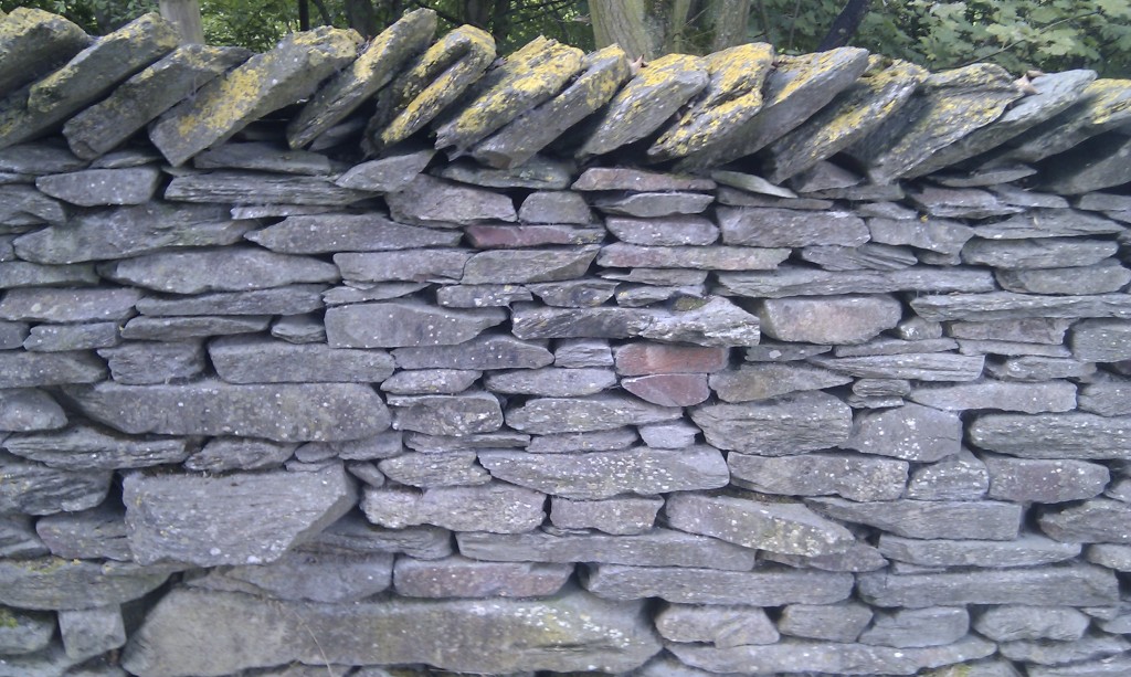
Note how the regular bedding makes for blocks that are brick-like and easy to lay. You can get a similar but rougher effect from slates, like this Ordovician slate from the English Lake District.

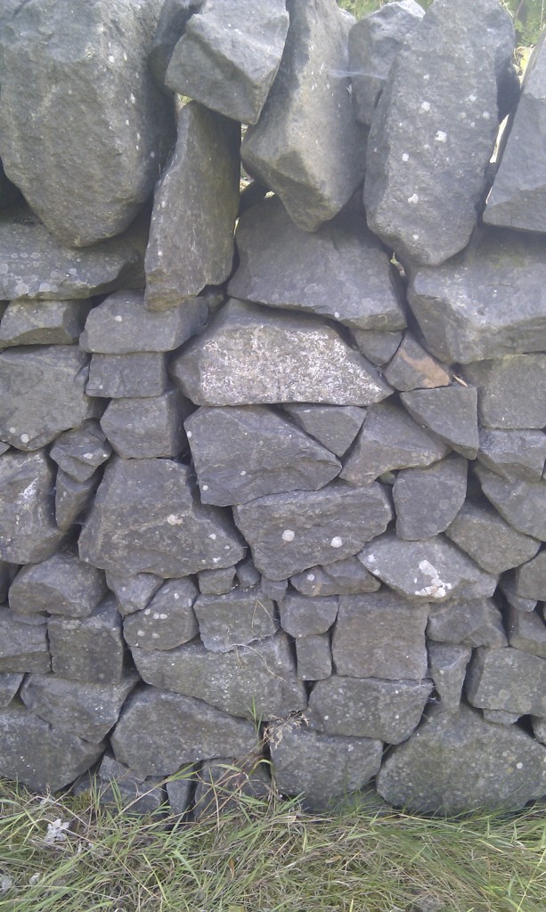
If you have only igneous rocks to hand, life is harder as there are no parallel surfaces to work with. Here with this Scottish dolerite, they’ve had to work hard to get a rough looking wall.

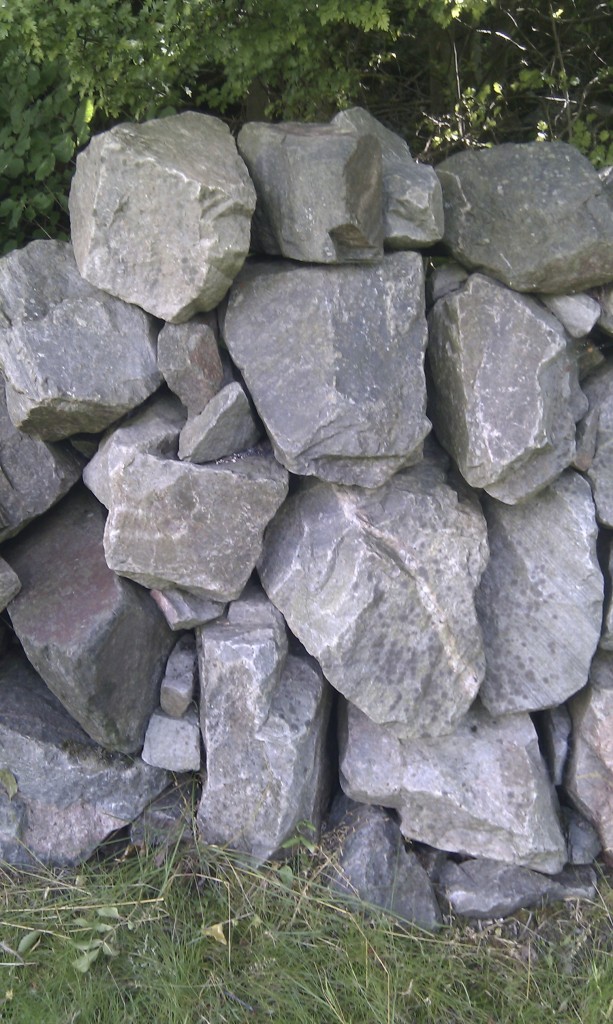
If you’ve only got tough metamorphic rocks to work with, things are getting pretty desperate. This Scottish wall of meta-quartzite really is just a pile of stones.

Stone walls are not much made, these days. If a wall falls into disrepair, it is far easier for a landowner to put up a barbed-wire fence instead. A shame I think.

Sediments and shiny shoes

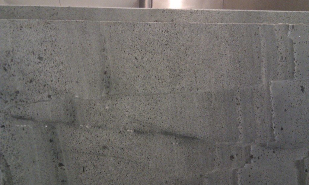
I’ve come across a most remarkable field area. I think I’m probably the first Geologist to study it. The samples are an extreme case of ‘float’ – they are very detached from bedrock. Exposure is excellent. Samples are nicely polished and form neat pavements, but blocks are never large and randomly arranged.

Field work is a little odd. In order to get access to the samples I have to wear some very unusual field-gear – shiny shoes, suit and tie. The samples are concentrated in special areas – the names used by the local people are ‘the lobby’ and ‘the gents’. I’ve heard that samples are also to be found in ‘the ladies’ but I am not allowed in this area due to local taboo. This is a frustration, as is the fact that taking samples is not allowed. Photography is fraught with hazard also, as I am doing fieldwork ‘undercover’. The locals are unlikely to understand why I am photographing the floor. Photography in ‘the gents’, while not explicitly taboo, is highly unorthodox. My smart phone is my friend.

I’ve battled with these hazardous conditions and returned with some photos of rather nice rocks, just for you.

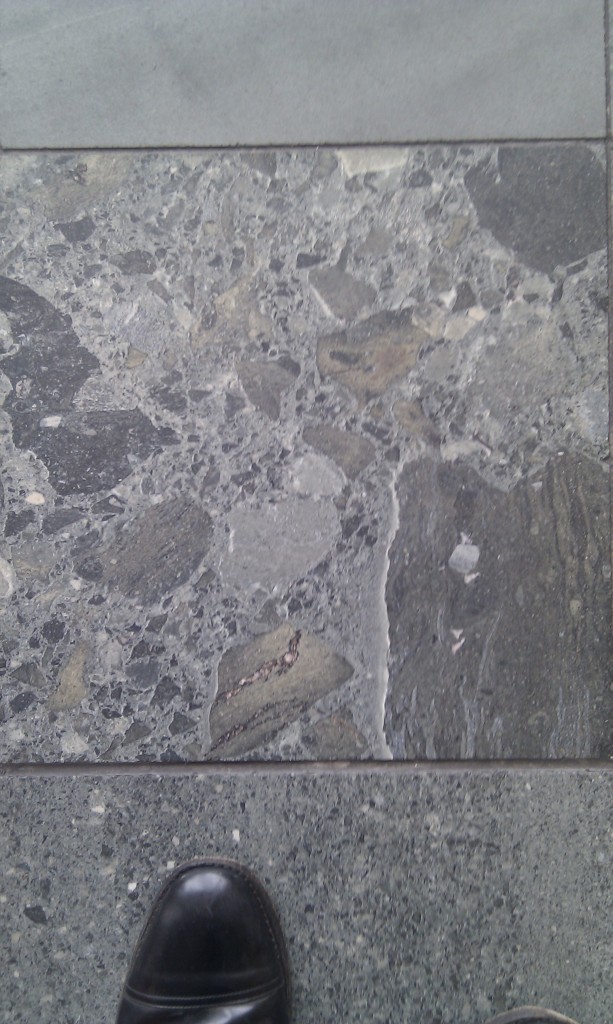
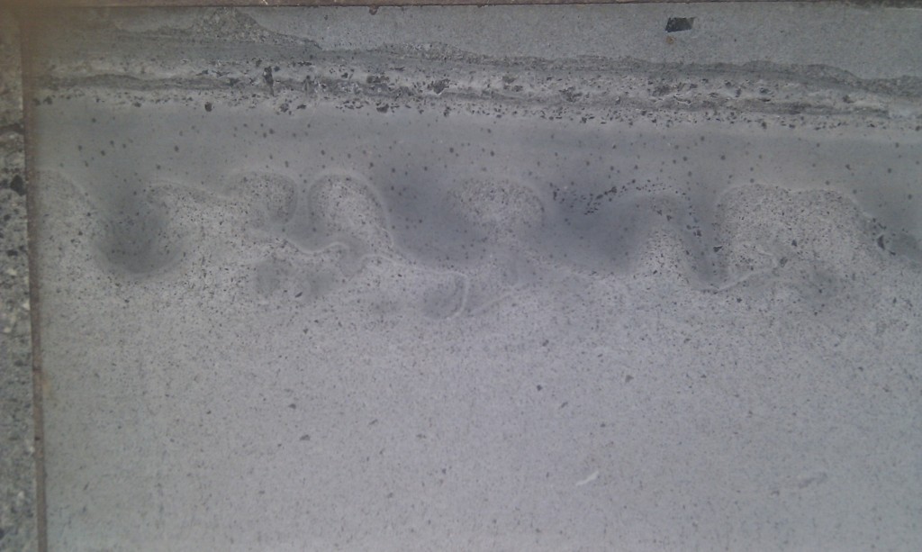
Here is a typical sample:

The field of view is about 50cm top to bottom. The rock is a poorly sorted sandstone. Clasts are irregular in size and volcanic in origin, some are intraclasts, samples of the sediment reworked as big pebbles. Note the minor faults.

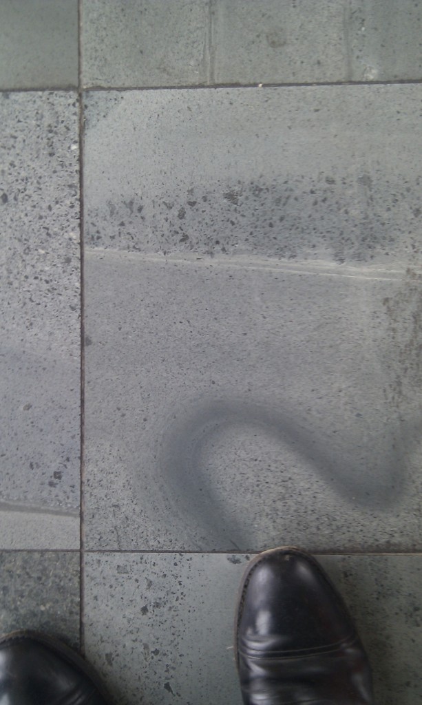
Here’s a look at an unbedded sample with large clasts, ‘shiny’ shoe for scale (for those of you who like precision, I take size 9 shoes which is 10 in US size, 44 European).

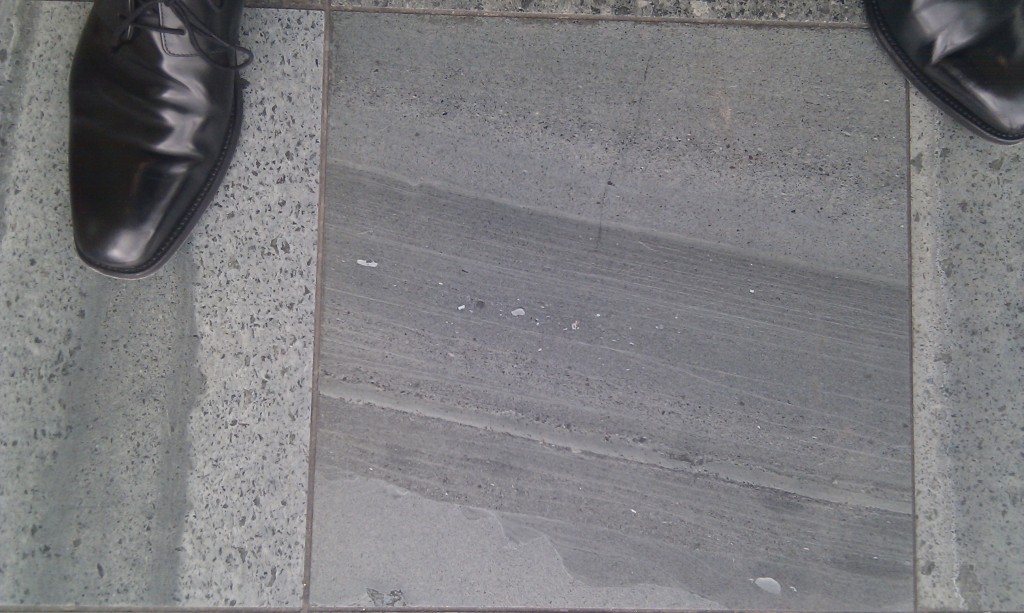
A more typical sample has lots of sedimentary features and shinier shoes.

You can see there is lots of fine bedding with large variation in grain size. Note the wavy shape of the lowest bed. Once the bottom gray layer was sitting there quite happily when something came along and scooped out three big bites. Later sediment filled these in until eventually the layers on top are flat again. What did this? A clue is in the big white clast sitting bottom right. In order to move something that big, you need fast moving water. I’m thinking turbidity currents and my guess is that the ‘scoops’ are cross sections through flute marks or other types of gouges that these big flows of sediment-rich water produce.

So I’m visualising somewhere near volcanoes, steep underwater slopes down which big piles of sediment-rich water periodically sweep. What do you often get associated with volcanoes? Earthquakes. Shaking up piles of sediment can do some very interesting things.

First the faulting. You saw some in the first picture and you probably visualised this as something that happened to the sediments long after they were lithified. Maybe. Have a look at this.


I know its not the world’s best photo, any advice on discretely taking photos of shiny surfaces in dark corners gratefully received. The short dimension is 8 centimetres. Here’s an annotated version to make things clearer.

Green lines are sedimentary boundaries. The bottom one is clearly cut by a single fault. The second one is cut by a few minor faults and seems a little folded next to the faults. The top one is unfaulted. Did the faults simply peter out and not reach the top layer? I’m not so sure, look at the layer immediately beneath the top boundary. It is thicker above the downthrown side (the right). It looks to me like this faulting happened while the sediments were forming. The top layer isn’t faulted as it wasn’t there when the faulting happened. I’ve not traced the faults thorough the thick layer, as there the disruption seems a bit more diffuse, which I guess is also consistent with fracturing of unlithified sediments.

This is all on a tiny scale, but a similar process happens on a km scale, where faulting in sedimentary basins can be the main control over sediment thickness.

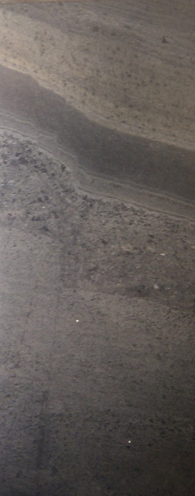
What happens if you pile coarse sand on top of web mud and shake it? Here’s what:

Firstly, did you assume that this photo is the right way up? Looking at the irregular top boundary I think it is ‘upside down’. I thought of rotating the photo to match the orientation when the sediments were laid down, but that is only my interpretation as I’ve no way of knowing for certain. If you work in structurally exciting areas, the ability to tell a sedimentary rock is upside-down is a useful skill.

Look a the layers about a third of the way down. The coarse sand was sitting on the finer-grained mud. When the sediment was shaken by an earthquake, the heavier sand started to sink as lobes into the mud. Displaced mud moved to fill the space, the earthquake stopped, eventually the rock lithified and froze this rather nice blobby-wobbly structure in place. I believe convolute bedding is a more generally accepted term.

Here’s a more dramatic example.

The rocks are rather green. They may have been metamorphosed slightly, just enough to grown green minerals such as epidote or chlorite, but not enough to recrystallise so much that sedimentary features are lost. A few samples look as if they might have some spaced cleavage in them.

My attitude to sedimentary rocks is usually summed up by the word ‘protolith’, but these are so nice I’m almost converted. I still don’t where these rocks are from originally as the records of the people who placed them here are lost. Any ideas? Also, any other features I should be looking out for?

I’ll end on a mystery. It looks like boudinage, but the folded layers are cut by higher ones which seems to rule out deformation. What is it?

Relict of the flood?

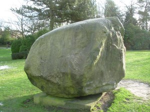
I’ve recently spent a lot of time with my kids in the fabulous public parks of Macclesfield. An ex-mill town in the north of England, Macclesfield expanded greatly in the Nineteenth Century and the civic leaders at the time took care to build large green spaces into the town. In a nicely manicured lawn in West Park, there is a large stone, which is rather interesting.

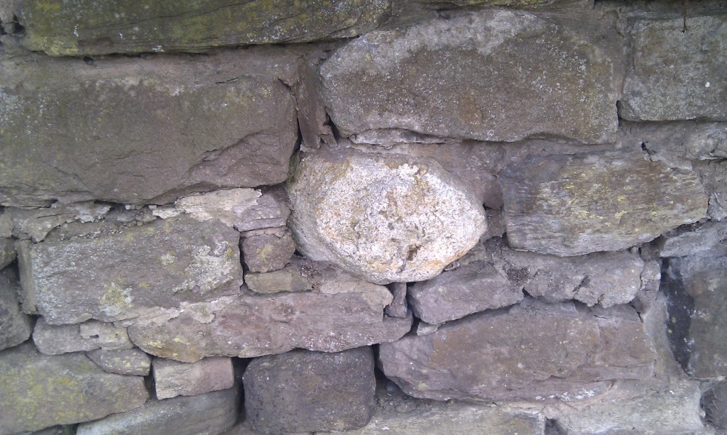
It is a large boulder with rough edges, but a striated smooth top. It is of course a glacial erratic, that is a large block of rock, picked up in a glacier or ice sheet, moved a long way and then dumped somewhere else. It is, in the loosest sense, granite and to anyone familiar with English geology, comes from the Lake District. Smaller blocks from the Lake District are extremely common in the East Cheshire area, and are often seen ‘sticking out’ of dry-stone walls, where their rounded shape spoils the otherwise regular pattern.

A teenie-tiny glacial erratic incorporated into a typical Macclesfield stone wall. The rounded white-weathering block of Lake District igneous rock contrasts with regular bedded local stone

At the last Ice-Age maximum, Macclesfield was near the southern edge of the glaciated area, which covered pretty much all of the British Isles to the north. An ice-dome centred on the high ground of the Lake District swept down south over the Cheshire Plain. Just east of Macclesfield is the higher ground of the Peak District, that remained unglaciated.

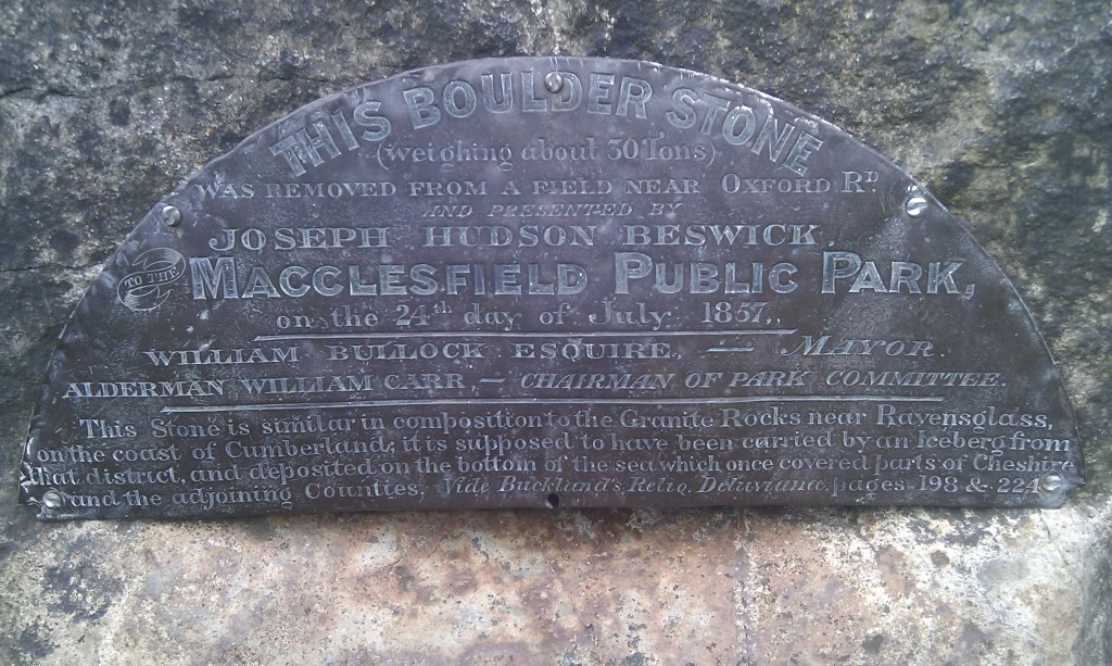
The West Park boulder was found in 1857 and was moved a small way by a team of 8 horses into the 3 year old park where it was put on a plinth and a brass plaque attached.

The bottom section of the text says: “This Stone is similar in composition to the Granite Rocks near Ravenglass on the coast of Cumberland; it is supposed to have been carried by an Iceberg from that district and deposited on the bottom of the sea which once covered parts of Cheshire and the adjoining Counties. Vide Buckland’s Relio. Deluvianae, pages 198 & 224″.

William Buckland, was an interesting character and important figure in Nineteenth Century science. His 1823 book, referenced on the plaque, “Reliquiæ diluvianæ: or Observations on the organic remains contained in caves, fissures, and diluvial gravel, and on other geological phenomena, attesting the action of an universal deluge” was a best-seller and evidently a copy made it as far as Macclesfield. Following the plaque reference to page 199 shows that the reference to Ravenglass is a direct lift from Buckland’s book (rocks like this are found all over the Lake District, Ravenglass is only where Buckland happened to see them). Page 224 summarises his main argument, that blocks like this are evidence of a ‘universal deluge’, such as described in the bible, and that this block is a relict of the Biblical flood.

William Buckland is a great figure in Geology, because, like Darwin, he was one of the people who used careful observation to overturn the traditional idea that the Bible is a literal description of the Earth’s history. By 1836 he had changed his mind about the flood and by 1840 was in agreement with Louis Agassiz‘s theory that features such as erratics were the product of glacial processes.

So, by 1857, the theory expressed in Reliquae diluvianae had been rejected by its own author in favour of one we would agree with today. However nobody had told the good folk of Macclesfield. Or had they? The reference to an iceberg as the form of transport does not come from Buckland’s early book; Noah’s ark was not an ice-breaker, so where does the ice reference come from? It suggests to me that the text on the plaque is a form of compromise. The book and its idea of the block moving while Macclesfield was underwater is in there, but so is a reference to the more modern theory of ice being involved. The result is still wrong (an ice-sheet, not an iceberg was the form of transport) and it is not surprising that they started their description with the phrase “it is supposed to have been”, if they couldn’t agree amongst themselves.

So, next time you get access to most of human knowledge via your smart-phone, spare a thought for your ancestors. This plaque reminds us that only 150 years ago, in a town in one of the (then) most-developed and wealthiest countries on earth, the most definitive source of geological information available was a 30 year old book.