Power and postboxes in Sonning-on-Thames

I live in the Thames Valley, an attractive area of England found to the west of London. It is generally an affluent place, but it contains little spots, clustered near the river, where you can almost smell the vast amounts of money and power. The Fat Duck (the “world’s best restaurant”) is in the little village of Bray, site of a small cluster of Michelin stars that shine on the conspicuously expensive cars in the car parks.

20130915_094113

The village of Sonning-on-Thames is a little like Bray. It has swanky restaurants from which middle-aged men stagger with women young enough to be daughter (but no-one would wear a skirt *that* short to a family meal). Unlike Bray, it is not just a temple to gastronomy but also a place where normal people live. But the landscape here has been shaped by its powerful residents, modern and old.

I live in adjacent Woodley, separated from Sonning by the Great Western Railway. This marvel of Victorian engineering spread out from London’s Paddington station (home to marmalade-loving bears) west to Wales, Bristol and far-flung Cornwall. The ground-breaking engineer Isambard Kingdom Brunel was adept at dealing with hills and valleys, but he was forced to back-down when faced with the Power of Property.  In Berkshire, the Great Western Railway closely follows the river Thames, and the logical route into Reading would take it through Sonning. However, the local MP Robert Palmer1, owned land on the route, was opposed to the railway and refused to allow it through. The only solution was to make a more direct route into Reading, passing through the small hill above Sonning.
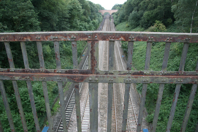
Sonning Cutting. Image from Pete Reed under Creative Commons.

Sonning Cutting. Image from Pete Reed under Creative Commons.

Originally a tunnel was planned, like the one through Box Hill that was being built at the same time further west. However Sonning’s rocks are gravels and muds, sitting above the Chalk. These layers, the Reading Beds and London Clay are barely rock and too soft to take a tunnel. So Sonning Cutting was created, dug by hand over several years.

A lovely spot now, it had an inauspicious start. Several men were killed building it and within a few years it was the site of the world’s first major rail disaster. After heavy rain, a small landslide derailed the train and 8 people, travelling in an open Third class carriage were killed. A faint tang of death lingers still, even though it has been widened and the slopes safely un-steep and wooded.  My favourite bridge over it had low sides with holes in it. Peer through it with a small boy and slow-moving train drivers would wave and toot. The large sign for the Samaritans suicide hotline was a sombre reminder why this is known as Suicide Bridge. Current modifications to increase the height of the sides (as part of electrification of the line) will remove a lovely view, but perhaps for the best.

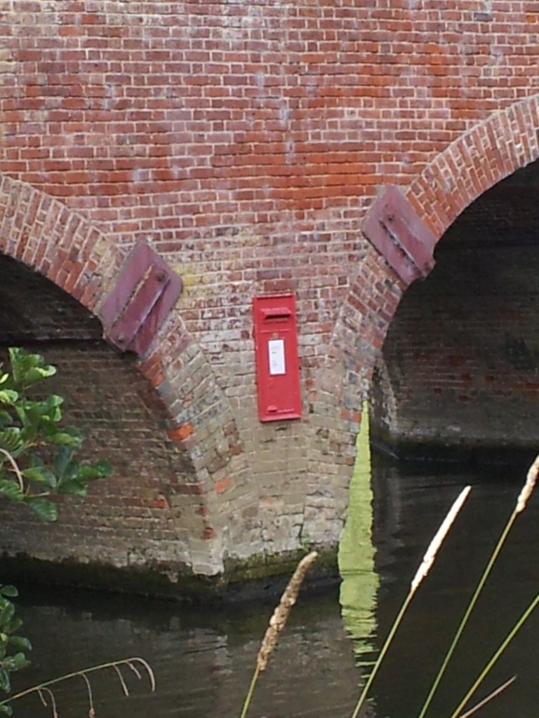
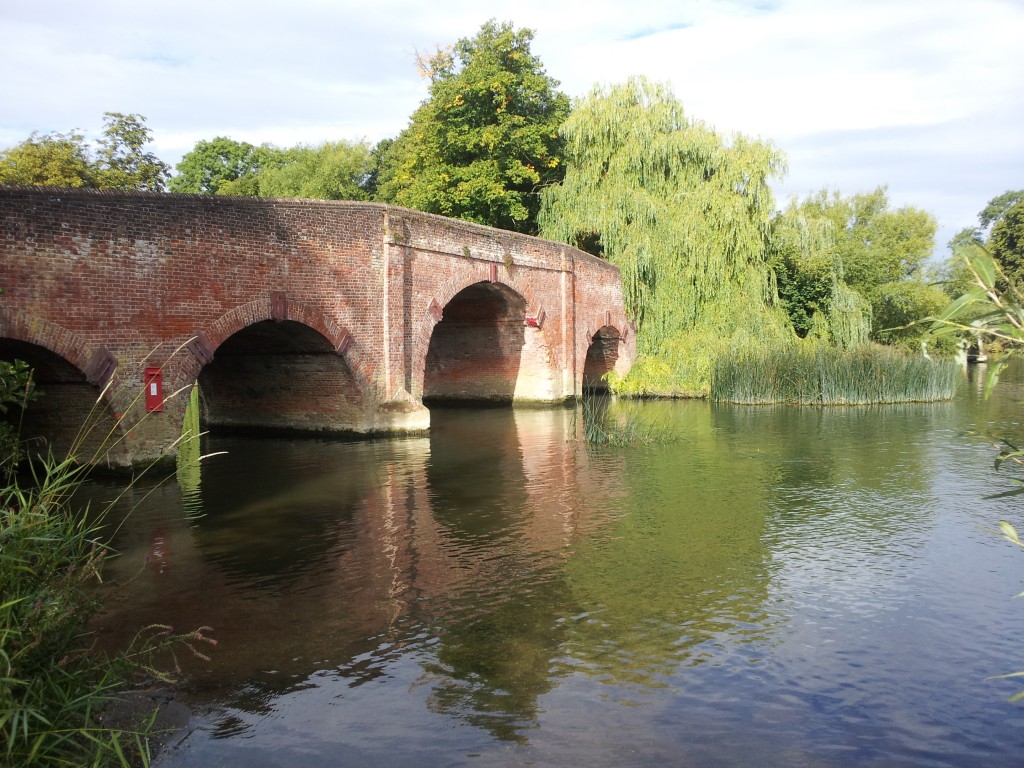
I crossed the Cutting to visit Sonning recently to view a Postbox. It’s not a real one. It sits on the side of bridge, reachable only from the fast-flowing river Thames. From a distance it is a very convincing Royal Mail post box. What is its purpose? Is it a reference to the impending sale of the Royal Mail, being sold down the river? According to a friendly dog-walker, it is likely connected to a local pub – a similar one had appeared on the wall there recently. Who else but the landlord of the nearest pub would most benefit from the media attention and increased visitors this mystery post box has generated?

20130915_094053

The bridge is ‘listed’, meaning it is protected by law. Sadly this means that any unauthorised changes must be removed. Friendly dog-walker and I agreed that this was a shame, the world should have more stylishly pointless things in it.

The media coverage of this anonymous piece of art was blighted by a modern powerful resident of Sonning. The BBC news article has Sonning resident Uri Geller centre stage. Famous for bending spoons, this “self-proclaimed psychic” told the BBC “he suspected it may have been placed there by the ghost of a small girl which reputedly haunts the bridge”.

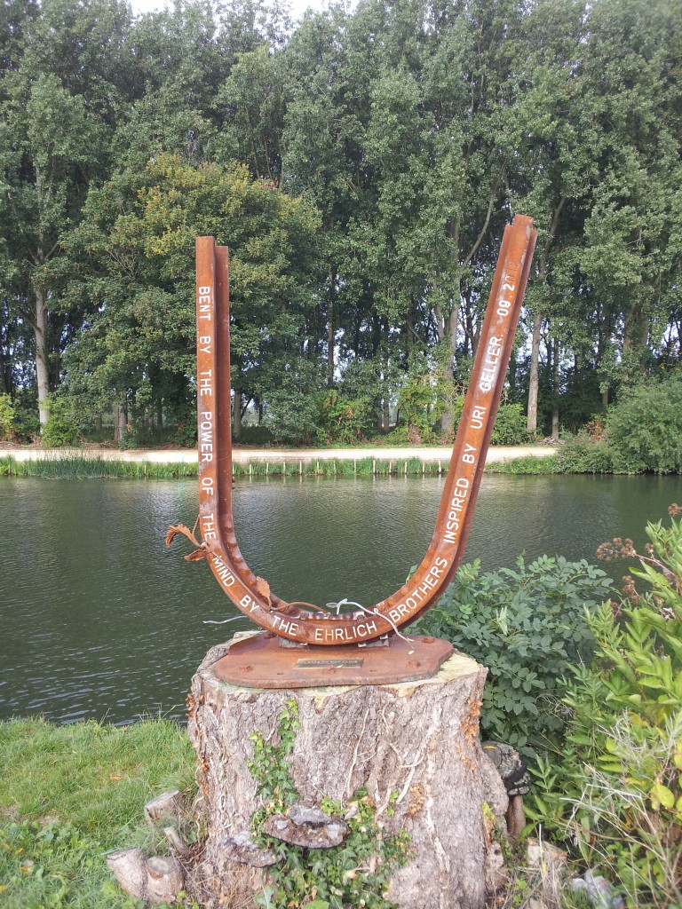
If you walk a small distance from the bridge you encounter imposing fencing covered in keep-out signs. His massive house sits on the hill above, bringing to mind H. L. Mencken’s quote “Nobody ever went broke underestimating the intelligence of (the American) people”. On the river bank there is an absurd sculpture of a bent railway sleeper ‘bent by the power of the mind … inspired by Uri Geller’.

20130915_094818

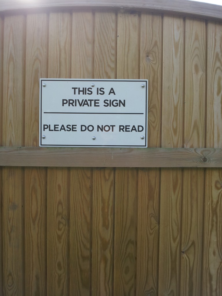
This lying piece of egomania was ‘donated to the people of Sonning’. A indication that they might not be entirely grateful comes from this wonderful sign on the imposing fence around his property.

20130915_094650

Sonning has long been shaped by the powerful men who live there. I look forward to seeing more counter-balancing signs of the anonymous and the subversive sprout there.

Fracking great science from the British Geological Survey

Fracking is rightly a major political issue. In Britain this is topical as the government has just released a technical report showing that very large volumes of natural gas are locked into rocks beneath northern England. As a tax-payer whose house is heated and food cooked using gas, but who is concerned about CO2 emissions and climate change, I will be directly affected whether we extract this gas or if we leave it be.  But what interested me about the report was not politics, not energy policy, but a genuine pride in the quality of unbiased scientific data contained within it. Politics can wait. Let’s celebrate the vast data sets and clear and comprehensive analysis that I’m glad my taxes have paid for.

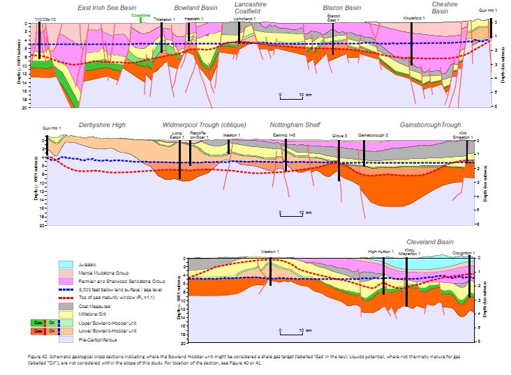
Figure 42, schematic cross sections of the north of England. Copyright DECC 2013

Figure 42, schematic cross sections of the north of England. Copyright DECC 2013

The report sits in a clean and fast web-page, linking to downloadable reports that include a vast amount of data. It’s copyrighted, but I can copy images into here, with attribution. There’s even an apologetic note that ‘users of assistive technology’ may not be able to make use of the files.  This is how all government websites should be.

The study focuses on a particular geological unit that covers much of the north of England, the Bowland-Hodder shale. For a geological introduction, I can’t better the report itself: “Marine shales were deposited in a complex series of tectonically active basins across central Britain during the Visean and Namurian epochs of the Carboniferous (c.347-318 Ma). …. The marine shales attain thicknesses of up to 16,000 ft (5000m) in basin depocentres (i.e. the Bowland, Blacon, Gainsborough, Widmerpool, Edale and Cleveland basins), and they contain sufficient organic matter to generate considerable amounts of hydrocarbons.” 

The study identifies draws on a mass of seismic and borehole data and distinguishes two horizons, an upper and a lower. The upper is a post-rift deposit that resembles “prolific North American shale gas plays”. The lower is less well known (not much drilling information) but was deposited during the rifting and so is a thicker deposit. Here’s a sense of how much data they are  drawing on:

Figure 8. Copyright DECC 2013

Figure 8. Copyright DECC 2013

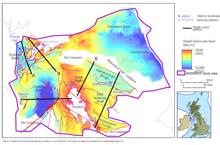
Seismic data gives you a cross-section view through the sedimentary layers. Borehole data allows you to link the layers to actual rocks. Gamma ray logging data allows you to estimate the amount of organic matter within these rocks. The report tells you how the deep the shale is:

Figure 17. Copyright DECC 2013

Figure 17. Copyright DECC 2013

It has other pretty maps showing how thick the layers are, plus lots of cross-sections.

These rocks started as mud with organic matter in them. This only turns into valuable oil or gas once that organic matter has been buried and heated. The shininess of woody matter from boreholes (called vitrinite reflectance), records how much the rocks have been heated. Particular values of vitrinite reflectance correspond to a ‘gas window’ indicating that shales with organic matter are likely to contain methane gas.

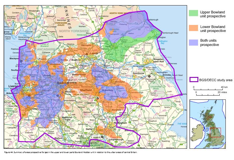
Putting all this data together, the British Geological Survey guys have produced maps of areas where the upper and lower units exist and have passed through the gas window.

Figure 44. Copyright DECC 2013

Figure 44. Copyright DECC 2013

What the man in the street wants to know is: how much gas is there? The study uses a Monte Carlo analysis of the various parameters to come up with an estimate. In layman’s terms, there is an enormous amount – around a quadrillion cubit feet. Even allowing for the fact that fracking can only extract a small proportion, the amounts are easily comparable with the conventional gas reserves already extracted from the North Sea.

I’ve barely scratched the surface of the data contained in these reports. I’m sure there are many geologists employed by industry studying them intently, but note that as far as I can tell, all of this data is provided by the British Geological  Survey. Will this report result in many more holes being drilled into the north of England? Only time will tell.

Cornwall: tin, pasties and the world

The county of Cornwall is like England’s foot, stretching out languorously into the warm waters of the Gulf Stream1. Now a relatively poor area, best known for fishing and tourism, it has a proud industrial past based on mining, notably of tin. Once the most important thing about Britain, Cornish tin is now distributed across the world. The up and downs of mining also scattered Cornish miners globally. If you look in the right places in the right ways, traces of both can still be found.

If you took a chunk of rock and analysed it, atom by atom, you’d find most elements inside it somewhere. In order to have a rock that is an ore, of interest to miners, it must contain enough of what you want so that it can be extracted commerciallyTherefore the formation of ore deposits is often associated with processes that take specific elements from large volumes of rock and put them into much smaller volumes. Granites, which are common in Cornwall, are good at doing this. As granite intrusions cool, water that was within the magma, or from the surrounding rocks, is heated and flows widely. Hot water is good at dissolving and transporting certain elements. At some point this hot water cools and the elements dissolved within it are precipitated out, often into fractures called veins. In places around the Cornish granites there are veins rich in cassiterite – tin oxide.

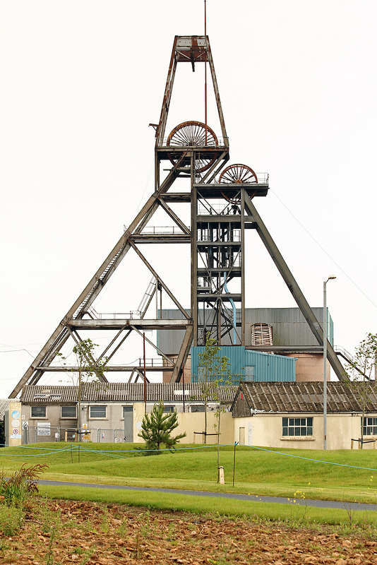
South Crofty Tin mine in Cornwall. Phone from exnottsminer under CC

South Crofty Tin mine in Cornwall. Photo from exnottsminer under CC

Cornwall’s tin travels far

The Bronze Age (in Europe 3000 BC to 500 BC) saw extensive trade networks develop across Europe. The technology of smelting copper and tin to form a durable alloy is first seen around the copper deposits of Cyprus. The warm Mediterranean world had few tin deposits, forcing them to trade with cold barbarian lands to the North. We know that from 2000 BC tin mining started in Cornwall, initially focusing on alluvial deposits (river gravels containing ore).

The Phoenicians, a now vanished pre-Roman civilisation in North Africa, traded directly with Cornwall. The name “Britain” comes from the Phoenician name “Baratanac”, meaning “Land of Tin”. The Greek historian Herodotus, who is the source for much of the little we know about the ancient world, describes how tin comes from the Cassiterides, ‘lands of tin’ that sat beyond Gaul (France). [See comment below for an informed correction of this paragraph] It’s thought that the Phoenicians, who managed the trade, might have been a little cagey about the exact whereabouts of this economically valuable land.

When great military powers invade far-off lands, there are always people who say that their true motivation was to get access to valuable natural resources. We don’t know of any ancient Romans waving banners saying ‘No Blood for Tin’ when Julius Caesar invaded Britain, but modern historians have suggested Cornwall’s tin deposits were a motive.

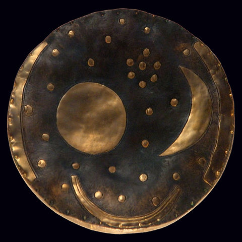
Given the lack of documentary sources for these ancient periods of history, its obvious that archaeology has a role to play. A recent paper used the black arts of isotope chemistry to study ancient tin. The isotopes within metals can be used to uniquely characterise where they came from2: the different geological settings leave a distinctive isotopic signature. Despite having an impressive 10 different isotopes it’s proved relatively difficult to do this with tin, but the authors have shown that a Bronze Age artifact in central Europe (the “Himmelsscheibe von Nebra” or sky disc of Nebra) contains tin  from Cornwall.

Bronze Age metal disc from Germany, containing Cornish tin. Image from Wikipedia

Bronze Age metal disc from Germany, containing Cornish tin. Image from Wikipedia

Another recent scientific study looks at Cornish bogs. By studying metal concentrations in layers within the bog, they can trace when mining was active. Local smelting would spread tin through the environment to be captured in the bogs. From this evidence they suggest that there was only a little mining before the Roman period and that the arrival of the Romans, with their Southern European work ethic and trading mindset3 greatly increased the rate of mining.

To get this direct evidence of the ancient movements of Cornish tin takes big machines run by dedicated scholars. Evidence of the movement of Cornish miners in the Nineteenth Century is easier to find, and tastier too.

Pasties – a world tour

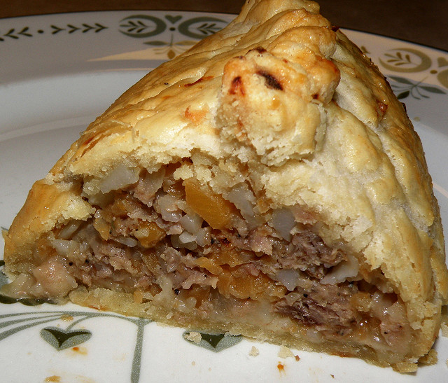
The Cornish pasty, now protected by the full might of European Law, is a folded and crimped pastry circle containing beef, potato, onion and swede. It was popular with the tin miners, as it was a convenient meal that could be eaten with dirty hands.

Cornish pasty. Image from Hammer 51012 under CC as I couldn't be bothered to take my own picture of one.

Cornish pasty. Image from Hammer 51012 under CC as I couldn’t be bothered to take my own picture of one.

The potato reminds us that this is not a Bronze Age dish. In many ways the pasties heyday was the Nineteenth Century, which was also a big time for Cornish mining. By this time all the surface ore had been found and miners were digging down deep, following the veins into the earth. Mining in Cornwall had its peak in the early 19th Century. The Royal Geological Society of Cornwall was founded in 1814 and is the second oldest in the world. Mining terms such as vug and gossan are Cornish in origin.

The mid-Nineteenth Century saw Cornish mining start on a slow but terminal decline as massive deposits were opened up in Bolivia and East Asia. As work dried up, tens of thousands of Cornish miners emigrated to new mining districts across the world, where their skills were in great demand. A Cornish saying of the time said that “a mine is a hole anywhere in the world with at least one Cornishman at the bottom of it!”4

Some went to America. The Californian gold rush of 1850s attracted many Cornishmen and Cornish Pasties are still found for sale in the Sierra Nevada to this day. Others went to the iron and copper districts of northern Michigan and also left pasties behind5.

They reached South Africa and Australia, but also non-English speaking countries such as Mexico and Brazil. They are credited with bringing football (“soccer”) to Mexico and also the ubiquitous pasty. Mexicans may add hot chili sauce to theirs, which would be frowned on in Penzance, but they did open the world’s first Cornish Pasty museum in 2011.

The business of mining and the shipping of raw materials is not glamorous, but it is important. Our civilisation depends on technology that needs particular materials, whether the tin in a Bronze Age sword or the rare metals in your mobile phone. Written histories, often created by politicians or the winners of wars, sometimes overlook the importance of such lowly matters. The study of objects, whether metallic or cultural, can help redress the balance a little.

A bit of Scotland in an English playground

There is a park near my home that my children like. As is the way of things, this means I stand around it a lot, ready to rub bruised knees or produce biscuits or push ‘faster!’, but otherwise redundant. My attention often wanders to the big blocks of stone in the park – they are worth looking at.

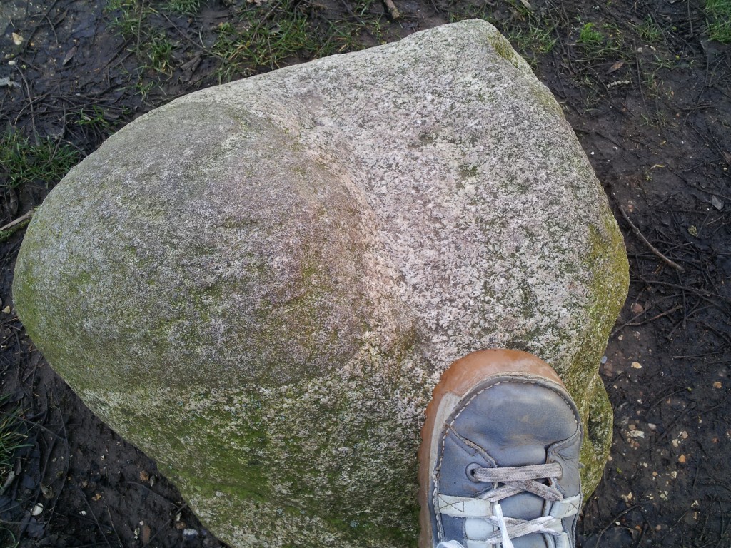
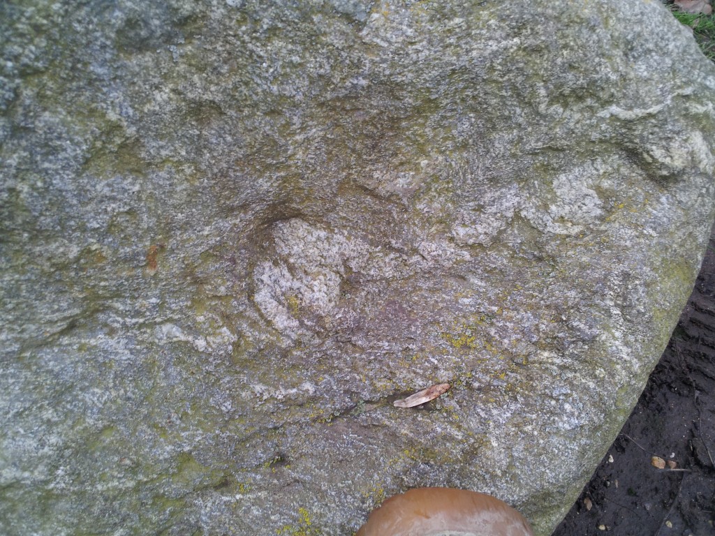
To start with, here’s some ‘granite’.

granite with xenolith / blobby

The white material is a medium to coarse grained igneous rock of ‘felsic’ composition – granite (loosely speaking). The dark area is a portion of material within the granite. It may be a xenolith, a piece of rock that fell into the magma, but it looks to me like diorite, possibly the result of magma mingling.

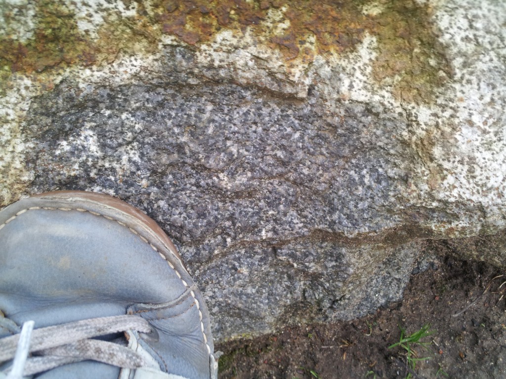
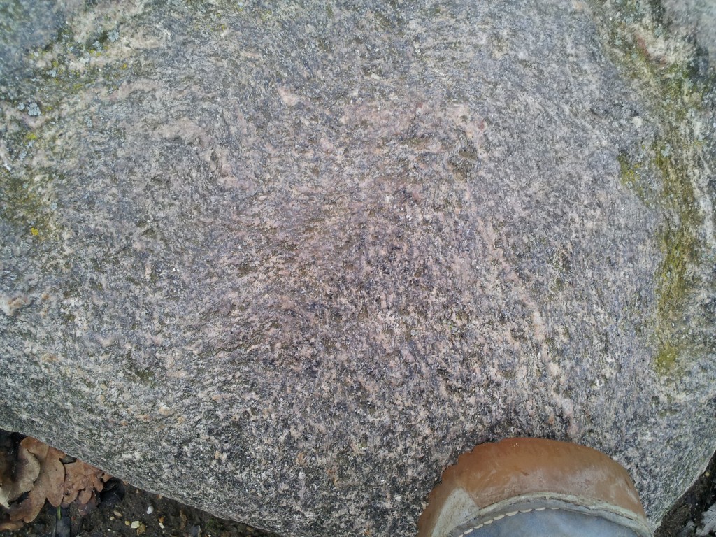
There are few blocks of mafic igneous rock:

20121227_145035

This ‘gabbro’ above shows both fresh and weathered surfaces. Plagioclase feldspar is colourless and weathers white while the dark minerals (pyroxenes?) sit within it. Note the rusty iron patch at the top.

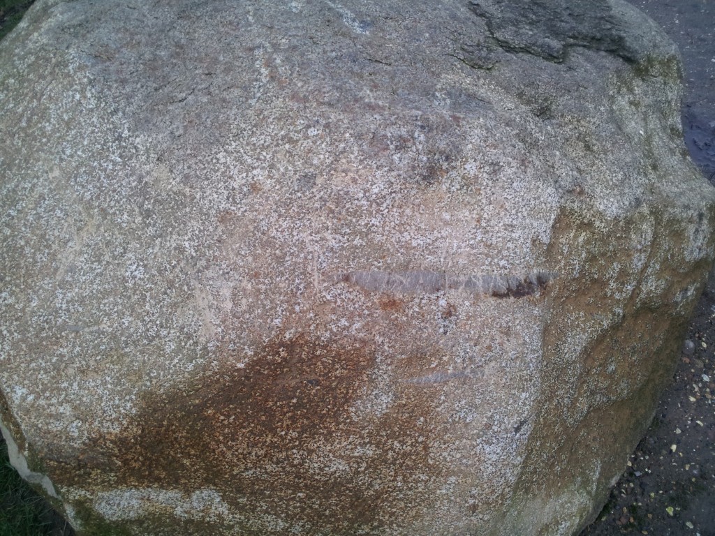
20121227_145103

Another block of gabbro has a slight sniff of layering to it.

Mafic magma is molten from about 1200°C, whereas more normal continental rocks (sediments say) can melt from 700°C. Put the two together, therefore and you expect some melting, producing migmatites.

migmatiteThis block is of high-grade metamorphic rock, with a gneissic foliation. A thin granite vein cuts through and has itself been folded.

high grade rockHere’s some more metamorphic rock, with a folded foliation and a mica sheen.

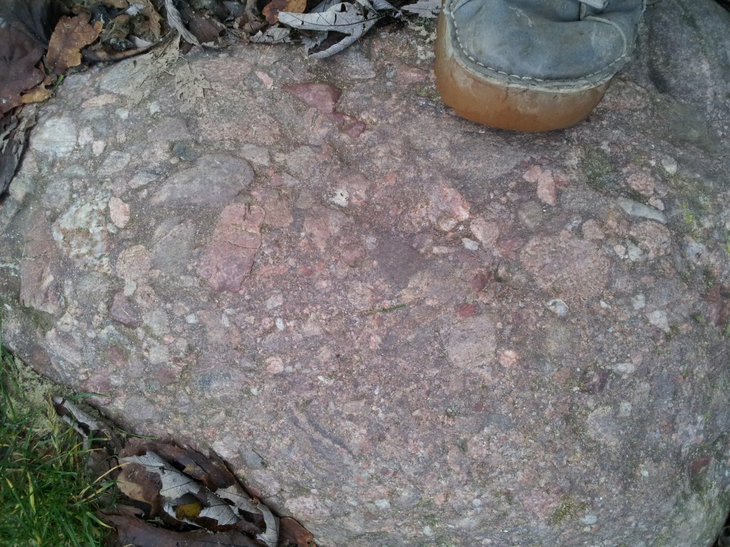
Our final type of rock is sedimentary, a conglomerate.

20121227_144803

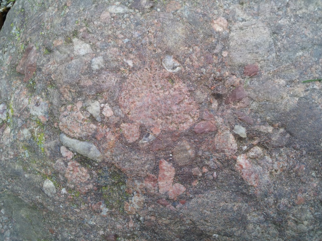
Notice the variety of clast types. We’ve some red sediments, some ‘granite’, vein quartz, quartzite and more. Here’s a closer look.20121227_144825

I’ve no idea where these blocks came from, but I know it’s not nearby. They are part of the park landscaping and so were brought from somewhere else in Britain, on a lorry. The blocks are rounded and weathered, so they are not blasted from a quarry. I think they are glacial blocks. Assuming they came from the same glacial deposit I suggest they are from North East Scotland. There is a series of syn-orogenic mafic intrusions in this corner of the world that sit within the high-grade parts of the Buchan and Barrow metamorphic areas. Granites are two-a-penny in Scotland and the conglomerate looks like the post-orogenic ‘Old Red Sandstone’.

These rocks are very similar to those in my PhD field area, so to have them turn up close to home is rather splendid.

All photos by me. I was hoping for a sunny day to take them, but I’ve given up waiting. The photos give you an authentically gloomy and dark view of rocks from Scotland, at least.