Chapman Abstract: Top down or bottom up? Volcanic history, climate, and the hydrologic evolution of volcanic landscapes
In July 2011, Anne was a plenary speaker at the Chapman Conference on The Galápagos as a Laboratory for the Earth Sciences in Puerto Ayora, Galapágos. Anne was tasked with reviewing the state-of-knowledge of volcanic island hydrology and identifying pressing questions for future research in this 40 minute talk. The following is the abstract which she submitted when she began the task.
Top down or bottom up? Volcanic history, climate, and the hydrologic evolution of volcanic landscapes
Volcanic landscapes are well suited for observing changes in hydrologic processes over time, because they can be absolutely dated and island chains segregate surfaces of differing age. The hydrology of mafic volcanic landscapes evolves from recently emplaced lava flows with no surface drainage, toward extensive stream networks and deeply dissected topography. Groundwater, a significant component of the hydrologic system in young landscapes, may become less abundant over time. Drainage density, topography, and stream and groundwater discharge provide readily quantifiable measures of hydrologic and landscape evolution on volcanic chronosequences. In the Oregon Cascades, for example, the surface drainage network is created and becomes deeply incised over the same million-year timescale at which springs disappear from the landscape. But chronosequence studies are of limited value if they are not closely tied to the processes setting the initial conditions and driving hydrologic evolution over time.
Landscape dissection occurs primarily by erosion from overland flow, which is absent or limited in young, mafic landscapes. Thus, volcano hydrology requires conceptual models that explain landscape evolution in terms of processes which affect partitioning of water between surface and subsurface flows. Multiple conceptual models have been proposed to explain hydrologic partitioning and evolution of volcanic landscapes, invoking both bottom up (e.g., hydrothermal alteration) and top down processes (e.g., soil development). I suggest that hydrologic characteristics of volcanic islands and arcs are a function of two factors: volcanic history and climate. We have only begun to characterize the relative importance of these two drivers in setting the hydrologic characteristics of volcanic landscapes of varying age and geologic and climatic settings.
Detailed studies of individual volcanoes have identified dikes and sills as barriers to groundwater and lava flow contacts as preferential zones of groundwater movement. Erosion between eruptive episodes and deposits from multiple eruptive centers can complicate spatial patterns of groundwater flow, and hydrothermal alteration can reduce permeability, decreasing deep groundwater circulation over time. Size and abundance of tephra may be a major geologic determinant of groundwater/surface water partitioning, while flank collapse can introduce knickpoints that drive landscape dissection. The combination of these volcanic controls will set initial conditions for the hydrology and drive bottom up evolutionary processes.
Climatic forcing drives many top down processes, but understanding the relative effectiveness of these processes in propelling hydrologic evolution requires broader cross-site comparisons. The extent of weathering may be a major control on whether water infiltrates vertically or moves laterally, and we know weathering rates increase until precipitation exceeds evapotranspiration. Weathering by plant roots initially increases porosity, but accumulation of weathered materials, such as clays in soils, can reduce near-surface permeability and promote overland flow. Similarly, eolian or glacial inputs may create low permeability covers on volcanic landscapes.

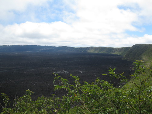
View of the 2005 lava inside the crater of Sierra Negra Volcano on Isabella Island, Galapagos. Photo by A. Jefferson
