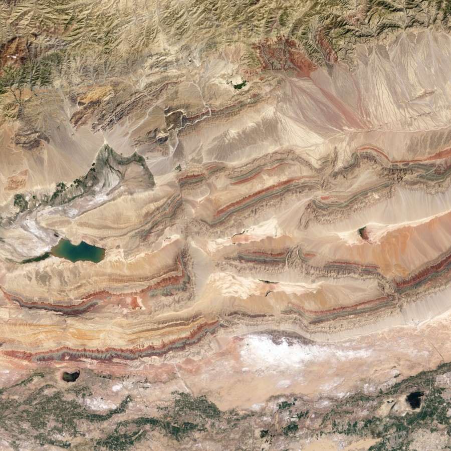
Satellite view of the foothills of the Tien Shan mountains, northern Tarim Basin, Xinjiang province. Click to enlarge. Source: NASA Earth Observatory

A real-life geological map, no colouring in required
Satellite view of the foothills of the Tien Shan mountains, northern Tarim Basin, Xinjiang province. Click to enlarge. Source: NASA Earth Observatory