This post describes my highlights from the 30th Nordic Geological Winter Meeting that took place in Iceland last week. The most interesting results include that Iceland’s glaciers may be gone in 200 years, that the May 2011 Grímsvötn eruption was supplied by a fresh input of magma, and that melt flows upwards into the columns that form when lavas are cooling.
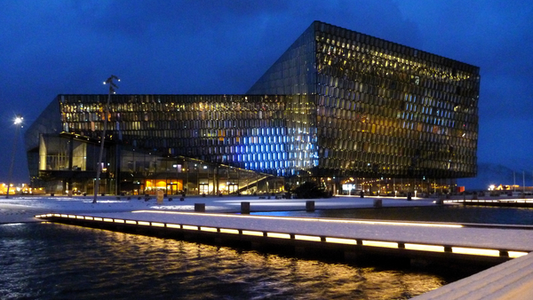
The meeting took place in Harpa, Reykjavík's newly-opened opera house and conference centre. It was attended by over 250 participants, mainly from Nordic countries. Sessions covered topics such as tephrochronology, glaciology, and igneous, metamorphic and resource geology.
Iceland’s shrinking glaciers
The alarming conclusion of Helgi Björnsson’s talk was that Iceland’s glaciers may have less than two centuries left. This seems incredible, given that they are so huge, but Björnsson demonstrated how their rapid demise results from a positive feedback loop or vicious circle: the smaller these ice caps get, the faster they will shrink. Understanding this depends on a concept known as the Equilibrium Line Altitude (ELA).
Above the ELA, more snow and ice accumulate on the glacier in the winter than are lost in the summer. The opposite is true beneath the ELA, which is known as the ablation zone. As long as the area above the ELA is large enough to collect enough snow to replace the ice lost beneath it, the glacier will be stable. With rising global temperatures, the ELA is rises, the glaciers lose more ice than can be replaced by annual snowfall, and they shrink. But this alone doesn’t explain the rapid shrinking.
Björnsson and colleagues have mapped the bedrock surface beneath Iceland’s glaciers using ground-penetrating radar. This is how we know, for example, that Katla’s glaciers are ~500 m thick. But this means that the surfaces of the glaciers are only above the ELA because of the ice itself. For example, 65% of the area of Vatnajökull is above the ELA, but only 20% of the bedrock is. As glacier shrinks, the surface altitude of the ice decreases, which reduces the area above the ELA, which makes the glacier shrink faster and so it continues.
There are equations that show how snow is compacted into ice. There are equations that show how glaciers flow under their own weight. There are equations that show how ice melts at lower, warmer, elevations. Combining these with the surface shapes of the glaciers, the radar maps of the bedrock and estimates of future climate (2°C increase by 2100), Björnsson and colleagues modelled the glaciers to see how they would change shape in the future. They concluded that they would be mostly gone in 150-200 years.
The disappearing ice was a theme in other glaciology talks and even in other sessions. Another glaciologist, Thorsteinn Thorsteinsson showed the results of 25 years of monitoring the Höfsjökull glacier, during which period it has lost 6.5% of its mass. The summers of 1991 and 2010 were particularly bad for the glacier, when a coating of fresh volcanic ash caused extra melting. Over in the geodynamics session, Thóra Árnadóttir presented results from GPS stations that are looking for tiny movements of the land surface caused by plate tectonics or volcanic activity. Every station that they put on the mountains poking through the glaciers (nunataks) shows a strong upward motion. This is caused by the land rising as the weight of the ice disappears, and is something to bear in mind when looking for signs of inflation at ice-covered volcanoes.
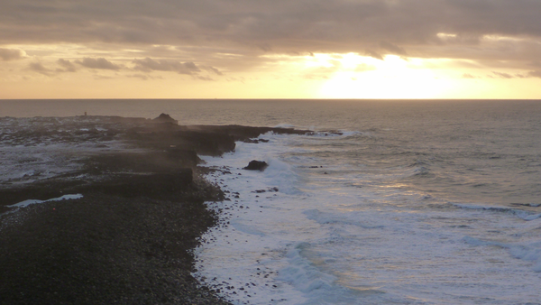
The Reykjanes peninsula basking in the midday January sun. This is where the mid-Atlantic ridge comes ashore. If you swam due south from here, the next land that you would hit would be Antarctica.
Fresh magma drove the Grímsvötn 2011 eruption
Olgeir Sigmarsson’s talk looked at the geochemistry of the magma from the Grímsvötn eruption in May, and concluded that the reason that the eruption was so powerful is that it was driven by a fresh batch of hot, gas-rich magma from deep beneath the volcano (see my post from August to see the deposits close up).
Geochemistry is a very important tool in understanding volcanoes. It relies on two facts, which will be familiar to any students of a Volcanology 101 class:
- Magma is a cocktail of many different chemical elements and their oxides e.g. SiO2, Al2O3, MgO, CaO, F, Cl.
- Magma doesn’t all melt or freeze at once or at a single temperature.
As magma solidifies, crystals grow, and the concentration of the ingredients of those crystals is reduced in the remaining liquid. For example, MgO is removed from the liquid when crystals of the mineral olivine ([Mg,Fe]2SiO4) form. This process is called fractional crystallisation.
A key piece of evidence in Sigmarsson’s talk was the concentration of the element thorium (Th) in samples of ash and pumice from each Grímsvötn eruption of the 20th century. These show an increase in Th concentration over time. This suggests that they all came from the same source beneath the volcano (the magma chamber), where growth of crystals of low-Th minerals results in an increase in concentration in the remaining melt. This melt was erupted in each of the events that produced the samples e.g. in 1998 or 2004, and was probably left over from the huge Laki eruption in 1783. The Grímsvötn 2011 samples contain much less Th than previous eruptions. This implies that it is a different magma: hotter, richer in gas, and closer to the composition of the original melt that formed in the mantle.
Melt migration into lava columns
Hannes Mattsson gave a presentation suggesting a previously-undescribed process within cooling lavas that explains the patterns in polished lava tiles (see image) as part of a study into the formation of columnar joints in basalt. This work has already been published in the journal Nature Communications. Joints are a system of cracks in a rock, and columnar joints break the rock into columns. Famous examples of columnar jointed lavas are the Giant’s Causeway in the UK, the Devil’s Postpile in the USA and Svartifoss in Iceland. Mattsson and colleagues found that melt flows into the columns as they form.

Basalt tiles on the conference centre floor. These were quarried from columnar-jointed lava, and each tile is a slice through a column like a plank of wood. The pattern, which resembles the grain in wood, results from melt movement within the columns as they cooled.
Columnar joints form because lava contracts as it cools. Usually, the top of the lava, exposed to the air, cools most quickly and the cracks grow downwards into the flow. Experiments show that basalt lava shrinks by 10-15% when it solidifies, but the volume of the gaps created between the columns is much less than this. Mattsson’s group thought that this is because more material flows into the columns as they form. Sometimes you can see where finger-like parcels of lava have done this, but they are not very common, so another mechanism is required.
This mechanism is also based on the fact that magma doesn’t freeze or melt all at once. As the lava cools, the first crystals to form are tiny, white, matchbox-shaped grains of plagioclase feldspar. The dark bands in the tiles are rich in a black-coloured mineral called titanomagnetite, which is the last mineral to start crystallising. If lots of plagioclase crystallises, then the crystals can lock into each other and form a network with some strength. By this point, the lava is effectively rigid, but the remaining melt is still free to move through the gaps between the crystals. It is equivalent to sucking coffee through a sugar cube.
Titanomagnetite, as the name would suggest, is magnetic. To test their hypothesis, Mattsson and colleagues measured the magnetic field across the column. It showed that the titanomagnetite grains were all lined up parallel to the column’s edge, instead of begin randomly orientated, or lined up with surface of the ground. This demonstrates that melt flows into the columns from the molten interior of the flow, and seems to confirm their idea. The different colours of the individual bands could be explained by different pulses of melt moving in.
If you visit Iceland, you will surely see these patterns, as the same tiles are used in the floor of Keflavík airport. Now you know what they are.
Other highlights
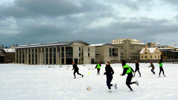
The conference was opened by the president of Iceland. He knew how to play to a room full of geoscientists. In his address, he said that seven-day creation myths are clearly false because Iceland was still being created. I imagine that he is equally unimpressed by stories about walking on water; in Reykjavík, people play football on the city pond.
- Thor Thordarson explained that subglacial basalt eruptions may release less sulphur dioxide than their subaerial counterparts because quenching of the magma by meltwater can freeze the gas inside the pumice and ash.
- Anja Schmidt looked at how tiny sulphate particles formed from volcanic sulphur dioxide would be dispersed across Europe by another Laki-sized eruption. Using equations linking air pollution and cardiopulmonary fatalities, she predicted that around 140,000 extra deaths could be caused in Europe (depending on weather conditions). The full study was published in PNAS last year.
- Guðrún Gísladóttir looked at sediment accumulation in western Iceland in lake and soil cores. You can easily spot the time when Iceland was settled around 900 A.D. because there is a distinctive ash layer from an eruption at the time. Before settlement, Iceland’s largest herbivore was the goose. The arrival of tree-chopping men and their vegetation-munching livestock coincides with a big increase in wind-blown sandy material in the cores as the plants that previously held it in place were stripped away.
- Rikke Pedersen concluded that the best way to explain a donut-like ring of uplift around Hekla between 20 and 40 km from the crater is that material is being added to a magma chamber deep below the volcano, while the upper part is subsiding under its own weight.
- Halldor Björnsson used webcam footage from Eyjafjallajökull and point-tracking computer software to study how the way that the plume rose above the volcano. These results will feed into improved understanding of how ash clouds form. This study is another great example of quality science being done using public data and a bit of programming skill.
- Sean Pyne-O’Donnell reported on the identification of ash grains from Alaska and the Cascades in peat bogs in Newfoundland, showing that ash from very large eruptions can travel great distances. He suggested that some ash grains found in Europe, and which have no chemical match with known Icelandic eruptions, may have come all the way from the Americas.
Ash from Iceland fell in the UK
My own talk showed that the recent eruptions of Eyjafjallajökull and Grímsvötn both deposited ash in the UK. It included a map of where Grímsvötn ash was found in the UK based on the tape samples sent to the British Geological Survey after our call last May. Thanks again to everyone that sent them in. The talk made the front page of the local paper, which was exciting, even if all the quotes about other European locations that were attributed to me actually came from someone else.
Acknowledgements and caveats
I am grateful to Marie Curie Actions, who provided funding to allow me to attend this meeting. All of the information presented above is based on my understanding of the conference and is therefore only as accurate as my note-taking on the day.

