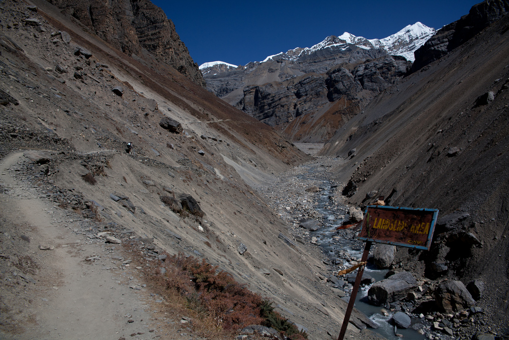
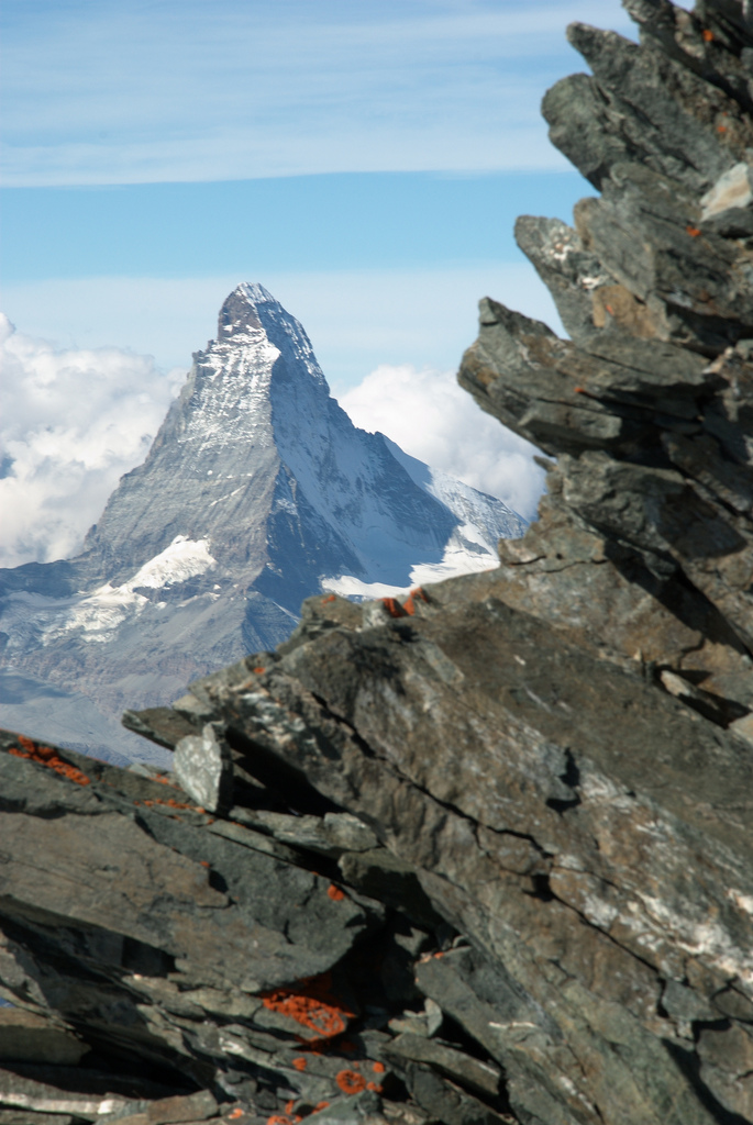
The thing that makes mountains so beautiful and fascinating,is not so much their height as their steepness. Climbers and trekkers flock to the High Himalaya, not to get altitude sickness but for the grandeur of the landscape, the experience of seeing views that require you to lift your head up. Mountains are created by deep-seated geological processes that raise the surface of the earth, but it is erosion that creates the scenery we love.
Erosion is often taught in terms of gentle everyday processes – tiny fragments of rock falling off and slowing washing downstream. Over the awesome expanse of deep time such tiny events can indeed wash away mountains. But mountainous areas can rise at rates of centimetres a year – is small-scale mechanical weathering really quick enough to keep up with such rapid uplift? Erosion in mountains also involves faster acting processes: ravine-making rivers, grinding glaciers and lots of landslides.
If you’ve ever had the pleasure of visiting high mountains such as the Himalaya, you’ll have noticed how common landslides are. A recent scientific paper seeks to quantify how their frequency relates to other factors.
Larsen & Montgomery from the University of Washington, studied the Namche Barwa area in the eastern Himalayas. This is an area where rocks are being brought to the surface extremely quickly by high rates of erosion. The mighty Tsangpo-Brahmaputra river flows through the area and its influence may extend deep into the earth, creating a tectonic aneurysm.
A river only directly erodes within a tiny area, but has a wider influence. Our authors start by describing the threshold hillslope paradigm. This is a concept three year old children understand: if you dig a hole in a sand pit, once the edge reaches a particular steepness, sand slides back into your hole, no matter how fast you dig. Within a mountainous area, if erosion rates are high enough, hill slopes are limited by the material strength of the rock.
“Vertical river incision into bedrock is thought to over-steepen hillslopes with gradients near the threshold angle, increasing relief until gravitational stress exceeds material strength and bedrock landsliding occurs.”
Somewhere like Namche Barwa, with high uplift and erosion rates, we would expect to see lots of landslides. To test this, they used an array of remote sensing data, including declassified spy satellite images, to map more than 1500 landslides over a period of 33 years. By looking at an area affected by differing erosion rates, that found a rough correlation between landslide erosion rate, stream erosion power and even cooling ages of metamorphic rocks. The study area showed an order of magnitude difference in exhumation rate which corresponded with a tiny 3 degree difference in average slope angle.
As well as providing evidence for the importance of landslides, they found insights into the processes. They see a link between large landslide dam bursts (flooding events), and landslides – flooding causes more erosion at foot of slope, destabilises the valley sides and causes a series of small landslides.
Another recent paper by James Spotila at Virginia Tech also derives useful data simply from looking at mountains in detail. He made a detailed analysis of topographical data from mountains across the world.
Browse photo galleries taken in mountains and you’ll find most pictures are of the peaks and mountain ridges – that is where the beauty lies. In contrast models of mountain erosion are (conceptually) peering into the valleys. Ridges and peaks are seen as the consequence of valley-shaping processes, in map view merely the negative image of drainage networks.
Spotila hypothesises that the highest peaks will form where two ridges meet, at ‘divide-junctions’. High peaks are often broadly shaped like pyramids, forming where three glacial or river valleys meet (and therefore where two ridges meet). Peaks of this shape may be mechnically more stable than on single ridges. Using digital topography to study 255 of the world’s most prominent peaks, Spotila finds that 91% of prominent peaks studied are found at divide junctions. Of these, all are pyramid shaped.
The highest mountains of central Nepal contain most of the world’s highest peaks. The Himalayas are cut by a number of large rivers. The high peaks are preferentially located close to the divides between these rivers – the drainage pattern controls the location of the highest peaks.
Once mountains become pyramidal and have flat triangular faces, they become more resistant to erosion. In the Himalaya the flat faces tend not to be covered by glaciers, for example. This may make them more stable over time. Some workers have talked of ‘teflon peaks’ that rise above the glacial buzzsaw. Recent models of landscape evolution have emphasised the importance of the migration of drainage divides over time. However if drainage-divide peaks are stable over time, they will anchor the overall drainage patterns, making them much more stable.
These details of the way mountains erode may seem detached from tectonic studies of mountains, but in fact so many aspects of mountain geology are beautifully intertwined. Erosion of mountains influences processes deep within the crust, allowing material to flow towards the surface – patterns of crustal flow are linked to drainage patterns via erosion. That these patterns of crustal flow become fixed in space due to the way peaks and ridges form is a beautiful idea about beautiful places.
First photo of landslide area, Annapurna region of Nepal, courtesty of Julien Lagarde on Flickr under Creative Commons Second photo of Matterhorn, Swiss Alps, courtesy of Martin Jansen on Flickr under Creative Commons
Larsen, I., & Montgomery, D. (2012). Landslide erosion coupled to tectonics and river incision Nature Geoscience, 5 (7), 468-473 DOI: 10.1038/NGEO1479
Roering, J. (2012). Tectonic geomorphology: Landslides limit mountain relief Nature Geoscience, 5 (7), 446-447 DOI: 10.1038/ngeo1511
Spotila, J. (2012). Influence of drainage divide structure on the distribution of mountain peaks Geology, 40 (9), 855-858 DOI: 10.1130/G33338.1


Pingback: Stuff we linked to on Twitter last week | Highly Allochthonous
I must thank you for the efforts you have put in penning this site.
I’m hoping to see the same high-grade blog posts by you later on as well. In fact, your creative writing abilities has motivated me to get my very own blog now 😉