Reflecting on my cities and their water
This week’s mini-assignment for my urban hydrology class reads thus: “In 1-2 paragraphs, describe your hometown (or some other city you know well) in terms of its location, size, and form and why it is that way (i.e., historical context). Then write a paragraph describing your city’s relation to water. For example, what is the water supply and where is wastewater disposed? Are there local water bodies or water issues important to the community? You don’t need to include references with your assignment, but you should check your facts if you are unsure about anything.”
Because I’m a water geek, and I wanted to model a good response to these questions, I present not one, but two, reflections on cities I’ve known well and how those cities relate to water.
I grew up in Winona, Minnesota, a town of about 28,000 people in the southeastern corner of Minnesota. The main part of the city is situated in the middle of the Mississippi River floodplain, with the main channel on one side and a former channel (now lake) on the other. The Winona area was inhabited by Native Americans for millennia, prior to its establishment by white settlers in 1851. Winona’s location along the river made it an important link for railway and steamboat transportation, and Winona was the second place on the Mississippi to be crossed by a railroad bridge (opened in 1891). Winona grew rapidly, and by 1900 had almost 20,000 residents. Winona was a major sawmilling center (with logs floated down the river to the mills), and Winona is still a major port on the river for loading agricultural products onto barges. In southeastern Minnesota, the Mississippi River sits in a ~500 foot deep valley, so as the city has grown larger, it has spread outwards into tributary valleys and up onto the plateau. However, most of the population still lives on the floodplain, and most of the developed area (including pretty much all of the industrial and commercial areas) is in the valley bottom.
As is apparent by the paragraph above, Winona as a city is intricately tied to the Missisisippi River, physiographically and economically. River recreation (boating, fishing, duck hunting) is also a major past-time (and economic contributor) for Winonans. The river holds pride of place in town, but it was also a source of major and frequent flooding until 1985 when an 11-mile levee was built surrounding the town. Other than the occasional flood (now more a curiosity than a catastrophe), periodic public engagement with dredging of sand from the river bottom, and the enjoyment of boat trips on the river, I would say that Winonans’ aren’t particularly attentive to water issues, because it is abundant and out of their way. The city gets its water supply from a Cambrian sandstone aquifer several hundred feet below town, where water is abundant and good quality. It disposes its treated wastewater into the river at the downstream end of town. The big water issue I remember growing up, was about water quality in the Lake, which was quite degraded by the invasive exotic, Eurasian water milfoil. There is actually a water issue that has cropped up over the last several years in the region, which is getting local attention, and that is the mining of “frack sand” from the local sandstone formations. This is getting attention because of problems with heavy truck traffic in town, blowing sand from exposed storage piles, and from destruction of rural areas where the sandstone is being mined. However, to me, it is ultimately a water issue, because those sandstone formations are the regional aquifers. It’s not clear to me yet what effect the mining will have on local or regional water quality, but it seems like an issue to watch.
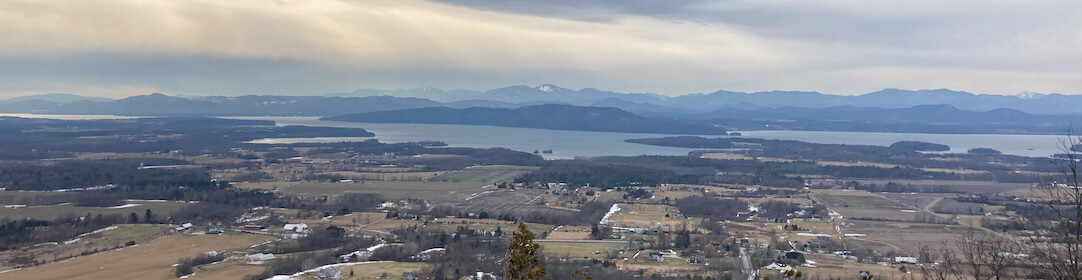
I spent five years living in Charlotte, which is the largest city in North Carolina, with a metropolitan population of 1.8 million people. Charlotte is a major financial center, and also the home of NASCAR. The city was founded around 1755 at the intersection of two Native American trading paths, and it was a “hornet’s nest of rebellion” during the American Revolution, being the first place that city leaders signed a declaration of independence from Great Britain. Charlotte’s history includes being close to the site of the first gold boom in the US, and becoming a major cotton processing center and railroad hub. Banking and NASCAR rose to prominence since the 1970’s, and the region has experienced explosive population growth (and urban sprawl) since then. The population of the city itself has gone from 241,000 in 1970 to over 730,000 in the 2010 census. There is a relatively small, high density city center surrounded by miles of low density residential, commercial, and industrial development. The gentle rolling topography of the Piedmont forms no barriers to the geographic expansion of the urban area. Several small towns have been agglomerated by the urban area, and many people commute from these communities into the city center or across the city.
The Catawba River, which has a watershed area of 3343 miles upstream of the South Carolina border (Charlotte’s southern boundary), flows through the urban area a few miles west of downtown Charlotte. The River is impounded in a series of reservoirs used for hydroelectric generation by Duke Energy, and was one of the first rivers in the country used for that purpose. Most of the land along the river is privately owned by relatively affluent people, and there are only a few public parks on the reservoirs. Power-boating recreation is popular with those along the river, but swimming is banned in the county in which Charlotte sits, because of concerns about liability. The river forms the water supply for the city, because the fractured crystalline rocks in the area don’t support pumping of large groundwater volumes. Wastewater is treated and disposed of back into the river (farther downstream) or into local streams. There are a number of small urban streams that flow through the city, and these streams are quite prone to flooding during heavy rainstorms. The city and county have undertaken a major stream restoration and stormwater management program to try to reduce flooding hazards, and a series of greenways have been established along the some of the streams. When I moved to Charlotte in 2007, we were in the middle of an intense drought, and subject to limitations on outdoor water use. However, as soon as the drought lifted, local water conservation mindfulness seemed to disappear too. There is an illusion of abundance of water in the southeastern US, even though as population grows water supplies are becoming stressed (Atlanta is a stark example of this). In a recent book, author Cynthia Barnett highlighted Charlotte as a prime example of a city that was “disconnected” from its water supply, meaning that the people of the area lacked a water culture or ethic that would encourage conservation and sustainable use.
I probably spent about 20 minutes writing each piece, but I’m fairly familiar with the water issues and setting in each area (see above: I’m a water geek). So it might take you a bit longer to do a similar amount of writing. One essay is 499 words, and the other is 528 words, but you could write less and still cover the relevant information. I haven’t included hyperlinks to lots of sources here, because I didn’t require that of my students, but I might go back later and add them, because it just seems like wasting the capabilities of the web to not do so.