GSA abstract: Soils and Geomorphology of Five Reclaimed Surface Mine Sites in the Cuyahoga Valley National Park, Ohio
Later this month, Caytie, Garrett, and I will be representing the Watershed Hydrology Lab at the Geological Society of America Annual Meeting in Seattle, Washington. Caytie will be presenting the following poster on Tuesday, October 24th in spot 257-4 in the Washington State Convention Center.
Soils and Geomorphology of Five Reclaimed Surface Mine Sites in the Cuyahoga Valley National Park, Ohio
Ruhm, C., Jefferson, A., Blackwood, C., Minerovic, A., and Davis, C.
Abandoned mine lands are common to human-altered landscapes. Despite the improvement of remediation techniques, the geomorphic and ecological function of historical abandoned mines persist as a concern to many regions. Cuyahoga Valley National Park (CVNP) is home to ~50 abandoned gravel, sand, and topsoil mines. After mining ceased, these sites were backfilled, compacted, and seeded. Following reclamation, rills and gullies appeared on some steep slopes within the sites. Additionally, reforestation efforts at these sites have not been successful. The causes of these failures are not well understood. Previous studies of coal mines have pointed toward altered chemical properties as a cause of reforestation failure. However, since the CVNP sites lack coal and associated tailings, further research is required to understand how the mining and reclamation affect erosion control and reforestation efforts.
Our research is investigating the geomorphology and soil quality of five of the abandoned mine sites within CVNP relative to four reference sites with similar slope and aspect, but mature forest. We aim to (1) determine the quality of the soils within the sites in comparison to the reference locations, (2) determine if the sites are currently undergoing erosion in exceedance of the reference locations, and (3) inform future reclamation projects to assist in the creation of successful practices.
We have collected ~250 soil samples from the five sites and four reference locations to analyze for grain size distribution, soil pH, concentrations of extractable Al, Ca, Fe, K, Mg, and P, and total C and N. Preliminary results indicate a marked difference in soil pH between the mined (pH 7-8) and forested reference (pH 3.6-6) sites. Measurements of infiltration capacity and bulk density are underway. Preliminary results of bulk density indicate that the density is very high (>2000 kg/m3) in the mined sites, which may be impeding plant growth and promoting overland water flow. Pressure transducers in three gullies on the mined sites indicate water flow during and following intense rainfall, and silt fences are allowing us to quantify sediment flux. Mapping of gully long profiles and cross-sections will enable us to calculate the volume of sediment removed by the gullies since reclamation occurred.
Geological Society of America Abstracts with Programs. Vol. 49, No. 6
doi: 10.1130/abs/2017AM-303598
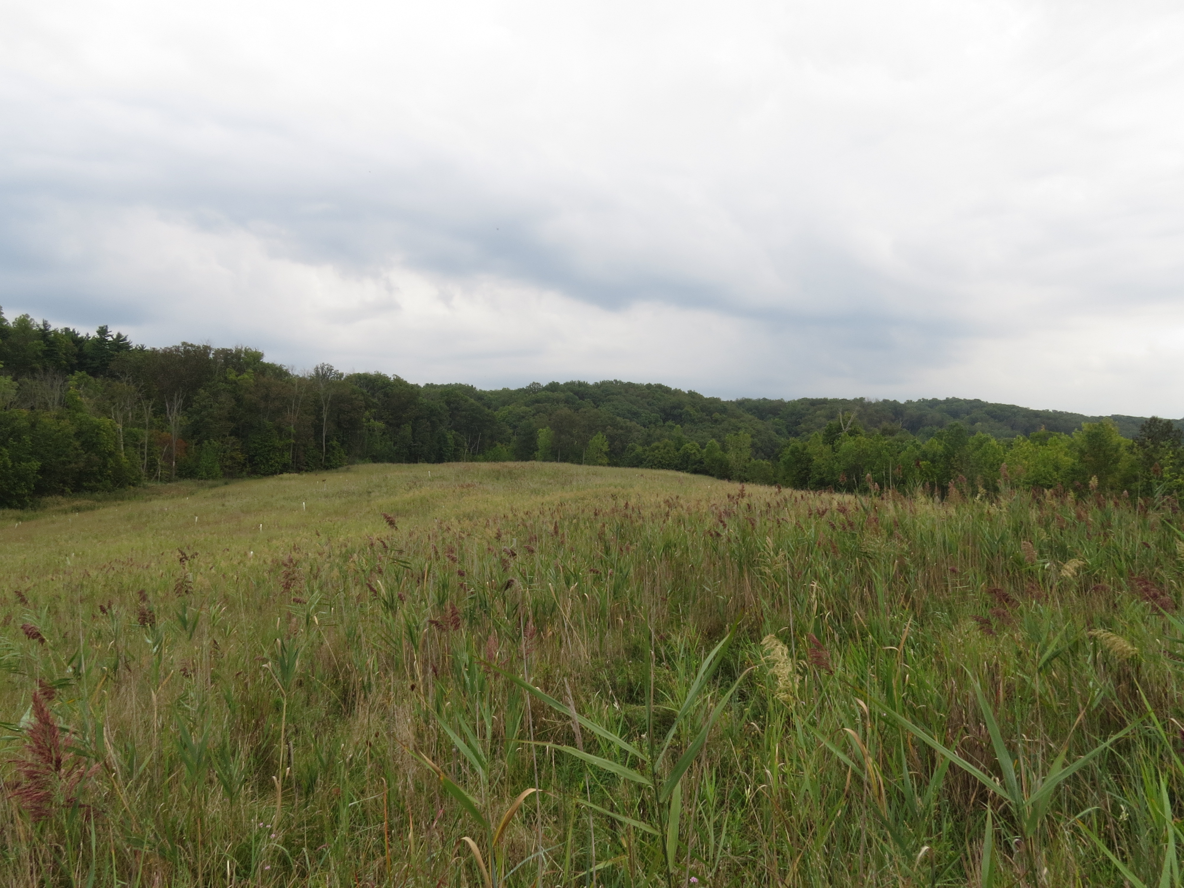
One of the sites that Caytie is studying, as it appeared in October 2016. The several acre site was host to invasive Phragmites reeds and a failed tree planting.