This post is part of my journey into the geology of mountains.
I’ve got a picture of Mount Everest to show you. It is gorgeous. I’ve got a plan to rhapsodise for a good while about its Geology, too. I’m going to make you wait though, so I can be sure that you understand what I’m talking about, that you fully understand how the Geology of Everest is interesting and counter-intuitive. You’ll see it in the context of mountain belts across the world, old and young. What a glorious moment that will be!
In order to reach those giddy heights I need to do two things. First, write a series of posts detailing our geological understanding of mountains, secondly get you to read them. A huge challenge no doubt, but I at least will enjoy the journey. So, I’ve a mountain to climb, let’s get going!
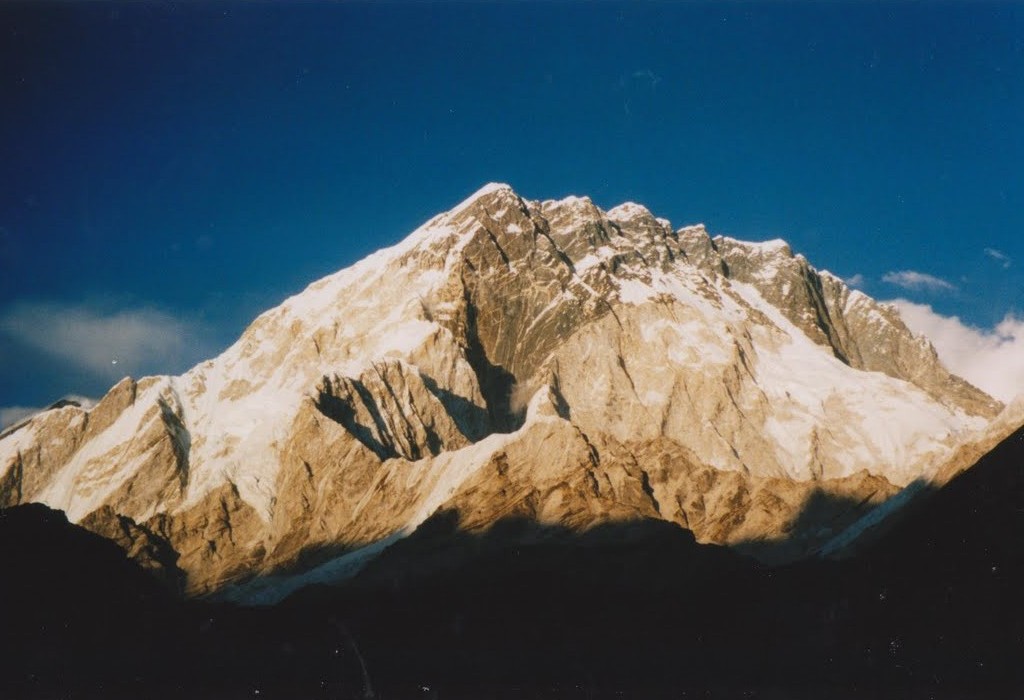
Mountains are rather obvious things, if you’ve been near any. They look like this:
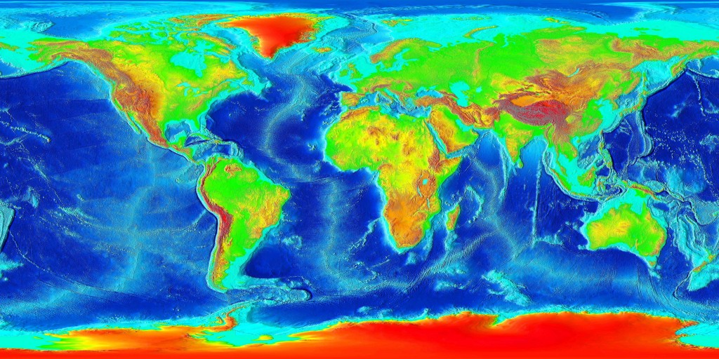
Big, pointy, covered in snow. A look at a topographic map of the world shows us where modern mountains are to be found.
 Look at the red areas which are high altitudes. Ignore Greenland and the Antarctic, they are high due to ice-caps, which is cheating. Ignore Southern Africa as that is a high plateau rather than mountainous. Otherwise, what do you see?
Firstly, an obvious chain of mountains all along the west side of the Americas. Next a line of red staring at Spain and Morocco moving east via the Alps, Iran into the Himalayas and Tibet. Extra marks if you spotted New Guinea. All of these areas are active mountain belts. Belts because of the shape, active because the plate tectonic forces that created them are still ongoing.
As with most things in Geology, an explanation of why mountains are formed starts with plate tectonics. Where a continental plate is involved in a collision, mountains are formed. The second plate might be oceanic (Pacific ocean hitting Americas = the Andes, Rockies) or continental (India/Africa hitting Eurasia = Alps/Himalayas). That’s the sentence-length explanation. Much more in later posts.
Oh, and we are not talking about volcanoes. A volcano is a big hilly thing and so is a mountain, but geologically it is totally different. Think about the volcanoes in the Andes. They are locally important but the reason the Andes stand out in the map above is not due to the volcanoes, they sit on top of the mountain belt.
There are those who say that the only sensible place to study how mountains form is in active mountain belts. Where you know the plate tectonic context (you can trace India’s progress north, for example) and you can use geophysical techniques to infer what is happening at depth. There are others (those with smaller fieldwork budgets perhaps) who say that studying ancient fossil mountain belts is also vital. Why restrict yourself to only the few active mountain belts? There are rocks that were formed in ancient mountain belts virtually everywhere. When discussed these, geologists are apt to start using the term orogens or orogenic belts. These are basically fossil mountain belts. They contain rocks that are deformed and metamorphosed, recording the processes that caused a mountain belt to be formed. Across Geological time, there have been a lot of orogenies.
My favourite orogenic belt is the Appalachian-Caledonian, which sits either side of the North Atlantic. It stretches from the Appalachians via Ireland and Scotland into Norway and east Greenland. A note of caution here, the orogen is found in areas that are locally known as mountainous, but this is not due to mountain building processes directly. The Appalachian mountains are higher than their surroundings because they are more resistant to erosion, or due to effects relating to Atlantic opening (same for Scotland and Norway). Also, with all due respect, they are not real mountains. They only reach 2km in height whereas most of the Tibetan plateau is at 5km and Everest is nearly 9km. If large chunks don’t regularly fall off and you don’t get short of breath due to altitude at the top, its not a real mountain, no matter how pretty it is.
In the next step on our journey up towards the top of world, I’ll be talking about how the recognition that classic plate tectonics doesn’t work well with mountainous areas led to the complimentary concept of continental tectonics.
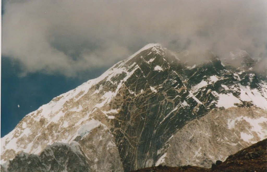
I’ll leave you with another view of Nuptse, to whet your appetite.
Topographic map of world courtesy of Wikicommons. All others are mine, for a change.


I love the last shot — looks like some annotatable geology exposed on that face: granitic intrusion?
It is a granite intrusion. I’ll be annotating this and other photos in the final post. I want to be able to describe the granite in terms of decompression melting close to an extensional fault in the context of channel flow, so I feel the need to write about all those topics first. Could take some time….
Just a brief comment (please don’t think me too picky) but the modern Rockies (especially the Southern Rockies) are due to structures developed during the Cretaceous somewhat removed form the orogenic belt(s) to the west (Sevier Orogeny). I fact the Southern Rockies mostly reactivated the Ancestral Rockies (Carboniferous) structures. Modern topographic expression mostly due to complex interactions with the Colorado Plateau microplate and the San Andreas fault/transform along with climatic changes (significant late Tertiary semiarid climate change) allowing for reduced erosion. Owing the mountain building to plate-to-plate collision is somewhat an overstatement.
Pick away! I’ve no argument with your point that it would be more accurate to talk in terms of plate convergence as the driving force, rather than plate collision.
I don’t know much about the Rockies and its interesting to hear about the role of reactivation and climate as these are topics I was considering covering as part of the journey. Do you know of any good sources of info into these topics I could look at, modern review papers or the like?
Sounds like a great series of posts. Getting me to read it won’t be much of a challenge. Here’s hoping you as much fun writing it as I will reading it and the rougher the going the more I’ll like it.
Pingback: Continental tectonics | Metageologist
Pingback: The many ways of understanding mountains | Metageologist
very interesting topic…. please keep posting. i live in the mountains spending great deal of time trekking and camping, beside appreciation of their physical magnificence i don’t know anything about its geological aspect.
sir, i got a doubt, how will world map be after melting of polar caps? can u please post a futuristic map?
I don’t know myself, but I found this.
http://www.cejournal.net/?p=1376
Pingback: World building begins with the world « Renn Hadley