For all that we currently know about earthquakes and faulting, seismology remains primarily a descriptive science. We can tell where an earthquake occurred, and how powerful it was, but we still don’t understand why some ruptures trigger failure over a large section of a fault, and others do not. Plate tectonics allows us to predict the overall motion across a fault zone, and even the type of faulting that is needed to accommodate it, but we can’t predict whether that motion will be expressed by a single large earthquake or dozens of little ones.
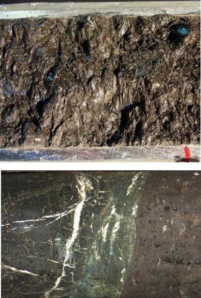
A large part of the problem is that we don’t know much about what faults are like where it really matters: although many large faults break and deform the Earth’s surface, the initial rupture in an earthquake always occurs several kilometres below, where increased temperatures and pressures make rocks behave somewhat differently that they do in the part of the fault we can see and touch. Geophysical techniques can tell us roughly where the fault zones are, but lack the resolution to tell us much about a feature which may only be tens of metres across. Which is why the rocks pictured below are so important: they were collected from 3 km below the surface, right in the heart of the San Andreas Fault.