Field Pack Amenities

[a post by Anne Jefferson]
Adding to the meme begun by Short Geologist (requirements for a field hotel) and followed on by Maria (requirements for a field vehicle), I’ll present my requirements for a field pack. The topic has been on my mind a bit recently, because I’m launching a new project this summer and will be spending a non-trivial portion of it swatting mosquitoes, avoiding snakes, and collecting data.
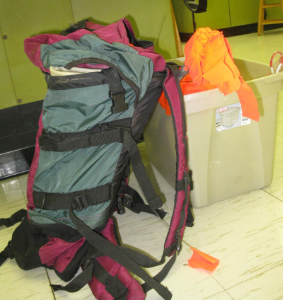
When I go in the field, I generally go for a 6-10 hour day, departing from home, field station, or campsite and field vehicle. For me, field work has consisted of two basic types of tasks: (1) collecting samples in the field and lugging them home; and (2) downloading data from field instrumentation, with limited sample collection. As someone interested in how water interacts with the geology and the landscape, I’ve lugged rock samples for chemical analysis, hauled kilograms of salt for dilution discharge measurements, and collected thousands of water samples from springs and streams. I’ve also spent a lot of time with a backpack loaded with a lap-top and hip waders, for days when I need to download data from temperature probes and water height recorders. Occasionally I’ll have field days where I have to lug a bunch of awkwardly shaped stuff into the field in order to set up instrumentation, but I really haven’t found any graceful or systematic way of doing that. A rough estimate would be that I spent about one out of four years¬†of my PhD in the field, so I’ve spent a fair bit of time contemplating what works and what doesn’t for field packs. Pictured below is the trusty field pack that seen me through since my undergraduate days.

fieldpack.jpg

My two main field tasks would be optimally served by two different packs, so I’ll present their requirements separately below. But there are some key things that all field packs should have.

  1. A zipper compartment, preferably with clip for my wallet, keys, and cell phone.
  2. A compartment near the top of the pack for my lunch. I detest squished sandwiches.
  3. Outside pockets sized appropriately to securely hold my water bottles in easily accessible places
  4. An easily accessible pocket for a field notebook and writing implement. Maps could go here too. A GPS could go here, but is no substitute for the proper maps.
  5. Comfortably padded hip and shoulder straps that allow me to carry weight on my hips.
  6. Various straps and clips for attaching random bits of gear (e.g., rock hammer) to the outside of your pack. These straps and clips should be usefully configured for carrying things and should not just be decorative.
  7. A place to store the absolutely necessary first aid kit. Don’t leave home without it.

Sample lugging packs should have:

  1. A big open compartment suitable for dropping things in and not worrying about them until I get back to the vehicle, field station, or lab.
  2. Sufficient back padding to protect my back from any oddly protruding samples. Anyone who’s hiked miles with a piece of basalt stuck into their mid-back will know just how crucial this is.
  3. Another compartment (in addition to the list above) to hold rain gear or other protective apparel (e.g., glasses). This compartment should be accessible even when the pack is full of samples, because when the cloudburst starts, you don’t want to spend precious minutes extracting your rain gear from below your samples.

Data download packs should have:

  1. A padded computer sleeve that holds the computer close to my back and protects the computer on all four sides.
  2. Numerous compartments to hold various download cords and dongles, flagging, tools, and bits and pieces of repair items for instrumentation.
  3. A compartment for holding a limited number of samples. This compartment should be smaller than the one described in the sample lugging pack, and could also double as a place to store any portable equipment that I will use in the field. When I collect small water samples, I store them in a small padded lunch box that I slide in and out of my pack. I might also be storing a Marsh-McBirney flow meter here.

My field pack, above, is definitely of the sample lugging variety, but lately I find that most of my work is of the data-download sort. I’m hiking short distances and then collecting small water samples, making field notes, and downloading temperature probes and other loggers. My big field pack isn’t well suited for this sort of work, so I’m the market for a second field pack. I’m hopeful that REI (or the local outfitter of choice) will be able to supply me with a pack that meets my requirements. I’m also curious to know what things other people look for in field packs. Is the ideal field pack the same for a hydrogeologist as a volcanologist or paleo-seismologist? I’m not a vest-wearer. For those who wear field vests, how does that change what you look for in a pack?

Categories: by Anne, field gear, fieldwork

Where rocks, water, and history intertwine

[a post by Anne Jefferson]

“Ten thousand rocks and grassy islets meet the traveler’s eye, ten thousand murmuring streams meander through them. During low water the cattle delight to graze upon the islets…at such times they furnish a curious spectacle in the midst of a mighty river.”

So wrote architect Robert Mills in 1826, describing an outcrop of ~550 million year old diorite in the Catawba River south of Rock Hill, South Carolina. The Catawba River is one of the principal rivers of the Carolinas, with an annual average flow of 4018 cubic feet per second (114 m3/s) just upstream of our diorite outcrop. The outcrop is about 2.6 km long, and changes the single-thread river into a substantially wider, multi-thread anabranching river (Figures 1 and 2). This cattle-friendly piece of rock then represents a major obstacle to flow of the river, and that has ensured it a place in the region’s history.

figure1-google-earth.jpg
Figure 1. Aerial view of the Catawba River in the vicinity of the diorite outcrop (left) and immediately downstream (right). Both photos are at the same scale and captured from Google Earth.

figure2.jpg
Figure 2. Close-up of diorite outcrops along the shore of the Catawba River at Landsford Canal State Park. The vegetation on the left bank of the channel is an island on a larger diorite protrusion. Flow at USGS gage # 02147020 was 3840 cubic feet per second (108 m3/s) on the date this picture was taken.

The diorite outcrop made an easy place for early travelers to ford and cross the river. In the 1700s, Thomas Land owned the land around the outcrop, and the area today is known as Landsford. But the rock that made the river easy to cross, also made it hard for boats traveling downstream, particularly because of the rapids upstream of the ford proper. And that’s where Robert Mills comes in to the story. Mills was the architect of the Department of Treasury, U.S. Post Office, and the Washington Monument, and he was also the architect of a solution to the transporation dilemma presented by the diorite at Landsford.
In 1823, a canal opened to allow boats to bypass the rapids and ford. Robert Mills was the architect that designed the canal and the locks. All in all, the 1.5 mile (2.4 km) canal, with two locks, circumvented 32 feet (9.75 m) of elevation loss by being dug in at the upstream end and elevated at the downstream end. The canal was lined with clay to prevent dewatering to the alluvial soils. The canal allowed boats 7 feet (2.14 m) wide, 60 feet (18.29 m) long, and carrying up to 50 bales of cotton to be pulled by mules or horses. The canal was built during the height of the American canal craze, and by 1846 it was out of use, replaced by railroads. Today the canal is mostly dry and has been substantially eroded at its downstream end. In places on the banks, there are large trees that couldn’t have been there when the boats were being pulled through the canal. The stonework in the locks is diorite from a nearby quarry and is well-preserved.

figure3.jpg
Figure 3. The upstream end of Landsford Canal.

The diorite outcrop and the canal are preserved in Landsford Canal State Park, and you can walk on the mule path along the canal, or along a trail on the banks of the Catawba River. In late May and early June, the park draws thousands of visitors to see spider lilies blooming from amidst the rocky islets. I’m planning to head back in a few weeks and check it out, but I’d really like to explore the area from a kayak.
Information in this post was gleaned from interpretive signs at the State Park and from Exploring the Geology of the Carolina by Kevin G. Stewart and Mary-Russell Roberson (UNC Press).

Categories: by Anne, outcrops

Back to work

Apologies for the silence over the last few weeks: after a lot of dashing around to various places for various reasons, I managed to leave my muse somewhere, and just haven’t felt like writing anything. It’s strange how sometimes, the words just vanish – it’s not like, most of the time, I have any shortage of things to see, and opinions to impart. That said, perhaps you’ve enjoyed the silence…
Anyway, as I sort out the rest of the my life, my good friend (and semi-regular) guest blogger Anne Jefferson has provided a couple of posts for you to enjoy, which will go up presently.

Categories: bloggery

So near, yet so far

I’ve just returned from a few days visiting a friend in Northern Ireland. Whilst I was there, she very kindly drove me out to the north coast to visit the Giant’s Causeway (whilst getting considerable comic mileage out of accusations that I’d only condescended to visit her because she’d ended up living near some interesting rocks).

Unfortunately, the weather was rather uncooperative, and whilst torrential rain and strong winds might not have been enough to discourage me from a couple of hours poking at columnar basalts, it would have been beyond unfair to force such conditions on my companion. We briefly stopped at a small harbour a little way down the coast in where you can see some of the same basaltic lava flows, erupted during the opening of the North Atlantic about 60 million years ago, but instead of nice regular columns there’s a much more irregular jumble, probably thanks to the interaction of water with the cooling lava (as I’ve discussed before).

Irelandlava.jpg

Fortunately, since the Bushmill’s Distillery is just down the road, the excursion was not entirely without its delights. And all this really means is that I’ll have to revisit Northern Ireland… to see my friend again, of course!

Has anyone else driven past cool geological sites without getting to see them?

Categories: outcrops, photos

Not dead – just in Oman

Apologies for the unannounced hiatus in my blogging. Basically, I’m out in Oman doing some fieldwork, a trip that went from ‘happening at some point’ to ‘why don’t you leave next Monday?’ in a length of time rather too ridiculously short for me to do anything than find my hammer, polish my drill bits and get on a plane. And, since the internet in Oman is either non-existent or slow, and has up to now refused to let me access my blog, I wasn’t even able to post an update. Now I wish I had succumbed to my iPhone urge a month or so ago.
Anyway, I’ll be back home next week, and will have plenty to talk about. Whilst you wait, perhaps you could tell me what you’d most like to hear about my travels – you’ll get the rocks of course, whether you like it or not – but is there any other aspect of the fieldwork experience you’d particularly like to hear about?

Categories: fieldwork