
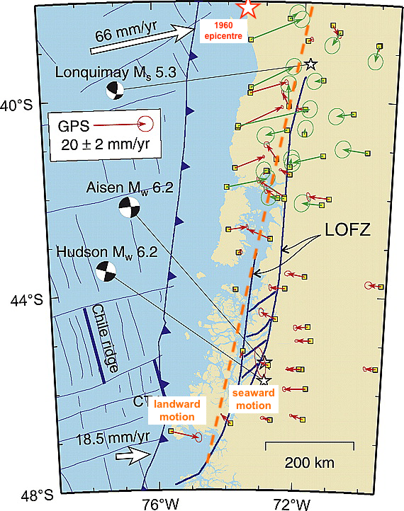
Orange dotted line shows the transition from GPS stations currently moving landward (east, closer to coast) and stations moving seaward (west, further inland) in region ruptured in 1960 Valdivia earthquake (red star shows approximate epicentre). Source: Wang et al., 2007